At long last! After living in Pembrokeshire for the last forty-six years and despite walking many miles of the Pembrokeshire coast, and meandrering around a lot of the Welsh countryside discovering wonderful places, lakes, waterfalls … scenary, we hadn’t been on Skomer island. This week we finally managed to go. And it was a glorious day’s adventure.

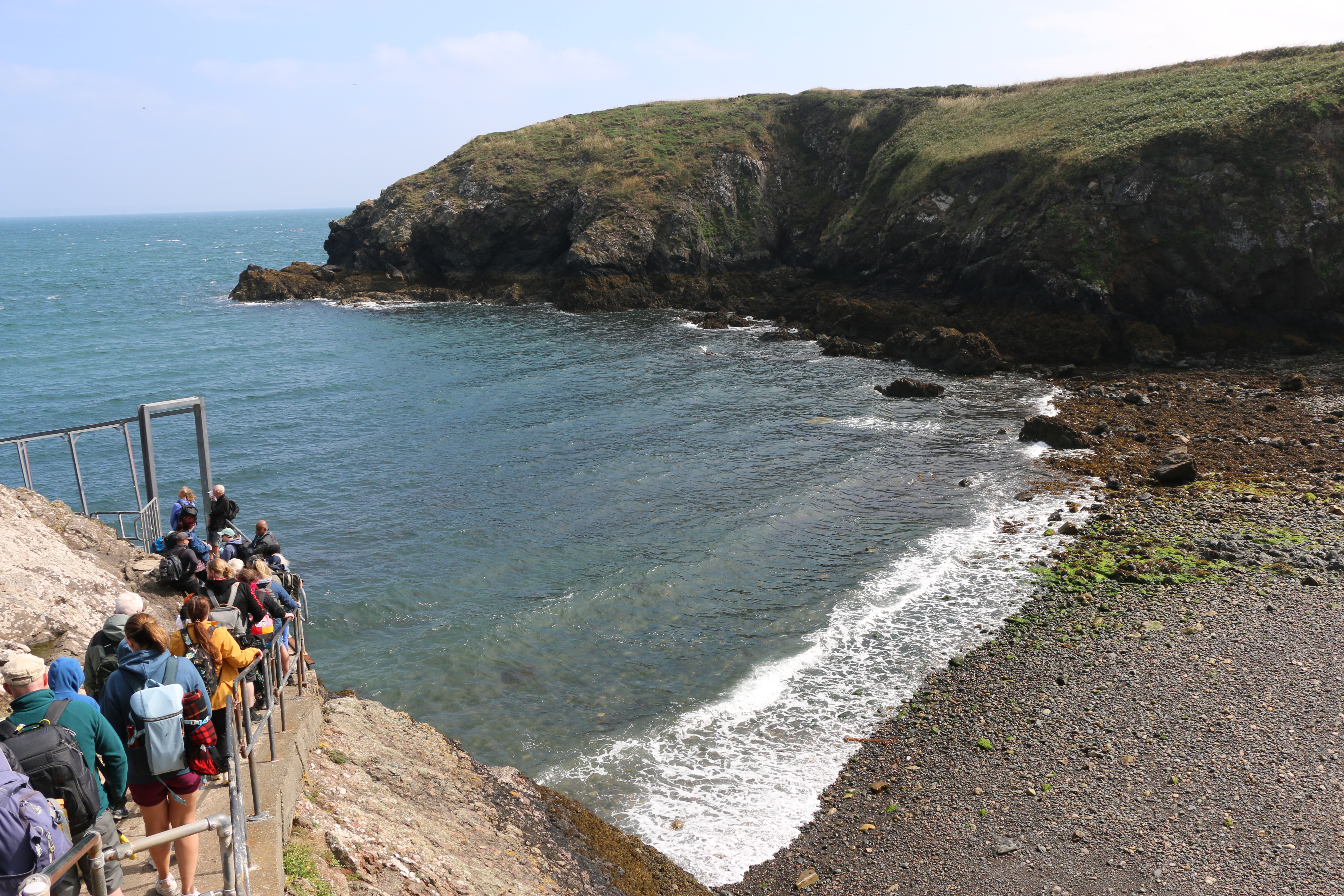
Together with the thirty other people we had been on the boat with, we climbed the steps and slopes from North Haven beach to the Information and Welcome Point, passing the ruins of one of the lime kilns on the island, now used as a shelter.
Following the short introductory talk by one of the National Trust volunteers on the numerous species of birds on the island, and advice on which paths to take, according to what we were most looking forward to seeing, we set off. Surprisingly it soon seemed that we were on our own as we began our walk of the south section of the island.
During the more prosperous farming days of the nineteenth century lime was important on the island, both as mortar for the buildings and to spread on the land as fertilizer. Limestone and coal would have been imported from the mainland, landed on the beach at North Haven and moved to the kilns to be heated.
In search of the second of the lime kiln ruins, which is beyond the Harold Stone we took a diversion.
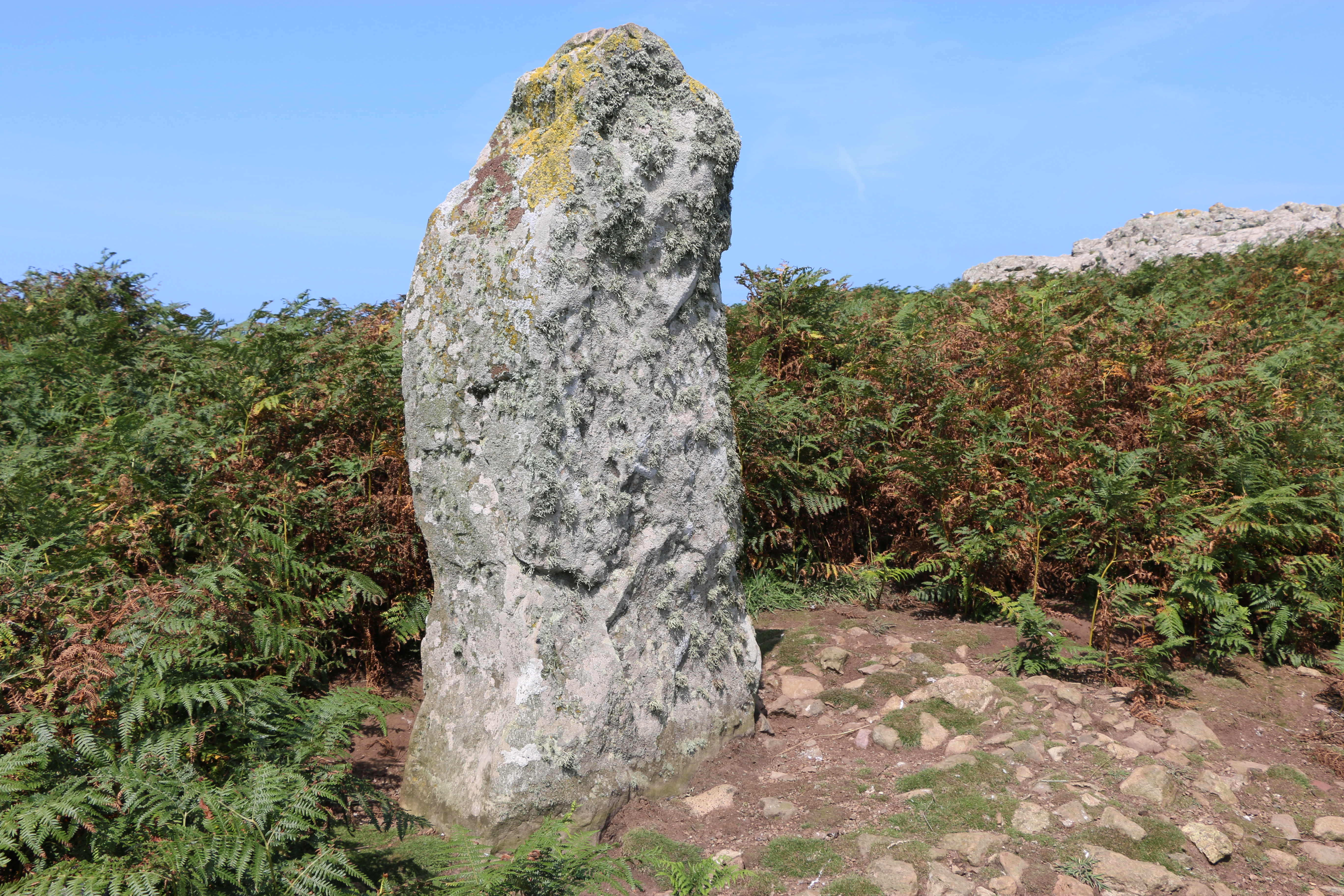
The Harold Stone has no cutting or tool marks, so seems to be mostly unshaped by man, and apparently smoothed by decades of cattle and other animals rubbing against it. As with many standing stones there are various ideas as to its function: the site of an ancient burial ground, a ritual or lookout area of an Iron Age settlement, (there are a number of Iron Age settlements around the Island, each one slightly different),or a marker for boats to approach North Haven.
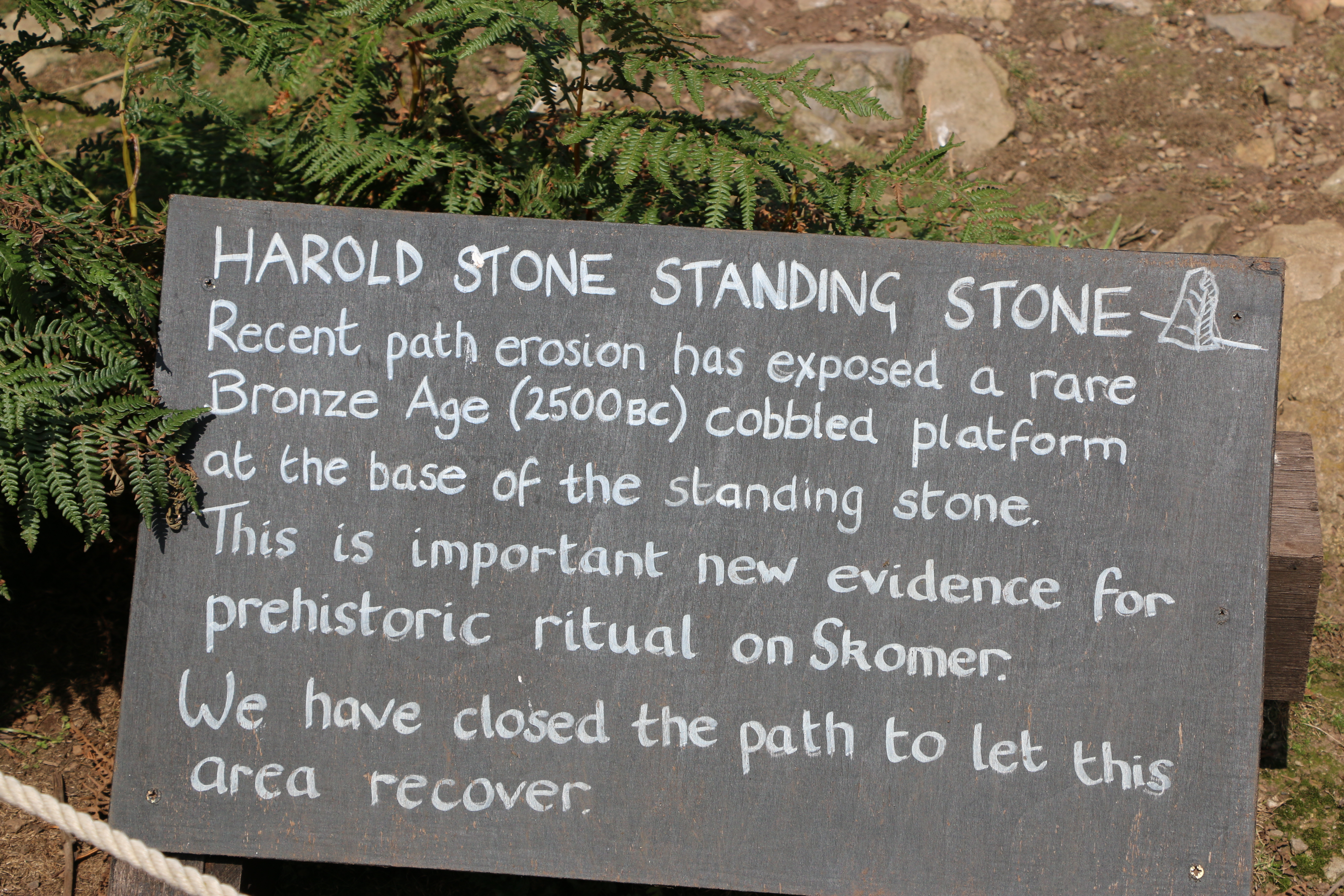
We were impressed by the care that is taken by the National Trust volunteers in preserving numerous areas of paths and grassland. At one point we saw an outline of a figure, dark against the bright sunshine, carrying an enormous scythe. As she passed us, she laughed and said she felt like the Grim Reaper. Walking on we saw the area she’d cleared and roped off to allow a patch of ground to recover.
We walked on...

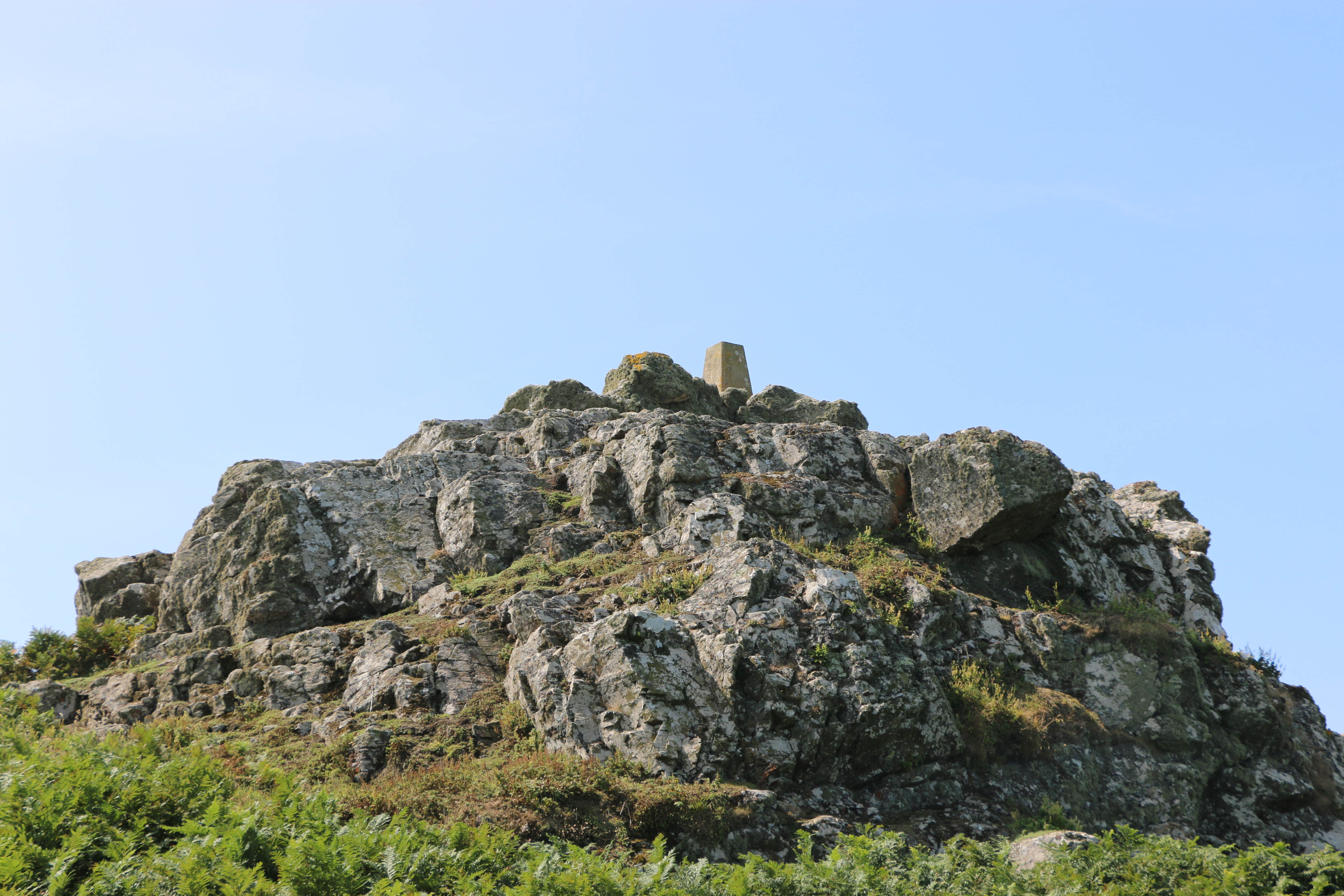
We couldn’t find out what the small ‘monument ‘ is on top of this rock formation.

True to form we didn’t follow our intended circuit and meandered along paths, and retraced our steps in rather a haphazard fashion, (although the Photographer will dispute this and declare our route to be organised according to the circuit he planned). However true his statement was, I must admit we did pass numerous impressive limestone outcrops covered in lichen, and vast expanses of ferns, heather, gorse and wild flowers.
And we did see the majority of Skomer by the end of our time there.

After our short respite at the farmhouse we moved on to Skomer Head. The rocky headland was covered with fading pink Thrift (and evidence of the rabbits). It’s an impressive view from there; we could see Skokholm, which is a sandstone island, and, less clear but still visible, the island of Grassholm. I remembered that. many years ago, we took a trip on the Waverley (the last seagoing paddle steamer) and passed Grassholm. It’s the third largest Gannet colony in the world, and the island is covered in white. I’ll leave that last statement to your imagination!

There are the remains of an Iron Age boundary wall running parallel to more modern boundary walls from Skomer Head. The modern one is close to the path and the remaining stones of the prehistoric one on the nearby rock ridge above.
We crossed Wick Stream; a wetland area with small streams that are apparently connected by six dams. We couldn’t see them, though it was interesting to be told by one of the National Trust volunteers that they could be part of the Iron Age walls but they might also be of later origin. Their purpose is not known ,although it’s most likely that they were for water conservation, creating ponds for storage of water and watering stock. The paths along the way were protected by boardwalks, but mostly were rough and rocky on our way to The Wick.

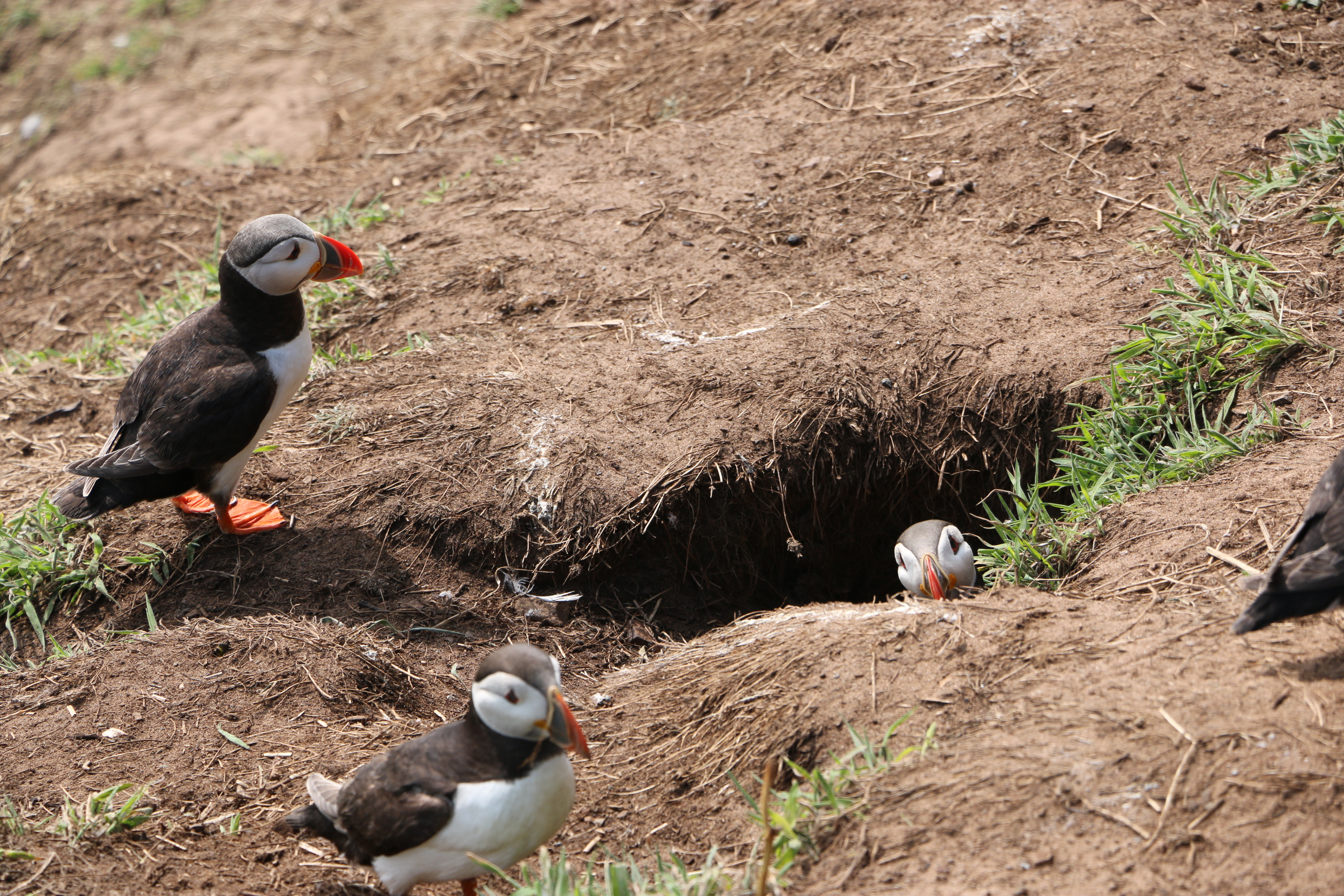
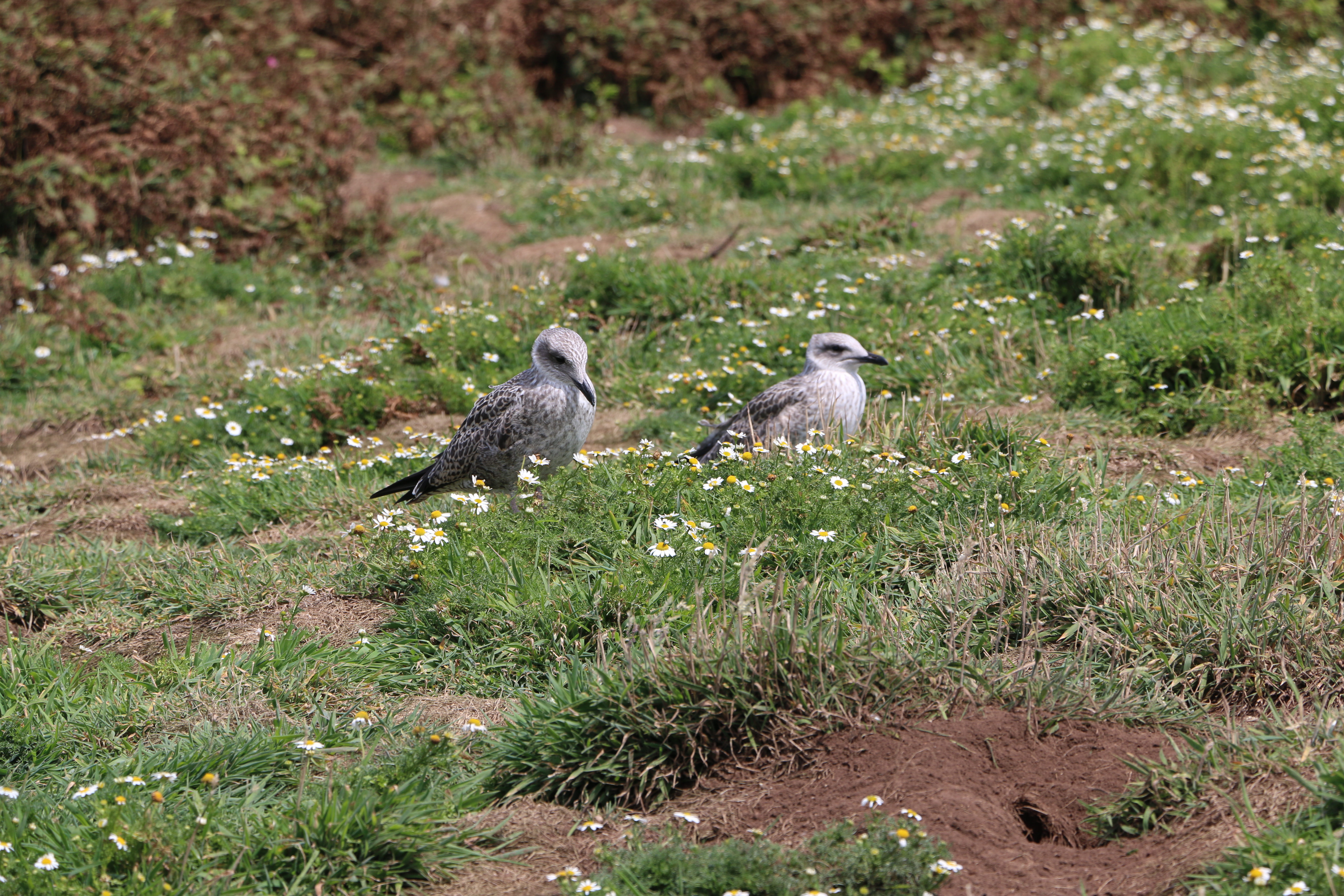
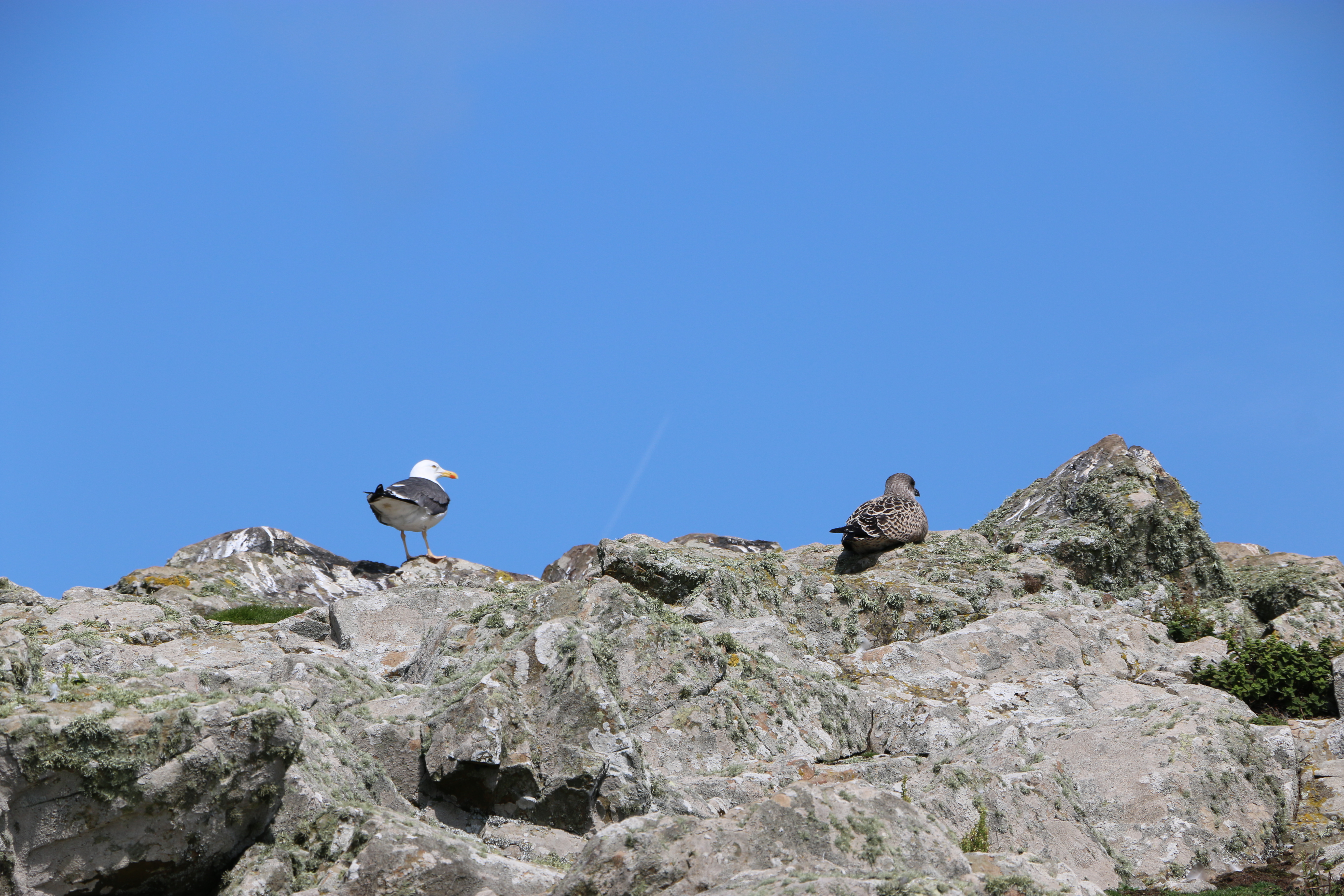
The Wick was formed by geological fault activity and basaltic lava flows. It’s a magnificent cliff face, rocky on one side, steep slopes opposite, and filled with the sound of the breeze and the waves. We saw Fulmars and Great Black-backed Gulls swooping and riding the air currants. It was quite nerve-wracking to peer over the edge from the safety of the ledge that appeared to be especially placed there for that purpose (I could be wrong, but it was what most people were using it for – but as the area was cordoned off to protect the puffins to cross the space to reach their burrows – otherwise the gulls would predate them – the ledge was useful)
The Photographer! Just to prove he took the photos and that it was really hot, sunny weather.
We were running out of time so began to make our way back to North Haven. The path was steep and even more rocky in places but the views were still imposing.


Reluctant though we were to leave Skomer, we arrived back in good time for our departure slot for Dale Princess to take us back to the mainland with many photographs and great memories.
A short history of Skomer Island:
Around thirty-seven thousand years ago, Skomer would have been part of the mainland, only being cut off, following rising sea level, by the end of the last Ice Age around twelve thousand years ago
There is evidence of untouched remains of huts, fields and cairns that appear to prove that between five and twelve thousand years ago there was an Iron Age settlement of a small farming community on Skomer. Near the Garland Stone, a pyramidal (shaped like a pyramid), just off the northern tip of the island, there is a short circular detour off the main path across a ridge where a group of nine small cairns have been identified. This is probably a prehistoric cemetery. In North Valley, looking towards North Pond when conditions are suitable the remains of a number of circular Iron Age huts in pairs can be seen. This is the most complete and untouched remains of this period in the whole of Europe.
But then, except for some evidence of Medieval buildings on the island there is no clear record of any habitation until around the thirteenth century.
Farm Complex – I researched for a more detailed history of the farmhouse described in Part One, which may be of interest to some:
The farm was lived in by various tenants and owners of the island:
Lord Kensington bought the island in 1897 and used it mainly as part of his sporting estate. A J Neale, a trawler owner from Cardiff, leased the Island in 1905 with the aim of protecting the wildlife, but had to relinquish the lease later and then it was bought by a Mr Sturt, who stayed on the island with his family. His daughter eventually married a local man Reuben Codd. The Codd family farmed the Island until the outbreak of the Second World War in 1939. Afterwards the Island became a Field Study Centre for a year until 1946, run by the West Wales Field Society, and visitors stayed in the house. In 1950 the Codds left the Island. Then, in 1954, the roof of the old farmhouse was severely damaged during a major storm – it was left a ruin. The Skomer Island Heritage Project enabled the old farmhouse was reinstated and took in visitors again. The old barn, once a two-story barn for storage and animals, is now used for visitor and research accommodation.