Last year I wrote – “At long last! After living in Pembrokeshire for the last forty-six years and despite walking many miles of the Pembrokeshire coast, and meandrering around a lot of the Welsh countryside discovering wonderful places, lakes, waterfalls … scenary, we hadn’t been on Skomer island.”
This week we managed to visit Skomer again. Like last year, it was a glorious day’s adventure, and though warm, it was slightly … hmm … a lot more windy, especially on our walk along the rocky path to the far end of Skomer Head, the one place we missed seeing in 2025.
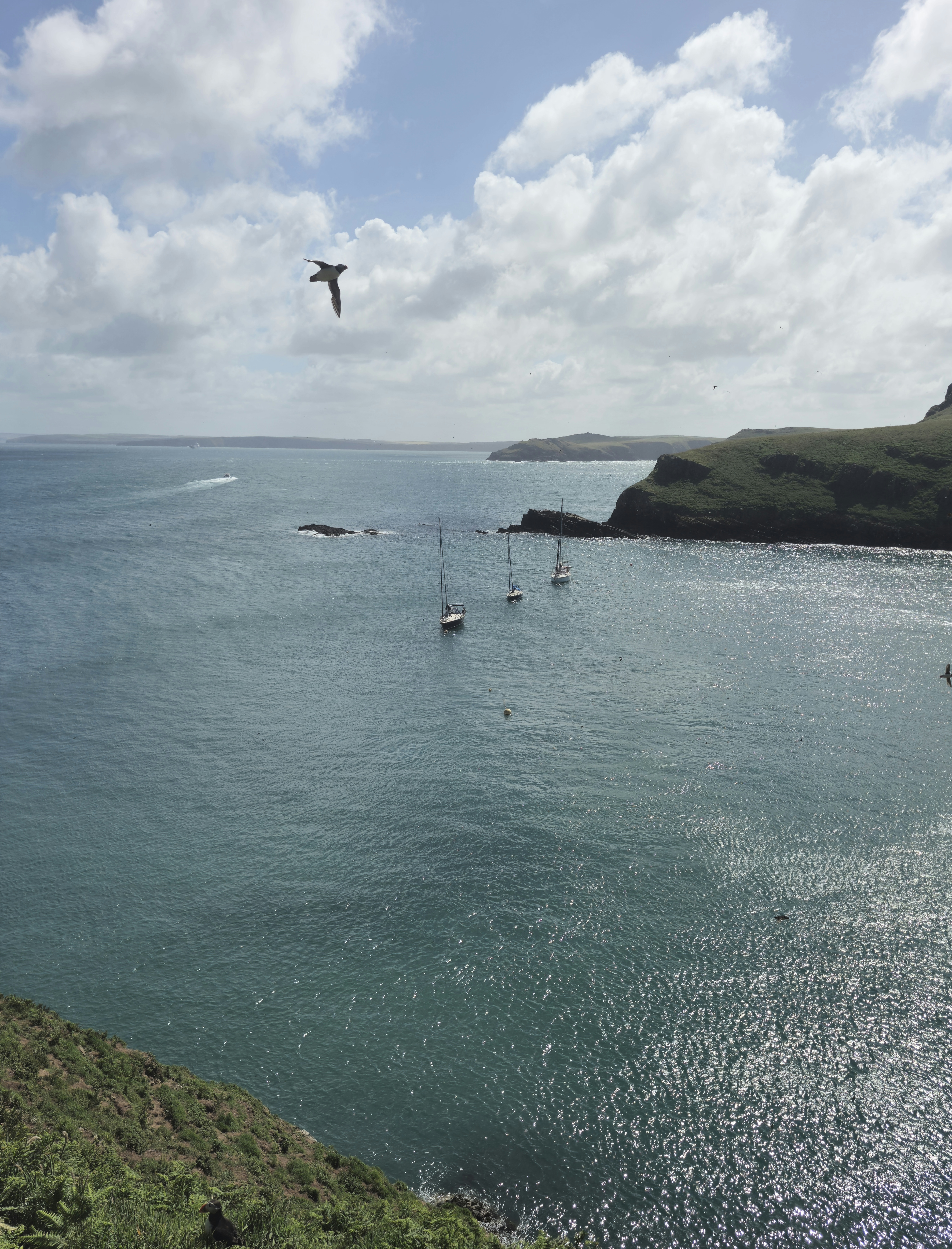
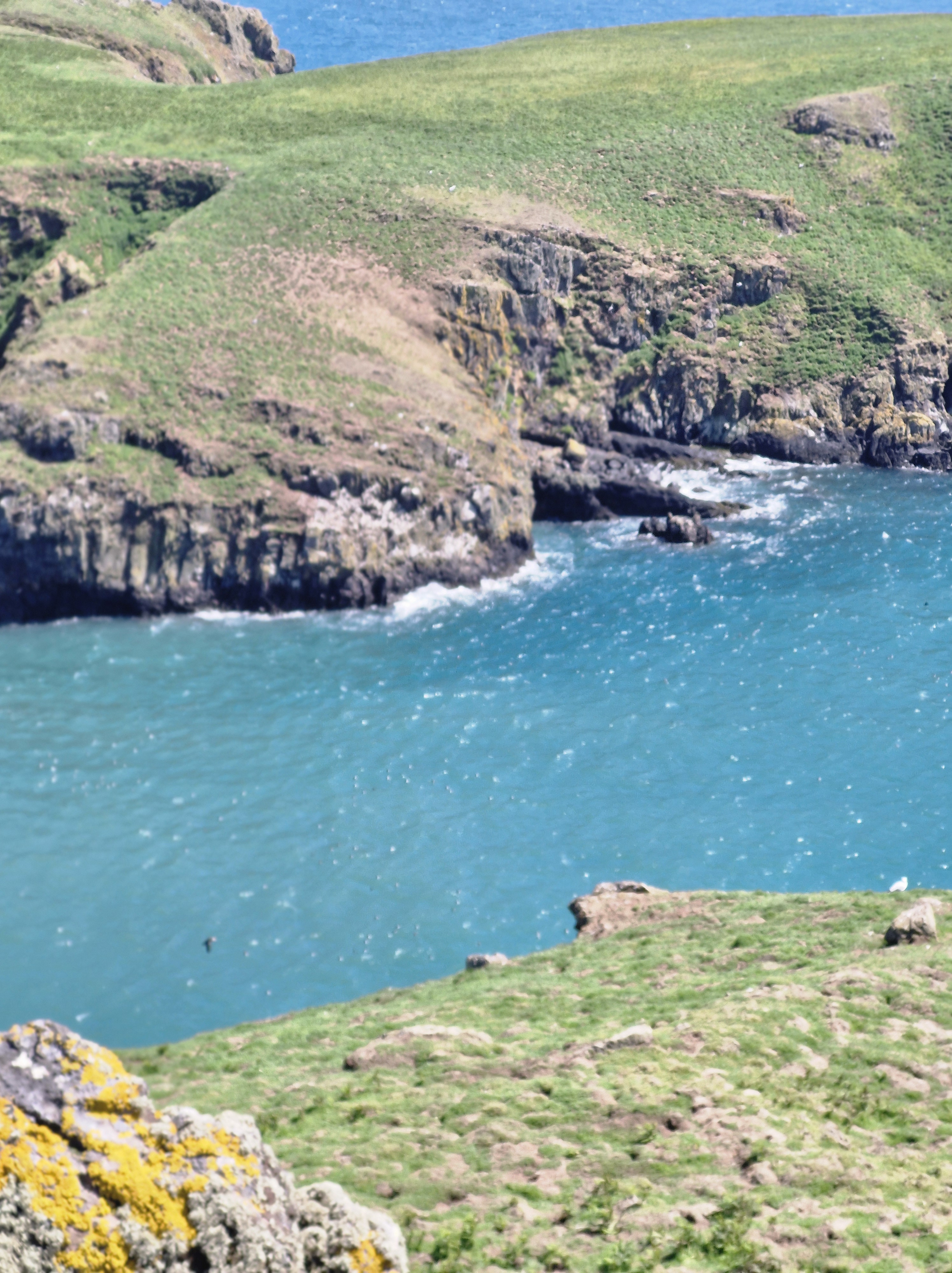
Skomer Head
The wind was so strong at this point we struggled to walk. It gave the Photographer an excuse to stop many times.
After being buffetted so much we were relieved to find that, when we turned inland, it was slightly calmer.
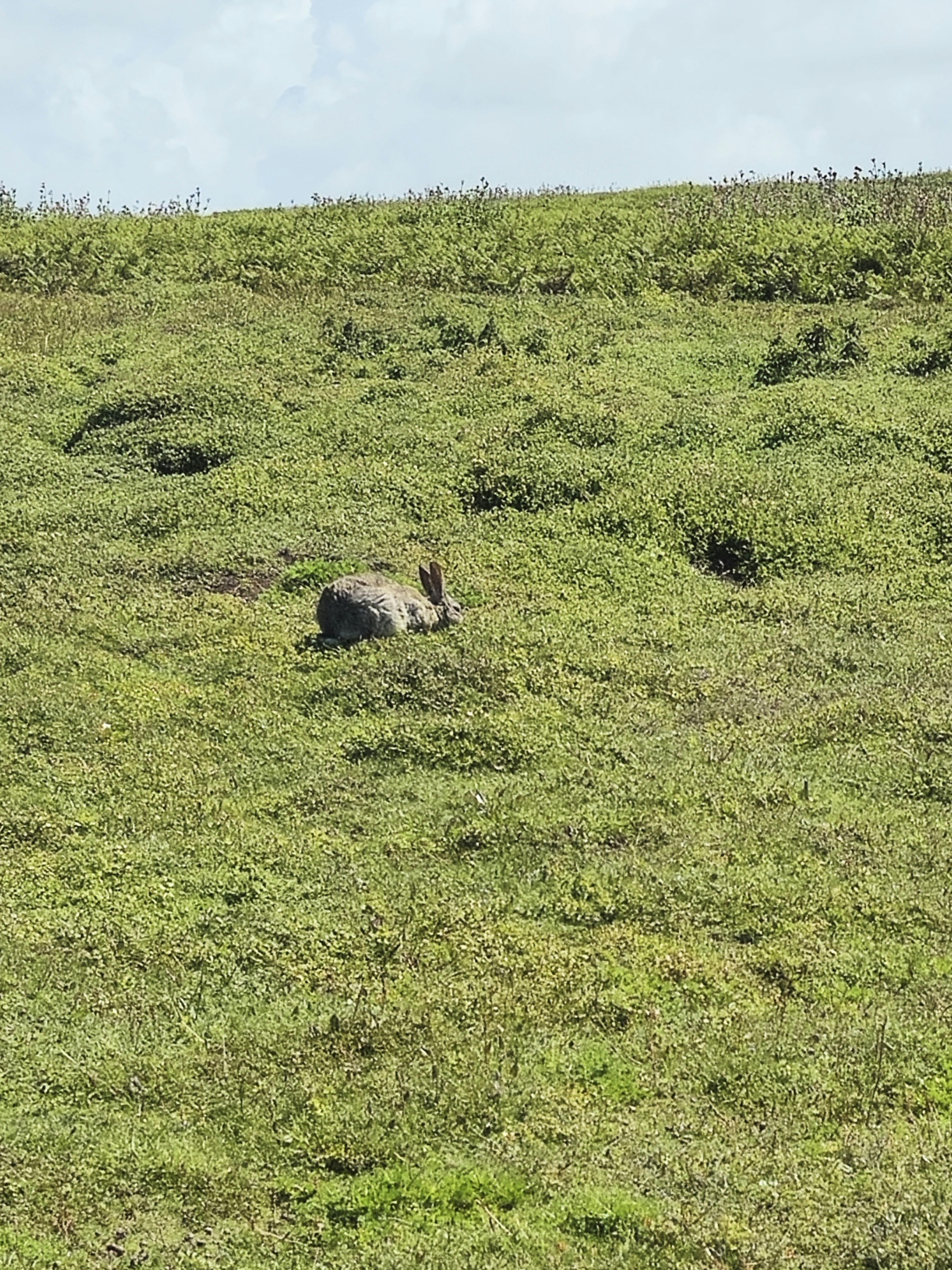
This rabbit took not the slightest notice of us.
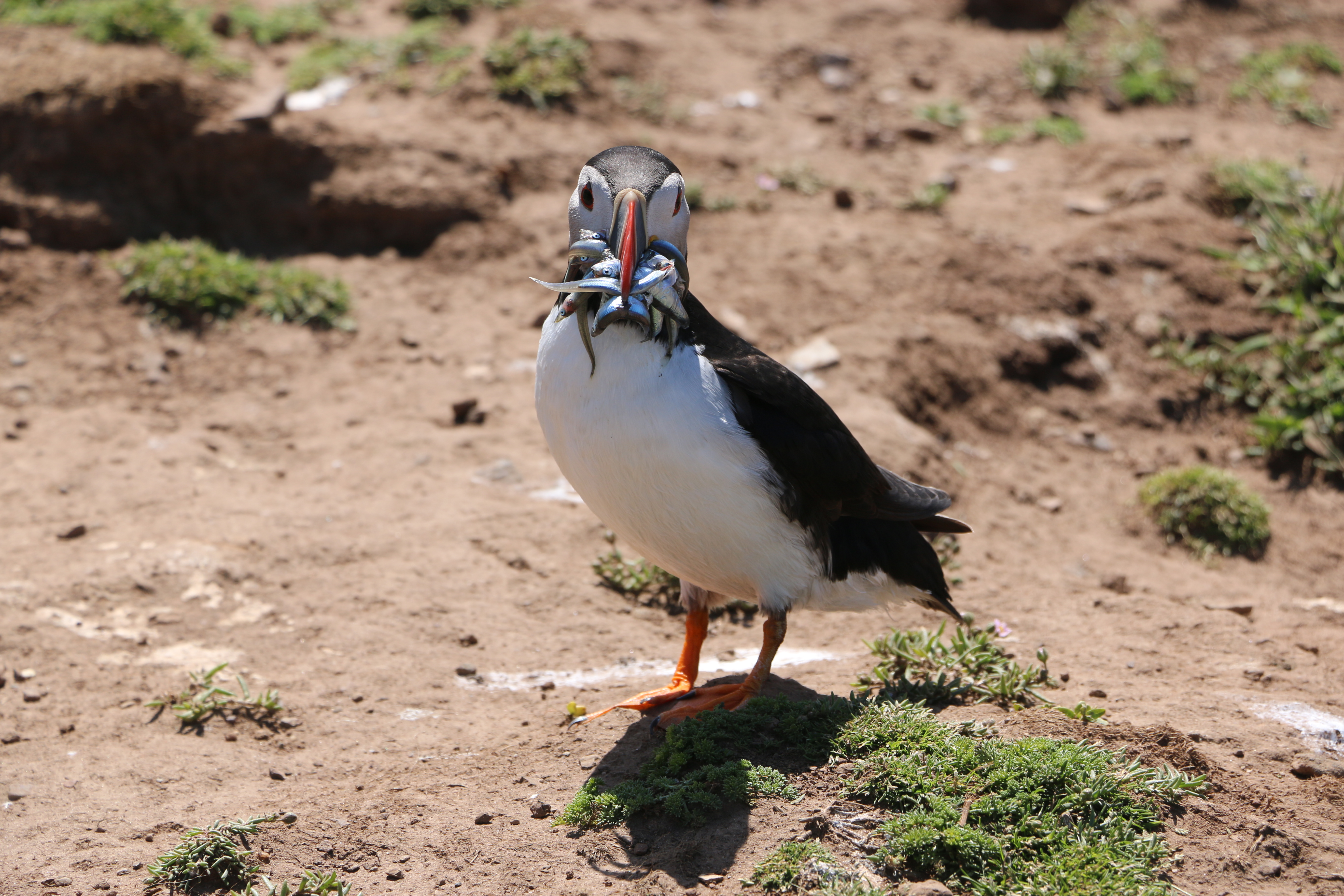
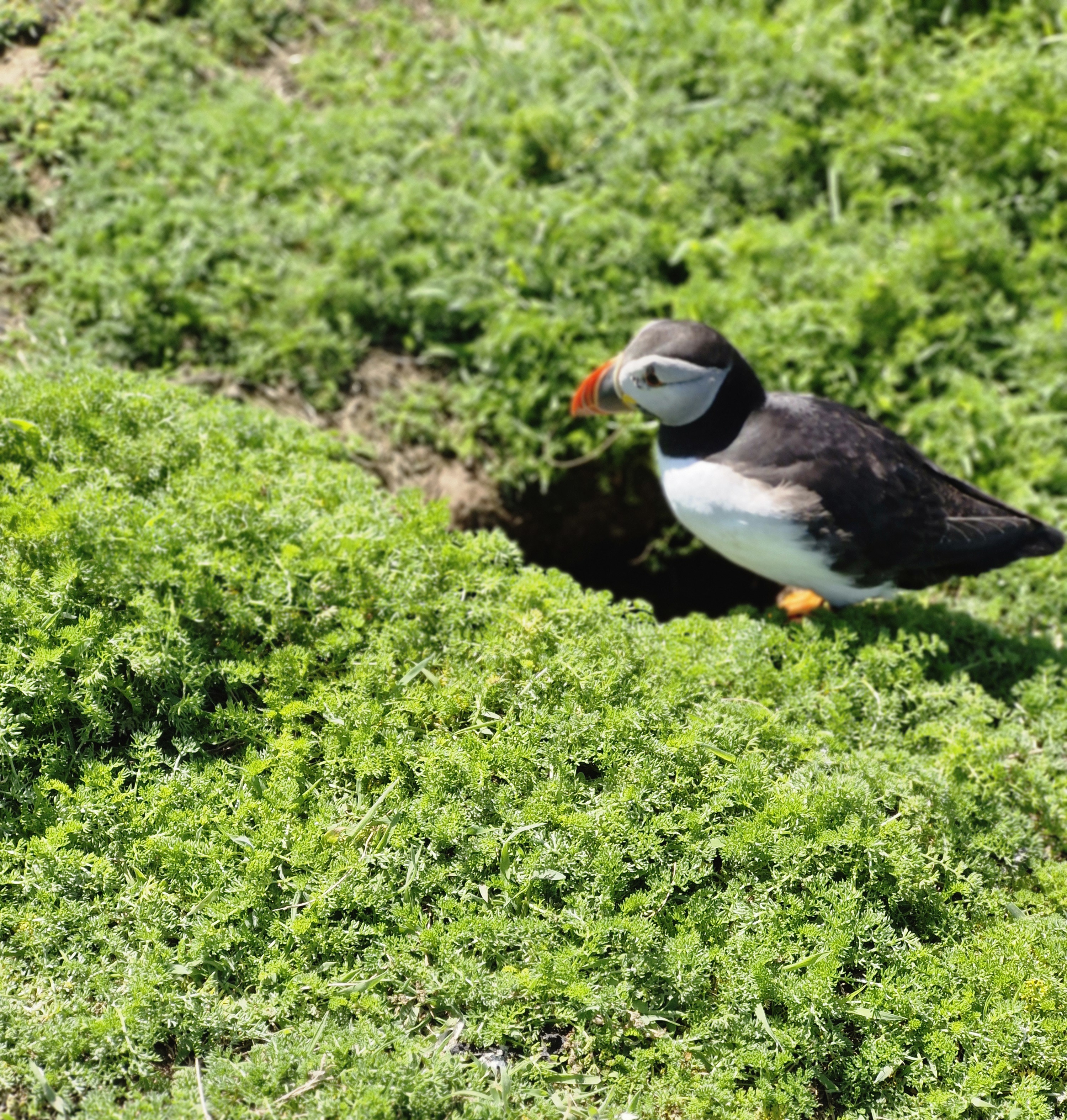
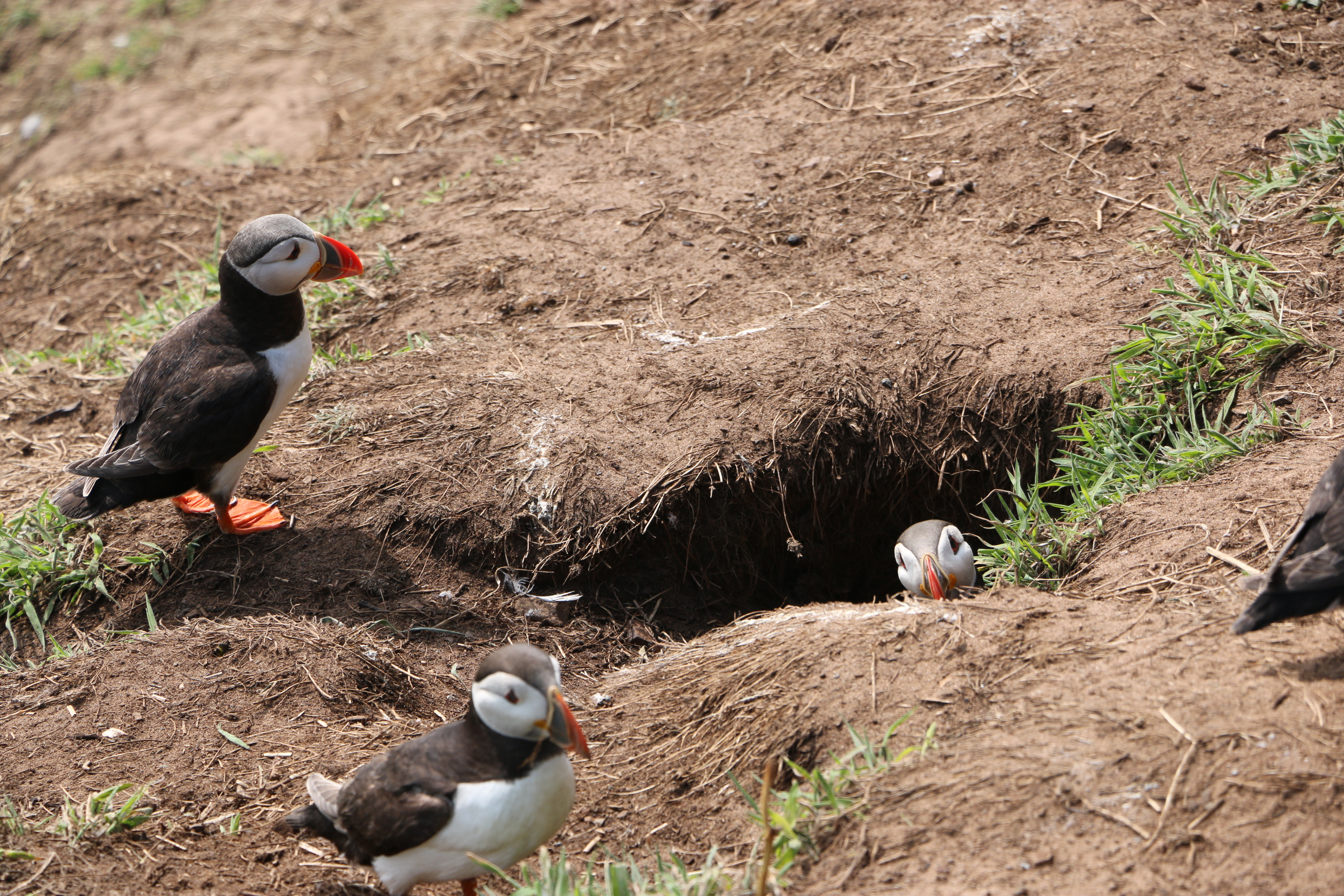
Unlike the Puffins …
Skomer is internationally important for seabird, especially Puffins. When the Photographer stopped to take their photos at The Wick, they were as curious of us as they were last year. Wonder if some of them were the same birds!
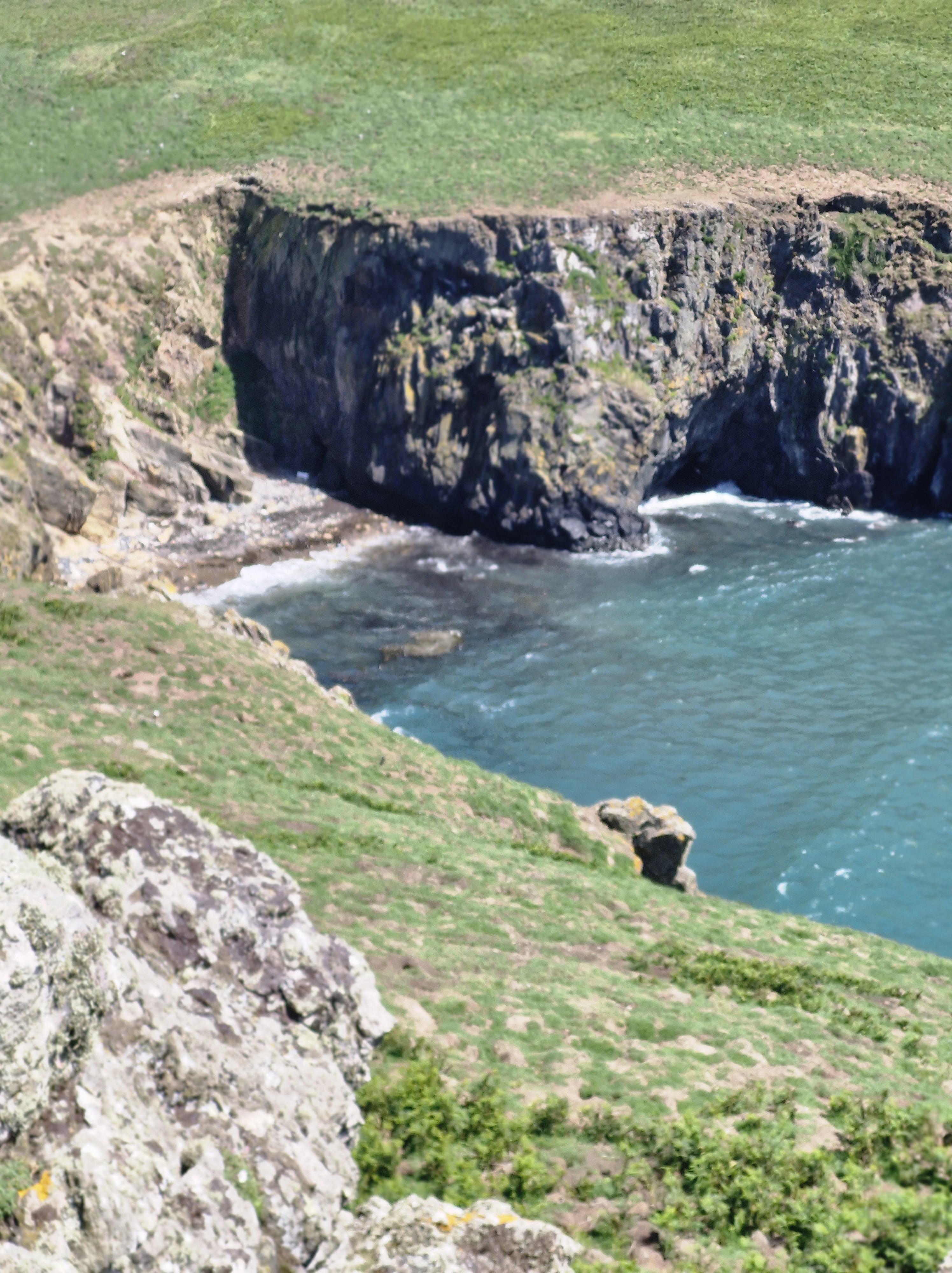
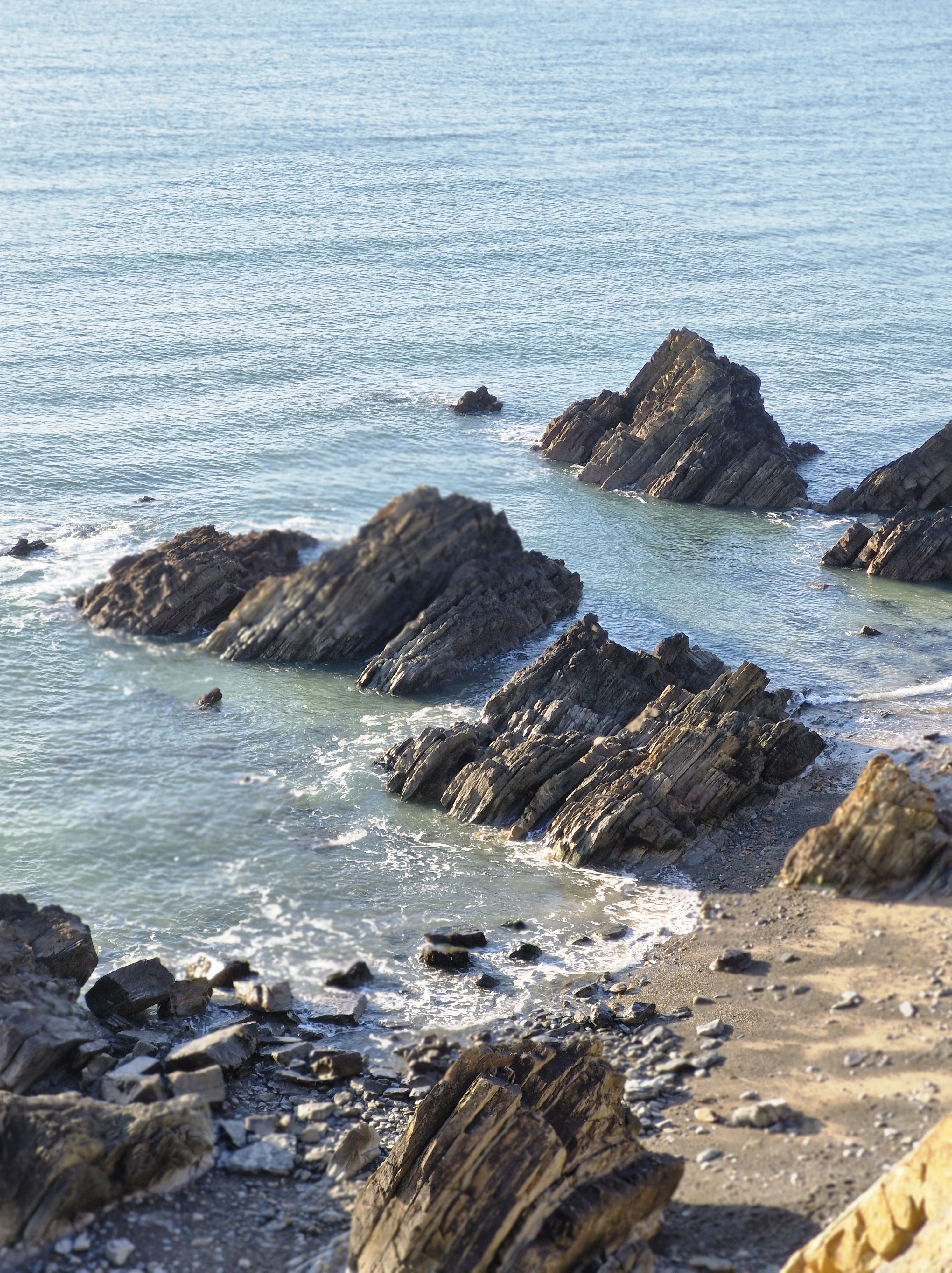
Last year I wrote about the geological fault activity and basaltic lava flowsthat long ago formed The Wick in Crossing Off the Bucket List Part Two). Looking over the edge of the cliff was just as scary to me as then. And, like last year, the Fulmars and Great Black-backed Gulls swooping and riding the air currants, were just as noisy.
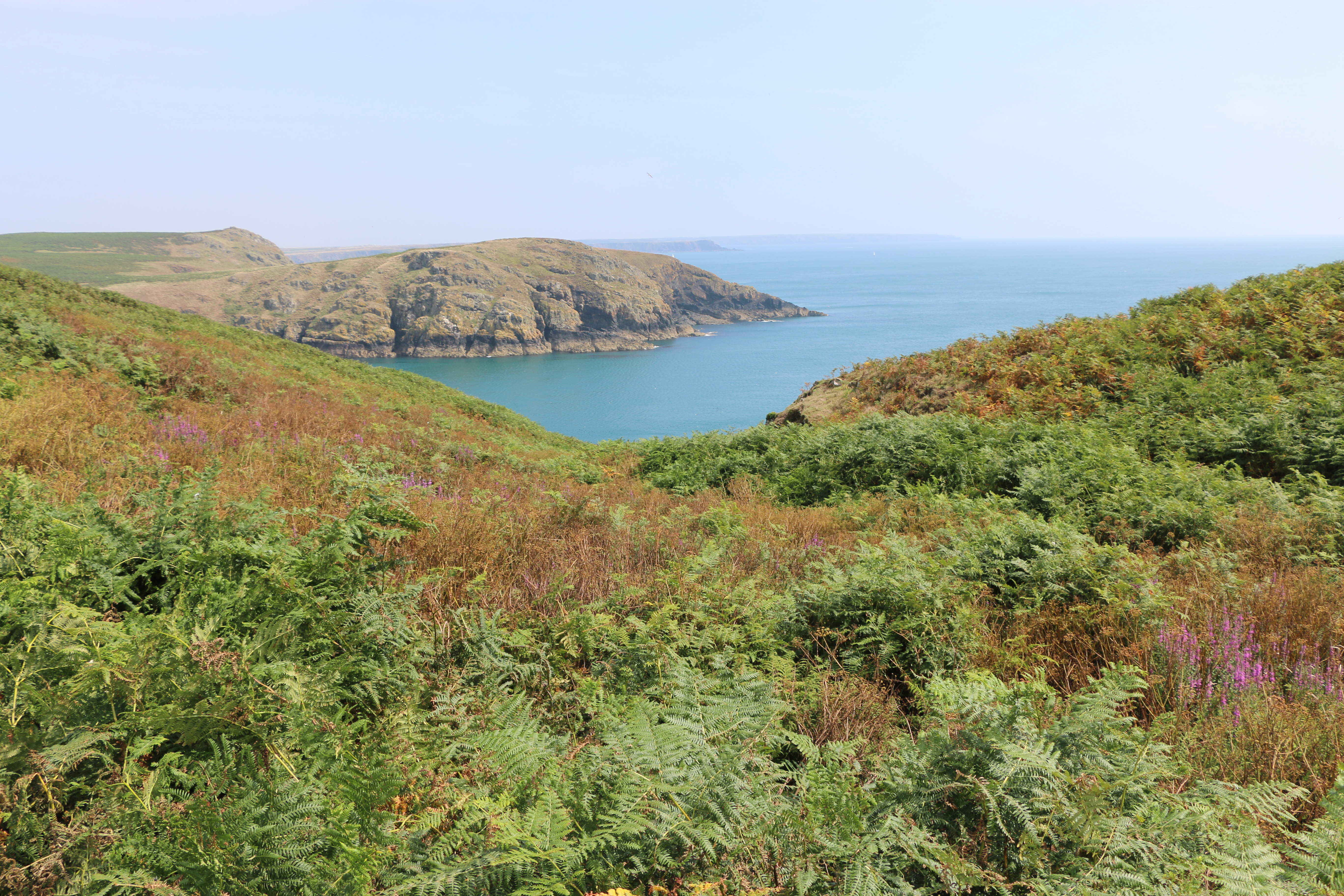
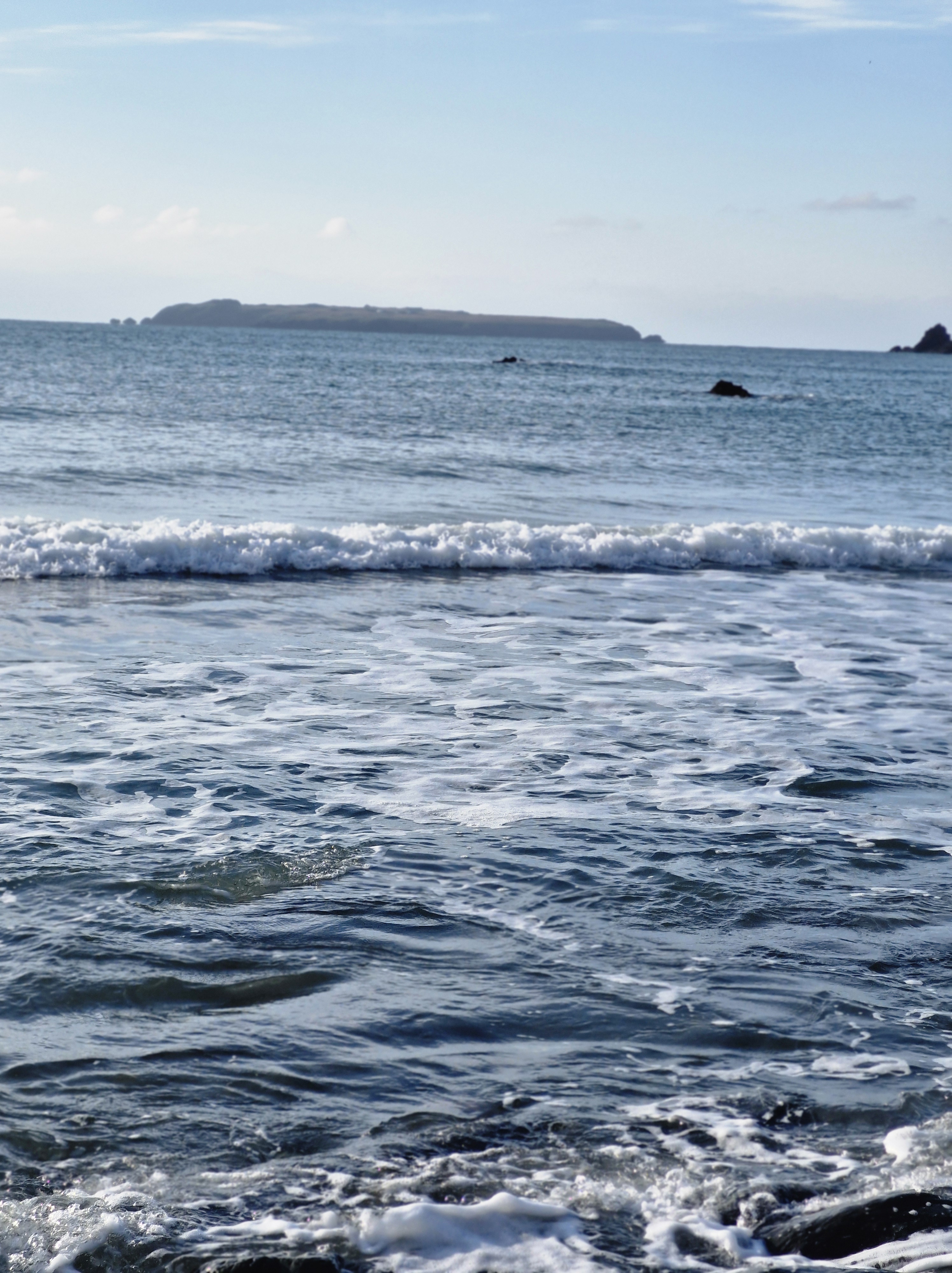
After almost four hours of walking we finally stopped by an outcrop of rocks to eat a belated lunch and admire the sweep of the glorious coastline.
Packing up, I looked at the path we needed to take to get back to the harbour. It seemed a long way!!Undaunted the Photographer set off. “Come on,” he said, cheerfully. ” It’s further on where we saw the Manx Shearwaters, Guillemots, Razorbill, and Kittiwakes last year.” I followed. After all, he had the last bottle of water (and the chocolate) in his rucksack.
And, after all, who could resist a last look at the magnificent scenary of this island and another chance to spot different seabirds?
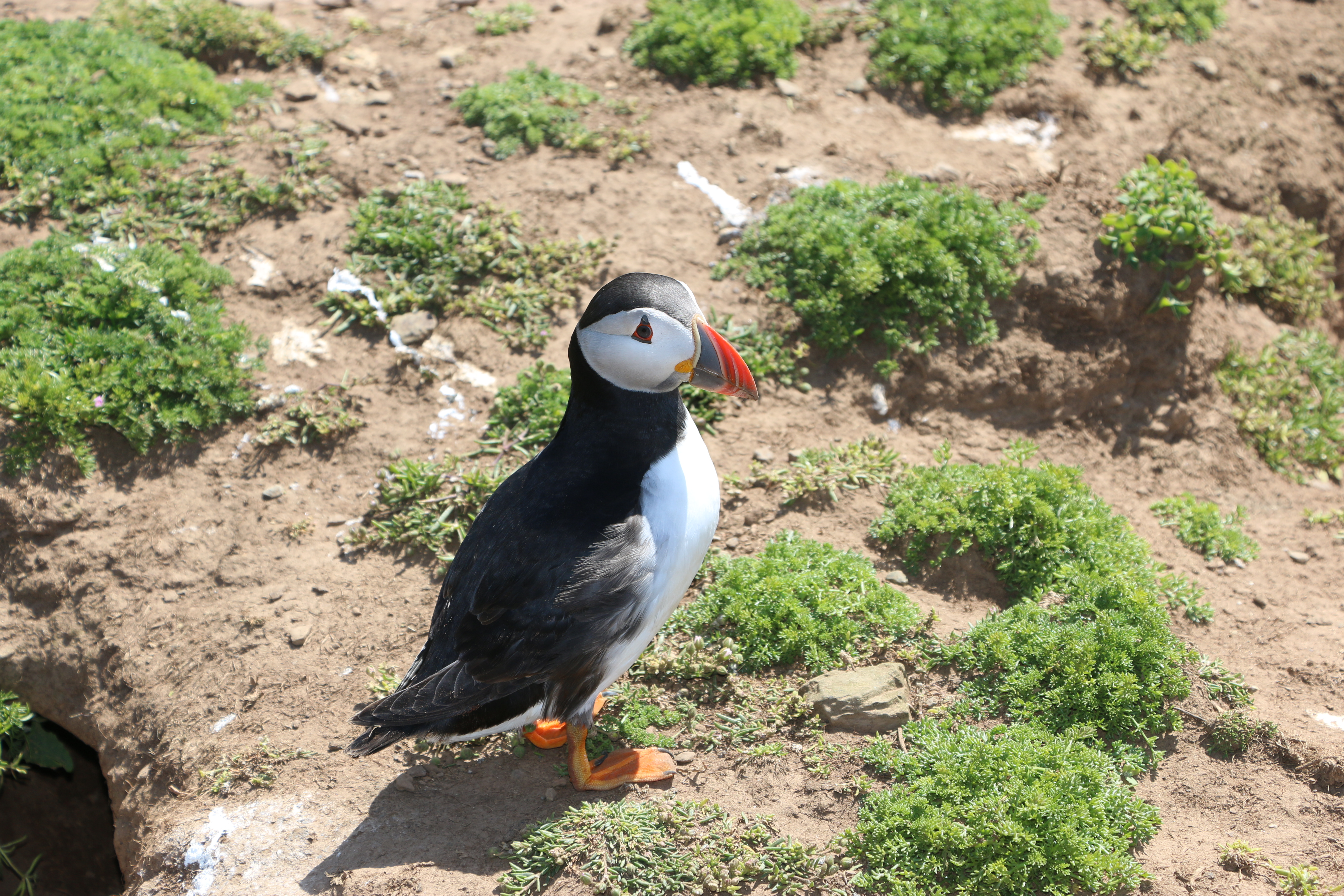
We arrived back at the harbour in good time to see the boat coming in. And to take a final Puffin photo.
A short reminder of the history of Skomer Island:
Around thirty-seven thousand years ago, Skomer would have been part of the mainland, only being cut off, following rising sea level, by the end of the last Ice Age around twelve thousand years ago
There is evidence of untouched remains of huts, fields and cairns that appear to prove that between five and twelve thousand years ago there was an Iron Age settlement of a small farming community on Skomer. Near the Garland Stone, a pyramidal (shaped like a pyramid), just off the northern tip of the island, there is a short circular detour off the main path across a ridge where a group of nine small cairns have been identified. This is probably a prehistoric cemetery. In North Valley, looking towards North Pond when conditions are suitable the remains of a number of circular Iron Age huts in pairs can be seen. This is the most complete and untouched remains of this period in the whole of Europe.
But then, except for some evidence of Medieval buildings on the island there is no clear record of any habitation until around the thirteenth century.
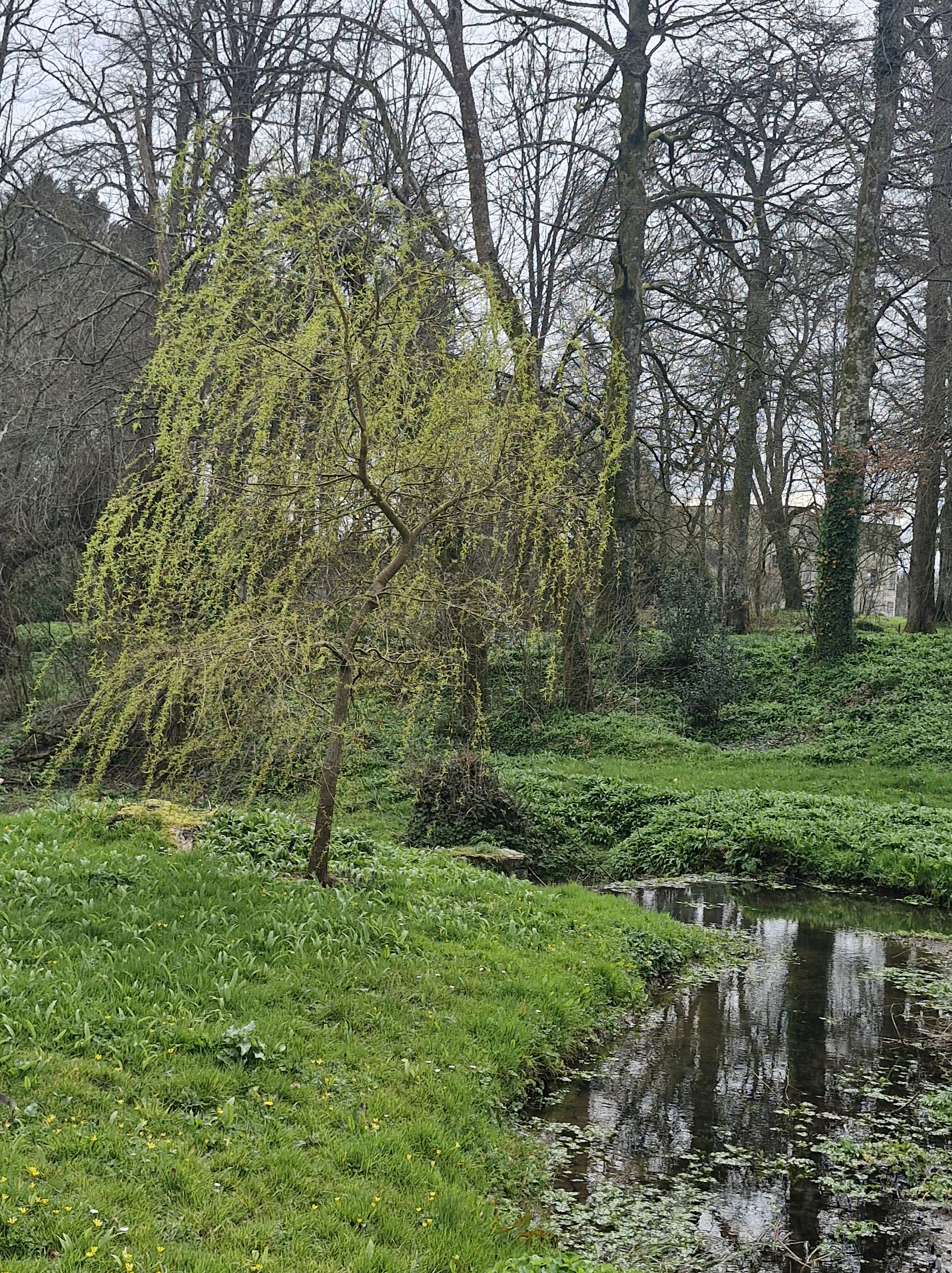
Arran, where I am lucky enough to go on a writing retreat with four brilliant author friends. The surroundings always inspire. This is Glen Rosa.
I was at a meeting the other day. It was a roomful of lovely, interesting people, many of whom I talked with, many of whom told me fascinating stories – letting me catch a glimpse of their lives, of themselves.
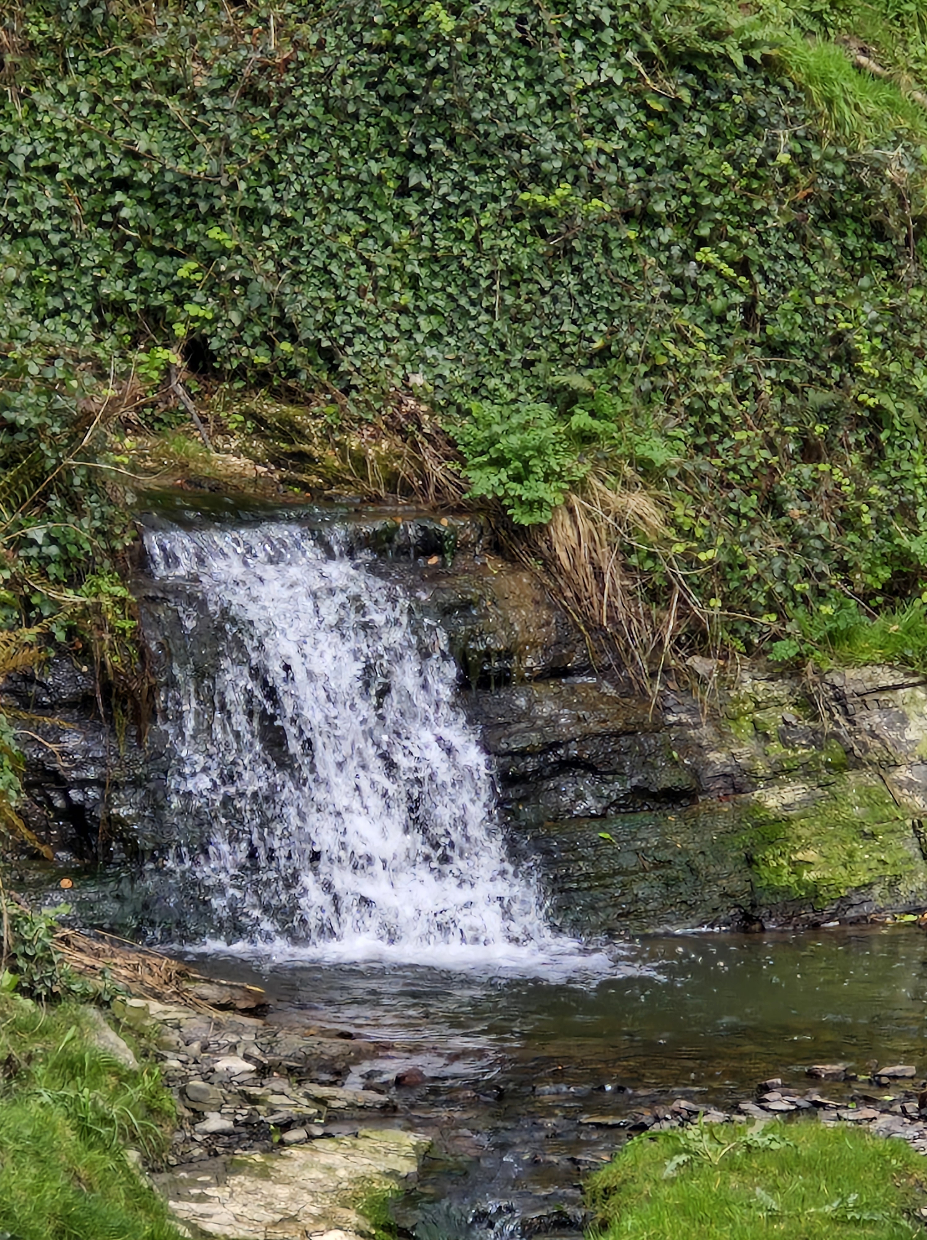
Glenashdale Falls (Eas a’ Chrannaig), Arran. looking down is a little scary – but really gets the brain/ emotions working
But it was one man who I spoke with for a few minutes who has left me with an impression I wasn’texpecting … or needed, to be honest. He was asking about my creative writing class, and I was in my usual enthusiastic mood about the stories we all have within us, that everyone has a genre they can excel at, and how he would be so welcome to join our group – when he stopped my gallop (as my mother would say). He said that he really didn’t need or want to join in with a collection of people trying to write from their experiences in life. He knew all he had to do was to, “Put a few ideas into ChatGPT, take the story it produced, and tidy it up…” It was something he’d been doing for a while apparently. And it worked for him. When I asked how he “tidied the story up,” he looked blankly at me, and then said, “you should know, the punctuation etc.” It was the “etc” that told me that I should just smile and say something benign like, “okay. Or each to their own” or some such – and leave.
Tides out. Looking over towards Holy Island from Kingscross.
Instead I asked him what about all the different experiences we have as we move through life? The memories of the world at a certain time, of observed situations, of the people we met, lived alongside. Of our interpretation of all those things, and the way we reacted. Of using all of our five senses to bring a story to life, to hopefully evoke a response, a reaction to our reader?
On another trip to Arran, the Photographer and I were walking along a track with Mount GoatFell in the distance. The path became narrower and narrower – until we saw …
Whereupon I and Dusk, our gorgeous companion lent to us by our friend, refused to go any further.
Relaxing by the side of Loch Garbad after a bit of a trek from Eas Mor.
As I was speaking to the man I became aware of his smile growing wider. Now I swear it was a smirk (I was getting increasing frustrated inside by his calm indifference to my side of the discussion – and it was a discussion, not an argument – I learned the difference between them many years ago – see: https://tinyurl.com/yssmpde7. But my husband says the man’s smile was one of sympathy and understanding that I “simply don’t know how the world of writing works these days.” Yes, he did say that, obviously allowing that I was too old, was too set in my ways to accept the way things are now.
And yes, it still discourages me seeing his belief written here.
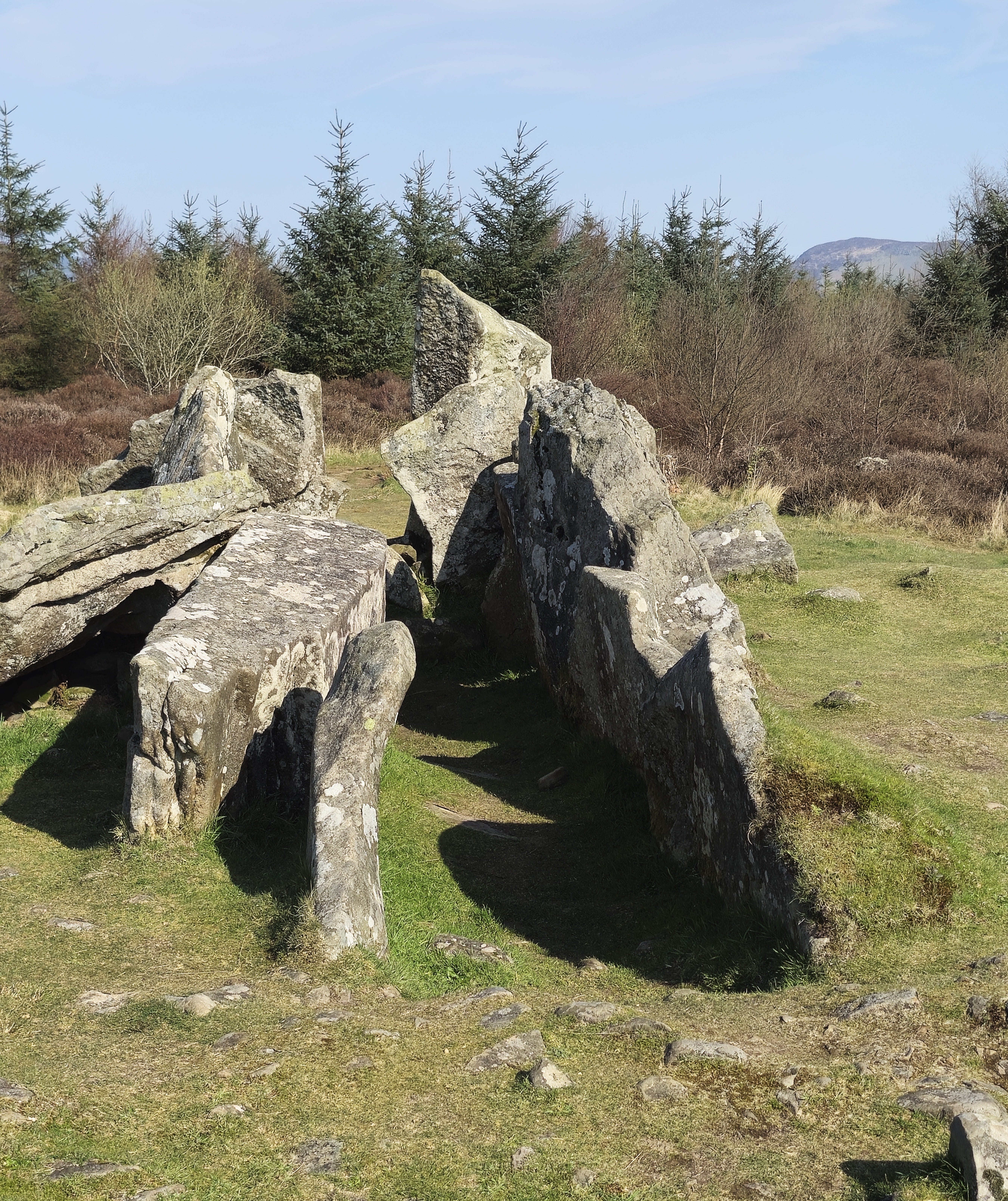
Giants Graves – above Whiting Bay.
But there is nothing I can do about that. So here I am, flogging away to get the right words to fit together to get the right ‘feeling’ in this part of the book I’m writing at the moment. Trying to bring a scene to life, using all that I have in me, all that I have experienced, learned, over the years. Using my imagination. And the fleeting moment of wondering if I’m wrong, that some inanimate object, ChatGPT, can do it better than me, is only that … a fleeting moment. Because there’s only me in my head, there are only my memories, my thoughts, my emotions in my brain.
My effort at a picture. Looking back at the steps from the Giants’ Graves, leaving the Photographer behind as he …
… disappears through the grass on the hill overlooking Whiting Bay – ever in the search for ‘the best shot’.
And if what I write, my stories, are not what some (or many) readers want, that’s okay. Because there are as many different readers as there are authors. It’s all subjective. And I know I won’t stop writing – because I can’t.
I should end this by saying I’m not judging; it’s not my place to judge anybody. And I’m not saying I’m right and it’s wrong to use ChatGPT. We all do things differently. I’m only saying it’s how I’ve always felt about my work, it’s how I write. I don’t judge.
I just wish that man hadn’t smirked at me. Despite what my husband says, I just know he smirked!!!
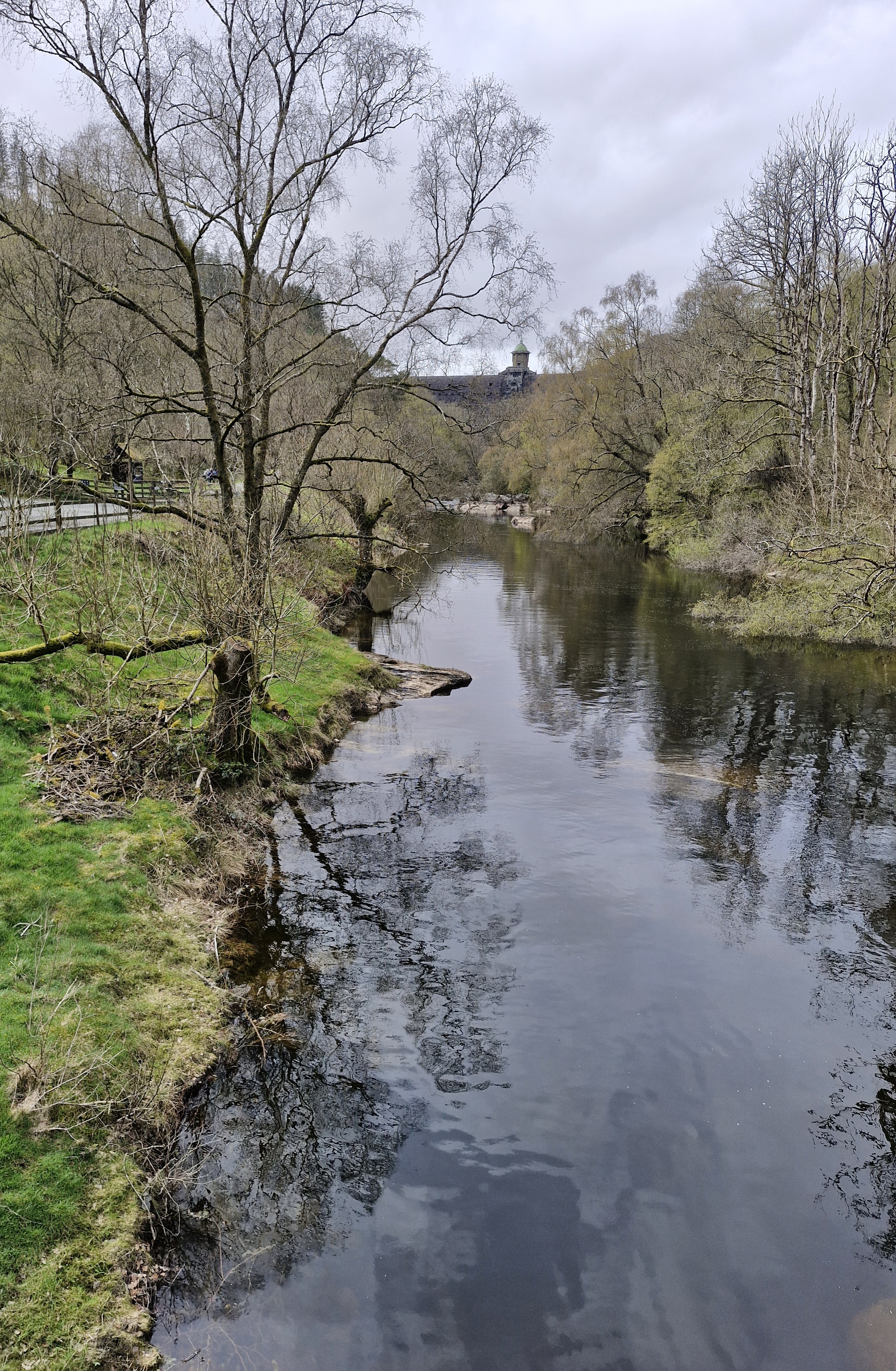
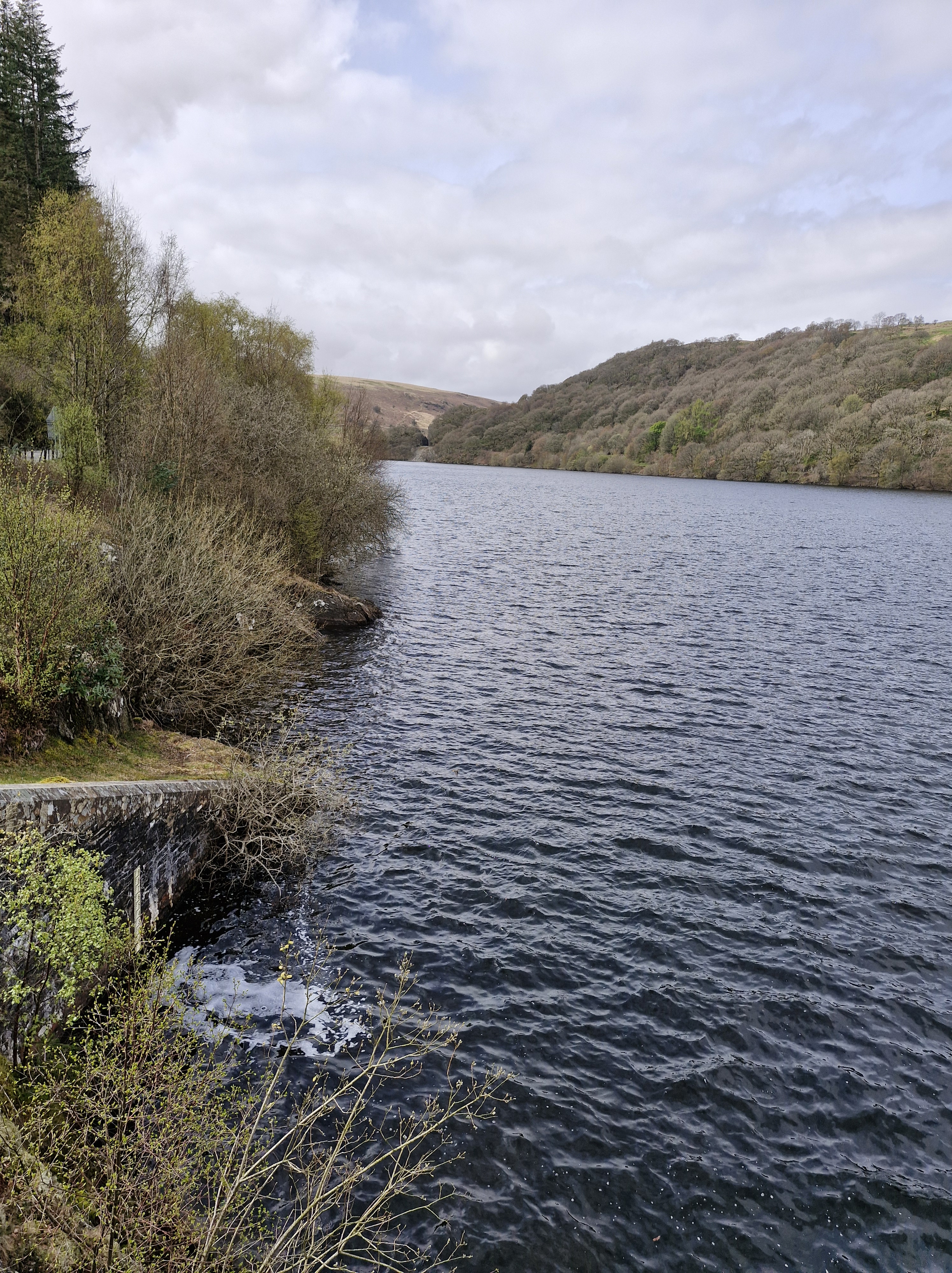
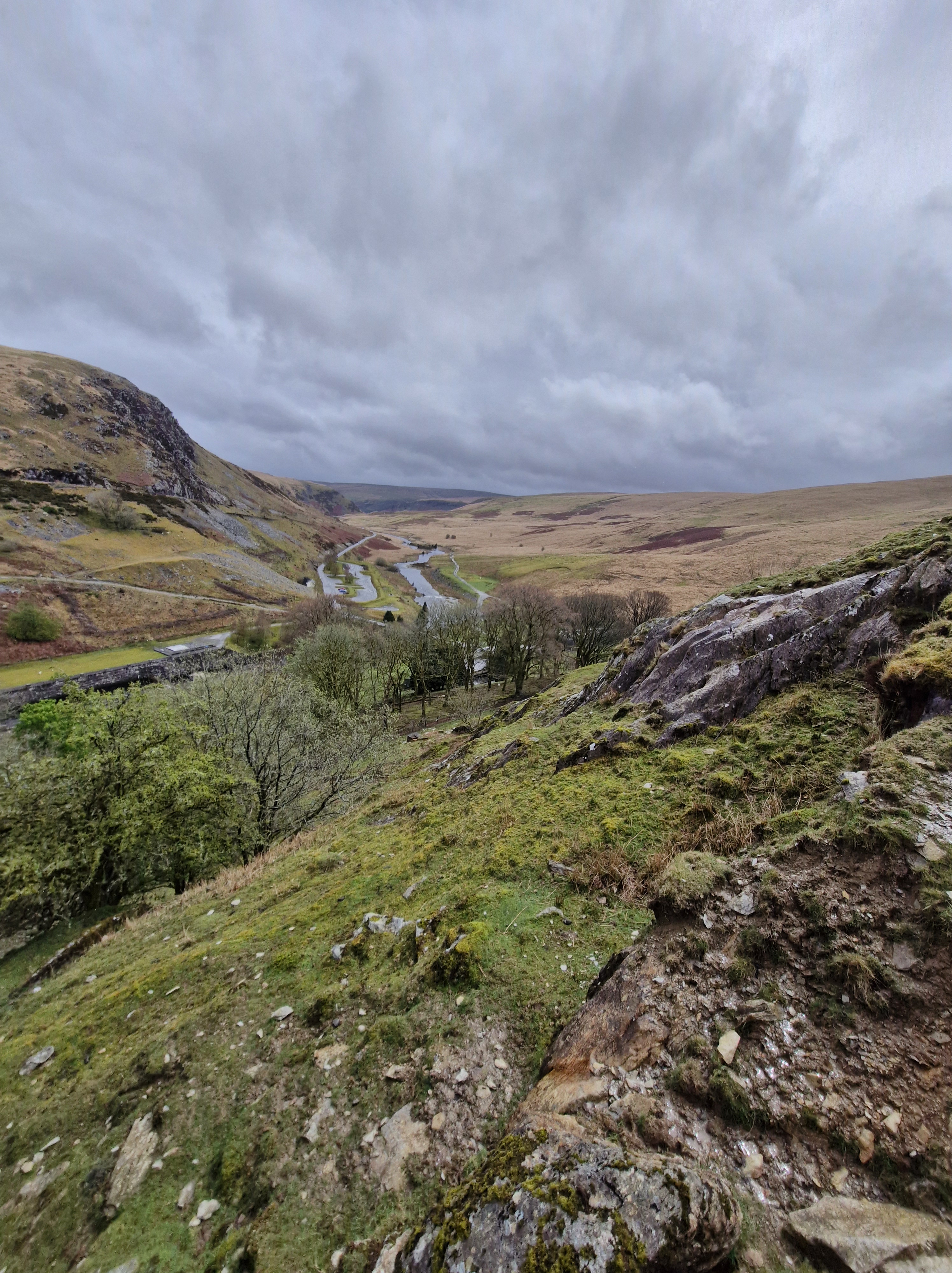
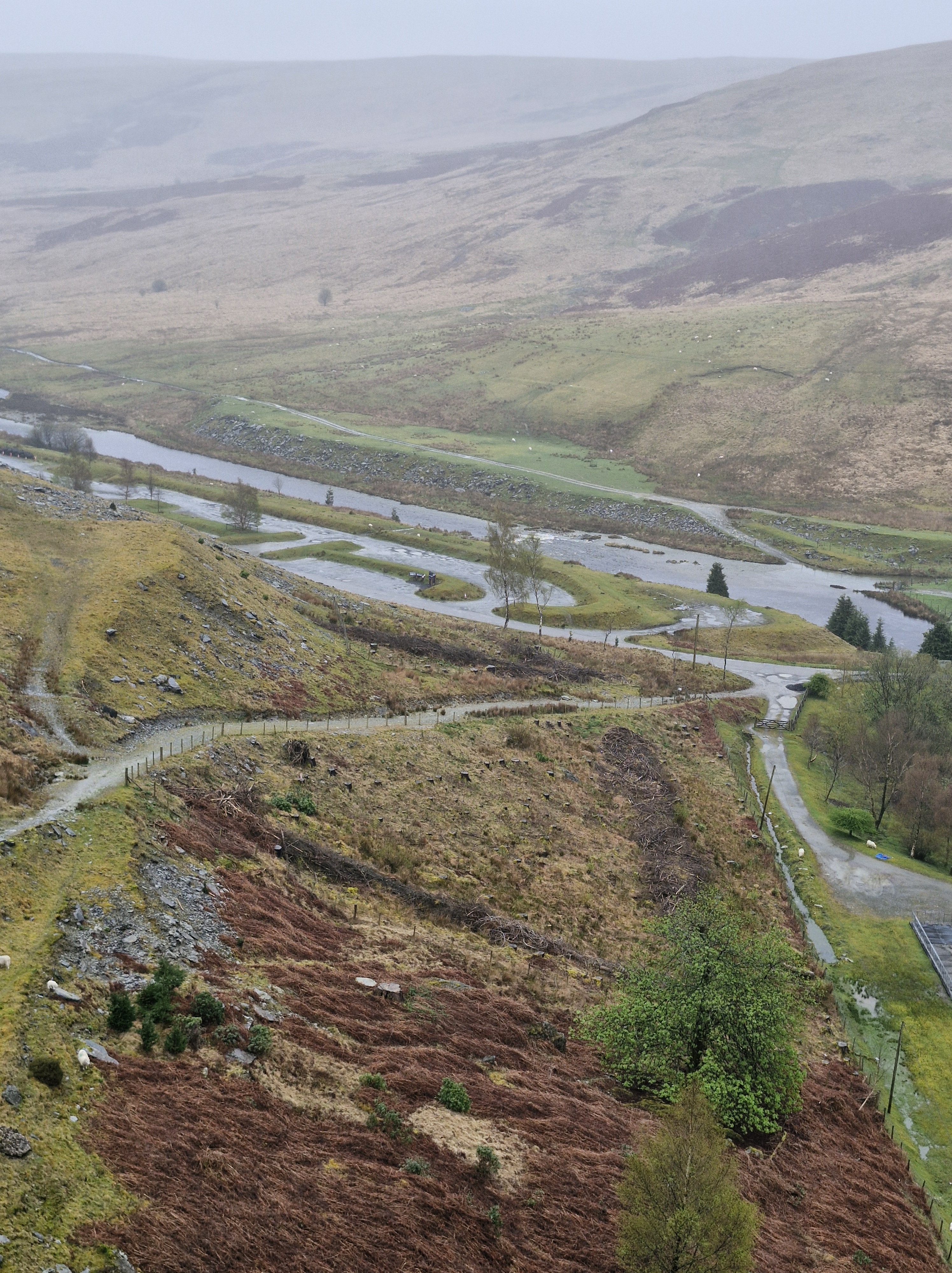
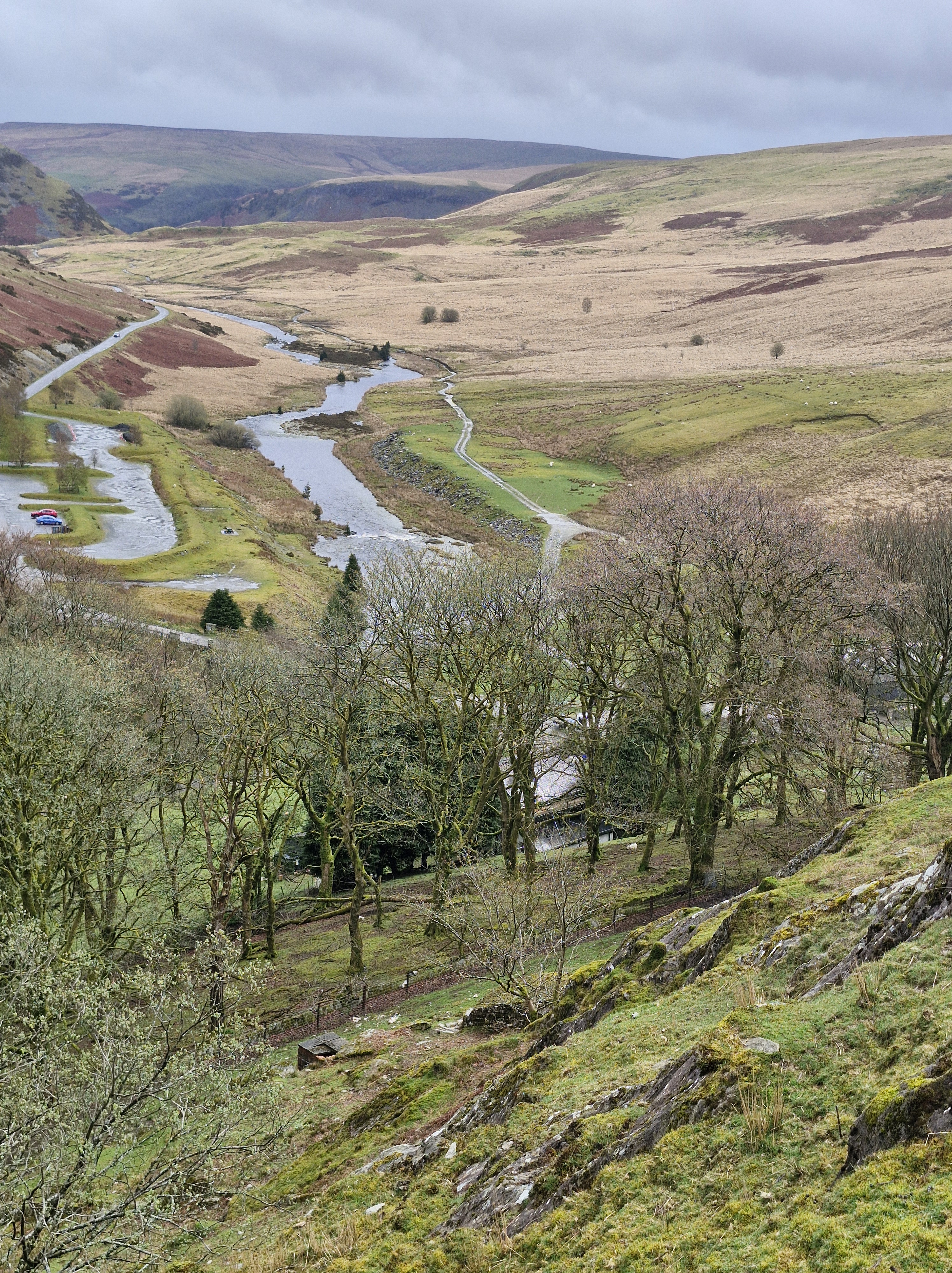
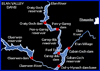
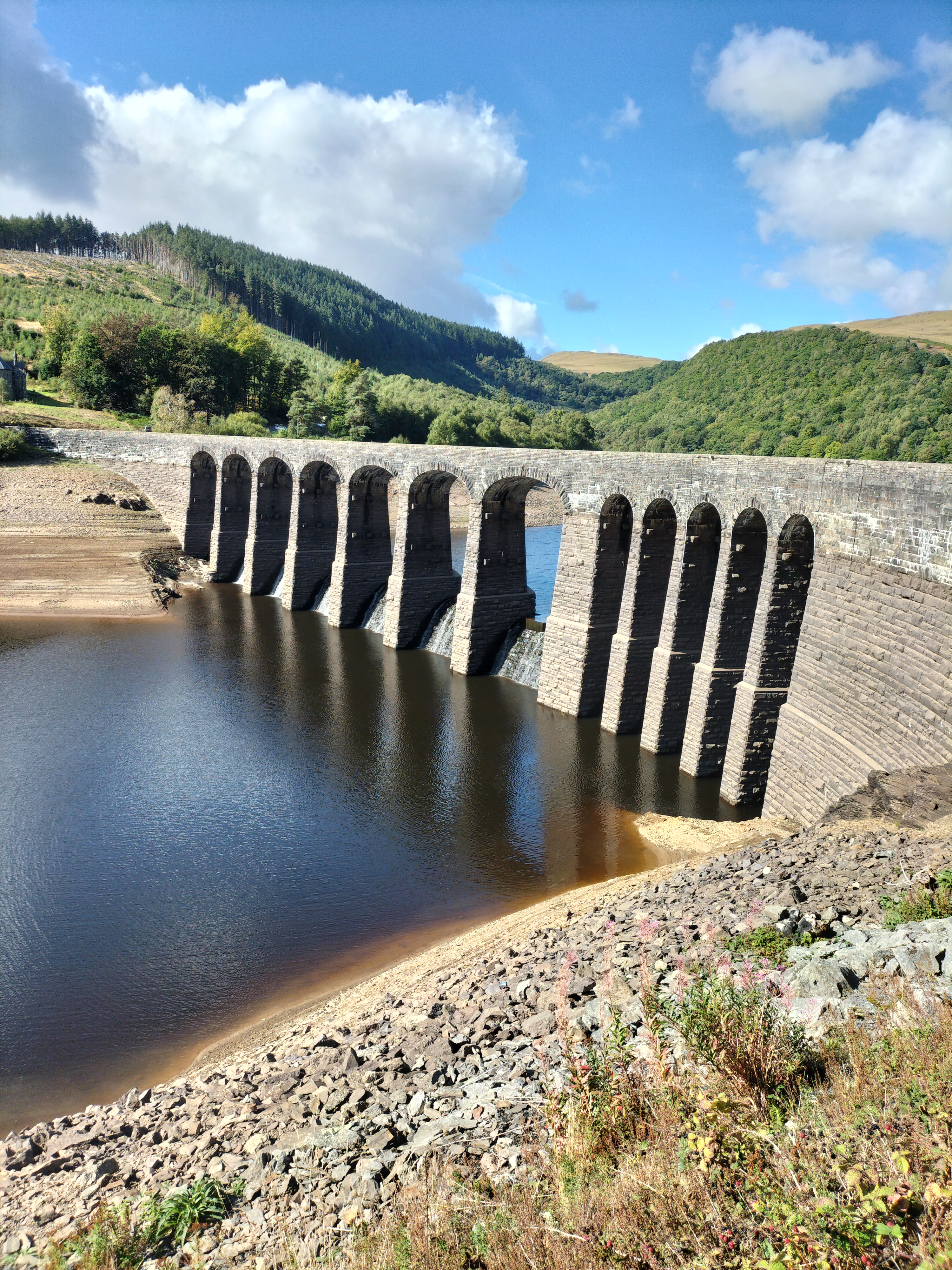
Our first day in Elan Valley andit was gloriously sunny. We’d driven and walked a little way around Pen y Garreg, Garreg Ddu, and Caban Coch.
After a leisurely coffee at the Ty Penbont cafe we sauntered alongside the river to the base of Craig Goch.
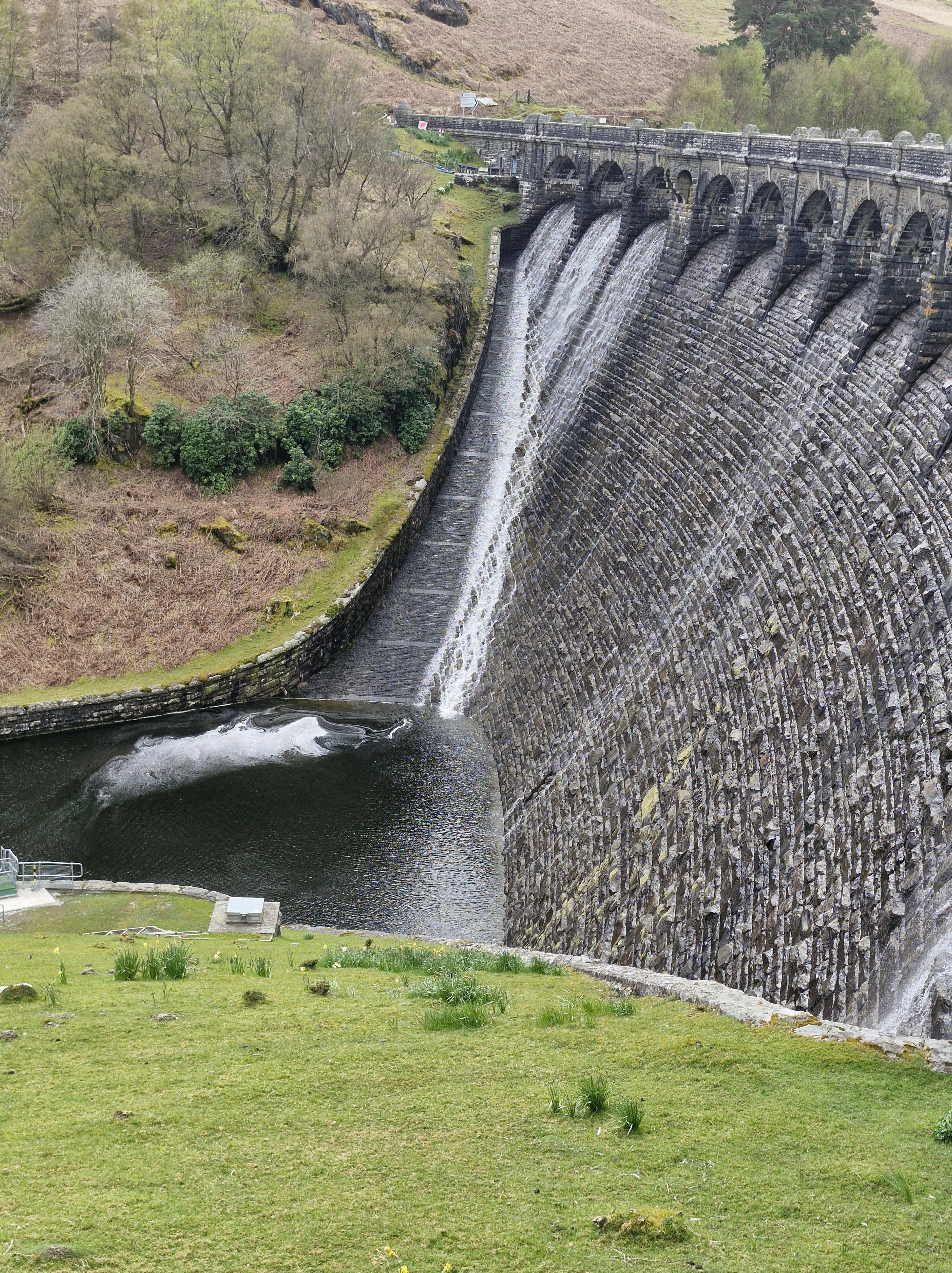
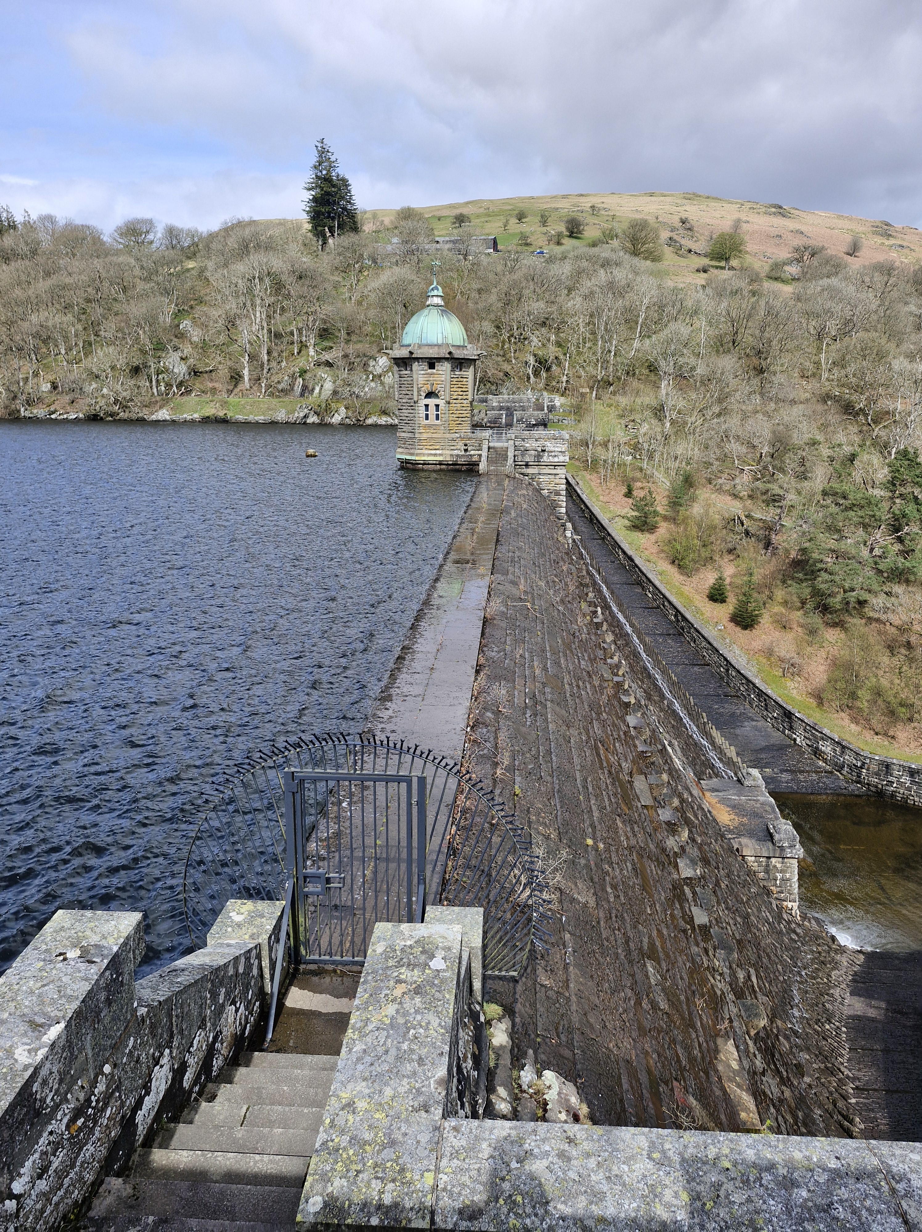
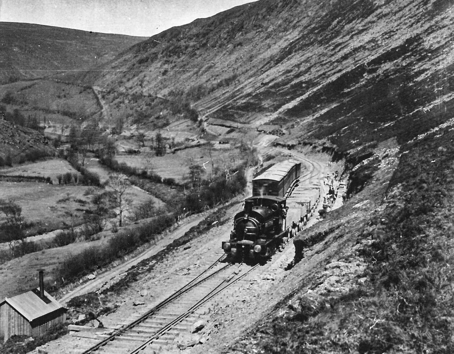
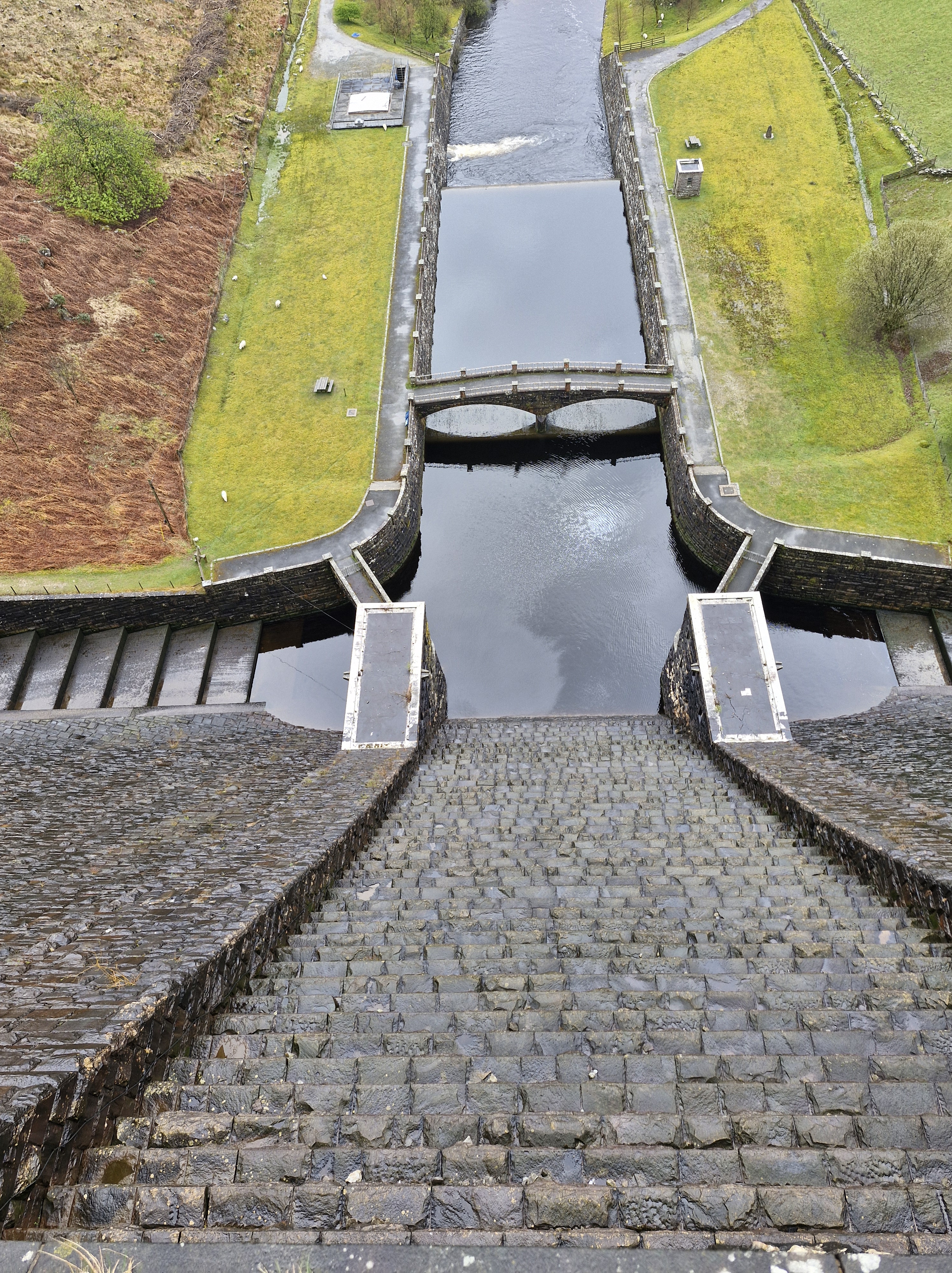
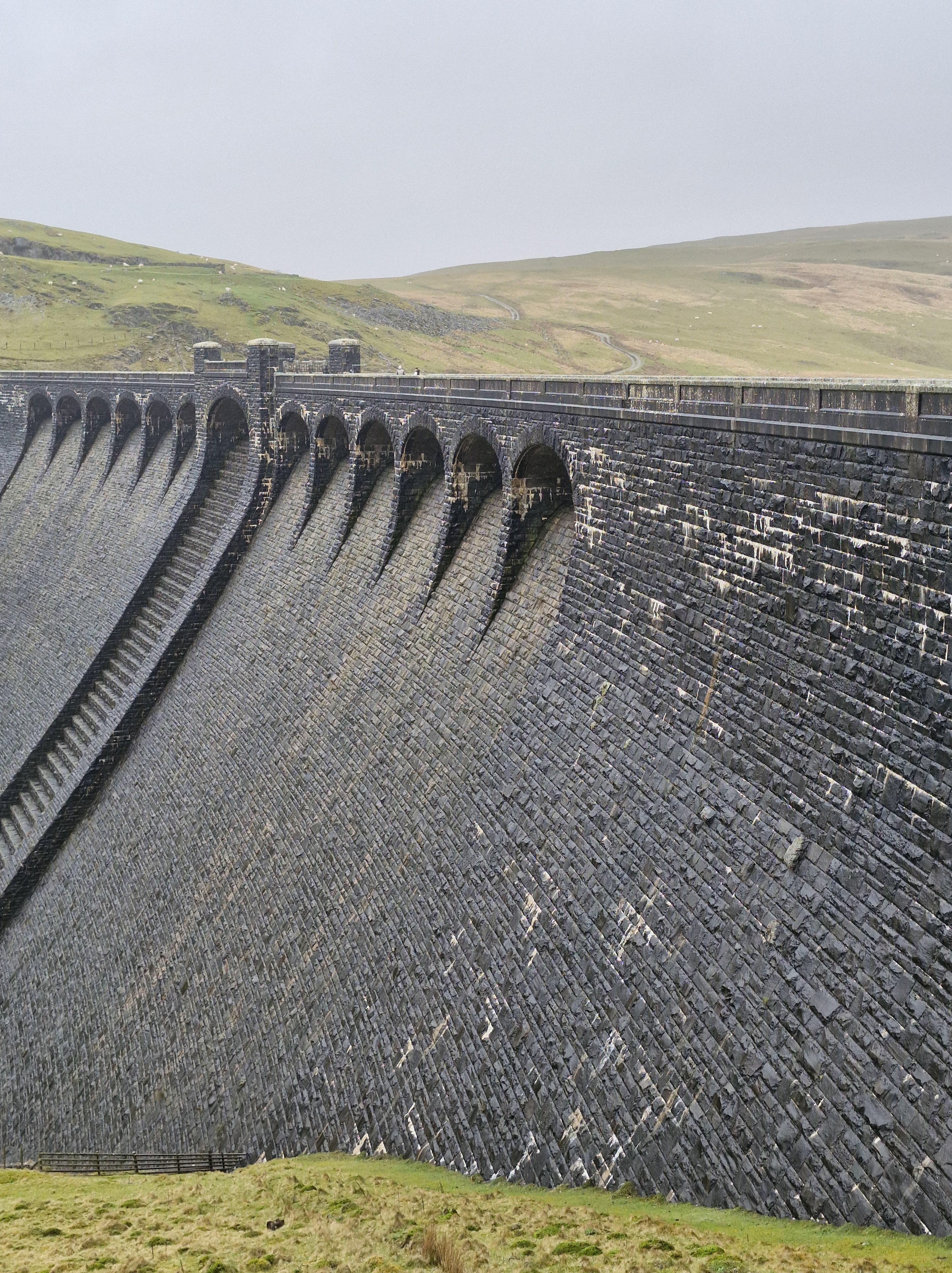
Craig Goch is the highest dam upstream in the Elan Valley and is often referred to as the ‘top dam.’ It’s three hundred and seventeen metres above sea level. Work on excavating the foundations for a secure base for this dam started in July 1897, around three years after the start of work on the lowest dam at Caban Coch.
Viewed as the most attractive of the dams, with an elegantly curved retaining wall and a series of arches, there is a narrow path across the top of the dam.
Railways were the main form of transport at the time. As with all the dams, work couldn’t begin before the construction of the railway line in order to transport equipment, materials and men to the dam sites.
Construction of the railway began in 1893 and was completed in 1896.
The official opening took place on 21st July 1904 by King Edward VII and Queen Alexandra.
The locomotives were all named after rivers and streams on the Estate. The first two were acquired in April 1894 and were named Elan and Claerwen. These were joined by Nant Gwyllt and Methan in October 1894, followed by Rhiwnant and Calettwr in 1895.
Today’s Visitor Centre was converted from the old workshops and part of the car park was the site of the locomotive shed and sidings.
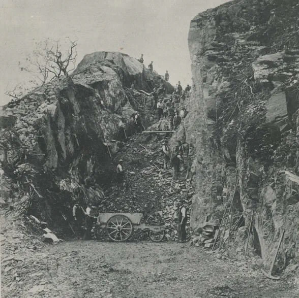
For Craig Goch the line had the furthest to go and a rocky outcrop had to be blasted and dug through on the route to the site. Blasting the cutting mid-way along this route held up the construction of Craig Goch by three months, earning it the name ‘The Devil’s Gulch’
But, seeing Craig Goch in all it’s glory, it was wonderful to see how the persisitance of the workers give us the views of the dam as it is today. As, I think, the Photographer would agree!
Although we have visited Elan Valley many times we had never been to the top of the Claerwen (Clear Light) dam.
Built between 1946 – 1952 by a workforce of almost five hundred men the outside of dam blends in with the other Elan Valley dams, although the inside is a concrete structure. Because British stonemasons were working in London after World War II Italian stonemasons were employed to work on the dressing stones,
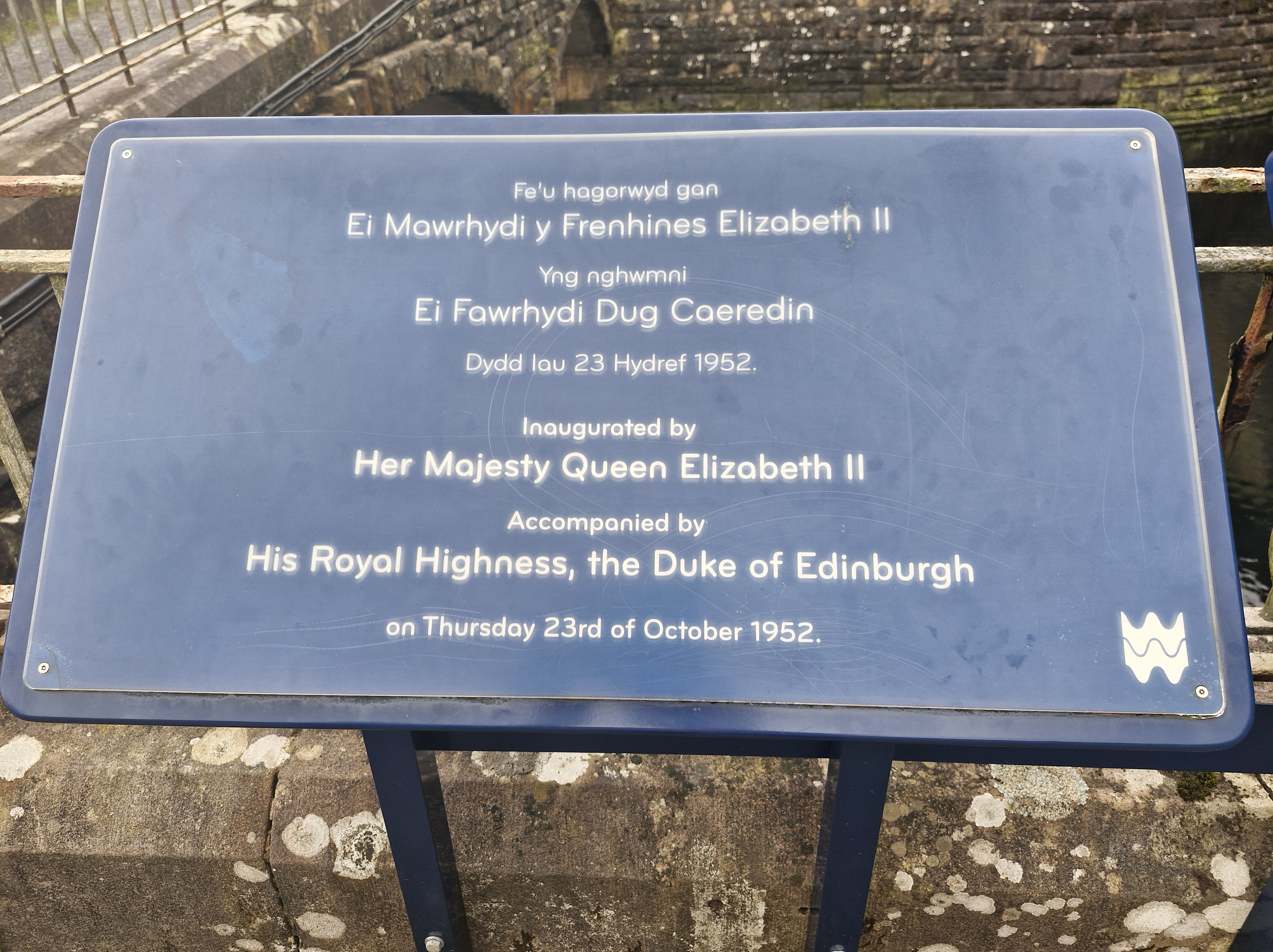
Claerwen was opened by Queen Elizabeth II on the 23rd of October 1952 on her first engagement in Wales.
At eighteen metres deep Claerwen holds almost as much water as all the other reservoirs combined.
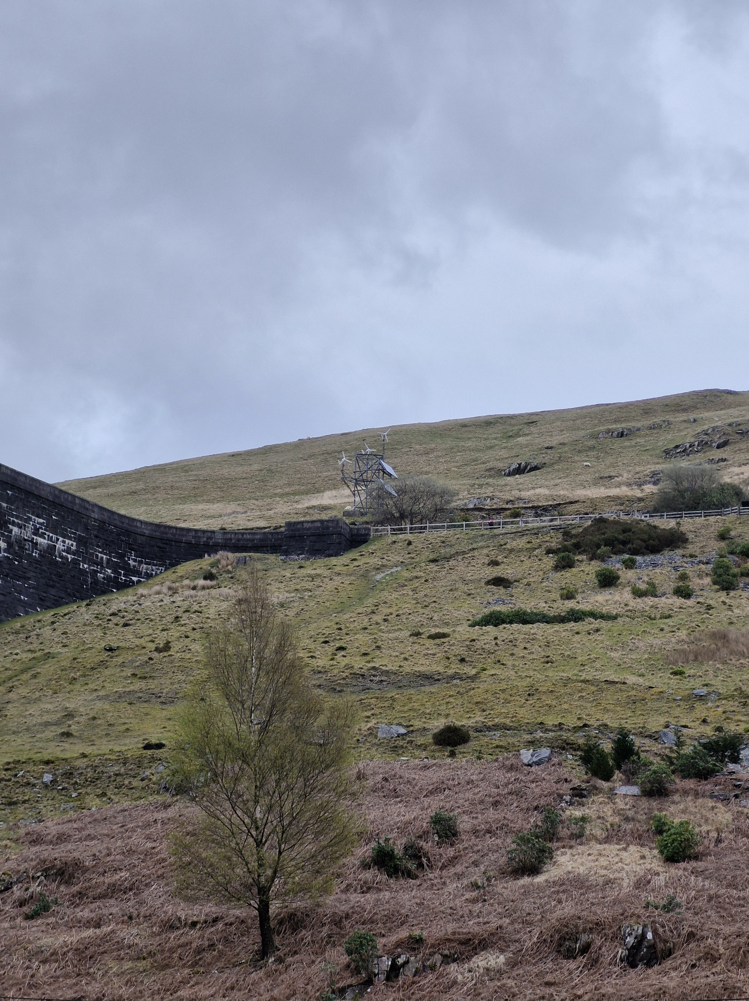
There is potential for producing renewable electricity from the one hundred and ninety-nine million tonnes of water stored in the reservoirs. Since 1997 there has been hydropower production from turbines installed at the base of all the dams.Clearwen can produce 1680 kilowatts.Combined all the dams can produce 3.5 megawatts, which is about six thousand homes.
The day before we were here it was a gloriously sunny day and we’d driven and walked a little way around the four dams on the river Elan: Craig Goch, Pen y Garreg, Garreg Ddu, and Caban Coch.
The following day it rained. But the photographer was adamant it would clear up (he’s an avid follower of the BBC weather forecast!), and, by the time we’d driven to the top Claerwen dam he was insistant there would be a break in the drizzle.
As usual he was right.
Next time we will walk to the Dol y Mynach dam. Dol y Mynach is the unfinished dam and is a Site of Special Scientific Interest (SSSI. There is a bird hide here from which Ospreys and other species of birds, including the Crested Grebe, have been spotted.
The late nineteenth century plan for the collection of dams and reservoirs in the Elan and Claerwen valleys included three dams on the River Claerwen. These would be constructed later when additional water supplies were needed.
So it was necessary to build the base of the Dol y Mynach Dam at the same time as the other dams in the adjacent valley of the River Elan.Dol y Mynach’s foundations were built during the first phase of the scheme, and was planned to be completed in the second phase, alongside plans for two other dams in the Claerwen valley. But after World War II, technology had advanced so the only the much larger Claerwen needed to be built. But, just in case it’s needed, a tunnel runs from Dol y Mynach to Garreg Ddu reservoir to fill up Garreg Ddu.
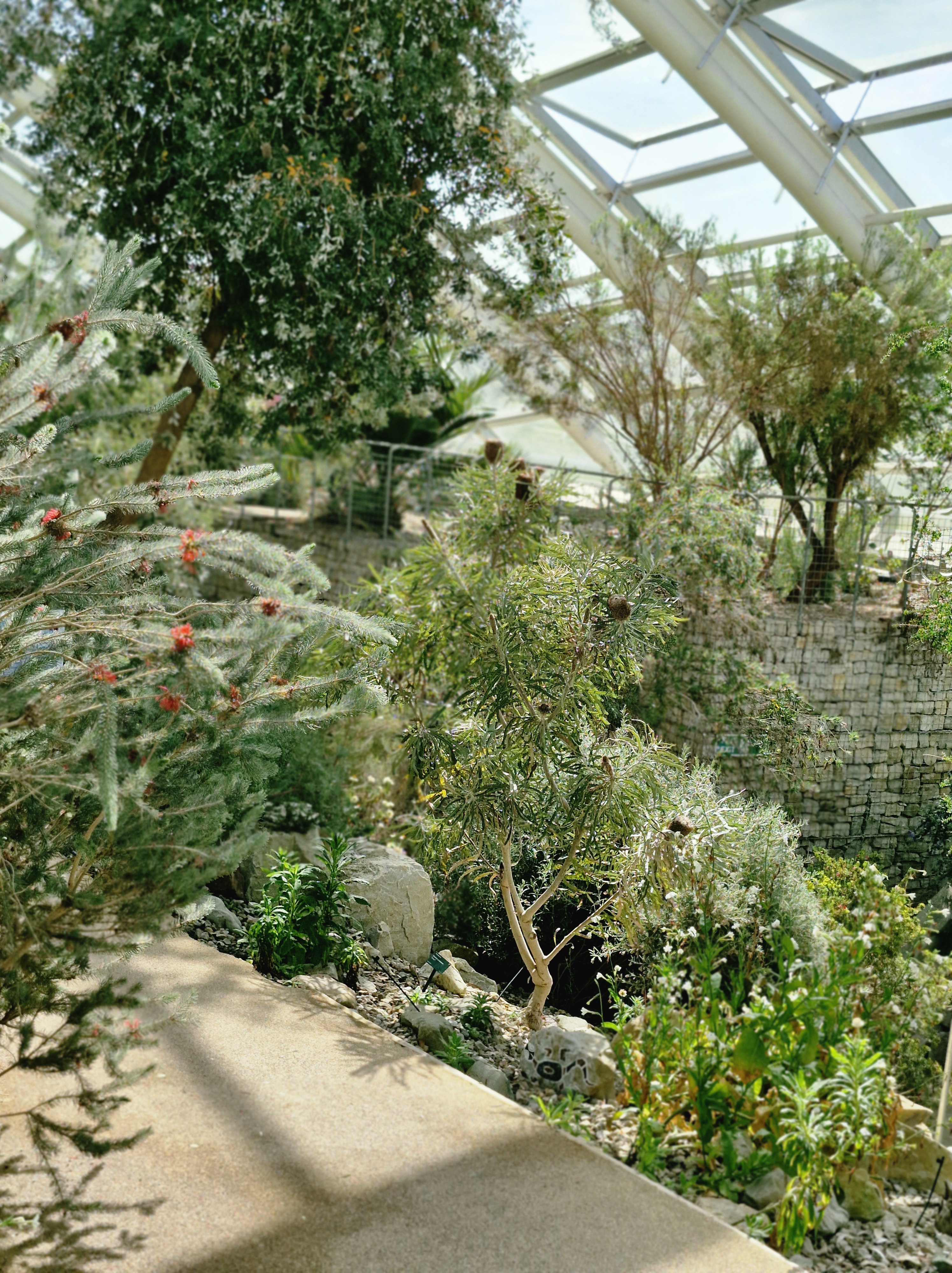
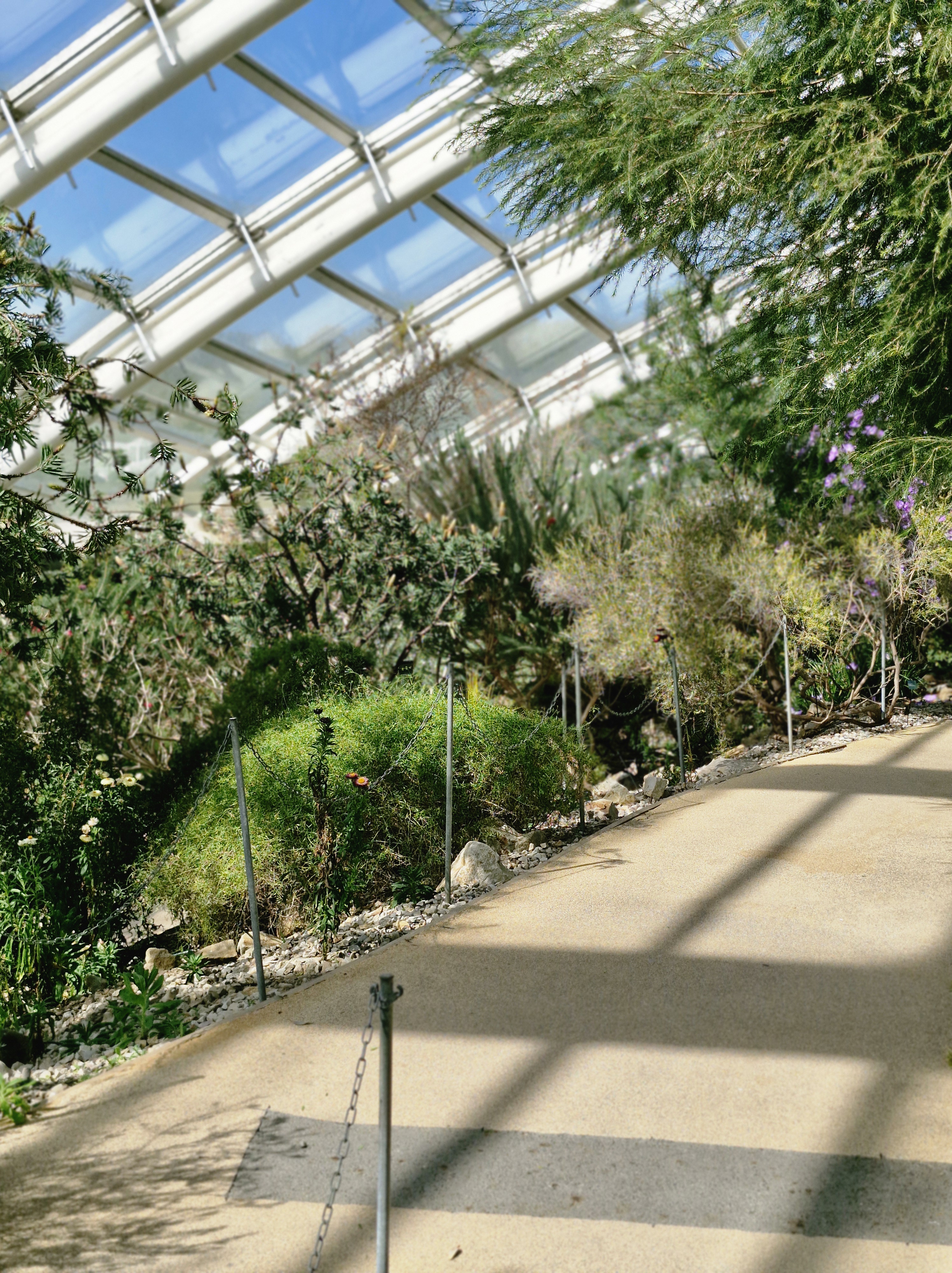
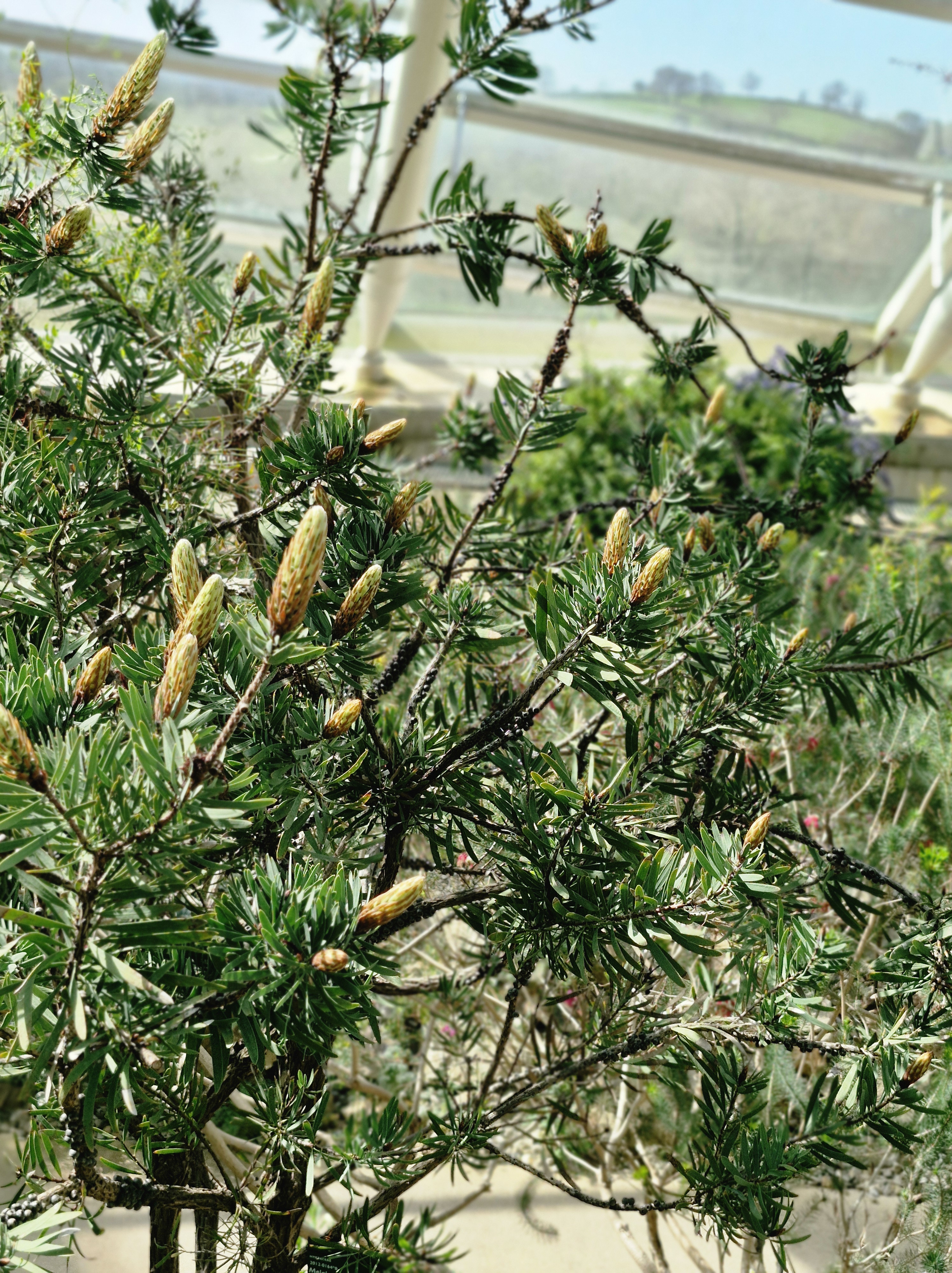
Or rather sauntered, because that’s the only way to take in these glorious grounds and to study the abundance of plants that are Indigenous to so many countries in the world’s largest single-span glasshouse.
The National Botanic Garden is located at Llanarthney in the River Tywi valley, Carmarthenshire, Wales, not too far from our home. So, not only are we lucky enough to live near the stunning Pembrokeshire coast, these impressive gardens are also almost on our doorstep. How fortunate are we!
And, on the day of our visit we had the one day of glorious weather that week.
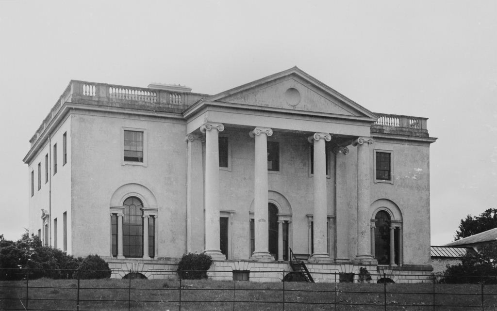
The National Botanic Garden of Wales is on the former Middleton Estate.
The Middleton Estate was so named after the three Middleton brothers from Chester, who helped set up the East India Company in 1600 in order to trade in highly profitable spices.
Two hundred years later, in 1789, William Paxton returned to Britain from being the Master of the Mint in Bengal for the East India Company. With the fortune he had made in India and together with his business associate, Charles Cockerell he employed Charles’ brother the architect Samuel Pepys Cockerell to design Middleton Manor. Paxton had the park laid out: planting trees, damming streams to form four lakes and waterfalls, having bridges and bath houses built. He also had a folly constructed to commemorate Nelson’s heroic deeds in the Battle of Trafalgar, named Paxton’s Tower.
In the 1930s there was a fire that destroyed Middleton Manor. The remains were subsequently demolised in 1954. Only the foundations arestill visible.
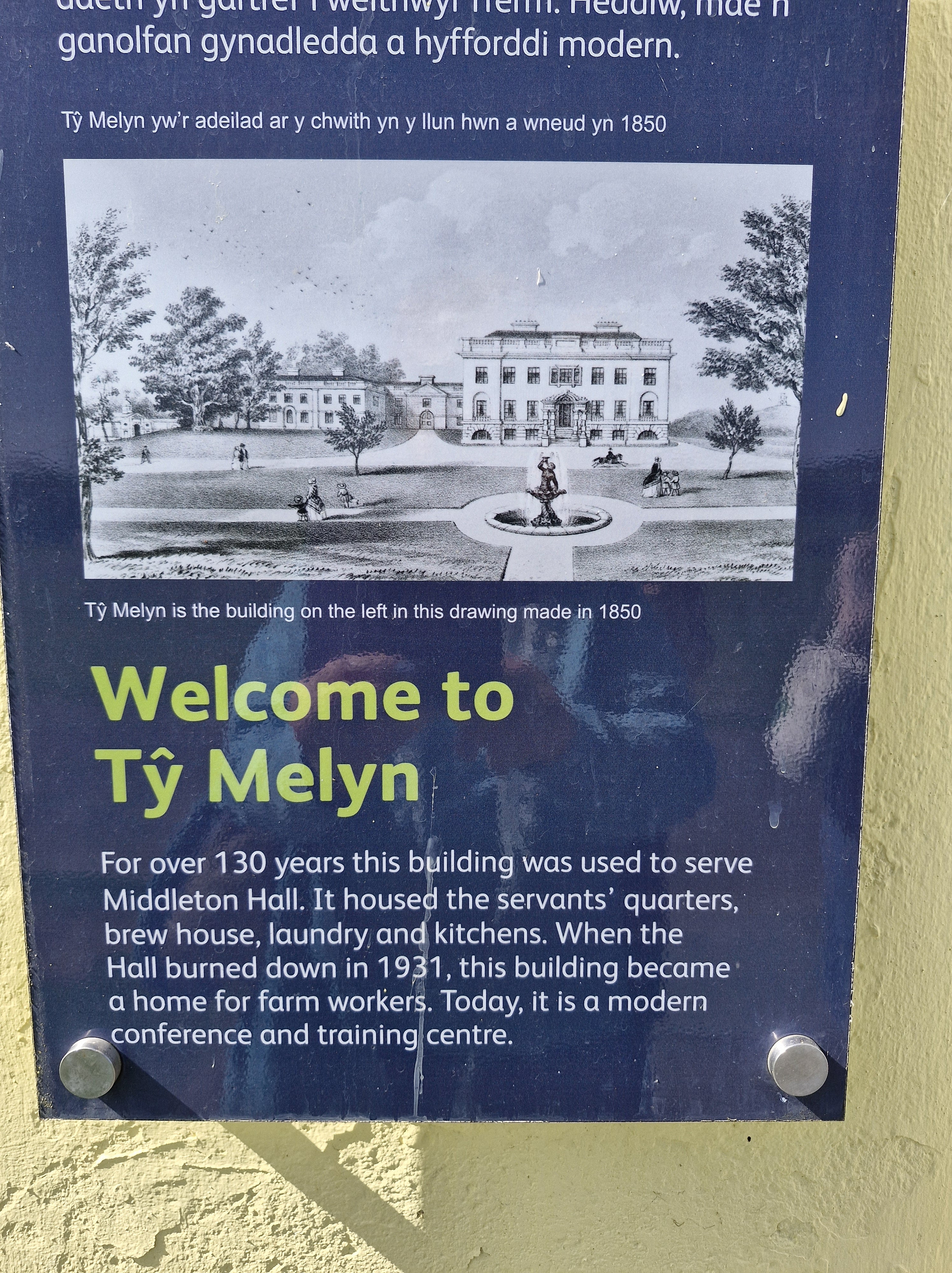
Ty Melyn is nowa venue for conferences, board meetings, training days. seminars, presentations, exhibitions etc.
Other buildings which survived were the stable buildings (now a café (( delicious food!!)) a gallery and offices) an ice-house and the double-walled garden with the remains of its Peach-house.
There is/has been acknowledgement of the unease about the heritage of the land that the Botanical Gardens stands on. Read more on this: https://tinyurl.com/227k9eyc. And there is an excellent article written by Meurig Williams under the umbrella of Nation Cymru: https://tinyurl.com/52v3ckf5.
But this shouldn’t detract from the initial and ongoing aims of National Botanic Garden of Wales, which is a charity backed by the Welsh Government. Since its opening it has been dedicated to research, conservation of biodiversity and sustainability, and lifelong learning and the enjoyment of the visitor.
Opened in May 2000, the site of the gardens was partly chosen because it was an example of the grand scale garden design of past eras. And the fundamental principles of the National Botanic Garden of Wales are strictly adhered to.
We’ve visited the gardens many times over the years, different times, different seasons, for different events. There is always much to see, much to enjoy.
This time I also learned that a certain Welsh Suffragette lived here at one time. During my research for the prequel of my Haworth Series, A Hundred Tiny Threads, I discovered that many Welsh Suffragettes and Suffragists joined the peaceful march to London in 1913. I’ve given many talks on that event. Tempted to write a post about her…
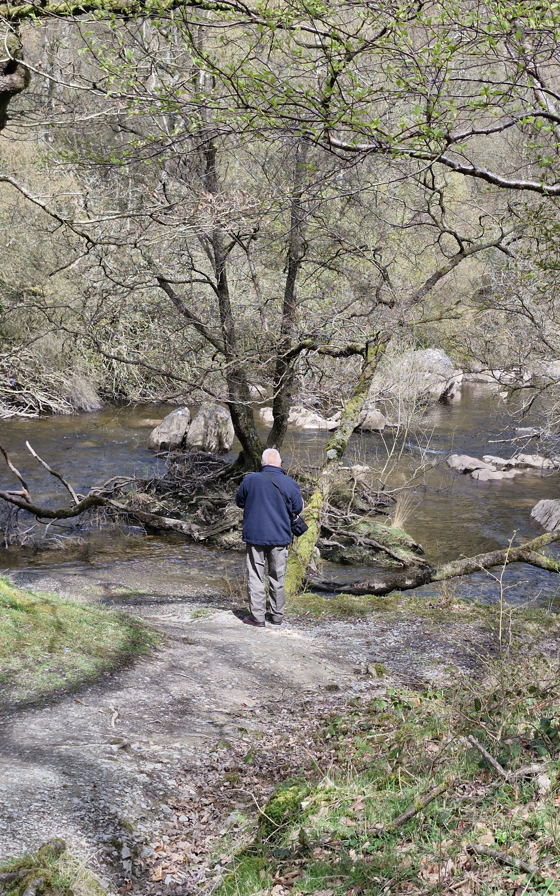
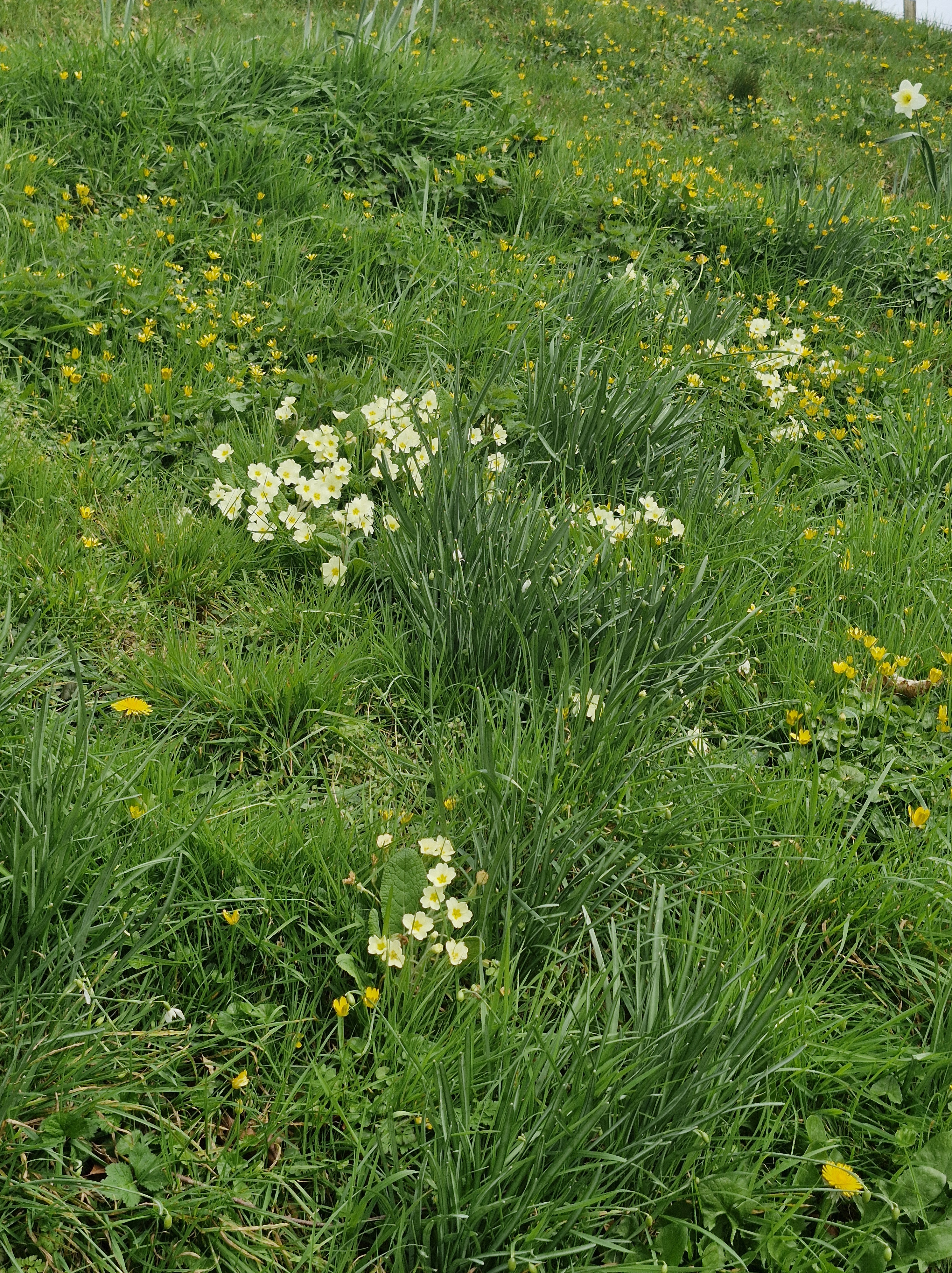
This morning, with the weather fine, though a little chilly, we wrap up and take another of our favourite walks. As usual, Slebech Park Country Estate doesn’t fail to provide great views, some glorious wild flowers, and impressively maintained grounds.
Over the years we’ve visited the park many times, in all weathers, at all times of the year. Maybe Spring is our favourite season here – or maybe summer – or autumn – or even winter, when even the bleakness of the days can’t detract from the scenery.
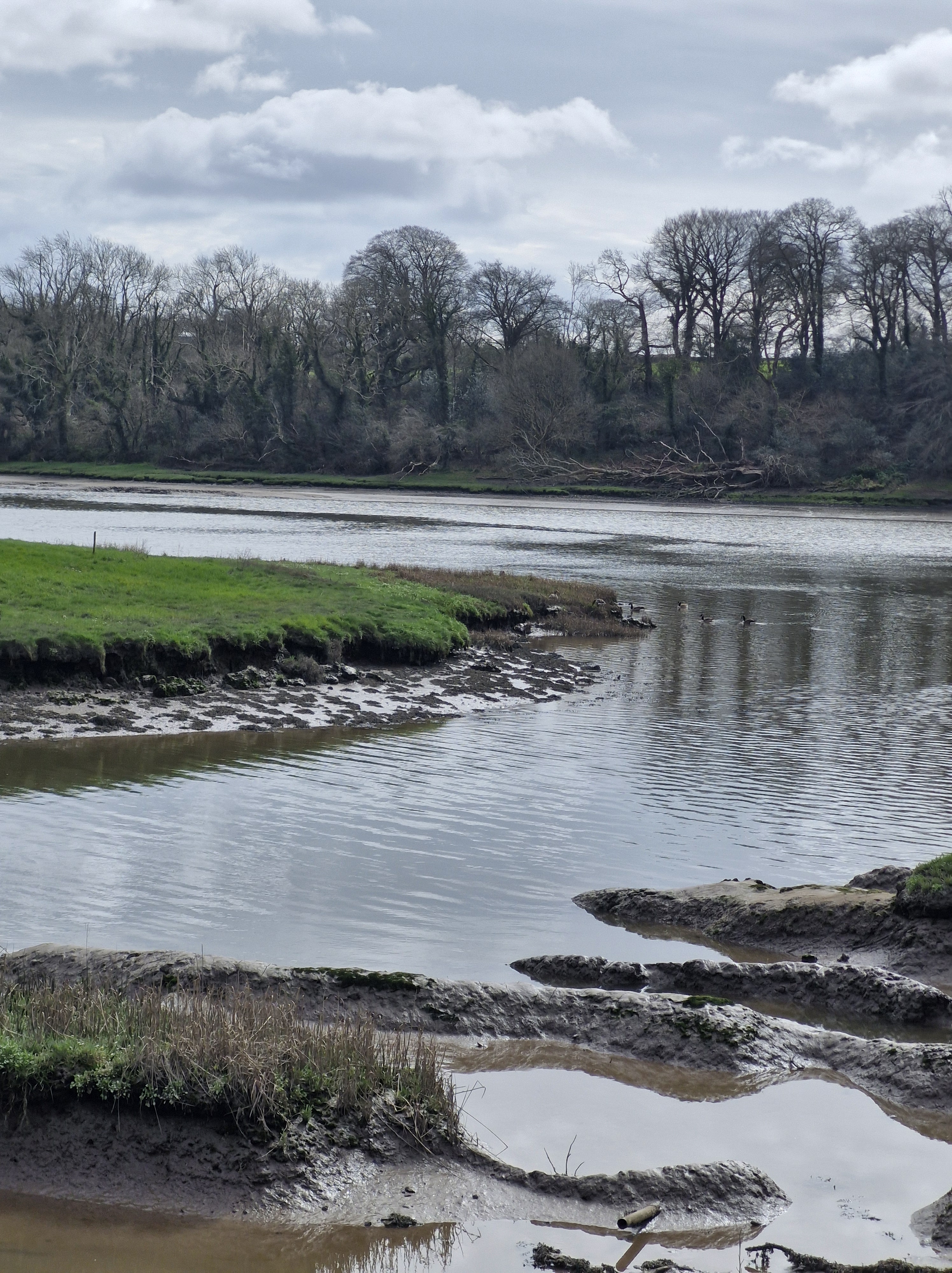
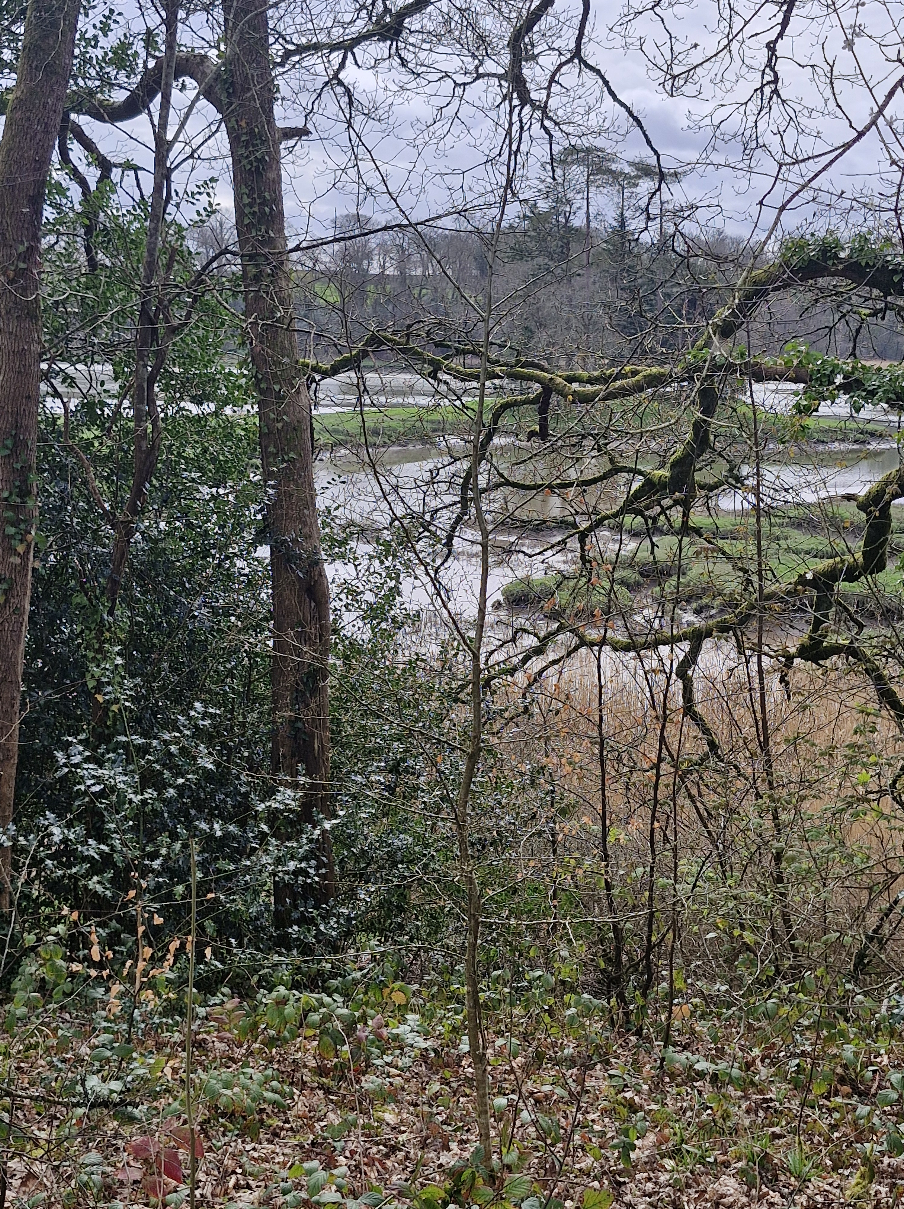
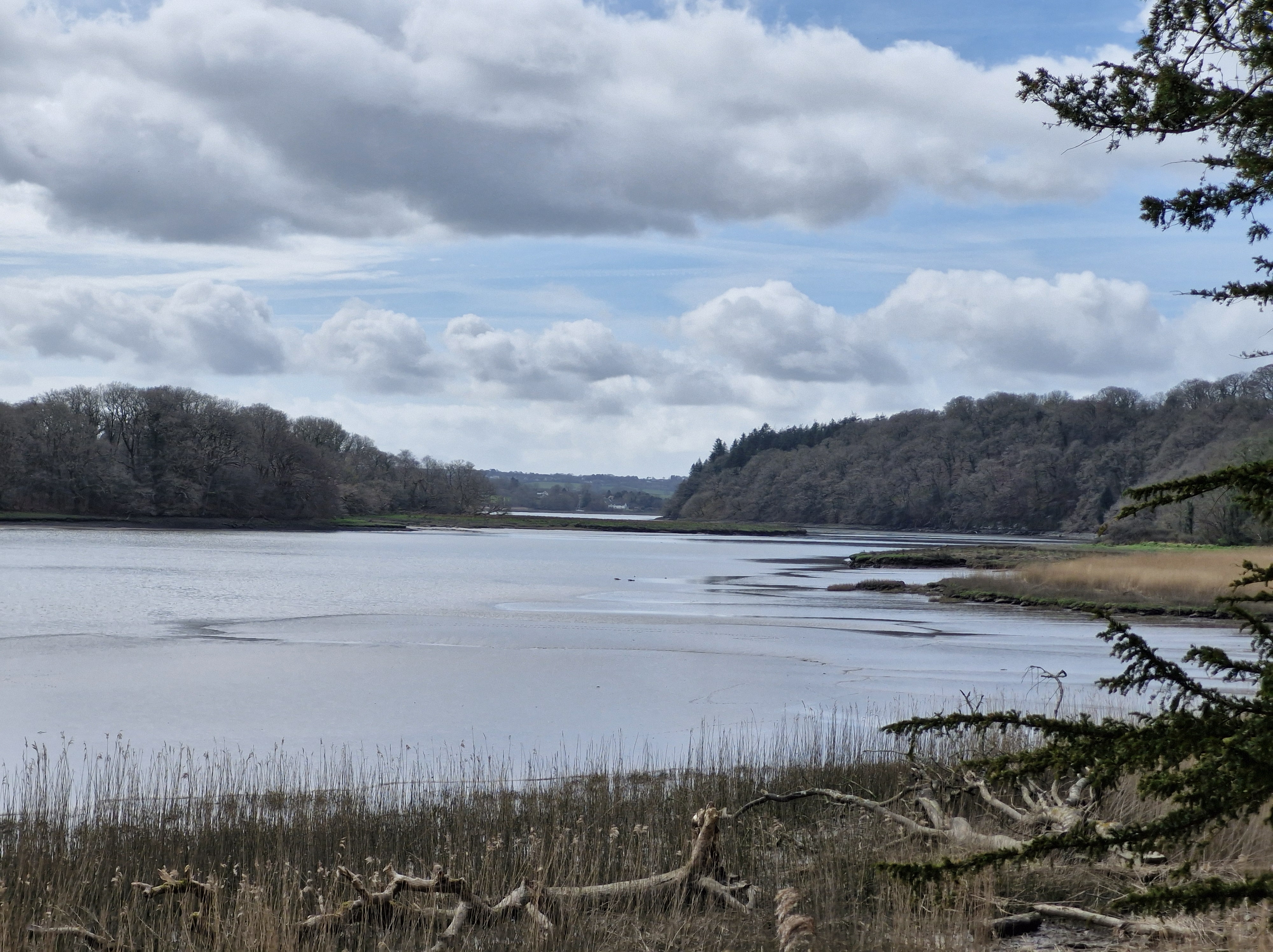
We’ve walked the trail from Canaston Bridge, always looking forward to our first glimpse of the Cleddau. Sometimes, as a tidal river, the water is low, the mud flats glistening in the sun, sometimes it’s high, lapping quietly against the banks, and with ducks and seagulls floating on the surface alongside one another.
Today, though, is different. Not wanting to walk along the usual, longer path from Canaston Bridge, we park in a layby alongside the busy road to Haverfordwest, climb stiles, walk along a rough track – muddy from recent rain – and alongside the estate farm.
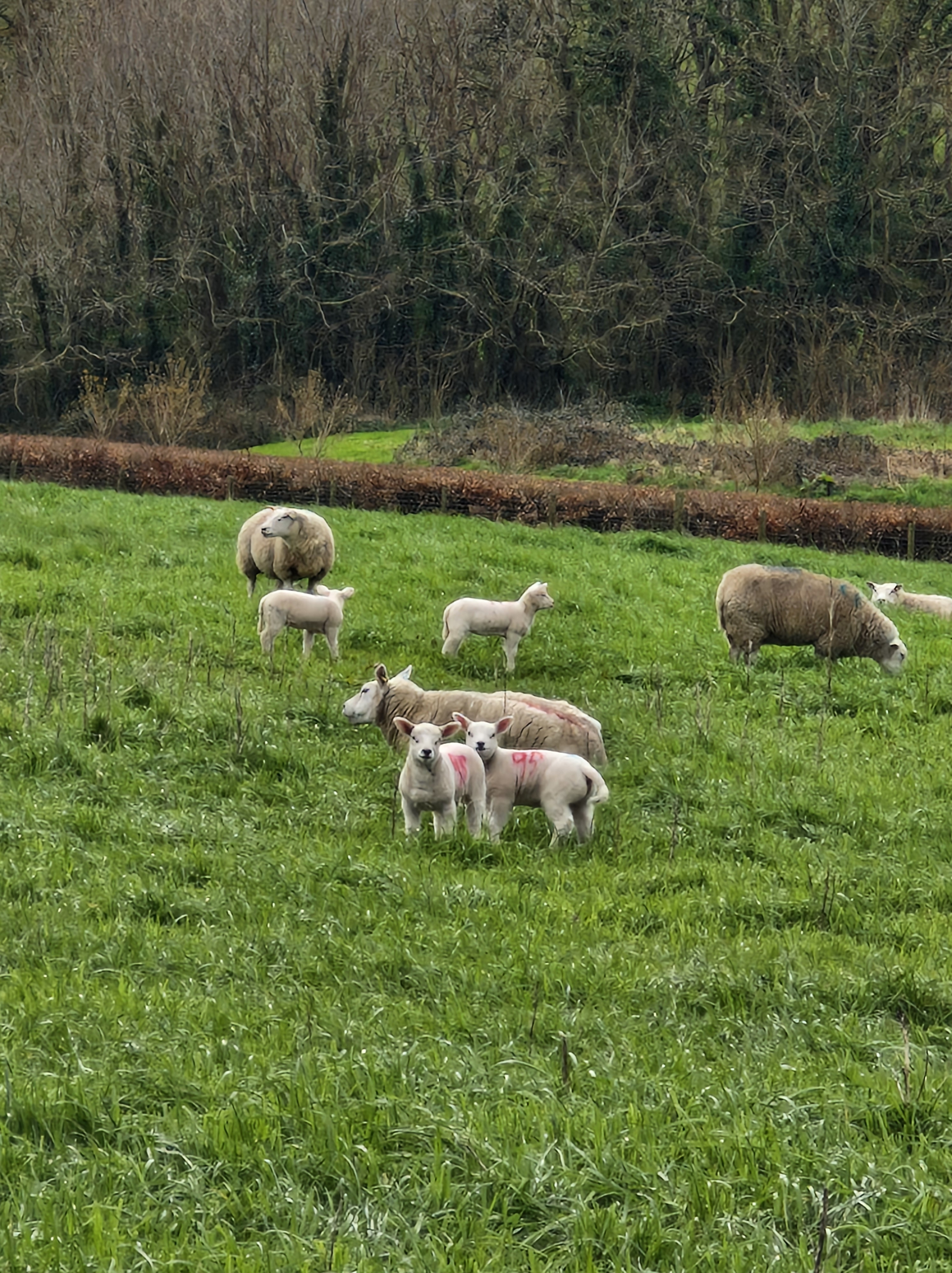
And say hello to the lambs, in the nearby field, who fix their eyes on us until we are safely past them.
This morning the tide is in.
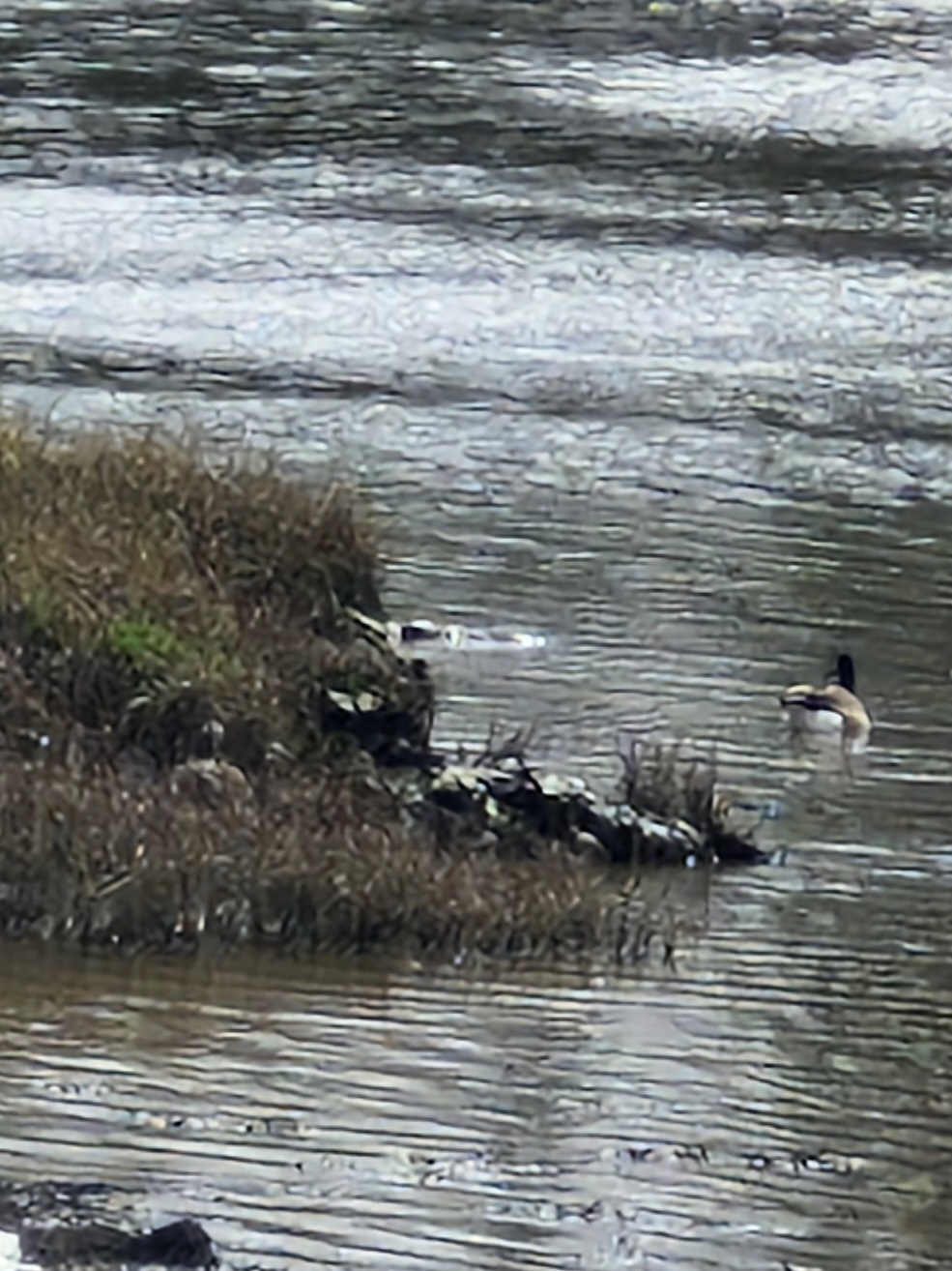
But the ducks are quite elusive. Except for one!
We saunter around the park, conscious that we are actually carrying out a recce for a stroll for members of our local U3a: somewhere fairly flat, easy walking … and no stiles!!
With moments when we are able to stop – to admire – to just be! …
Time for lunch!We walk back to the car, having established that a stroll around the estate will be enjoyed by all.
The history of Slebech Park:
The origin of the word Slebech is thought by some to be derived from a Viking term meaning “Stoney Beach.” It is likely that Vikings sailed inland to Slebech on raiding parties and, upon seeing its commanding position on the river and small harbor, viewed it as a place of refuge. Slebech has long held a significant place in the history of Wales. From the 6th century onwards, it served as a major meeting point for pilgrims traveling to St. David’s Cathedral. Over the centuries, it has been visited by notable figures including William the Conqueror, Henry II, Edward I, and Queen Eleanor.
The estate’s history is intertwined with social stratifications of the time, as it hosted lands divided for the rich and poor. A “Beggars’ Field” is believed to have existed, though its location remains undiscovered. In recognition of its importance, Pope Calixtus decreed that two visits to St. David’s equaled one pilgrimage to Rome. The oldest building standing today is the Norman tower in the estate’s 12th-century church. Likely part of a watchtower, it strategically overlooks the river. This site was connected to other Norman castles, forming a defensive line across Pembrokeshire. During the 13th and 14th centuries, Slebech became home to Wales’s most powerful monastic foundation, managed by the Knights of St. John (formerly the Knights Templar, now known as St. John’s Ambulance). The hospice here made Slebech a crucial gathering point for knights embarking on crusades. In fact, knights killed in foreign battles had their hearts pickled and reburied in the church crypt and on Dog Island, now a Scheduled Ancient Monument. A 12th-century sword, found on Dog Island, is now displayed in the Welsh National Museum. Slebech’s prominence waned during Henry VIII’s Reformation when the powerful Commandery was disbanded, and its lands were redistributed. Today, only the 12th-century church, some tunnels, and remnants of thick walls from Slebech Hall remain from this period. The rest of the estate’s medieval structures were destroyed during the English Civil War. After being sold by the Crown, the estate came into the hands of Roger Barlow, a powerful Tudor gentleman and close confidant of Henry VIII. An adventurer, Barlow sailed with the Spanish fleet on voyages to the Americas. The Barlow family owned Slebech until the 18th century, when Catherine Barlow inherited the estate. Catherine married Sir William Hamilton, but died childless in 1782. Sir William later married Lady Emma Hamilton, famous for her affair with Admiral Lord Nelson. When Sir William died, he was buried alongside his first wife, Catherine, in Slebech’s old churchyard. Slebech Hall, one of Wales’s finest Georgian manor houses, was constructed in the 1750s. It was reputedly designed by architect Anthony Keck, also believed to have designed Highgrove House, home to Prince Charles. Around the same time, the estate’s modest granary buildings were transformed into stables and coach houses, some of which still retain their original charm today. These buildings were castellated, inspired by nearby Picton Castle. Slebech Hall remains largely intact and is Grade II* listed, with future plans to restore it to its original grandeur and incorporate it into the hotel operations. The estate later passed to Nathaniel Phillips, a Jamaican sugar plantation owner known for his duels and his marriage at 65 to a 19-year-old heiress from Picton Castle. His daughter, Mary Dorothea, married Baron De Rutzen, an eccentric figure who built the “back to front” church on the A40, an imposing structure still standing today. The family line ended with John Frederick Foley, who died in Italy during WWII. During WWII, Slebech was used by the US Army as they prepared for D-Day, with local lore suggesting a Willis jeep remains submerged in the estate’s lake—a symbol of youthful folly. Eventually, the estate was sold to the Honorable William Phillips, father of Geoffrey Mark Phillips, who began the current hotel operation. The Phillips name quietly exited the estate’s history in 2013, marking the beginning of a new chapter. Today, Slebech Park continues to welcome travelers, just as it has for over a thousand years. With its rich history, bespoke bedrooms, fine dining, and serene walks through stunning landscapes, Slebech offers a truly historic and unique destination that embodies both luxury and heritage.
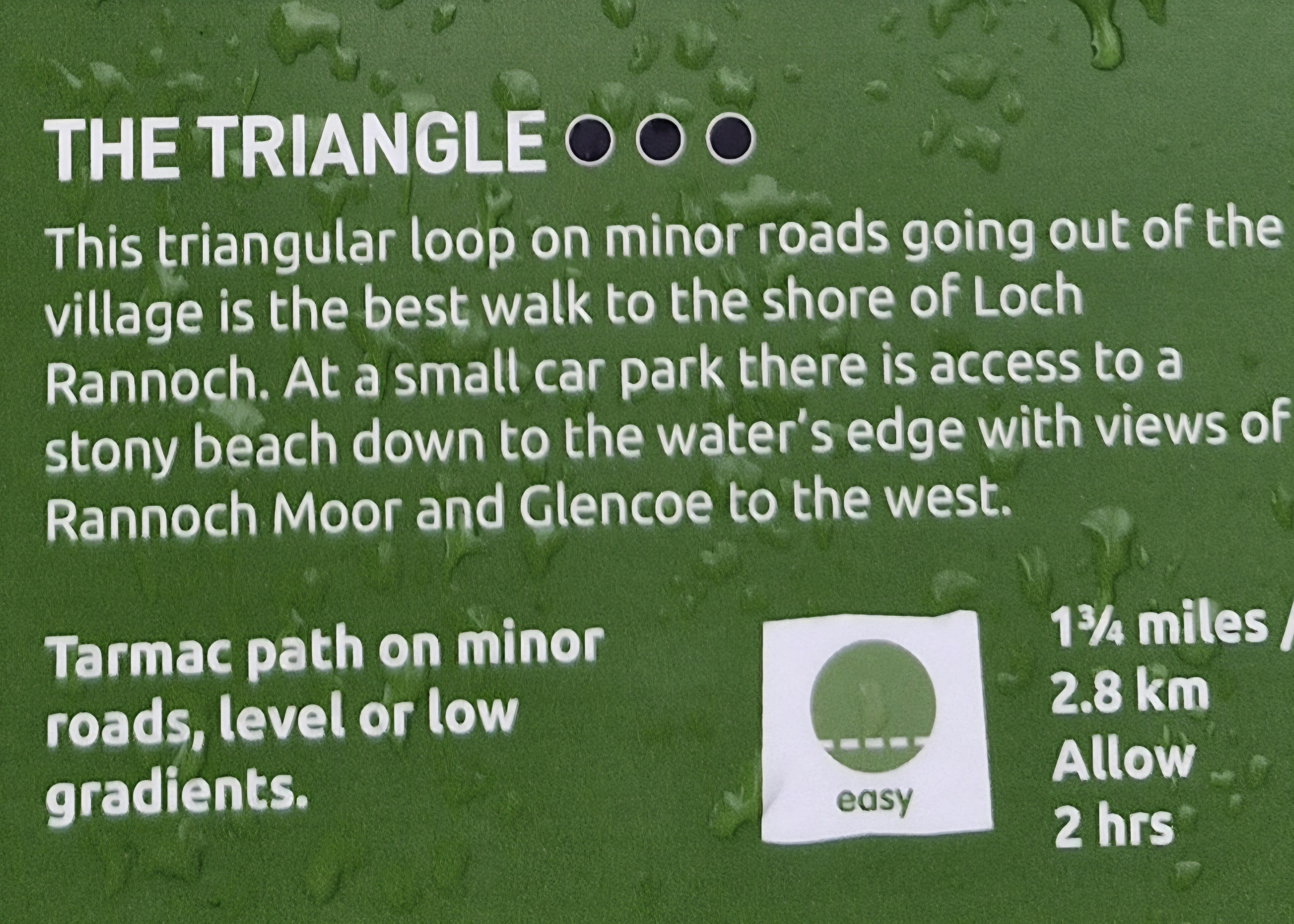
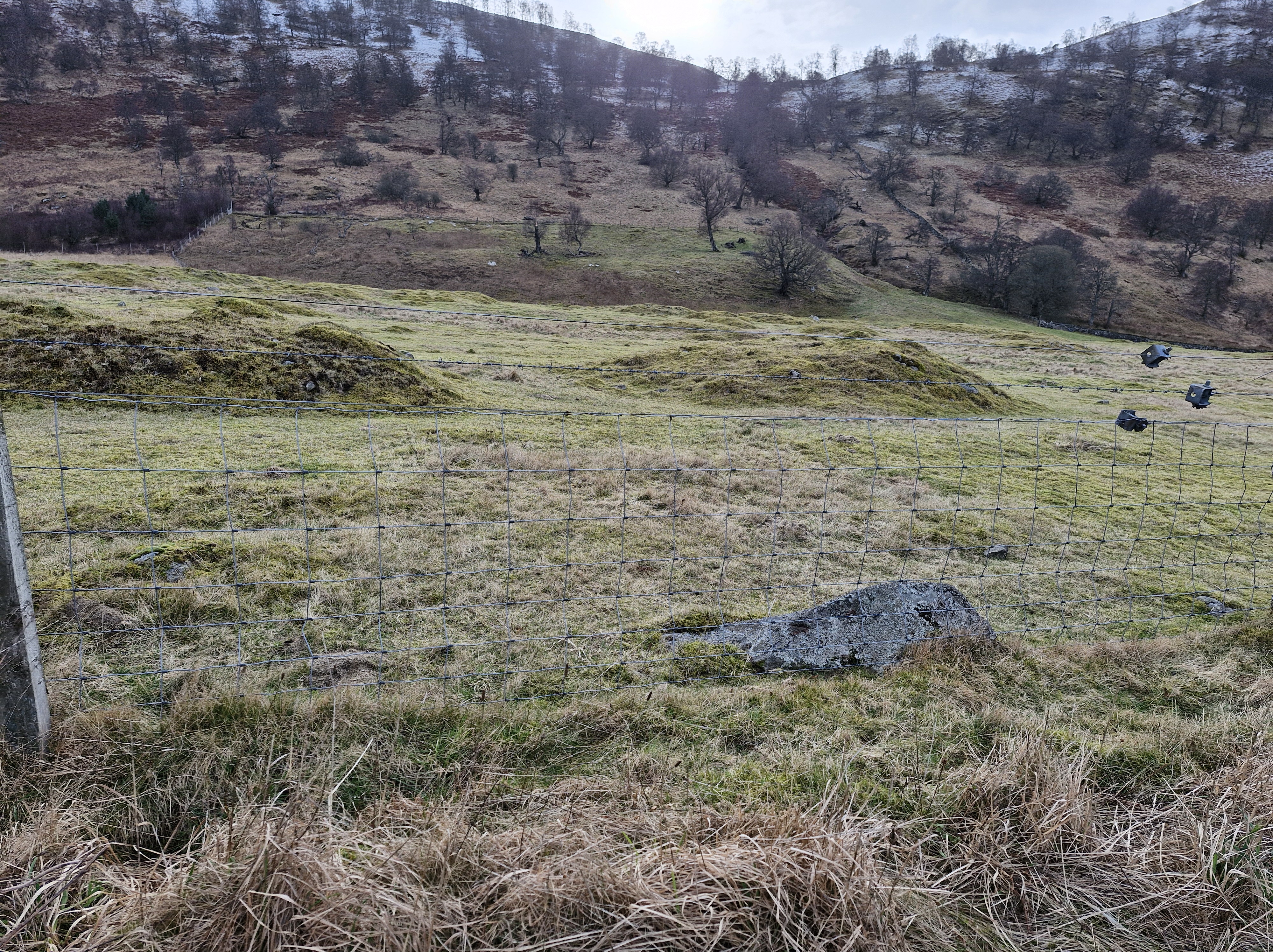
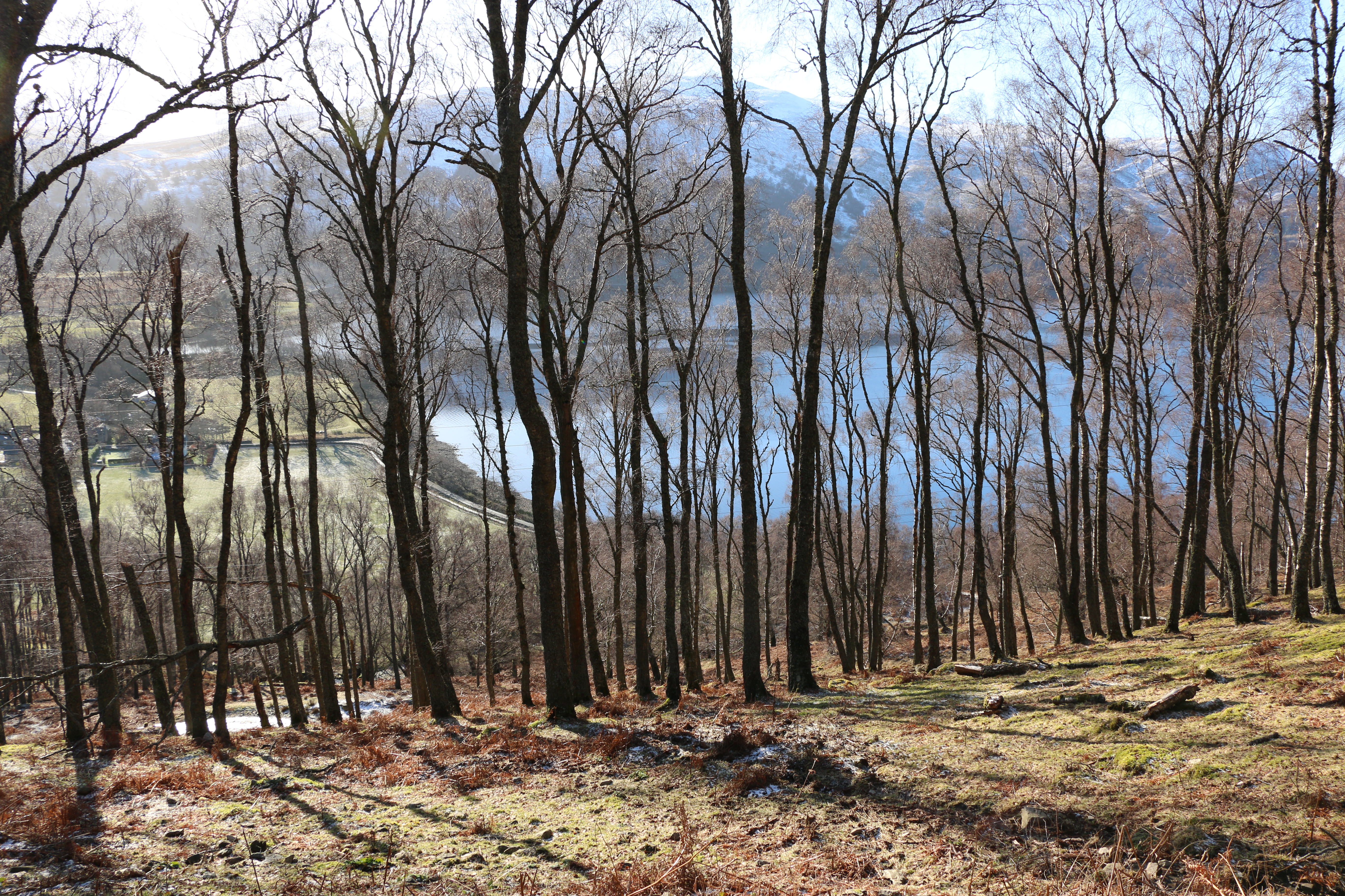
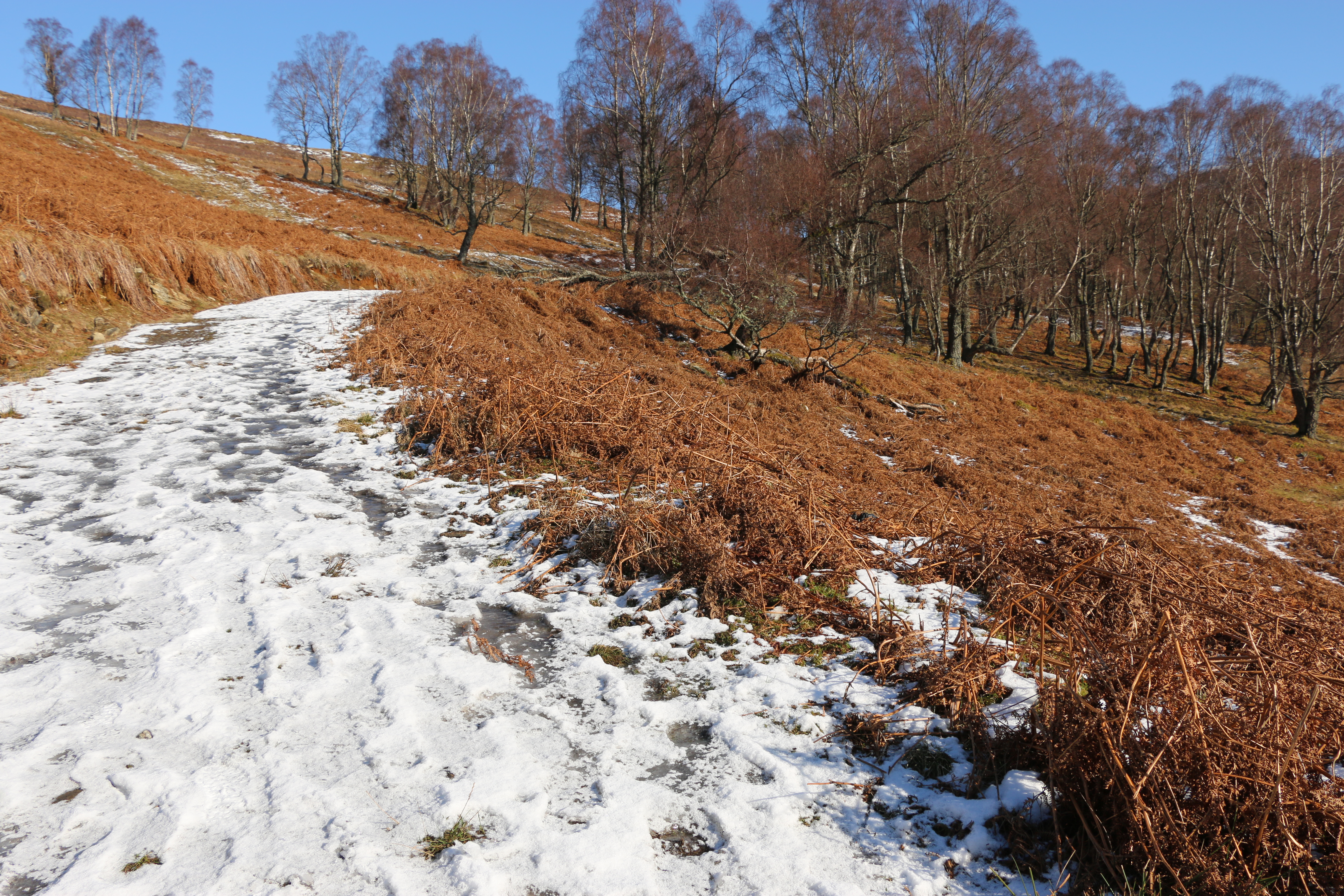
Or rather strolled!.This walk was part of a couple of the short walks we had over our stay as guests with one of the members at the Loch Rannoch Highland Club.
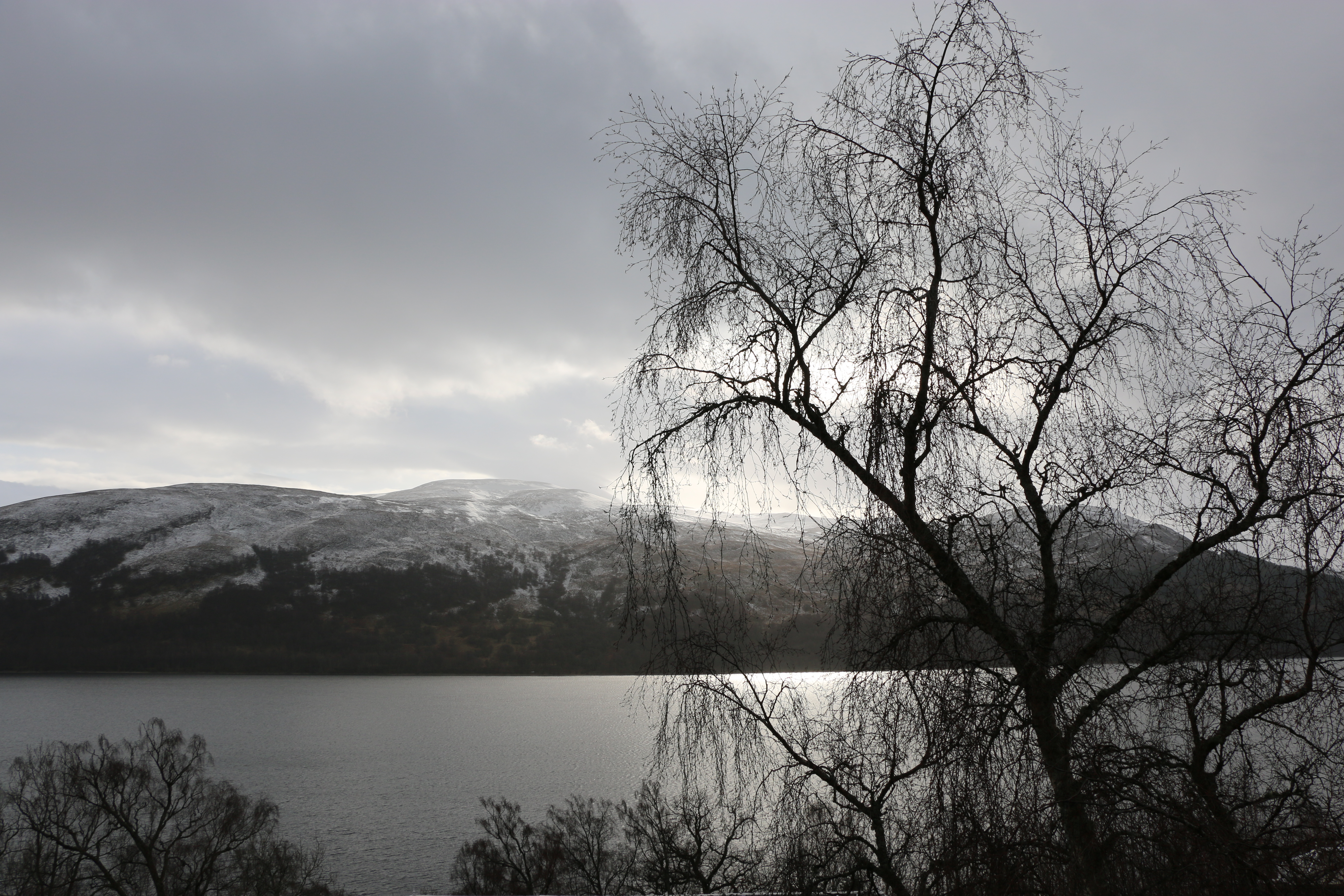
It truly is a wonderful place to stay, with every one of the lodges overlooking Loch Rannoch. The Photographer took this photo on our first night we arrived. We were hooked!It snowed, but soon cleared and we had four glorious days. The Triangle walk was an easy morning’s stroll that we found on the third day.
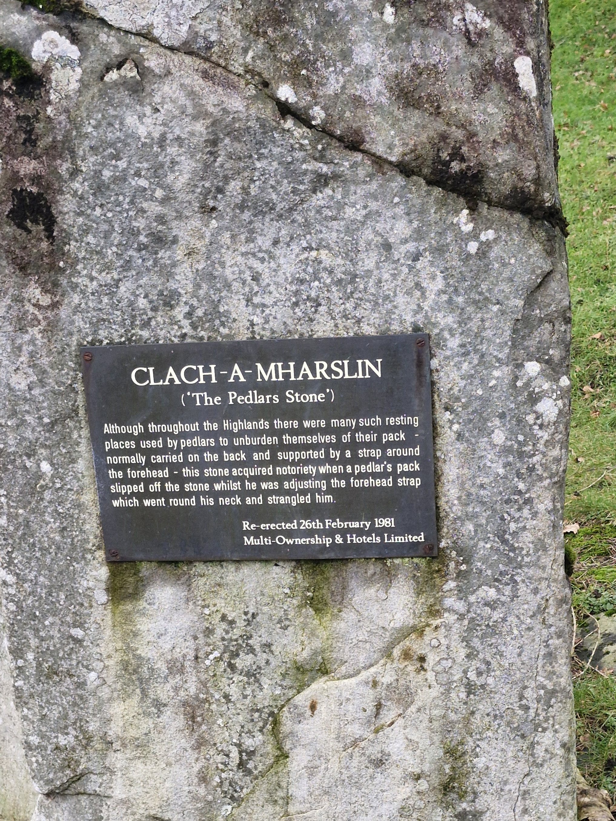
We’d previously passed a stone on the edge of the grounds of the club. That morning we stopped to read the inscription.
Hmm – not a cheerful tale! The Clach-a-Mharslin (Stone of the Packman) is the legend of a pedlar, travelling with a pack slung over his shoulders. Sitting down by the stone to rest, he put his pack on top of the stone. The pack slipped down the back of the stone, the loop tightening around his neck. Trapped, the heavy pack strangled him.
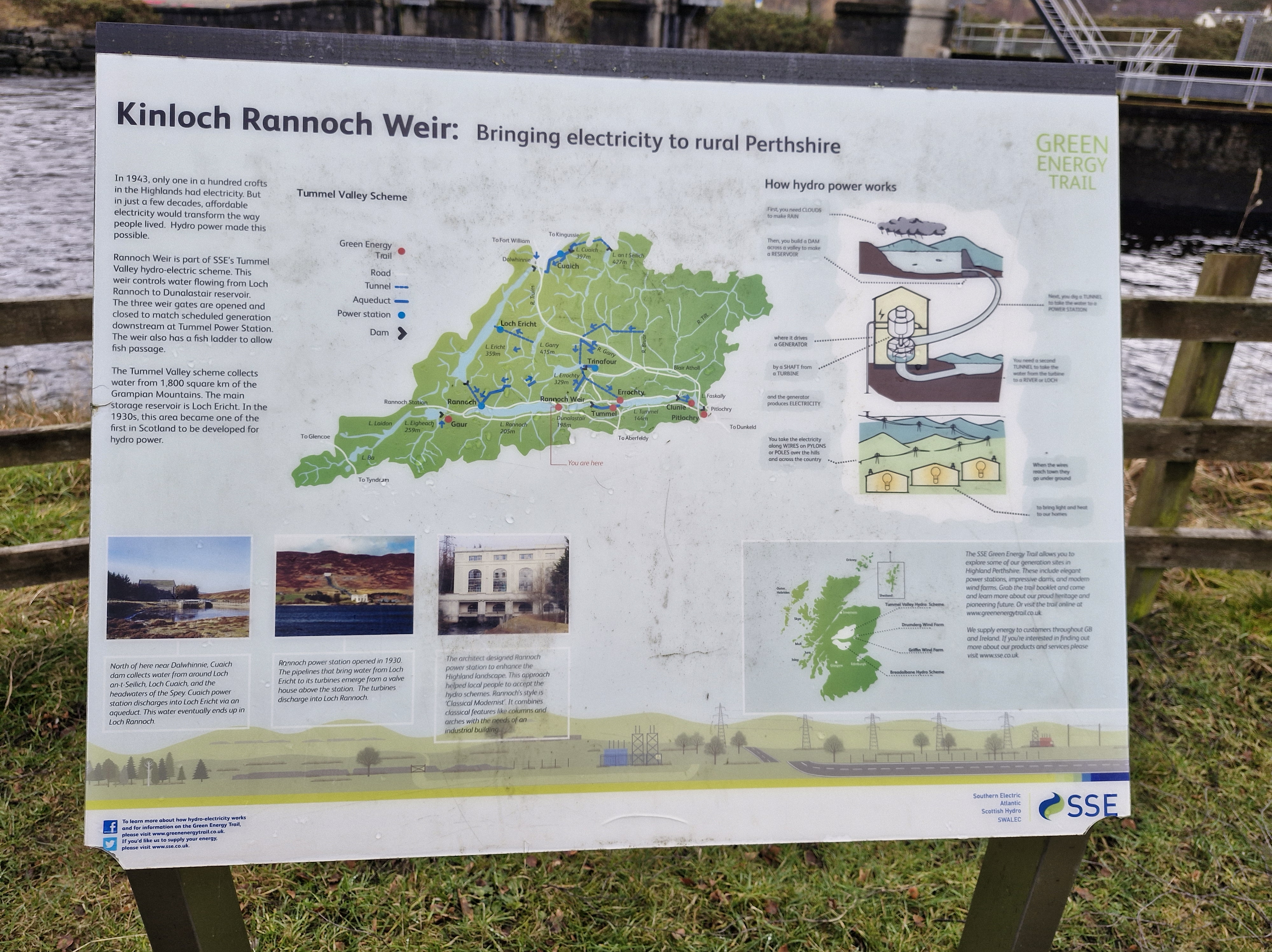
The Triangle walk is exactly what it says: we headed south from the loch to Kinloch Rannoch.Following our map, we left the village and walked along a lane for half a mile along the road that eventually leads to Aberfeldy.
Believe it or not, there are deer here. We had trouble spotting them as well – they were all lying down.
We turned right onto Bunrannoch road, a long stetch of lane near the edge of the Dall Estate, which dates back to 1347. (We were told by the man in the village shop – the residents of Kinnloch Rannoch are such a friendly lot – that the estate surrounds Dall House, built in 1855 as the new seat of the Robertson Clan (Clan Donnachaidh) and gifted by Robert the Bruce for service in the Scottish Wars of Independence.)
There is little to be seen of the old Rannoch village. But we were lucky enough to chat with an elderly man who explained that there were possible plans for another archeological dig being planned. And that the mounds were the remains of a settlement: three prehistoric roundhouses, two larger early historic monumental roundhouses, and five medieval longhouses. He also said that in the 1990s, archaeological digs at Bunrannoch had discovered some bronze axes, and that, in the nineteenth century, a bronze armlet, a form of Scottish Iron Age jewellery belonging to aristocracy and a symbol of power and prestige in the first and second centuries AD, was found. Artefacts all now in collections in the National Museum of Scotland.
It just shows – always stop to chat to fellow walkers!!
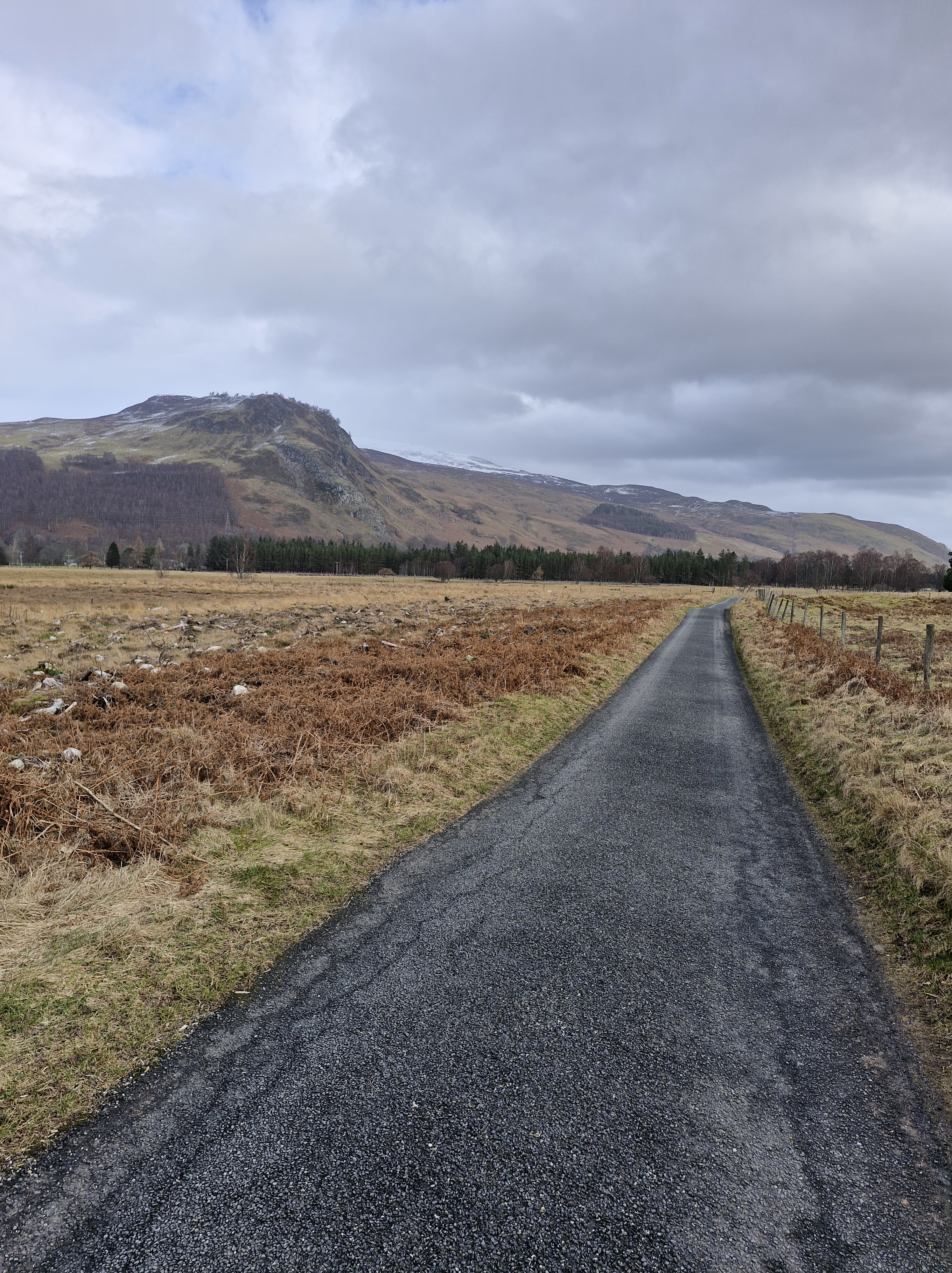
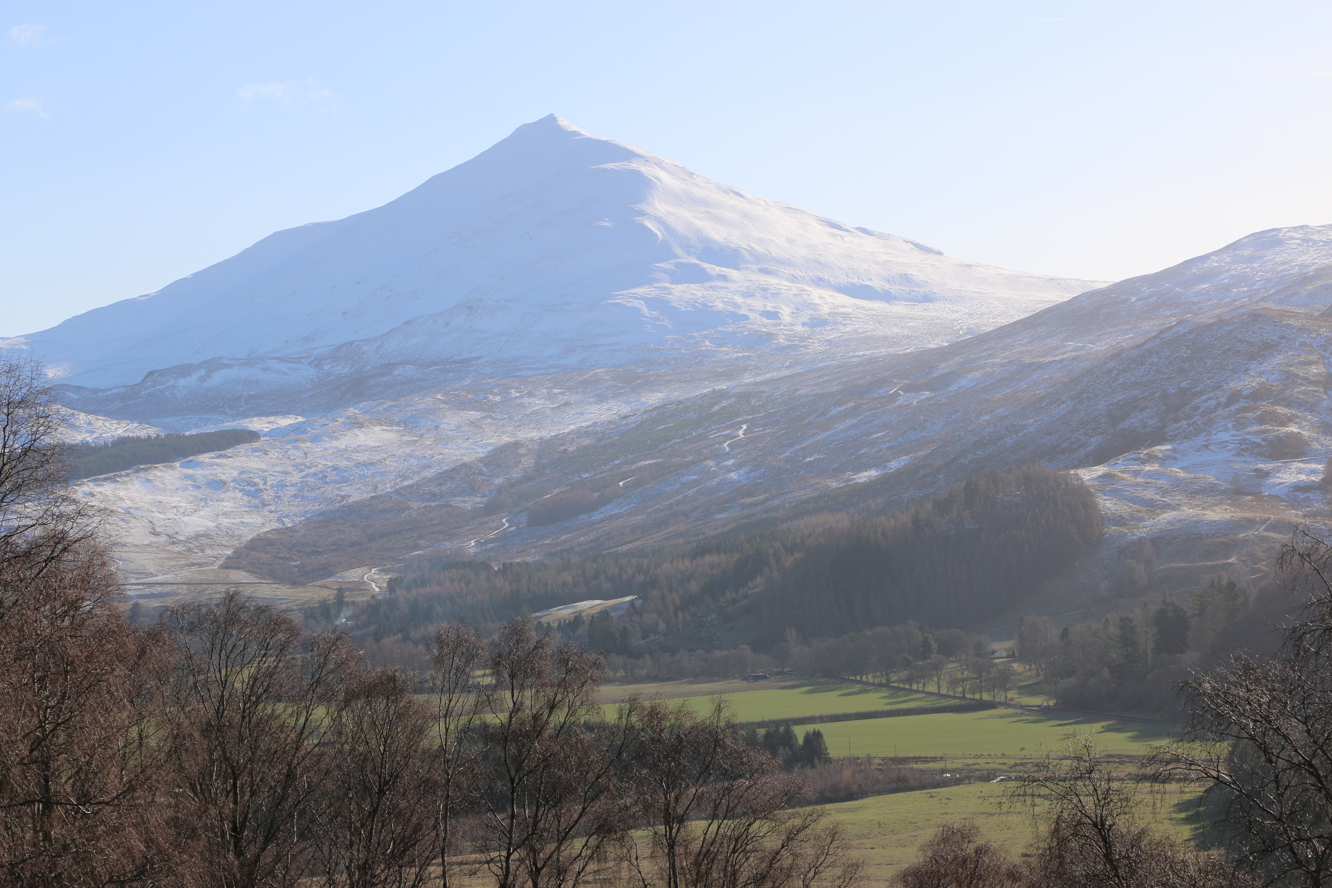
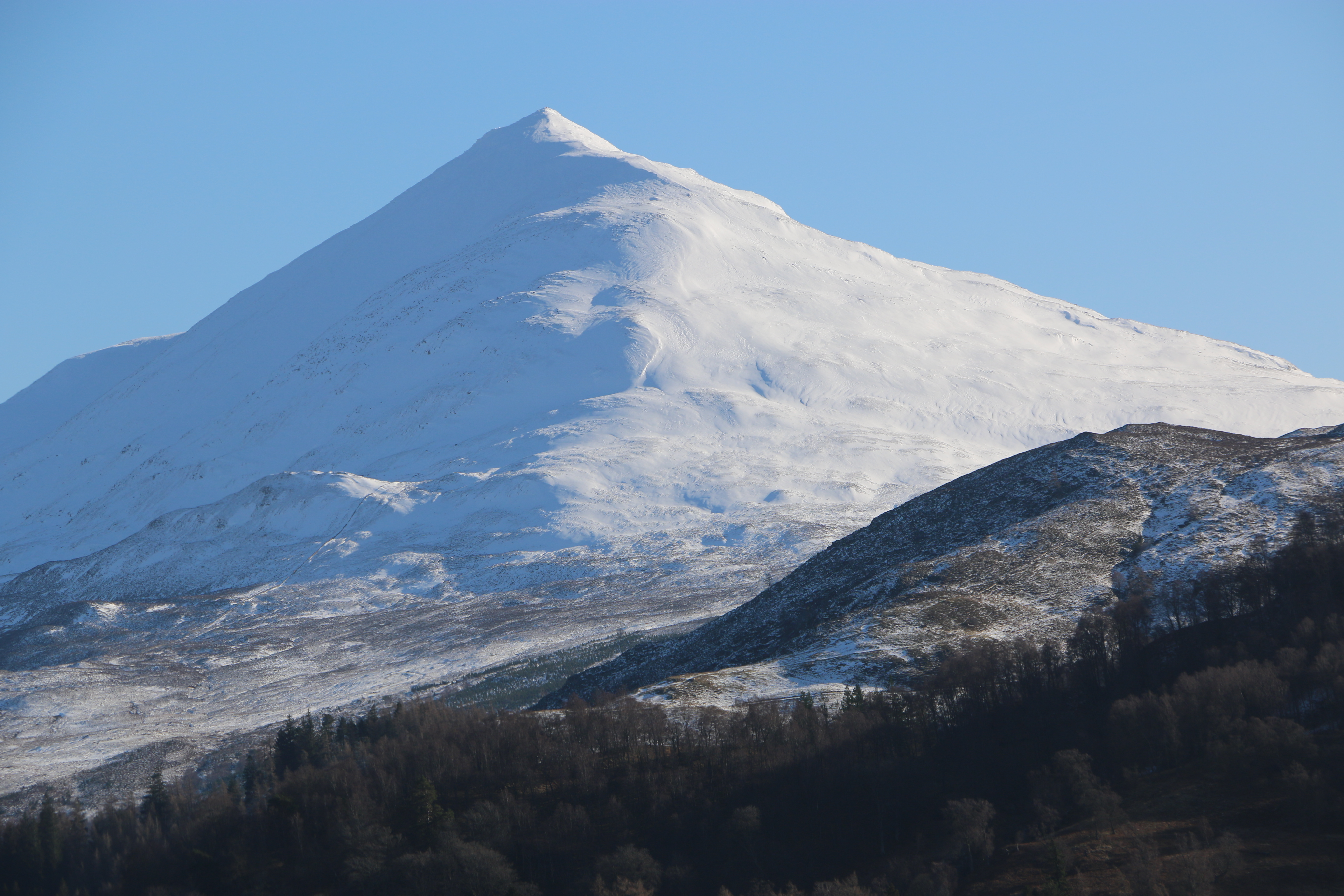
The walk passes the base of Schiehallion, one mountain we weren’t tempted to climb. Though the Photographer was so impressed by the symmetry of it he took many photographs.
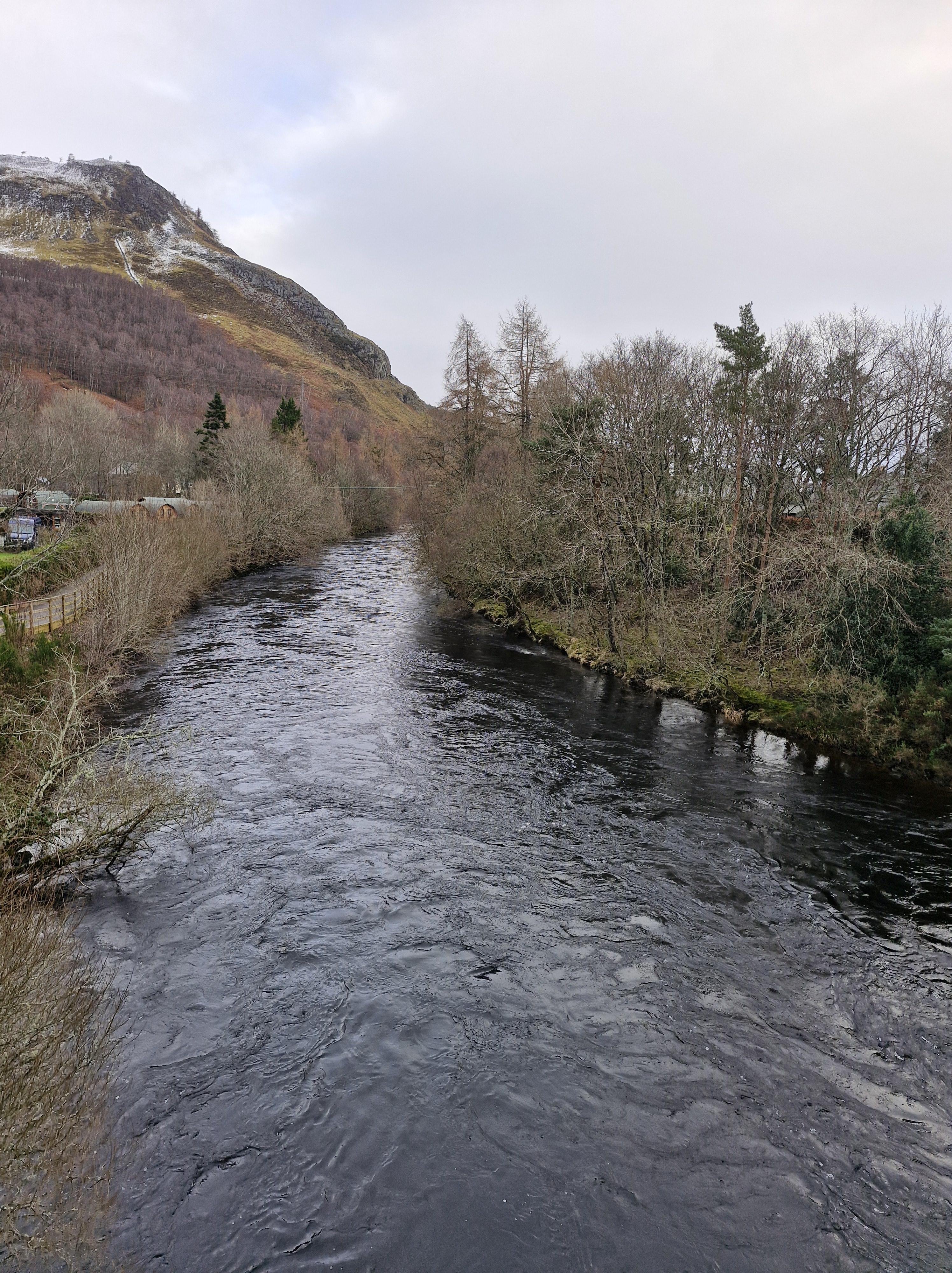
And back to the village. Triangle completed, a lovely easy stroll. We crossed the bridge over the Tummel River. The water was high and deep, swiftly running after all the many previous weeks’ rain.
There’s an inscription on Rannoch Bridge that reads “THIS BUILDING ERECTED A.D. 1764 AT THE SOLE EXPENSE OF HIS MAJESTY OUT OF THE ANNEXED ESTATES”. It’s obviously propaganda intended to show the personal generosity of George 111 after the 1745 Jacobite Rising when the British government confiscated the estates of Highland leaders who supported the rebellion. Though the profits gained were used to fund trade and agricultural developments in Scotland and, I guess, went someway, maybe, to improve stewardship of the estates forfeited.
At the village square we stopped at the Buchanan monument, Dedicated to Dugald Buchanan (1716–1768), a famous Gaelic poet known for religious poetry, such as Judgement Day. He was crucial in translating the New Testament into Scottish Gaelic and operated a school in the area.
Previously, this was also the site of gallows.
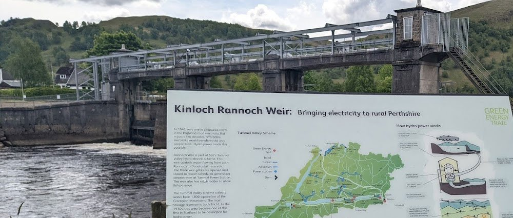
And then took the path alongside the Tummel river, past the weir. Kinloch Rannoch Weir is a low-level dam located at the eastern end of Loch Rannoch, and controls the outflow of water into the River Tummel towards Dunalastair Reservoir. As part of the wider Tummel Hydro-Electric Scheme, it regulates loch levels for environmental and power generation purposes. It is a Grade B listed structure and is believed to date back to the 18th century.
A short walk, but one that gave us a chance to discover a little of the history of Kinnloch Rannoch.
Arriving back at lodges that evening, we treated ourselves to a meal at the Loch Rannoch Highland hotel, the independently-owned hotel that’s on the same site as the club. We could have used the pool and spa there, but not having brought our swimsuits – well we forgot, it was February after all – we didn’t. However we did have some excellent food there.
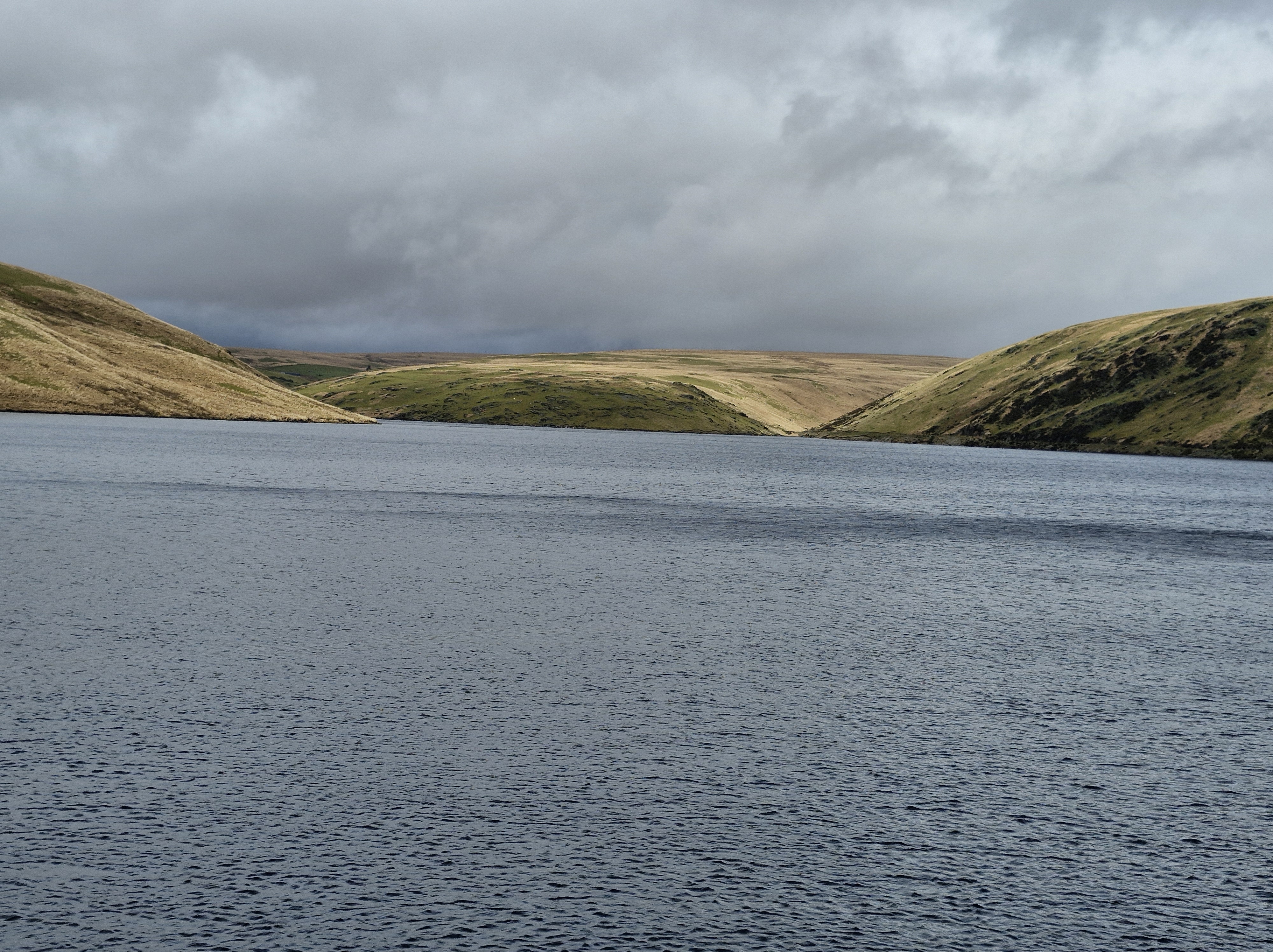
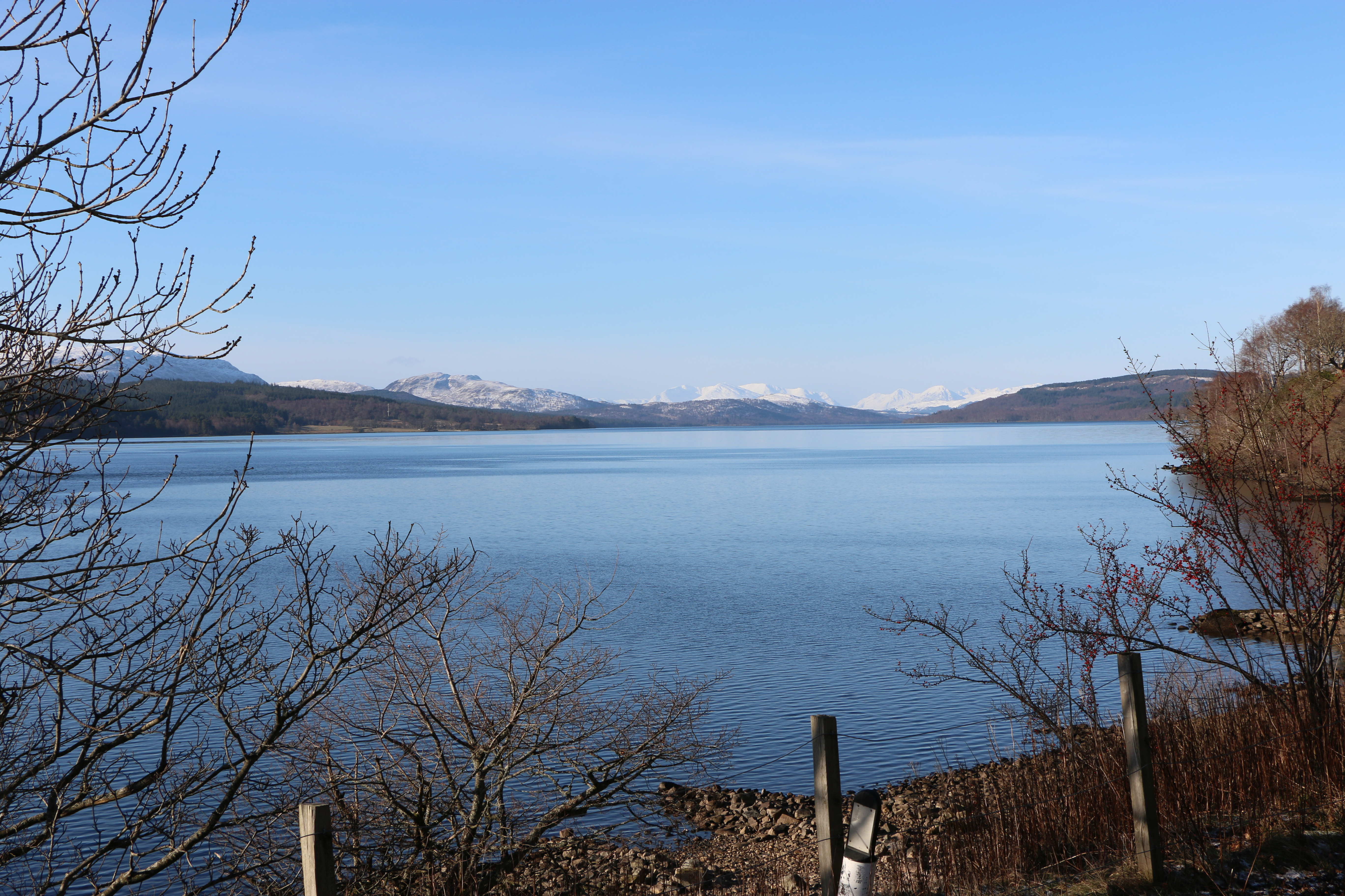
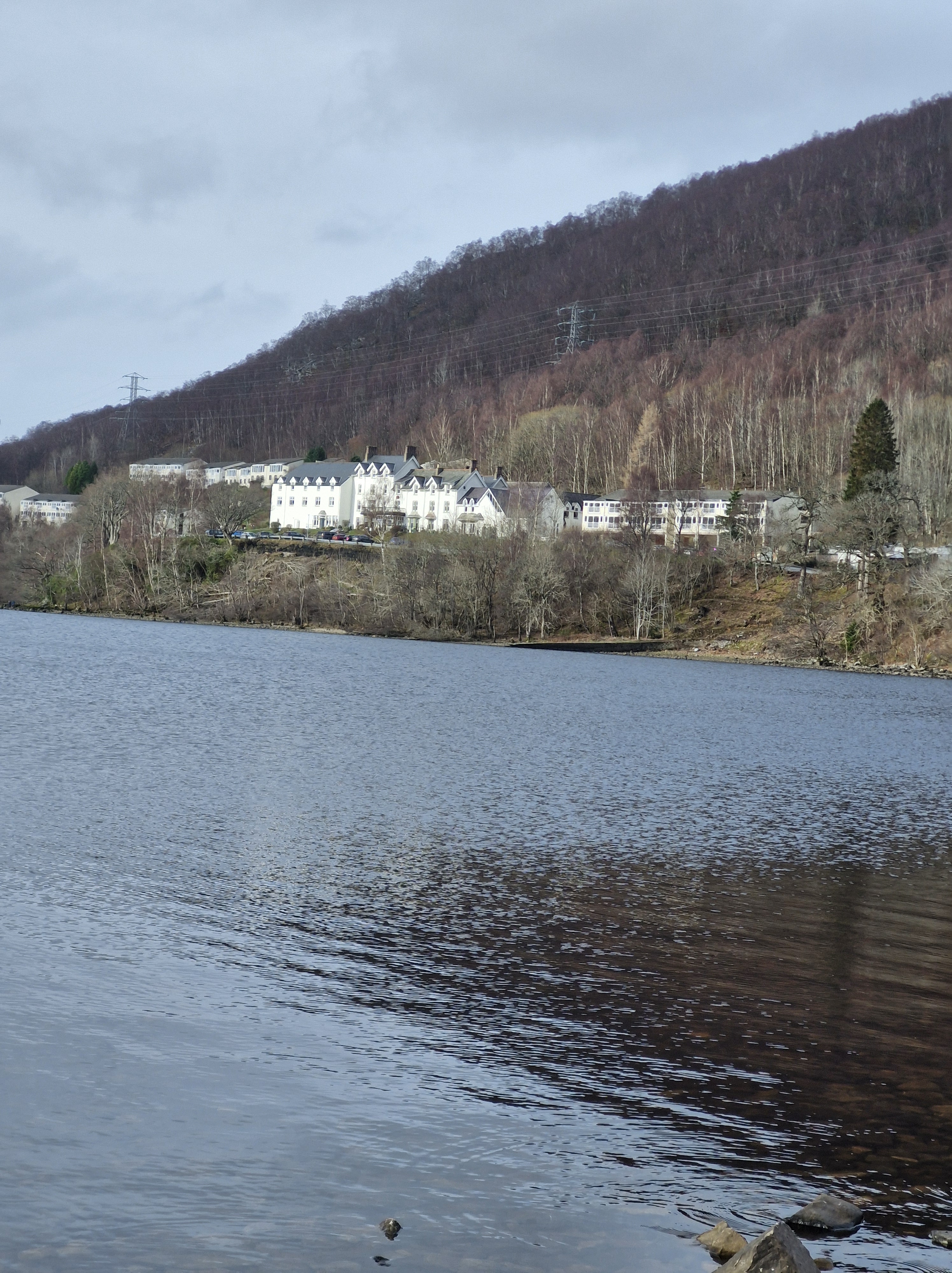
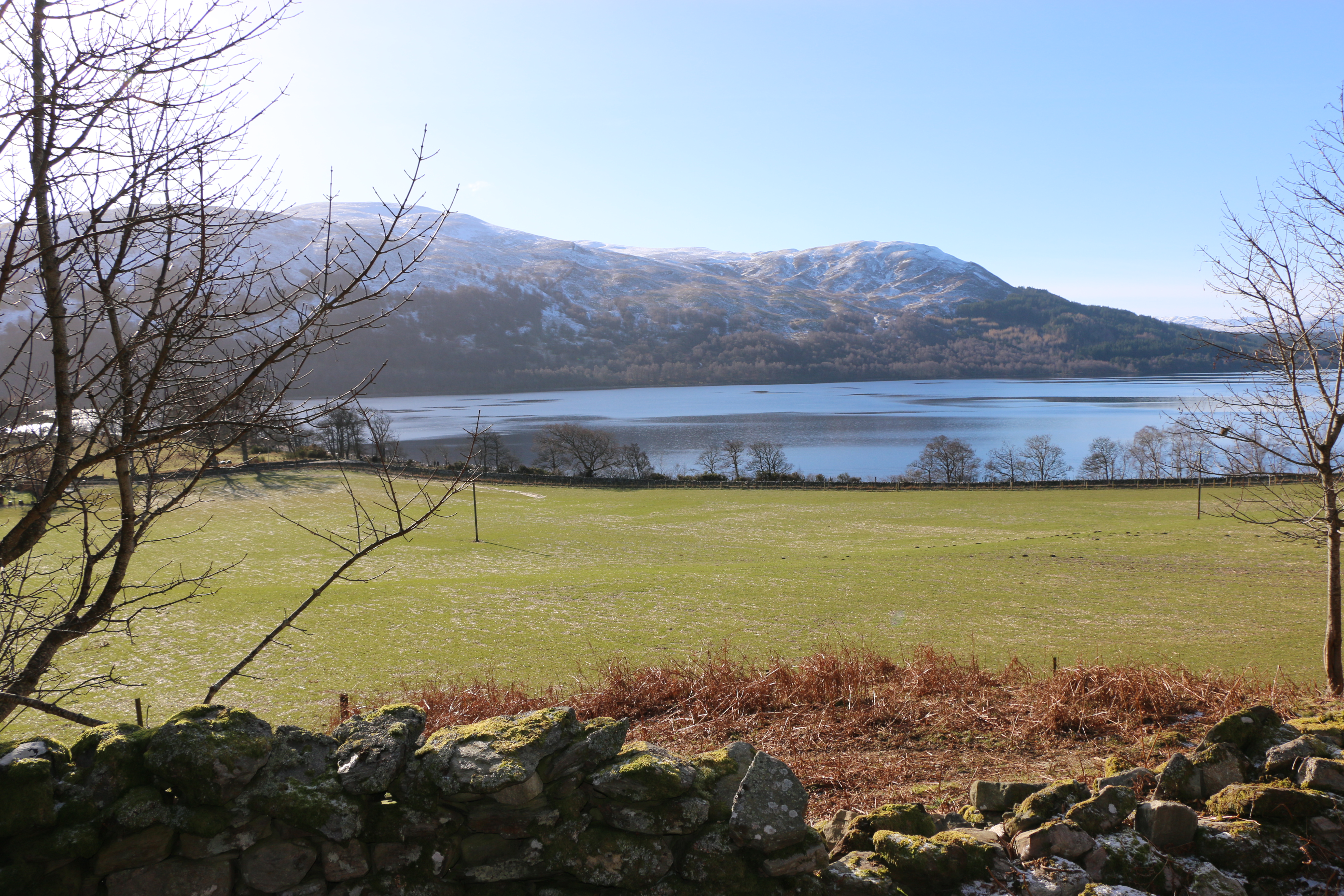
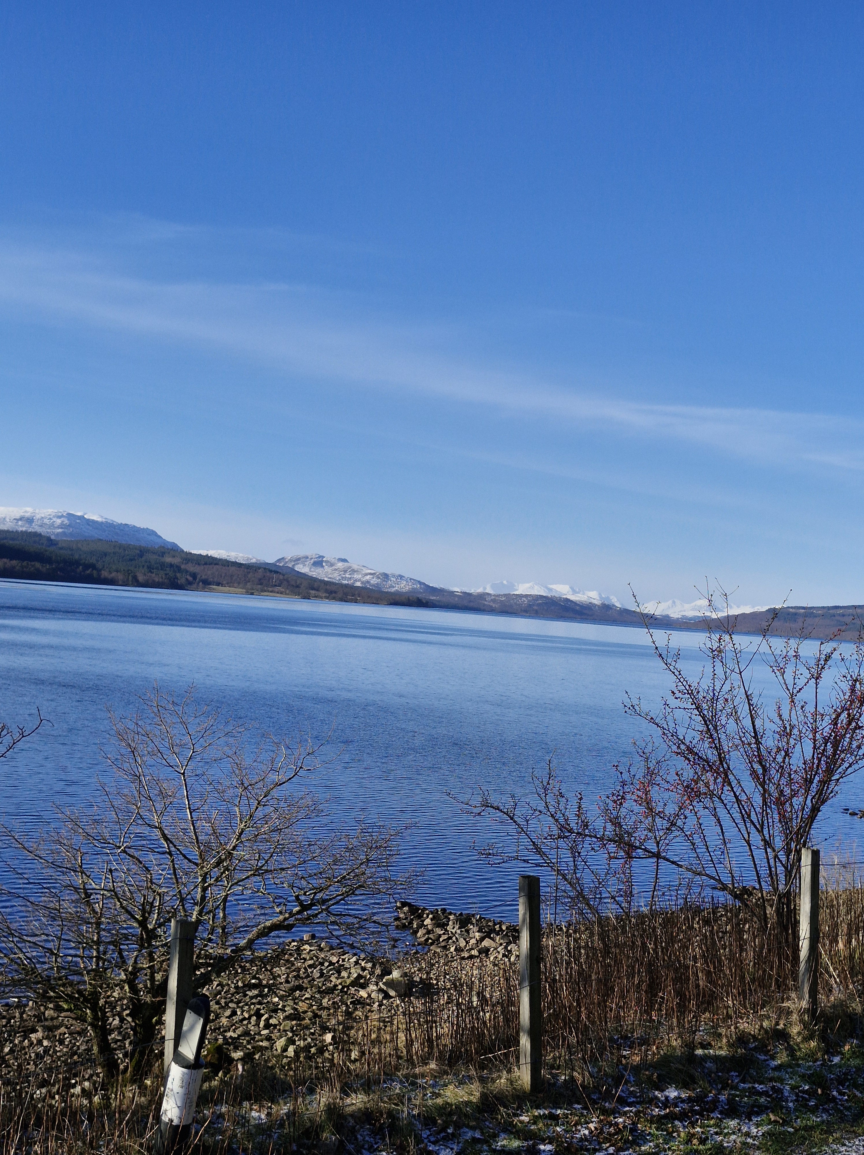
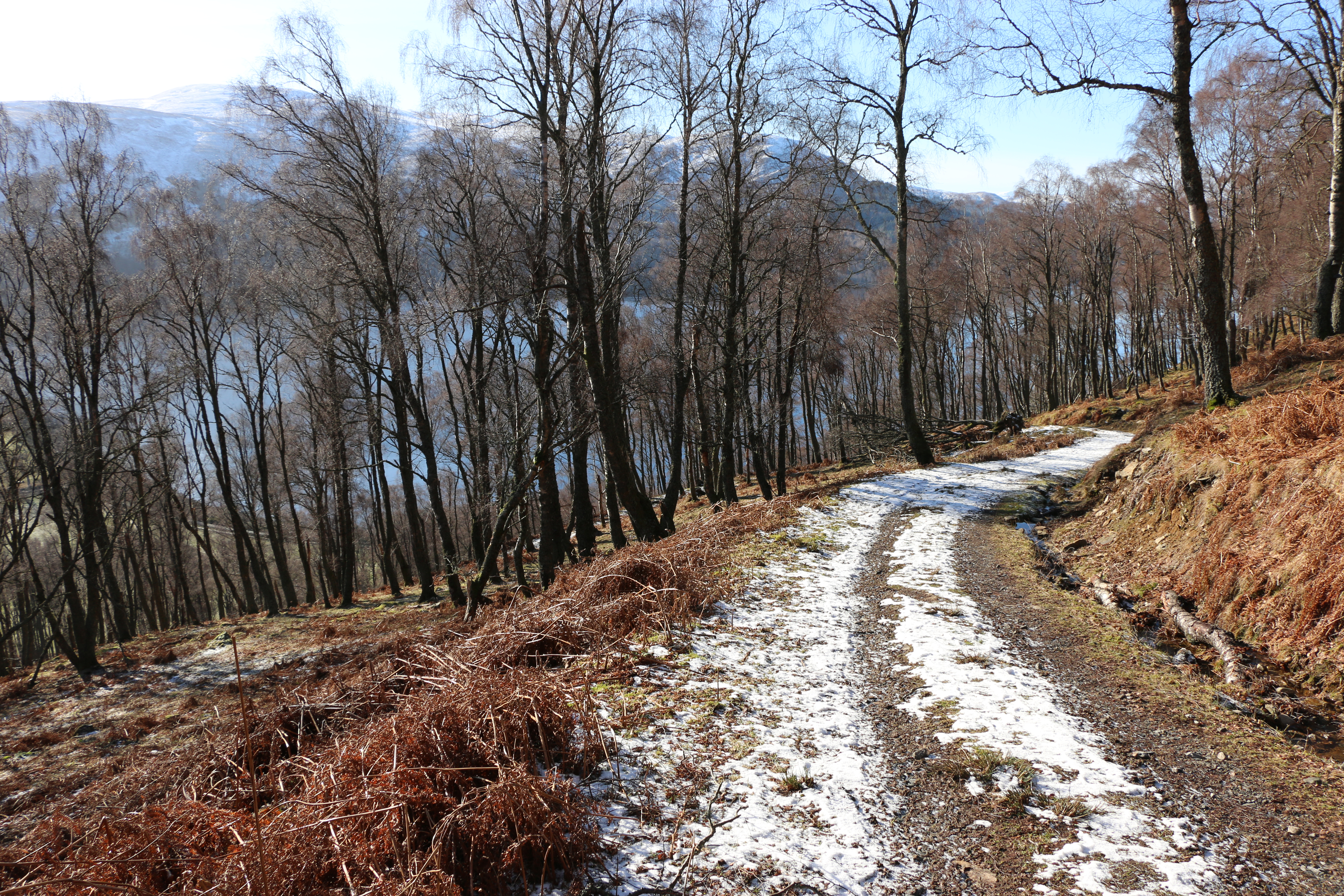
After our venture onto Craig Varr we decided to take an easier walk alongside Loch Rannoch.
Loch Rannoch is glorious: set in one of the most peaceful areas we’ve ever been fortunate to visit, it’s a freshwater loch. Long and narrow it was carved out by glaciers during the last Ice Age. At a circumferance of twenty-two miles or thereabouts I balked – just a little – at the thought of walking all the way around.
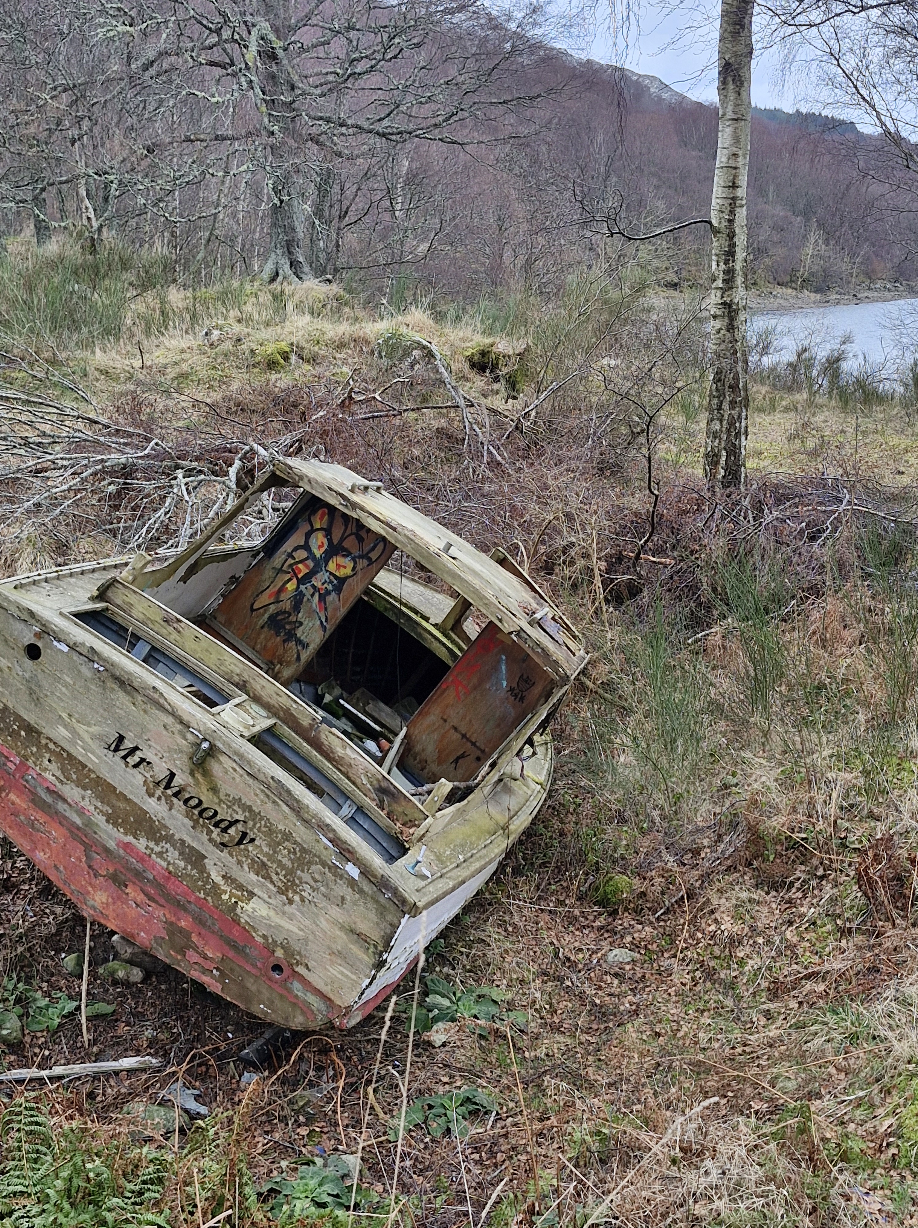
‘We could go halfway,’ the Photographer suggests. I’m not daft; halfway means turning round and we’d still be treking twenty-two miles. And, as the loch is a mile wide, and it’s February, swimming across the water back to the lodge we’re staying at is definitely out of the question.
And I wasn’t going to trust the abandoned boat we discovered. I wasn’t surprised its name was Mr Moody!!
So, in the end, it was a short, and very pleasant stroll.
Later that evening we settled down on the balcony of the lodge, with a glass of wine, to watch the sunset over the loch.
There are many legends and stories of Loch Rannnoch and the surrounding areas.
We particulary enjoyed the following::
The story of the sword that lies in the depths of Loch a’Chlaidheimh (The Loch of the Sword) in Rannoch.
There were two clans that resided on Rannoch Moor: the Camerons, and the Rannochs. Frequently, these clans would clash over the ownership of Beinn a’bhric, a valuable grazing ground. Year in, and year out, the two clans would come to loggerheads over who owned the land and whose livestock had the right to graze there. Year in, and year out, no solution was reached, and the issue only increased the rift between the two factions with each passing season. Eventually, the two parties decided that enough was enough, and it was time to, at last, put an end to the conflict. So it was that Ewen Cameron of Lochiel and the Earl of Atholl decided to meet and they would not part until the boundaries of their lands were decided once and for all. In order to avoid potential violence, the meeting was to be arranged under specific conditions: each man would venture alone, with only one piper for company. So Cameron set off, piper at his back playing a merry tune, setting a positive mood for what he hoped would be a productive meeting. As he travelled through Rannoch Moor, Cameron thought deeply about the confrontation at hand, concocting an iron-clad argument that might win him the grazing grounds. So deep in thought he was, that he hadn’t noticed striding straight onto the land of an infamous wise woman who lived upon the moor, known as The Blue-Eyed One. ‘You are going to meet the Earl of Atholl without any men?’ she asked, askance. ‘Aye, lady, I am,’ said Cameron. ‘Those were the terms of our agreement.’ The Blue-Eyed One shook her head ‘Do not meet the Earl alone, man. Take sixty five of your best men, and hide them among the heather, ready to be called, should you need them.’ Cameron was swayed by the old woman’s words, as she was known for her wisdom and sight. So, Cameron did as she had suggested, and called his sixty five best men to his side, and ordered them to conceal themselves in the heather, and to be ready should the Earl of Atholl look to turn violent. When the sun reached its zenith, the two proud leaders approached each other on the seemingly empty moor. The discussions opened with the easy exchange of pleasantries, and progressed swiftly to the matter at hand. Where at first it appeared the pair would remain cordial, the exchange heated as the boundary was debated, working up to an inferno, until the men were shouting and drawing their swords upon the other. It was then, that the Earl of Atholl whistled, and from the moor behind him sprung fifty soldiers, armed and ready to defend their master. ‘These are the Atholl sheep coming to eat the Lochaber grass!’ the Earl of Atholl cried. And so, Cameron, grateful for the words of the Blue-Eyed One, whistled, and his own men sprung from the heather. ‘Here are the Lochaber hounds going to eat the flesh of the Atholl sheep!’ he responded. The Earl of Atholl sized up Cameron’s forces, but he could only admit that Cameron’s hounds outnumbered his sheep, and reluctantly, he sheaved his sword and called his men down. He bent his head, renounced the contested lands, and, as a signifier of the deal struck and the peace that would come from it, he hurled his blade into the loch. There, the sword remained. That was until 1812 during a long, dry summer, when a herd-boy was working that same old disputed land. The loch had drained with the drought, unveiling the sword cradled in its peaty belly. For a time, the sword was removed and ogled by the locals, until a blue eyed woman who lived nearby told them a tale of a conflict solved by the throwing of a sword, and so it was decided the sword should be returned to the Loch of the Sword. Seton Gordon described the moment the sword was thrown once more into the depths: ‘For an instant as it sped, its trusty blade turned to glowing bronze in the sunlight, then, like Excalibur, it sank forever from sight!’
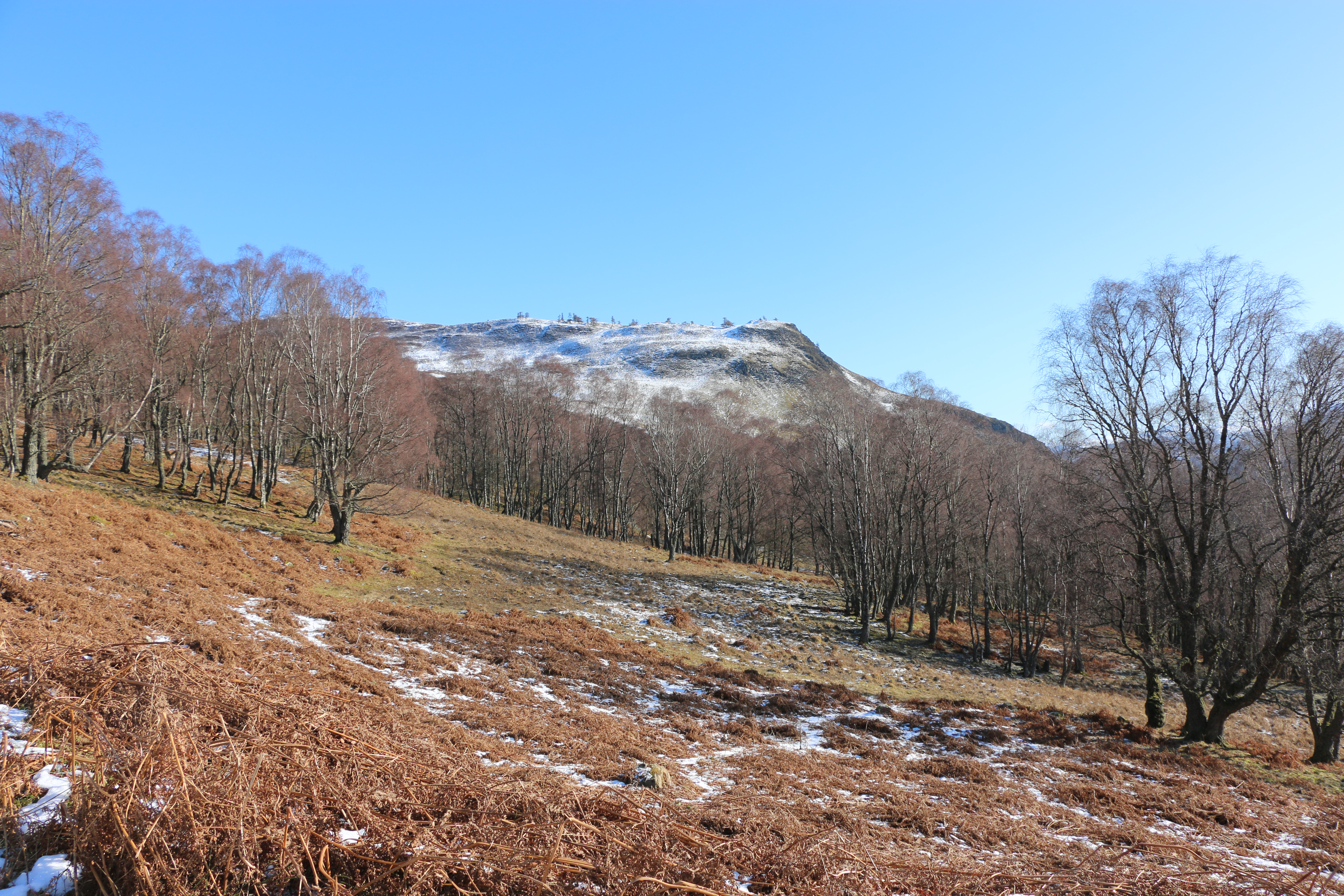
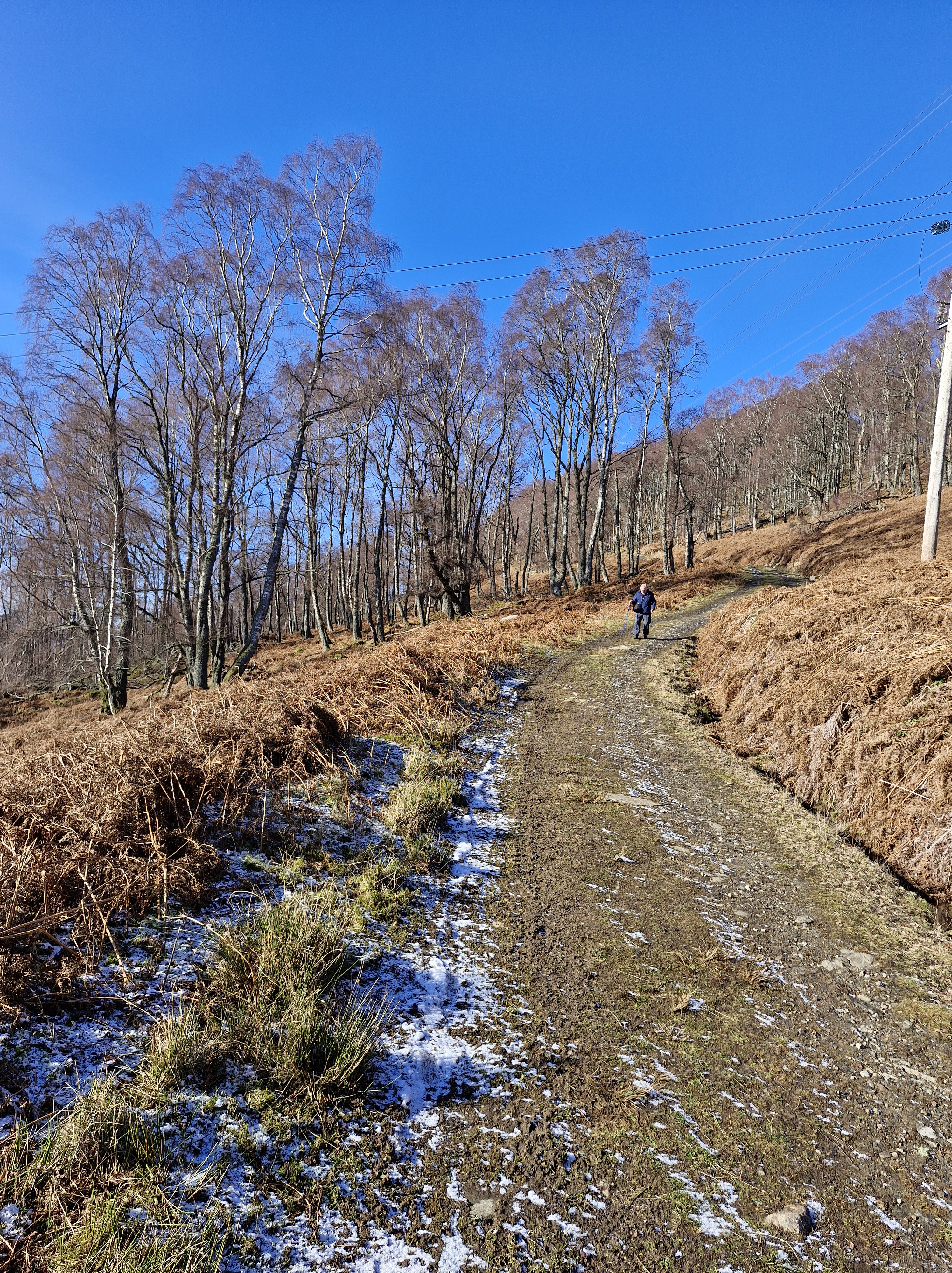
Craig Varr is a truncated spur; a ridge cut off by the glaciers of the last ice age around ten thousand years ago. The result of the ice erosion is a cliff close to Kinloch Rannoch and a ridge that leads northeast to Beinn a’ Chuallaich (Mountain of the Herding”) .
Craig Varr – the first walk that the Photographer had identified when we knew we were going to Kinloch Rannoch. We perhaps should have taken notice of the warning: ‘Very steep initial ascent on a wide path; then pathless and boggy for a section before a final rough ascent’,
Especially when, on the day we arrived, it snowed!
But the Photographer was keen – very keen – to take some photographs, particularly of the mountain to the south, the triangular profile of Schiehallion. He was convinced that if we could climb only a short way up to Craig Varr, he would get a decent phtograph. As you can see, he did!
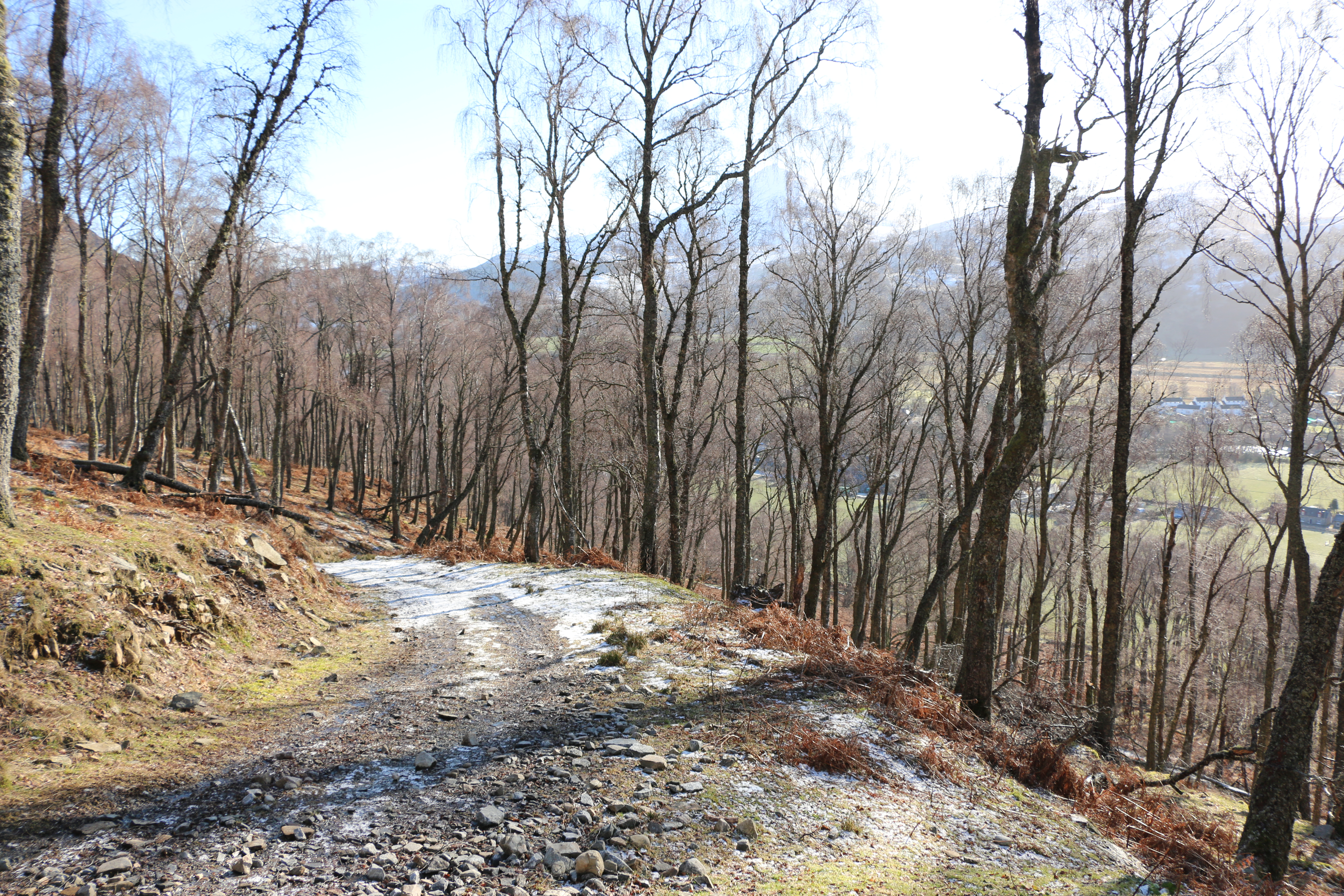
We often forget how old we are. And it was with this oblivious attitude that we set off in hiking boots and with poles.
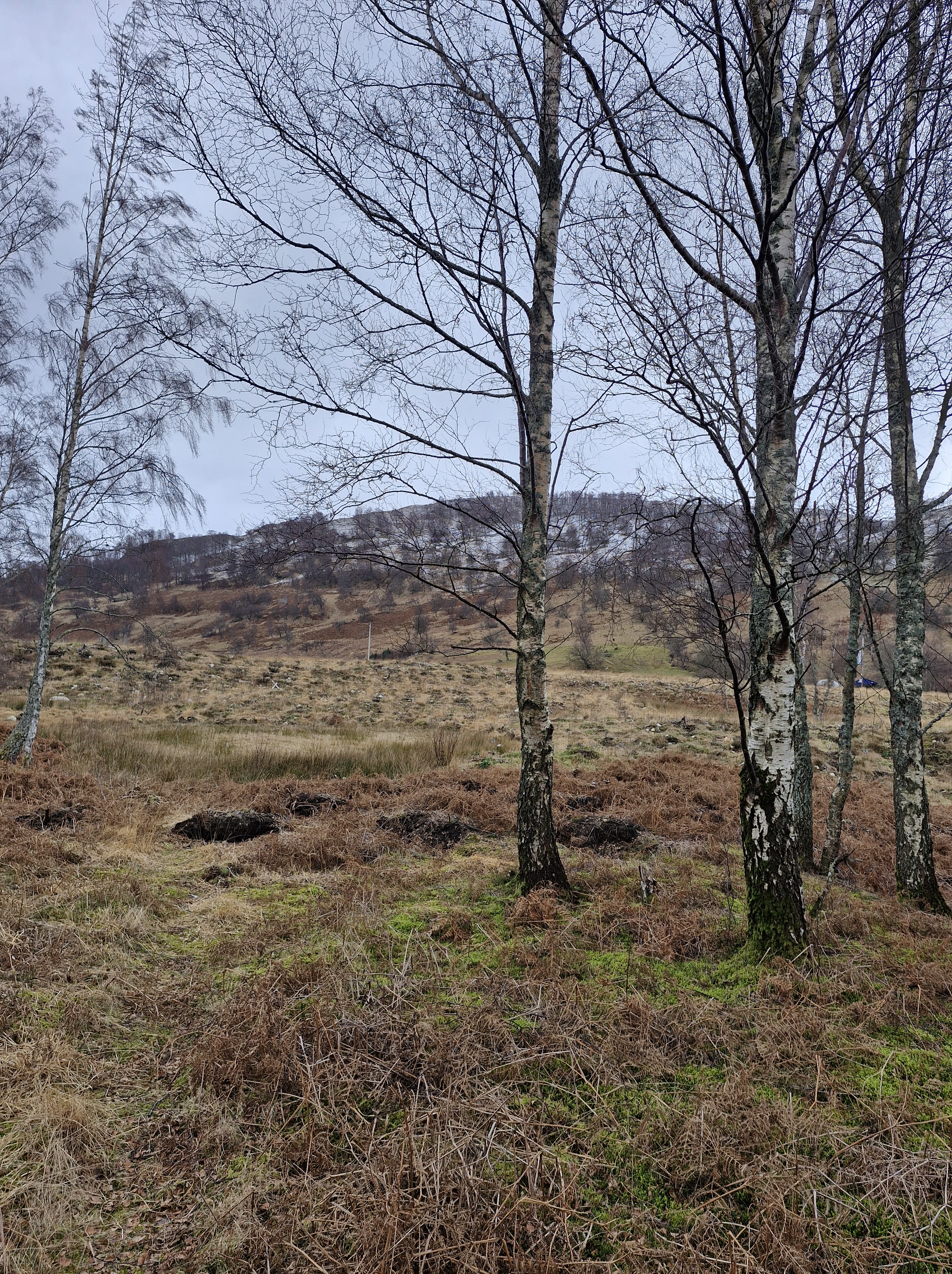
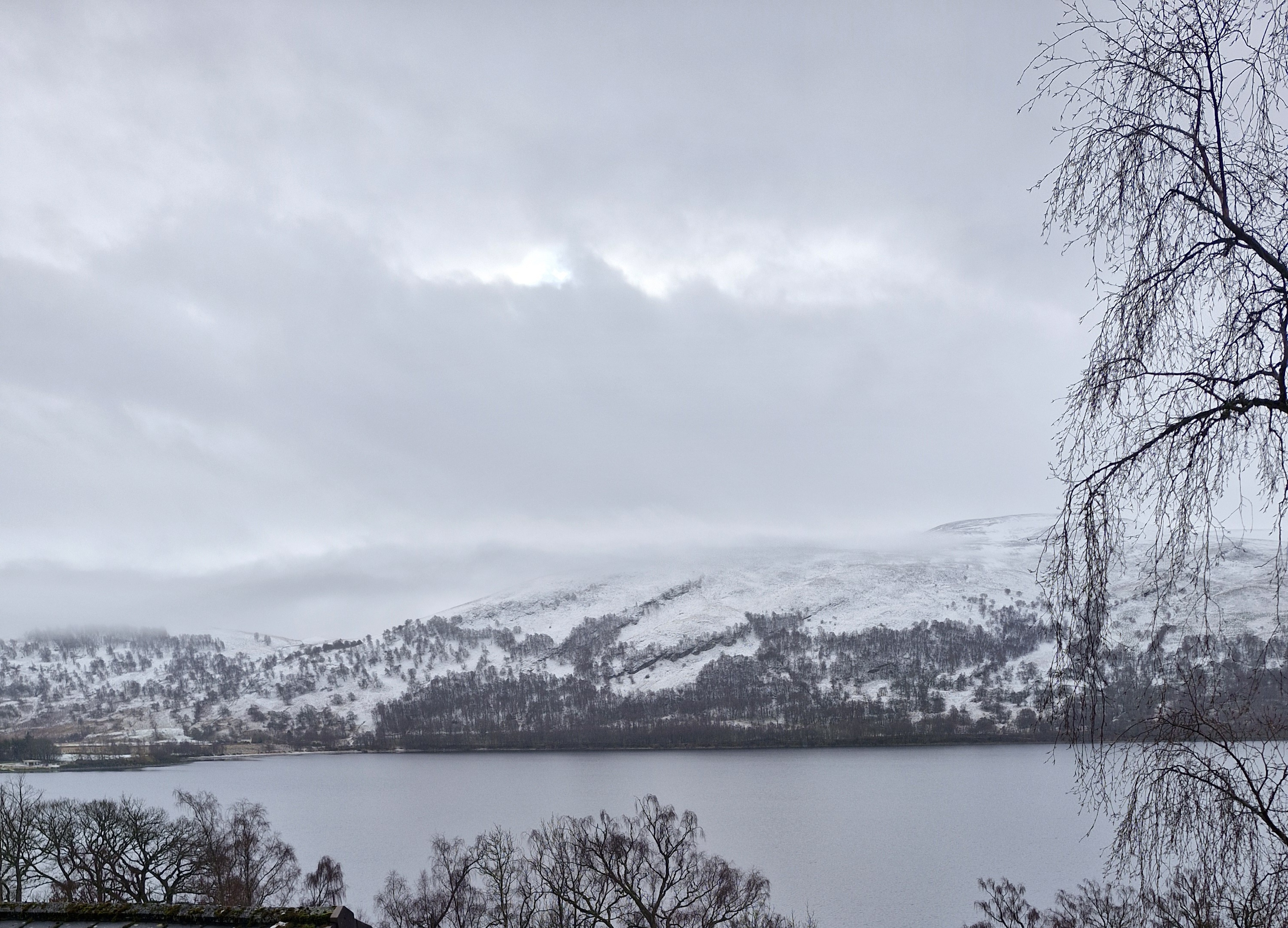
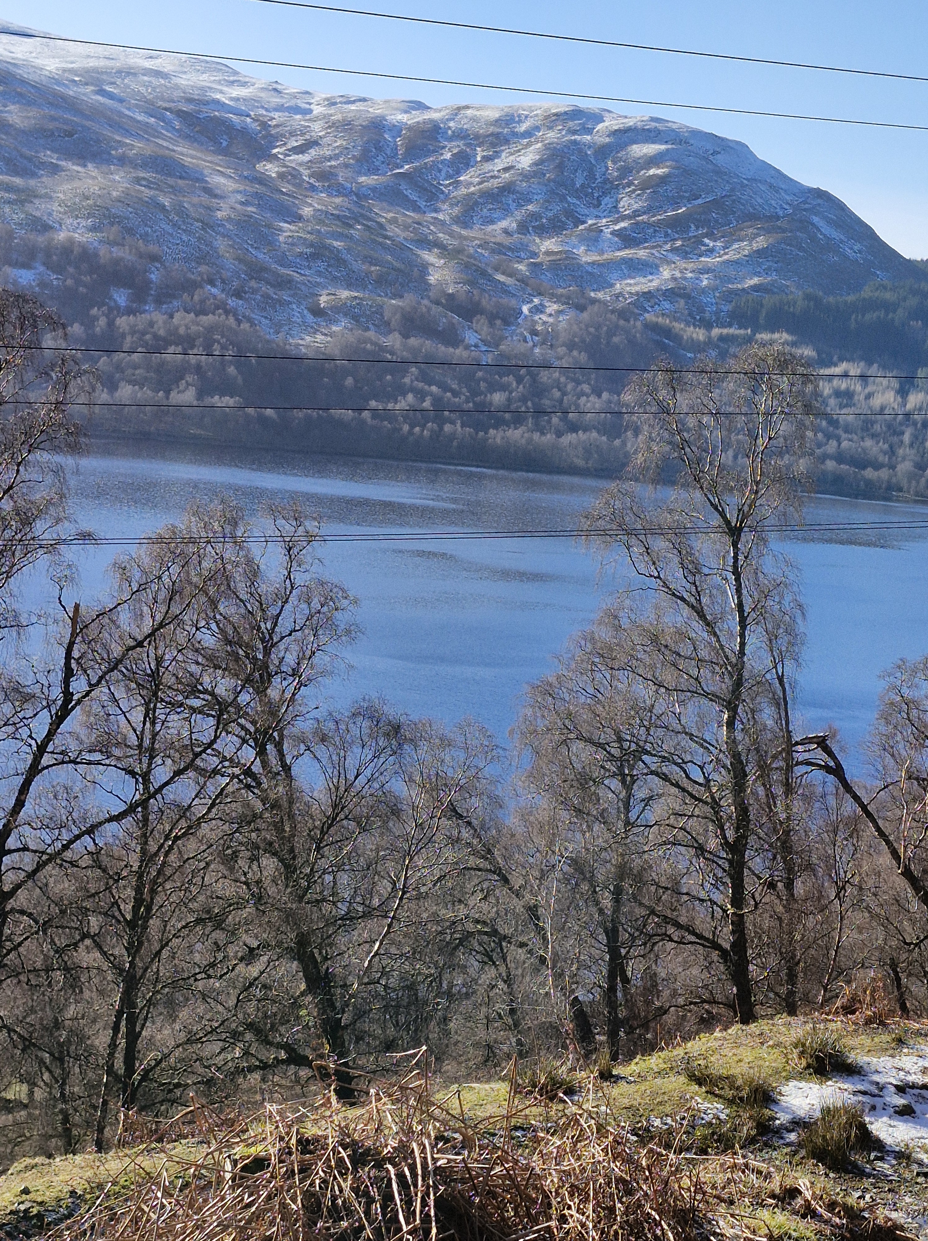
We left mid morning: the snow had disappeared from the roads, the sun shone, the air was quite warm, and from the path overlooking the loch it felt like a lovely Spring day, despite it only being February.
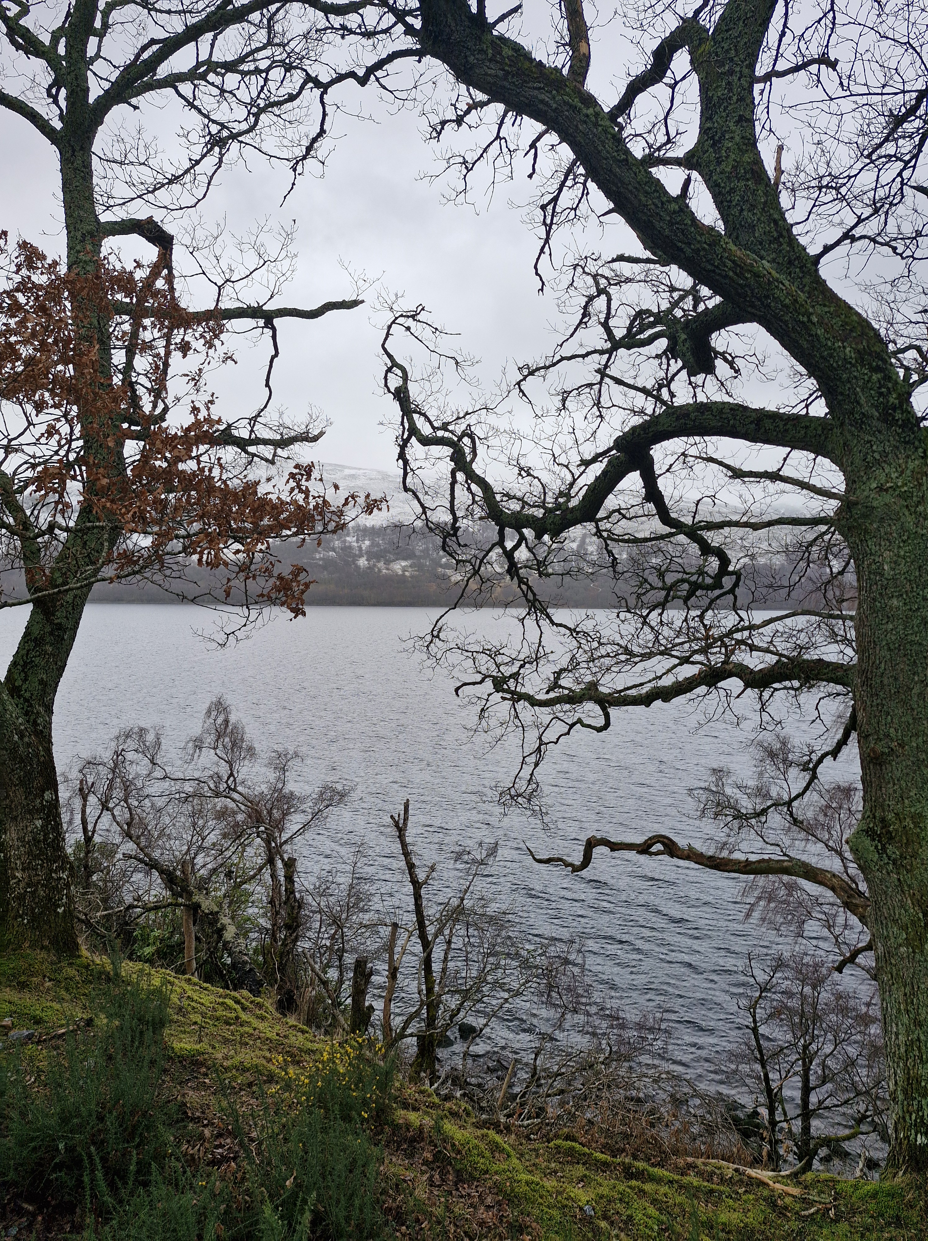
Against the clear sky the loch was impressive through the trees.
The Photographer stopped often to take photos.
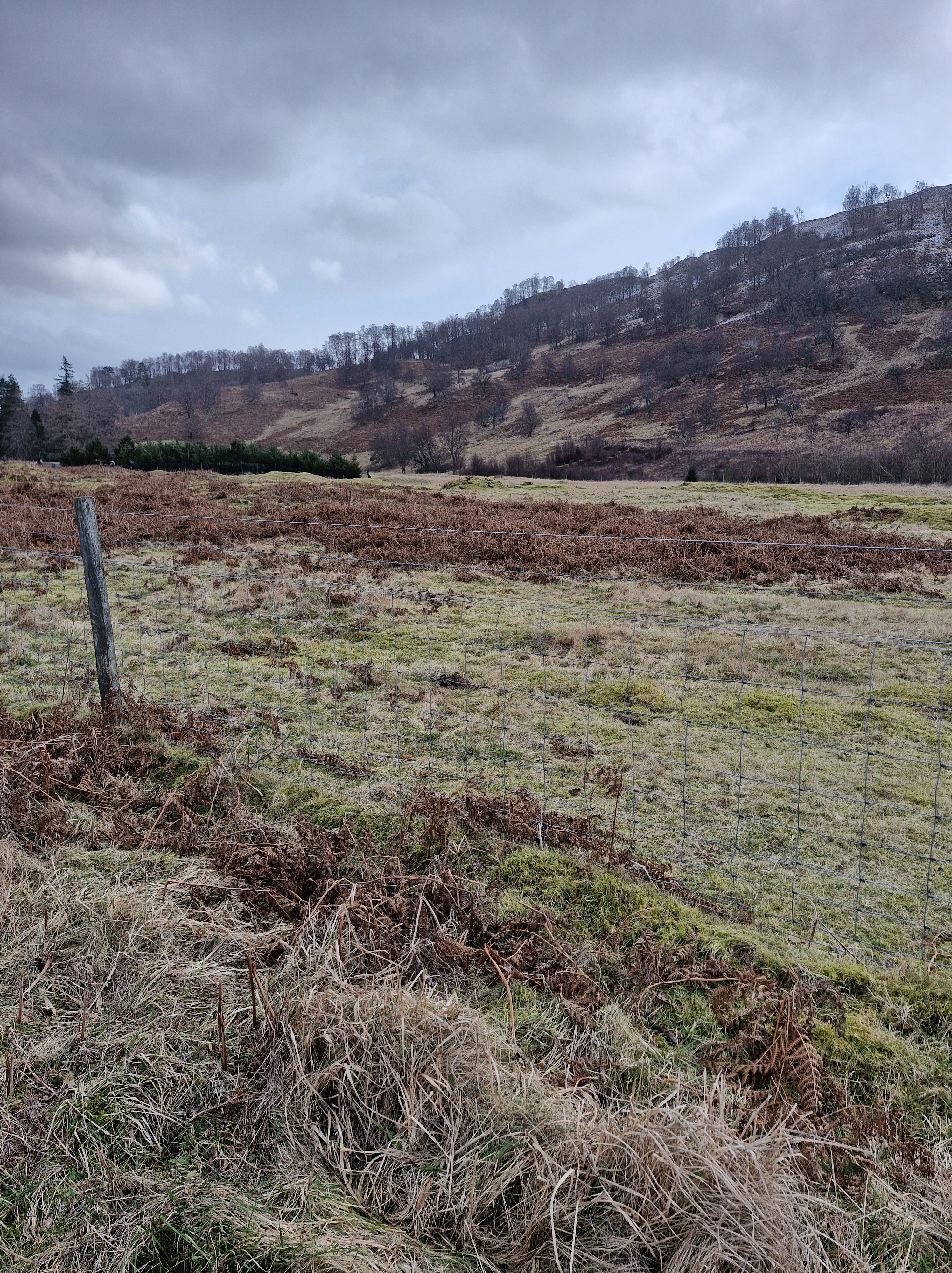
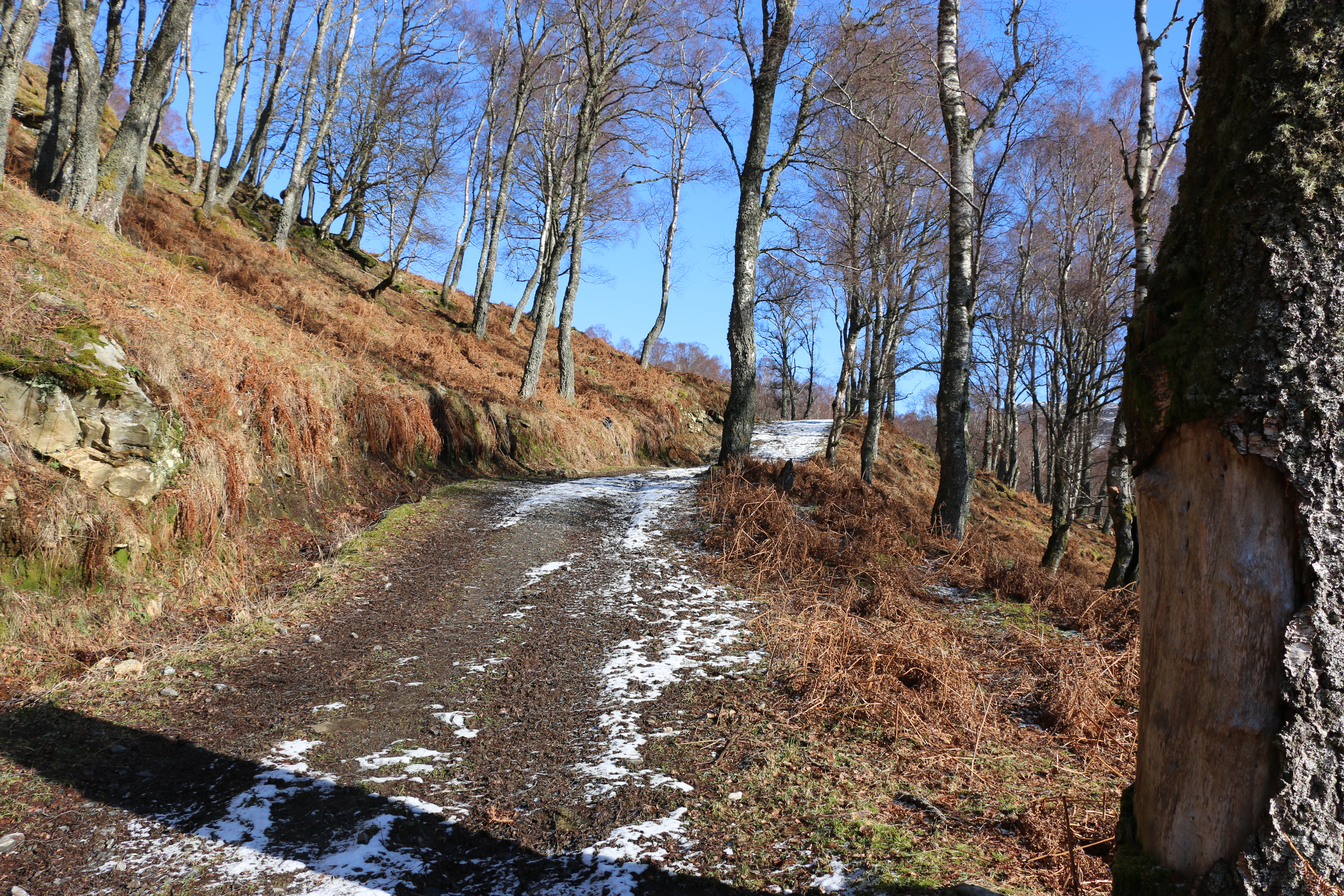
The track, though rough, was easy at first. We resolved to walk as far as it proved so.
But soon we encountered more snow and ice
Common sense kicked in – we turned back. The climb would be for another day, preferably a long summer’s day. Or at least a day when there wasn’t any snow.
Back at the lodge we agreed that tomorrow’s walk would be on lower ground – probably around the loch.
N.B. For interest:
Schiehallion: the mountain that weighed the Earth
This superb quartzite mountain was chosen in 1774 as the site of a famous experiment to weigh the Earth; today it is an unrivalled viewpoint. Six to seven hundred million years ago the area that now forms the Grampian Highlands was a shallow sea. Layer upon layer of sediment was formed from mud eroded from the land, white quartz sands, and limy deposits. As these layers were buried and compressed, they became mudstone, sandstone and limestone. At that time Scotland was at the edge of a continent which included North America, separated by the deep Iapetus Ocean from the rest of Europe. Plate tectonic movements closed this ocean 470 to 430 million years ago, subjecting the buried rocks to great heat and pressure. Mudstone became schist and slate; sandstone became very hard, creamy-white quartzite; all were folded and fractured in complex patterns. At the end of these earth movements the rocks were uplifted to form the Caledonian Mountains. Perhaps one of the most amazing things about Schiehallion is that this folding and fracturing of the rock layers is so pronounced in the area around the mountain that the mountain itself is almost ‘upside-down’! In other words, the older rock layers can be found at the top of the mountain and the younger layers at the bottom. Several different rock types can be seen on the main path up Schiehallion,. You may come across a limestone pavement with water-worn fissures and potholes. Locally, these limey soils support unusual plants. The same rock can be seen in quarries and a restored 19th century lime kiln at Tomphubil. . Most of the ridge is grey to white quartzite, with current bedding in a few places and an occasional band of pinkish brown microdiorite. In the Tempar Burn to the northwest is the famous Schiehallion Boulder bed, an ancient glacial tillite. During the Ice Ages of the last two million years, glaciers flowed east from Rannoch Moor, carving the hard quartzites of Schiehallion into a streamlined ridge and digging deep valleys on either side. The ice has carried blocks of granite and schist, and dropped them all the way along the east ridge, up to a height of about 980m. From there to the summit the path goes over bedrock with only local quartzite boulders. The experiment of 1774 to weigh the Earth involved measuring the deflection of a plumb line resulting from the gravitational pull of a nearby mountain. Schiehallion was considered the ideal mountain, due to its isolation and almost symmetrical shape. The tiny deflection of a plumb-line from the vertical must be measured relative to the fixed background of the stars, which requires extremely careful measurements on either side of the mountain. The mass of the mountain can be worked out from its volume and the density of its rocks. These values can be used to find the gravitational pull of the Earth, and thus its mass. Text contributed by Carol Pudsey for https://www.scottishgeologytrust.org/
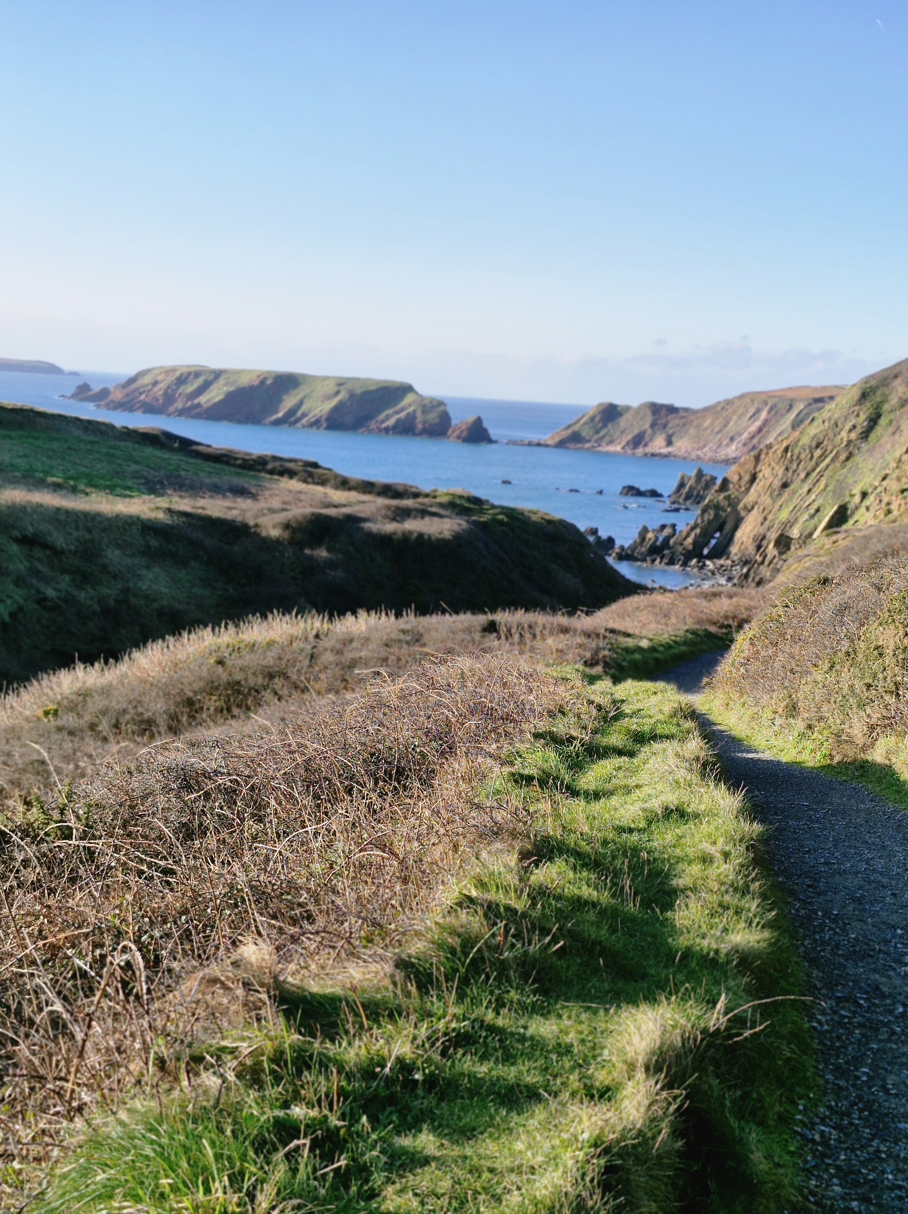
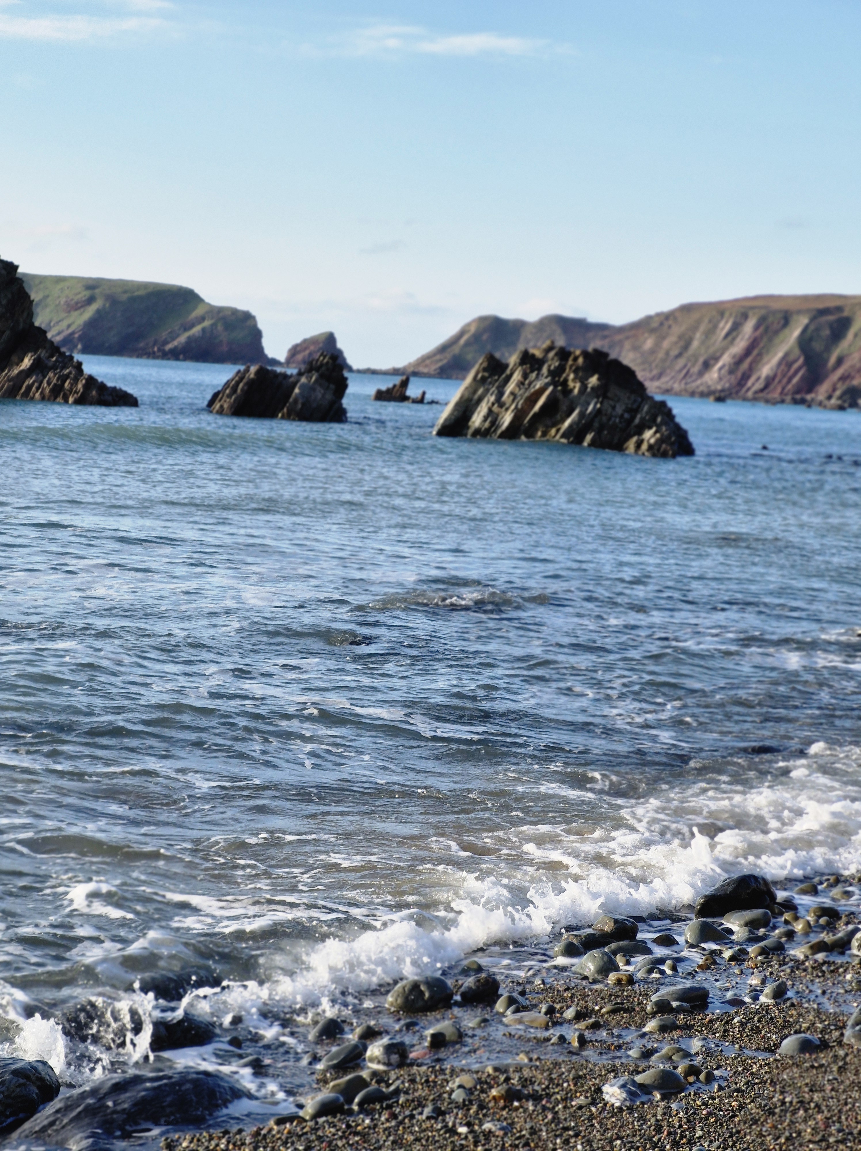
The last time we were here was last summer, on a warm and sunny day. After parking the car we’d walked down the winding track to the beach. The tide was well out and we’d strolled along the edge of the lapping gentle waves on the long stretch of sand.
This time: Boxing Day 2025, so bitterly cold that initially it took away our breath. But the sun was shining and the sky was a gloriously clear blue. It was good to be outside after days of rain. We sauntered down the track to the grassy path that led to the beach
The tide was in. In the distance we could see Skomer Island which we’d visited inJuly. An adventure I’d written about here and here.
We turned away from the beach and, after only slight hesitation, we crossed a small footbridge over a stream and followed a path to the top of the cliff that we’d not walked on before.
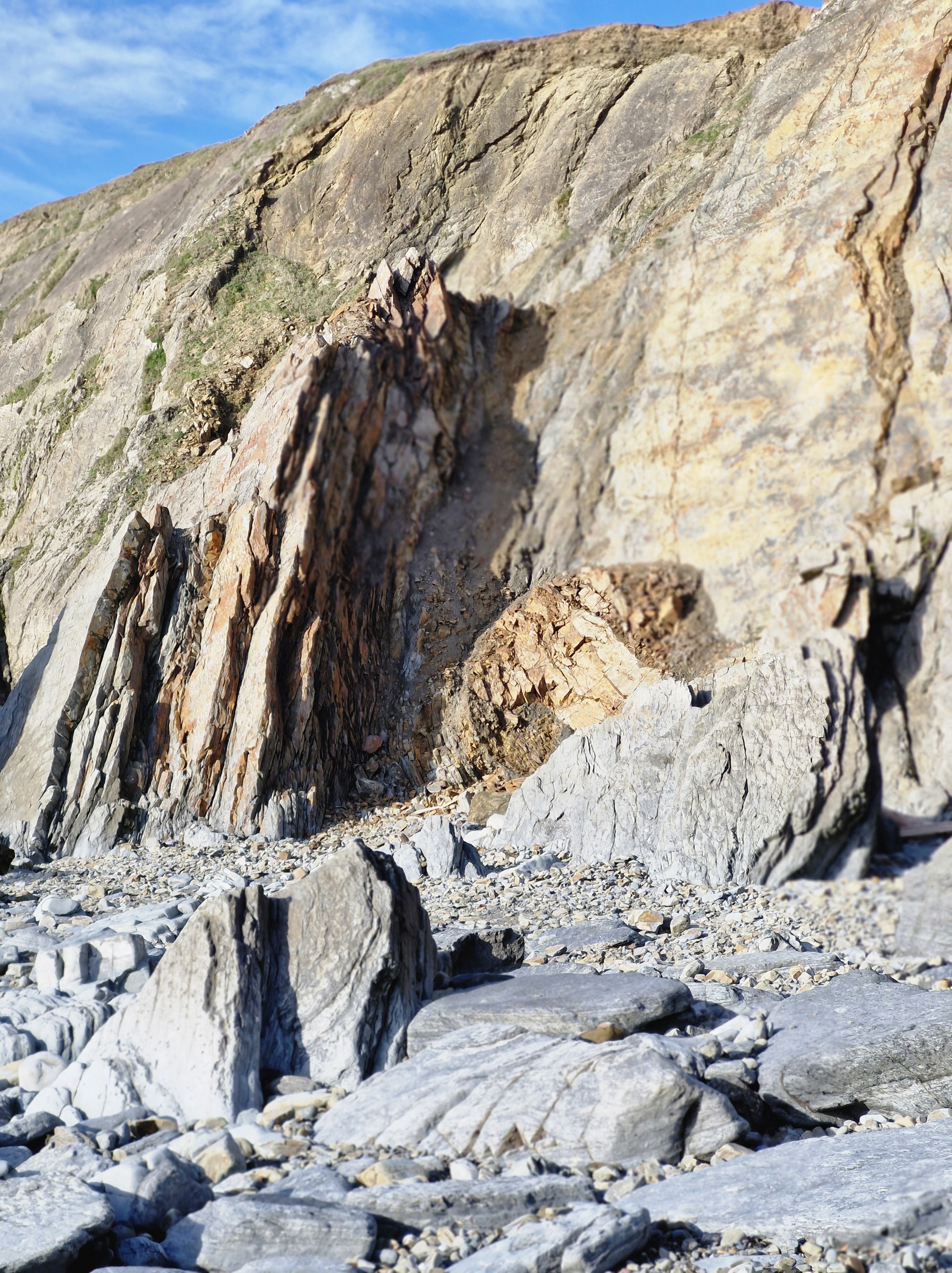
It was a little hair-raising to be honest. But the views were wonderful. After half an hour along an ever rising, and narrowing pathwe came to a halt at the top of steep and winding steps that obviously led down to the beach. Go on, or go back? We’re not very good at going back on walks, however lost we are, or in this case, however daunting the steps. So we decided – in for a penny and all that…
It took us ten minutes of walking sideways down each step and being very grateful for the walking poles we’d debated on bringing with us – (After all, it’ll only be a beach walk!” I’d said, foolishly).
I don’t know who’d built those steps but they’d obviously decided that anyone who could navigate them thus far would be fit enough to leap over the last two metres of sheer rock at the bottom to reach the beach.
Before I could decide to either slide down the rock on my backside, or roll down through the gorse bushes on either side of the path I heard a cry. ” Bravo! You are legends!”A lady appeared below. “Stay there. I’ll help you down, you legend. Grab my hand.” I was, I have to say, very grateful for the help.
Until, finally on level ground – (levelish – i looked it up, there is such a word, specially invented i guess for rocky beaches) – I looked at this lovely lady – and realised she was probably around our age.
To be clear though, she did tell us she’d arrived at this particular spot at low tide, and had walked along the wide stretch of sand from the other end of the beach – where we’d we’d originally planned to walk from. And also that the steps we’d come down were locally know as the emergency exit steps for when someone was caught out by the high tide.So that was the answer – whoever built the steps knew that anyone wanting to use them would probably be swimming to them – and not by choice; to escape being trapped by the tide.
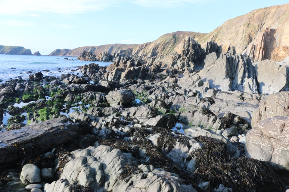
Luckily for us the tide was on its way out. There was no way I was tackling those steps again to the top of the cliffs. We judged that, if we took our time, we could navigate around and over the rocksto get back to our originally planned starting point at the other end of the beach.
Having navigated rocks near the sea’s edge we made our way to the top of the beach near the cliffs where there was a gap between two tall, jagged rocks. A group of people came through as we were deciding on our next move. If they could do it so could we!Yes, I know … mad!! But we don’t like to be beaten.
We made it to the other side. “No problem,” said the photographer (He was standing on the sand taking this photograph with the path that leads up to the track, and on up to the car park, behind us). I ignored his confident smile; there were a few moments when I’d thought we would be needing a sea rescue.
N.B: Just as a matter of interests, Marloes Sands was the filming location for: Snow White & the Huntsman (September 2011). The Lion in Winter (1968).
And could I, should I, leave this post without a small metion of my books?
As I’m hoping the book I’m working on at the moment, and hope to publish in 2026 (Well, one can always live in hope!), I guess not. So here is the link to my Amazon page.
Thank you to all my readers; I appreciate each and every one of you.
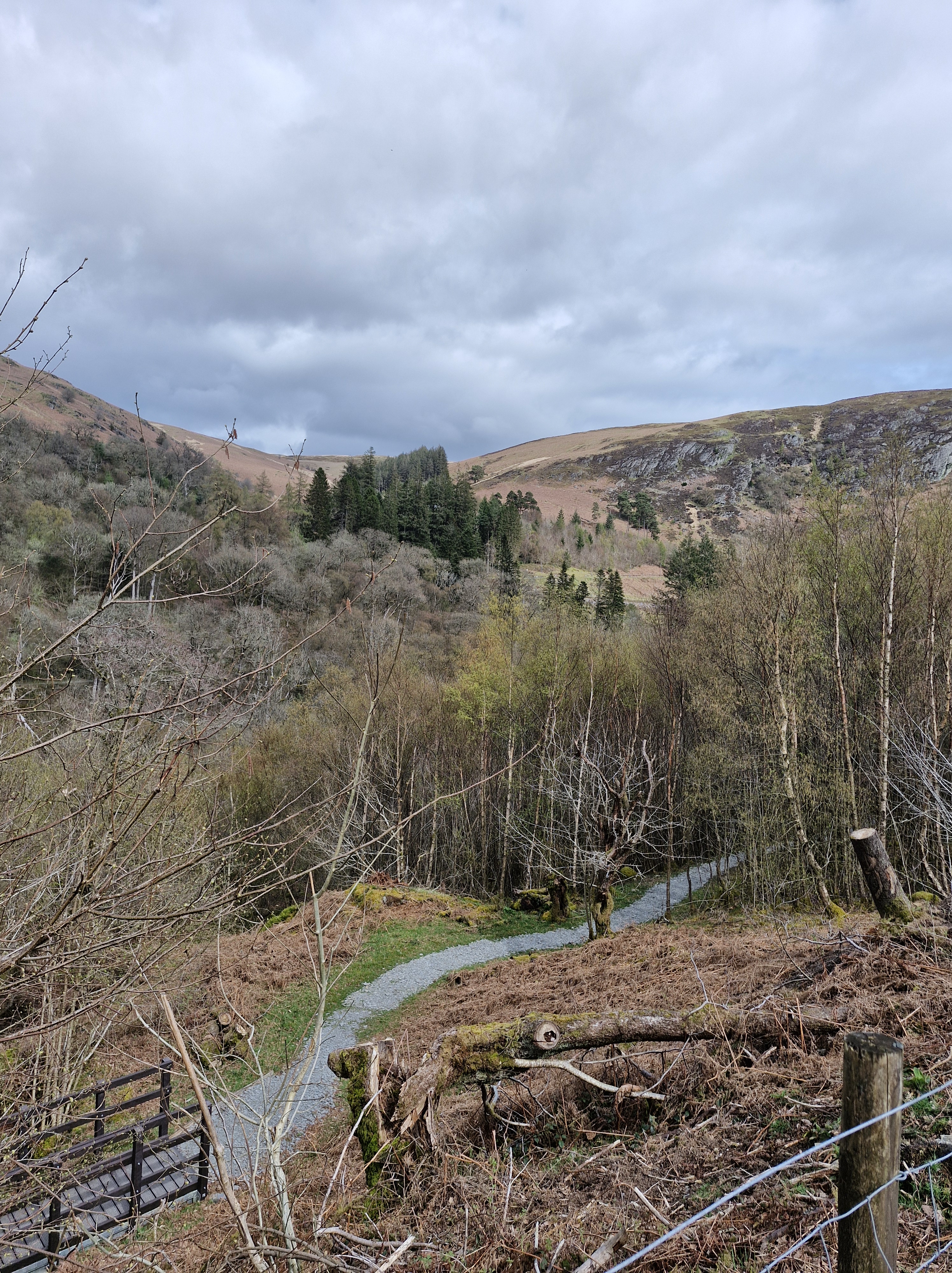
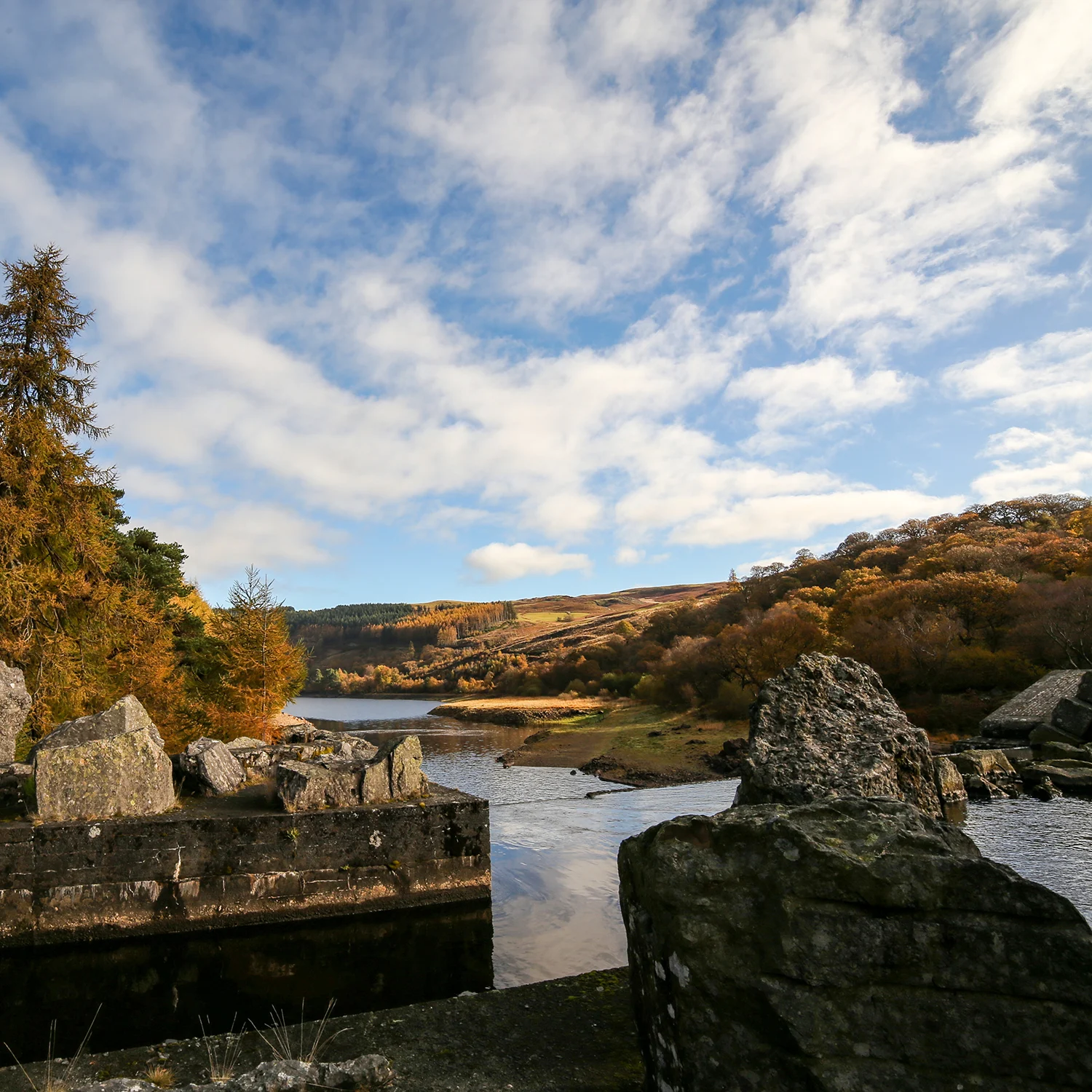
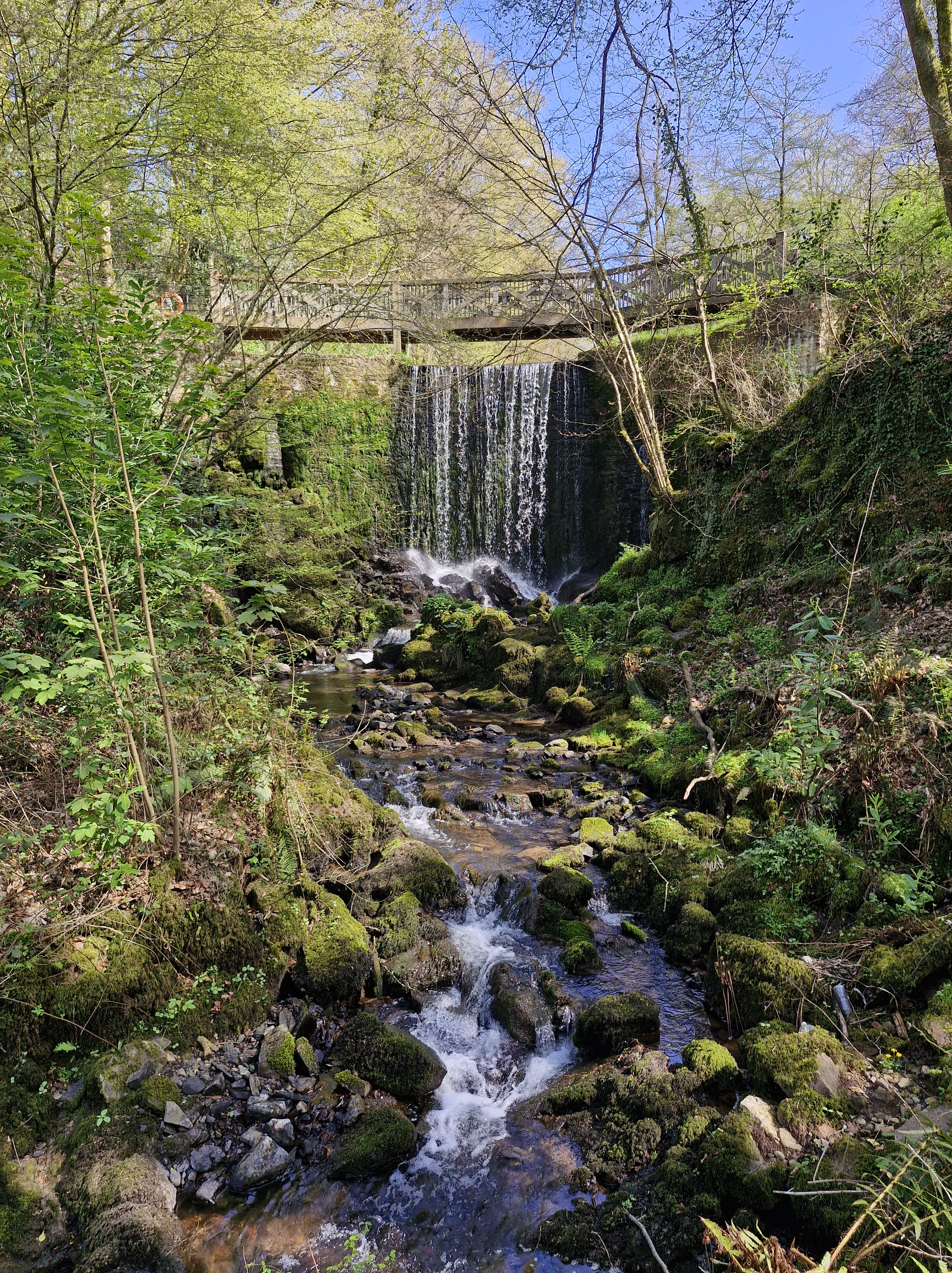
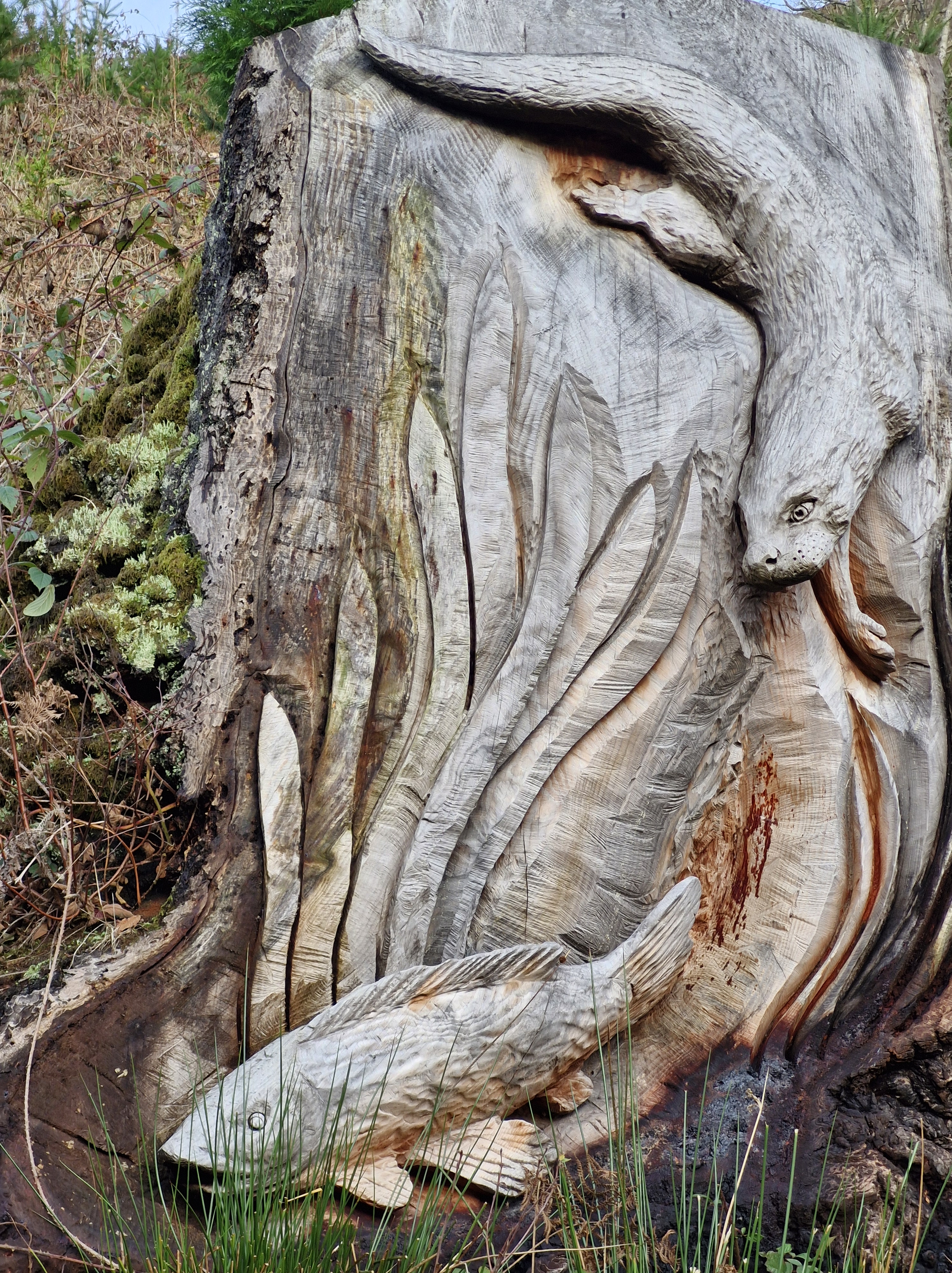
On our recent walk around Garreg Ddu Dam in the lower Elan Valley we noticed that, since we were last here, even more carvings had been created along the trail.
This area of land was originally a Victorian Douglas Fir plantation, clear-felled to reintroduce native species and increase biodiversity. The project to carve the trees lining the road was commissioned Dŵr Cymru Welsh Water and created by chainsaw sculptors Simon O’Rourke, Paul Edwards, and Matthew Crabb, who worked from ideas presented by schoolchildren from the community.
It was getting late in the afternoon, the day had been gloriously sunny and warm, but now dusk was settling in and the gathering clouds in the sky were showing signs of the rain forecast for the following day.
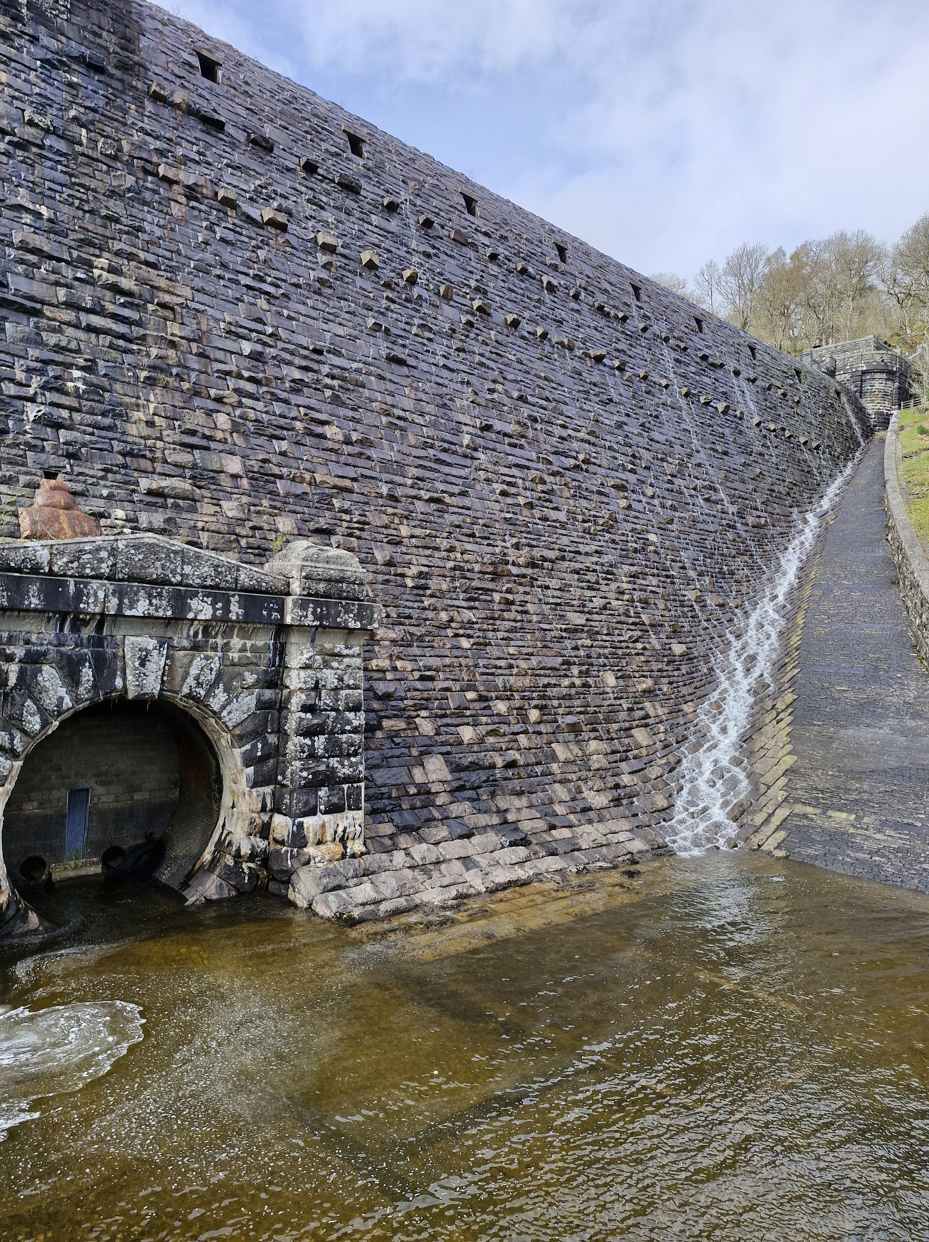
Foel Tower: a point of interest at the start and end of our walk around Garreg-ddu:Just upstream from the submerged dam at Garreg-ddu is the Foel Tower, the starting point for the 70 mile journey of the water supply to Birmingham.
The lower section of Foel Tower has a number of openings inside at different levels where a system of valves and cylinders can be raised and lowered to draw off water from the reservoir at the right depth for the current water level.
The above photograph was taken in 1947 showing the Foel Tower during very low water levels in the Garreg-ddu. Most of the openings in this image are normally underwater.
Foel Tower takes in water from the Claerwen Valley through a pipeline which takes water underground from the dam system. Water is also collected by Pen-y-garreg and Craig Gochhe, the two dams higher up in the Elan Valley.
My latest book, published in November 2024 is The Stranger
Review for The Stranger: 5.0 out of 5 stars Storytelling in a class of its own… stunning.
“One of the author’s many strengths is in capturing the clear and authentic voice of a confused child – Mandy’s voice, in The Stranger, still haunts me, torn between her own grief, her sense of right and wrong, and her love for her family. And once more, in her latest book she wonderfully portrays the suffering of eight-year-old twins Chloe and Charlie – already grieving the loss of their mother, their lives torn apart by their father’s marriage to her former nurse, an evil manipulator of the highest order…“
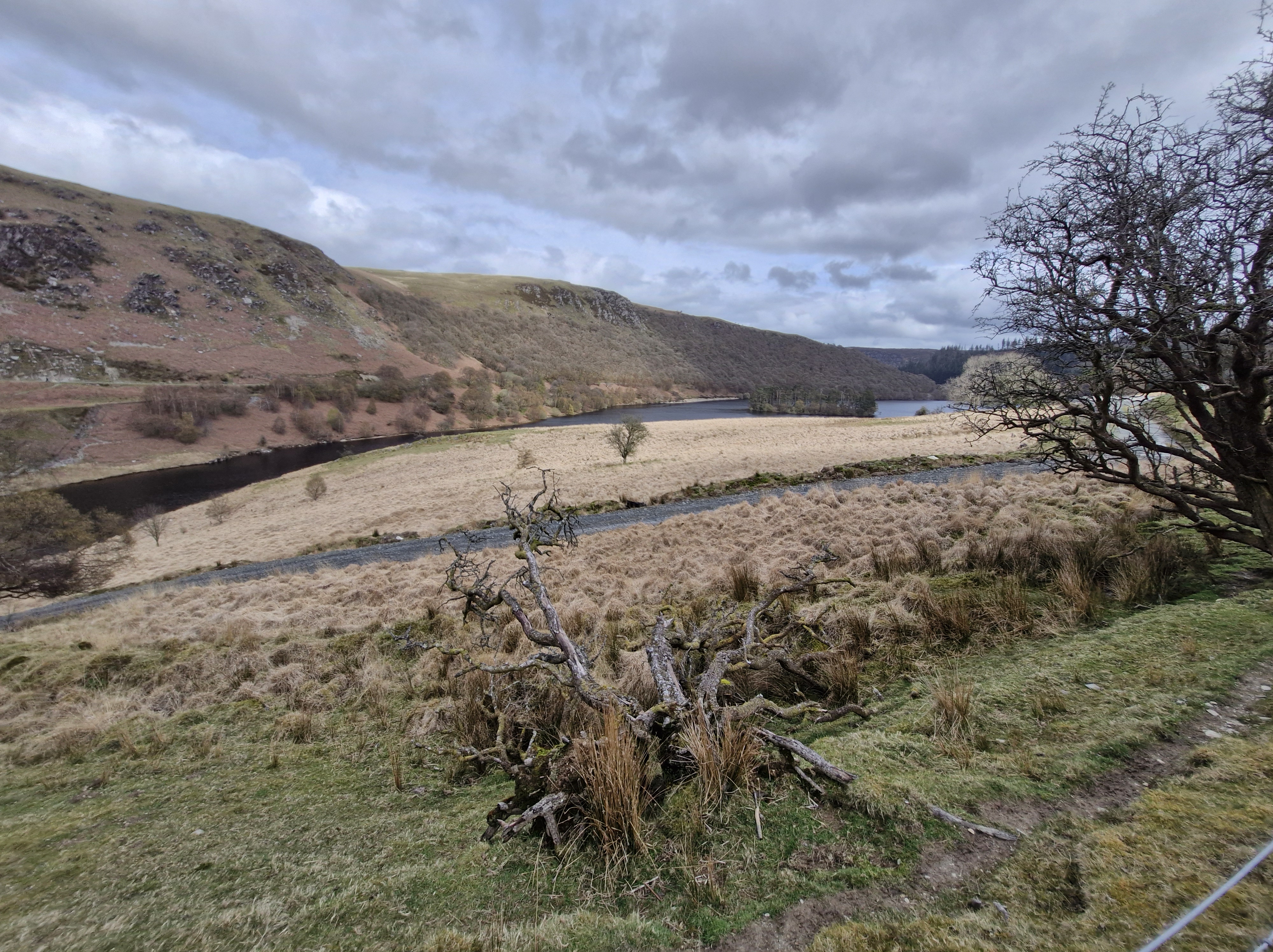
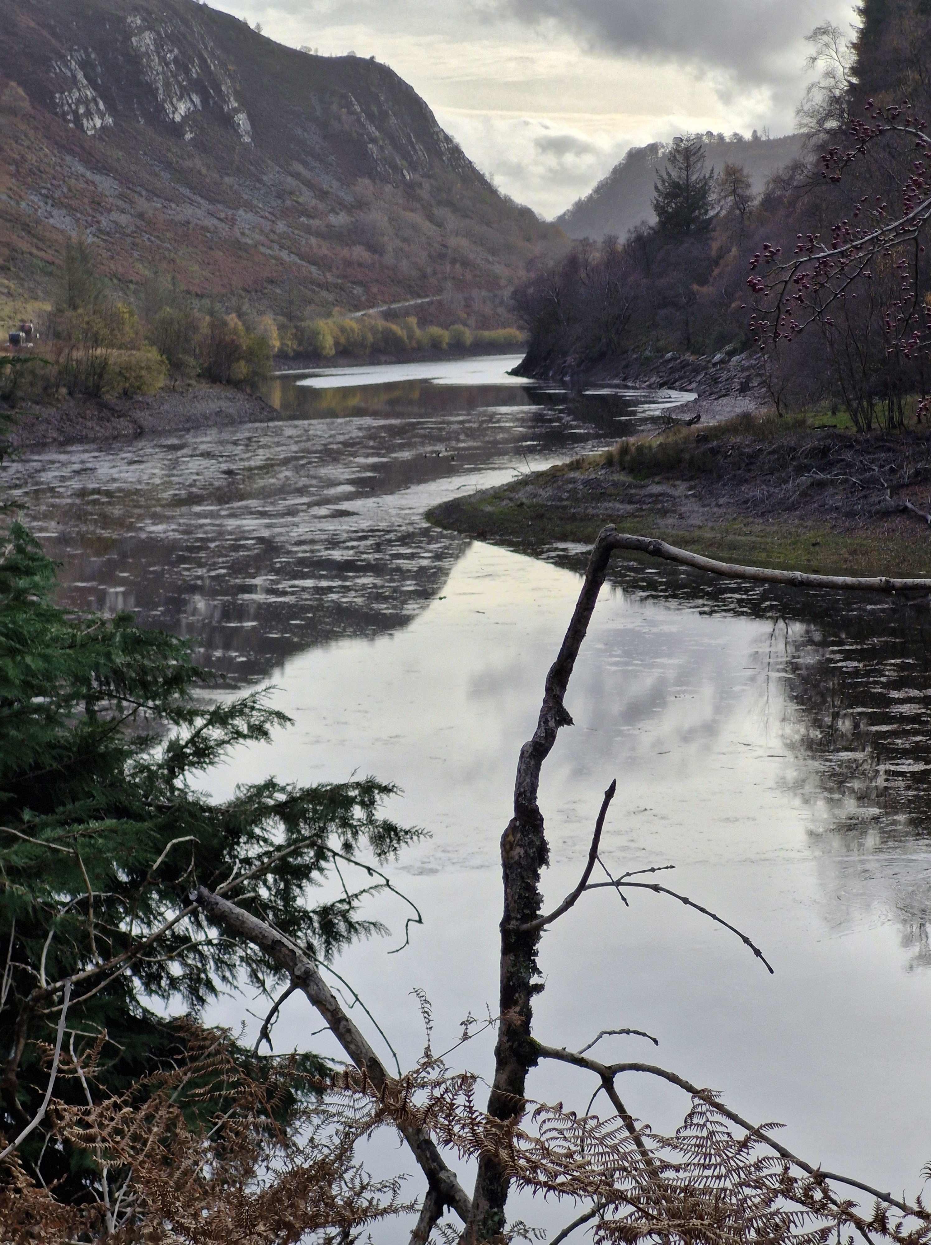
After weeks of what seems to have been constant rain, we embarked on a couple of days away, determined to walk, whatever the weather. We headed for Mid Wales.
We were lucky: the clouds parted, the rain stopped, the sun came out. We took a trip to Elan Valleyand walked around Garreg Ddu to Pen y Garreg.
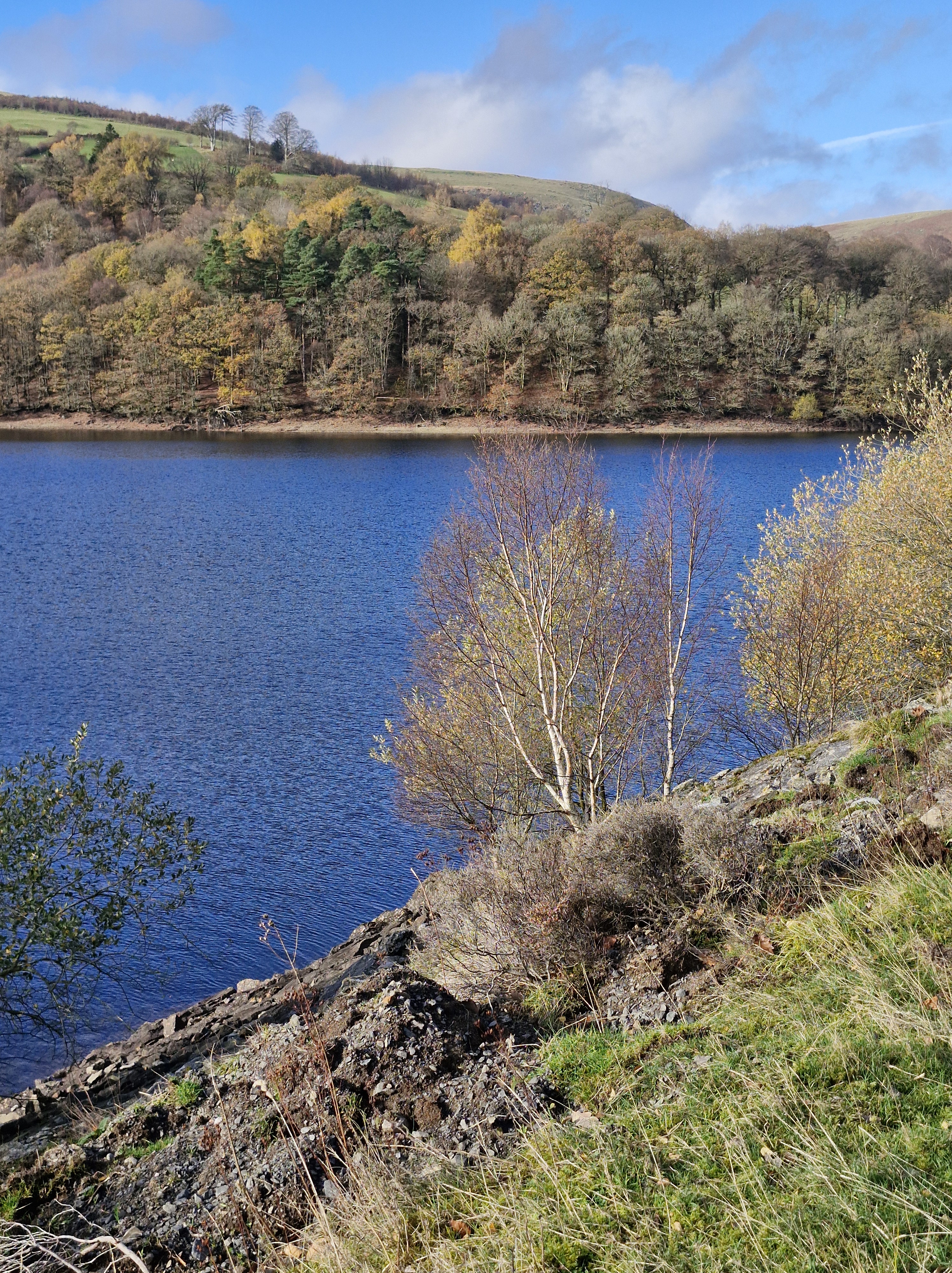
We’ve been a few times in the past, the last being in 2023 when there was a drought declared. Below is the road bridge/ wall between Garreg Ddu and Caban Coch. On the left 2023, on the right this time, in November.
Though there were less daylight hours this time to walk we still were able to see some of the differences in the water levels in the reservoirs between our visits in 2023 to this November.
In 2023 the water was so low we could see the outlines of the houses, the roads and the church that were compulsory purchased in 1892 in order to dam the Elan and Claerwen rivers within the Elan Valley and supply water to Birmingham. This was because of the rapid growth of that industrial city, and the numerous outbreaks of disease that prompted Birmingham City Council to petition the British government to pass the Birmingham Corporation Water Act in 1892, allowing the corporation to acquire the land.
Building work began in 1883. There are six impressive dams altogether. Four follow the Elan River – Craig Goch, Pen y Garreg, Garreg Ddu, and Caban Coch and two are on the river Claerwen – the Claerwen dam and the unfinished Dol y Mynach dam.
The History of Elan Valley:
In 1893 one hundred people in Elan Valley had to move to allow the work to begin, but only landowners received compensation payments. Many buildings were demolished: three manor houses, eighteen farms, a school and a church – the latter being replaced by the corporation and renamed Nantgwyllt Church. Over the next three years a railway line was constructed to transport the workers and thousands of tonnes of building material each day.
Thousands of men and their families lived in wooden huts in the the purpose-built Elan Village, where, eventually a library, a public hall, a shop, and a canteen were built. There was also a hospital, used for injuries and as an isolation hospital. There was even street lighting which was powered by hydroelectric generators. New workers were initially expected to spend the first overnight in a lodging house to be deloused and examined for infectious diseases. Only then were they allowed across the river to the village. Single men lived in groups of eight in a terrace house shared with a man and his wife. A guard was employed to check for illegal importation of liquor and unauthorised visitors. There was a bath house which the men could use up to three times a week but the women only once. And the pub was for the men only. A school was provided for those under elevens, after this the children were expected to work.
The dams were built in two phases. The first phase, which cost six million pounds and employed fifty thousand was opened on the twenty-first of July 1904 by King Edward VII and Queen Alexandra. The building of the second phase dams was delayed due to the two World Wars and work only started in 1946. Because of engineering advancements just one large dam was built instead of the three smaller ones originally planned for. This was the Claerwen. This dam was completed in 1952 and opened by Queen Elizabeth II on the twenty-third of October.
Over the last few weeks we have walked along the Pembrokeshire coast with the Pembrokeshire U3a and the National Trust …
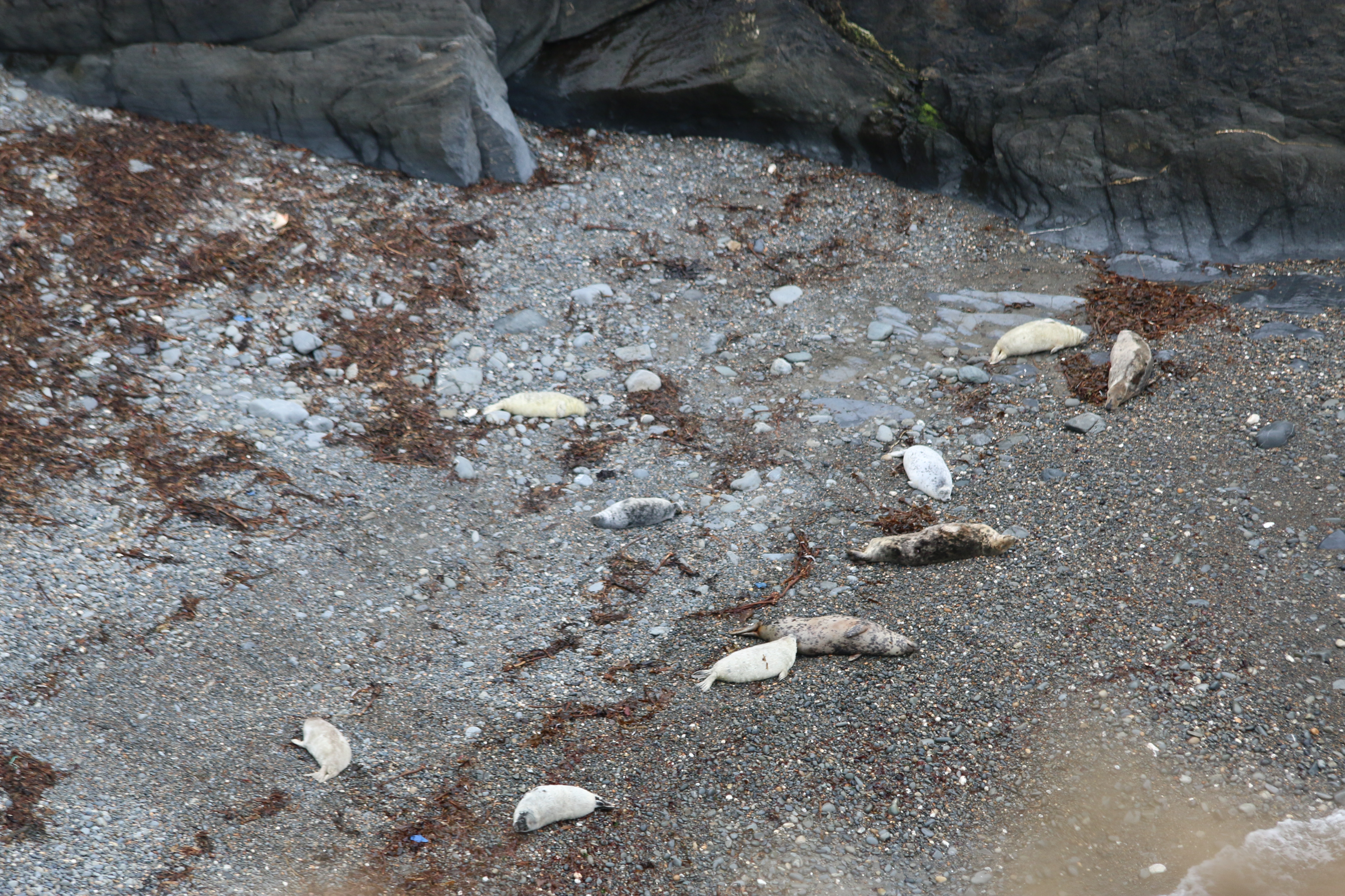
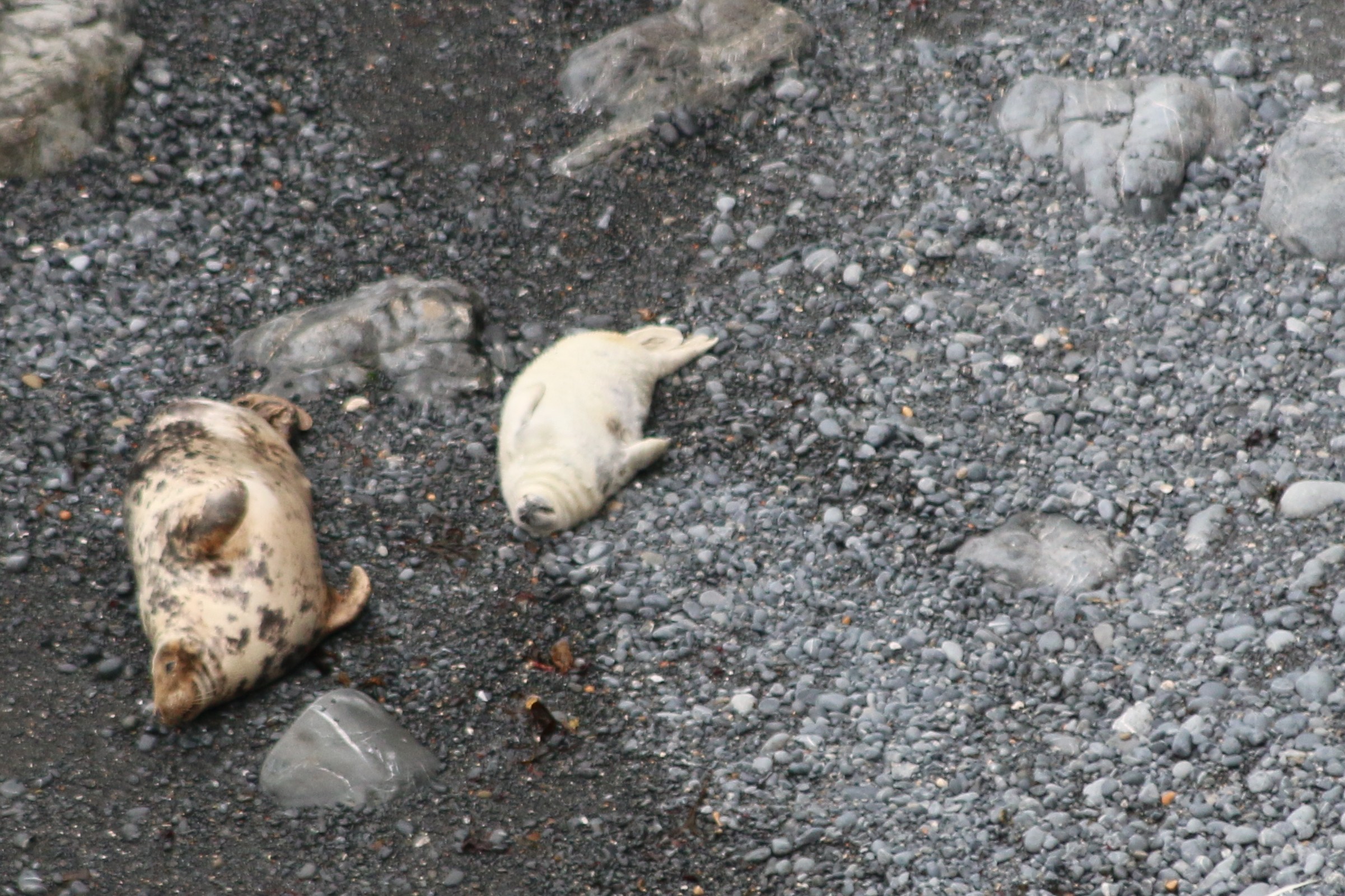
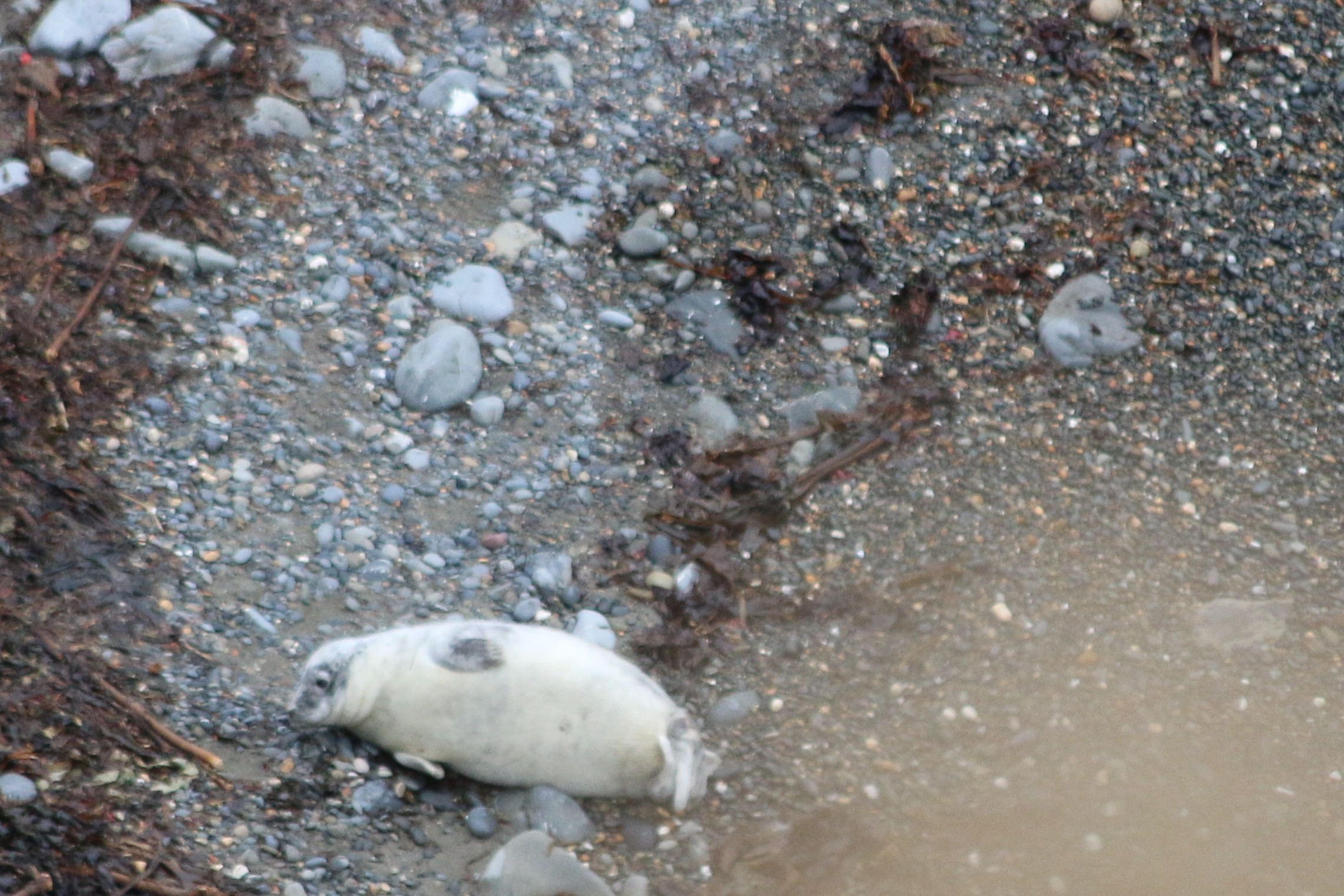
And joined in with a couple of days seal spotting … from the clifftops, so at a distance, of course.
And watching the mothers with their pups was fascinating
Around the coast of West Wales, grey seals can be seen throughout the year. In the summer, around sunset, the seals begin to return to the beach hauling out their daily catch of fish. Mostly, at this time, they bob about in the water, waiting to come ashore to rest. Seals spend a lot of time at sea but come ashore to breed from August until early November, when parents and their pups can be spotted on beaches around Pembrokeshire.
On land they are cumbersome and slow, compared with their agility in the ocean.
Which gave The Photographer plenty of time to get his pictures!
Many thanks Pembrokeshire U3a and the National Trust for two brilliant days .
Fossil records indicate that the ancestors of modern seals first entered the ocean on the west coast, about 28–30 million years ago.
Seals see very well under water—better than they do in bright light above water. Their eyes are adapted with round lenses (like fish) and a large iris that fully opens underwater. On land the iris closes the pupil to a small pin point that lets the seal see clearly through the round lens. A seal’s eye is also adapted for low-light vision with a lining (similar to a cat’s eye) that reflects and amplifies the weak light at depth in the ocean.
A seal’s body stores enough fat in the blubber layer to allow the animal to go for extended periods of time without eating. In addition, most seals are opportunistic feeders and will consume a variety of fish, shellfish, and crustaceans. Seals do not eat on land.
Like all marine mammals, seals get all the water they need from their food. Their bodies are very efficient at removing and recycling water from their food. They avoid drinking sea water; if a seal drinks too much sea water it can become seriously sick. Arctic seals, which spend time on ice, may sometimes eat fresh water ice and snow.
NB: Seals are protected in the UK under various acts, including the Conservation of Seals Act 1970, which prohibits killing, injuring, or taking them except under specific circumstances. Both native species, the grey seal and common seal, are protected, along with any other seal species found in UK waters.
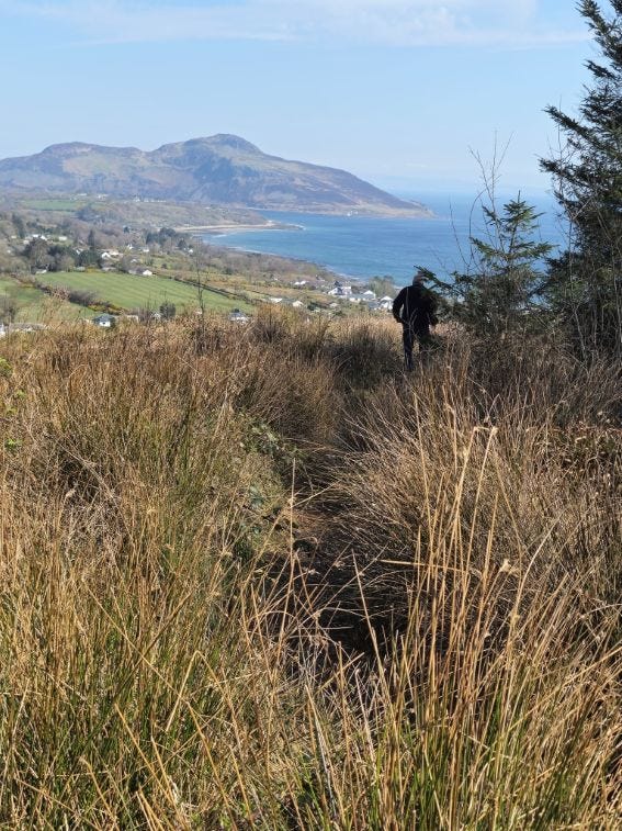
At long last! After living in Pembrokeshire for the last forty-six years and despite walking many miles of the Pembrokeshire coast, and meandrering around a lot of the Welsh countryside discovering wonderful places, lakes, waterfalls … scenary, we hadn’t been on Skomer island. This week we finally managed to go.And it was a glorious day’s adventure.
Together with thethirty other peoplewe had been on the boat with, we climbed the steps and slopes from North Haven beachto the Information and Welcome Point, passing the ruins of one of the lime kilns on the island, now used as a shelter.
Following the short introductory talk by one of the National Trust volunteers on the numerous species of birds on the island, and advice on which paths to take, according to what we were most looking forward to seeing, we set off. Surprisingly it soon seemed that we were on our own as we began our walk of the south section of the island.
During the more prosperous farming days of the nineteenth century lime was important on the island, both as mortar for the buildings and to spread on the land as fertilizer. Limestone and coal would have been imported from the mainland, landed on the beach at North Haven and moved to the kilns to be heated.
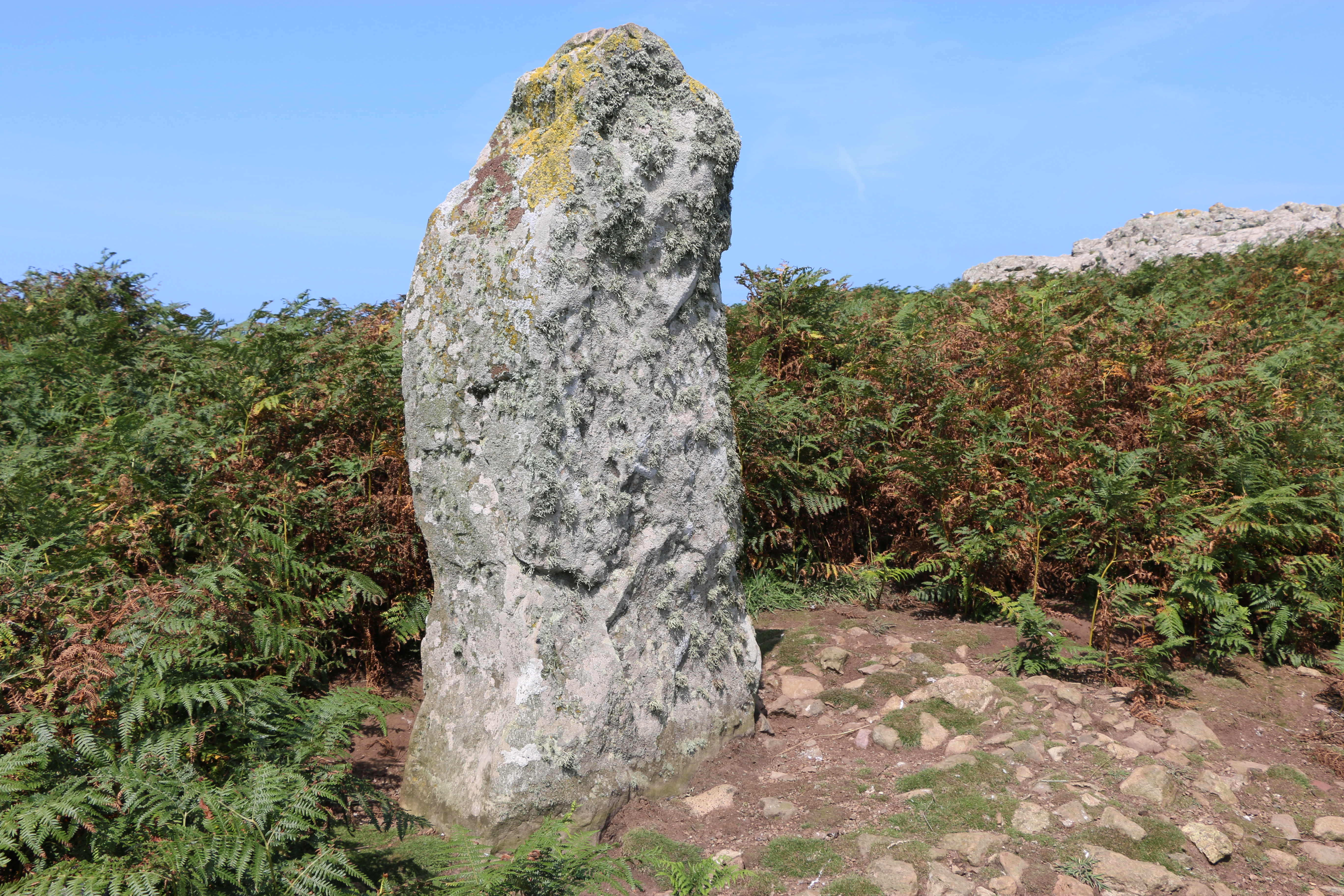
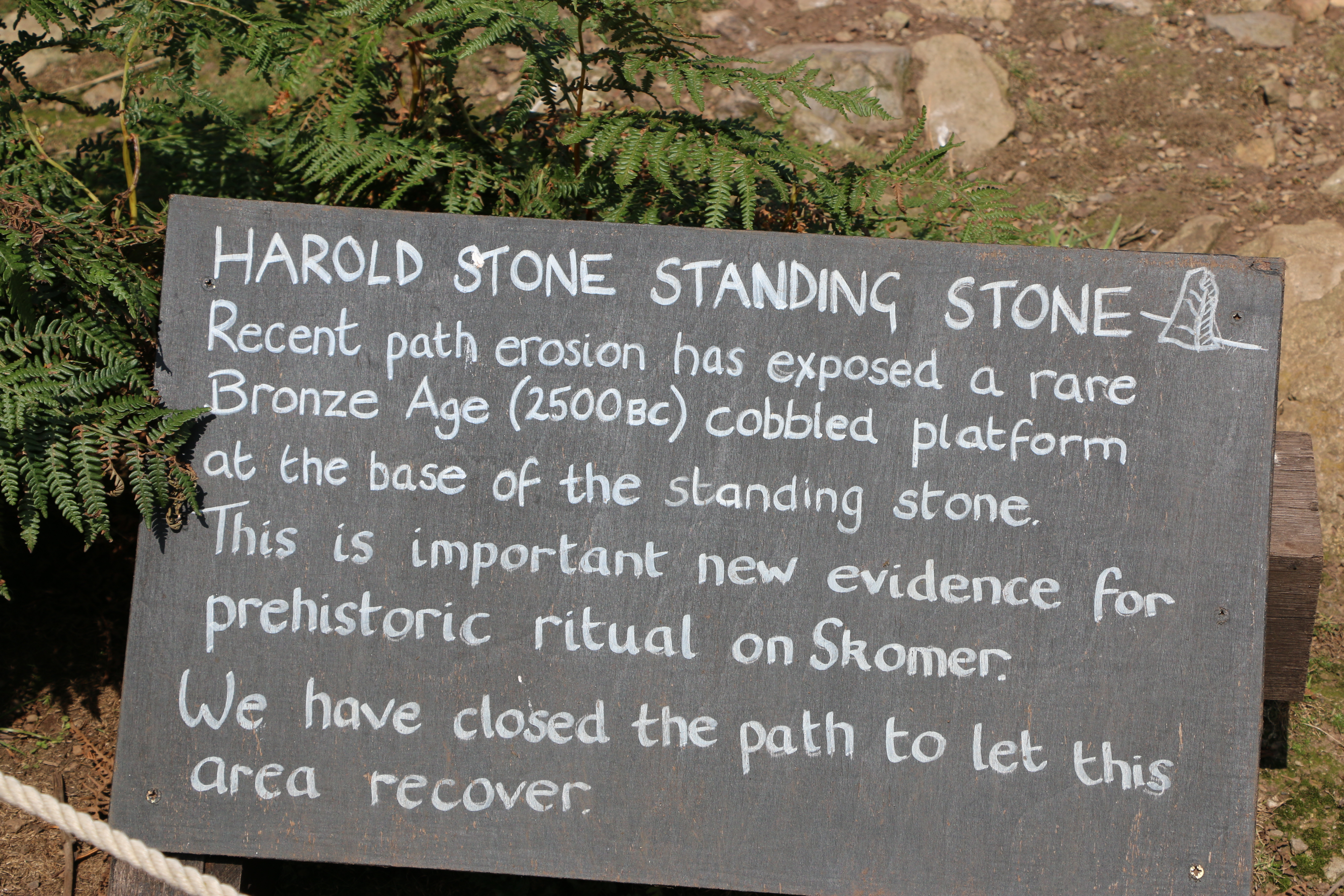
In search of the second of the lime kiln ruins, which is beyond the Harold Stone we took a diversion.
The Harold Stone has no cutting or tool marks, so seems to be mostly unshaped by man, and apparently smoothed by decades of cattle and other animals rubbing against it. As with many standing stones there are various ideas as to its function: the site of an ancient burial ground, a ritual or lookout area of an Iron Age settlement, (there are a number of Iron Age settlements around the Island, each one slightly different),or a marker for boats to approach North Haven.
We were impressed by the care that is taken by the National Trust volunteers in preserving numerous areas of paths and grassland. At one point we saw an outline of a figure, dark against the bright sunshine, carrying an enormous scythe. As she passed us, she laughed and said she felt like the Grim Reaper. Walking on we saw the area she’d cleared and roped off to allow a patch of ground to recover.
We walked on...
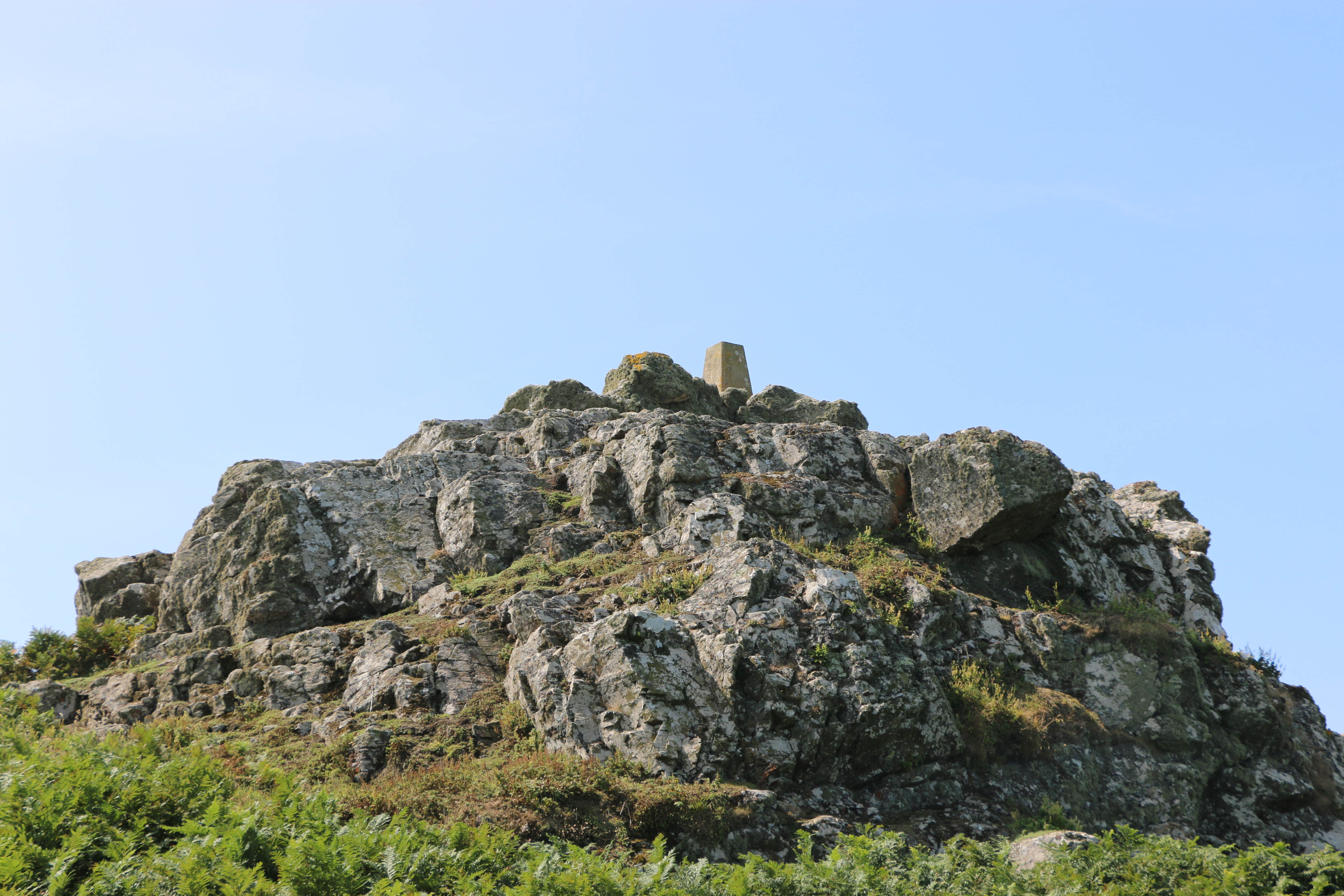
We couldn’t find out what the small ‘monument ‘ is on top of this rock formation.
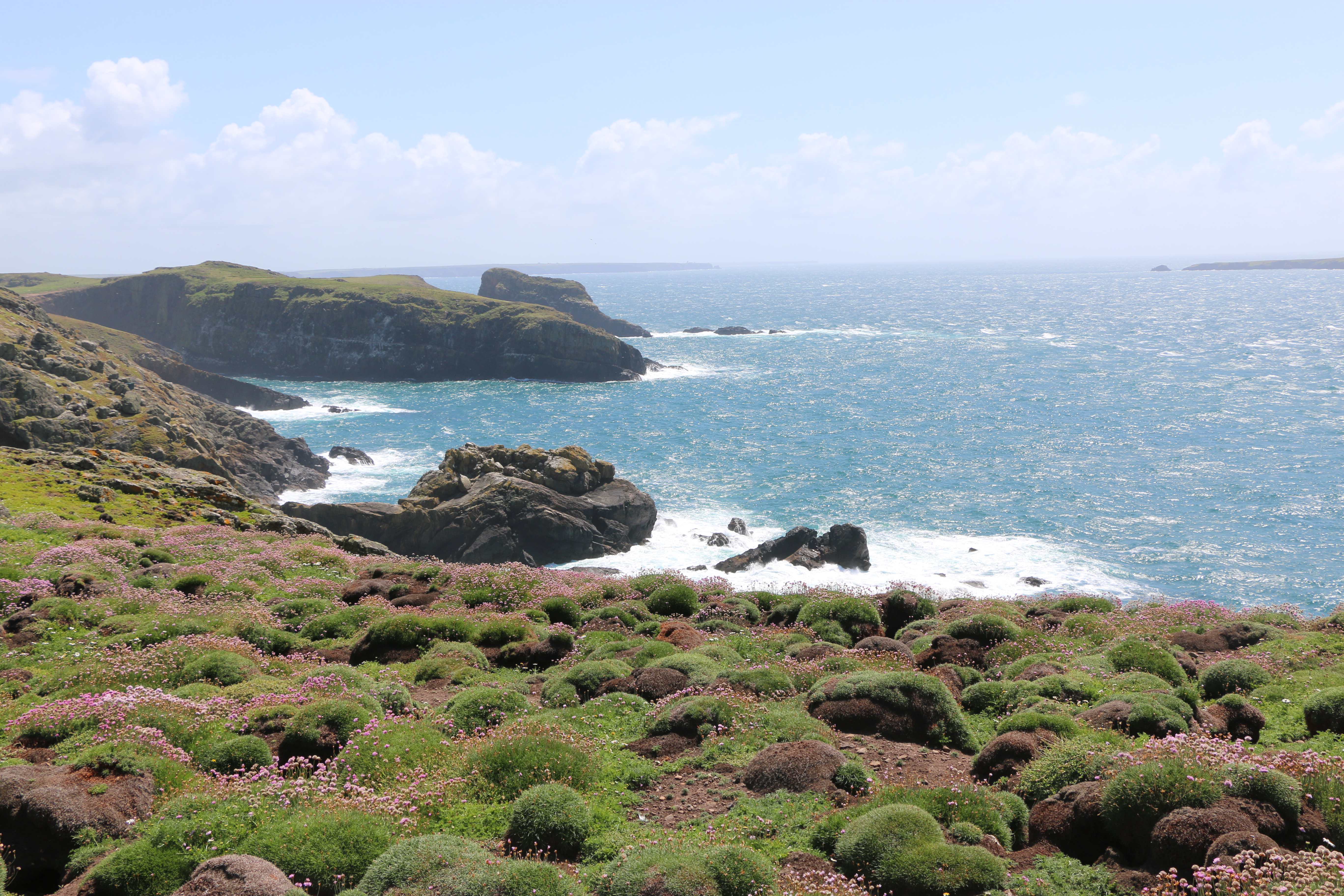
True to form we didn’t follow our intended circuit and meandered along paths, and retraced our steps in rather a haphazard fashion, (although the Photographer will dispute this and declare our route to be organised according to the circuit he planned). However true his statement was, I must admit we did pass numerous impressive limestone outcrops covered in lichen, and vast expanses of ferns, heather, gorse and wild flowers.
And we did see the majority of Skomer by the end of our time there.
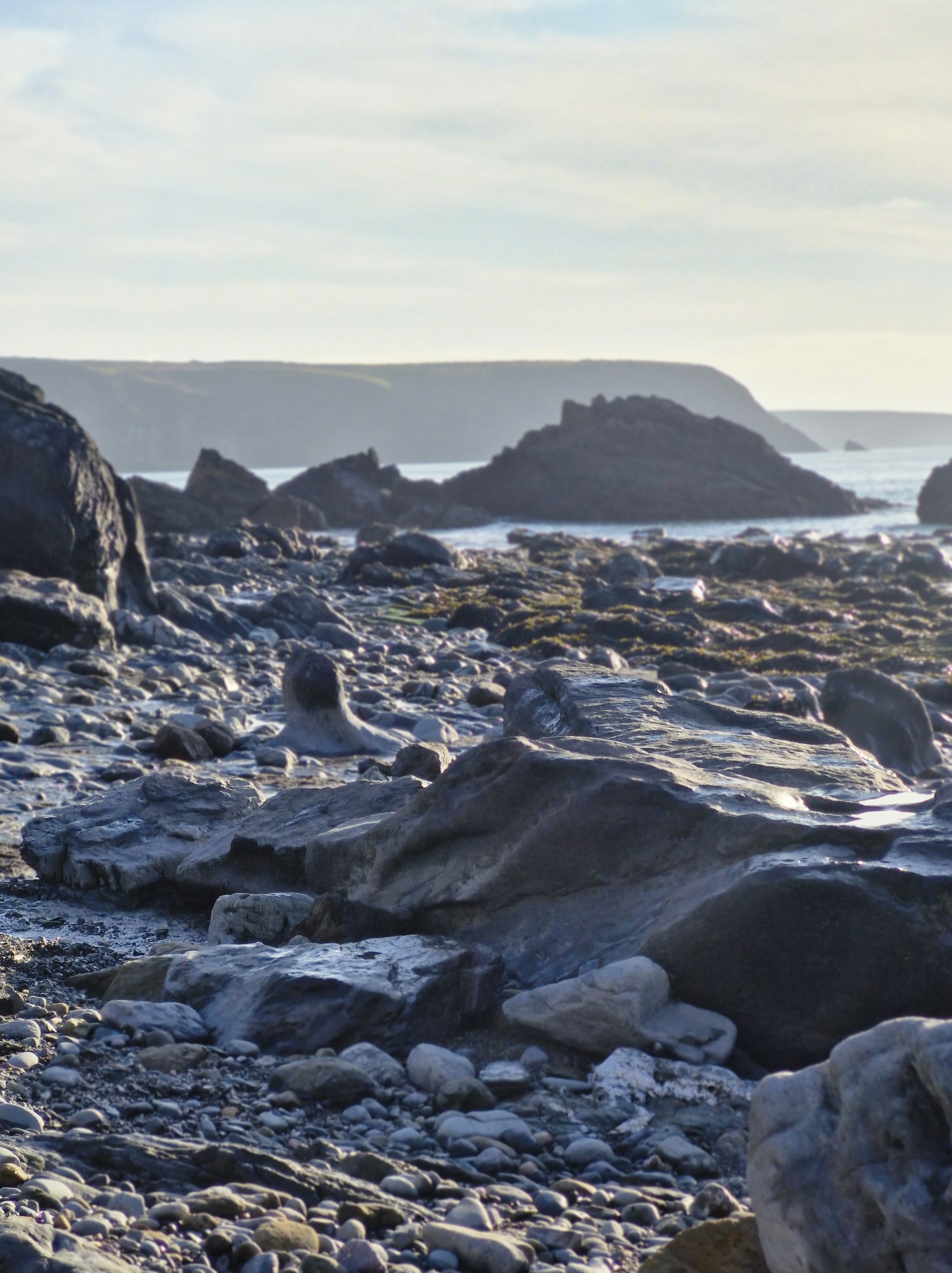
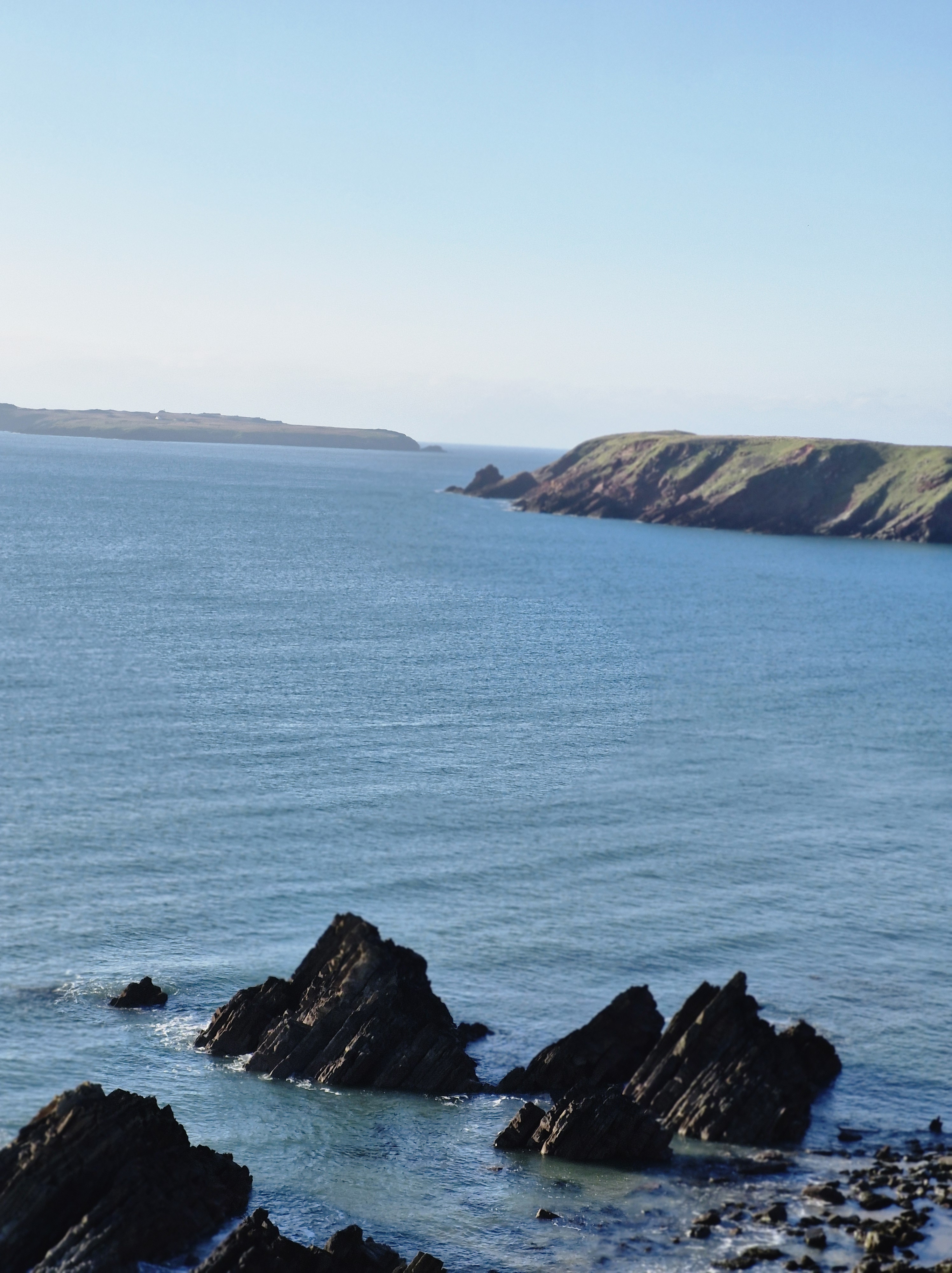
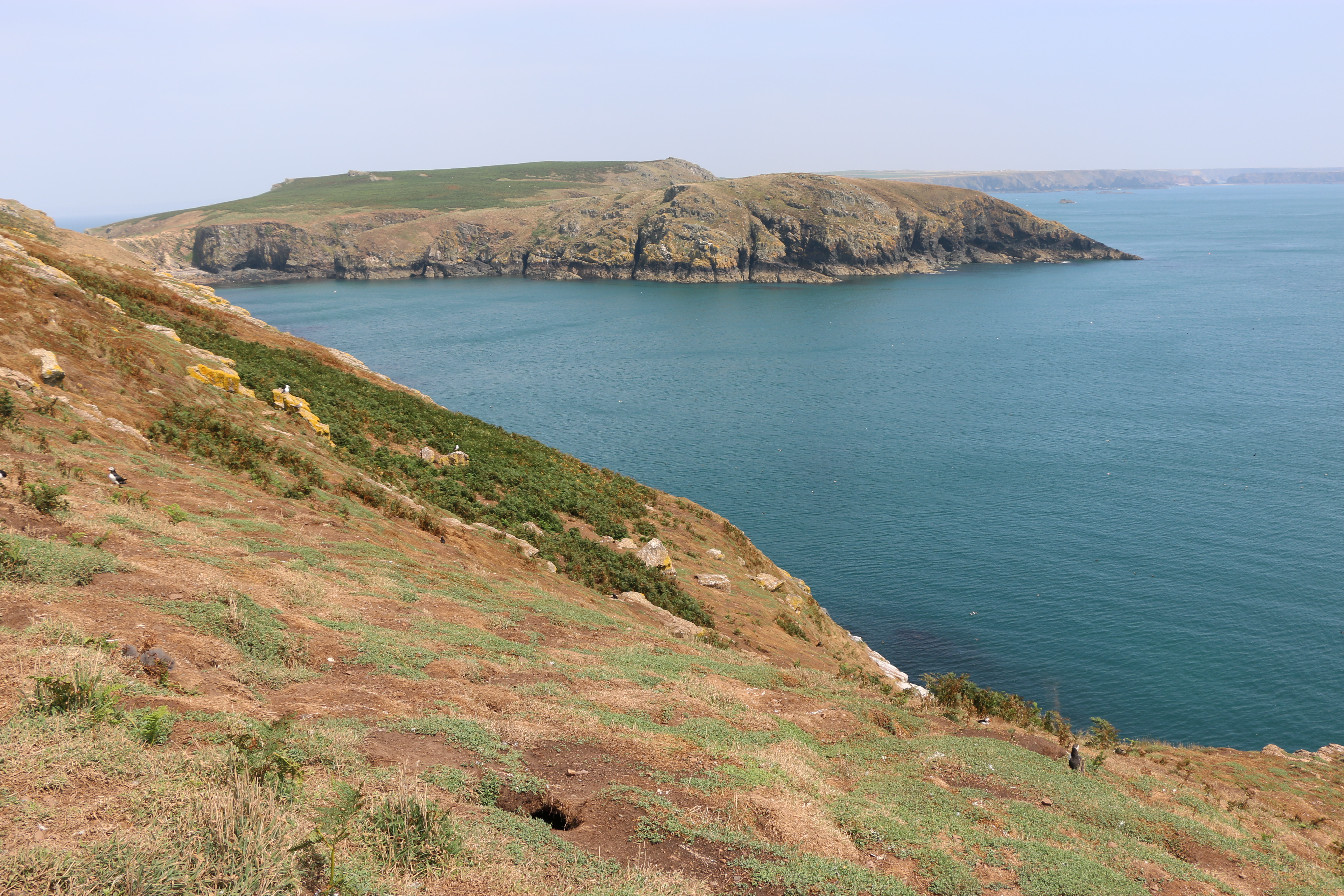
After our short respite at the farmhouse we moved on to Skomer Head. The rocky headland was covered with fading pink Thrift (and evidence of the rabbits). It’s an impressive view from there; we could see Skokholm, which is a sandstone island, and, less clear but still visible, the island of Grassholm. I remembered that. many years ago, we took a trip on the Waverley (the last seagoing paddle steamer) and passed Grassholm. It’s the third largest Gannet colony in the world, and the island is covered in white. I’ll leave that last statement to your imagination!
There are the remains of anIron Age boundary wall running parallel to more modern boundary walls from Skomer Head. The modern one is close to the path and the remaining stones of the prehistoric one on the nearby rock ridge above.
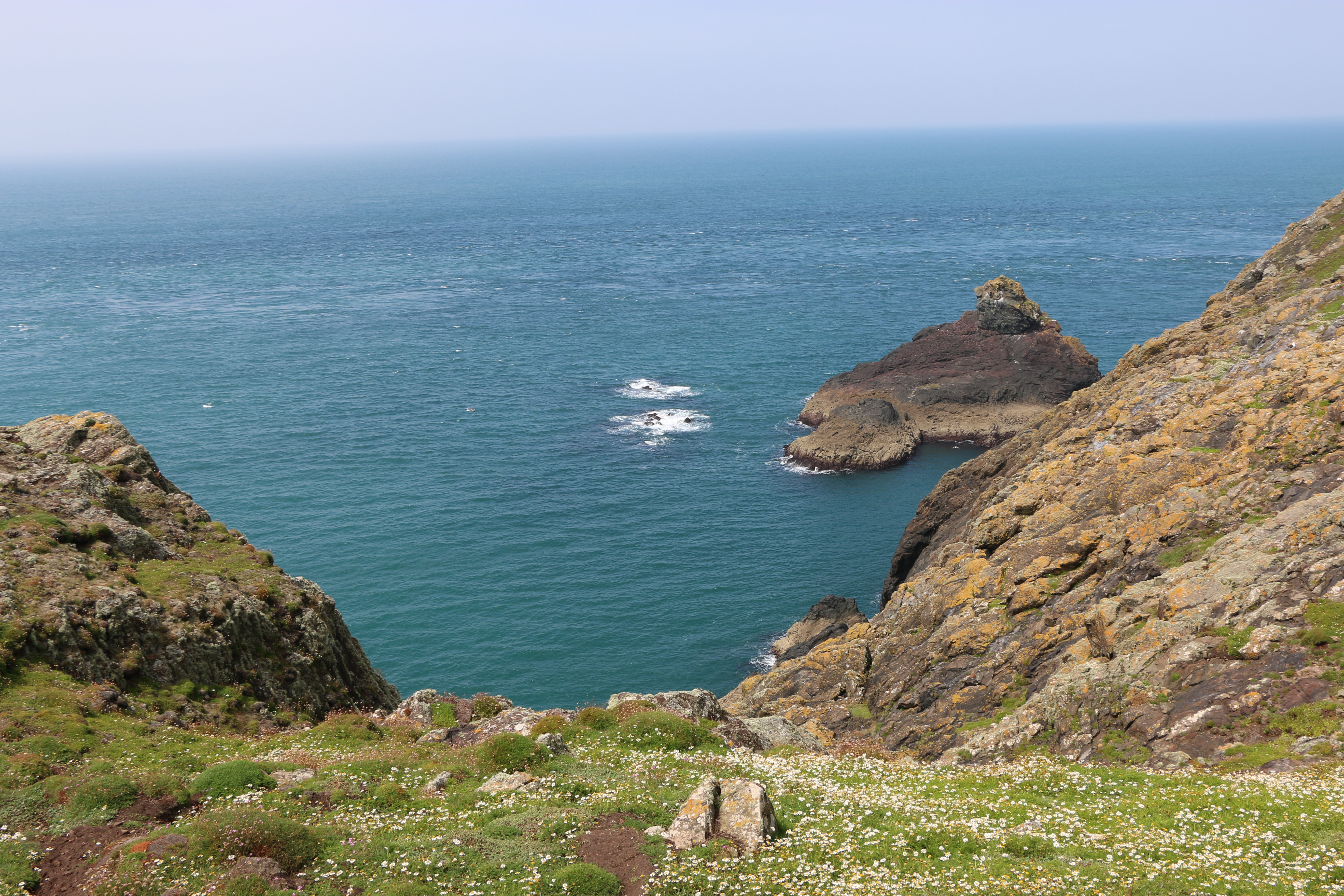
We crossed Wick Stream; a wetland area with small streams that are apparently connected by six dams. We couldn’t see them, though it was interesting to be told by one of the National Trust volunteers that they could be part of the Iron Age walls but they might also be of later origin. Their purpose is not known ,although it’s most likely that they were for water conservation, creating ponds for storage of water and watering stock. The paths along the way were protected by boardwalks, but mostly were rough and rocky on our way to The Wick.
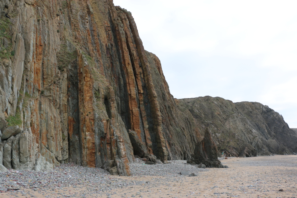
The Wick was formed by geological fault activity and basaltic lava flows. It’s a magnificent cliff face, rocky on one side, steep slopes opposite, and filled with the sound of the breeze and the waves. We saw Fulmars and Great Black-backed Gulls swooping and riding the air currants. It was quite nerve-wracking to peer over the edge from the safety of the ledge that appeared to be especially placed there for that purpose (I could be wrong, but it was what most people were using it for – but as the area was cordoned off to protect the puffins to cross the space to reach their burrows – otherwise the gulls would predate them – the ledge was useful)
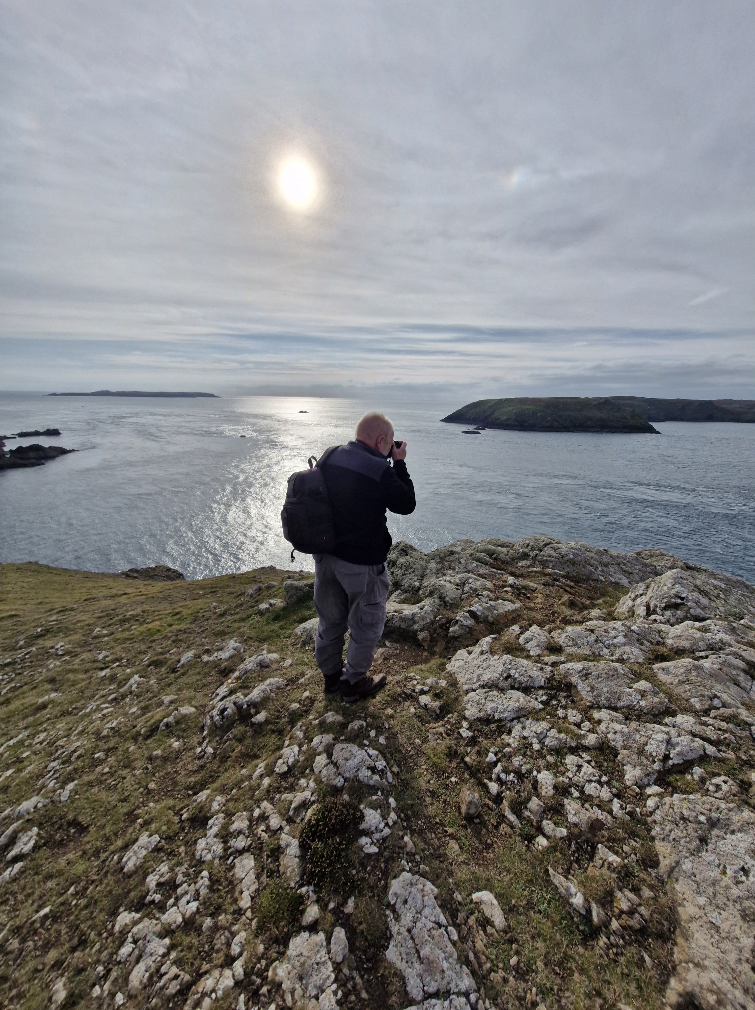
The Photographer! Just to prove he took the photos and that it was really hot, sunny weather.
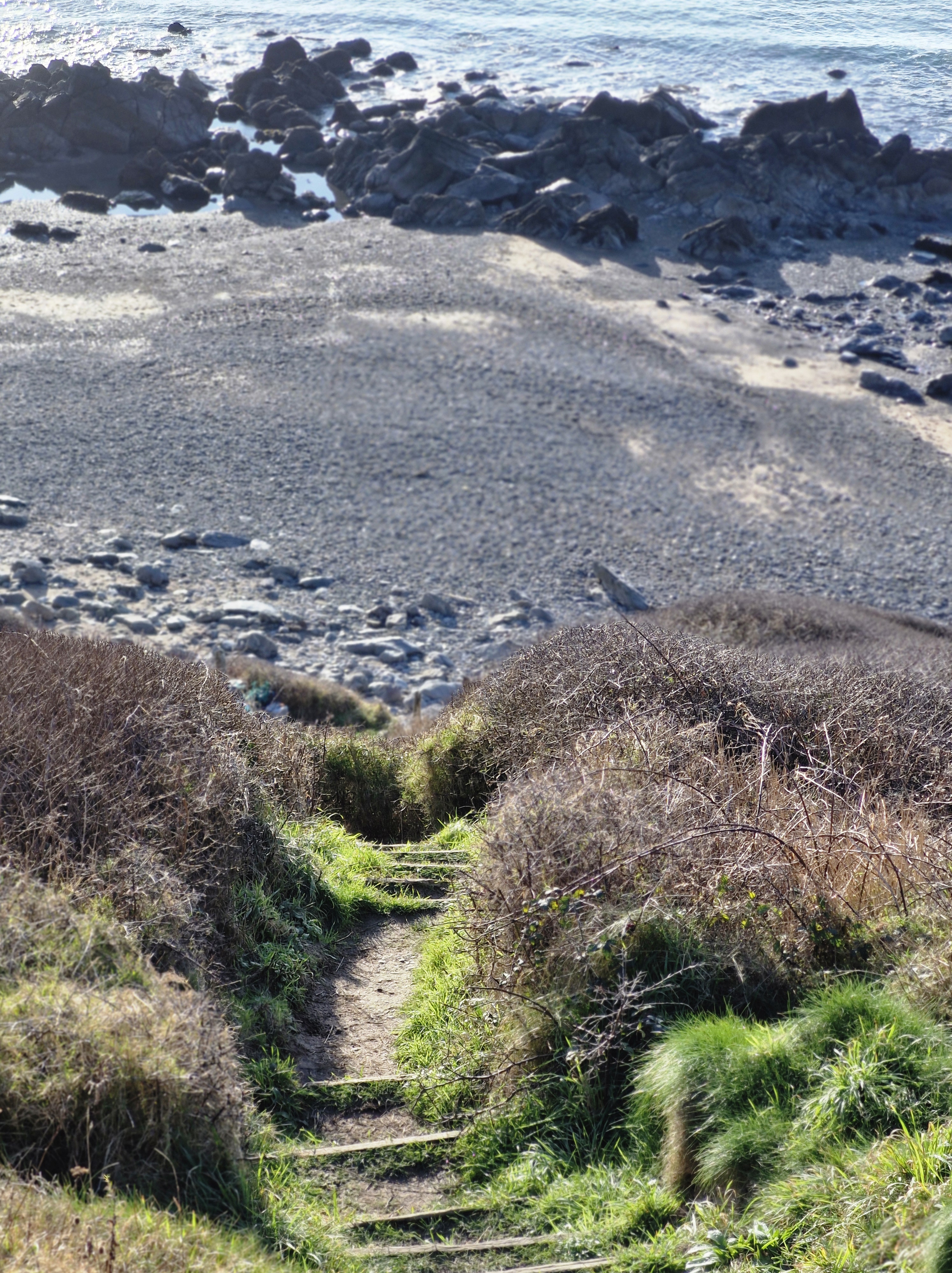
We were running out of time so began to make our way back to North Haven. The path was steep and even more rocky in places but the views were still imposing.
Reluctant though we were to leave Skomer, we arrived back in good time for our departure slot for Dale Princess to take us back to the mainlandwith many photographs and great memories.
A short history of Skomer Island:
Around thirty-seven thousand years ago, Skomer would have been part of the mainland, only being cut off, following rising sea level, by the end of the last Ice Age around twelve thousand years ago
There is evidence of untouched remains of huts, fields and cairns that appear to prove that between five and twelve thousand years ago there was an Iron Age settlement of a small farming community on Skomer. Near the Garland Stone, a pyramidal (shaped like a pyramid), just off the northern tip of the island, there is a short circular detour off the main path across a ridge where a group of nine small cairns have been identified. This is probably a prehistoric cemetery. In North Valley, looking towards North Pond when conditions are suitable the remains of a number of circular Iron Age huts in pairs can be seen. This is the most complete and untouched remains of this period in the whole of Europe.
But then, except for some evidence of Medieval buildings on the island there is no clear record of any habitation until around the thirteenth century.
Farm Complex – I researched for a more detailed history of the farmhousedescribed in Part One, which may be of interest to some:
The farm was lived in by various tenants and owners of the island:
Lord Kensington bought the island in 1897 and used it mainly as part of his sporting estate. A J Neale, a trawler owner from Cardiff, leased the Island in 1905 with the aim of protecting the wildlife, but had to relinquish the lease later and then it was bought by a Mr Sturt, who stayed on the island with his family. His daughter eventually married a local man Reuben Codd. The Codd family farmed the Island until the outbreak of the Second World War in 1939. Afterwards the Island became a Field Study Centre for a year until 1946, run by the West Wales Field Society, and visitors stayed in the house. In 1950 the Codds left the Island. Then, in 1954, the roof of the old farmhouse was severely damaged during a major storm – it was left a ruin. The Skomer Island Heritage Project enabled the old farmhouse was reinstated and took in visitors again. The old barn, once a two-story barn for storage and animals, is now used for visitor and research accommodation.
At long last! After living in Pembrokeshire for the last forty-six years and despite walking many miles of the Pembrokeshire coast, and meandrering around a lot of the Welsh countryside discovering wonderful places, lakes, waterfalls … scenary, we hadn’t been on Skomer island. This week we finally managed to go.And it was a glorious day’s adventure.
Boarding the Dale Princess
Arriving on Skomer …
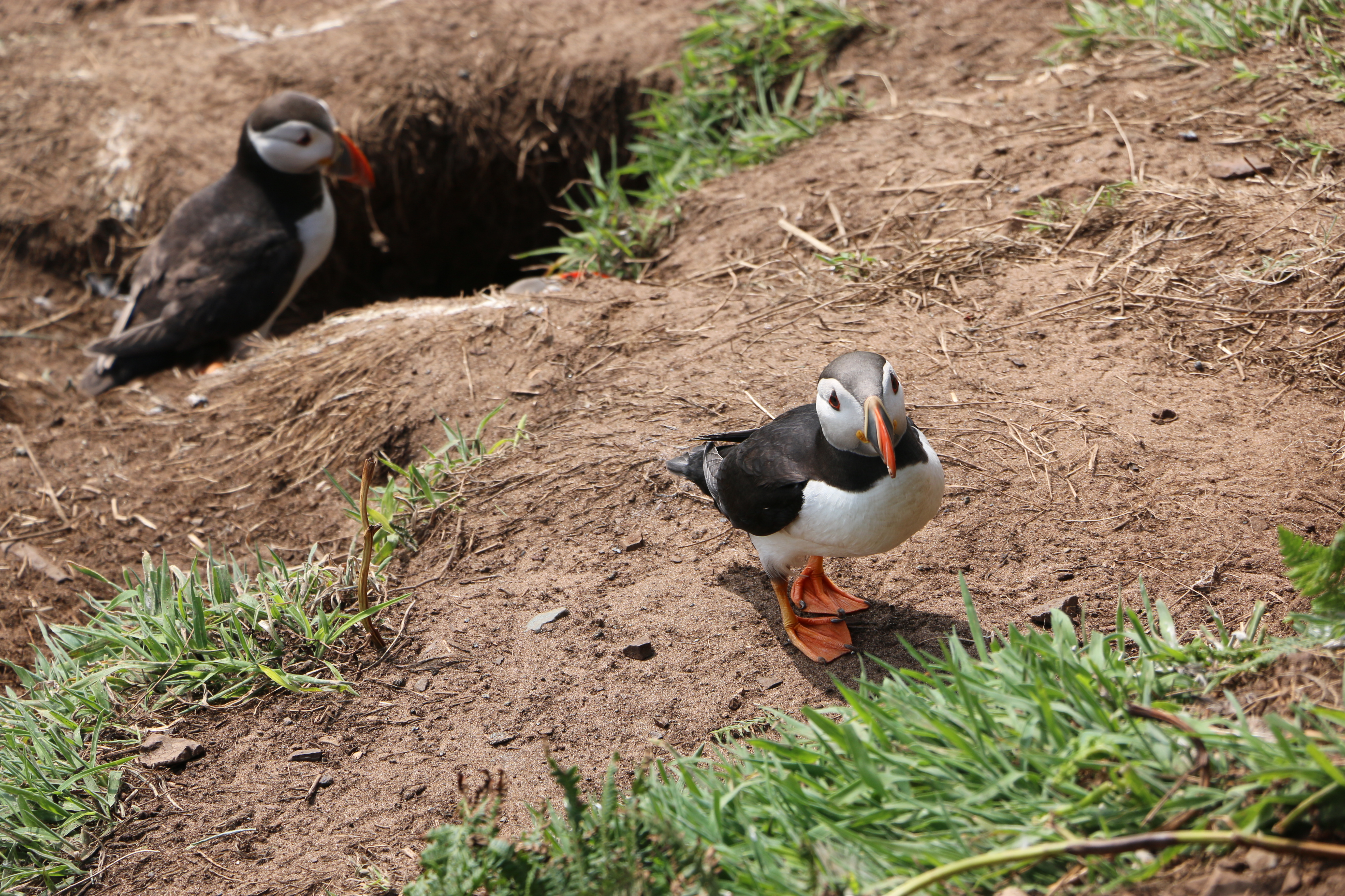
To be greeted by numerous curious puffins who seemed as interested in us as we were in them….
Skomer is internationally important for seabirds and, of course, there are necessary rules to protect the birds so we were told where and how we could walk the paths. One of the National Trust volunteers told us about the numerous species of birds on the island which included the Puffins – now in their last week before they leave the island – we were so lucky to see them.
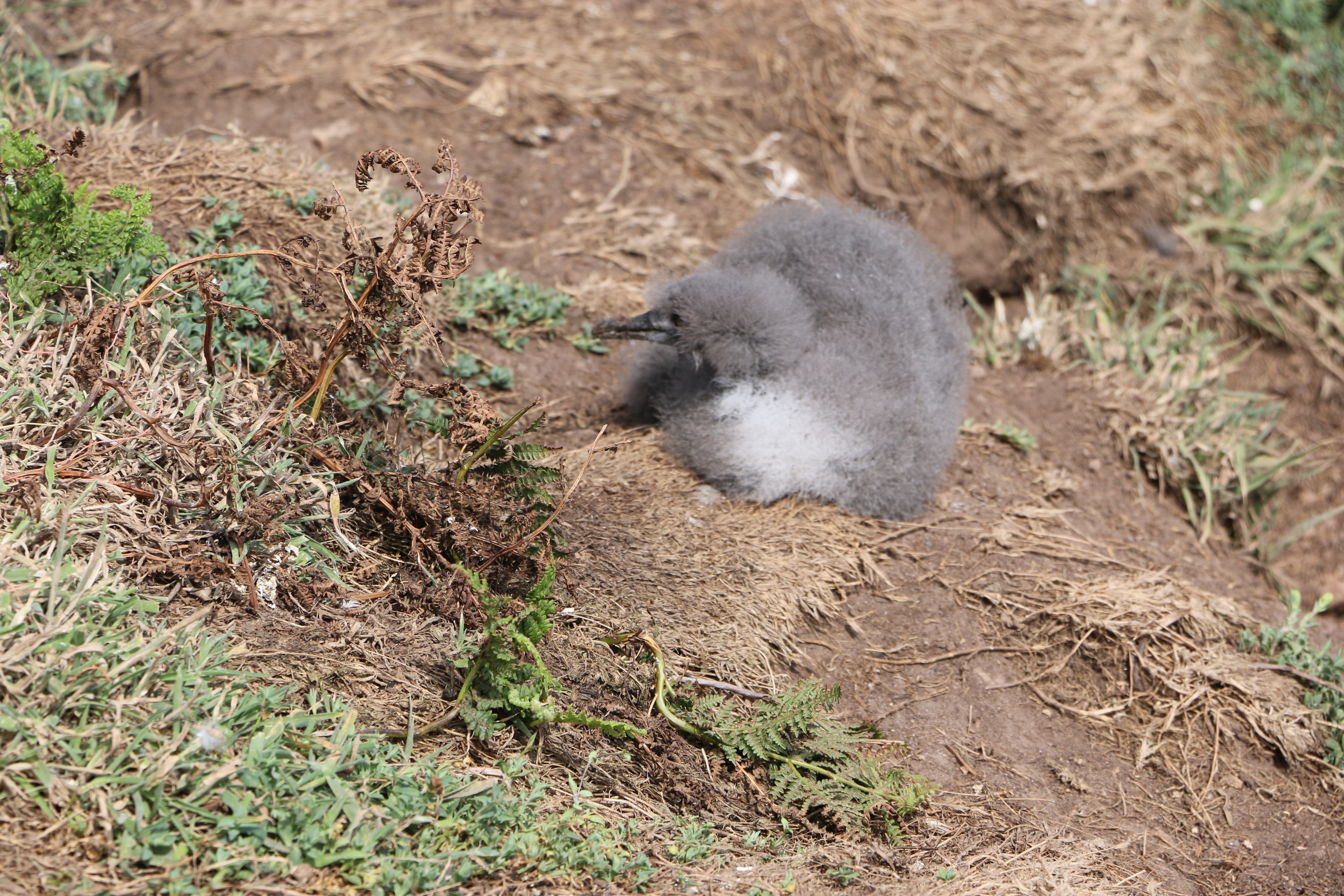
The colony ofManx Shearwaters is the largest colony in the world. Unfortunately we found quite a few remains of these on the narrow paths, apparently caught by the Great Black-backed Gulls. Later in the day we came across a crowd of people watching a Manx Shearwater chick which had wandered out of its ground nest. Seeing the amount of Gulls flying overhead, we hoped it managed to shuffle back to safety.
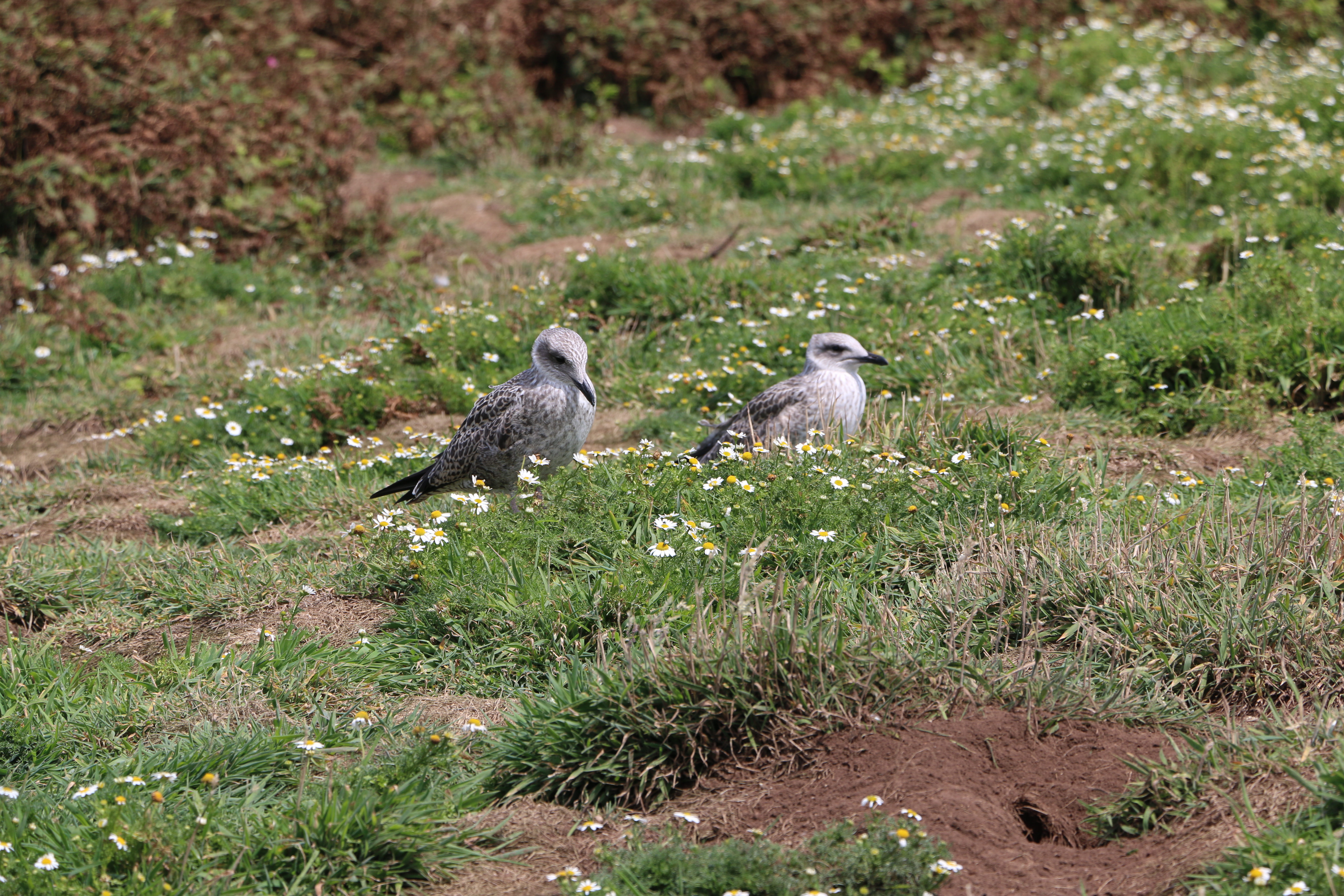
We weren’t lucky enough to see the Storm Petrels that are usually here on the island (they probably were but our binoculars were of slightly less quality than those hired out for five pounds by the National Trust). But we did see Guillemots, Razorbill, Kittiwakes, and so many of the ubiquitous Carrion Crows and Ravens
And at the Bird Hide, we watched Fulmars, Herring, Lesser and Great Black-backed Gulls as well as a pair of Canada Geese around the North Pond. (Well, I think they were Canada Geese, the Photographer said they were … ducks!) Huh!
Two watchful Kittiwakes
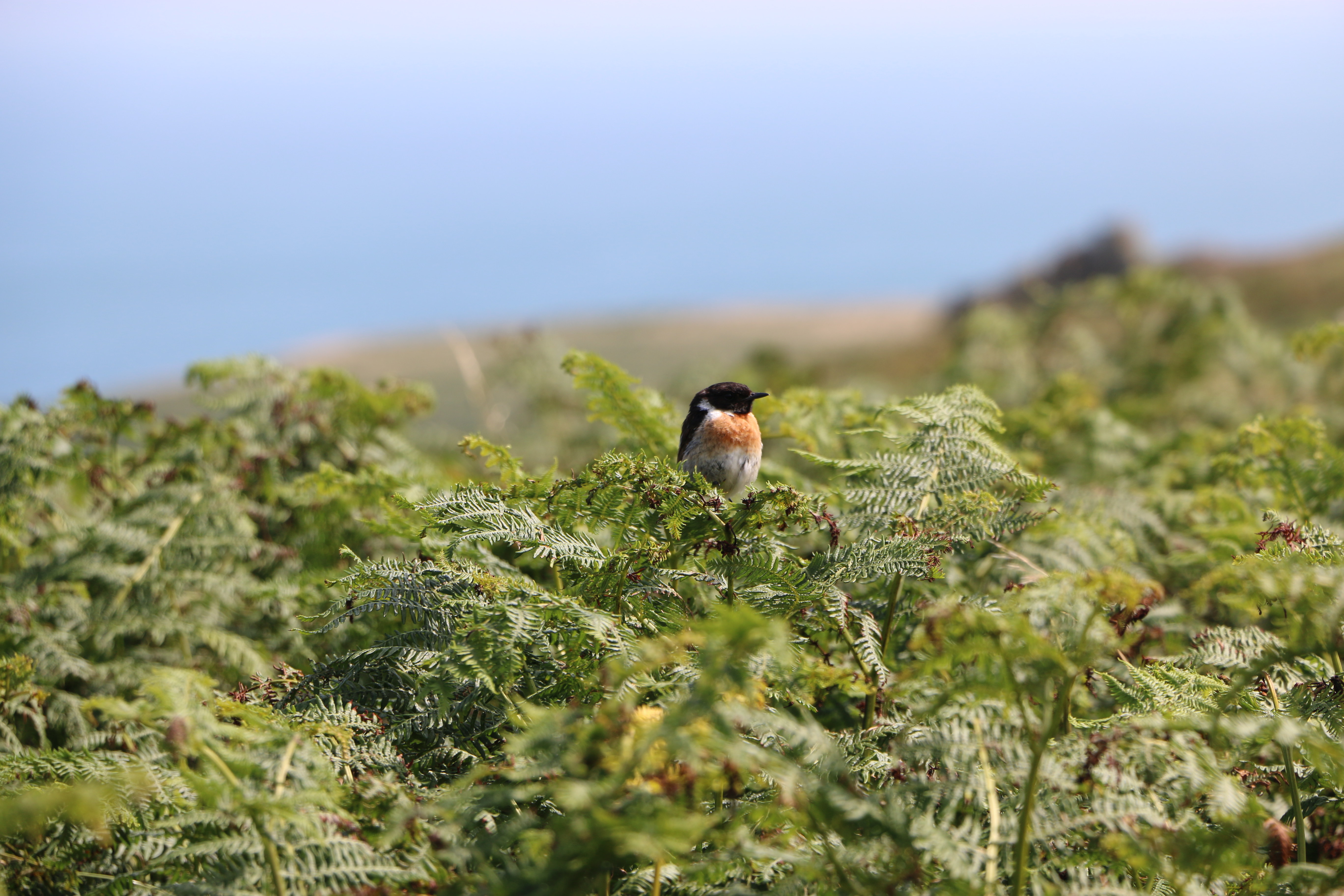
And, later in the day we were followed by a pair of these little birds – we think they were trying to lure us away from their nest.
We thought they were Stonechats – or Linnets – but maybe someone more knowledgeble will be able to correct us?
Some of the paths are so narrow they were designated one way paths – we were warned not to stand on the grass alongside in case therethere were still Puffin burrows with chicks in them. Others are wider and surrounded by ferns, daisies, wild flowers … a treat to see.
We arrived at the old farmhouse where we stopped for our picnic.
History of the farmhouse:
There are unsubstantiated records of a house built in the centre of the island, thought to be around seventeen hundred on which are the ruins of the old farmhouse, itself dated from about 1840. This was once an impressive and substantial house, built in the traditional Pembrokeshire style with small slates fixed in mortar, protecting the front of the house. Early pictures show a metal veranda running the length of the house, and at the back of the building, an old smoking oven where fish and meats would have been preserved. The slightly thicker soils in this part of the island and access to water in North Valley enabled a range of crops to be grown. There are records of the farm supporting three families at one time with cows and sheep grazing on the land as well as horses to help with the heavy work. Farming was largely abandoned after the outbreak of the First World War and all agriculture on the island finally ended in 1950.
And onwards to today:
In 1959 the Island was bought by the Nature Conservancy (the Government department that became the Countryside Council for Wales) helped by the West Wales Field Society (the charity that became the Wildlife Trust of South and West Wales). It was declared one of the country’s first National Nature Reserves and is now owned by National Trust and managed by the Wildlife Trust of South and West Wales.
In the next part of our visit to Skomer we move on from the farmhouse to the magnificent coastlineand impressive views.