Where We Walked Part Three @SkomerIsland2026 #walks #photographs #birds #plantlife #Memories

Last year I wrote – “At long last! After living in Pembrokeshire for the last forty-six years and despite walking many miles of the Pembrokeshire coast, and meandrering around a lot of the Welsh countryside discovering wonderful places, lakes, waterfalls … scenary, we hadn’t been on Skomer island.”

That post here: Crossing off the Bucket List: Part One.

This week we managed to visit Skomer again. Like last year, it was a glorious day’s adventure, and though warm, it was slightly … hmm … a lot more windy, especially on our walk along the rocky path to the far end of Skomer Head, the one place we missed seeing in 2025.

Skomer Head

The wind was so strong at this point we struggled to walk. It gave the Photographer an excuse to stop many times.

After being buffetted so much we were relieved to find that, when we turned inland, it was slightly calmer.

This rabbit took not the slightest notice of us.

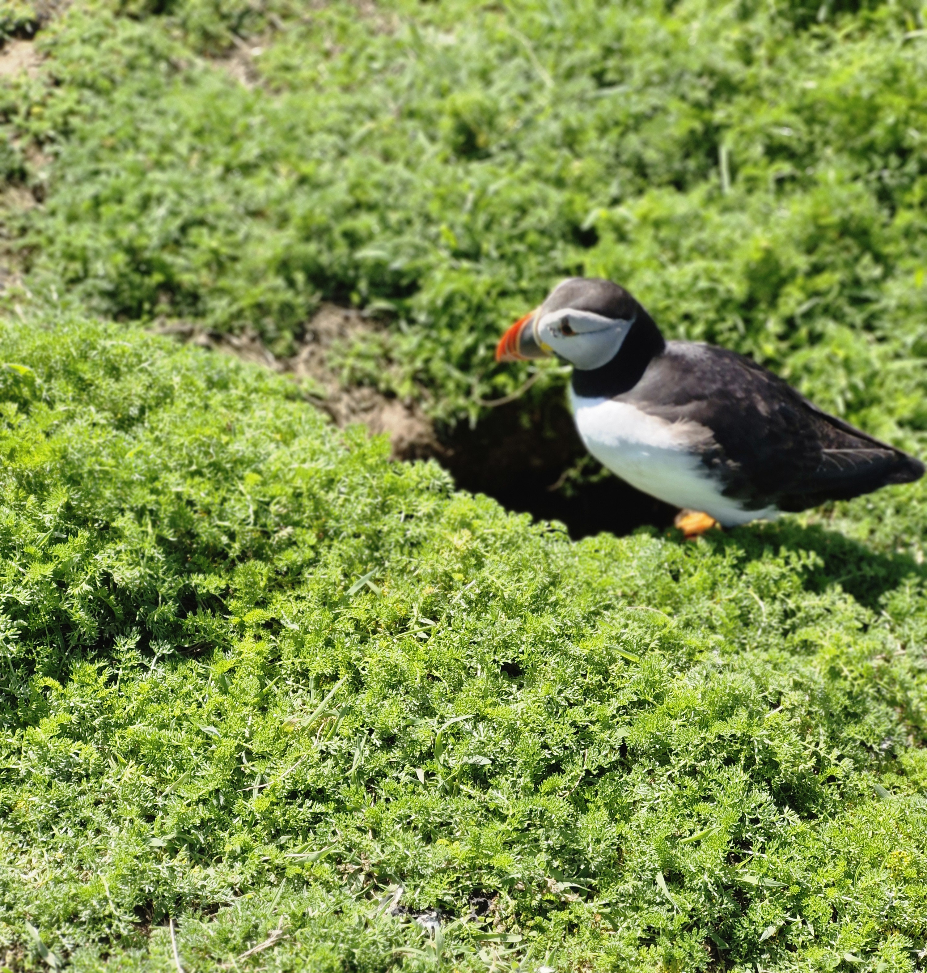
Unlike the Puffins …

Skomer is internationally important for seabird, especially Puffins. When the Photographer stopped to take their photos at The Wick, they were as curious of us as they were last year. Wonder if some of them were the same birds!

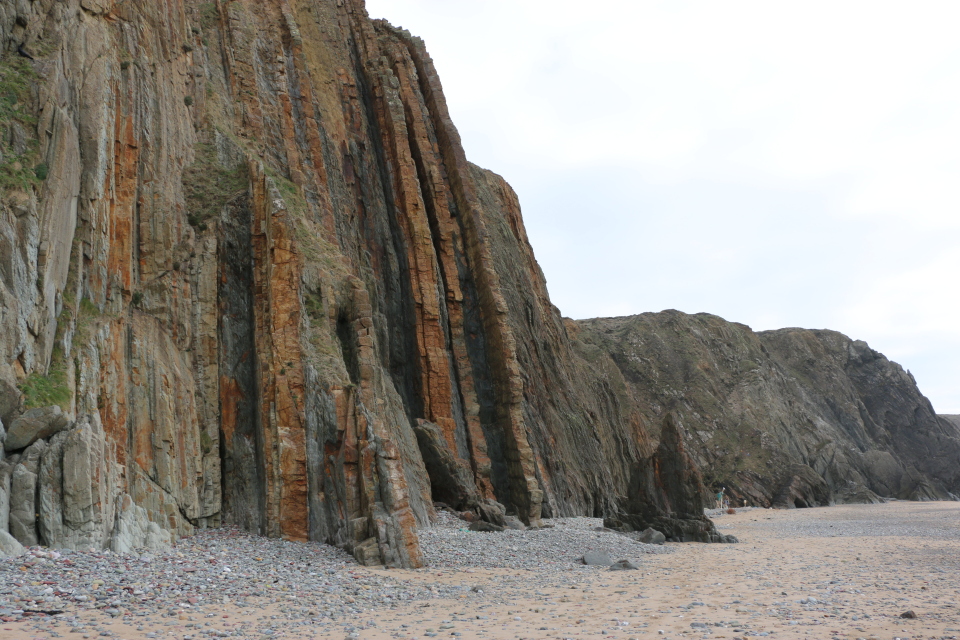
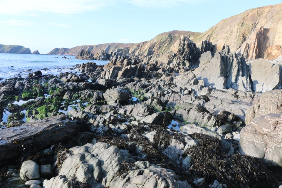
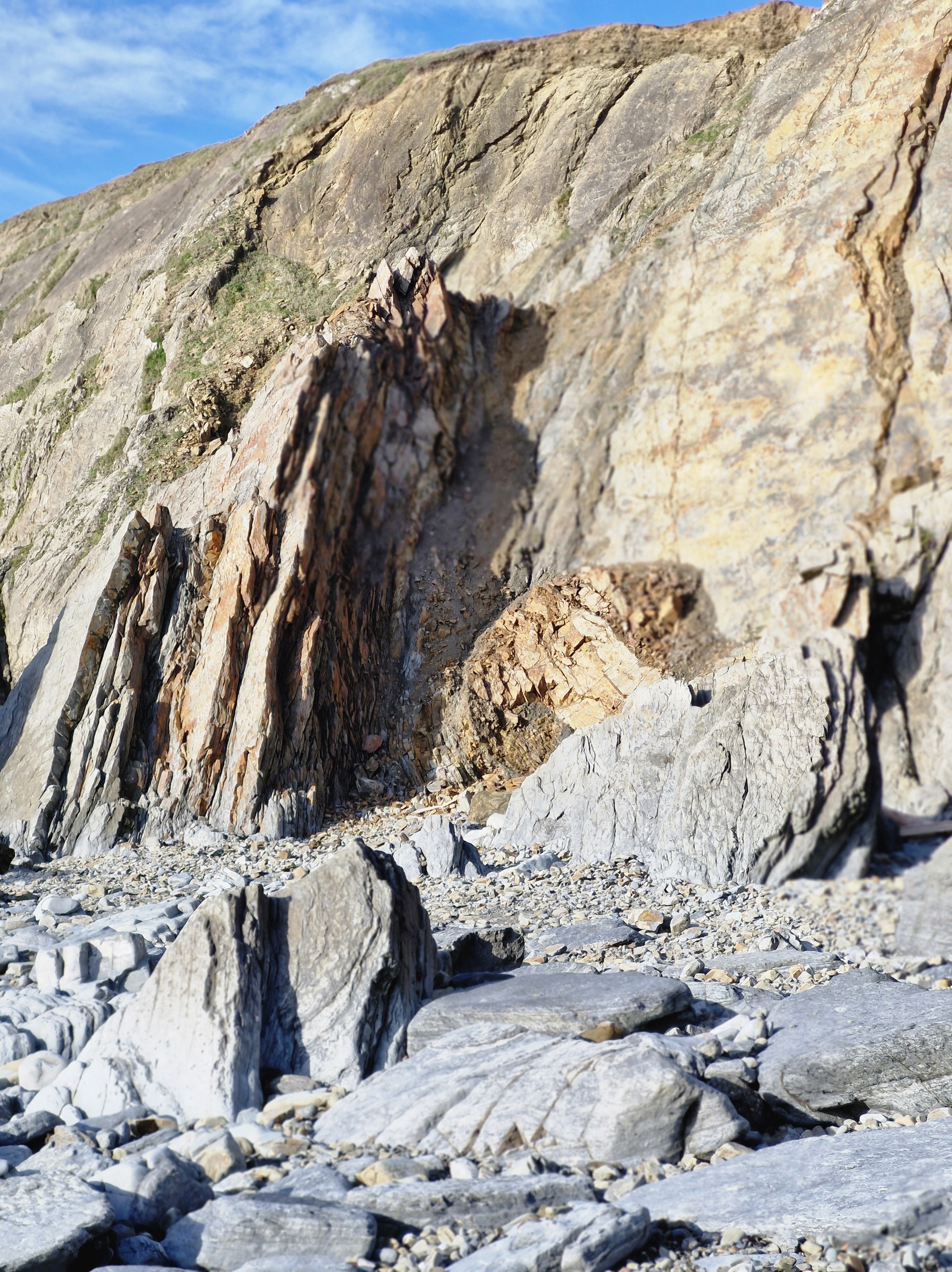
Last year I wrote about the geological fault activity and basaltic lava flows that long ago formed The Wick in Crossing Off the Bucket List Part Two). Looking over the edge of the cliff was just as scary to me as then. And, like last year, the Fulmars and Great Black-backed Gulls swooping and riding the air currants, were just as noisy.

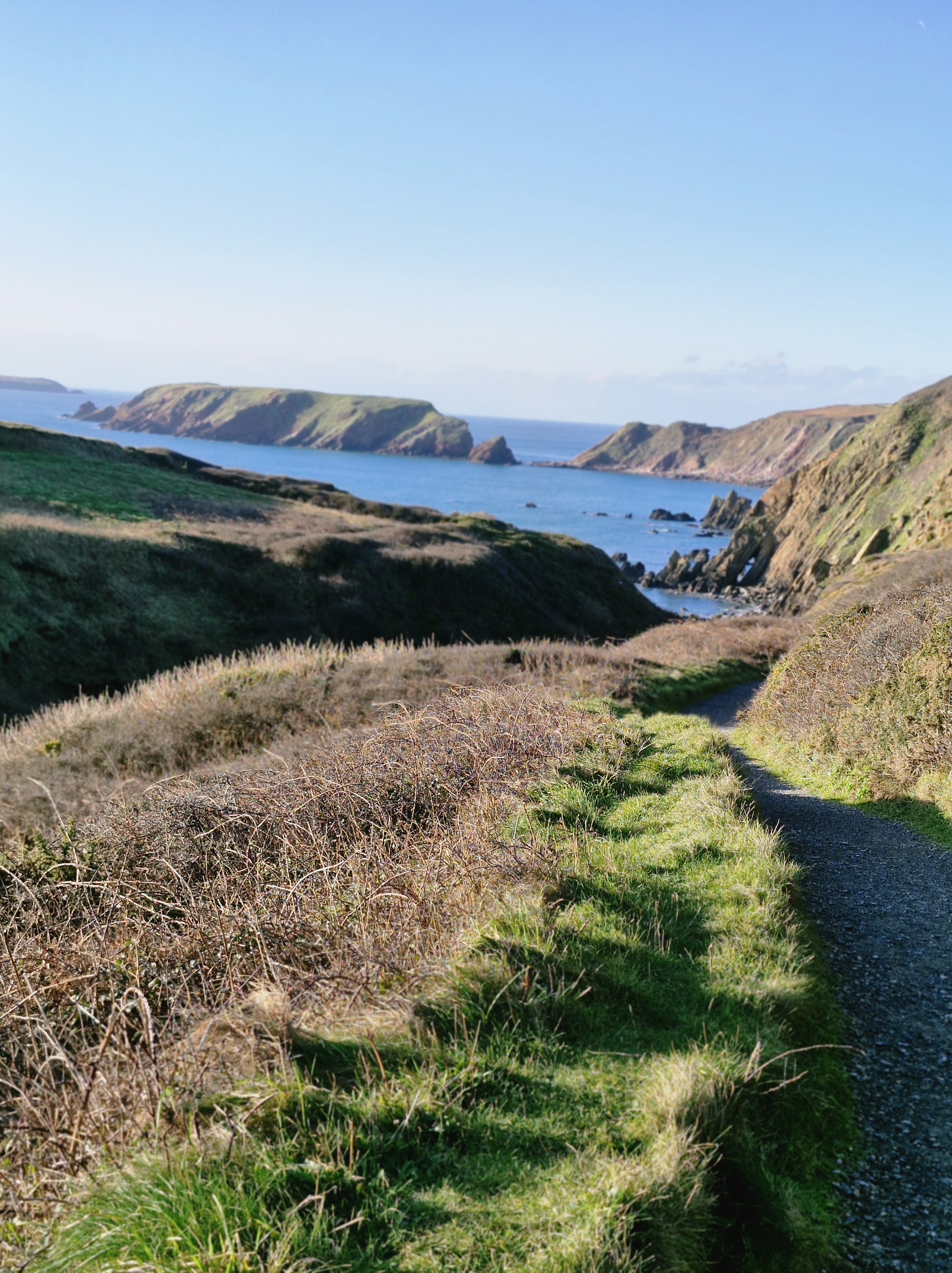
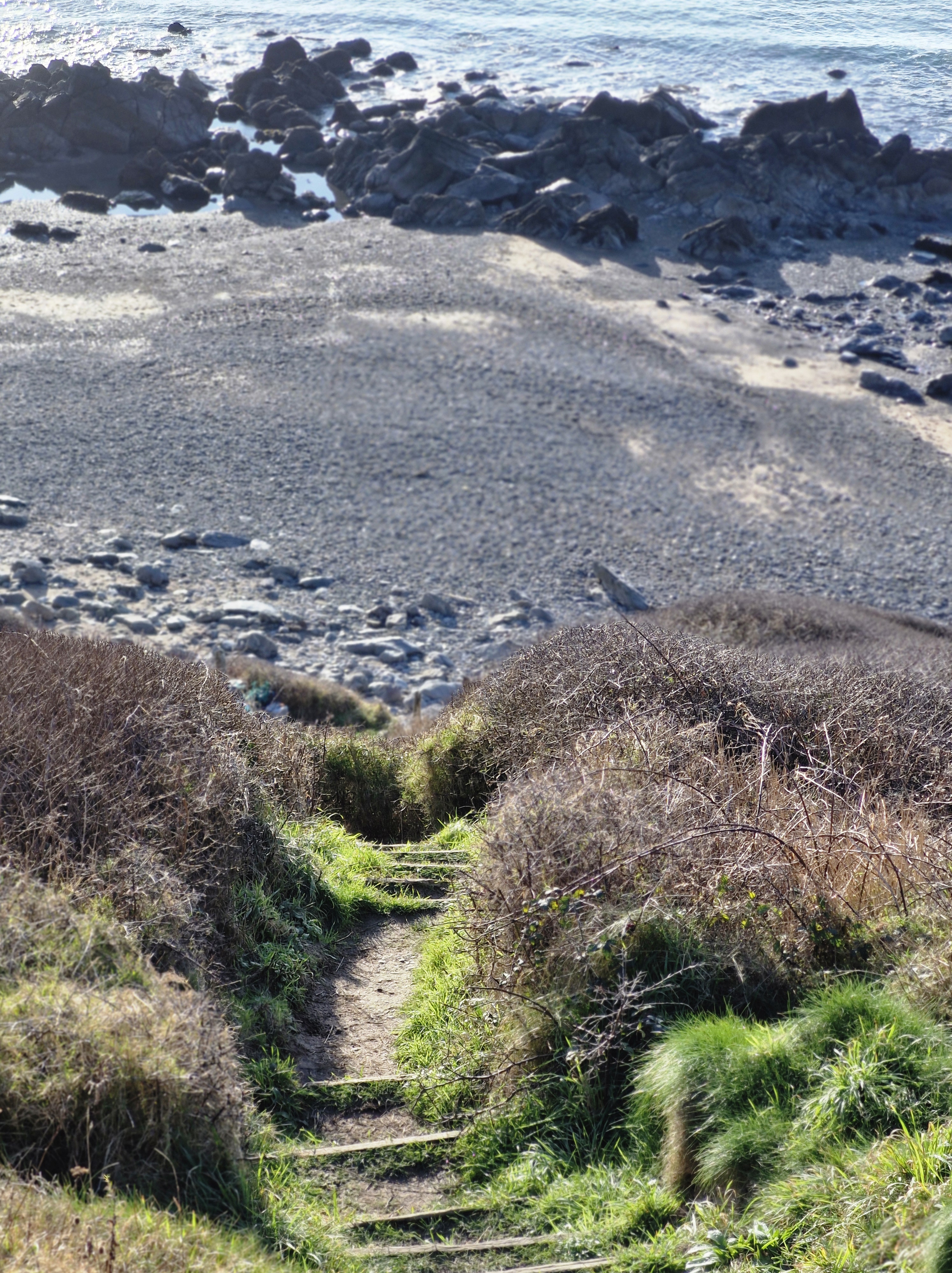
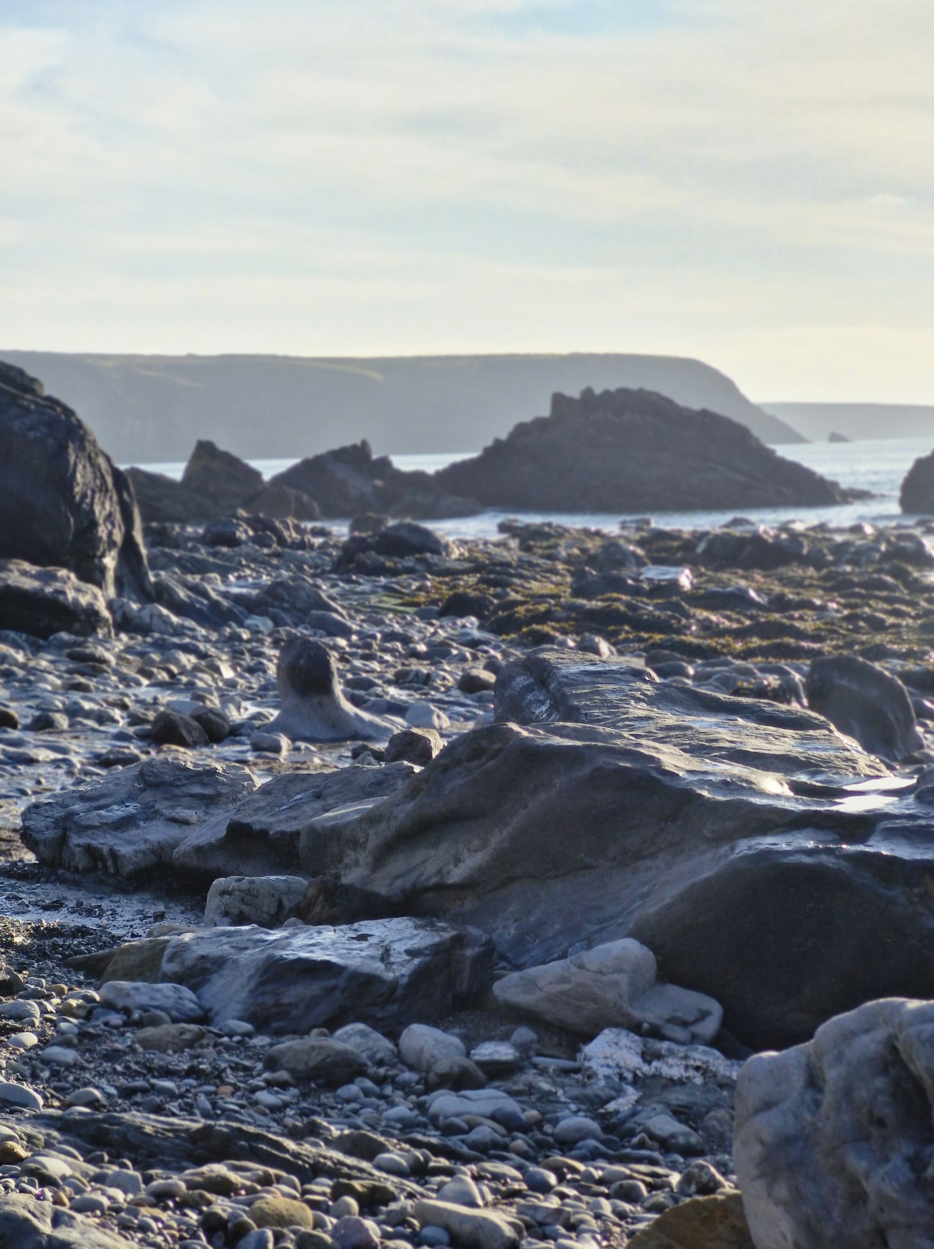
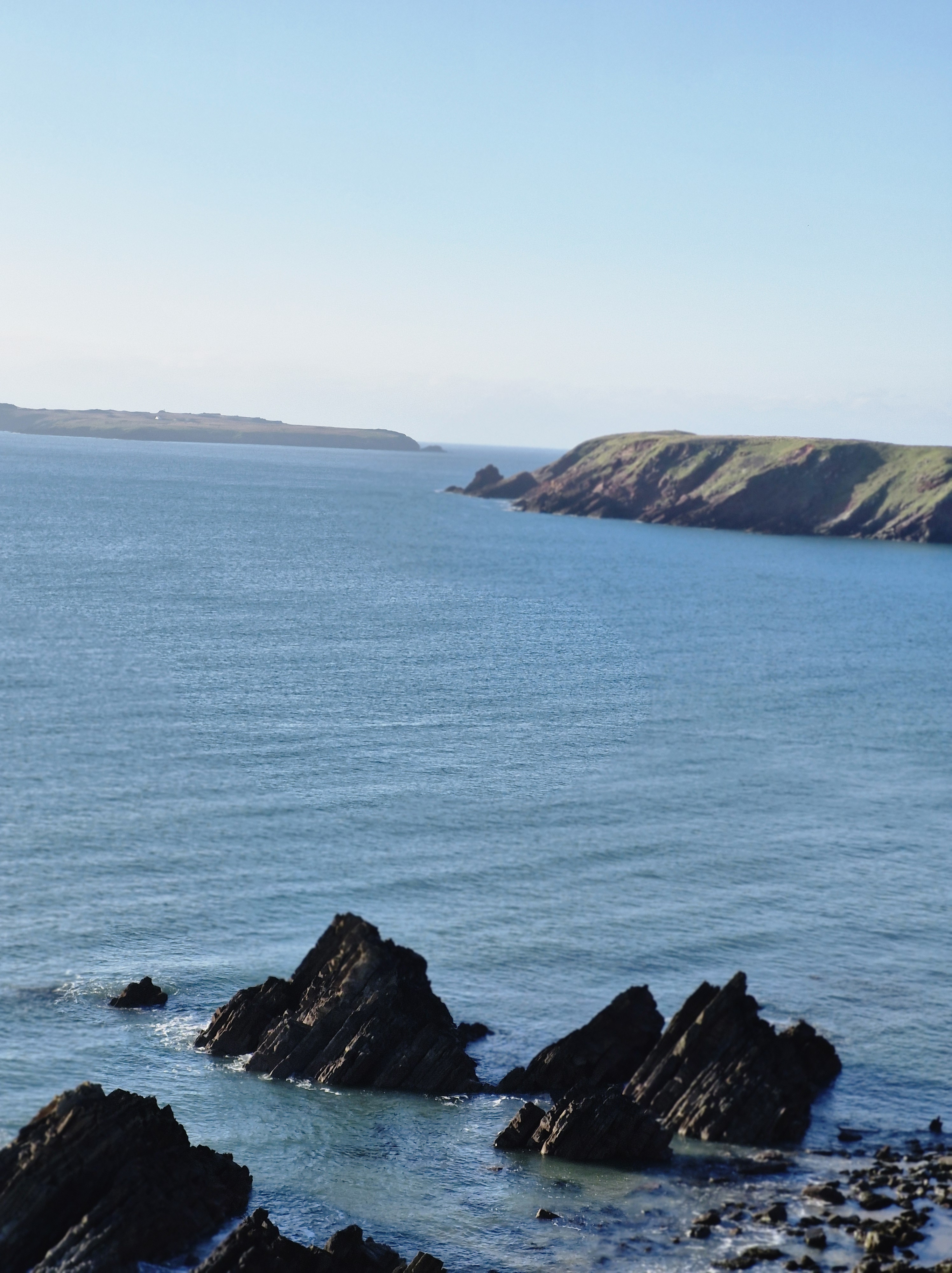
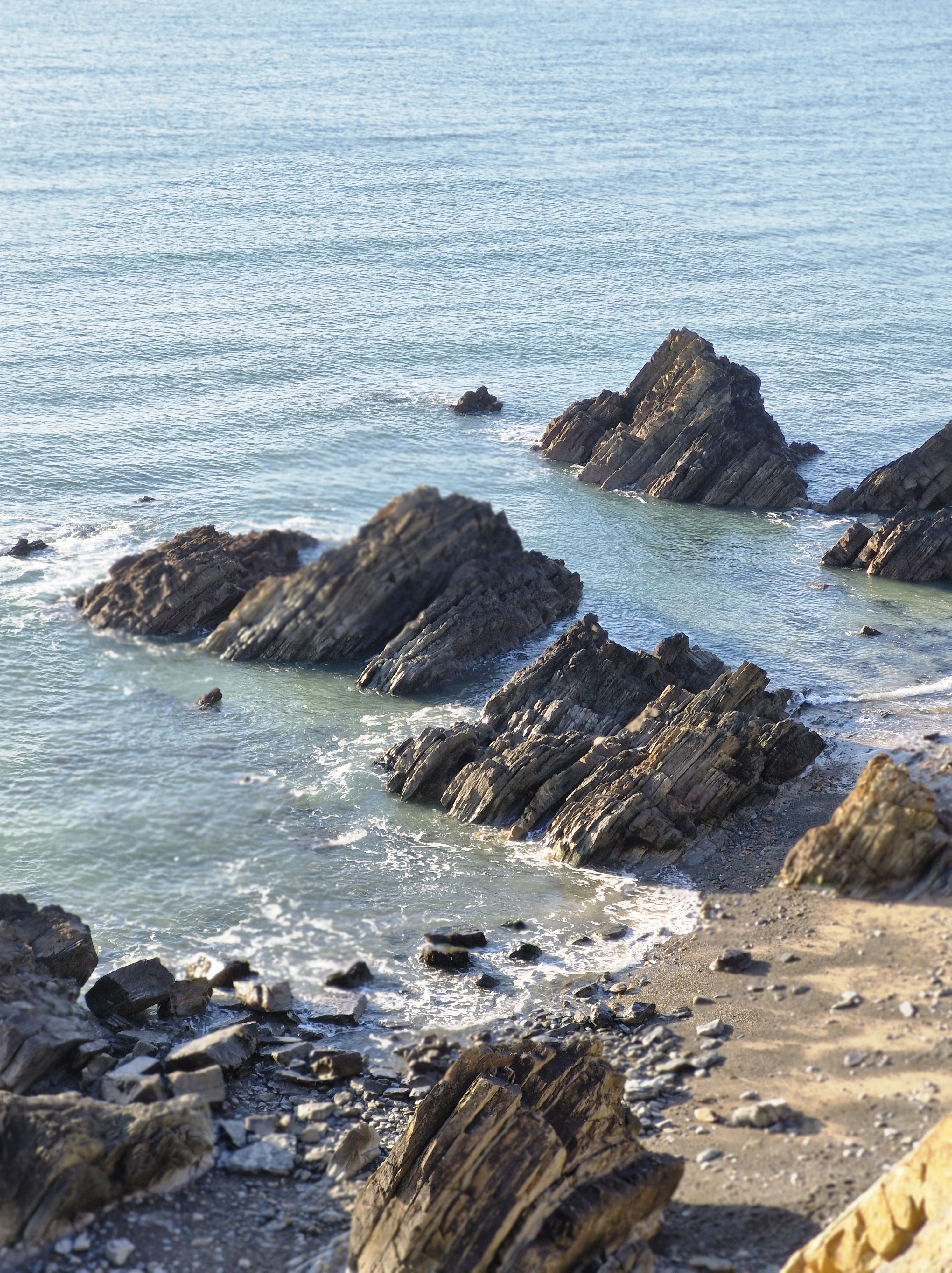
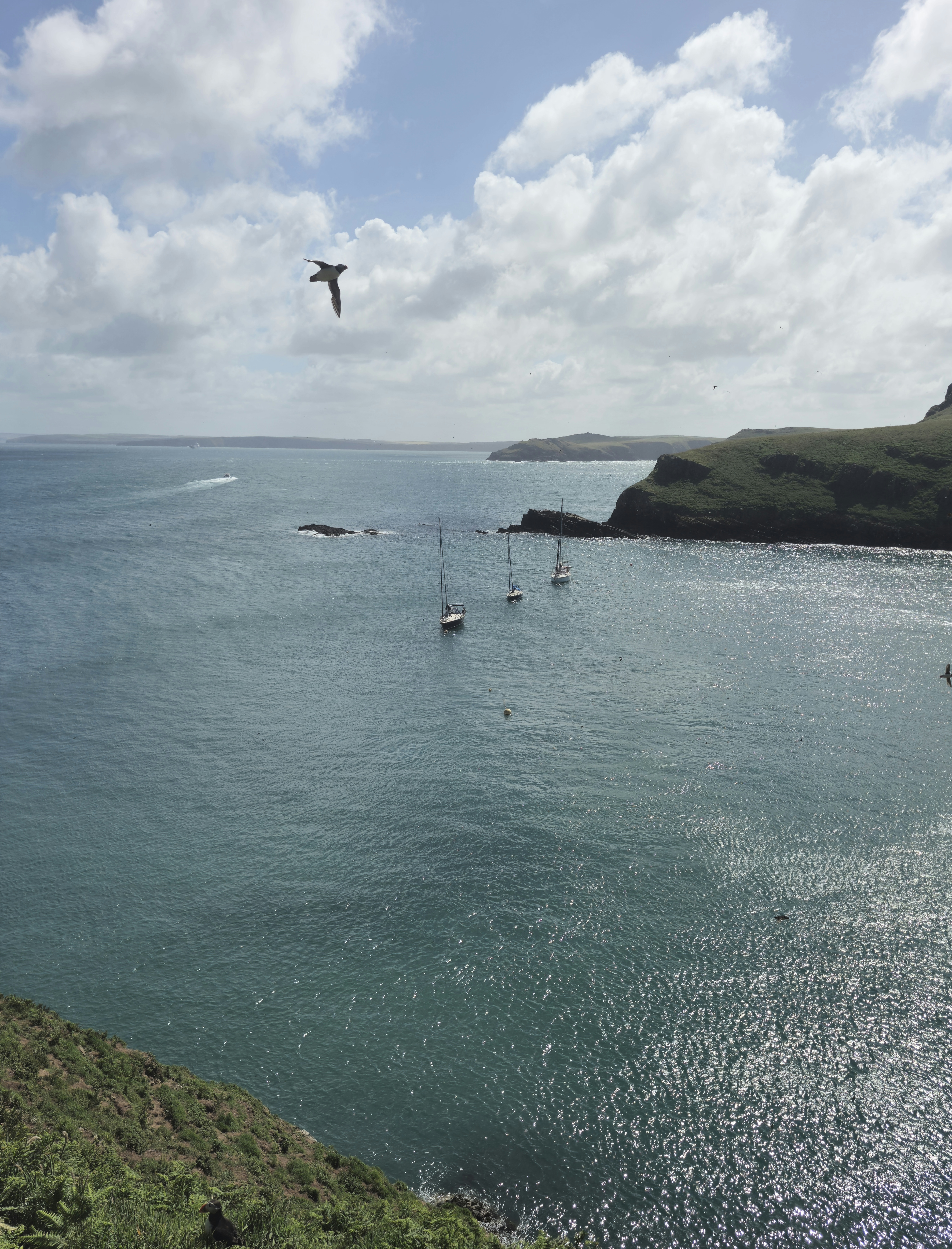
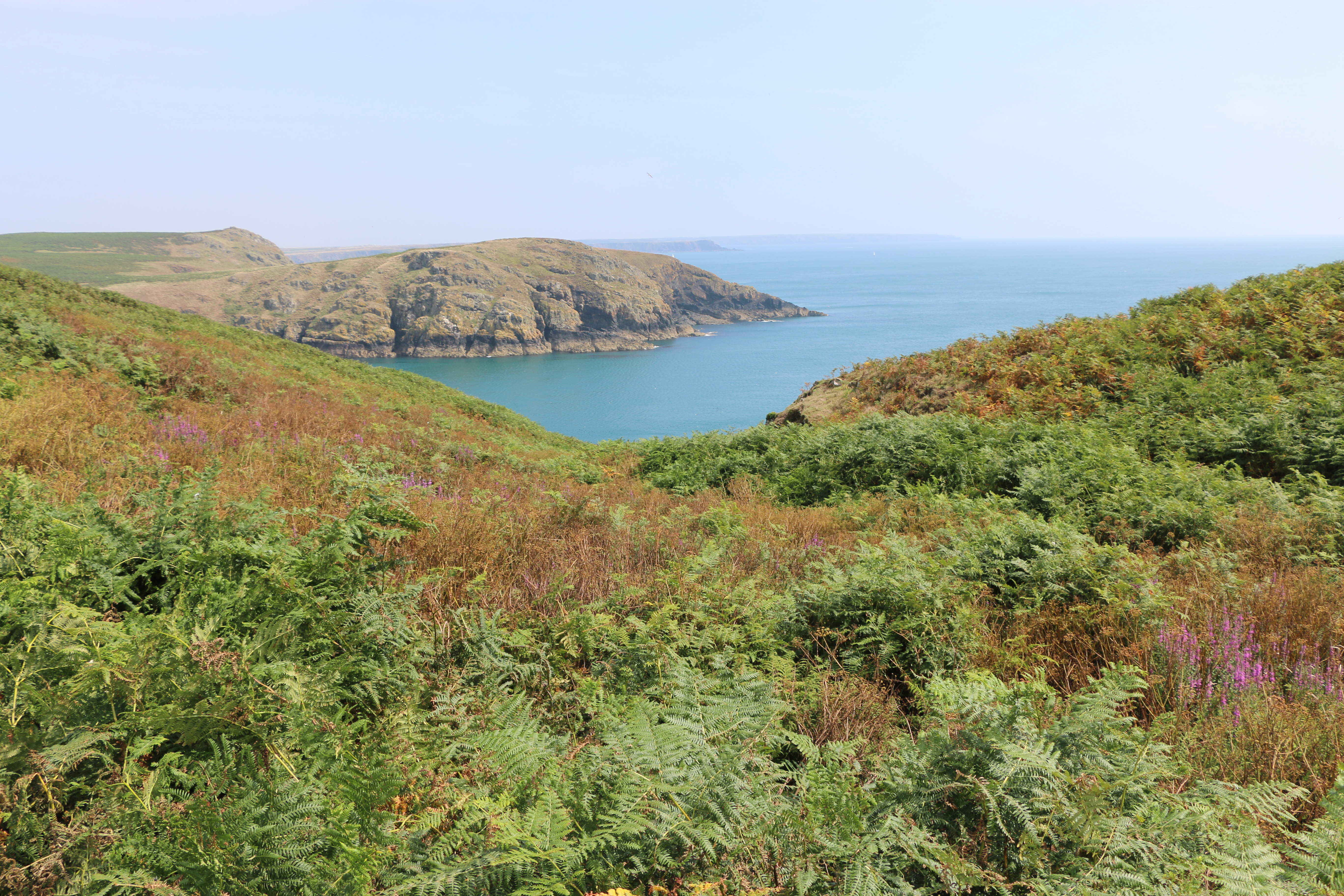
After almost four hours of walking we finally stopped by an outcrop of rocks to eat a belated lunch and admire the sweep of the glorious coastline.

Packing up, I looked at the path we needed to take to get back to the harbour. It seemed a long way!! Undaunted the Photographer set off. “Come on,” he said, cheerfully. ” It’s further on where we saw the Manx Shearwaters, Guillemots, Razorbill, and Kittiwakes last year.” I followed. After all, he had the last bottle of water (and the chocolate) in his rucksack.

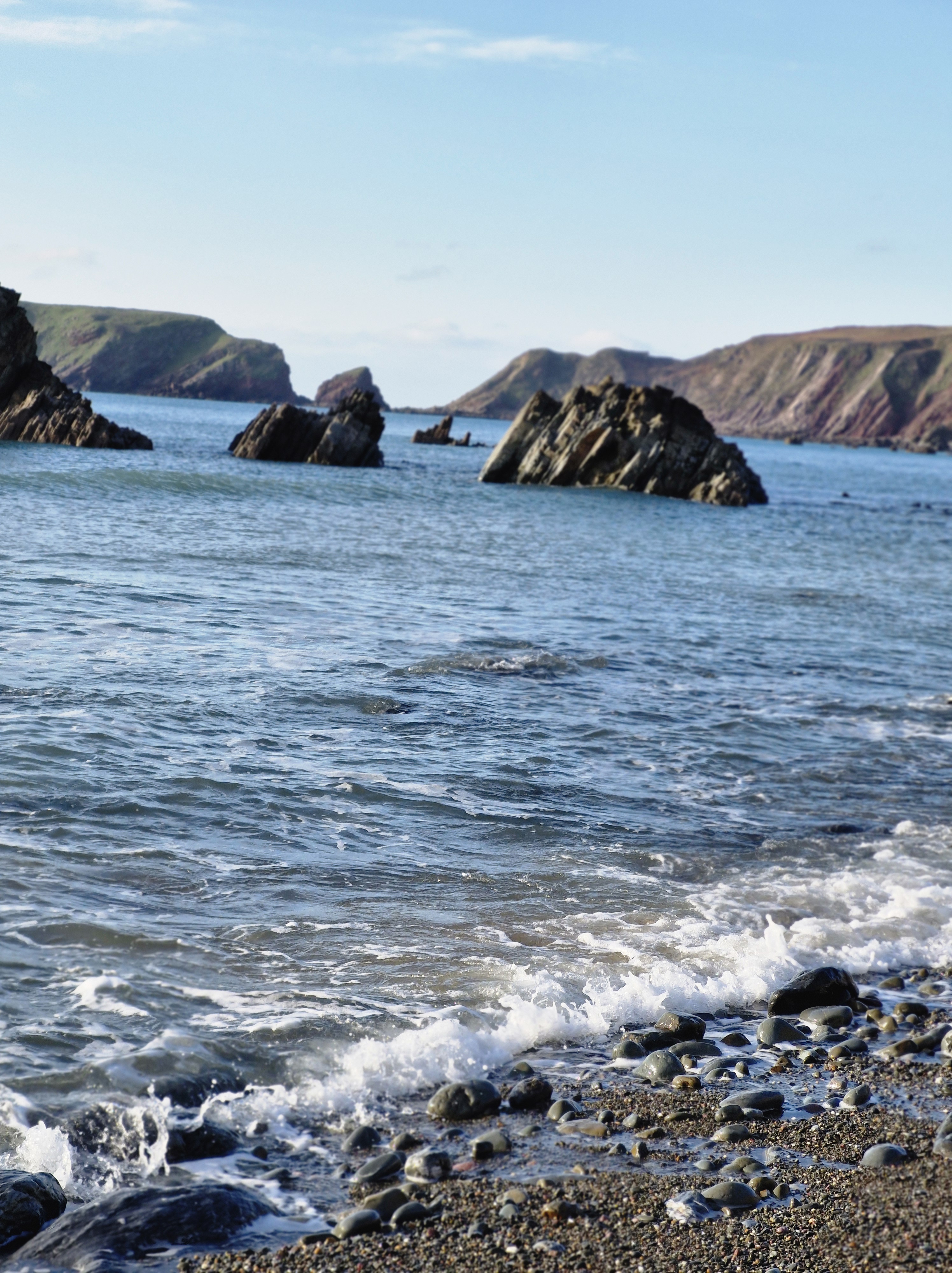
And, after all, who could resist a last look at the magnificent scenary of this island and another chance to spot different seabirds?

We arrived back at the harbour in good time to see the boat coming in. And to take a final Puffin photo.

A short reminder of the history of Skomer Island:

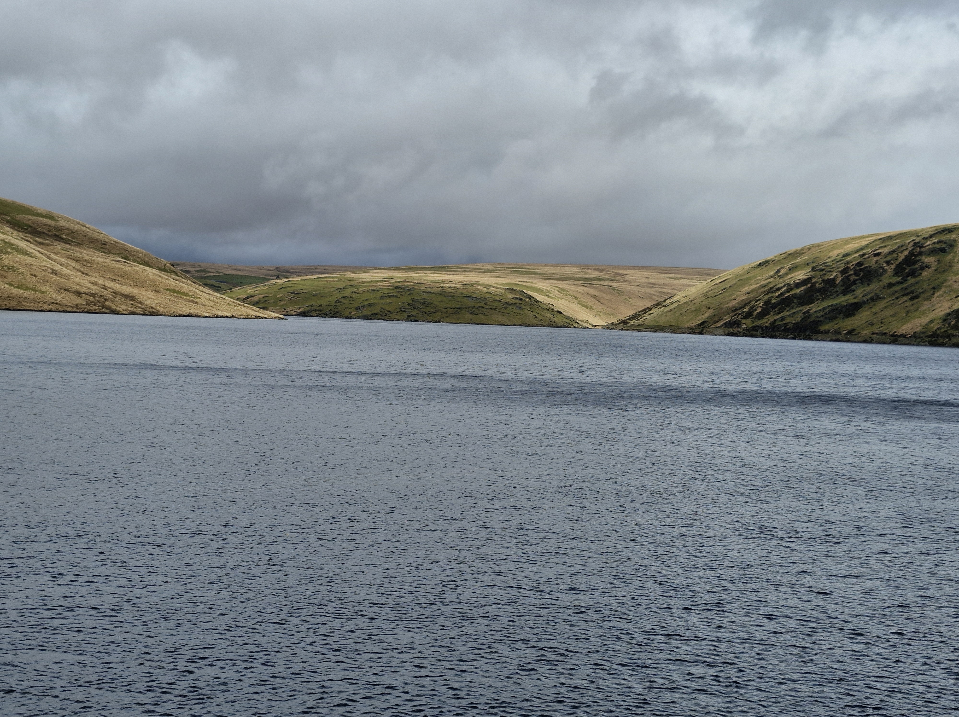
Around thirty-seven thousand years ago, Skomer would have been part of the mainland, only being cut off, following rising sea level, by the end of the last Ice Age around twelve thousand years ago

There is evidence of untouched remains of huts, fields and cairns that appear to prove that between five and twelve thousand years ago there was an Iron Age settlement of a small farming community on Skomer. Near the Garland Stone, a pyramidal (shaped like a pyramid), just off the northern tip of the island, there is a short circular detour off the main path across a ridge where a group of nine small cairns have been identified. This is probably a prehistoric cemetery. In North Valley, looking towards North Pond when conditions are suitable the remains of a number of circular Iron Age huts in pairs can be seen. This is the most complete and untouched remains of this period in the whole of Europe.

But then, except for some evidence of Medieval buildings on the island there is no clear record of any habitation until around the thirteenth century.

****************************************************************************************************

‬Author of Domestic Thrillers, Domestic Noir, Contemporary Fiction & Historical Family Sagas.

Link:
https://www.amazon.co.uk/Judith-Barrow/e/B0043RZJV6

Where We Walked #ClaerwenDam #Elan Valley #Powys #Wales #VisitWales #Walks #Photographs

Although we have visited Elan Valley many times we had never been to the top of the Claerwen (Clear Light) dam.

Built between 1946 – 1952 by a workforce of almost five hundred men the outside of dam blends in with the other Elan Valley dams, although the inside is a concrete structure. Because British stonemasons were working in London after World War II Italian stonemasons were employed to work on the dressing stones,

Claerwen was opened by Queen Elizabeth II on the 23rd of October 1952 on her first engagement in Wales.

At eighteen metres deep Claerwen holds almost as much water as all the other reservoirs combined.

There is potential for producing renewable electricity from the one hundred and ninety-nine million tonnes of water stored in the reservoirs. Since 1997 there has been hydropower production from turbines installed at the base of all the dams. Clearwen can produce 1680 kilowatts. Combined all the dams can produce 3.5 megawatts, which is about six thousand homes.

The day before we were here it was a gloriously sunny day and we’d driven and walked a little way around the four dams on the river Elan: Craig Goch, Pen y Garreg, Garreg Ddu, and Caban Coch.

The following day it rained. But the photographer was adamant it would clear up (he’s an avid follower of the BBC weather forecast!), and, by the time we’d driven to the top Claerwen dam he was insistant there would be a break in the drizzle.

As usual he was right.

Next time we will walk to the Dol y Mynach dam. Dol y Mynach is the unfinished dam and is a Site of Special Scientific Interest (SSSI. There is a bird hide here from which Ospreys and other species of birds, including the Crested Grebe, have been spotted.

The late nineteenth century plan for the collection of dams and reservoirs in the Elan and Claerwen valleys included three dams on the River Claerwen. These would be constructed later when additional water supplies were needed.

Image courtesy of : https://tinyurl.com/8feekf7p

So it was necessary to build the base of the Dol y Mynach Dam at the same time as the other dams in the adjacent valley of the River Elan. Dol y Mynach’s foundations were built during the first phase of the scheme, and was planned to be completed in the second phase, alongside plans for two other dams in the Claerwen valley. But after World War II, technology had advanced so the only the much larger Claerwen needed to be built. But, just in case it’s needed, a tunnel runs from Dol y Mynach to Garreg Ddu reservoir to fill up Garreg Ddu.

Where We Walked – Marloes Sands #BoxingDay #Pembrokeshire #Wales #Walks #Photographs #memories

The last time we were here was last summer, on a warm and sunny day. After parking the car we’d walked down the winding track to the beach. The tide was well out and we’d strolled along the edge of the lapping gentle waves on the long stretch of sand.

This time: Boxing Day 2025, so bitterly cold that initially it took away our breath. But the sun was shining and the sky was a gloriously clear blue. It was good to be outside after days of rain. We sauntered down the track to the grassy path that led to the beach

The tide was in. In the distance we could see Skomer Island which we’d visited inJuly. An adventure I’d written about here and here.

We turned away from the beach and, after only slight hesitation, we crossed a small footbridge over a stream and followed a path to the top of the cliff that we’d not walked on before.

It was a little hair-raising to be honest. But the views were wonderful. After half an hour along an ever rising, and narrowing path we came to a halt at the top of steep and winding steps that obviously led down to the beach. Go on, or go back? We’re not very good at going back on walks, however lost we are, or in this case, however daunting the steps. So we decided – in for a penny and all that…

It took us ten minutes of walking sideways down each step and being very grateful for the walking poles we’d debated on bringing with us – (After all, it’ll only be a beach walk!” I’d said, foolishly).

I don’t know who’d built those steps but they’d obviously decided that anyone who could navigate them thus far would be fit enough to leap over the last two metres of sheer rock at the bottom to reach the beach.

Before I could decide to either slide down the rock on my backside, or roll down through the gorse bushes on either side of the path I heard a cry. ” Bravo! You are legends!” A lady appeared below. “Stay there. I’ll help you down, you legend. Grab my hand.” I was, I have to say, very grateful for the help.

Until, finally on level ground – (levelish – i looked it up, there is such a word, specially invented i guess for rocky beaches) – I looked at this lovely lady – and realised she was probably around our age.

To be clear though, she did tell us she’d arrived at this particular spot at low tide, and had walked along the wide stretch of sand from the other end of the beach – where we’d we’d originally planned to walk from. And also that the steps we’d come down were locally know as the emergency exit steps for when someone was caught out by the high tide. So that was the answer – whoever built the steps knew that anyone wanting to use them would probably be swimming to them – and not by choice; to escape being trapped by the tide.

Luckily for us the tide was on its way out. There was no way I was tackling those steps again to the top of the cliffs. We judged that, if we took our time, we could navigate around and over the rocks to get back to our originally planned starting point at the other end of the beach.

Having navigated rocks near the sea’s edge we made our way to the top of the beach near the cliffs where there was a gap between two tall, jagged rocks. A group of people came through as we were deciding on our next move. If they could do it so could we! Yes, I know … mad!! But we don’t like to be beaten.

We made it to the other side. “No problem,” said the photographer (He was standing on the sand taking this photograph with the path that leads up to the track, and on up to the car park, behind us). I ignored his confident smile; there were a few moments when I’d thought we would be needing a sea rescue.

N.B: Just as a matter of interests, Marloes Sands was the filming location for: Snow White & the Huntsman (September 2011). The Lion in Winter (1968).

And could I, should I, leave this post without a small metion of my books?

As I’m hoping the book I’m working on at the moment, and hope to publish in 2026 (Well, one can always live in hope!), I guess not. So here is the link to my Amazon page.

Thank you to all my readers; I appreciate each and every one of you.

Where We Walked #Nantmor to Beddgelert via Bryn Ddu #Wales #walks #climbs #photographs #holidays – Part Two

Continuing our walk …

From the lookout point we could see Beddgelert – now only two miles away. All down hill. Very downhill!

The village is in the Snowdonia area of Gwynedd, Wales. It’s thought that it’s possibly named after an early Christian missionary called Cilert who settled there to become the leader in the eigth century. The earliest record of the name Beddgelert appears on a document dated 1258( recorded as Bekelert). The local Welsh dialect often shortens the name of the village to Begél.

It didn’t look very much closer through binoculars, to be honest.

Image courtesy of https://en.wikipedia.org/wiki/Welsh_Highland_Railway

Zig-zagging down the steep hillside to reach Beddgelert, and then through the magnificent Aberglaslyn Pass and on to Porthmadog, is the Welsh Highland Railway, the UK’s longest heritage railway. These trains are the world’s most powerful narrow gauge steam locomotives, and run for twenty-five miles from Caernarfon to Porthmadog. They climb from sea level to over six hundred and fifty feet below Snowdon, before descending to Beddgelert. On numerous walks we heard the ‘toot-toot’ of the train. Many times we waited for it to come into view … until we realised the sound echoed all around the mountains … and it was always miles away from where we eagerly anticipated (well, one of us did!) a “great photo opportunity”.

One of the most sought after/ looked for attraction – from a tourist point of view – is the raised mound in the village, called “Gelert’s Grave” and the statue of the faithful hound. The folk tale is synonymous with Beddgelert. By the way, the ‘hill’ (as the photographer first described it to me) in the background is Bryn Ddu mountain – the one we’d just scambled down.

But the grave was actually built by the late 18th-century landlord of the Goat Hotel, David Pritchard, who created it in order to encourage tourism.

We called in to have a wander around the local church, the Church of St. Mary stands at the end of Stryd yr Eglwys (Church Street). Parts of the building date from the 12th century; the chapel section being originally a part of an Augustinian Monastery. the rest the of the monastery was destroyed by fire during Edward I’s war of conquest. It really is a lovely peaceful church. And welcoming, as the following shows …

The village is also linked with the Rupert Bear stories.

Image courtesy of https://www.beddgelerttourism.com/Rupert/

Alfred Bestall wrote and illustrated some of the stories whilst he lived in the village, in a cottage at the foot of the Mynydd Sygun ( Sygun Mountain). There is even a small area known as ‘Rupert Garden’ in the village, dedicated to the Bear; a short walk from Alfred Bestall’s old home.

Lying in the heart of Snowdonia, Beddgelert is small, and a beautiful conservation village in the heart of the National Park, nestled below mountains at the confluence of the Glaslyn and Colwyn rivers. The path alongside the Glaslyn river was the last section of our walk back to Nantmoor. The path sounds so innocuous doesn’t it? Especially when it’s called the Fisherman’s Path – images of quiet contemplation, the swish of fishing rods, the ripple of water…

On to Part Three…