We parked opposite the Eas Mòr Ecology centre, and crossed the road to pass the Forest at the Falls cafe. “We can call in for a drink and a bite to eat afterwards,” the Photographer says when I look longingly at the table where a couple are enjoying a coffee. The aroma is tempting but Dusk and I follow him up the short, steep path ….
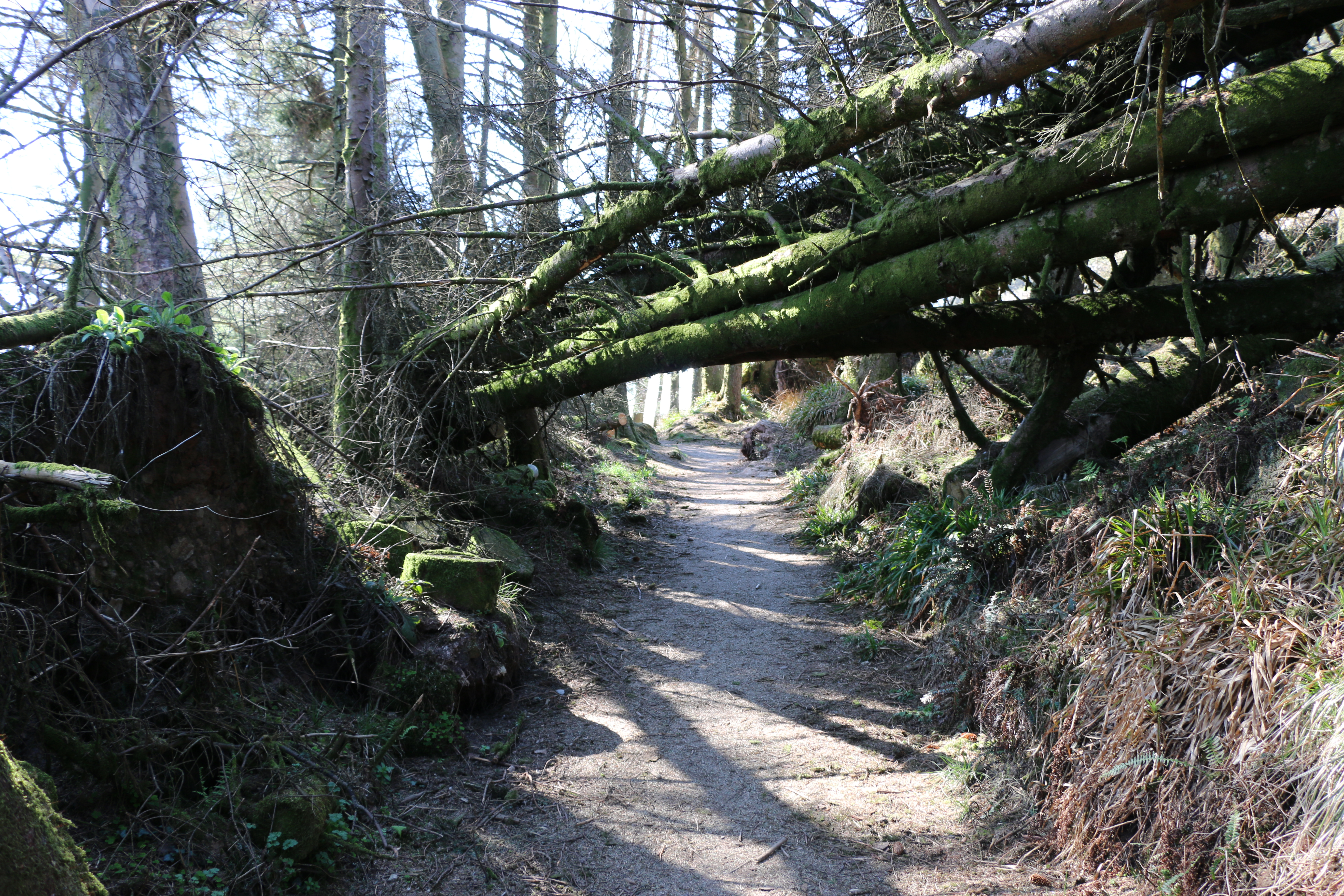
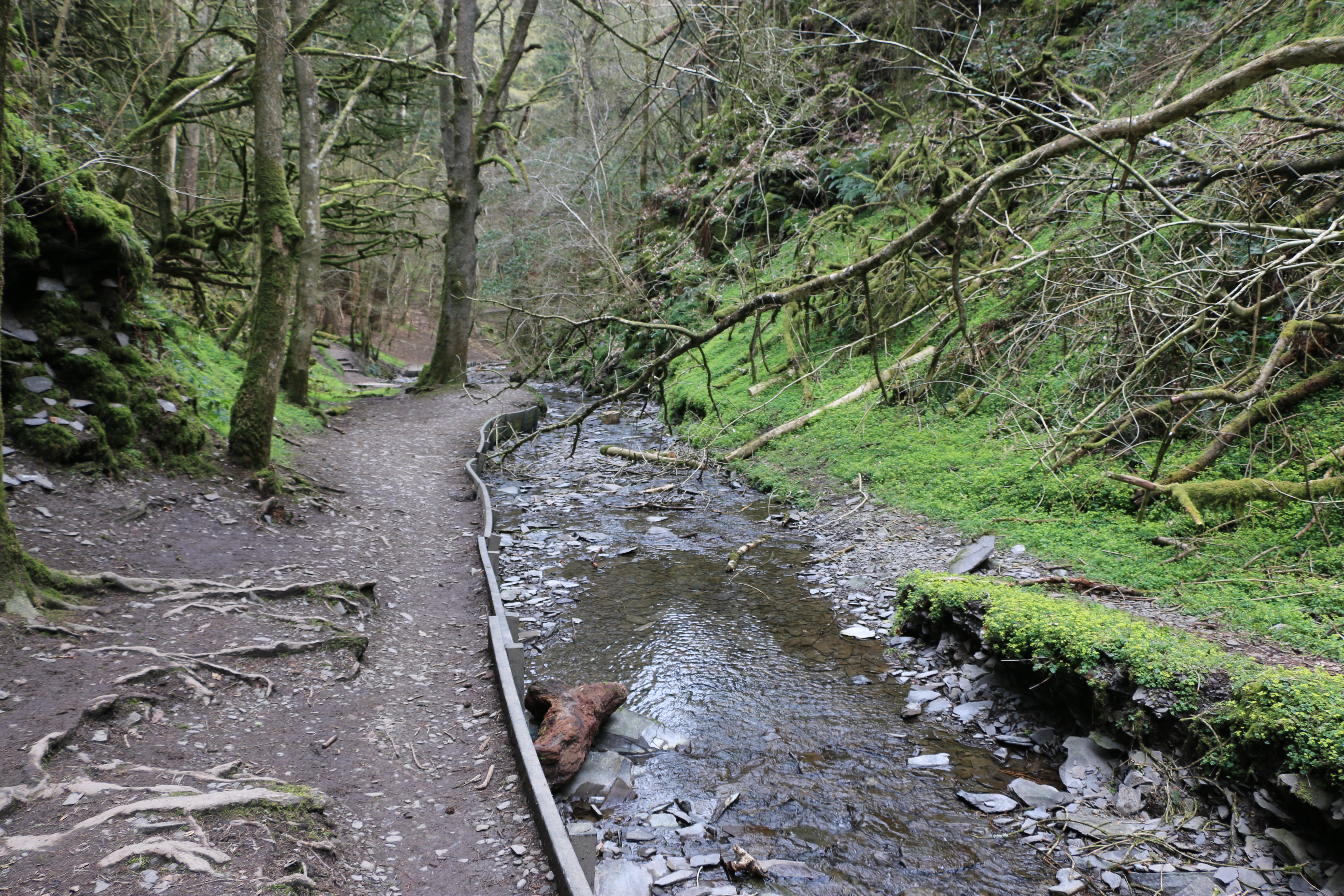
We duck under the trunks of a couple of trees that have fallen across the path. One has a plaque nailed to it – “Bow your heads for you enter sacred and magical lands”. As we were to discover when we finally reached Loch Garbad. Butfirst to the Eas Mór falls.
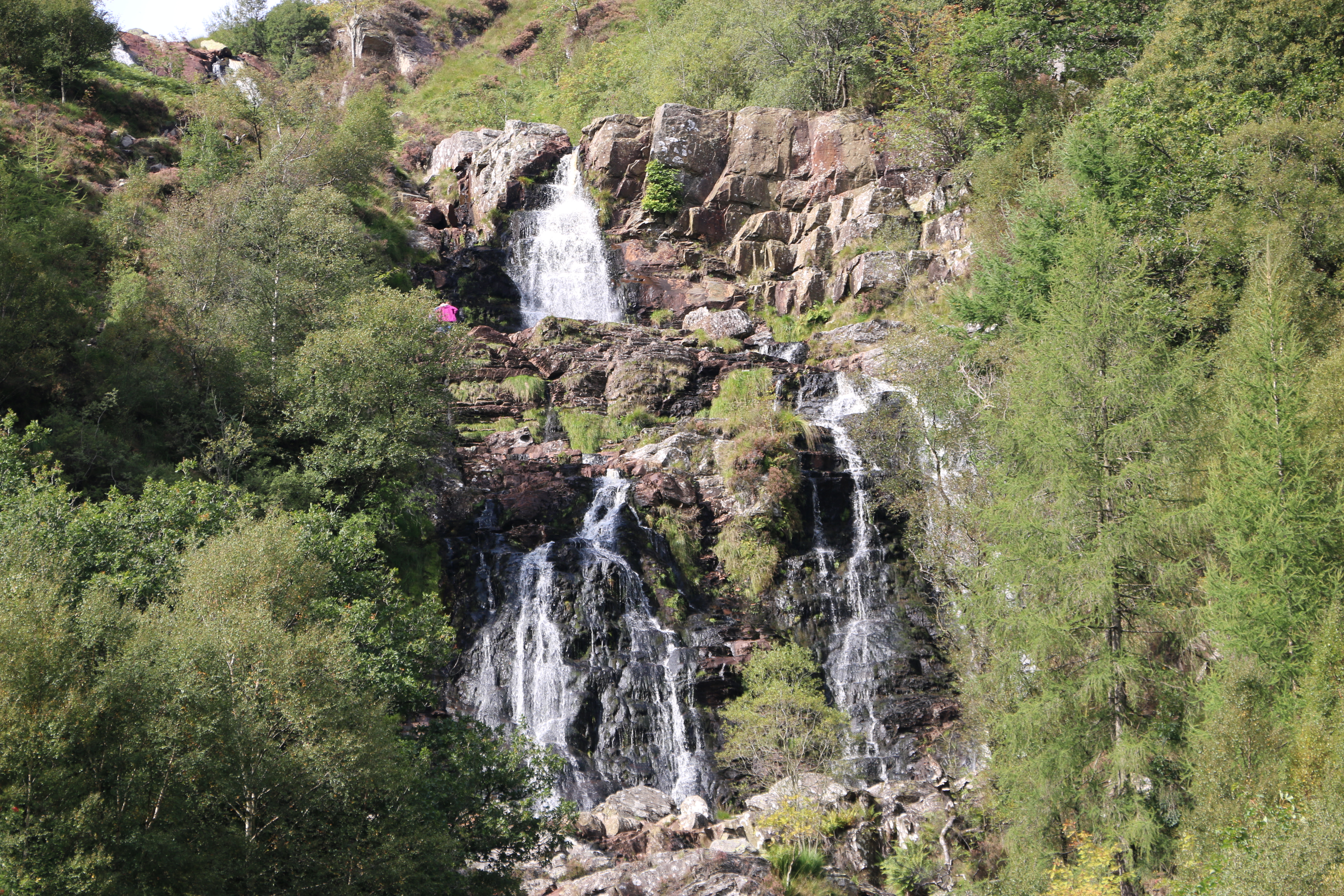
Today the falls are not as magical as the photographs from the travel website promised when we discovered this walk. It’s a little disappointing but it’s because the weather has been so dry. Only a small slender stream of water runs, mostly obsured by the surrounding shrubs and grasses from where we stand. (hence the above borrowed photograph). It’s certainly not as impressive as the Glenashdale Waterfall from our first walk on Arran, but it does fall over the cliff in a single dramatic drop into a deep dark gorge.
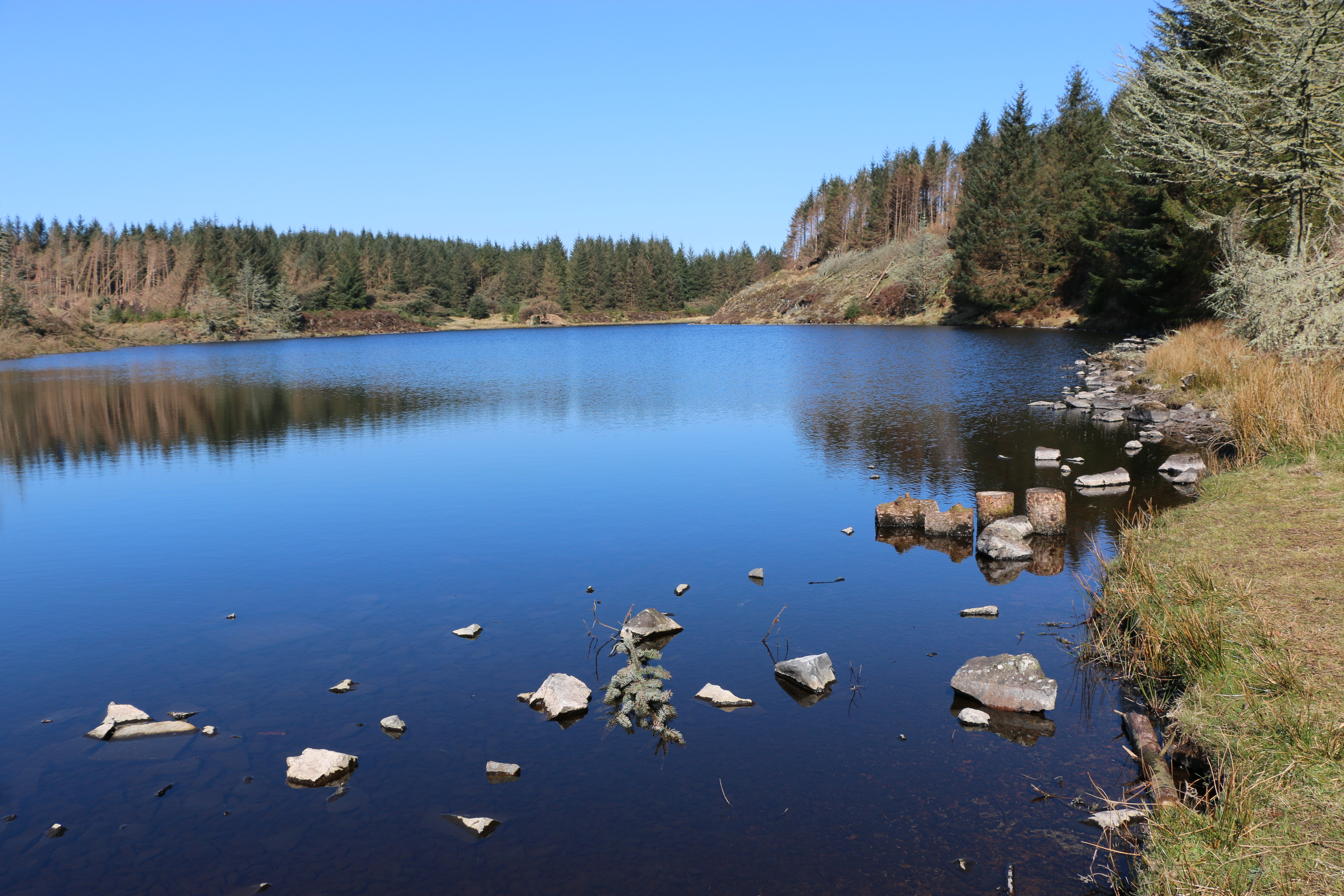
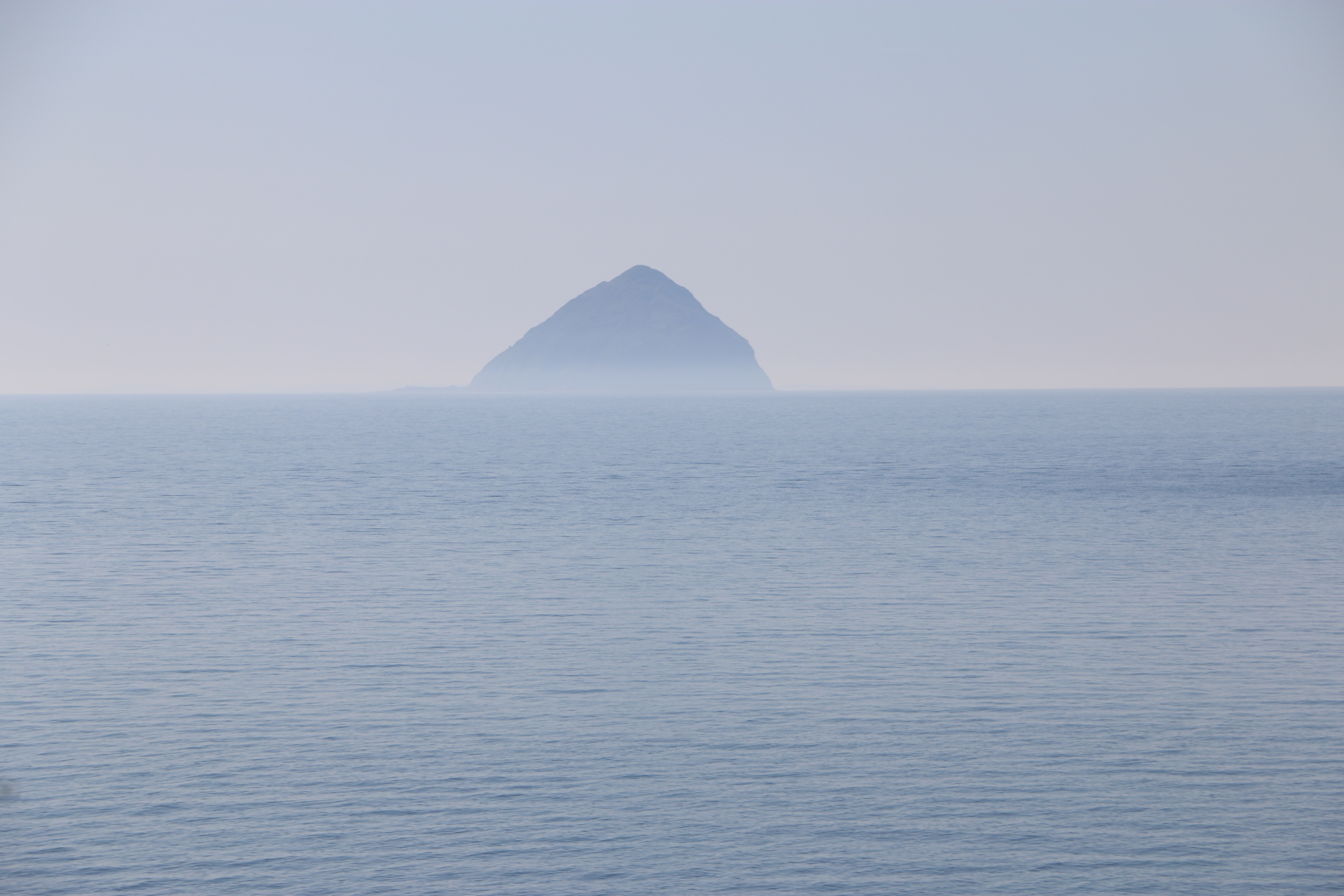
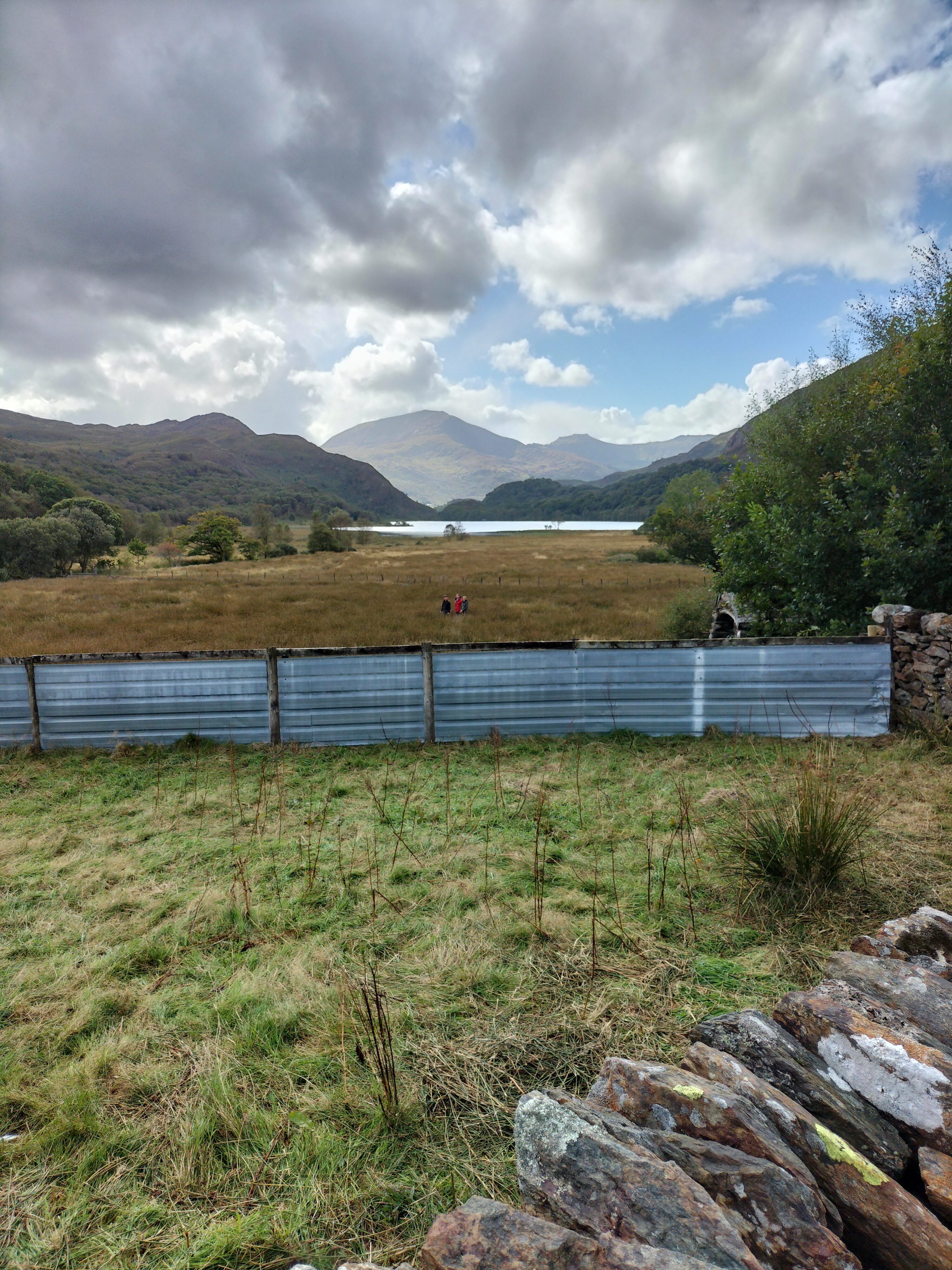
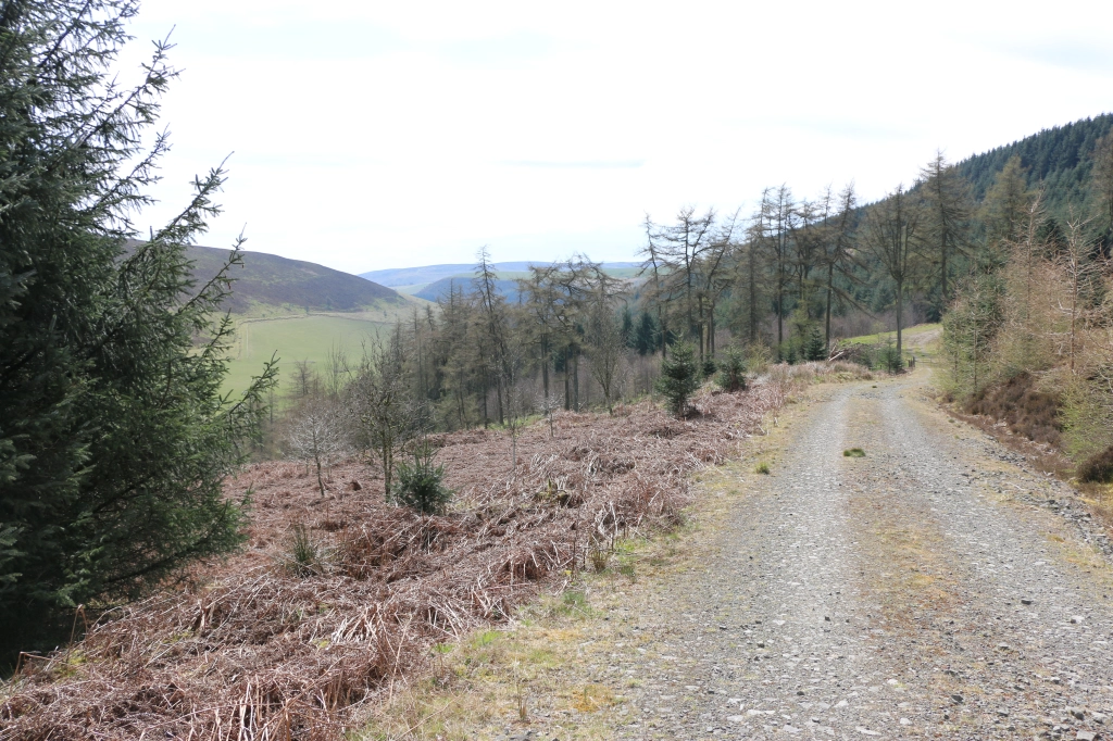
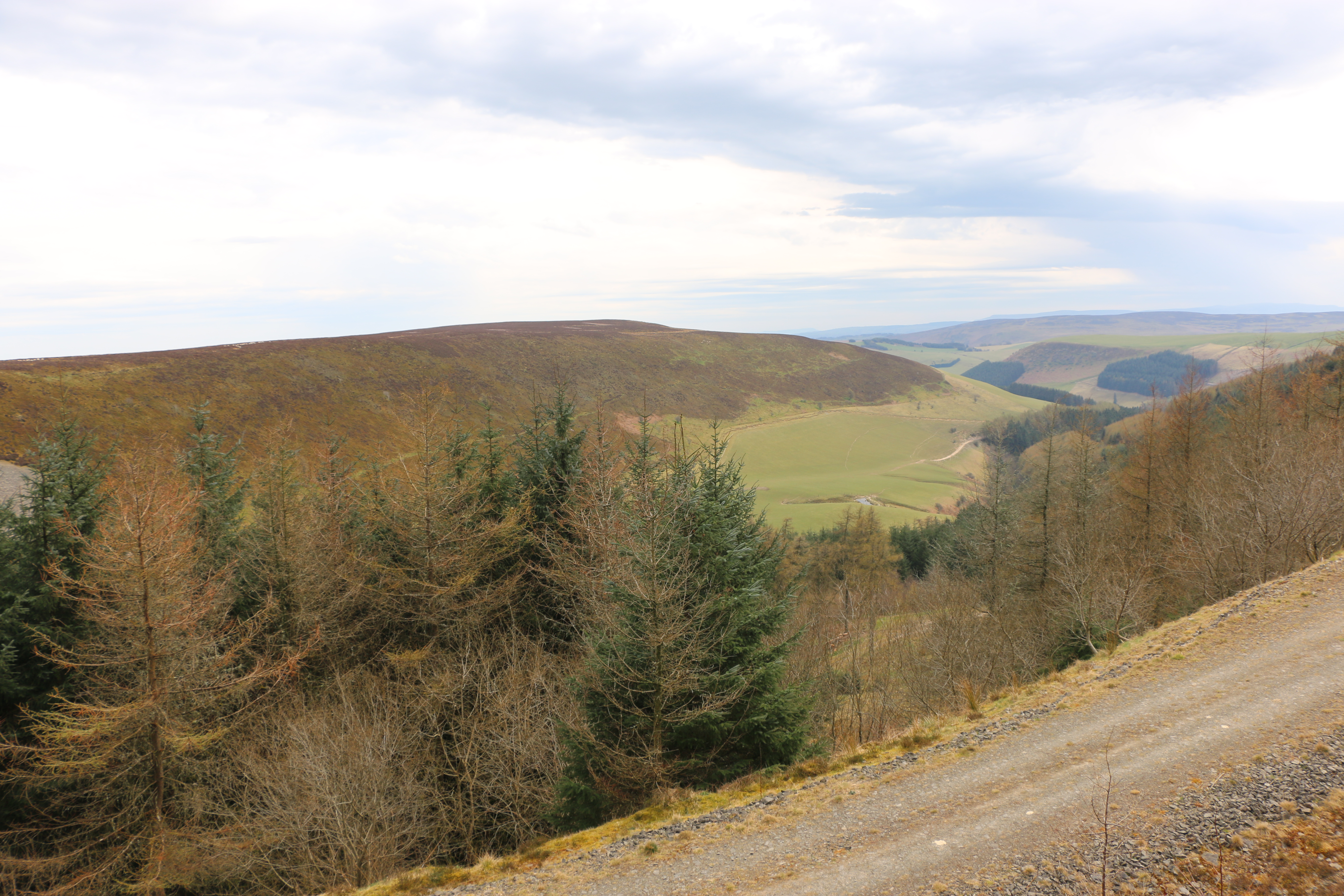
At a stone seat there’s a path junction with a signpost for Loch Garbad. From the description on the map we are following we expected to be walking though woodland but no; all the forest towards the loch has been felled under the Eas Mor project. This is the gradual conversion of the commercial conifer plantations back to semi-natural trees, so many of these have already been planted as saplings. (I’ve included the Facebook link above, because I think it is so impressive what they are doing in so many areas).This is a vast open area of brash (the above ground parts of the tree that hasn’t been removed from the site after felling – the foliage, branches and crown). Not yet as attractive as it will be, but it has opened up a terrific view across to Pladda Island to Ailsa Craig….
We stop for a while to admire and take photographs. Then carry on along the track …
It’s a bit of a slog. We meet only one other couple with a dog. Dusk and it exchange pleasantries, as do we, and then we plod on. (Yes, that is a sly photo of Dusk and me, taken by the Photographer!) The track is rough and narrow in places. I wonder how it must have felt in past times, winding through the overgrown woods, and I appreciate the openness, being able to see that last hill before we get to Loch Garbad.
Not far now.
We’re told to ‘pose’ – As you may be able to see, neither Dusk nor I appreciate this.
We’re both much happier sitting down for a welcome drink of water and taking in the remote beauty of the loch, whilst the Photographer goes off to do his own thing.
An hour later and we’re off again, somehow managing to take a wrong turn and having to retrace our steps to get onto the right path down the hill. Eventually taking the steps past the waterfall again and towards …
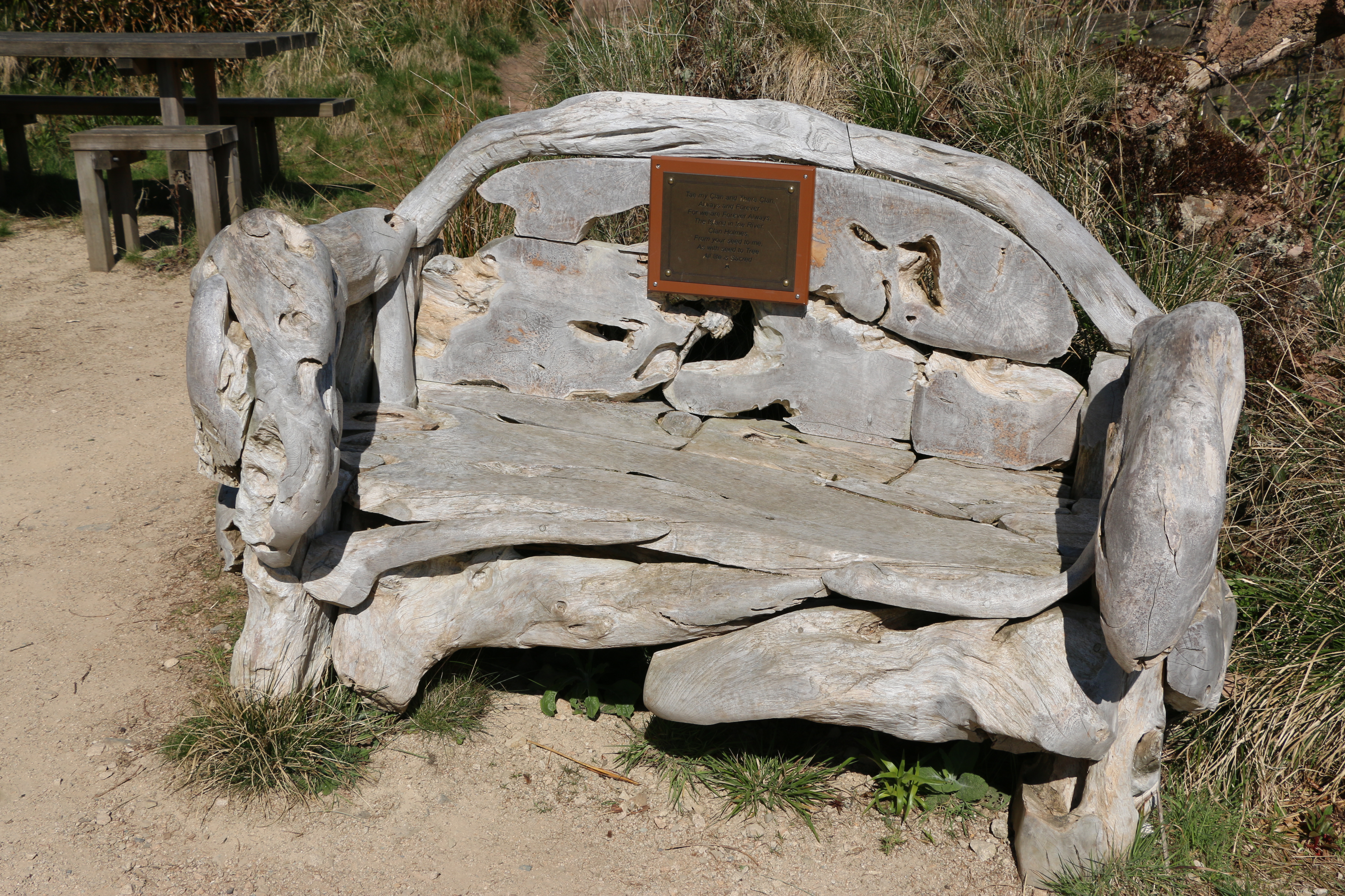
The Library in the Woods – which is exactly what it says – housed in a small log cabin it’s a hidden library in beautiful woodland, and filled with books and messages left by visitors over the years. Another project created by Eas Mor Ecology and built in 1998 from trees felled in a storm on Boxing Day.
Time to leave.We take a narrow path downwards through woods and across the bridge over the stream fed by the waterfall. Just in time … to see the cafe closing. “Never mind,” says the Photographer, ” We’ll be back at the house in no time. We can have a coffee there. What’s for tea?”
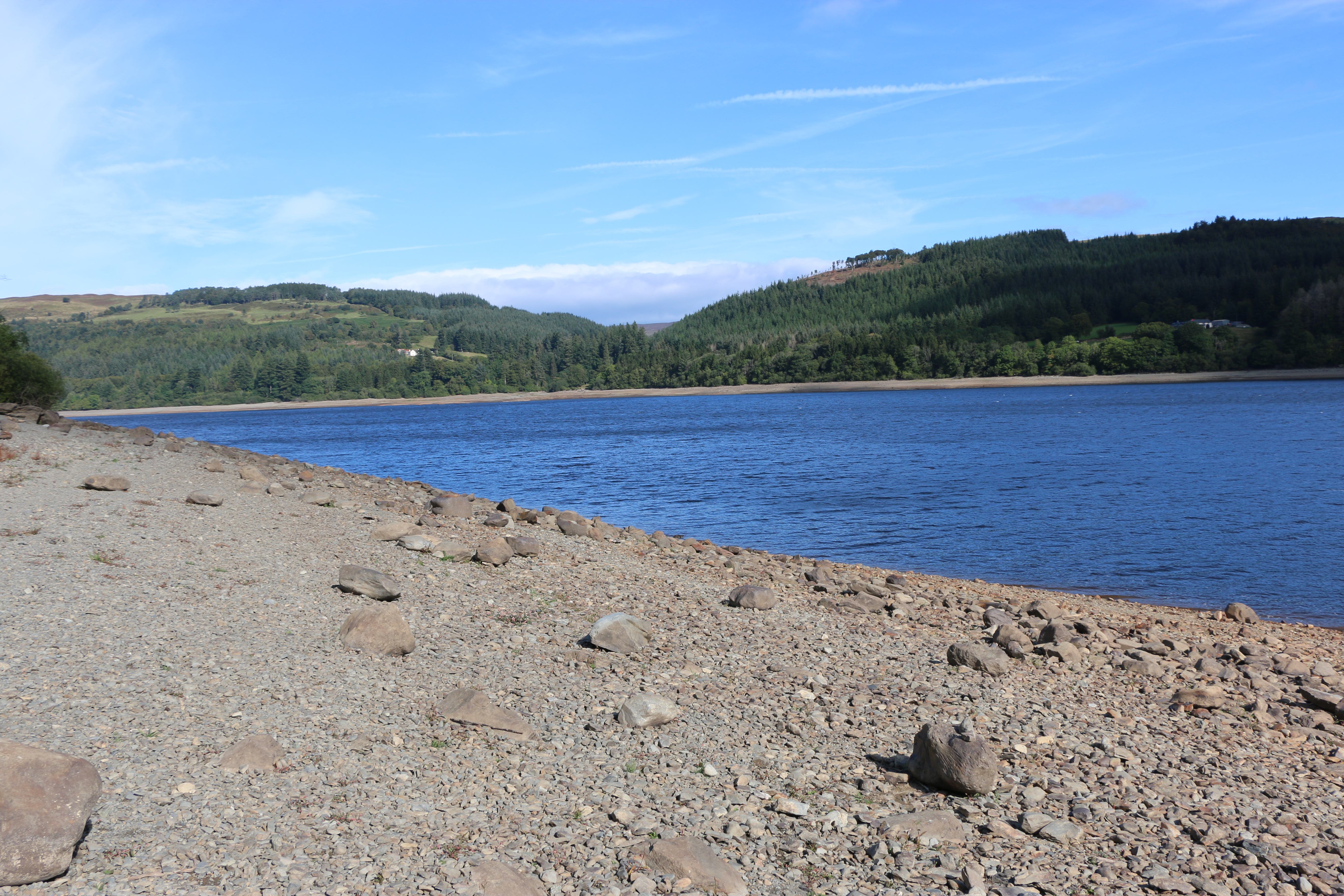
Llyn Dinas is a fairly shallow lake that lies on the valley floor a few miles north of Beddgelert in Gwynedd in north Wales. It is formed by the River Glaslyn. The lake takes its name from the nearby Dinas Emrys, a hill just downstream of the lake where a rock, Carreg yr Eryr (The stone of the eagle), was said ,in a charter of 1198 ,to mark the spot where the boundaries of the three medieval Welsh land division of Aberconwy, Ardudwy and Arfon met. According to Giraldus Cambrensis an eagle used to perch on it once a week, anticipating battle between the men of the three cantrefs.
We walked around Dinas Lake twice. Well, I say that. I should say we attempted to walk around the lake twice.
After that glorious, long day’s walk to Beddgelert, the clouds the following morning promised rain, and it was cold. Not to be thwarted we rugged up and set off.
On that first walk around Dinas Lake, we were attempting the one the National Trust recommended in the brochure we found in the cottage. We later discovered it was 1998 version, so unfortunately, the directions were out of date. Halfway up the hill it petered out into brambles and undergrowth.
Thisactually turned out to be fortunate. Giving up on the idea of cutting our way through the brambles – mainly because we didn’t have secateurs or knives, we backtracked and decide to walk to the end of the lake. Within ten minutes, we had hailstones bouncing down on us and we needed to shelter close to the stone wall under trees, alongside nine sheep who seemed completely oblivious to us. We gave up and went back to the cottage.
The next day, with the weather just about fine, we decided to try Lake Dinas again.
The water was calm, there was a party of canoeists preparing to go on the lake, and on the far side a group of children were being taken up a fast running stream. Dressed in hard hats and waterproofs it looked as if they were participating in a form of orienteering. From the screams of laughter we presumed they were enjoying themselves. Not for us we decided.
We crossed the bridge over the river to the path just as the rain started.
The path is banked by many rowan trees. There was a plethora of berries on them all. Is that a sign of a bad winter to come? Or is that an old wives tale? (as soon as I wrote “old wives’ tale” I wondered why it was called that. Apparently the name “old wives’ tale” comes from the fact that older women would often pass down their advice to the younger generation in the form of sayings that were easy to remember. The “wives” don’t refer only to married women, though. The term came from the Old English word wif, which means “woman.”) Just another rabbit hole I went down!!
At the far end of the lake we saw a farm house with outbuildings. There seemed to be a lot of activity. Despite the rain and being naturally nosy I urged the Photographer on with the words, ” I bet there’ll be a great view looking back along the lake.” It worked!!
This is the farm… Llyndy Isaf, a farm in Eryri (Snowdon) owned by the National Trust, since 2012 (Image: National Trust)
The farm was bought following a public fundraising campaign to preserve it for the nation. It has previously been home to five young farmers on a scholarship, who have managed Welsh Mountain ewes and Welsh Black cattle on the stunning site, which includes several Sites of Scientific Special Interest (SSSI:
Lake Dinas’ geology is important for nature conservation with habitats of saltmarsh, rush pasture, mire, mudflats, and reedbed, so is a natural home to a variety of wildlife, including bird species, such as Red Kites, Pied Flycatchers, Redstarts, Common Sandpipers, Dippers and Grey Wagtails, (a bird twitcher’s dream), over two hundred invertebrate species, and more many species of lichens and mosses, liverworts and hornworts ( bryophytes – non-vascular plants, which have no roots or vascular tissue, so absorb water and nutrients from the air through their surfaces).
When we approached the Llyndy Isaf farmhouse we were told it was a production team for television. They were more than willing to explain what they were working on.The National Trust has been on the hunt for someone to take over Llyndy Isaf farm. The process of choosing a tenant will be documented for Channel 4’s Our Dream Farm with Matt Baker, in early 2025. Applicants are vying for a fifteen year tenancy of the farm by participating in a three-week selection process. The Trust is seeking an individual with a fervour for sustainable farming.
A drone flew overhead filming Matt Baker with the lake in the background at the same time as the Photographer was attempting to take his photograph at the end of the lake. I’m just hoping the drone didn’t capture the two bedraggled people peering over the wall. I guess, when the programme is aired, we’ll see…
‘Let’s go to Lake Vyrnwy,’ Husband said. ‘Take some photos.‘
“Take some photos”, is a phrase that has been used many time down the years of our marriage. Sometimes it makes my heart sink; it often means I carry on walking along a chosen trail, before realising I’ve left Husband behind, oblivious, and capturing, “just the right shot” and have to retrace my steps. I have complained that this means I have walked miles more than him, but he, (“quite reasonably,” he says) means I’m burning more calories off. I ignore the implication of this… normally… but make sure I eat his chocolate bar as well as my own, when we stop for lunch.
Anyway… Lake Vyrnwy...
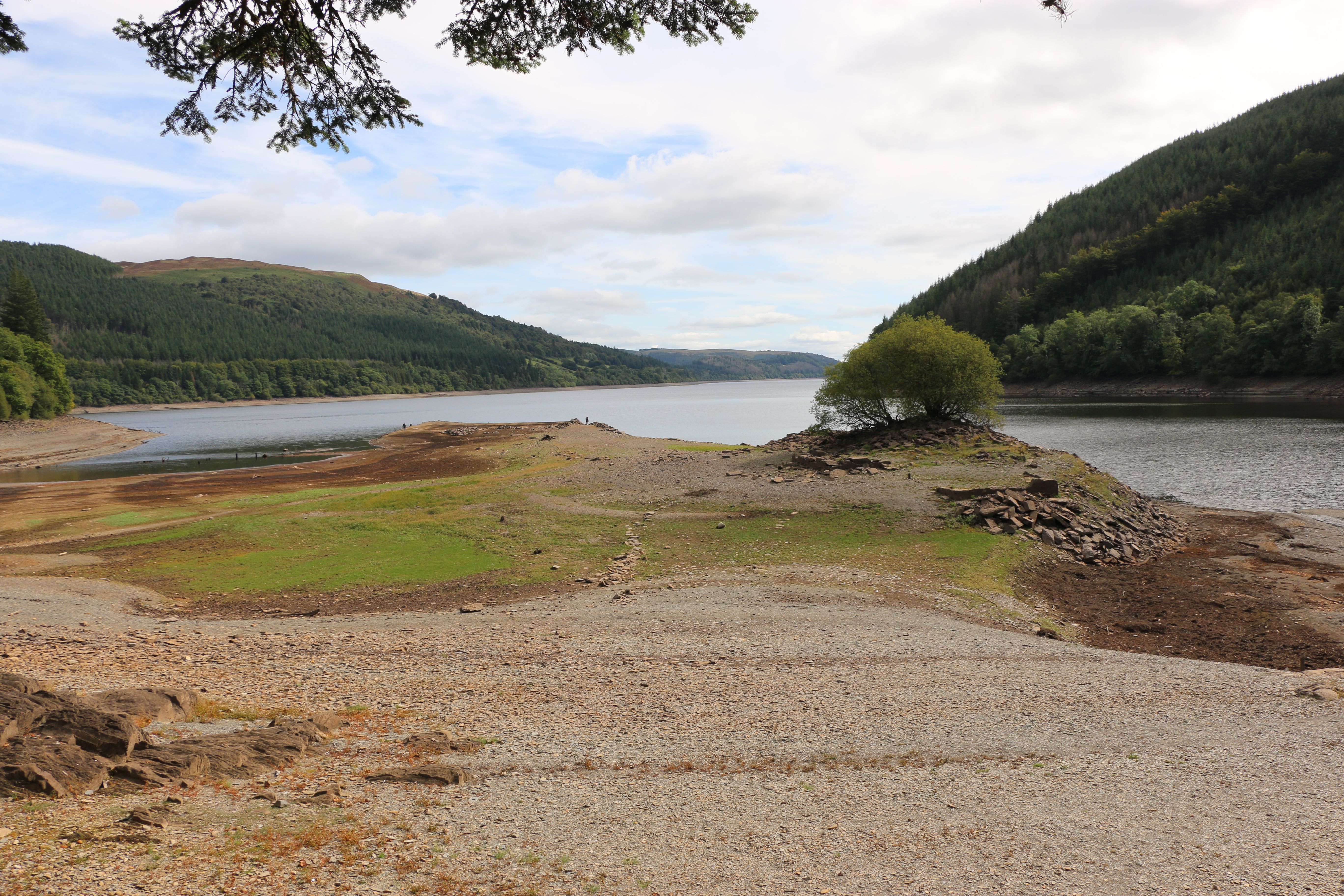
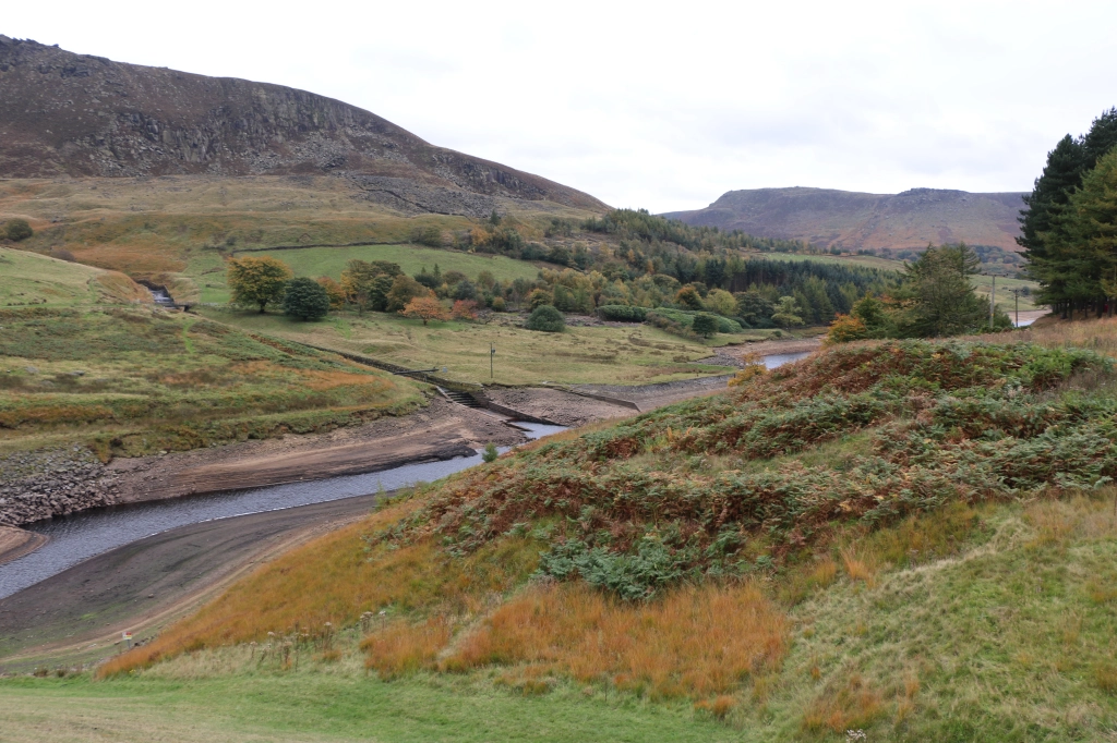
Just on the edge of The Snowdonia National Park and south of Lake Bala, Lake Vyrnwy is set amidst the remote and beautiful Berwyn Mountains. With spectacular waterfalls, and unspoilt open countryside. Except that, although the scenery is, as always, fantastic, the waterfalls are sadly depleted. As is the reservoir. However, since these photos were taken in August, and we’ve had such downpours, with fingers crossed, an inch or two may have been added to the water level. One can but hope!
We parked in a designated area that was supposed to be on the edge of the lake. It wasn’t; the water was so low we could have walked quite a few metres on shingle that should… would … in ‘normal times’ be submerged. It reminded us that, underneath, was a village, lost many years ago.
Llanwddyn was a village on the hillside next to the Cedig river. There were thirty-seven houses, three chapels and a Church of St John, and, in the surrounding countryside, ten farmsteads. Farming was the main occupation of the people in the valley, they ate simple food, such as mutton broth, porridge, gruel, and milk and burned peat from the moors in their fireplaces.
But, with expanding industries in the the Midlands and the north-west of England, and the prospect of higher wages, many people left. To make matters worse for those still trying to make a living from the land, in 1873 the local vicar,Reverend Thomas H. Evans published a report that the area was useless for agriculture, because it was waterlogged for much of the winter.
Seeing this, made us realise how many streams must has poured down the hills. Imaging the rush of water, I suppose it’s easy to understand the Reverend’s statement. Yet it has left me wondering why he wrote the report. Was he paid? Were the villagers aware of what he’d done? If they did find out, what was the reaction? I haven’t been able to discover that. The writer in me is itching to research that time. It did coincide with a time when the authorities of Liverpool were exploring the country for sites to build a new reservoir to cope with the growing population on both sides of the Mersey. So who’s to say!
Various sites were under consideration in northern England and Wales, but in most cases there were snags By 1877 a group of engineers arrived in Llanwddyn. Their visit was to look into the possibility of damming the river Vyrnwy. A survey revealed a large area of solid rock, just where the valley narrowed, two miles south of the village, which could act as a base for creating a large, artificial lake that had the potential for holding many millions of gallons of water.
It brings a feeling of awe, of sadness, almost, to be walking on land that is normally submerged under water, on land where a village once stood, where people once lived.
Driving further around the lake we pass a sign at the side of the road – “Track to impressive hillside view. Not to be missed”. Well, if ever there was a challenge to a photographer, that was it. Husband got out of the car and disappeared for a few minutes, soon to return. ‘It doesn’t look too bad. Come on.’
And indeed the first few steps were not too bad. And then we turned a corner… to be faced by an almost vertical path, a rocky vertical path. I stopped; why do I always let myself be fooled?
‘Come on, it’s not far!’ He said that numerous times for the next ten minutes. Hauling me from bend to bend. ” Think of the view!”
I couldn’t think of anything, except how to get my next breath.
But I had to admit, the view was worth it. The coniferous forests planted around the lake by the Forestry Commission are impressive.
On the way back, Husband found two stout branches to use as walking sticks, to scrabble down between mossy rocks and sliding muddy stones. It was either that or an undignified descent on my backside.
In 1880 the Liverpool Corporation Waterworks Act was passed by Parliament, and received the Royal Assent. Preparations were at once put in hand to gather the work-force and equipment necessary for the construction of what was to become the first large masonry dam in Britain and the largest artificial reservoir in Europe at the time. Work on the site began in July 1881.
The stone for the masonry was obtained from the quarry specially opened. All other materials were brought by horse and cart from the railway station at Llanfyllin, ten miles away. Stabling for up to 100 horses was built in Llanfyllin. The labour force topped 1,000 men at the busiest stage of the work on the dam. Many of them were stone masons working in the quarry, dressing the stone which was not easy to handle.
In a very short time the dam was completed. The village of Llanwddyn, and all buildings in the valley that were designated to be covered by the water, were demolished.
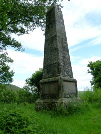
St Wddyn’s church was built on the hill on the north side to replace the parish destroyed by the flooding of Vyrnwy valley. Many of the graves were relocated from the graveyard of the old church to St Wddyn’s before it was flooded. It was was consecrated on the 27 November 1888, the day before the valves were closed. It took a year before the water reached and spilled over the lip of the dam.
On a previous walk, some years before, we witnessed a wedding procession coming from the church, led by a chimney sweep in all his glory. Apparently it’s considered lucky to see a chimney sweep on your wedding day, the belief being they bring good luck, wealth, and happiness. The bride and groom did look joyous. I would have loved to have tagged onto the procession, but, that day, we were looking for “a good view of the water”, further along the road.
On the same hill as the church a monument was erected in memory of ten men who died in accidents on the site during the building of the dam and another thirty-four who died from other causes at the time.
Stone houses, matching the stone of the dam, were built on either side of the valley for the people whose homes had disappeared under the lake. I suppose there must have been a lot of opposition to flooding the valley to provide Liverpool with water at the time, and since, but records have apparently shown that it brought prosperity and stability to the area.
Our final excursion on our walk was to the waterfalls.
One of the highest is the Rhiwargor waterfall at the northern end of Lake Vyrnwy. From the car park I was relieved to see the relatively flat path along the valley of the river Eiddew. There was a trail leading up and up along the side of the falls. Despite much attempted persuasions, I declined, and opted for a coffee and a picnic at a nearby picnic table. And I ate his chocolate bar! Well, after that impromptu climb earlier, I thought I deserved it.Who said I hold grudges?!!
N.B.The Lake Vyrnwy Nature Reserve and Estate that surrounds the lake is jointly managed by the Royal Society for the Protection of Birds (RSPB) and the Hafren Dyfrdwy (Severn Dee). The reserve is designated as a national nature reserve, a Site of Special Scientific Interest, a Special Protection Area, and a Special Area of Conservation.
There are places that remain in our memories, the details may become slightly blurred, nostalgia may colour our thoughts, but they don’t fade. And how those places made us feel at the time is the one thing that remains.
This is a round-up of the Places in our Memories posted over the last few weeks. There have been some wonderful memories shared by writers from all over the world who have joined in the series so far:
Thorne Moore tells us about her first real grasp of history. “The past was just under my feet and nothing was permanent after all…”
Robbie Cheadle tells us about her life as a child and how she’d lived in twenty-one houses and attended fourteen schools, before the age of twelve. And of her love for her sisters…
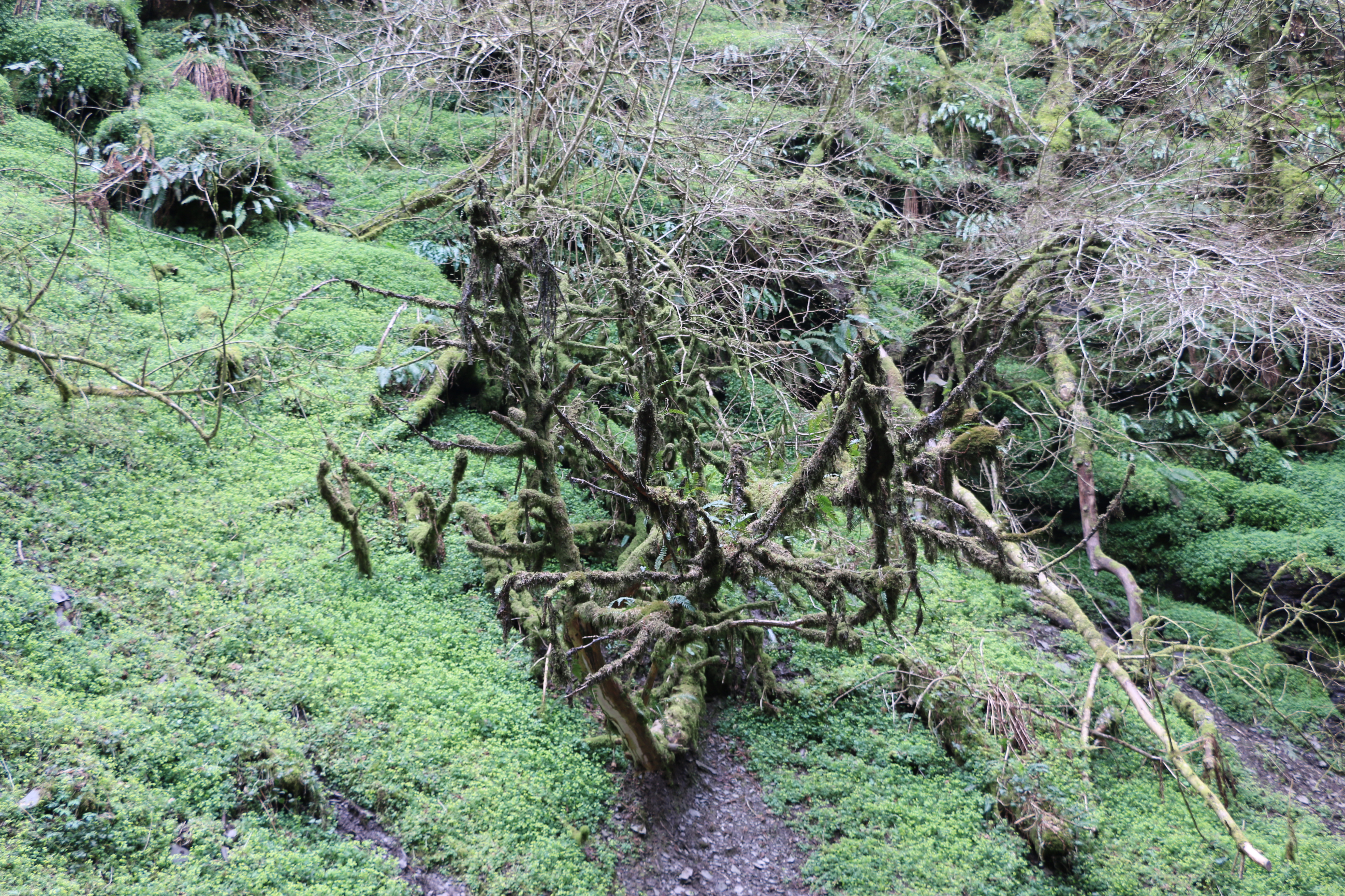
The sunny day disappeared as we walked through the short steep-sided gorge – following in the footsteps of Victorian touristto the Water-Break-its-Neck waterfall, around a mile from the village of New Radnor ( Maesyfed – the Welsh name), in the county of Powys,Wales.
It was a spectacular sight.Yet, beyond the sound of the water it was strangely silent.
The water tumbled through the black slated rocks, a silvery mesmerising flow, to the small stream and creating a fine rainbow mist in the air. Yet there was an eerie and ephemeral feeling to the fallen, bare oak branches laced with lichen and boulders covered in dark green moss and surrounded by curtains of gently swaying ferns.
We made our way back along the narrow path. I thought we would be taking a slow ramble along the walking trails in Warren Wood – so named for the labyrinth of rabbit warrens that kept the locals fed for centuries, now dwarfed by towering beeches, oaks and conifers.
Husband had other ideas. ‘Let’s walk up the road to the top of Warren Wood,’ he said, pointing vaguely to the left as we left the path. ‘We could get some brilliant photographs.‘
‘How far is it?’
‘Not far.’
I’ve been caught out by “Not far”, before. Why do I always believe him?
If only I’d read the Nature reserve signage:
“In the 1800s The Victorian landowners planted trees on the moorland, to provide a landscape of scenic beauty thus creating a forest, part of Radnor Forestwhichwas once a royal hunting ground. In those days it wasn’t an area covered in trees but an unenclosed piece of land, legally set aside for the Norman kings to hunt deer. Today, Radnor Forest is a land of hill farming and moorlands, steep narrow valleys and hills, rising up to the highest point in Radnorshire, Black Mixen at 650 metres.“
Note the words, ‘steep’, hills, and 650 metres. What we didn’t know, was that the wide concrete road in front of us was not only steep but has many twists and turns – and always upwards before it got to 650 metres.
Two and a half hours later, with stops for photographs, we reached the top… I thought. We sat on a convenient rock, drinking from our second bottle of water.
‘We could go on for a bit longer?’ Husband said.,looking around. ‘The road carries on.’
‘The proper road stops here not up there.’ I pointed to the dirt track behind us. Steep dirt track.
I’I bet we could get brilliant photos, though. I’ll go and check.’ Ten minutes later he was back. ‘Come on, it’s a fantastic view.’
We walked in silence. Well, to be honest I had no breath to use up in conversation.
Though the views were wonderful. We could see as far away as Hereford and beyond…..
‘Ready to go back?’ Husband asked.
I didn’t think I could face that road again. ‘We could try going that way?’ I point to a gentle downward sloping track.’It looks like it’s going back to the start.’
‘It doesn’t.’
‘It does.’I insisted.
I should,perhaps have said, before now – I have little sense of direction. We stumbled/slid down walked for over an hour with the wind whistling through the tall conifers that lined the ever-steeper, downward track. I became increasingly aware of a brooding silence, each time I said cheerfully,’It has to lead to somewhere…’ and, ‘We’re going in the right direction…’. Until we weren’t… we rounded a corner- to see the road end in a turning point for the Forestry Commission. A thick forest faced us…Hmm…
Back we went,stopping every fifty paces to catch our breath. To be fair there were only a few recriminations. Although I did hear some mutterings – which I ignored. Later,we worked out that we had walked thirteen miles – seven more than we had planned.
The following day we creaked our way rambled sedately aroundthe fields where we were stayingnear Bettws Cedewain, a place in a sheltered valley on the banks of the river Bechan. around five miles from Newtown. The village grew around the crossing of the river where a church was founded by St Beuno in the sixth century. I read that the name of the village is thought to derive from the Welsh word ‘Betws’ – which means a prayer house or bead house where the number of prayers had been counted on beads by the earliest church-goers in Cedewain.