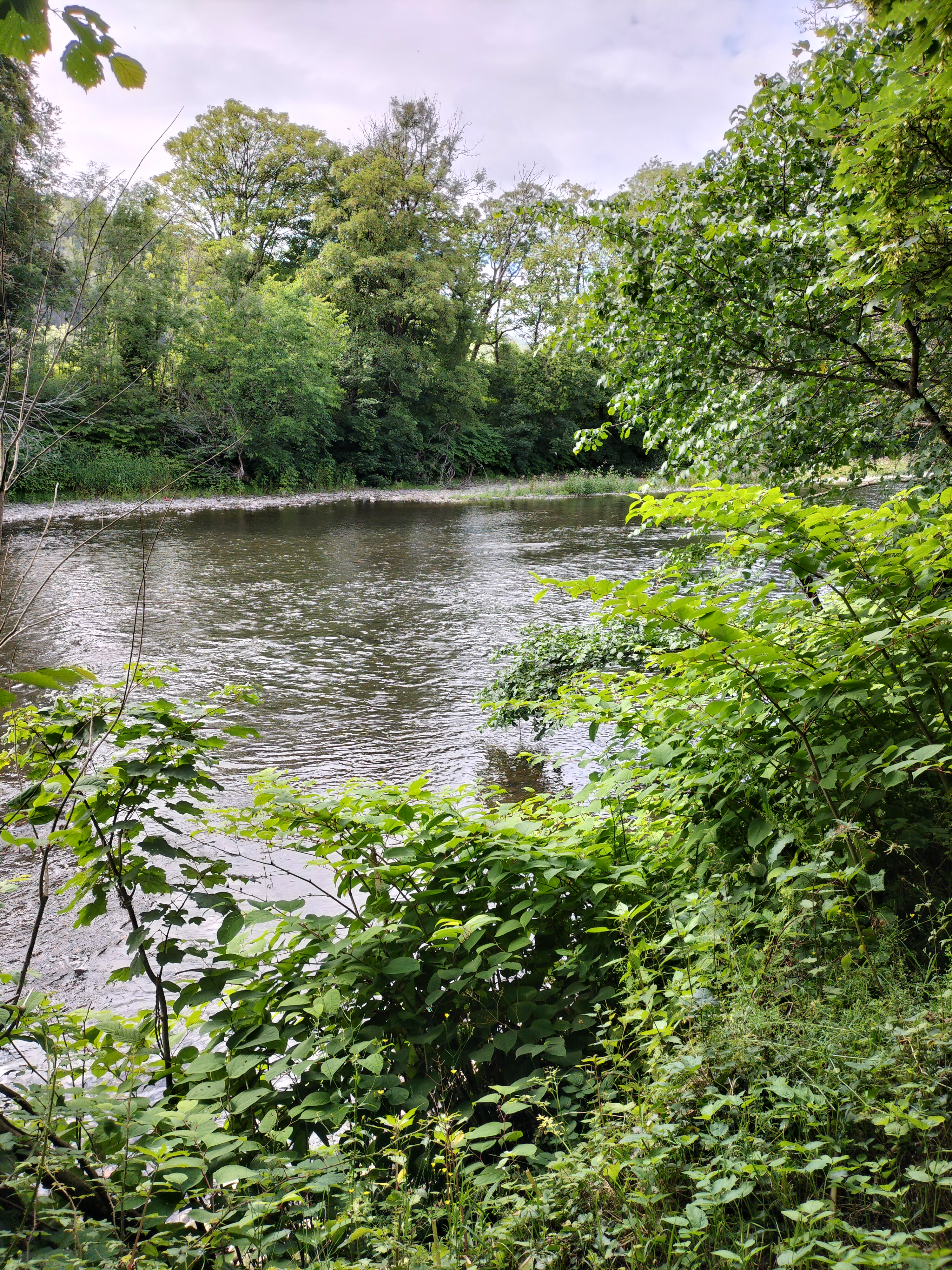
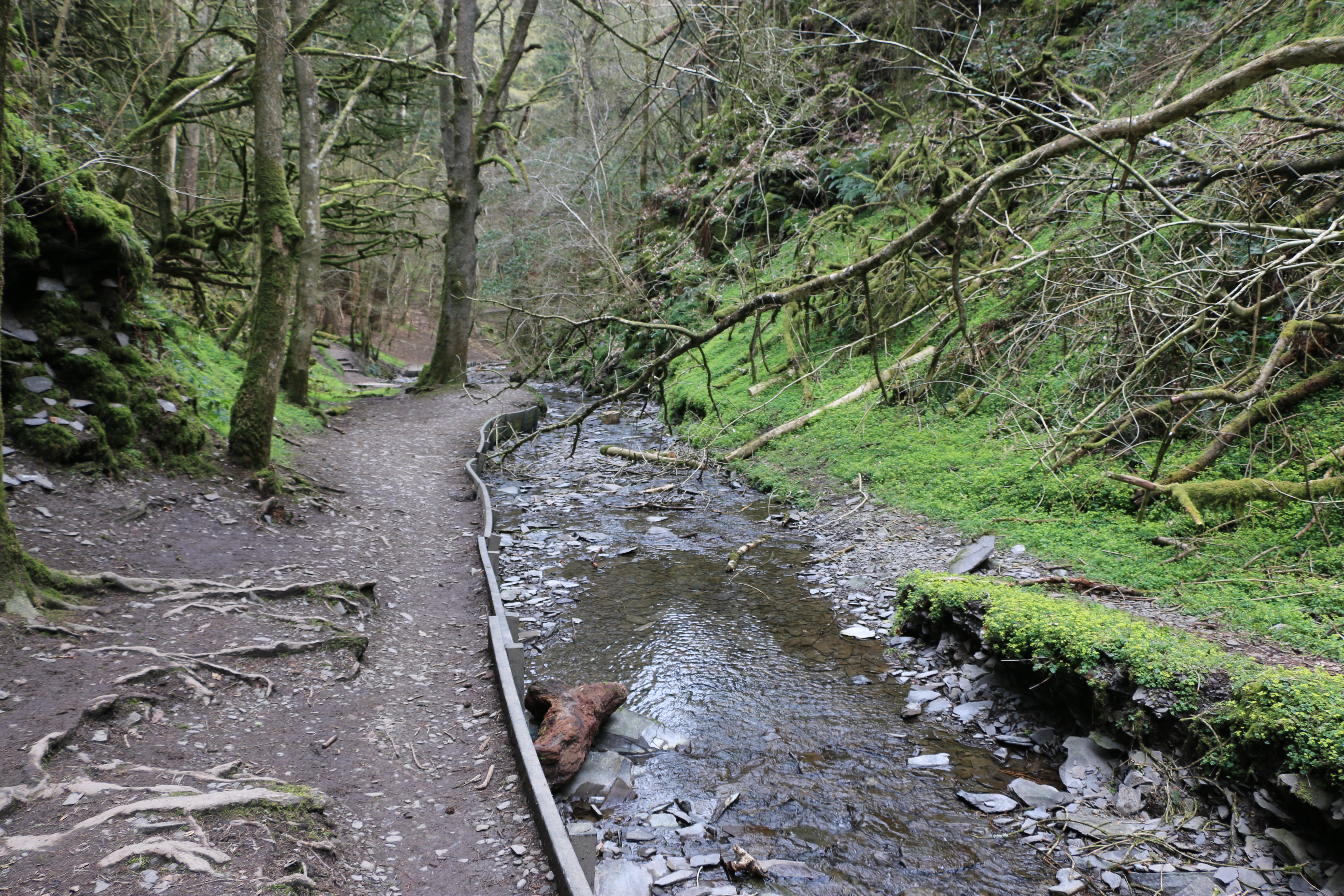
The start to our week of walking in the Yorkshire Dales and we began with an easy stroll along the banks of the river Ribble. The name ‘Ribble’ is thought to derive from the Breton word ‘Ribl’ meaning ‘riverbank’. The river begins in the Yorkshire Dales in Ribblesdale, at at a spot called Gavel Gap high on the moor above Newby Head. It’s a famous salmon river and in the Autumn it’s possible to watch salmon leaping up the various waterfalls along its course.
But we’re here in May, and it’s the time of bluebells and wild garlic.
Ribblesdale is the best known walking area in the National Park and features Yorkshire’s famous Three Peaks – Whernside, Ingleborough and Pen-y-Ghent (more about the last on my next post) – offering challenging walks and amazing views. This short walk is the easiest section of the Ribble Way.
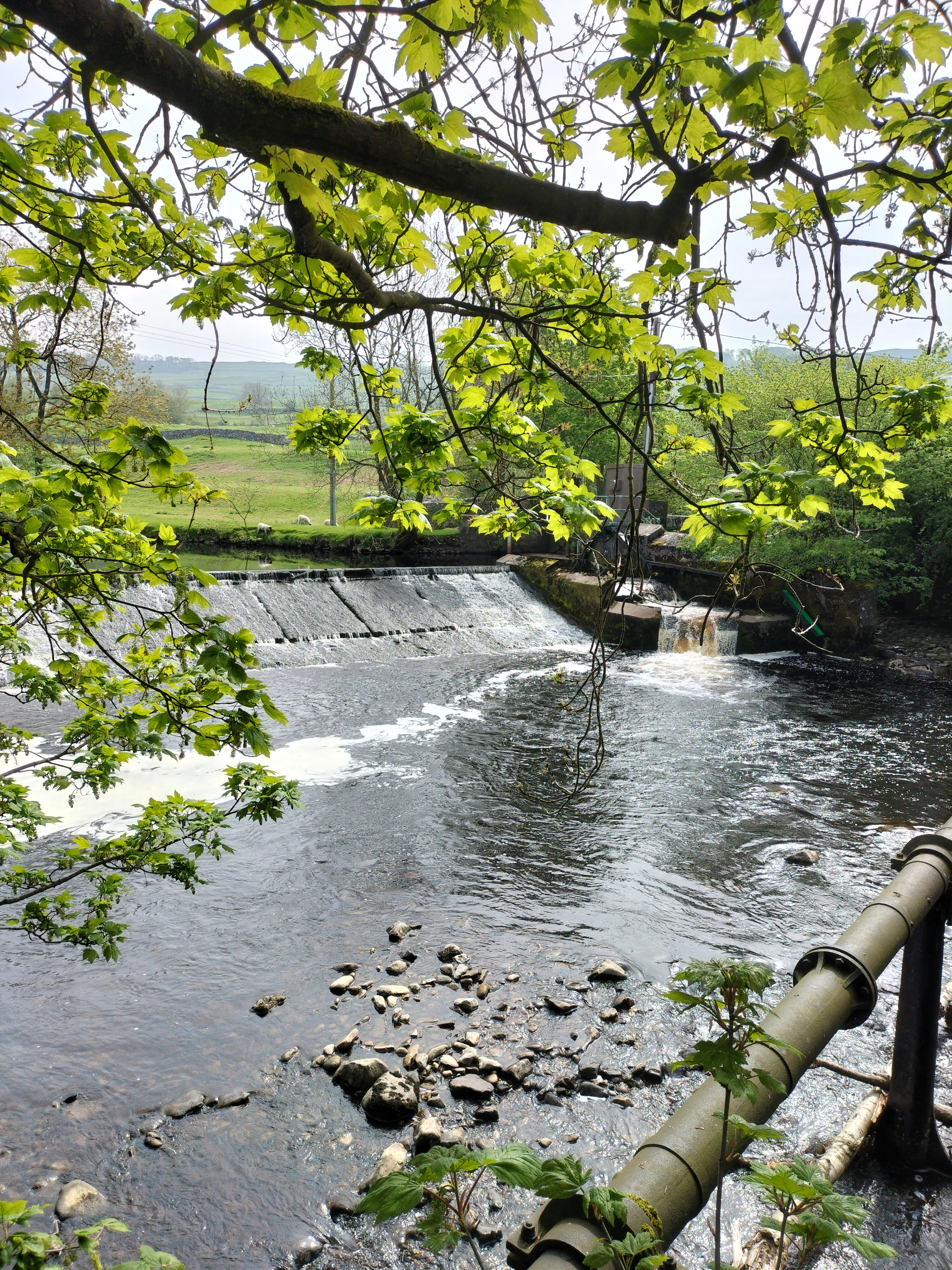
The weir at Longcliffe.
We passed the remains of old cotton and snuff mills, industries long gone now but the houses that were the homes for many of the labourers still stand, strong buildings many built of the local grit stone.
Nearby is the town of Settle where the hydro harnesses the river to create clean, green electricity.
Photograph courtesy of settlehydro.org.uk/
The Hydro is powered by water from the Ribble immediatelyabove the weir, through a sluice gate, down what is called the Archimedes Screw (the turbine) and back into the Ribble just after the base of the weir. Electricity is generated by the falling water rotating the turbine which, in turn, drives a generator. The electricity is fed by a direct line to the old mill building which is now apartments. Any electricity not needed by the apartments is fed into the National Grid.
It was a lovely easy trail, the weather was good, a perfect stroll through the fields and on the Settle bridleway.
And perfect for the photographer to capture two of his favourite subjects… Water and reflections.
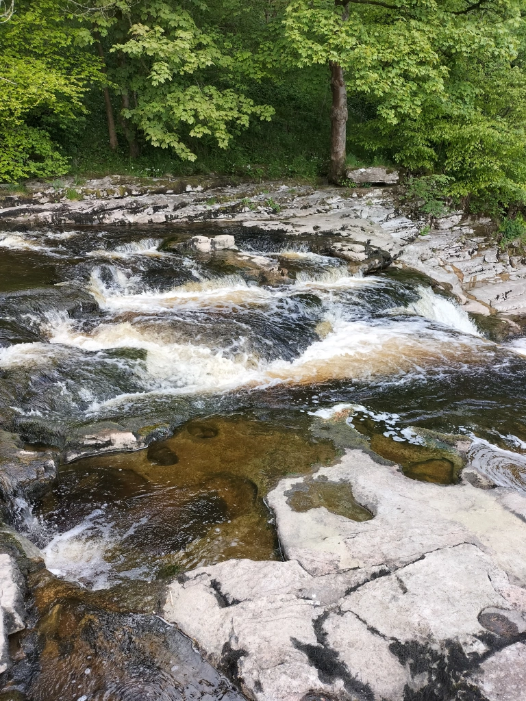
Our main aim for this walk was to see Stainforth Force,the two metre high cascade waterfallwhere the salmon leap in the Autumn.
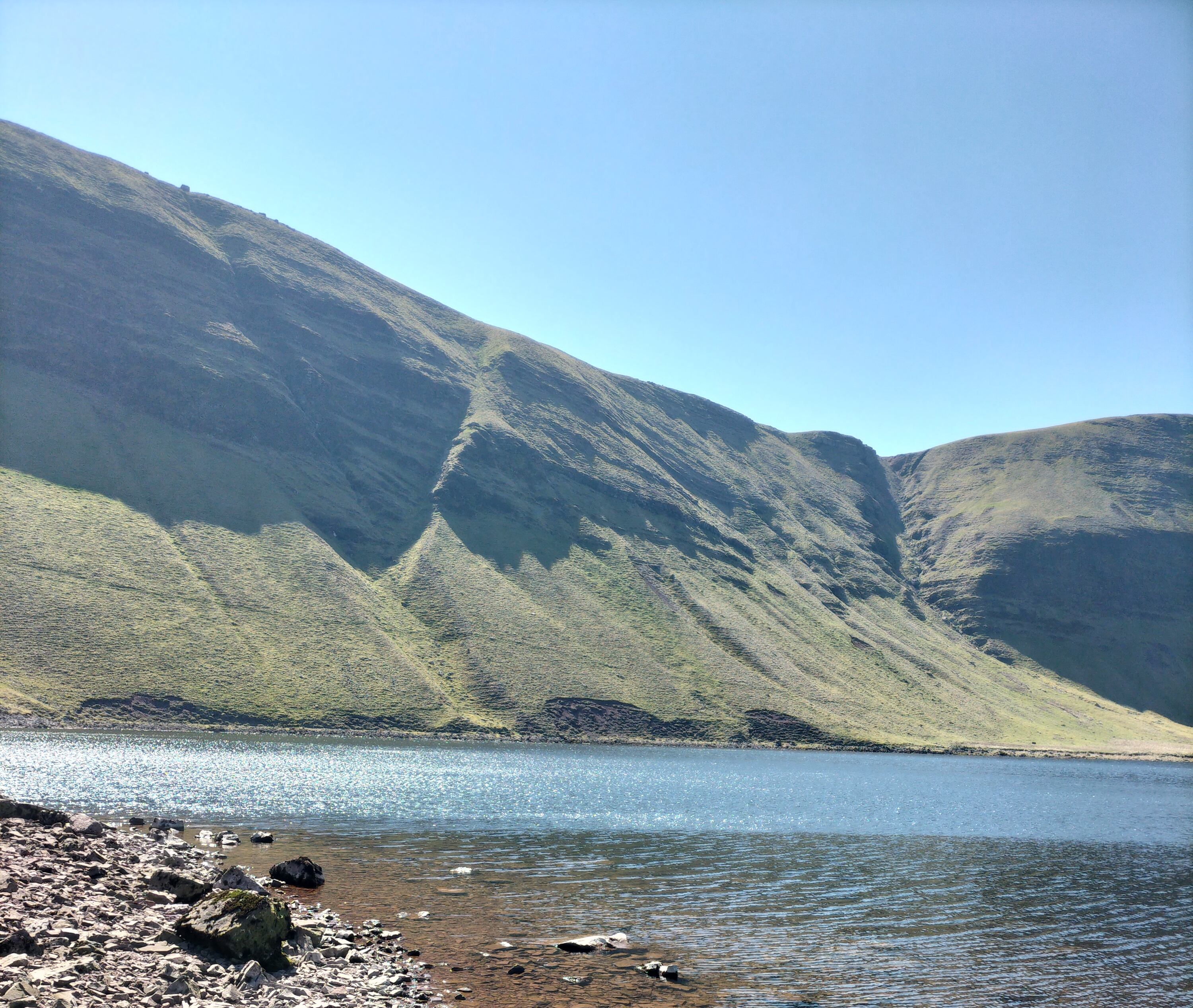
Llyn y Fan Fach is a glacial lake in the Brecon Beacons situated beneath Picws Du mountain, the second highest peak of the Carmarthen Fans in the Carmarthenshire section of the Black Mountain in the west of the Brecon Beacons. (The name Brecon Beacons has recently reverted to its old Welsh name, Bannau Brycheiniog, which means “the peaks of Brychan’s kingdom”)
For anyone interested Brychan Brycheiniog was a legendary 5th-century king of Brycheiniog (Brecknockshire, alternatively Breconshire in Mid Wales.
Brychan depicted in a window of the church in Brecon, Wales.
There is one thing I want to say before we go any further with this post.
Never believe the stats!
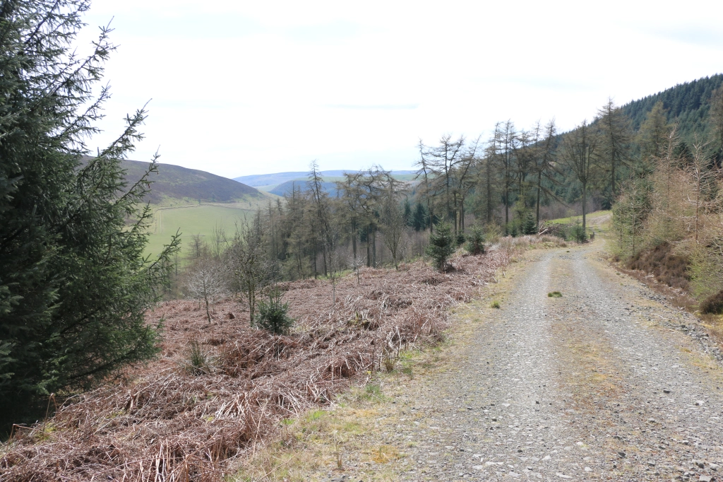
Distance: 9.2 miles (14.8km) circuit (Let’s just say Circuitous! Or, if you’re really wanting to be pedantic – like a dog’s hind leg… or two!) Elevation gain: 720m (Gain is the right word. The exhilaration of getting anywhere near that height makes one feel as if one has reached the top of the world. If you can get enough breath to get that far!) Difficulty:Moderate (if you can call the initial mile of a one in ten ratio upwards on a stony, gravelly track, followed by steeper narrow paths – Moderate.
The Llyn y Fan Fach car park near is reached by a winding single track road (with the added bonus of few signposts in an area that the SAT NAV doesn’t recognise – we went in a complete circle at one point) and is remote with no facilities. At all (Am I selling it to you yet? Hmm? Well… I will… later. Honest.).
All the previous being said, we had a wonderful day’s walk. Hike… I should have said hike, here(Or even … climb!)
Actually, when we arrived there was a group of young people from London who were walking the area as part as their Duke of Edinburgh Award. Very chatty – when they stopped to get their breath – which was as often as us. So I didn’t feel that decrepit!
And, of course, we had a picnic sitting by Lyn y Fan Fach, a beautiful lake surrounded by magnificent craggy mountain peaks. Sheltered by a wall, with the sun warm on our backs, we watched the grass swaying under the clear water, the surface a glistening reflection of the sky. The only sounds were the rustling of the wind, the cries of the skylarks, and, in the distance, the faint voices of people walking along the ridges of the Picws Du mountain
Which gave the photographer a chance to peruse the area.
Llyn y Fan Fach is renowned for Welsh Folklore. One folklore legendis the myth of ‘The lady of the lake’. In the folktale, a young farmer of the 13th century spotted the most beautiful girl he’d ever seen emerge from the lake, she was a princess from the kingdom of fairies. He courted the fairy princess by baking her bread and after three attempts he succeeded in winning her hand in marriage on the condition that if he hit her three times she would leave him. He complied easily because she was so beautiful and they were happy for years bringing up a family at his farm near Myddfai, with her magic dowry of farm animals. In time the inevitable happened he hit his wife (reported as apparently playfully!?) and she disappeared back into the lake taking her prized animals with her, leaving the farmer with her sons. The sons once grown became known as the “Physicians of Myddfai” who became physicians to the English royal court..
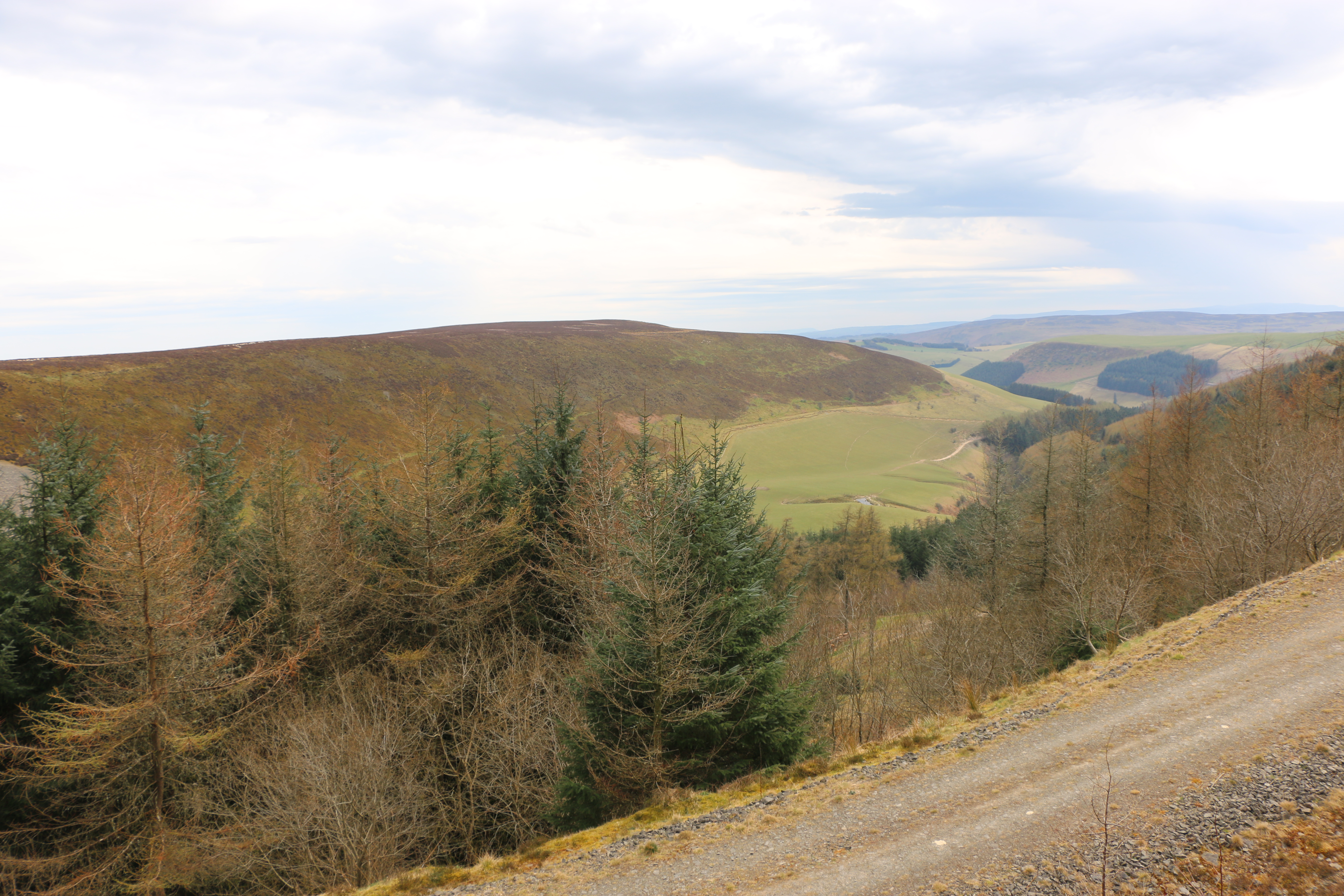
Further to the east, beneath the peak of Fan Brycheiniog, there is another larger lake called Llyn y Fan Fawr. These lakes and peaks can be visited through a combination of mountain walks. We studied the climb to the right. A very steep climb. And decided to take the easier routeto the left.Easier for some – see below – the photographer in the distance, eager to get more photo opportunities.
It was so clear we could the rise and fall of the land for miles, it was stunning.
The path often disappeared under the mounds of long tough tussock grass and patches of boggy water. Though awe inspiring it felt very isolated: a few people far above us on the ridges of Fan Brycheiniog, a man striding, then sitting down, in the distance, a group of young men studying compasses and maps.We stopped – often – when skylarks rose and fluttered in front of us, desperate to take us away from their nests in the undergrowth. The wind came in strong cold bursts, and after we’d walked another mile, we knew, however disappointing it was, that we should turn back; not try to reach the other lake, Llyn y Fan Fawr, beneath the peak of Fan Brycheiniog, The speed we were going, we would chance being there after dark. Perhaps we shouldn’t have lingered so long at the first lake.Or set out earlier in the day. Or not got lost.
So, after a couple of photo shots, we made our way back across the land and down the track to the car. The Duke of Edinburgh students were still somewhere on the ridge. Knowing how they had dreaded the climb I didn’t envy them. And yet, not having achieved what we set out to do…
Still, a wonderful day in all.
Until the next time we attempt this walk …. or not.
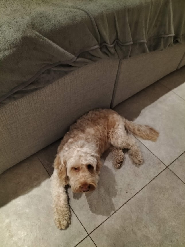
I’d no intention of getting lost – but there again, I never do. It just happens. Usually I have a husband (not a random husband, the one I’ve had for some years) to point me in the right direction. He’s used to me saying ” how far away are we from where we were?”, but this time I was on my own. Well, me and daughter’s dog, Benji.
Looking non too happy. (the reason will become apparent later)
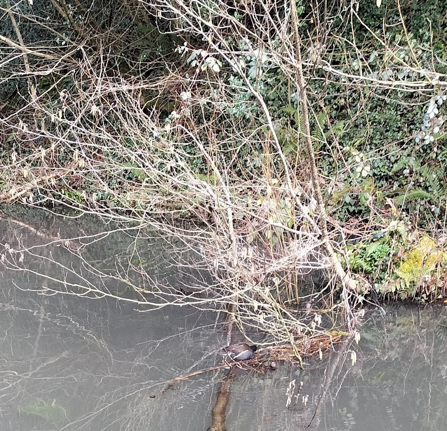
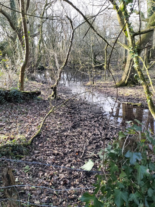
Radyr Woods is around fourteen acres of woodland, with a network of footpaths, boardwalks, and steps throughout the wood.
There is easy access to a mixed woodland and include a local nature reserve (Hermit Wood), with a canal, streams, ponds, springs, grass and heath land.
And ducks.
Look carefully… there is a duck, hiding on a mix of branches… honest!
And another… swimming this time.
And there are interesting panels explaining the intriguing history of the area...
Apparently there are the remains of a late-Prehistoric burnt mound where hot stones would have been immersed in water until it boiled and the burnt and broken stones or pot boilers formed the mound. Although it’s not known what the mound was used for (one could guess rituals – but I’ll go no further with that idea) The mound wasn’t discovered until 1911, but it is evidence that the site was inhabited centuries ago. There are also rumours that a 10th century holy well existed on the site In medieval times Radyr Woods formed a part of the walled deer park of Radyr Court, the historic home of the Mathew family.
The area was farmed and quarried up to the mid 20th century. Conglomerate stone from the Radyr Quarry was used in the construction of both Llandaff Cathedral and Cardiff Castle.
There were quite a few other dog walkers to pass pleasantries with and allowing the dogs to sniff one another’s bottoms socialise. Then I met a man walking his dog, and his ferret
He offered to show me how the ferret walked on the lead. But I had seen him walking towards us for some time. And Benji was showing rather too much interest in the proceedings. I thought it safer for the man to hold said ferret up high-ish. Still a bit too close to Benji, I thought. His dog just looked bored.
I walked on, not noticing which paths I took. Until I realised I didn’t know where I was, and how to find my way back.
When one path seemed to run out and I sank into the mud I thought I’d better turn back. After wandering aimlessly for ten minutesI met a young woman I’d spoken to earlier and when she realised how clueless I was, she took pity on me and, with the aid of Google maps (“you haven’t got Google maps?!”, looking askance at me), walked back with me (quite a long way) to where I eventually recognised a path.
Quite fortuitous meeting her, actually. She belongs to a reading group and I’ll be going to talk with them sometime soon.
As for the sulky looking Benji at the start of this adventure – covered in mud when we eventually arrived back at the house, he needed a bath. And wasn’t impressed.
‘Let’s go to Lake Vyrnwy,’ Husband said. ‘Take some photos.‘
“Take some photos”, is a phrase that has been used many time down the years of our marriage. Sometimes it makes my heart sink; it often means I carry on walking along a chosen trail, before realising I’ve left Husband behind, oblivious, and capturing, “just the right shot” and have to retrace my steps. I have complained that this means I have walked miles more than him, but he, (“quite reasonably,” he says) means I’m burning more calories off. I ignore the implication of this… normally… but make sure I eat his chocolate bar as well as my own, when we stop for lunch.
Anyway… Lake Vyrnwy...
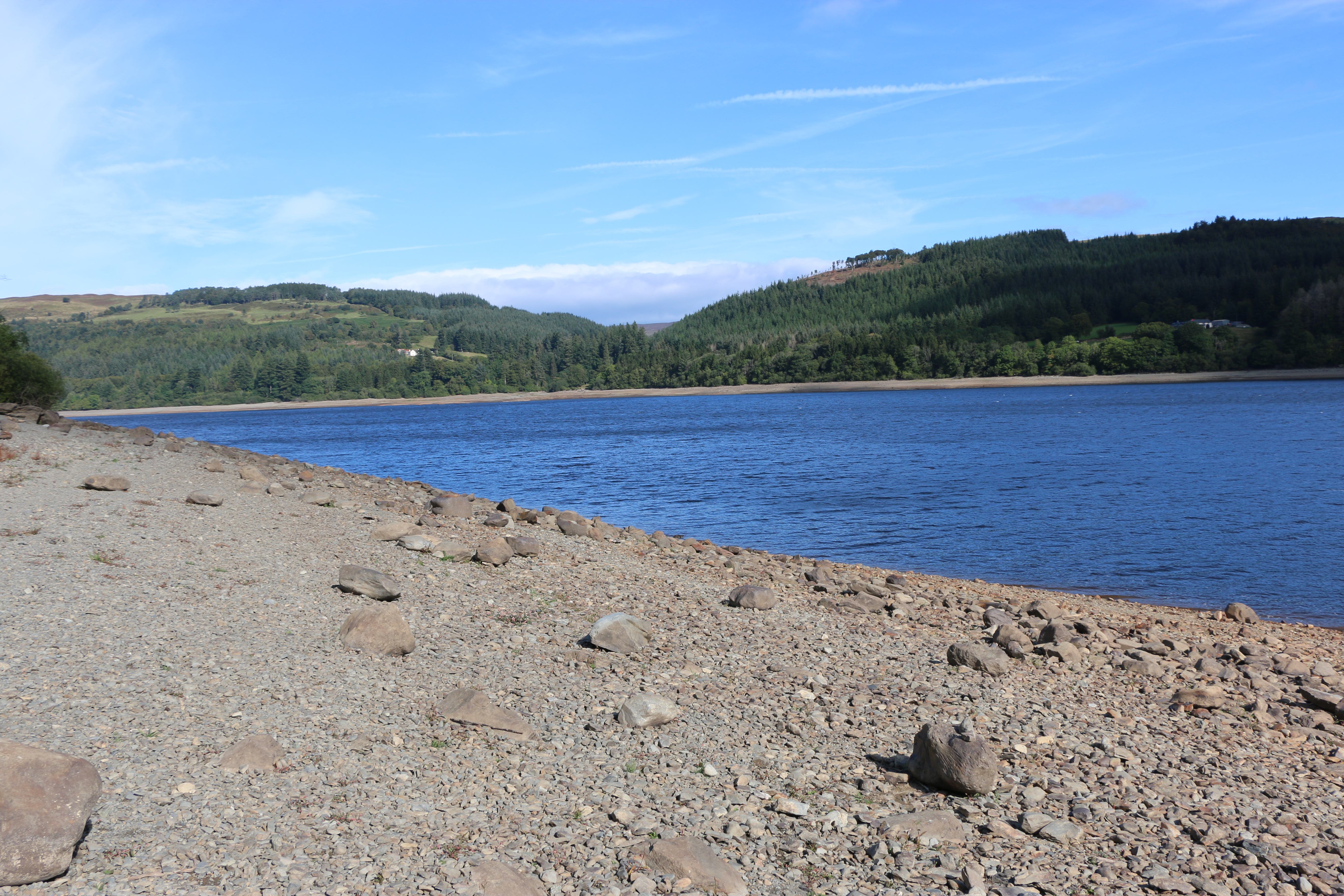
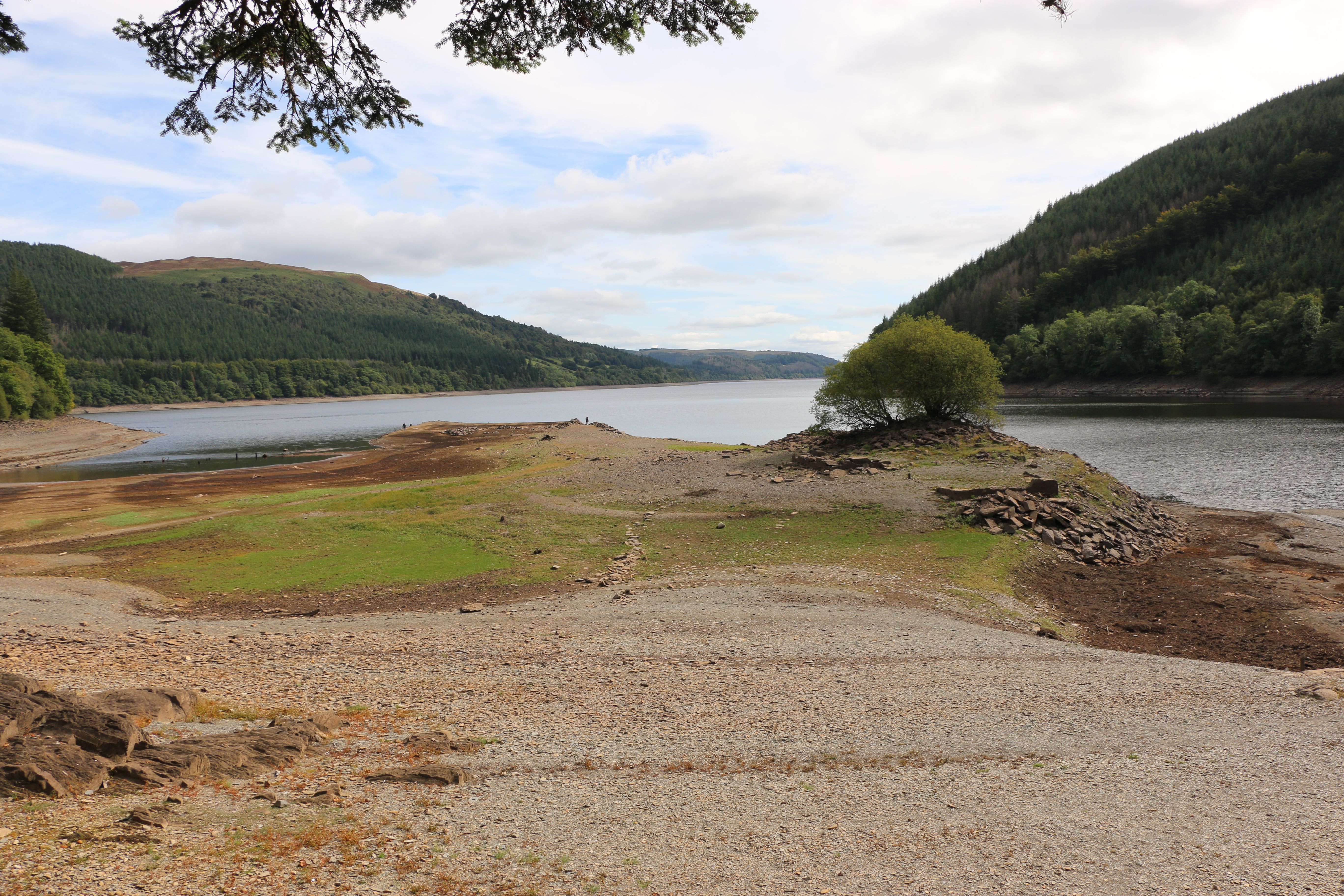
Just on the edge of The Snowdonia National Park and south of Lake Bala, Lake Vyrnwy is set amidst the remote and beautiful Berwyn Mountains. With spectacular waterfalls, and unspoilt open countryside. Except that, although the scenery is, as always, fantastic, the waterfalls are sadly depleted. As is the reservoir. However, since these photos were taken in August, and we’ve had such downpours, with fingers crossed, an inch or two may have been added to the water level. One can but hope!
We parked in a designated area that was supposed to be on the edge of the lake. It wasn’t; the water was so low we could have walked quite a few metres on shingle that should… would … in ‘normal times’ be submerged. It reminded us that, underneath, was a village, lost many years ago.
Llanwddyn was a village on the hillside next to the Cedig river. There were thirty-seven houses, three chapels and a Church of St John, and, in the surrounding countryside, ten farmsteads. Farming was the main occupation of the people in the valley, they ate simple food, such as mutton broth, porridge, gruel, and milk and burned peat from the moors in their fireplaces.
But, with expanding industries in the the Midlands and the north-west of England, and the prospect of higher wages, many people left. To make matters worse for those still trying to make a living from the land, in 1873 the local vicar,Reverend Thomas H. Evans published a report that the area was useless for agriculture, because it was waterlogged for much of the winter.
Seeing this, made us realise how many streams must has poured down the hills. Imaging the rush of water, I suppose it’s easy to understand the Reverend’s statement. Yet it has left me wondering why he wrote the report. Was he paid? Were the villagers aware of what he’d done? If they did find out, what was the reaction? I haven’t been able to discover that. The writer in me is itching to research that time. It did coincide with a time when the authorities of Liverpool were exploring the country for sites to build a new reservoir to cope with the growing population on both sides of the Mersey. So who’s to say!
Various sites were under consideration in northern England and Wales, but in most cases there were snags By 1877 a group of engineers arrived in Llanwddyn. Their visit was to look into the possibility of damming the river Vyrnwy. A survey revealed a large area of solid rock, just where the valley narrowed, two miles south of the village, which could act as a base for creating a large, artificial lake that had the potential for holding many millions of gallons of water.
It brings a feeling of awe, of sadness, almost, to be walking on land that is normally submerged under water, on land where a village once stood, where people once lived.
Driving further around the lake we pass a sign at the side of the road – “Track to impressive hillside view. Not to be missed”. Well, if ever there was a challenge to a photographer, that was it. Husband got out of the car and disappeared for a few minutes, soon to return. ‘It doesn’t look too bad. Come on.’
And indeed the first few steps were not too bad. And then we turned a corner… to be faced by an almost vertical path, a rocky vertical path. I stopped; why do I always let myself be fooled?
‘Come on, it’s not far!’ He said that numerous times for the next ten minutes. Hauling me from bend to bend. ” Think of the view!”
I couldn’t think of anything, except how to get my next breath.
But I had to admit, the view was worth it. The coniferous forests planted around the lake by the Forestry Commission are impressive.
On the way back, Husband found two stout branches to use as walking sticks, to scrabble down between mossy rocks and sliding muddy stones. It was either that or an undignified descent on my backside.
In 1880 the Liverpool Corporation Waterworks Act was passed by Parliament, and received the Royal Assent. Preparations were at once put in hand to gather the work-force and equipment necessary for the construction of what was to become the first large masonry dam in Britain and the largest artificial reservoir in Europe at the time. Work on the site began in July 1881.
The stone for the masonry was obtained from the quarry specially opened. All other materials were brought by horse and cart from the railway station at Llanfyllin, ten miles away. Stabling for up to 100 horses was built in Llanfyllin. The labour force topped 1,000 men at the busiest stage of the work on the dam. Many of them were stone masons working in the quarry, dressing the stone which was not easy to handle.
In a very short time the dam was completed. The village of Llanwddyn, and all buildings in the valley that were designated to be covered by the water, were demolished.
St Wddyn’s church was built on the hill on the north side to replace the parish destroyed by the flooding of Vyrnwy valley. Many of the graves were relocated from the graveyard of the old church to St Wddyn’s before it was flooded. It was was consecrated on the 27 November 1888, the day before the valves were closed. It took a year before the water reached and spilled over the lip of the dam.
On a previous walk, some years before, we witnessed a wedding procession coming from the church, led by a chimney sweep in all his glory. Apparently it’s considered lucky to see a chimney sweep on your wedding day, the belief being they bring good luck, wealth, and happiness. The bride and groom did look joyous. I would have loved to have tagged onto the procession, but, that day, we were looking for “a good view of the water”, further along the road.
On the same hill as the church a monument was erected in memory of ten men who died in accidents on the site during the building of the dam and another thirty-four who died from other causes at the time.
Stone houses, matching the stone of the dam, were built on either side of the valley for the people whose homes had disappeared under the lake. I suppose there must have been a lot of opposition to flooding the valley to provide Liverpool with water at the time, and since, but records have apparently shown that it brought prosperity and stability to the area.
Our final excursion on our walk was to the waterfalls.
One of the highest is the Rhiwargor waterfall at the northern end of Lake Vyrnwy. From the car park I was relieved to see the relatively flat path along the valley of the river Eiddew. There was a trail leading up and up along the side of the falls. Despite much attempted persuasions, I declined, and opted for a coffee and a picnic at a nearby picnic table. And I ate his chocolate bar! Well, after that impromptu climb earlier, I thought I deserved it.Who said I hold grudges?!!
N.B.The Lake Vyrnwy Nature Reserve and Estate that surrounds the lake is jointly managed by the Royal Society for the Protection of Birds (RSPB) and the Hafren Dyfrdwy (Severn Dee). The reserve is designated as a national nature reserve, a Site of Special Scientific Interest, a Special Protection Area, and a Special Area of Conservation.
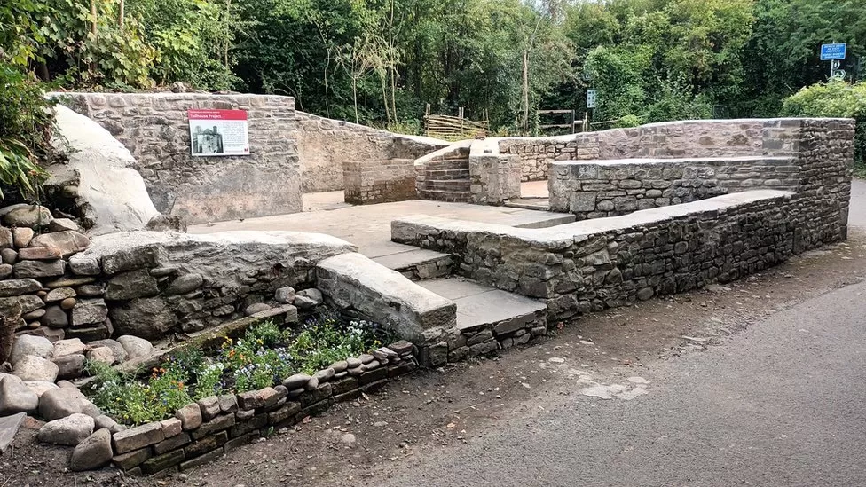
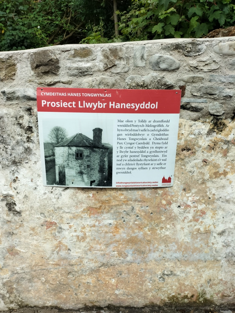
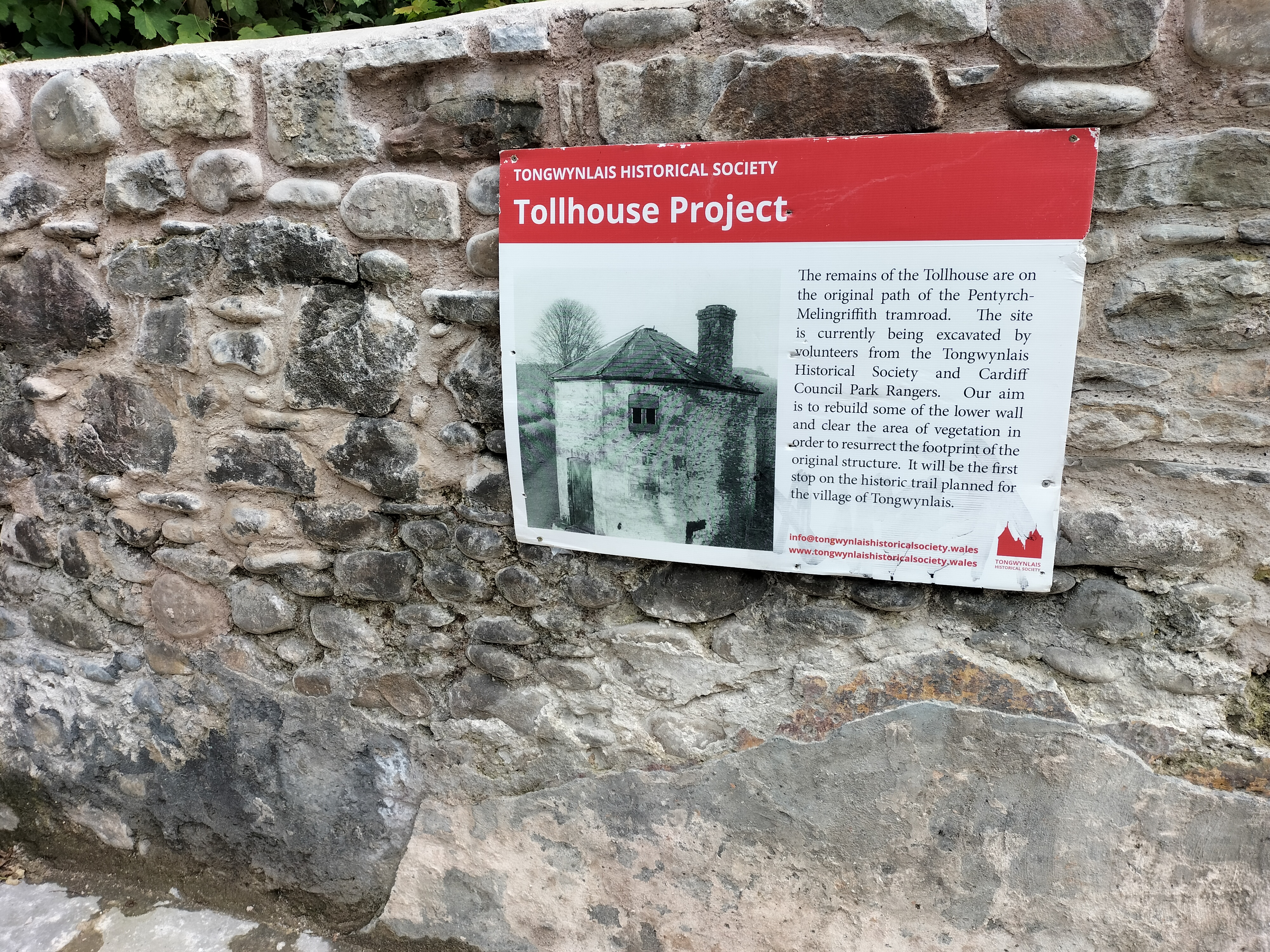
“Villagers have restored the shell of a historic “unloved eyesore” tollhouse demolished more than 70 years ago.The original building was among hundreds used to collect money from 18th and 19th century travellers. Volunteers in Tongwynlais, on the edge of Cardiff, have spent more than a year rebuilding it as the first step towards creating a local history trail.“Our volunteers have been fantastic,” said Sarah Barnes, of the Tongwynlais Historical Society.
Before this wonderful restoration granddaughter and I walked the Taff Trail – so thought you might like to see the before and after. Or, in the case of this blog, the “after and before”.
Put a lovely sunny day, with a dog desperate to go a walk, with a granddaughter who needs to be dragged from her mobile and bribed by the thought of a chocolate brownie and a drink of Sprite, and there was only one place to head for, the cafe in the garden centre at the end of the Taff Trail in Radyr.
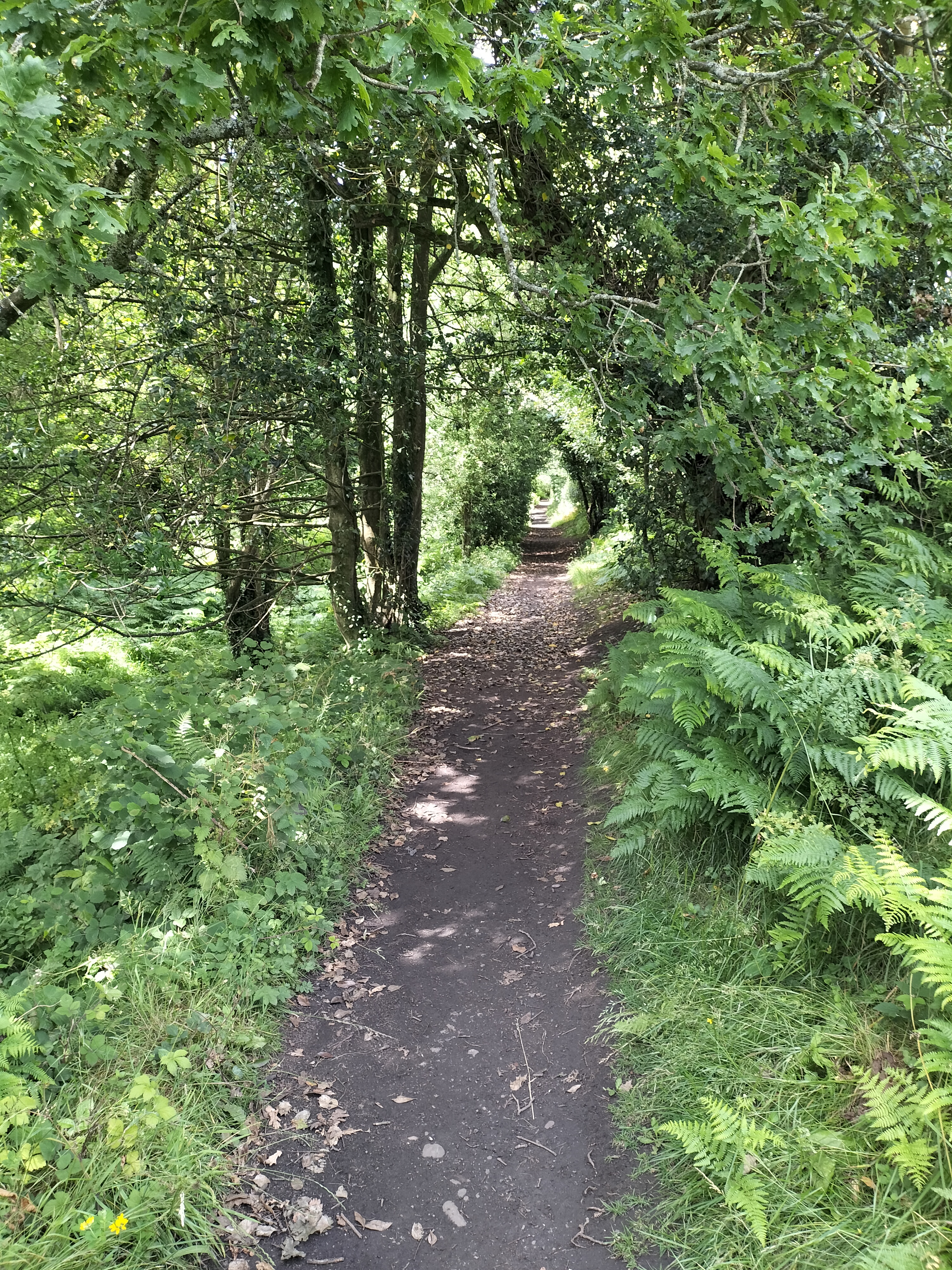
The Radyr section of this lovely river walk is one we’ve done often
But this time we decided to meander along various smaller paths, even though we needed to retrace our steps numerous times. I was so glad we did because look what we found:
The tollhouse, once used by the Pentyrch and Melingriffith Iron and Tinplate Works in the late 1800s
Thanks to the Tongwynlais Historical Society ( co-founders,Sarah Barnes and Rob Wiseman) the Tollhouse returns to life. What was once nothing more than a few visible bricks covered in 70 years of vegetation, is now a recognisable shell complete with growing wildflower garden.
I thought I’d better seek permission to add some of the photographs from the Tongwynlais Historical Society. I made contact with a very helpful chap, Jack Davies, whose fascinating website also contains an article about the Tollhouse and other history of the village: https://tongwynlais.com/history/
Granddaughter, Seren, with soulful companion, Benji, who patiently waited to continue his walk.
Seren also very kindly leant a hand to point out this lovely heart shaped stone, with a wonderful inscription:
Which immediately brought to mind (well, my mind anyway), my book, The Heart Stone, which was published by Honno, in 2021: So, never one to pass up on an opportunity…
The inspiration for The Heart Stone partly came from research for my degree on The First World War some years ago; a subject that both fascinates and repulses me. At the time I’d found my grandfather’s army records and discovered he’d volunteered to join the local Pals Battalion with two of his friends, although they were all underage.
I only ever remember him as a small man who spent his days in a single bed under the window in the parlour, who coughed a lot, and was very grumpy. He died when I was eight.
There was no conscription at the beginning of the war. The Pals Battalions were formed, to answer Lord Kitchener’s call for volunteers, by encouraging local magistrates to drum up community spirit and patriotic fervour.
The gist of the speeches used were that young men,”… should form a battalion of pals, a battalion in which friends will fight shoulder to shoulder for the honour of Britain and the credit of their town and villages.”
My grandfather was gassed in 1916 near the Somme. He was also shell-shocked and was unemployed for the rest of his life. Once, my mother told me he had never spoken of his experience but had suffered nightmares for as long as she could remember. And that there were whole streets around the house where they’d lived where the men had never returned.
It’s a haunting image.
Four years ago, after my mother passed away and we were clearing her home, I found my grandfather’s army papers again.
During the following week, whilst my husband and I were walking along the Pembrokeshire coastal path, we found a smooth stone, almost heart shaped, placed on top of a cairn amongst the Marram grass. Picking up the stone to examine it, a folded paper blew from underneath. There had been words on it but were, by then, indecipherable.
A love note, I thought; a love note under a heart shaped stone.
A love note, under a heart shaped stone, from a young man who had never returned.
And so The Heart Stone started to form.
The Heart Stone was published byHonno Pressin Feb 2021
I’m,originally from Saddleworth, a group of villages on the edge of the Pennines, but have lived in Pembrokeshire, Wales, for over forty years.
I have an MA in Creative Writing with the University of Wales Trinity St David’s College, Carmarthen. BA (Hons) in Literature with the Open University, a Diploma in Drama from Swansea University. I’m also is a Creative Writing tutor and hold workshops on all genres.
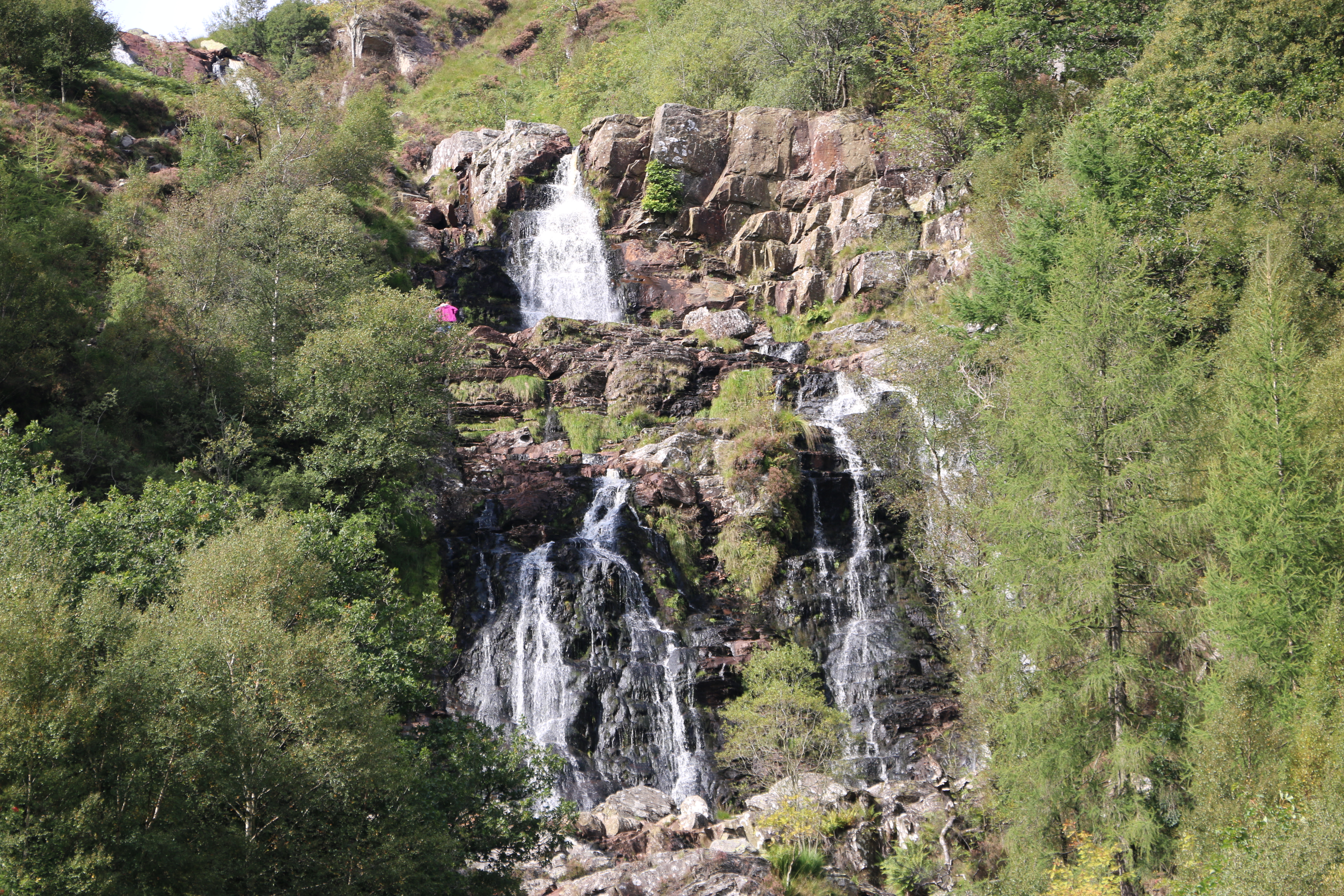
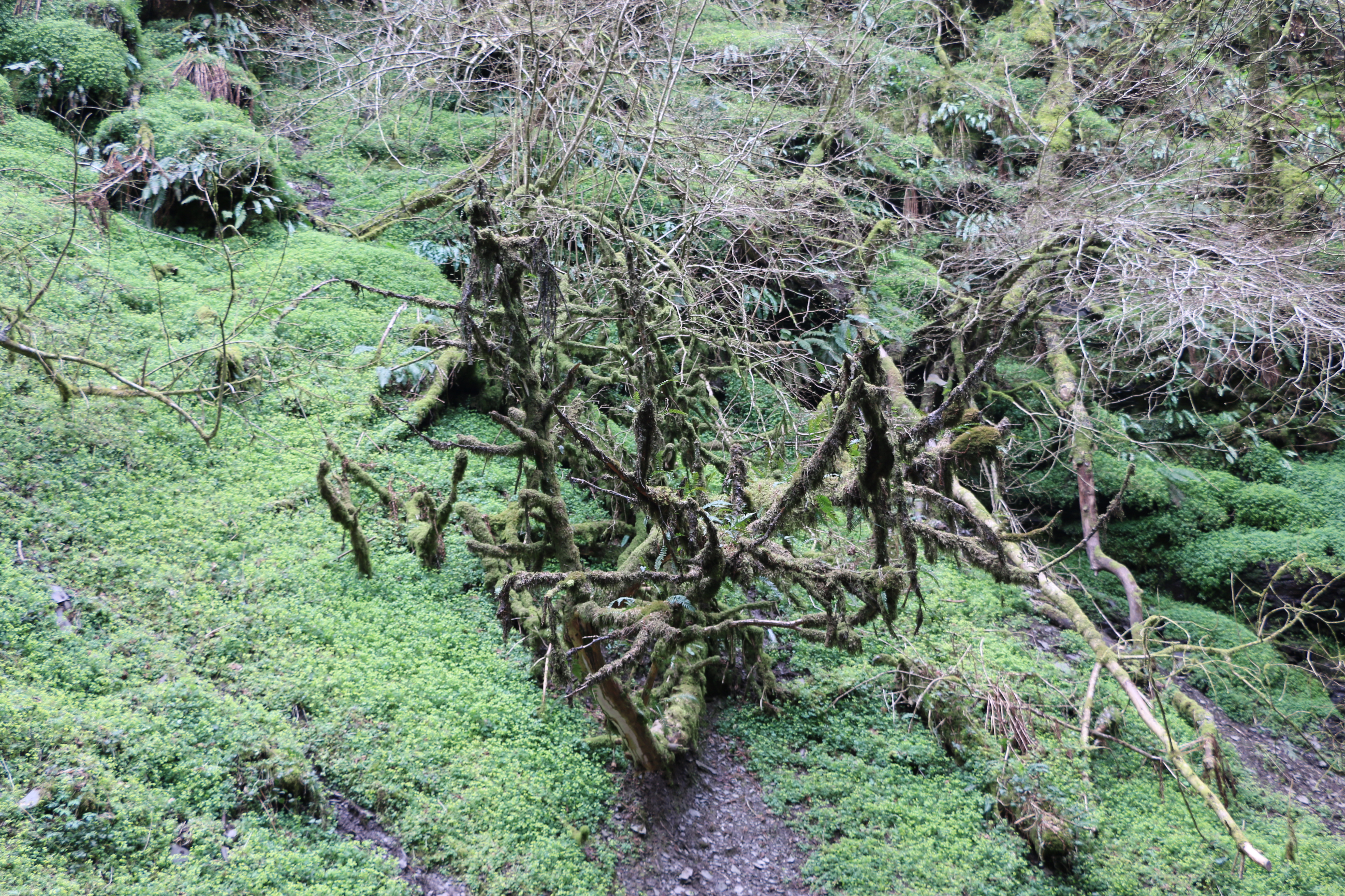
The sunny day disappeared as we walked through the short steep-sided gorge – following in the footsteps of Victorian touristto the Water-Break-its-Neck waterfall, around a mile from the village of New Radnor ( Maesyfed – the Welsh name), in the county of Powys,Wales.
It was a spectacular sight.Yet, beyond the sound of the water it was strangely silent.
The water tumbled through the black slated rocks, a silvery mesmerising flow, to the small stream and creating a fine rainbow mist in the air. Yet there was an eerie and ephemeral feeling to the fallen, bare oak branches laced with lichen and boulders covered in dark green moss and surrounded by curtains of gently swaying ferns.
We made our way back along the narrow path. I thought we would be taking a slow ramble along the walking trails in Warren Wood – so named for the labyrinth of rabbit warrens that kept the locals fed for centuries, now dwarfed by towering beeches, oaks and conifers.
Husband had other ideas. ‘Let’s walk up the road to the top of Warren Wood,’ he said, pointing vaguely to the left as we left the path. ‘We could get some brilliant photographs.‘
‘How far is it?’
‘Not far.’
I’ve been caught out by “Not far”, before. Why do I always believe him?
If only I’d read the Nature reserve signage:
“In the 1800s The Victorian landowners planted trees on the moorland, to provide a landscape of scenic beauty thus creating a forest, part of Radnor Forestwhichwas once a royal hunting ground. In those days it wasn’t an area covered in trees but an unenclosed piece of land, legally set aside for the Norman kings to hunt deer. Today, Radnor Forest is a land of hill farming and moorlands, steep narrow valleys and hills, rising up to the highest point in Radnorshire, Black Mixen at 650 metres.“
Note the words, ‘steep’, hills, and 650 metres. What we didn’t know, was that the wide concrete road in front of us was not only steep but has many twists and turns – and always upwards before it got to 650 metres.
Two and a half hours later, with stops for photographs, we reached the top… I thought. We sat on a convenient rock, drinking from our second bottle of water.
‘We could go on for a bit longer?’ Husband said.,looking around. ‘The road carries on.’
‘The proper road stops here not up there.’ I pointed to the dirt track behind us. Steep dirt track.
I’I bet we could get brilliant photos, though. I’ll go and check.’ Ten minutes later he was back. ‘Come on, it’s a fantastic view.’
We walked in silence. Well, to be honest I had no breath to use up in conversation.
Though the views were wonderful. We could see as far away as Hereford and beyond…..
‘Ready to go back?’ Husband asked.
I didn’t think I could face that road again. ‘We could try going that way?’ I point to a gentle downward sloping track.’It looks like it’s going back to the start.’
‘It doesn’t.’
‘It does.’I insisted.
I should,perhaps have said, before now – I have little sense of direction. We stumbled/slid down walked for over an hour with the wind whistling through the tall conifers that lined the ever-steeper, downward track. I became increasingly aware of a brooding silence, each time I said cheerfully,’It has to lead to somewhere…’ and, ‘We’re going in the right direction…’. Until we weren’t… we rounded a corner- to see the road end in a turning point for the Forestry Commission. A thick forest faced us…Hmm…
Back we went,stopping every fifty paces to catch our breath. To be fair there were only a few recriminations. Although I did hear some mutterings – which I ignored. Later,we worked out that we had walked thirteen miles – seven more than we had planned.
The following day we creaked our way rambled sedately aroundthe fields where we were stayingnear Bettws Cedewain, a place in a sheltered valley on the banks of the river Bechan. around five miles from Newtown. The village grew around the crossing of the river where a church was founded by St Beuno in the sixth century. I read that the name of the village is thought to derive from the Welsh word ‘Betws’ – which means a prayer house or bead house where the number of prayers had been counted on beads by the earliest church-goers in Cedewain.
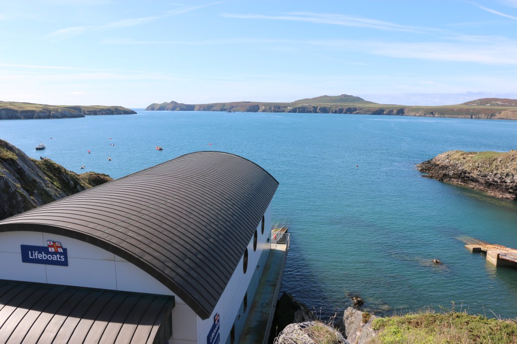
And then wonderful views overlooking Ramsey Island
Just to prove I was there!!
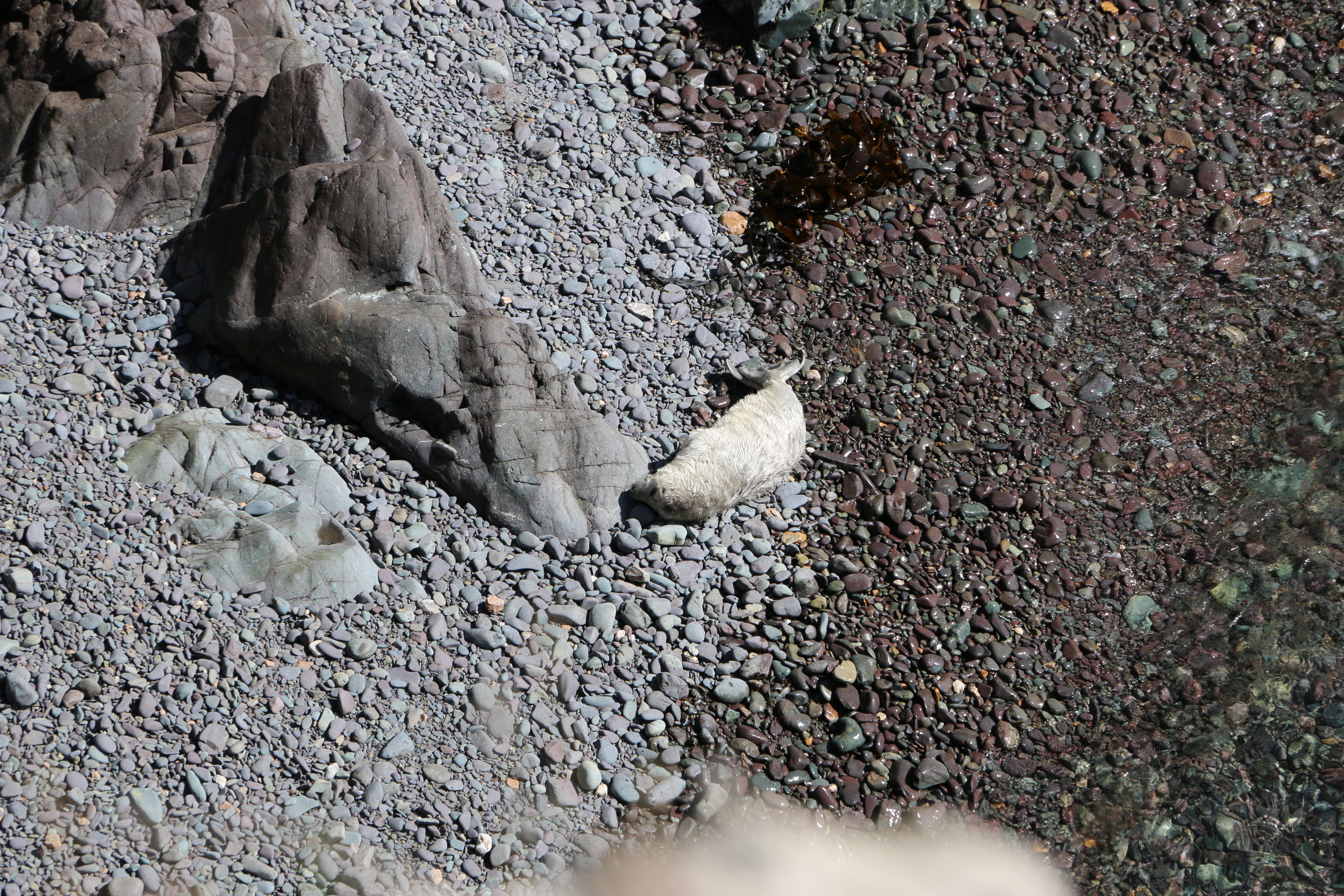
And look who we saw! (from a great distance)
Seal pups and their mums
So… who was St Justinian?
Justinian was born in Brittany in the 6th century. At some point in his life, he made his way to Wales, where he settled on Ramsey Island.
Justinian soon became close friends with St David, the patron saint of Wales, and visited him often in the monastery where the cathedral now stands.
He was less impressed however by the lax behaviour of some of the monks and decided to isolate himself on Ramsey island. According to legend, he took an axe and chopped up the land bridge that linked the island and the mainland. As he worked, the axe became blunter and the lumps of rock remaining became larger and larger. They are still visible today in Ramsey Sound, where the waters foam over them at high tide. Followers joined him on the island but his actions didn’t go down well with everyone though. They soon turned them against him and they beheaded him!
To the astonishment of his killers,he picked up his head and walked across the sea to the mainland, and where he set his head down, another spring of water issued forth. This is the one enclosed today by a stone canopy.
A spring of water gushed up from the ground where his head first fell and this became the famous healing well.
Justinian was buried where the chapel now stands. Within its walls are some stone footings, which may mark his original gravesite. His body was removed to the cathedral, probably at some time before the end of the 15th century.
During the early medieval period, two chapels were built on Ramsey. One was dedicated to St Tyfanog; the other to St Justinian. There is no trace of either building today, though their sites are known.