Where We Walked: Wiston Castle and Church #Pembrokeshire #Wales

Following a recce for a Narberth U3a future Stroll and Photo at Llys-y- Fran, we took a diversion to Wiston castle. Even though not long enough for a walk, the castle and nearby church are historically interesting.

The castle was built by an early Flemish settler with the unusual name of Wizo (in Latin) or Gwys (Welsh). Wizo was one of the powerful Norman lords who took control of southern Wales in the decades following the Norman Conquest. The settlement was called Wiston, which was an old Flemish/Saxon word for Wizo’s enclosure. And I am reliably informed, by someone who knows far more about these things than I do, that Wiston is pronounced Wizon,

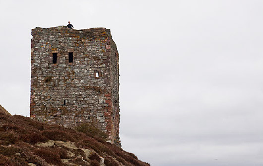
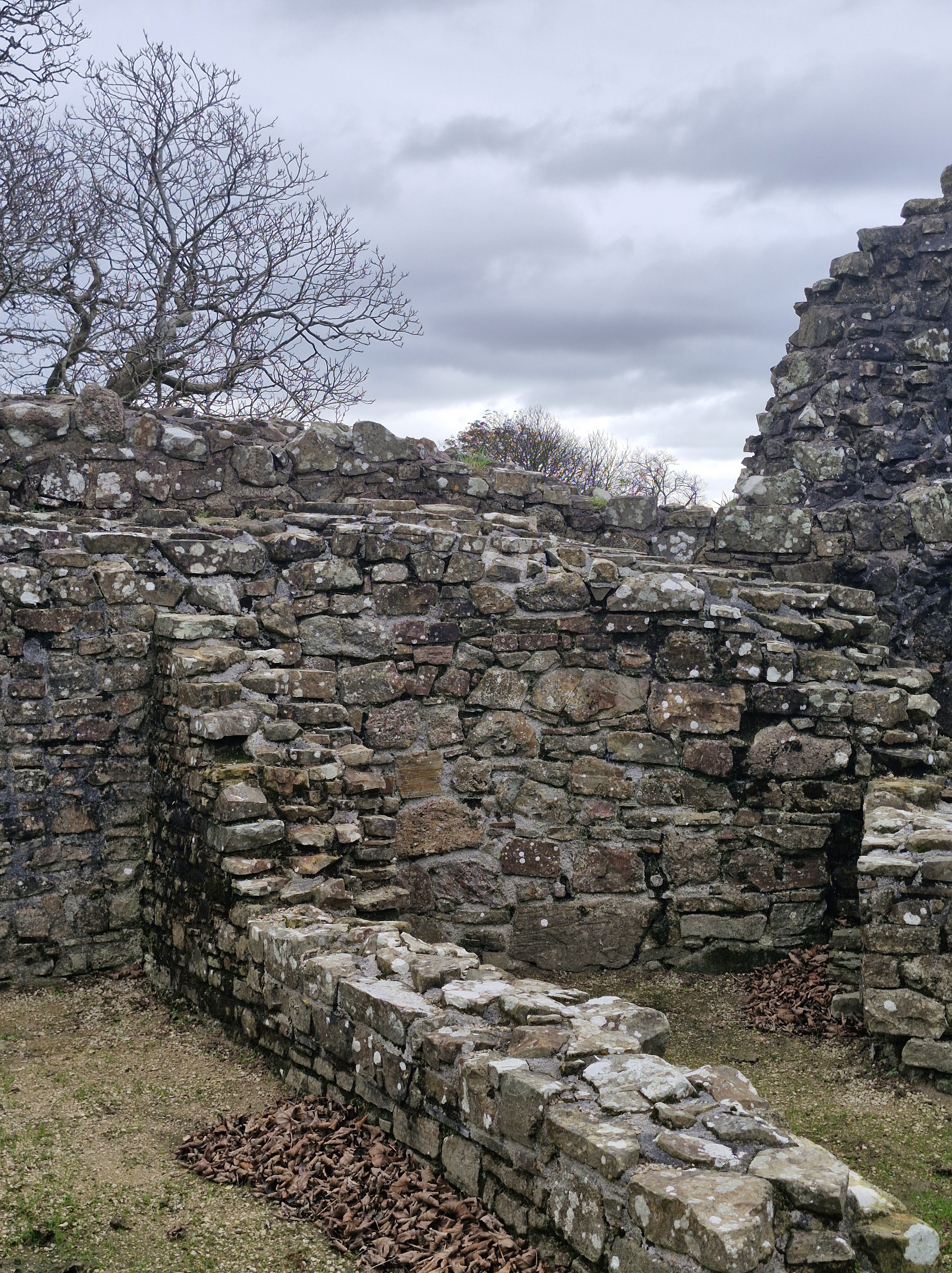
Wiston is one of the best-preserved motte-and-bailey castles in Wales, (A bailey is an enclosed courtyard within a castle, typically surrounding a central mound (the motte), a small mound or hill which was fortified in the past).

The castle is first mentioned in documents in 1147 when it was attacked by the Welsh, and then again by Hywel Sais, who was the son of The Lord Rhys who ruled this area of Wales, in1193. The castle was again attacked and destroyed in 1220 by Llywelyn ap Iorwerth (Llywelyn the Great). There is more information of the history of Wiston castle here:

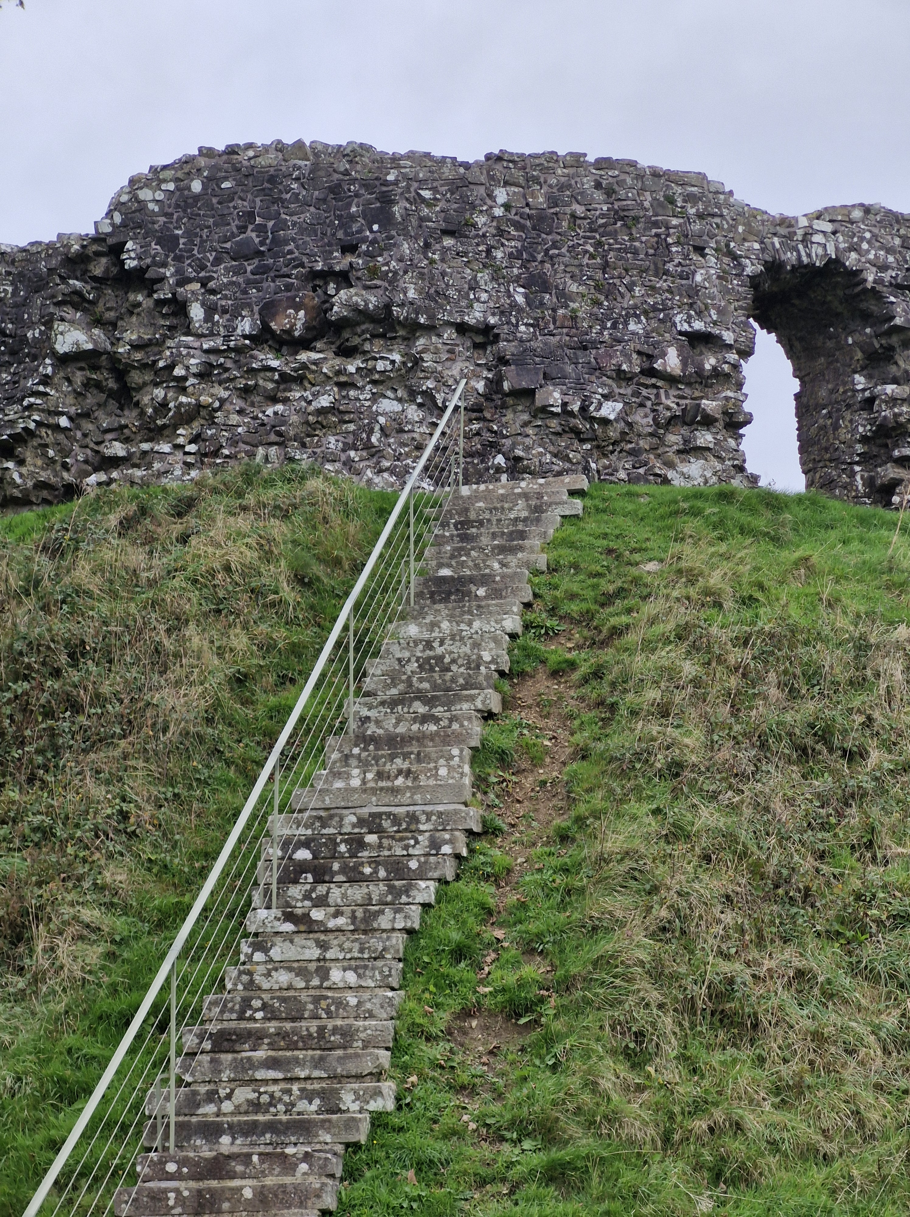
There are forty-nine steps … I counted!

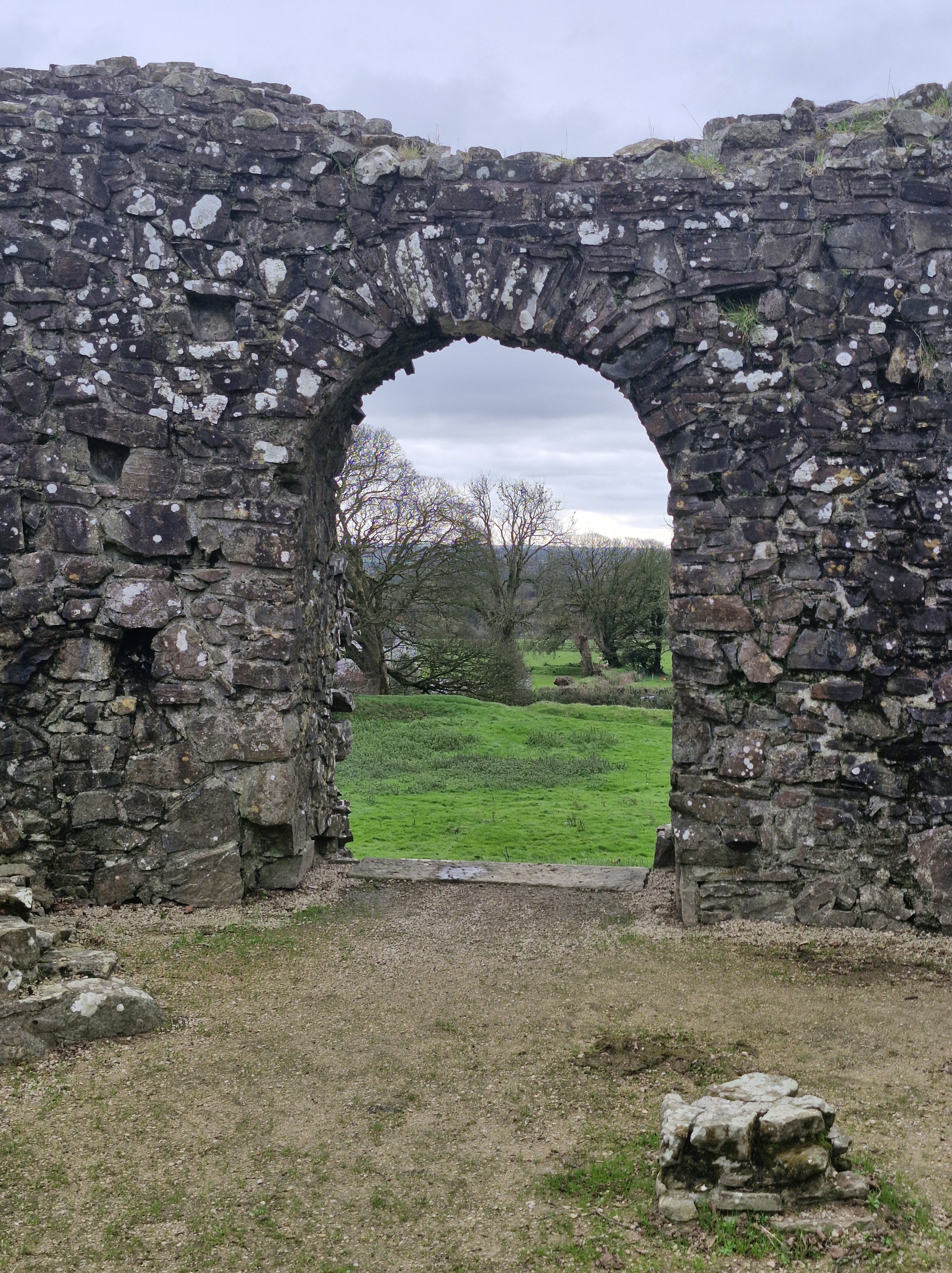
The Keep was a large fortified enclosure. This would originally be an early thirteenth century timber tower within a palisade. The present sixteen-sided stone shell keep was a replacement and would have risen another story with a parapet. The entrance was barred by a stout wooden door and the residential upper floor was reached by stone steps just inside the doorway.

A deep ditch surrounds the base of the mound, separating it from the bailey (the enclosed courtyard within a castle) to the south, and connecting with the moat of the outer bailey on the eastern and western sides. This would have contained essential buildings like stables, barracks, and a chapel – the fortified area where soldiers, servants, and livestock lived and where the day-to-day activities of the castle took place.

Impressive stone walls. Spot the lookout!

And, of course, who goes up … must then go down. Much easier!

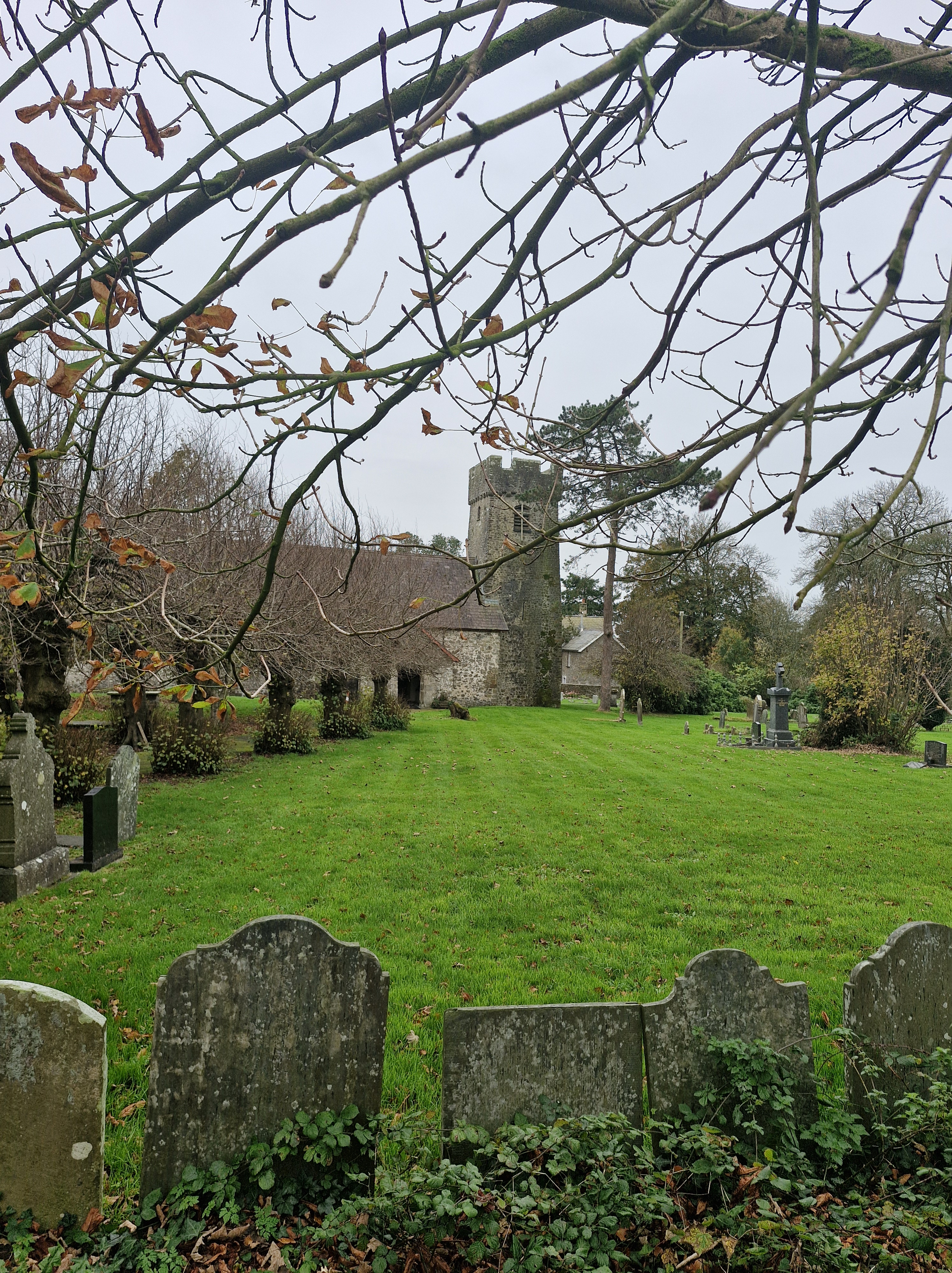
The Church of St Mary Magdalene.

Wizo also founded the church nearby at the same time. Though altered by subsequent generations, the church is essentially a Norman building, entered by a very simple doorway made of large slabs of local red sandstone. An interesting church to visit at a later time, I think.

Where We Walked … Well, What We Saw From Where We Walked #Ailsa Craig #Arran #Scotland

Image courtesy of https://ayrshireandarran.com/ailsa-craig/

Ailsa Craig, sometimes referred to as the Granite Jewel of the Firth of Clyde, is an island that is colloquially known as “Paddy’s Milestone”. It was a haven for Catholics during the Scottish Reformation in the 16th century, and is also reknowned for being approximately the halfway point of the sea journey from Belfast to Glasgow, which was a traditional route for Irish labourers emigrating to Scotland to seek work.

The island is actually a volcanic plug from an extinct volcano, and is owned by David Thomas Kennedy, the 9th Marquess of Ailsa – except for the two hectares which were sold to the Northern Lighthouse Board in 1883.

The lighthouse was built around 1886, by Thomas Stevenson, a pioneering Scottish civil engineer. It originally used oil-burning lamps, but these were later replaced with incandescent lighting, and then, in 1990, the lighthouse was automated. Further refurbishment, in 2001, meant it was converted to run on solar power.

The island contains some of Europe’s most important bird colonies, which includes the continent’s biggest gannet colony, as well as puffins, so is managed as a nature reserve by the Royal Society for the Protection of Birds (RSPB). It’s also designated a Site of Special Scientific Interest (SSSI) and a Special Protection Area, mainly because of the colony of grey seals, and the occasional whale. There are also visiting large basking sharks during the warm summer months which can be seen feeding at the surface on the planktonic bloom.

The texture of the rocks on Ailsa Craig is a granite called microgranite that is so hard and resistant to impact, it makes it ideal for the manufacture of curling stones. The manufacturer, Kays of Mauchline, Ayrshire in Scotland, has the exclusive rights to the granite, granted by the Marquess of Ailsa, and has been making these stones since 1851, and providing them for the Winter Olympics since Chamonix in 1924.

I thought it interesting that boulders of of the Ailsa Craig microgranite were transported by glaciers as far afield as County Donegal and Pembrokeshire. Of course this led me down another rabbit hole …

The microgranite is part of the geology of the Precambrian rock of the Pembrokeshire Coast National Park. Formed as the lava pushed through the existing rocks and solidified, these rocks can be seen in various locations, such as the coastline of St Bride’s Bay and the southwest tip of the St David’s Peninsula.

Something else I discovered…

There are ruins on the island of a castle.

Ailsa Craig Castle today – photgraph courtesy of Douglas Wilcox www.seakayakphoto.com

These remains are of a castle built in the middle of the sixteenth century by the Hamilton Family to protect the island from King Philip II of Spain. It stands on a shoulder of rock around three hundred feet above the sea, the only approach to it a steep and narrow footpath, although there used to be an external set of stairs to the tower. The castle was in ruins after the Reformantion but was later restored by Thomas HamiltonIn and the work recorded by an armorial panel high up on the south gable, showing the Hamilton arms. Today only the tower remains.