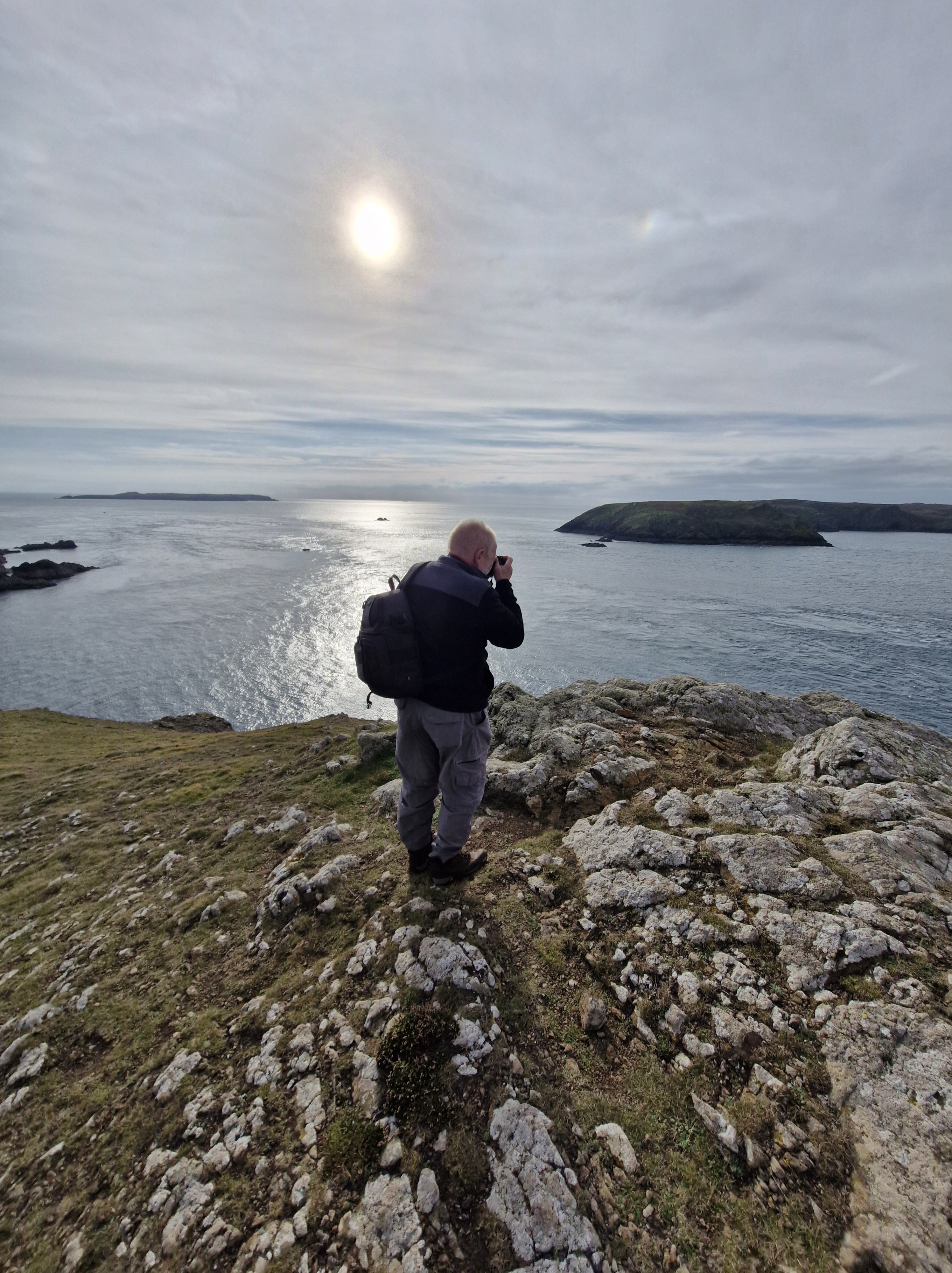
Over the last few weeks we have walked along the Pembrokeshire coast with the Pembrokeshire U3a and the National Trust …
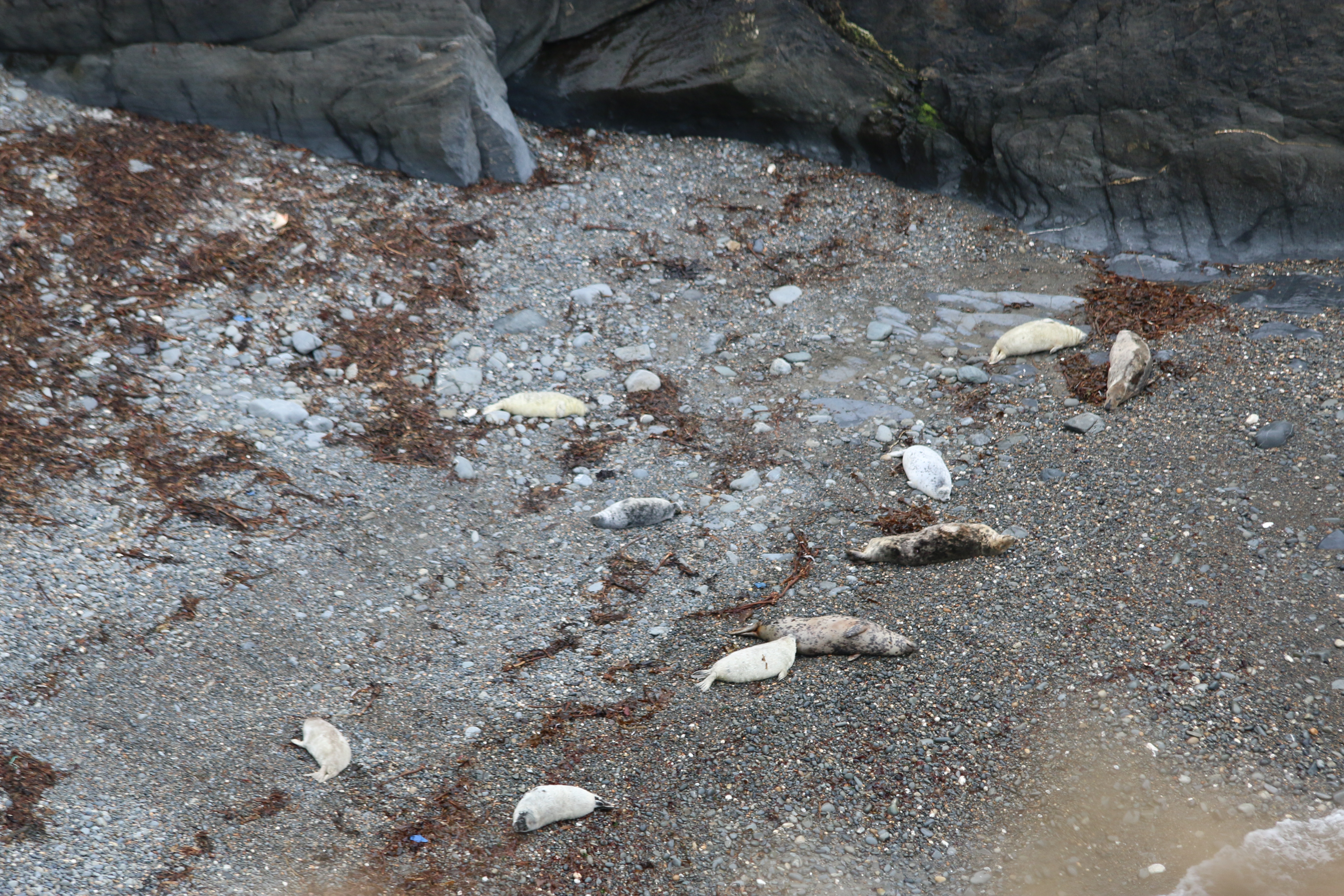
And joined in with a couple of days seal spotting … from the clifftops, so at a distance, of course.
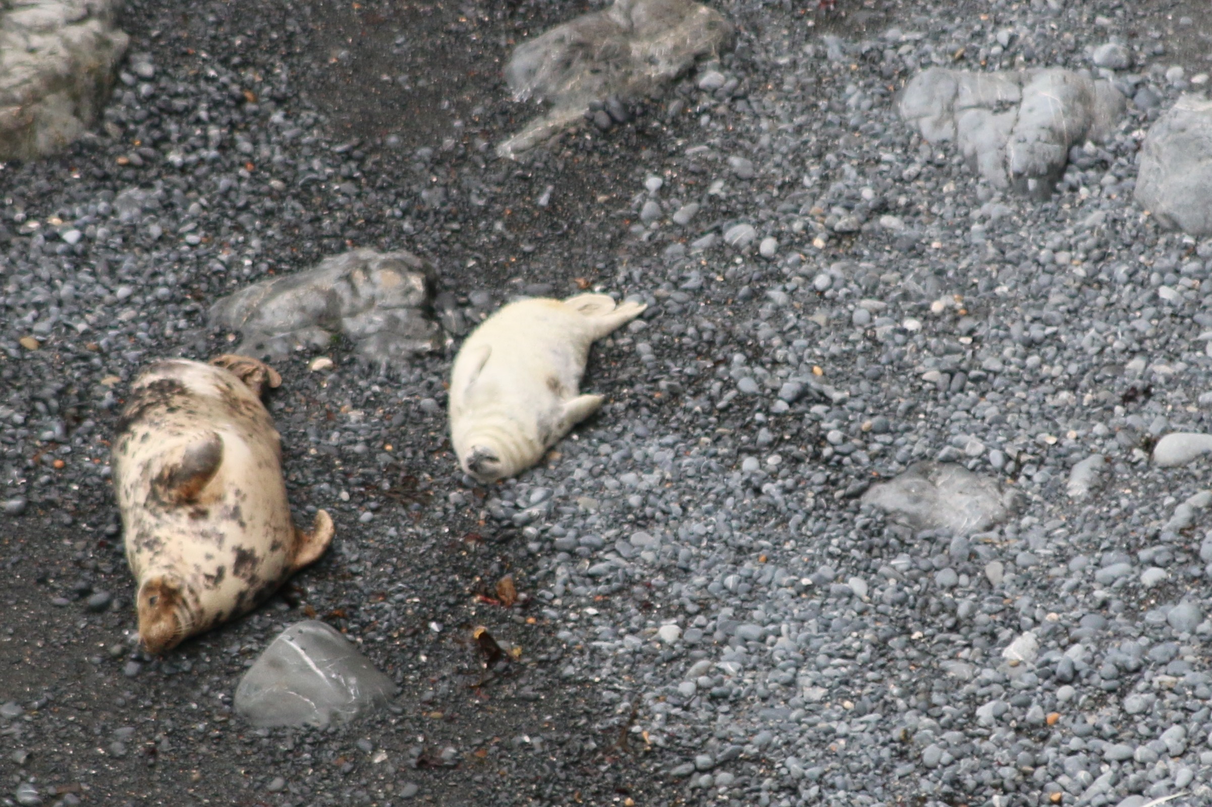
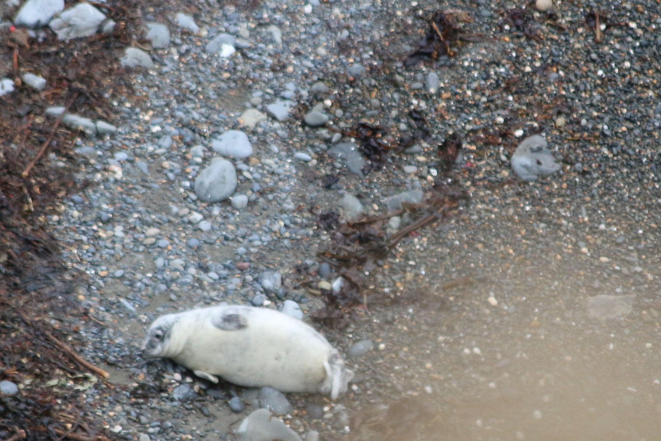
And watching the mothers with their pups was fascinating
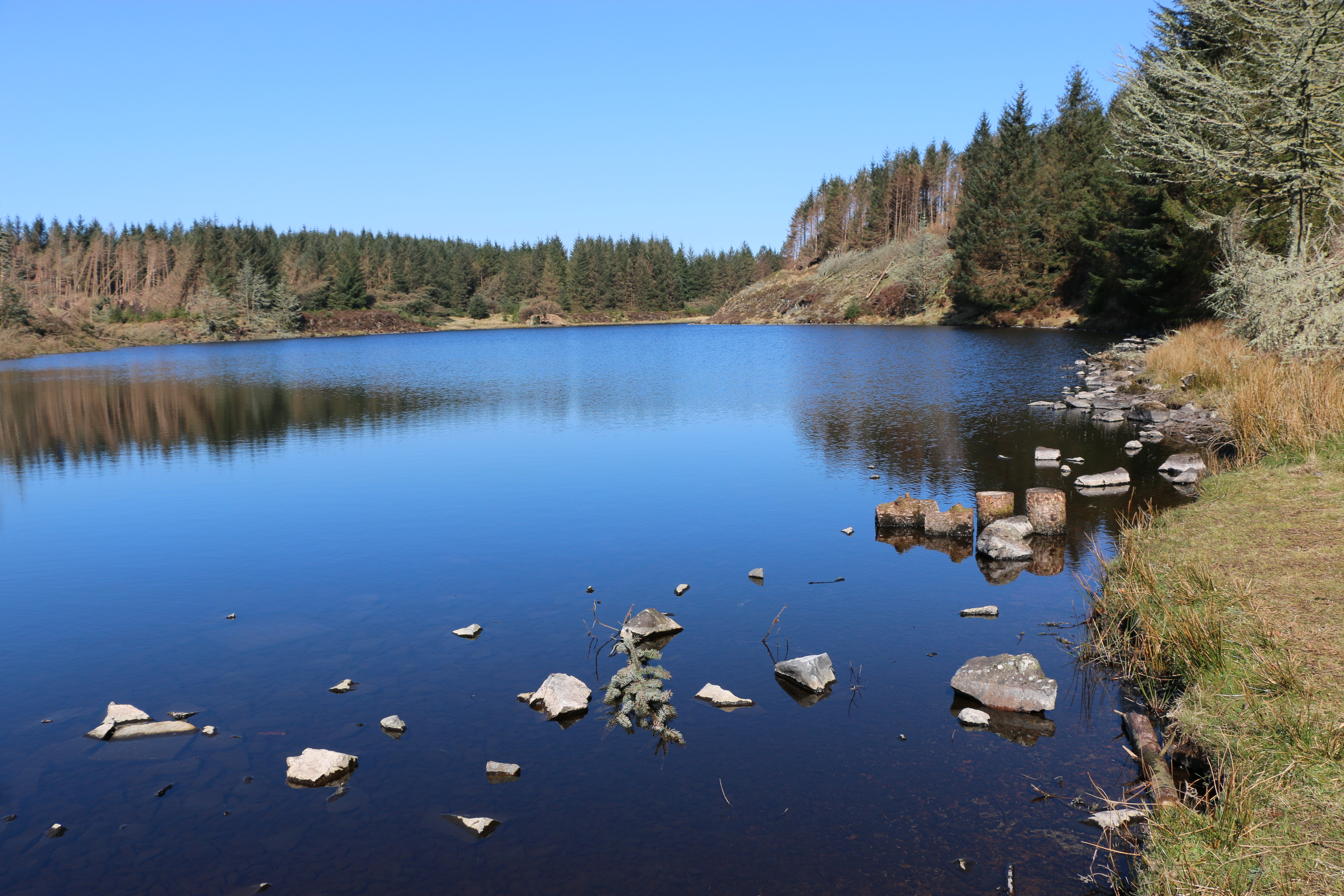
Around the coast of West Wales, grey seals can be seen throughout the year. In the summer, around sunset, the seals begin to return to the beach hauling out their daily catch of fish. Mostly, at this time, they bob about in the water, waiting to come ashore to rest. Seals spend a lot of time at sea but come ashore to breed from August until early November, when parents and their pups can be spotted on beaches around Pembrokeshire.
On land they are cumbersome and slow, compared with their agility in the ocean.
Which gave The Photographer plenty of time to get his pictures!
Many thanks Pembrokeshire U3a and the National Trust for two brilliant days .
Fossil records indicate that the ancestors of modern seals first entered the ocean on the west coast, about 28–30 million years ago.
Seals see very well under water—better than they do in bright light above water. Their eyes are adapted with round lenses (like fish) and a large iris that fully opens underwater. On land the iris closes the pupil to a small pin point that lets the seal see clearly through the round lens. A seal’s eye is also adapted for low-light vision with a lining (similar to a cat’s eye) that reflects and amplifies the weak light at depth in the ocean.
A seal’s body stores enough fat in the blubber layer to allow the animal to go for extended periods of time without eating. In addition, most seals are opportunistic feeders and will consume a variety of fish, shellfish, and crustaceans. Seals do not eat on land.
Like all marine mammals, seals get all the water they need from their food. Their bodies are very efficient at removing and recycling water from their food. They avoid drinking sea water; if a seal drinks too much sea water it can become seriously sick. Arctic seals, which spend time on ice, may sometimes eat fresh water ice and snow.
NB: Seals are protected in the UK under various acts, including the Conservation of Seals Act 1970, which prohibits killing, injuring, or taking them except under specific circumstances. Both native species, the grey seal and common seal, are protected, along with any other seal species found in UK waters.
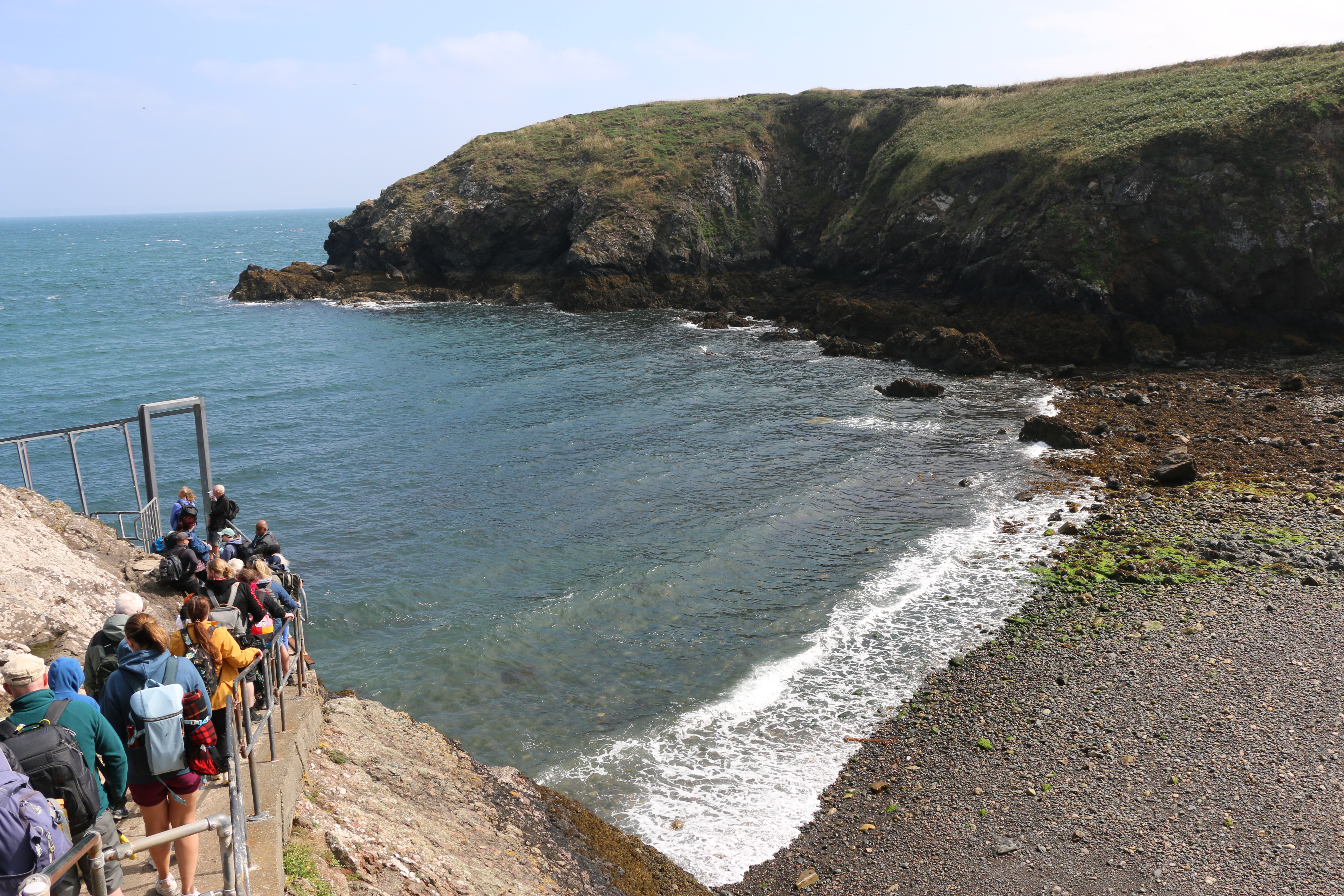
At long last! After living in Pembrokeshire for the last forty-six years and despite walking many miles of the Pembrokeshire coast, and meandrering around a lot of the Welsh countryside discovering wonderful places, lakes, waterfalls … scenary, we hadn’t been on Skomer island. This week we finally managed to go.And it was a glorious day’s adventure.
Boarding the Dale Princess
Arriving on Skomer …
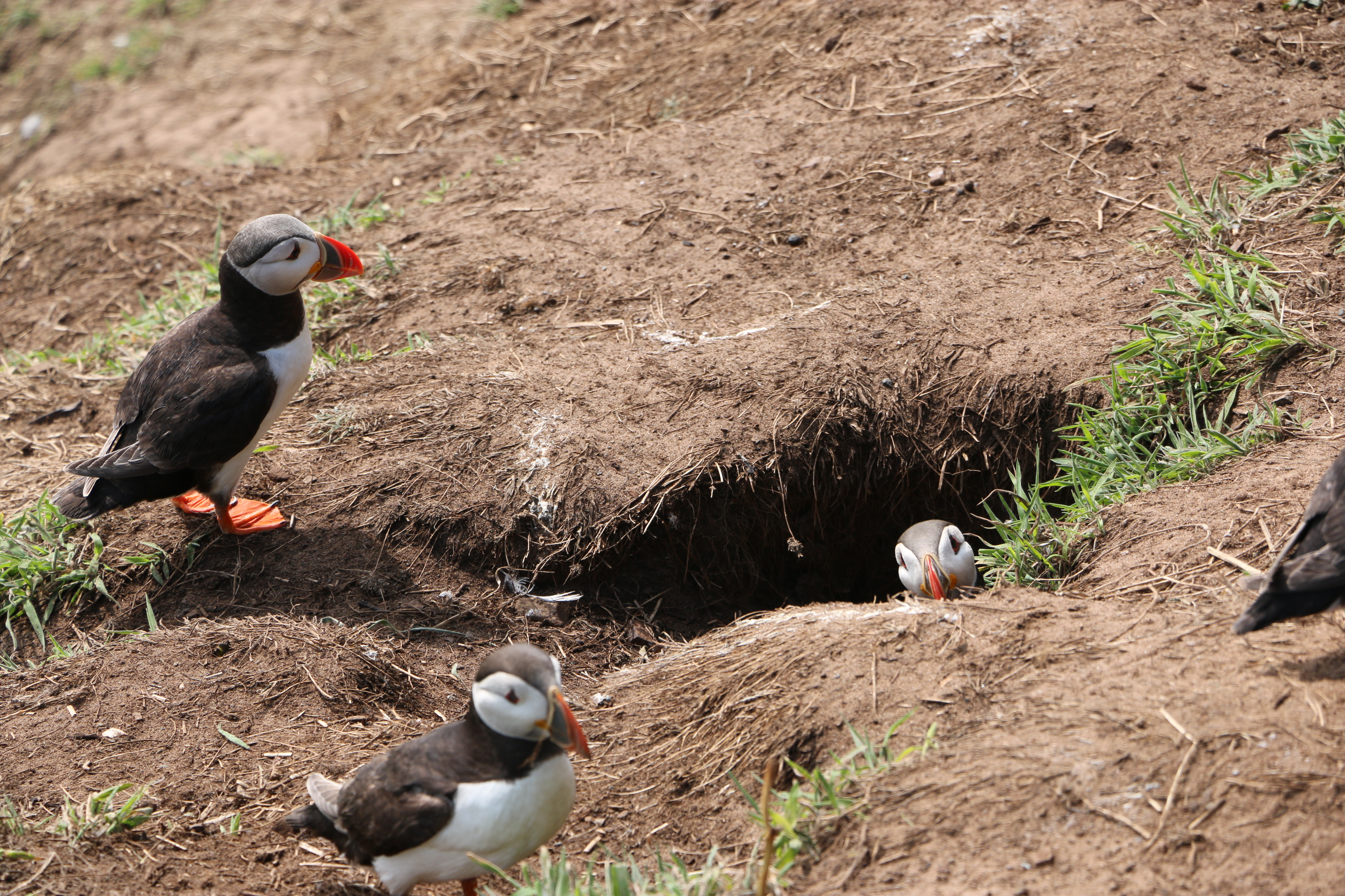
To be greeted by numerous curious puffins who seemed as interested in us as we were in them….
Skomer is internationally important for seabirds and, of course, there are necessary rules to protect the birds so we were told where and how we could walk the paths. One of the National Trust volunteers told us about the numerous species of birds on the island which included the Puffins – now in their last week before they leave the island – we were so lucky to see them.
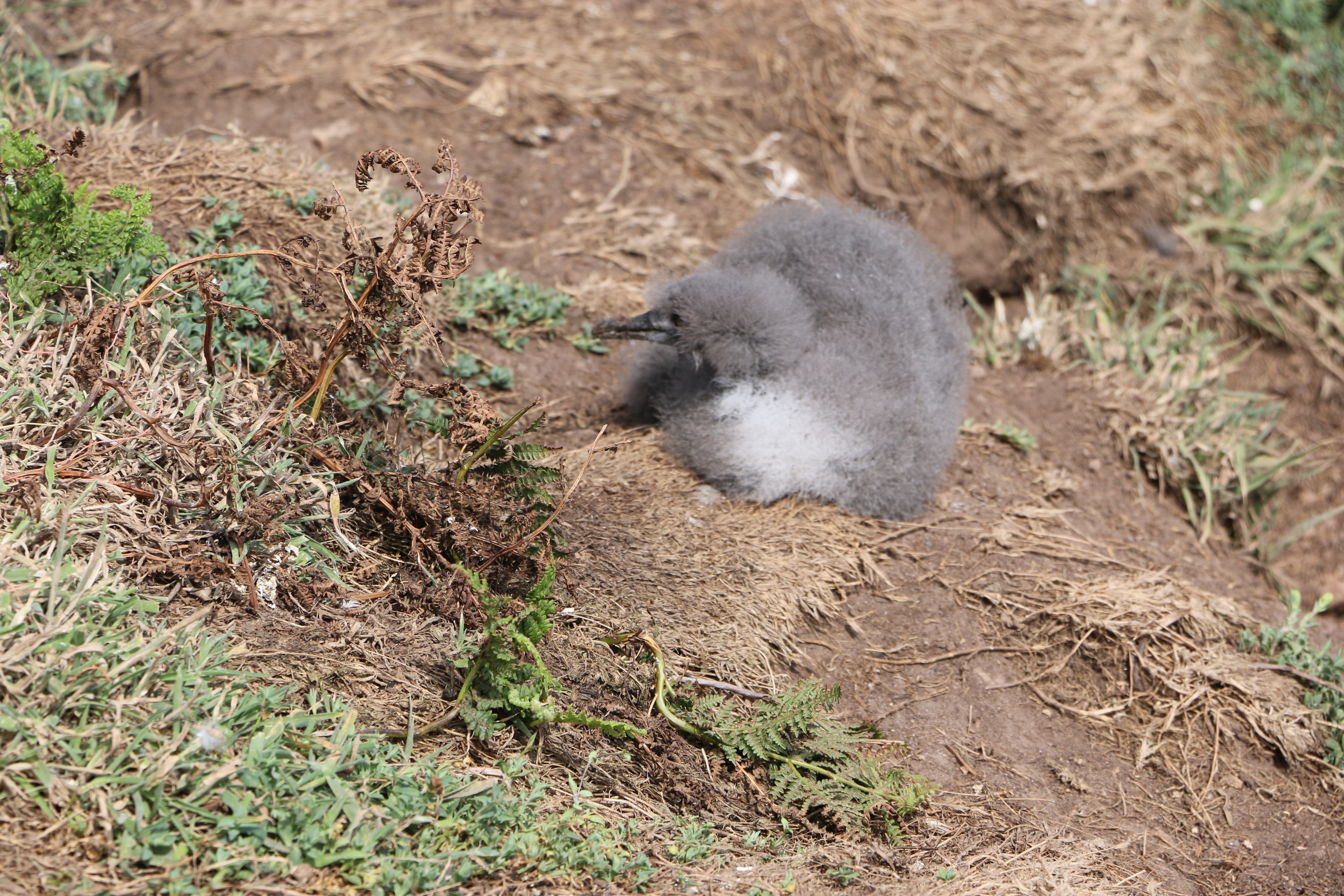
The colony ofManx Shearwaters is the largest colony in the world. Unfortunately we found quite a few remains of these on the narrow paths, apparently caught by the Great Black-backed Gulls. Later in the day we came across a crowd of people watching a Manx Shearwater chick which had wandered out of its ground nest. Seeing the amount of Gulls flying overhead, we hoped it managed to shuffle back to safety.
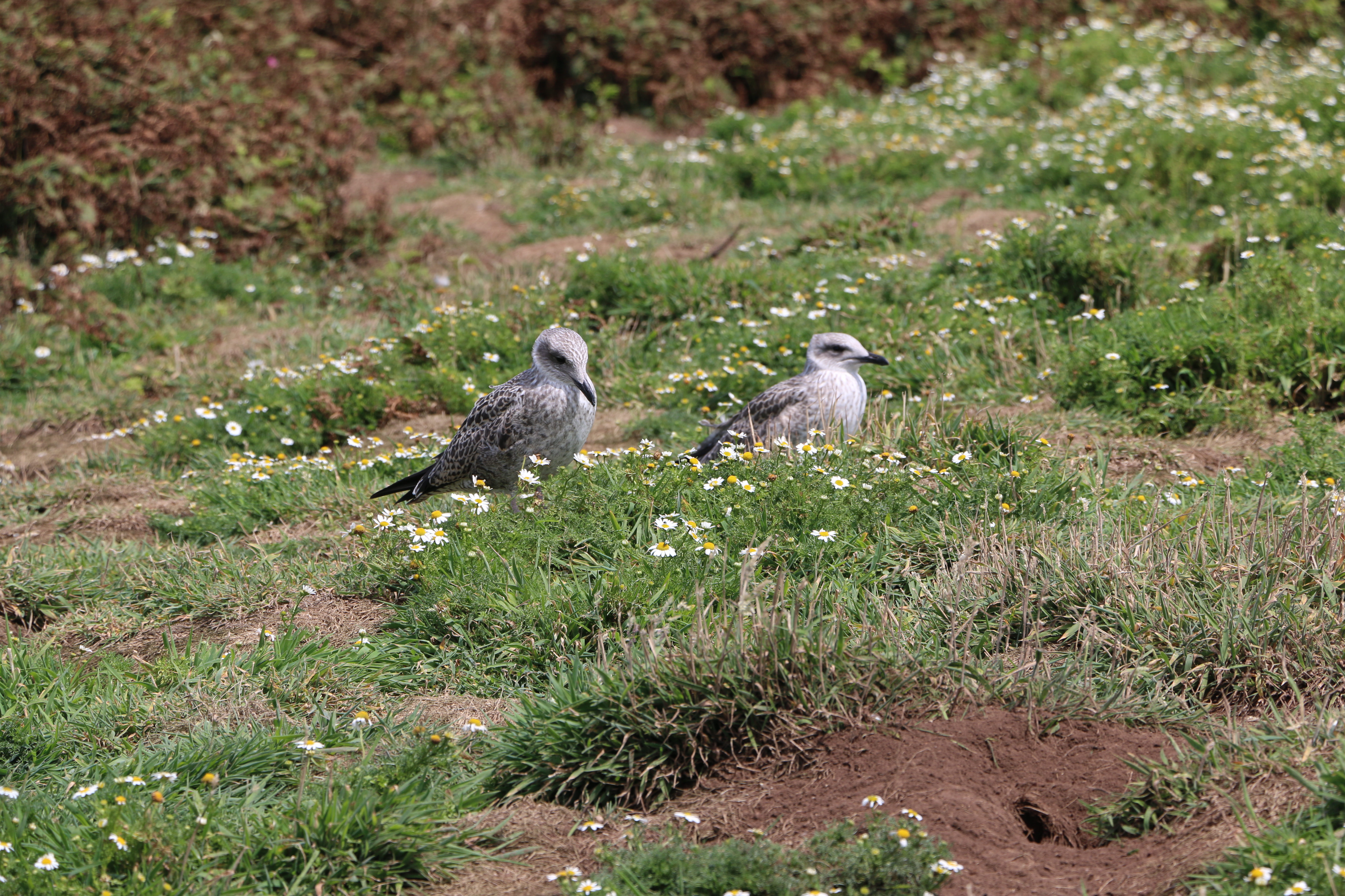
We weren’t lucky enough to see the Storm Petrels that are usually here on the island (they probably were but our binoculars were of slightly less quality than those hired out for five pounds by the National Trust). But we did see Guillemots, Razorbill, Kittiwakes, and so many of the ubiquitous Carrion Crows and Ravens
And at the Bird Hide, we watched Fulmars, Herring, Lesser and Great Black-backed Gulls as well as a pair of Canada Geese around the North Pond. (Well, I think they were Canada Geese, the Photographer said they were … ducks!) Huh!
Two watchful Kittiwakes
And, later in the day we were followed by a pair of these little birds – we think they were trying to lure us away from their nest.
We thought they were Stonechats – or Linnets – but maybe someone more knowledgeble will be able to correct us?
Some of the paths are so narrow they were designated one way paths – we were warned not to stand on the grass alongside in case therethere were still Puffin burrows with chicks in them. Others are wider and surrounded by ferns, daisies, wild flowers … a treat to see.
We arrived at the old farmhouse where we stopped for our picnic.
History of the farmhouse:
There are unsubstantiated records of a house built in the centre of the island, thought to be around seventeen hundred on which are the ruins of the old farmhouse, itself dated from about 1840. This was once an impressive and substantial house, built in the traditional Pembrokeshire style with small slates fixed in mortar, protecting the front of the house. Early pictures show a metal veranda running the length of the house, and at the back of the building, an old smoking oven where fish and meats would have been preserved. The slightly thicker soils in this part of the island and access to water in North Valley enabled a range of crops to be grown. There are records of the farm supporting three families at one time with cows and sheep grazing on the land as well as horses to help with the heavy work. Farming was largely abandoned after the outbreak of the First World War and all agriculture on the island finally ended in 1950.
And onwards to today:
In 1959 the Island was bought by the Nature Conservancy (the Government department that became the Countryside Council for Wales) helped by the West Wales Field Society (the charity that became the Wildlife Trust of South and West Wales). It was declared one of the country’s first National Nature Reserves and is now owned by National Trust and managed by the Wildlife Trust of South and West Wales.
In the next part of our visit to Skomer we move on from the farmhouse to the magnificent coastlineand impressive views.
Glen Rosa is a beautiful glen with Goat Fell mountain in the distance – stunning scenery.
Early morning (apparently the best time to do this walk), and we are already driving through Brodick. We turn into a lane just before the Old Brodick Burial Ground, signposted Cart Track, Glen Rosa’.There are two choices according to the directions; drive the first mile on a lane to where the track begins. or walk it. We debate. If it’s interesting, we’ll walk. We park, walk a little way … it’s just a lane between two hedges … nothing much to see.
The Photographer is keen to photograph the glorious views that the directions promise, so back to the cemetary.
The Brodick Old Cemetery was formerly associated with the Glen Shurig church,, erected in 1839 and demolished about 1931 when the congregation joined the Church of Scotland in Brodick. It looks like an isolated forest clearing and is difficult to acess, but the graveyard has a hundred and twenty-one monumental stones. They are mostly illegible but we do find one dated 1863.
When we arrive where the lane ends and the track begins, just alongside a campsite, we follow the example of others and pull onto the grass verge behind three other cars. We can see the riverbank of Glenrosa Water. We’re keen to get going: out of the car, hoist our rucksacks on our backs, the lead on Dusk.
The view up the glen opens up. We see Cir Mhor in the distance. And beyond it the summit of Cul nan Creagan, Glenshant Hill, and Goat Fell. I see the Photographer’s eyes light up; my heart sinks. ” We’re not going too far are we? It’s quite warm already.” He doesn’t answer – sets off almost at a gallop. Dusk and I follow…
The track is rocky and dusty, but wide, and the surroundings absolutely inspirational.
We arrive at a timber footbridge where the tributary, Garbh Allt, joins the Glenrosa Water and the pathsplits, with the left-hand fork tracing the smaller stream. The Photographer is already on the path at the other side. We see him looking down …
.Dusk and I stop. Two tiny snakes are wriggling around on the path. (For totally personal squeamish reasons I’ve made this photo as small as I can). However tiny they are, we are not going past them. We are going no further…
We wait. The Photographer is fascinated, as are three other walkers. But they don’t have a dog – “I need to stay here to protect Dusk!” I call. Eventually the snakes wriggle away into the grass, and I tentatively pass the spot they’d been cavorting on.
We follow the path alongside the Glenrosa Water. Before long we arrive at the Blue Pool.
A favoured spot for wild swimming, as a wet Dusk demonstrates.
After a stop for a picnic for us and a half of a dog treat for Dusk, we decide to carry on for more photo opportunities. But the path becomes narrower, more overgrown...
Until almost impassable.And after a friendly hiker informs us that it is the start of the breeding seaon for the adders who are coming out of hibernation (I don’t query his knowledge – just the thought decides me) … it’s time to be setting off back to the car … at a gallop.
We could have crossed an old stone bridge to join onto the circular walk, but we’ve been out for quite a few hours and it’s hot, so we retrace our steps and head back to the house.
N.B. Technical note: Goat Fell is labelled as a Corbett mountain. Corbetts are defined as Scottish mountains between 2,500–3,000 feet (762.0–914.4 m) in height with a prominence of at least 500 feet (152.4 m). They are named after John Rooke Corbett, a district valuer from Bristol, who compiled a list of them in the 1920s. He completed the Corbetts in 1939, when he was in his early 60s.
Climbers who climb all of the Corbetts are called Corbetteers, with the first being John Corbett himself. The second completion was by William McKnight Docharty in May 1960. A list of Corbetteers is maintained which as of July 2018 totalled 678.
We parked opposite the Eas Mòr Ecology centre, and crossed the road to pass the Forest at the Falls cafe. “We can call in for a drink and a bite to eat afterwards,” the Photographer says when I look longingly at the table where a couple are enjoying a coffee. The aroma is tempting but Dusk and I follow him up the short, steep path ….
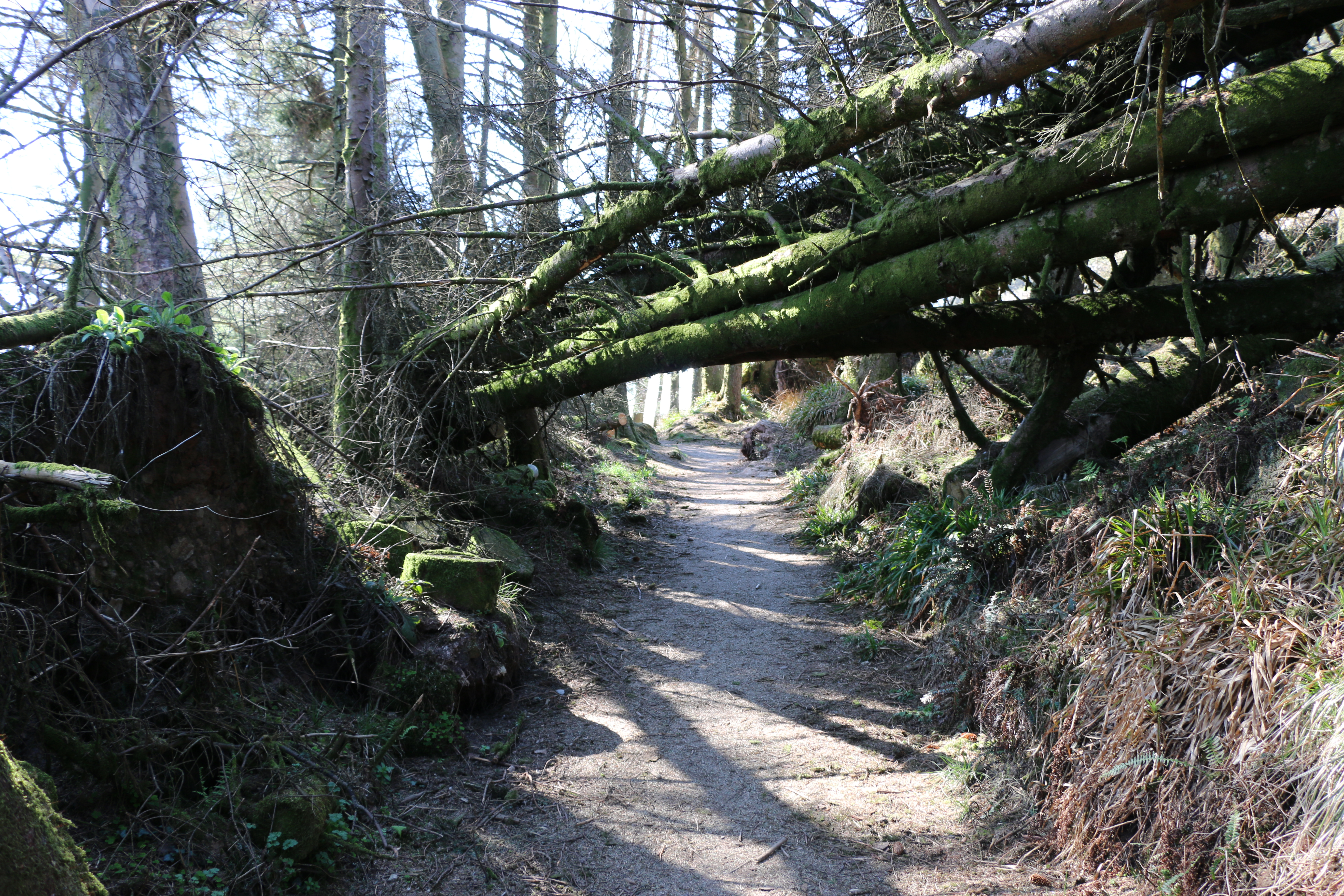
We duck under the trunks of a couple of trees that have fallen across the path. One has a plaque nailed to it – “Bow your heads for you enter sacred and magical lands”. As we were to discover when we finally reached Loch Garbad. Butfirst to the Eas Mór falls.
Today the falls are not as magical as the photographs from the travel website promised when we discovered this walk. It’s a little disappointing but it’s because the weather has been so dry. Only a small slender stream of water runs, mostly obsured by the surrounding shrubs and grasses from where we stand. (hence the above borrowed photograph). It’s certainly not as impressive as the Glenashdale Waterfall from our first walk on Arran, but it does fall over the cliff in a single dramatic drop into a deep dark gorge.
At a stone seat there’s a path junction with a signpost for Loch Garbad. From the description on the map we are following we expected to be walking though woodland but no; all the forest towards the loch has been felled under the Eas Mor project. This is the gradual conversion of the commercial conifer plantations back to semi-natural trees, so many of these have already been planted as saplings. (I’ve included the Facebook link above, because I think it is so impressive what they are doing in so many areas).This is a vast open area of brash (the above ground parts of the tree that hasn’t been removed from the site after felling – the foliage, branches and crown). Not yet as attractive as it will be, but it has opened up a terrific view across to Pladda Island to Ailsa Craig….
We stop for a while to admire and take photographs. Then carry on along the track …
It’s a bit of a slog. We meet only one other couple with a dog. Dusk and it exchange pleasantries, as do we, and then we plod on. (Yes, that is a sly photo of Dusk and me, taken by the Photographer!) The track is rough and narrow in places. I wonder how it must have felt in past times, winding through the overgrown woods, and I appreciate the openness, being able to see that last hill before we get to Loch Garbad.
Not far now.
We’re told to ‘pose’ – As you may be able to see, neither Dusk nor I appreciate this.
We’re both much happier sitting down for a welcome drink of water and taking in the remote beauty of the loch, whilst the Photographer goes off to do his own thing.
An hour later and we’re off again, somehow managing to take a wrong turn and having to retrace our steps to get onto the right path down the hill. Eventually taking the steps past the waterfall again and towards …
The Library in the Woods – which is exactly what it says – housed in a small log cabin it’s a hidden library in beautiful woodland, and filled with books and messages left by visitors over the years. Another project created by Eas Mor Ecology and built in 1998 from trees felled in a storm on Boxing Day.
Time to leave.We take a narrow path downwards through woods and across the bridge over the stream fed by the waterfall. Just in time … to see the cafe closing. “Never mind,” says the Photographer, ” We’ll be back at the house in no time. We can have a coffee there. What’s for tea?”
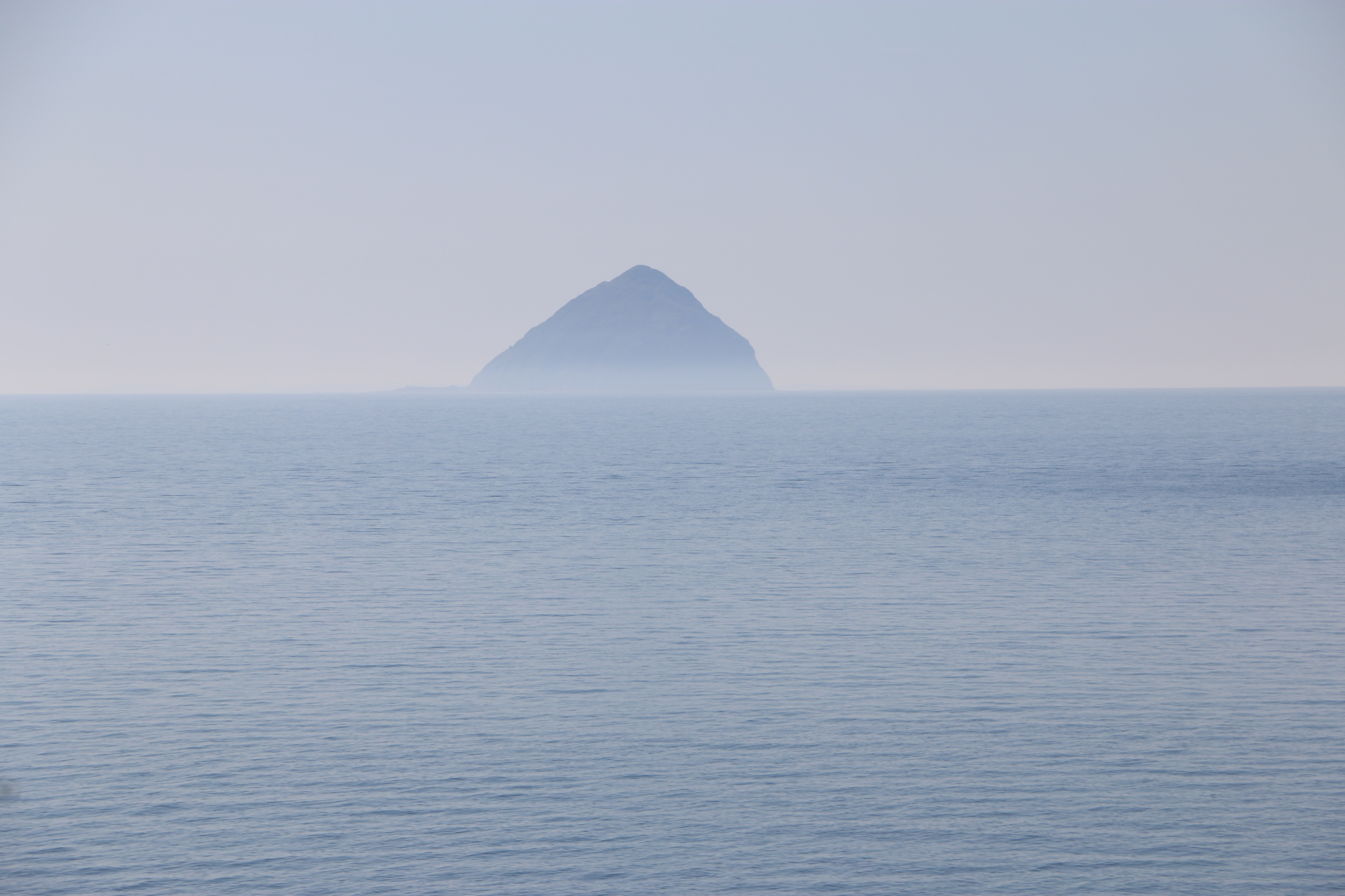
Ailsa Craig, sometimes referred to as the Granite Jewel of the Firth of Clyde, is an island that is colloquially known as “Paddy’s Milestone”. It was a haven for Catholics during the Scottish Reformation in the 16th century, and is also reknowned for being approximately the halfway point of the sea journey from Belfast to Glasgow, which was a traditional route for Irish labourers emigrating to Scotland to seek work.
The island is actually a volcanic plug from an extinct volcano, and is owned by David Thomas Kennedy, the 9th Marquess of Ailsa – except for the two hectares which were sold to the Northern Lighthouse Board in 1883.
The lighthouse was built around 1886, by Thomas Stevenson, a pioneering Scottish civil engineer. It originally used oil-burning lamps, but these were later replaced with incandescent lighting, and then, in 1990, the lighthouse was automated. Further refurbishment, in 2001, meant it was converted to run on solar power.
The island contains some of Europe’s most important bird colonies, which includes the continent’s biggest gannet colony, as well as puffins, so is managed as a nature reserve by the Royal Society for the Protection of Birds (RSPB). It’s also designated a Site of Special Scientific Interest (SSSI) and a Special Protection Area, mainly because of thecolony of grey seals, and the occasional whale. There are also visiting large basking sharks during the warm summer months which can be seen feeding at the surface on the planktonic bloom.
The texture of the rocks on Ailsa Craig is a granite called microgranite that is so hard and resistant to impact, it makes it ideal for the manufacture of curling stones. The manufacturer, Kays of Mauchline, Ayrshire in Scotland, has the exclusive rights to the granite, granted by the Marquess of Ailsa, and has been making these stones since 1851, and providing them for the Winter Olympics since Chamonix in 1924.
I thought it interesting that boulders of of the Ailsa Craig microgranite were transported by glaciers as far afield as County Donegal and Pembrokeshire. Of course this led me down another rabbit hole …
The microgranite is part of the geology of the Precambrian rock of the Pembrokeshire Coast National Park. Formed as the lava pushed through the existing rocks and solidified, these rocks can be seen in various locations, such as the coastline of St Bride’s Bay and the southwest tip of the St David’s Peninsula.
Something else I discovered…
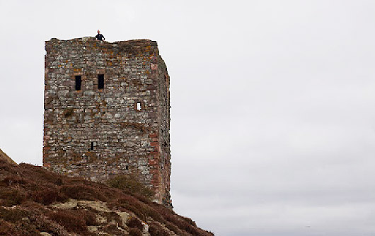
There are ruins on the island of a castle.
Ailsa Craig Castle today – photgraph courtesy of Douglas Wilcox www.seakayakphoto.com
These remains are of a castle built in the middle of the sixteenth century by the Hamilton Family to protect the island from King Philip II of Spain. It stands on a shoulder of rock around three hundred feet above the sea, the only approach to it a steep and narrow footpath, although there used to be an external set of stairs to the tower. The castle was in ruins after the Reformantion but was later restored by Thomas HamiltonIn and the work recorded by an armorial panel high up on the south gable, showing the Hamilton arms.Today only the tower remains.
We are on our way to walk to Loch Garbad. Dusk is on the back seat. When I hear her move, feel her patting me on the shoulder with her paw, I presume she needs a ‘comfort break’ (as they politly say on coach trips). We turn off the road onto a side lane towards the village of Kildonan, and park on the first layby we come to.
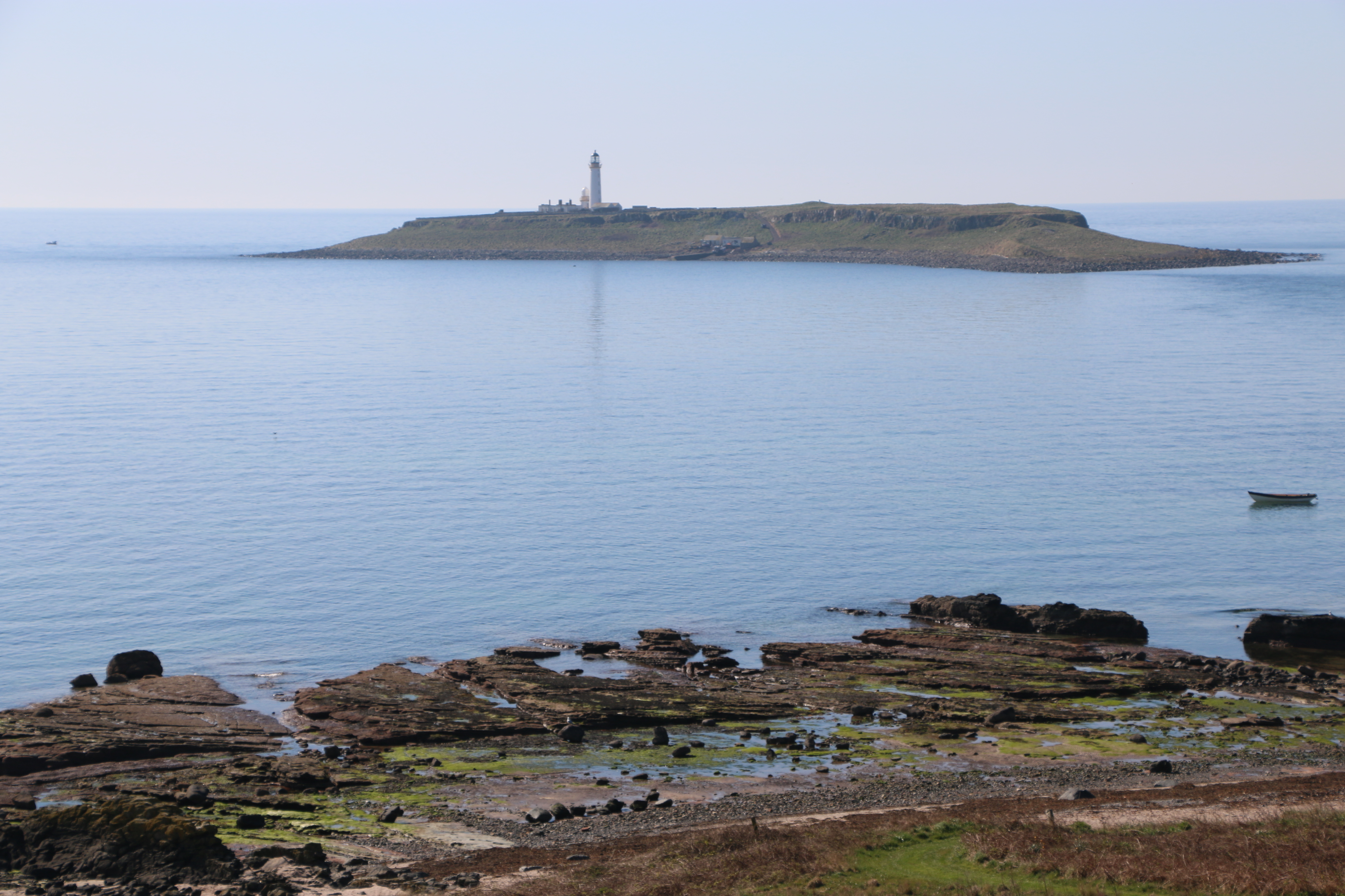
I think Dusk just wanted us to see the glorious coastline and the two islands nearby: Ailsa Craig and Pladda. Ailsa Craig deserves its own blog, so what follows is what we discovered about Pladda Isle.
Pladda Isle (Pladda – Scottish Gaelic: Pladaigh – the name comes from Old Norse and means “flat isle”) has been the site of a lighthouse since 1790).
The main structures of the Pladda lighthouse date from 1820 and were constructed under the administration of Thomas Smith of the Stevenson company.
To allow seafarers to distinguish it from the other nearby lighthouses at the Mull of Kintyre, Cumbrae and Copeland, a lower light from a small lantern twenty feet lower than the original one was installed and this carried on for more than one hundred years. And in 1876, a fog signal was also installed on Pladda.. This arrangement operated for about 100 years.
Pladda Isle (Pladda – Scottish Gaelic: Pladaigh – the name comes from Old Norse and means “flat isle”) has been the site of a lighthouse since 1790).
In 1901 fixed lights were no longer regarded as suitable for the island so coastal lights and a group of flashing lights were installed. The lower tower was then no longer needed.
The lighthouse keepers who were permanently attached to the station were brought provisions four times a month, two of which landed on Sundays to allow light keepers to attend church.
Everything changed in 1972 when a helicopter began to be used to transport the keepers. But then, in 1990 lighthouse became automated and the lighthouse keepers were no longer needed. The lighthouse is now monitored remotely from Edinburgh and the island is unoccupied. The traditional lantern and lens have been replaced by a couple of solar powered LED lights.
The modern plaque at the base of the main tower bears the crest of the Northern Lighthouse Commisioners and the motto “In Salutem Omnium” – For the Safety of the island
Previously the island was part of the Arran Estate, but in 2022 it was bought and is now privately owned.There are plans to build a luxury property on the island.
ENDNOTE:
For over one hundred and fifty years Robert Stevenson and his descendants designed most of Scotland’s Lighthouses. Battling against the odds and the elements – the Stevensons constucted wonders of engineering that have withstood the test of time, an amazing historical achievement.
“Coelum Non Solum”
Robert Stevenson’s talented family also included the famous writer/novelist Robert Louis Stevenson (his grandson). Visits with his family to remote lighthouses are thought to have inspired his books Kidnapped and Treasure Island.
“There is scarce a deep sea light from the Isle of Man to North Berwick, but one of my blood designed it. The Bell Rock stands monument for my grandfather; the Skerry Vhor for my uncle Alan; and when the lights come out along the shores of Scotland, I am proud to think that they burn more brightly for the genius of my father.”
Robert Louis Stevenson
The above was found on the link https://tinyurl.com/yb9x6mpj when I was researching Pladda. It’s fascinating going down these rabbit holes!!
We’ve just returned from a wonderful couple of weeks on Arran. The photographer sourced the walks for us. Today he promises a short outing because it’s rather warm; “maybe a couple of hours allowing for stops… for Dusk, our borrowed border collie, of course”. (Oh, not for photographs then?).
We are going to one of the most famous waterfalls on Arran, Glenashdale Falls, and then on to see the Giants’ Graves.
We follow the directions from a rather old book of walks, which immediately adds a couple of miles on by sending us along a wide rather rough road, instead of going to the end of Whiting Bay and turning onto the forestry track.
Though I have to admit we passed some peaceful scenic views.
We were unable to follow the path through the forest to the Iron Fort due to the damage and fallen trees, caused by the latest storm on the island. So we continued along the wide track for another mile.
We reached Glenashdale Falls, also known as Eas a’ Chrannaig, one of a series of falls on the Glenashdale Burn, which flows from moorland near the summit of Tighvein eastwards towards Whiting Bay.
The viewing platform – not for anyone scared of heights
Not sure why I was encouraged to go along the viewing platform first. Thinking about it, my walking companions may have thought I was heavier than the two of them put together…
The sound of the rushing water competes with the breeze rustling through the trees around us. It’s a magnificent, awe inspiring place.
We retraced our steps from the waterfall and turned left, following a sign to the Giant’s Graves along the wide track … for another mile.
The Photographer trudges through tall grass to the edge of the cliff to take pictures. At one point he disappears completely. Dusk and I wait – patiently – he’s done this disappearing act many times in the past, just to get a good shot of somewhere.
When he returns we walk on, until a sign for a narrowpath informs us we’re almost at the site of the Giants’ Graves.
The Giants’ Graves are the remains of two Neolithic chambered tombs on the Isle of Arran in Scotland on a ridge one hundred and twenty metres above the sea and overlooking Whiting Bay to the south. Mostly ruined, with turf covering part of the remains, they still have an air of mystery standing proud in a clearing in the forest. The North cairn, excavated in 1902, has a chamber that is six metres long, and is around one metre wide. Among the artifacts recovered were pottery shards, flint knives, and leaf-shaped arrowheads. The South Giant’s Grave has a chamber about four metres long, and over one metre wide. The initial excavations in 1902 only revealed soil and stones, but in 1961/2 more exploration produced nine shards of a round-based vessel, and fragments of burnt bone.
Legend has it that the giant referred to is Fionn mac Cumhaill, an early Irish war-leader, and his followers, known as the Fianna. Between the 10th and 14th centuries, his legend became widely known in Scotland. According to legend, Fionn and the Fianna had superhuman strength and size, being as much as 500 times larger than a man.
It’s getting late; we need to get back to Whiting Bay.
Beyond the graves the narrow path winds its way steeply down. And one of the rare times the Photographer catches me unawares for a photograph … from behind!
One last photo – Whiting Bay, with Holy Island in the distance.
The walk took us just a little more than the two hours that the more up-to-date directions we later discovered, so the following day we had a rest (using Dusk as our excuse again!) before our next adventure – a coastal trek as far as Kingscross Point, stopping to photograph the ruins of a viking fort and the views of Holy Island, before continuing back to Whiting Bay.
The Holy Island or Holy Isle is an island in the Firth of Clyde, off the west coast of central Scotland, inside Lamlash Bay on the larger Isle of Arran. The island is around three kilometres long and around one kilometre wide. Its highest point is the hill Mullach Mòr. There will be more about the Holy Island in our next post of walking on Arran.
And now a little self indulgent promotion…
A gripping ‘cuckoo in the nest’ domestic thriller
After the death of their mum, twins Chloe and Charlie are shocked when their dad introduces Lynne as their ‘new mummy’. Lynne, a district nurse, is trusted in the community, but the twins can see her kind smile doesn’t meet her eyes. In the months that follow they suffer the torment Lynne brings to their house as she stops at nothing in her need to be in control.
Betrayed, separated and alone, the twins struggle to build new lives as adults, but will they find happiness or repeat past mistakes? Will they discover Lynne’s secret plans for their father? Will they find each other in time?
The Stranger in My House is a gripping ‘cuckoo in the nest’ domestic thriller, exploring how coercive control can tear a family apart. Set in Yorkshire and Cardiff, from the 60s to the winter of discontent, The Stranger in My House dramatises both the cruelty and the love families hide behind closed doors.
“Judith Barrow’s greatest strength is her understanding of her characters and the times in which they live.” Terry Tyler
Grateful for this reader’s review. One of the first for The Stranger in my House, when it was published in November 2024.
“The Stranger in my House is an urgently compelling story of abusive power, detailing the damage that happens when those with the power to protect vulnerable children choose to turn their eyes away. Judith Barrow takes us into the dark & haunted world of coercive control, masterfully turning her own power as a storyteller on to this troubling theme, exploring it with insight & sensitivity.
In Lynne, the author has created a monster. Her victims, twin children Chloe & Charlie & their hapless father, are each portrayed with Judith Barrow’s usual precision & humanity; the writing as always, is impeccable.
It is a troubling book, but ultimately, on some level, redemptive. And although I found the ending satisfying & honest, I was nevertheless left with a sense of sadness, not only for Chloe & Charlie, but because decades on from the events in this book we still exist in a world where the emotional needs of children are too often subsumed by those of selfish, self-serving, abusive adults. The Stranger in my House is a hugely important book & I highly recommend it.“
The two hundred acres of Craflwyn estate is set in the heart of beautiful Eryri (Snowdonia), an area steeped in legend.
A walk of two halves today. We parked at the Crafwlyn Estate car park, just outside Beddgelert and, having read the information board, the Photographer and I decided to do the Green Walk. The sign promised an easy to moderately difficult ascent of only one and a half miles to the viewing point. It was the “spectacular views” that clinched it.
The heather was glorious. The path was … somewhere…
The walk turned out to be difficult, and certainly longer than one and a half miles. Quite the opposite in fact, and it and became steeper almost immediately, and very rocky. We assumed it would level out at some point but it never did and we just kept climbing and climbing.
Dinas Emrys is a rocky and wooded hillock near Beddgelert. Rising some seventy-six metres above the floor of the Glaslyn river valley, it overlooks the southern end of Llyn Dinas. The legend is that it’s where Merlin once trod and where a dragon still sleeps. At the top are the remains of a square tower and defensive ramparts belonging to the ancient princes of Gwynedd. We never saw that at any time over the week… ” the square stone tower at Dinas Emrys in Gwynedd, Wales is believed to be the base of a 12th century tower or citadel. The tower is now in ruins, but its rectangular shape and local rubble masonry are still visible. According to legend, the tower was built by King Vortigern as part of a castle he wanted to construct on Dinas Emrys. However, the walls would mysteriously collapse each night, which led Vortigern to seek the help of Merlin the wizard. Merlin revealed that two dragons, one red and one white, were fighting in a pool beneath the castle. Vortigern and his men dug into the mountain to release the dragons, and the red dragon eventually won the battle. The castle was then named Dinas Emrys in honor of Merlin, and the red dragon became a symbol of the fight against the Saxons.
oplus_32
Just at the point where the ferns and tufts of coarse grass petered out, and the way in front of us rose sharply and consisted of sharp rocks, it began to rain and the view disappeared. We turned and scrambled back down – the second time we’d turned back on a walk that week.
One disgruntled Photographer…
Twenty minutes later and wet through, we saw a sign for the Waterfall trail. A footpath lead through the woodland, following a waymarker to the right.
We passed the dragon bench. Too wet to sit on it though.
We walked up some steps to see a small waterfall. But we could hear loud splashing further along the path.
The large waterfall. Apparently deep enough to swim in. I didn’t test that theory.
It was a wonderfully peaceful end to the day – and to our last walk of the holiday.
We’d had a great week. The photographer was keen to get home to start downloading, printing off and framimg his photographs.
I was ready to finish the proofreading of my next book, The Stranger in my House, to be published by Honnoon the 14th November 2024 .
Described as…
“A gripping ‘cuckoo in the nest’ domestic thriller
After the death of their mum, twins Chloe and Charlie are shocked when their dad introduces Lynne as their ‘new mummy’. Lynne, a district nurse, is trusted in the community, but the twins can see her kind smile doesn’t meet her eyes. In the months that follow they suffer the torment Lynne brings to their house as she stops at nothing in her need to be in control.
Betrayed, separated and alone, the twins struggle to build new lives as adults, but will they find happiness or repeat past mistakes? Will they discover Lynne’s secret plans for their father? Will they find each other in time?
The Stranger in My House is a gripping ‘cuckoo in the nest’ domestic thriller, exploring how coercive control can tear a family apart. Set in Yorkshire and Cardiff, from the 60s to the winter of discontent, The Stranger in My House dramatises both the cruelty and the love families hide behind closed doors.” https://tinyurl.com/349ucdat
I’m happy to leave things as they are here. So, until next time … thank you for following the Photographer and I on our adventures.
Moel Hebog (Welsh for Bare Hill of the Hawk) is a mountain in Snowdonia, which dominates the view west from the village of Beddgelert.
This was the next walk we did. I say ‘walk’ as a vague description. And I need to say at this point that we hadn’t read the following review beforehand.
“This is very much a steepish persistent trek from the beginning to the end. The path is very sketchy in places and you have to work out the best way forward. You go around the false peak and a bit further up you come to a near vertical wall bit. Be careful here as a number of false paths on where to go up. Take your time to work out the safe route which is on the left side of the paths. It’s only two-four steps scramble then you are back on a reasonably marked trekking path. This trek is not for beginners you really need the experience of being able to work out safe routes and a little scrambling experience. You also need a reasonable level of fitness as it’s very much a full on upwards & downwards trek, not any flattish areas. When I did it mid May 2024 the forest walk on the descent was impassable as flooded, very boggy so had to walk around the gravel tracks that added around 4 miles to the trek. Really enjoyed this trek, it is physically challenging as you gain height quickly, I would fully recommend trekking poles as they help. The downward grassier slope going down to the forest is steep so trekking poles really useful. Enjoy, take your time and stay safe.”
Oblivious to this review (but with our trusty walking poles, as usual), we walked past Beddgelert Railway Station, then along a lane crossing the railway line.
We passed a farm, said hello to the dog who came out to watch us, and walked through a small wood before the land opened up. There was a stone path across crossing a field, and then a post which indicated we needed to go straight ahead to a stile over the stone wall. (Yes, there had to be a stile!!)
At first the path was a meandering course on spiky grass with golden brown ferns set in a landscape of small outcrops and boulders. (Later in the day, having coffee in a small cafe, we met three young climbers who told us that these boulders were called erratics, glacial boulders or rocks that have been transported by ice and deposited. The type of rock – the lithology – the physical, chemical, and mineralogical properties – that the glacial boulder is made from is different to that of the bedrock where it’s been deposited.)We live and learn!
As we climbed,I took advantage of every photo stop, as usual. (my ‘catching my breath’ time). The landscape was glorious. And there, in the distance, was Llyn Dinas.
We stopped for lunch, debating at this point on whether we’d gone as far as we should (could!) Just then two couples passed, going back down. ” That’s us done,” said one of the men. “We know when we’re beaten. Off for a pint.” They were about twenty years younger than us. We looked at one another, made our decision; if going any further was too much for them, we had no chance. We packed up our things.
So there we are – sometimes ignorance is bliss. Or very foolish. But it was a lovely day, we took our time, had food and water – and knew when we’d got as far as we wanted to.
We took one last look at the dark peak of SnowdonIn in the far distance before we turned and made our way down towards the road. “Got some fabulous shots though,” said the photographer, cheerfully. I agreed, relieved to be back on tarmac.
Later, looking back at the walk, I read the following.’The Moel Hebog shield (Welsh: Tarian Moel Hebog) or the Moel Siabod shield, is a large copper-alloy shield from Bronze Age, found in a bog on he north-west slopes of Moel Hebog. Discovered in 1784, it dates from 1300–1000 BC and is now in the British Museum in London.
Richard Blurton (a specialist in South Asian art and archaeology, formerly Assistant Keeper at the British Museum), wrote about the shield in his book The Enduring Image: Treasures from the British Museum (only £209, plus £9.75 postage). He says, “This shield is a splendid example, representative of the rise of large sheet-bronze work in later Bronze Age Europe. Much effort was directed towards the production of ceremonial metal armour indicating the prevalence of the idea of man as a warrior.“
The last part of our hike walk was along the Fisherman’s Walk,following the course of the Afon Glaslyn, a sixteen mile sea trout river whose source is a lake in a valley on the edge of Snowdon,and eventually runs into Tremadog Bay near Porthmadog.
We’d rewarded ourselves with a fabulously tasty but light meal in a bistro in Beddgelert and a wander around for an hour or so, before tackling the last part of the walk. After refilling our water bottles we strolled along a paved footpath along the riverside. This will be a doddle, I thought, watching the Photographer indulge in a few photos shots. A nice, calm, wide river.
Further on we crossed a footbridge beside the railway bridge and went through two kissing gates that crossed the railway line (still no sign of the elusive steam engine – to his disappointment and my relief at that point – after the day we’d had I didn’t fancy being run over by a steam train!).
But I wasn’t prepared for what was around the corner…
Glorious though the river was, it had rained quite a lot in the previous few weeks. Now Afon Glaslyn flowed swiftly over rocks and gulleys. And the path is made up of slabs, rocks and, sometimes an indiscernible way forward. I think the only thing I said in the next hour was … “Where’s the path gone?”
See what I mean?
This section was especially challenging – note the handholds hammered into the rock face so we could swing around the corner of the rock on the narrow path … er … stone slabs above the churning Afon Glaslyn.
One last scramble over rocks before we reached the relatively safer gravel path
And back onto the bridge that we’d stood on at the beginning of the day. And a chance for a last photograph.
And … a welcome sight … back to the cosy farm cottage in Nantmor, where we were staying for the week. Ready for an evening of quiet editing of my next book – The Stranger in my House
Nantmor is famous for being the filming location of the 1958 film, Inn of the Sixth Happiness starring Ingrid Bergman and Robert Donat. The film was based on the true story of Gladys Aylward,a British nurse who became a missionary in China in the unsettled years leading up to the Second World War. Nantmor doubled as China and people from the Chinese communities in Liverpool were brought in as extras for filming.
I found an interesting article on the history and repairs of the Popular Fisherman’s path in Beddgelert when ” After winter storms and high river levels washed away a 100m section of the Fisherman’s path, the Welsh Highland Railway swapped its cargo of tourists for stone, reverting to its original purpose for a day. Repaired, thanks to special delivery by Welsh Highland Railway.” Published: 20 February 2023: https://tinyurl.com/32md9b3f