
The last time we were here was last summer, on a warm and sunny day. After parking the car we’d walked down the winding track to the beach. The tide was well out and we’d strolled along the edge of the lapping gentle waves on the long stretch of sand.
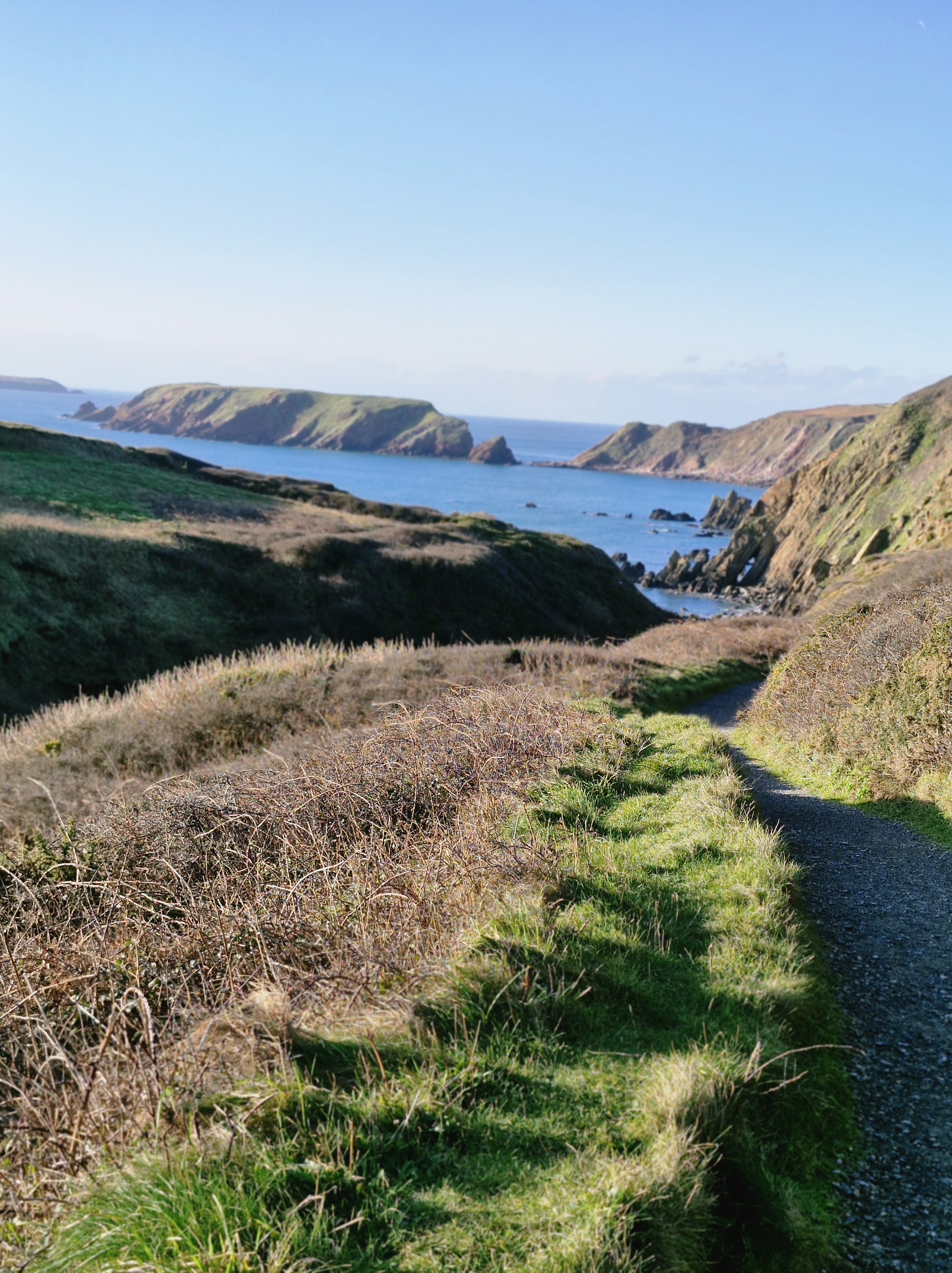
This time: Boxing Day 2025, so bitterly cold that initially it took away our breath. But the sun was shining and the sky was a gloriously clear blue. It was good to be outside after days of rain. We sauntered down the track to the grassy path that led to the beach
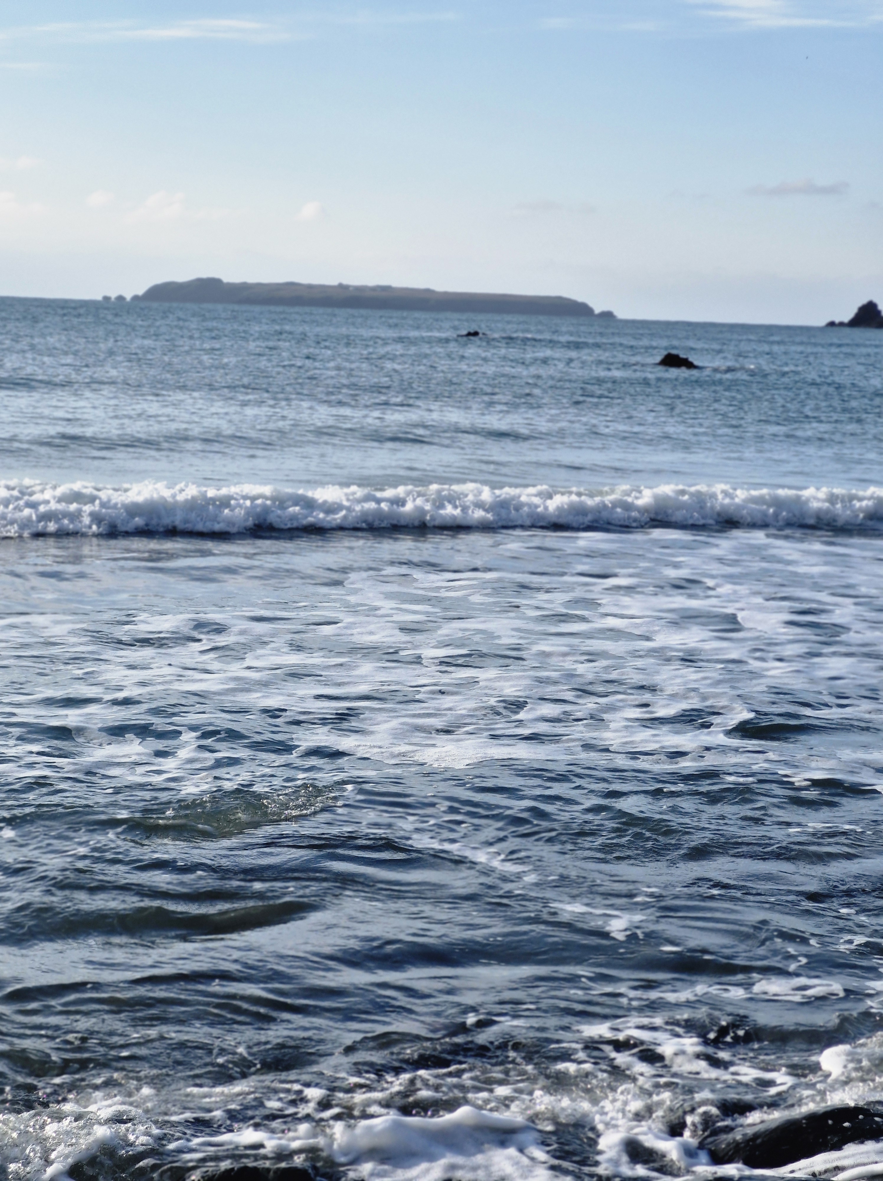
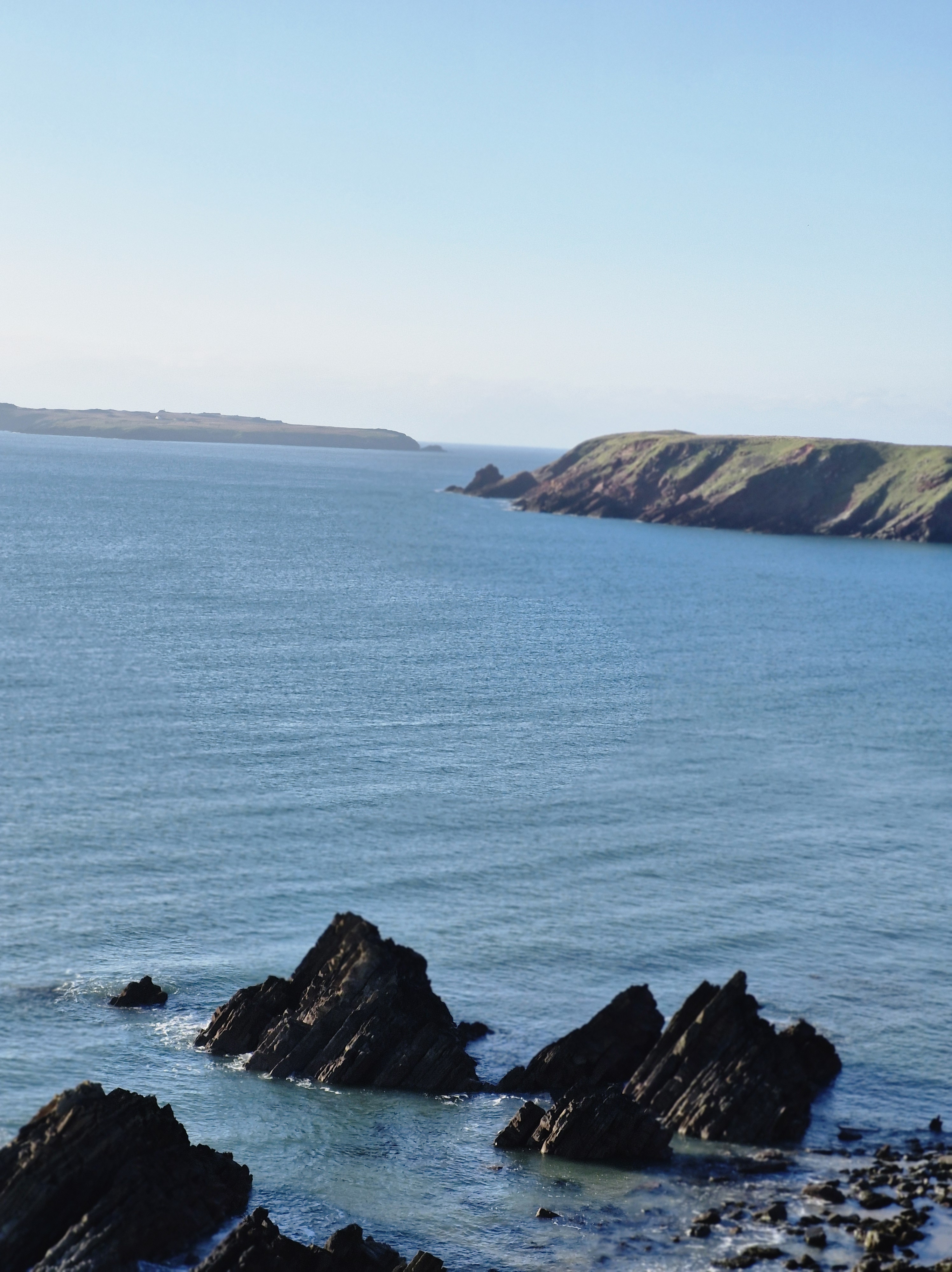
The tide was in. In the distance we could see Skomer Island which we’d visited inJuly. An adventure I’d written about here and here.
We turned away from the beach and, after only slight hesitation, we crossed a small footbridge over a stream and followed a path to the top of the cliff that we’d not walked on before.


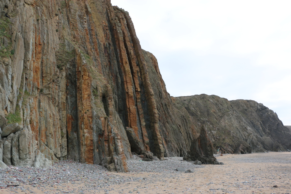
It was a little hair-raising to be honest. But the views were wonderful. After half an hour along an ever rising, and narrowing path we came to a halt at the top of steep and winding steps that obviously led down to the beach. Go on, or go back? We’re not very good at going back on walks, however lost we are, or in this case, however daunting the steps. So we decided – in for a penny and all that…
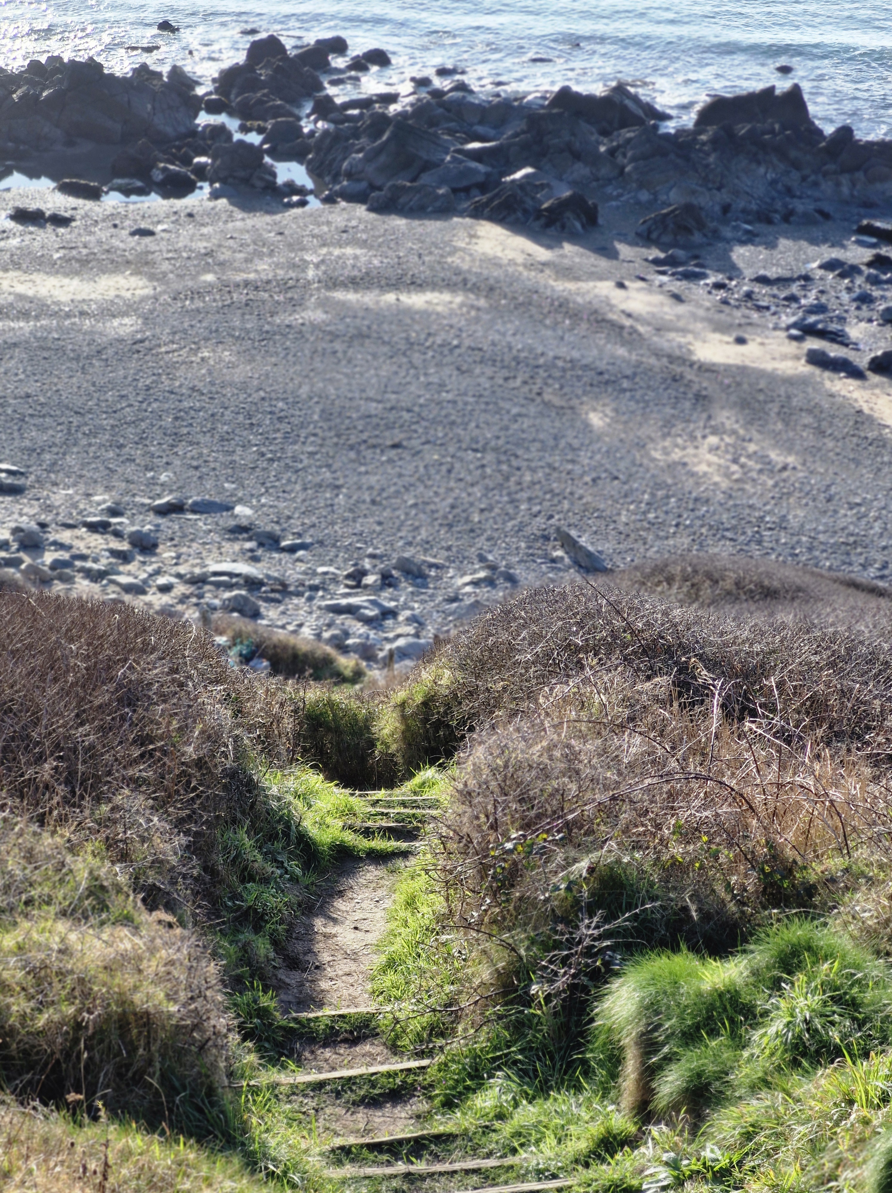
It took us ten minutes of walking sideways down each step and being very grateful for the walking poles we’d debated on bringing with us – (After all, it’ll only be a beach walk!” I’d said, foolishly).
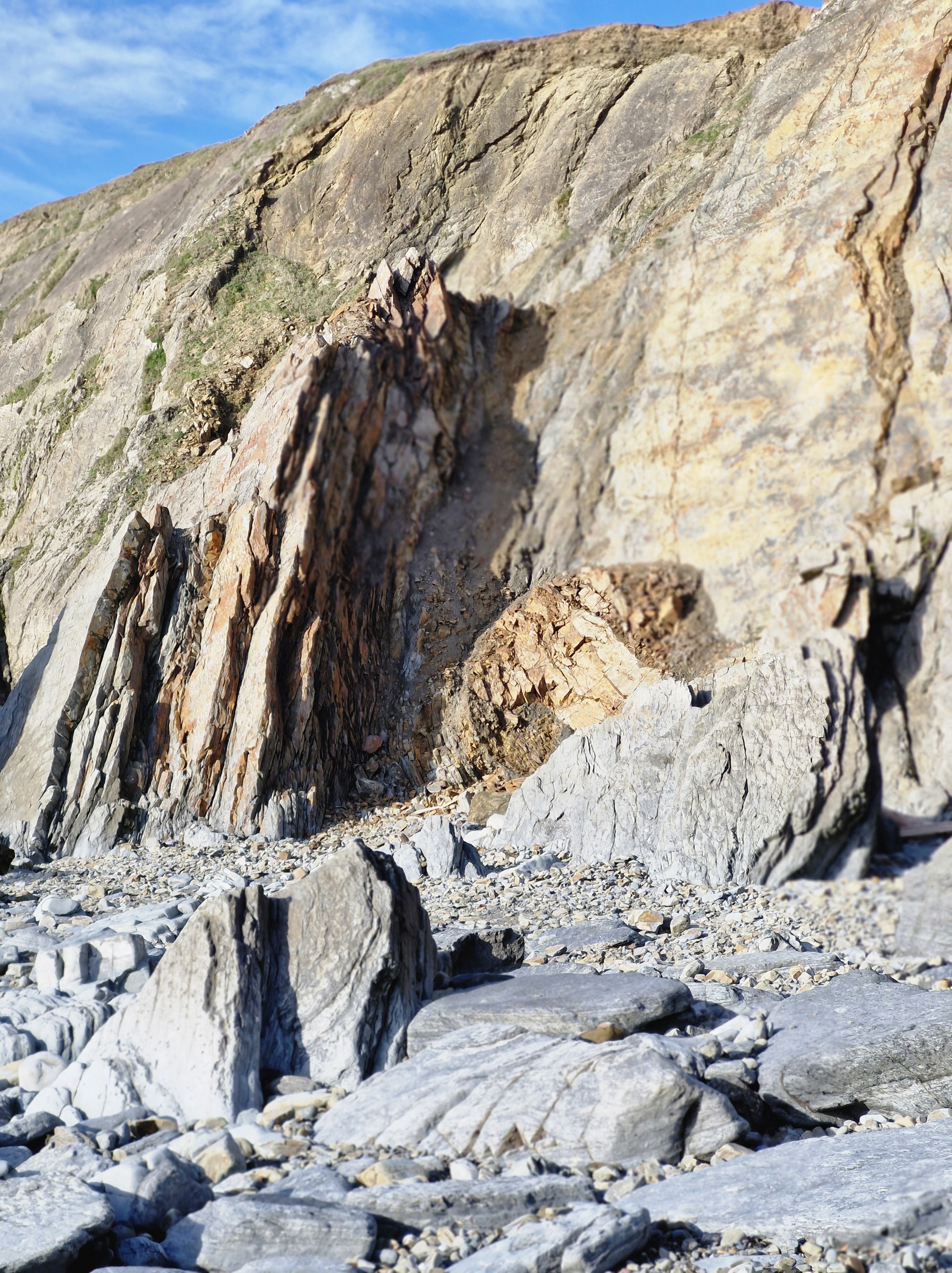
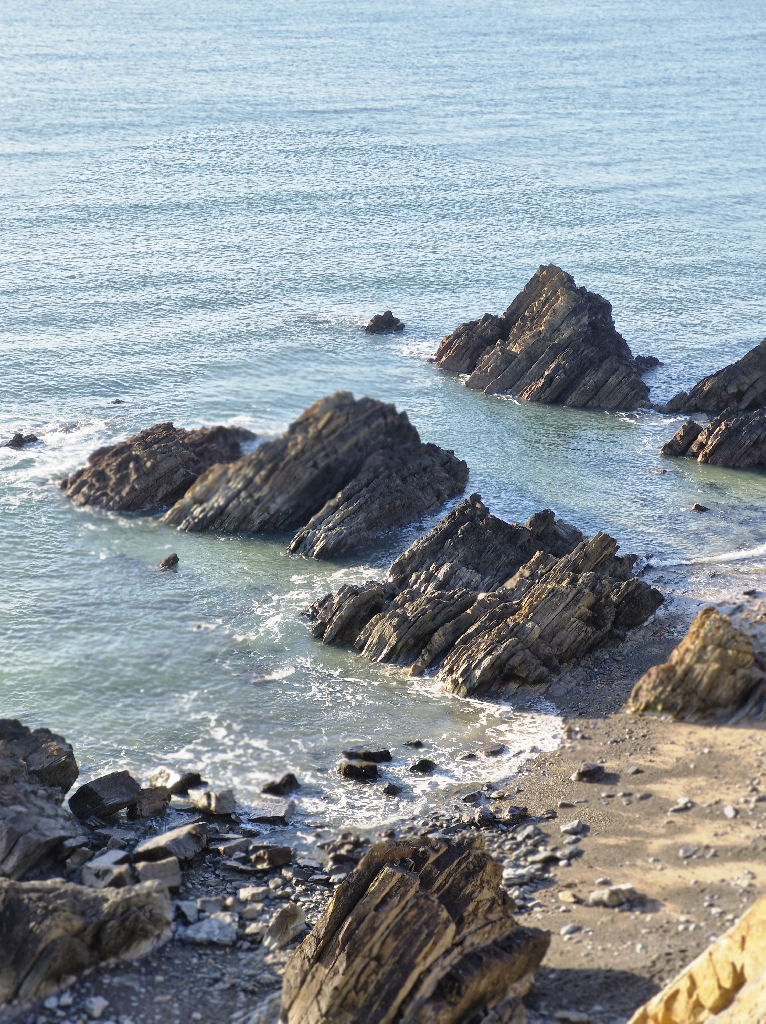
I don’t know who’d built those steps but they’d obviously decided that anyone who could navigate them thus far would be fit enough to leap over the last two metres of sheer rock at the bottom to reach the beach.
Before I could decide to either slide down the rock on my backside, or roll down through the gorse bushes on either side of the path I heard a cry. ” Bravo! You are legends!” A lady appeared below. “Stay there. I’ll help you down, you legend. Grab my hand.” I was, I have to say, very grateful for the help.
Until, finally on level ground – (levelish – i looked it up, there is such a word, specially invented i guess for rocky beaches) – I looked at this lovely lady – and realised she was probably around our age.
To be clear though, she did tell us she’d arrived at this particular spot at low tide, and had walked along the wide stretch of sand from the other end of the beach – where we’d we’d originally planned to walk from. And also that the steps we’d come down were locally know as the emergency exit steps for when someone was caught out by the high tide. So that was the answer – whoever built the steps knew that anyone wanting to use them would probably be swimming to them – and not by choice; to escape being trapped by the tide.
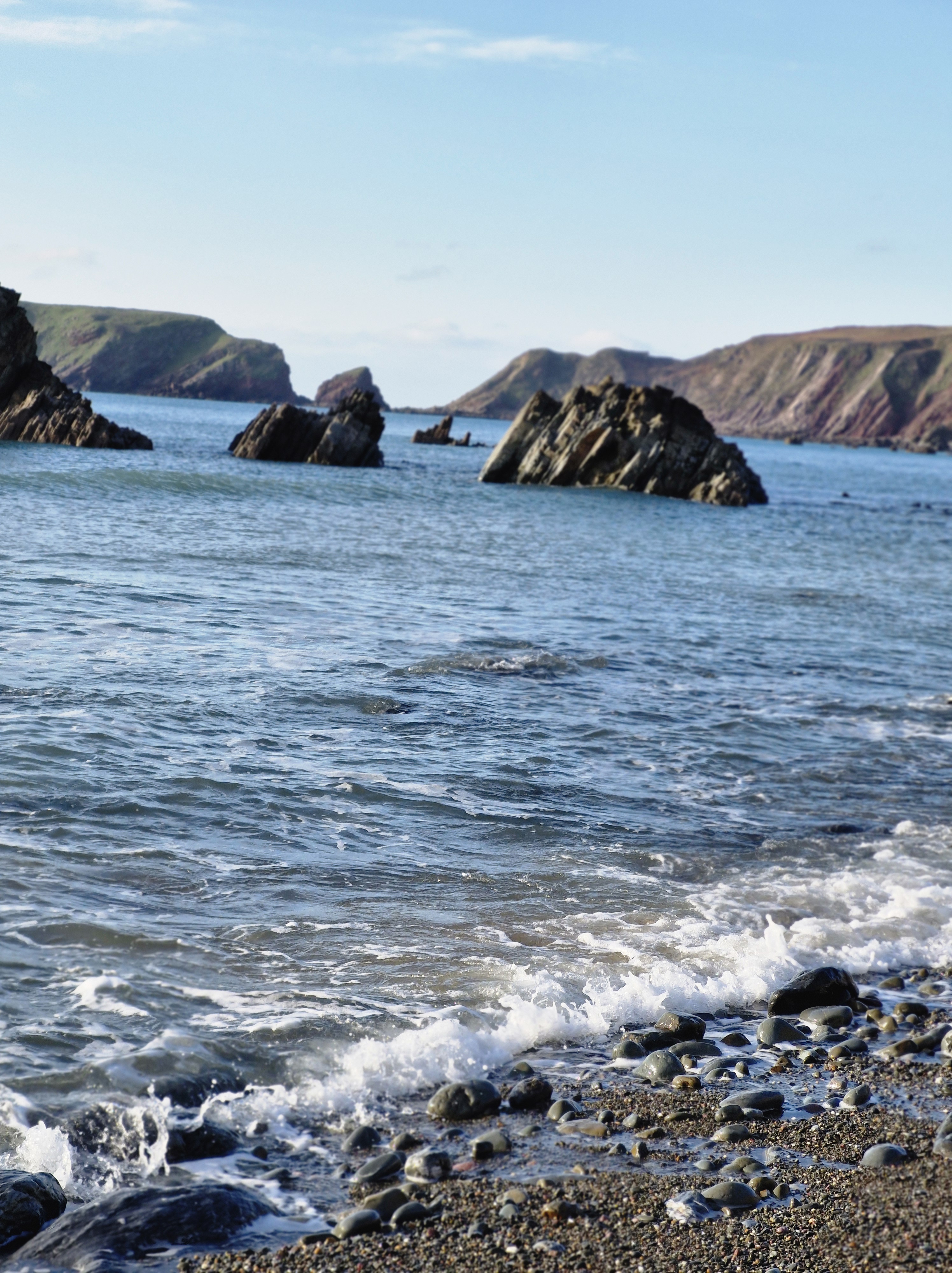
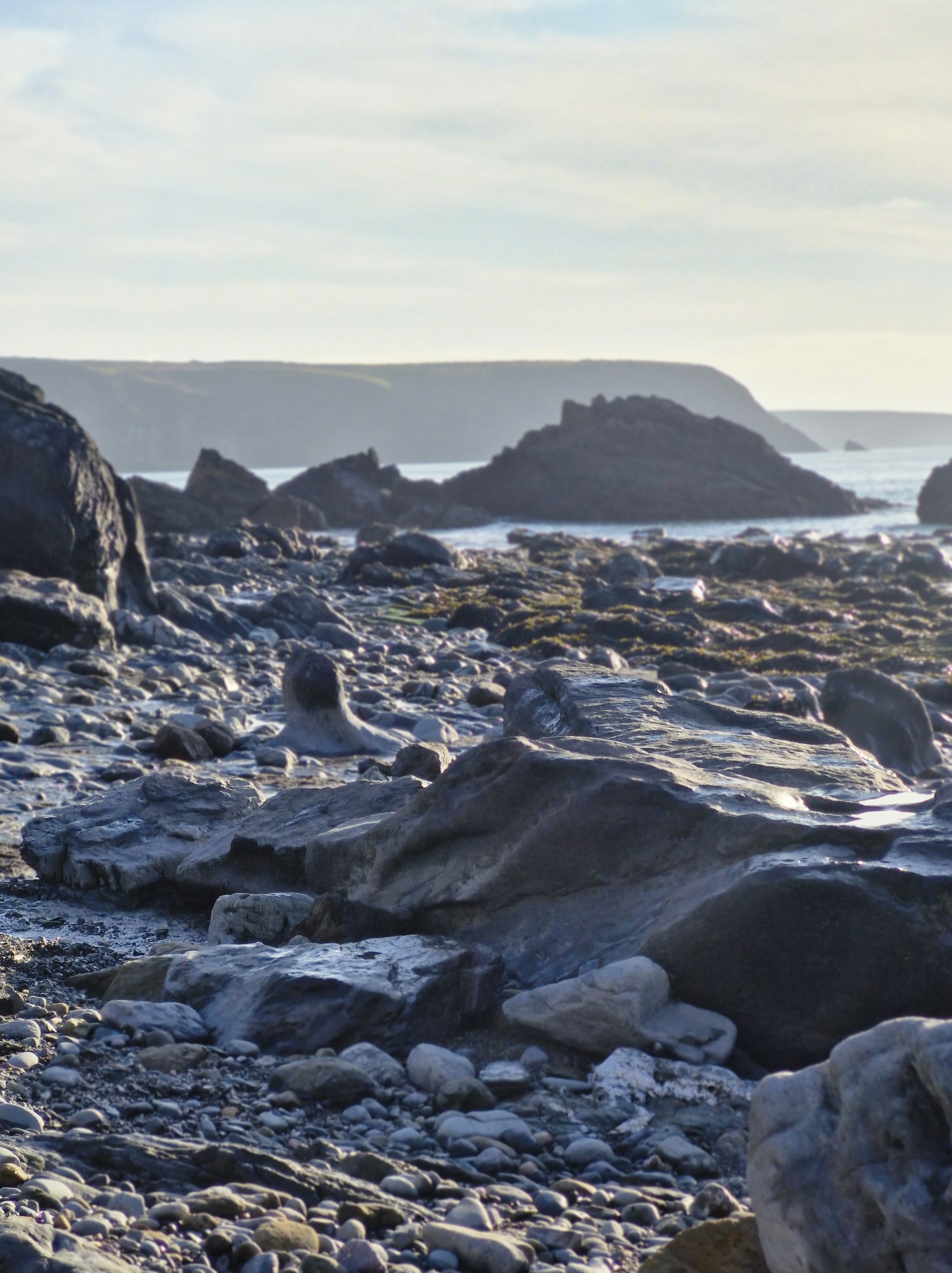
Luckily for us the tide was on its way out. There was no way I was tackling those steps again to the top of the cliffs. We judged that, if we took our time, we could navigate around and over the rocks to get back to our originally planned starting point at the other end of the beach.
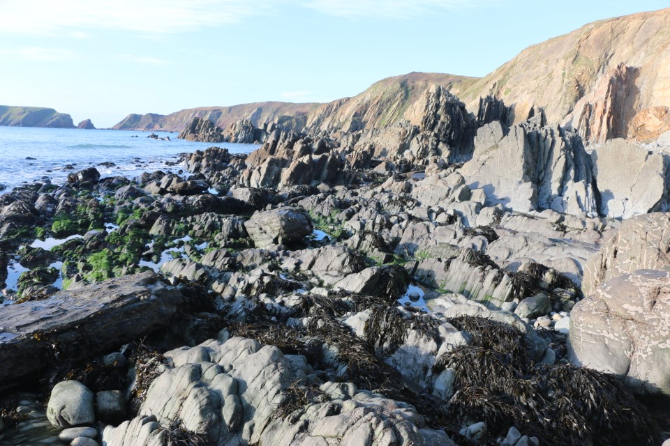

Having navigated rocks near the sea’s edge we made our way to the top of the beach near the cliffs where there was a gap between two tall, jagged rocks. A group of people came through as we were deciding on our next move. If they could do it so could we! Yes, I know … mad!! But we don’t like to be beaten.
We made it to the other side. “No problem,” said the photographer (He was standing on the sand taking this photograph with the path that leads up to the track, and on up to the car park, behind us). I ignored his confident smile; there were a few moments when I’d thought we would be needing a sea rescue.
N.B: Just as a matter of interests, Marloes Sands was the filming location for: Snow White & the Huntsman (September 2011). The Lion in Winter (1968).
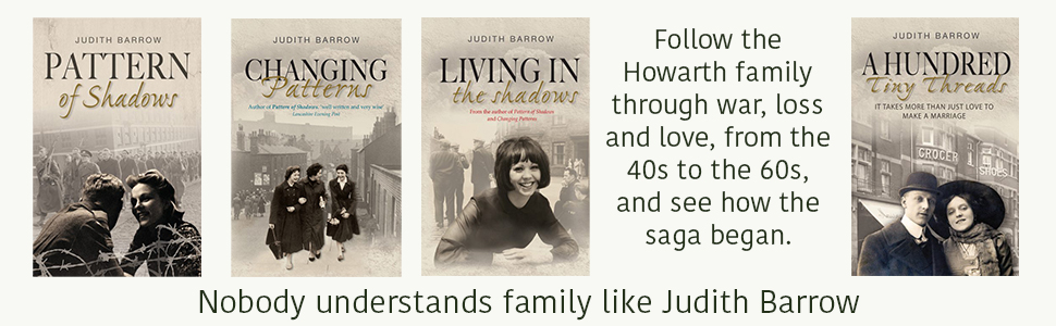
And could I, should I, leave this post without a small metion of my books?
As I’m hoping the book I’m working on at the moment, and hope to publish in 2026 (Well, one can always live in hope!), I guess not. So here is the link to my Amazon page.


Thank you to all my readers; I appreciate each and every one of you.


