Where We Walked #Pembrokeshire #Walks #Photographs #Leisure

One of our Interesting and Fun Group Walks with the U3a:

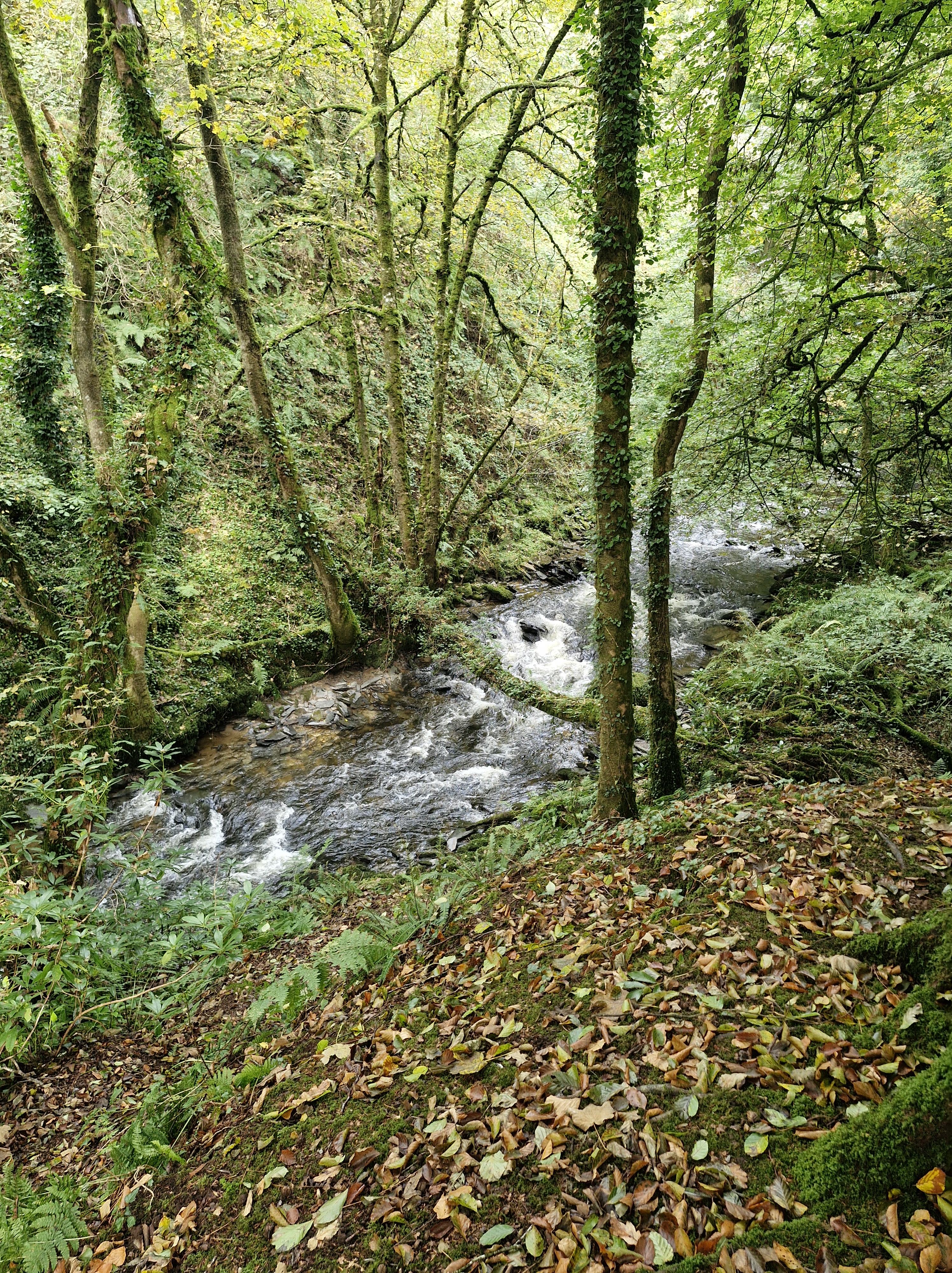
Yesterday we joined with Pembrokeshire U3a on their Monday Walk around the woods and alongside the River Sealy on the Sealyham estate near Wolfscastle.

There is a long history of owners of the land dating from the time when King Edward III, in the fourteenth century, granted some land to Thomas Tucker (a captain in the King’s army), who subsequently built a house there.

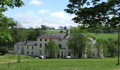
A house that was later rebuilt in the mid-18th century. Eventually, in 1905, the last of the descendant family members, Catherine Octavia Edwardsn with her husband Victor James Higgon, the last of the Tucker family to live at  Sealyham house moved another mansion in Pembrokeshire, Treffgarne Hall.

Around 1910, portions of the land were sold to the Pembrokeshire County Council and, in 1920, Sealyham House and part of the land were sold to the King Edward VII Welsh National Memorial Association and converted into a tuberculosis hospital until 1954. In 1955, it was re-purposed for elderly patients but was permanently closed as a medical facility in 1964.
In 1970, the Sealyham house was sold to a Nancy Ellen Perkins. She converted it into an apartment building as rentals. In 1980, it was sold again to an investment firm that used it for an outdoor activities centre.
It was resold in 1986 to the Sealtham Activity Centre for young people, as an educational facility,

Sealyham is also well known for the Sealyham Terrier. The Tucker-Edwardes family of the nineteenth century were one of the leading landowners of Pembrokeshire. Breeding dogs was a favourite and expected pastime people of noble families or military background. Captain John Edwardes’ family had the time and the means. Although no records were kept it’s believed that The Welsh Corgi, The Wire Fox Terrier, and the now extinct English White Terrier all played a part in the make up of the Sealyham. After Edwardes’ death in 1891, other breeders began to work with Sealyhams, including a man called Fred Lewis who promoted the breed. But, according to the Kennel Club the Sealyham Terrier is one of the dog breeds of British and Irish origin that are … “considered to be vulnerable due to their declining registration numbers. These breeds are at risk of disappearing from our parks and streets, simply because people don’t know they exist or because they aren’t considered fashionable. in 2024 there are only a hundred dogs of Tucker-Edwardes’ breed, making it an endangered breed.”

Where we Walked Glen Rosa #Arran #Scotland

Glen Rosa is a beautiful glen with Goat Fell mountain in the distance – stunning scenery.

Early morning (apparently the best time to do this walk), and we are already driving through Brodick. We turn into a lane just before the Old Brodick Burial Ground, signposted Cart Track, Glen Rosa’. There are two choices according to the directions; drive the first mile on a lane to where the track begins. or walk it. We debate. If it’s interesting, we’ll walk. We park, walk a little way … it’s just a lane between two hedges … nothing much to see.

Photo courtesy of https://creativecommons.org/licenses/by-sa/2.0/The

The Photographer is keen to photograph the glorious views that the directions promise, so back to the cemetary.

The Brodick Old Cemetery was formerly associated with the Glen Shurig church,, erected in 1839 and demolished about 1931 when the congregation joined the Church of Scotland in Brodick. It looks like an isolated forest clearing and is difficult to acess, but the graveyard has a hundred and twenty-one monumental stones. They are mostly illegible but we do find one dated 1863.

When we arrive where the lane ends and the track begins, just alongside a campsite, we follow the example of others and pull onto the grass verge behind three other cars. We can see the riverbank of Glenrosa Water. We’re keen to get going: out of the car, hoist our rucksacks on our backs, the lead on Dusk.

The view up the glen opens up. We see Cir Mhor in the distance. And beyond it the summit of Cul nan Creagan, Glenshant Hill, and Goat Fell. I see the Photographer’s eyes light up; my heart sinks. ” We’re not going too far are we? It’s quite warm already.” He doesn’t answer – sets off almost at a gallop. Dusk and I follow…

The track is rocky and dusty, but wide, and the surroundings absolutely inspirational.

We arrive at a timber footbridge where the tributary, Garbh Allt, joins the Glenrosa Water and the path splits, with the left-hand fork tracing the smaller stream. The Photographer is already on the path at the other side. We see him looking down …

.Dusk and I stop. Two tiny snakes are wriggling around on the path. (For totally personal squeamish reasons I’ve made this photo as small as I can). However tiny they are, we are not going past them. We are going no further

We wait. The Photographer is fascinated, as are three other walkers. But they don’t have a dog – “I need to stay here to protect Dusk!I call. Eventually the snakes wriggle away into the grass, and I tentatively pass the spot they’d been cavorting on.

We follow the path alongside the Glenrosa Water. Before long we arrive at the Blue Pool.

A favoured spot for wild swimming, as a wet Dusk demonstrates.

After a stop for a picnic for us and a half of a dog treat for Dusk, we decide to carry on for more photo opportunities. But the path becomes narrower, more overgrown...

Until almost impassable. And after a friendly hiker informs us that it is the start of the breeding seaon for the adders who are coming out of hibernation (I don’t query his knowledge – just the thought decides me) … it’s time to be setting off back to the car … at a gallop.

We could have crossed an old stone bridge to join onto the circular walk, but we’ve been out for quite a few hours and it’s hot, so we retrace our steps and head back to the house.

N.B. Technical note: Goat Fell is labelled as a Corbett mountain. Corbetts are defined as Scottish mountains between 2,500–3,000 feet (762.0–914.4 m) in height with a prominence of at least 500 feet (152.4 m). They are named after John Rooke Corbett, a district valuer from Bristol, who compiled a list of them in the 1920s. He completed the Corbetts in 1939, when he was in his early 60s.

Climbers who climb all of the Corbetts are called Corbetteers, with the first being John Corbett himself. The second completion was by William McKnight Docharty in May 1960. A list of Corbetteers is maintained which as of July 2018 totalled 678.