Pattern of Shadows was my first novel, the sequel, Changing Patterns was published in May 2013. The last of the trilogy, Living in the Shadows was published July 2015. In August 2017, the prequel to the trilogy, A Hundred Tiny Threads,was published. In March 2010, The Memory was published by Honno, a contemporary family saga. I also have an eBook, Silent Trauma, a fiction built on fact novel, published as an eBook. I have an MA in Creative Writing, B.A. (Hons.) in Literature, and a Diploma in Drama and Script Writing. I've had short stories, poems, plays, reviews and articles published throughout the British Isles, notably in several Honno anthologies. I am also a Creative Writing tutor and run workshops on all genres and available for talks and workshops.My blogs are on my website: https://judithbarrowblog.com/ where I review,interview other authors, and generally write about walks & photographs. At the moment I'm running a series of posts called Places in our memories, where writers talk about somewhere that brings back a memory. Always happy to hear from anyone who would like to join in with that. When I'm not writing or teaching creative writing I spend time researching for my writing, painting or walking the Pembrokeshire coastline
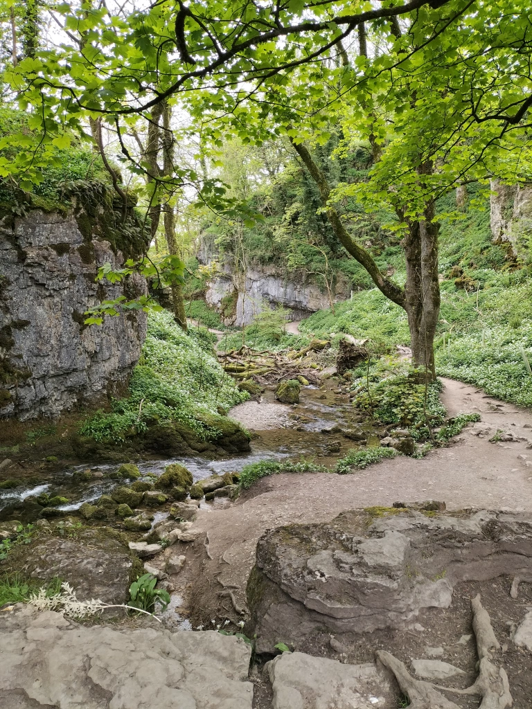
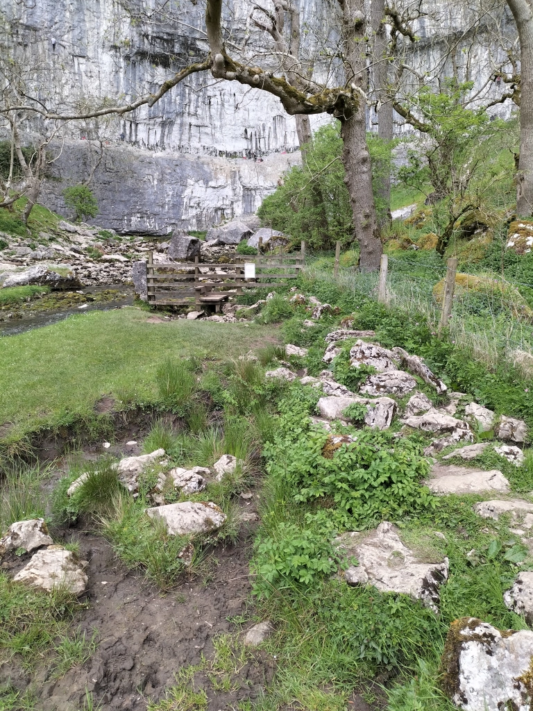
Our last walk in the Yorkshire Dales was a short early evening stroll to a small waterfall called Janet’s Foss, just outside Malham. The name for the waterfall apparently comes from an old folktale that a fairy queen, Janet (sometimes Jennet), lives in a cave at the rear of the fall. There are numerous stories about this: usually wraiths are not thought to be ghosts or demons, but rather a strange entity somewhere in between the two, similar to poltergeists but much more powerful when appearing as a full-bodied apparition. With Janet, there are claims that she would have practised black magic in life and this eternal damnation is her punishment. So, from the numerous conflicting tales we were told when we asked, she was either a magical fairy, or a vengeful creature.
The waterfall carries Gordale Beck over a limestone outcrop into a deep pool below. The pool was traditionally used for sheep dipping, which drew in local villagers as a social occasion. We were told that there have also been a few wedding ceremonies there.Our resident font of all knowledge in the local pub told us that the pool is occasionally used by all-weather wild swimmers. When I mentioned this to the photographer he announced he hadn’t brought his swimming trunks. Not sure he had the right idea about ‘wild swimming’.
Image courtesy of Annabelle Bradley
The footpath from Malham starts from Malham Smithy, where the female blacksmith, Annabelle Bradley, runs blacksmith experience days, and also designs and hand forges sculptural and functional wrought ironwork. We’d stopped to watch her work from outside the door, earlier in the week. It was fascinating. Just leaving the link here, just in case you’re interested: https://www.malhamsmithyonline.co.uk/
Walking over a short bridge and alongside a small beck we went through fields and kissing gates. (No stiles!!)
On the footpath to Janet’s Foss a couple of old tree stumps have become home to hundreds of pennies where people have left them and made a wish to Janet.
We could smell the garlic even before we entered the wood.
Here I go again … can anyone else see the profile of a face in these rocks?
We stayed listening to the rhythmic flow of the water, and waiting for the mysterious green mist that was supposed to sometimes rise from the water- until the chattering and clattering of boots announced the arrival of walkers, and brought us back to reality.
Time to make our way back to the cottage we were staying in. Time to pack for our return home the following morning. Time for just one more glass of wine.
Remember me saying in the last post about our visit toCatrigg Force – a small but impressive waterfall just east of the village of Stainforth? And that the first time we found it we’d actually planned to call to see it as the first part of a massively, more strenuous, longer walk – a longer walk, planned by the photographer? One where we could take in the landscape from the Victoria Cave in Ribblesdale? And I said, more to come on that another time? Well, this is it. The above is the last (nearly last) part of the track up to the cave
Another of my photographs when I stopped to take a breath on the path (path?!!) on the way up to the cave.The photographer was already there. Give him his due, he did come back to help me to the top.
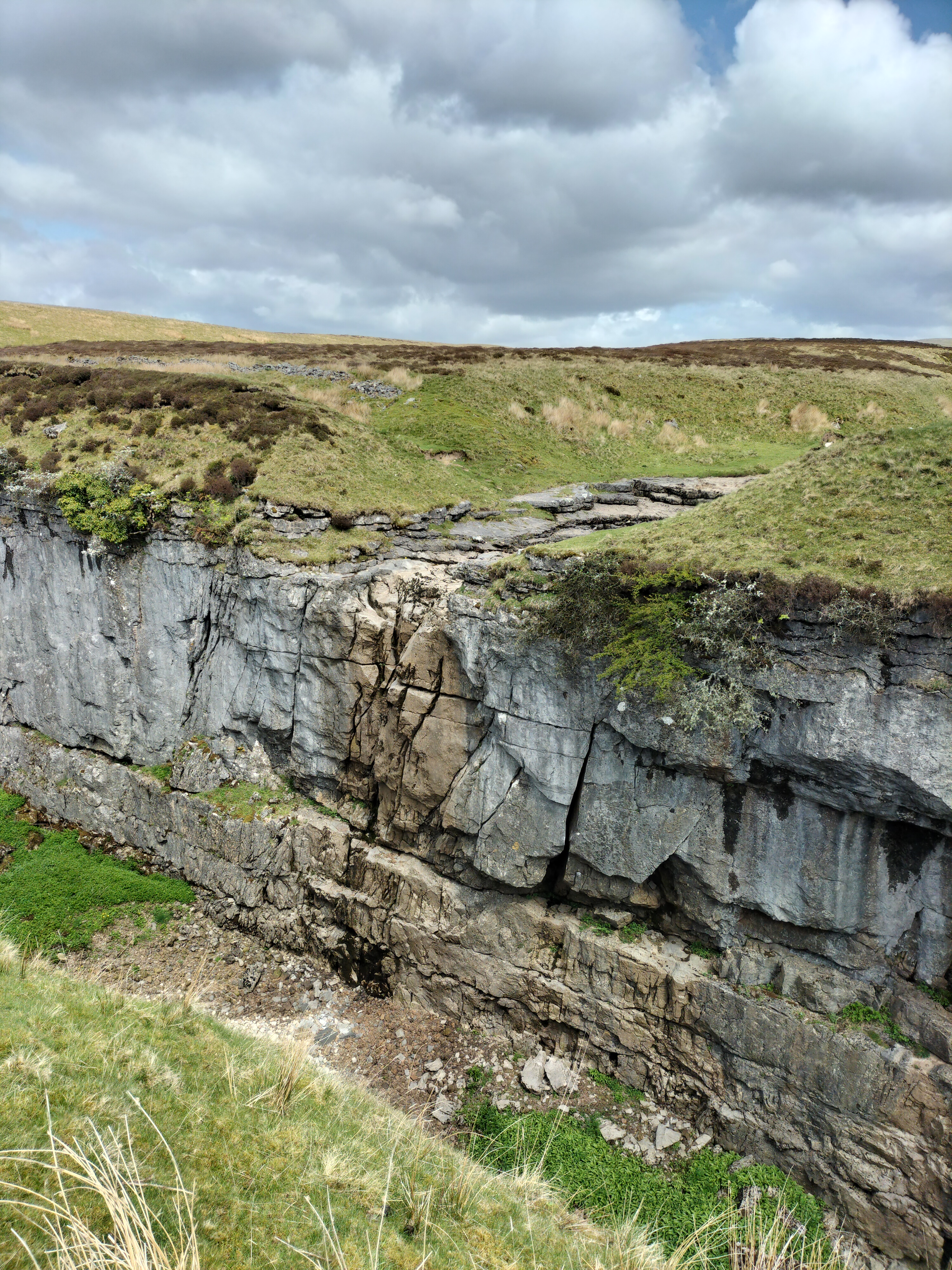
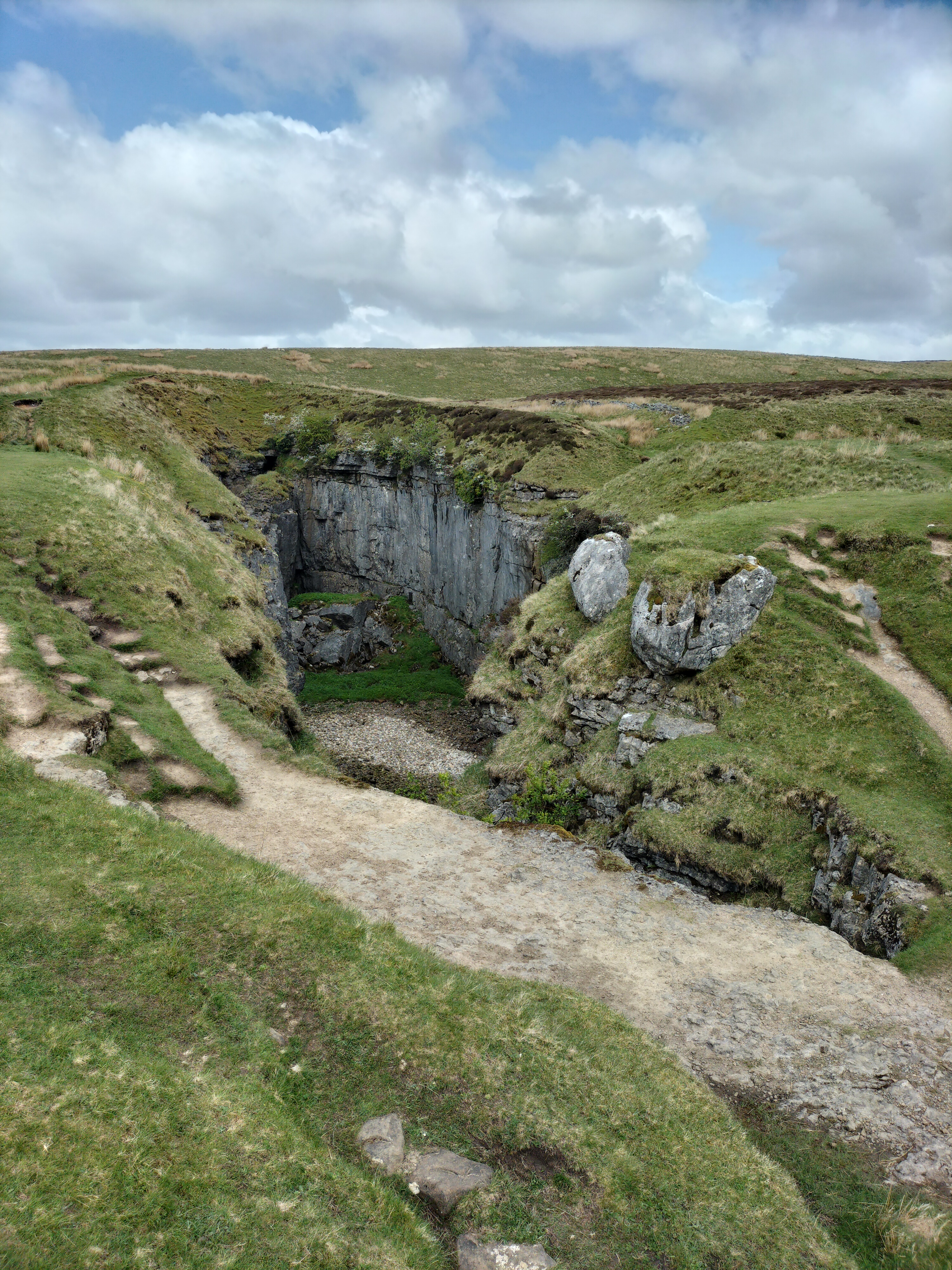
And here it it, the limestone Victoria Cave, located east of Langcliffe in Ribblesdale and discovered by chance in 1837, the year of Queen Victoria’s coronation.
Until then the cave was unknown. Tinsmith Michael Horner (1813-1878) struggled through a small hole between rocks,searching for his dog and found the cave. Inside tound bones, coins and various metal objects on the sediment floor. Later, on the 28th June 1838, Joseph Jackson, a keen amateur archaeologist, investigated further. The Victorians were fascinated by ‘bone caves’ where there might be a possibility of finding evidence for the earliest humans and extinct animals. Some animal bones were actually found here. It’s thought that hyenas used the cave as a den and dragged bones that had been scavenged into it, including hippos, narrow-nosed rhino, elephants and spotted hyenas bones. After the last Ice Age the cave was used by hibernating brown bears. In amongst the animal bones of reindeer was an 11,000 year old antler harpoon point, the first evidence for people in the Yorkshire Dales.Some items from the cave are held at the Craven Museum in Skipton.
The roof of the cave has become increasingly unstable over the years and roof falls are possible.We didn’t go in!
This is another one of my photos (yes I do know it’s less inspiring than the photographer’s). But I spotted this from up high, from outside the cave – and thought it was a large teddy bear, or the skeleton of a teddy bear!! Of course, when we got closer… it was just a pile of rocks. Note to self – contact optician
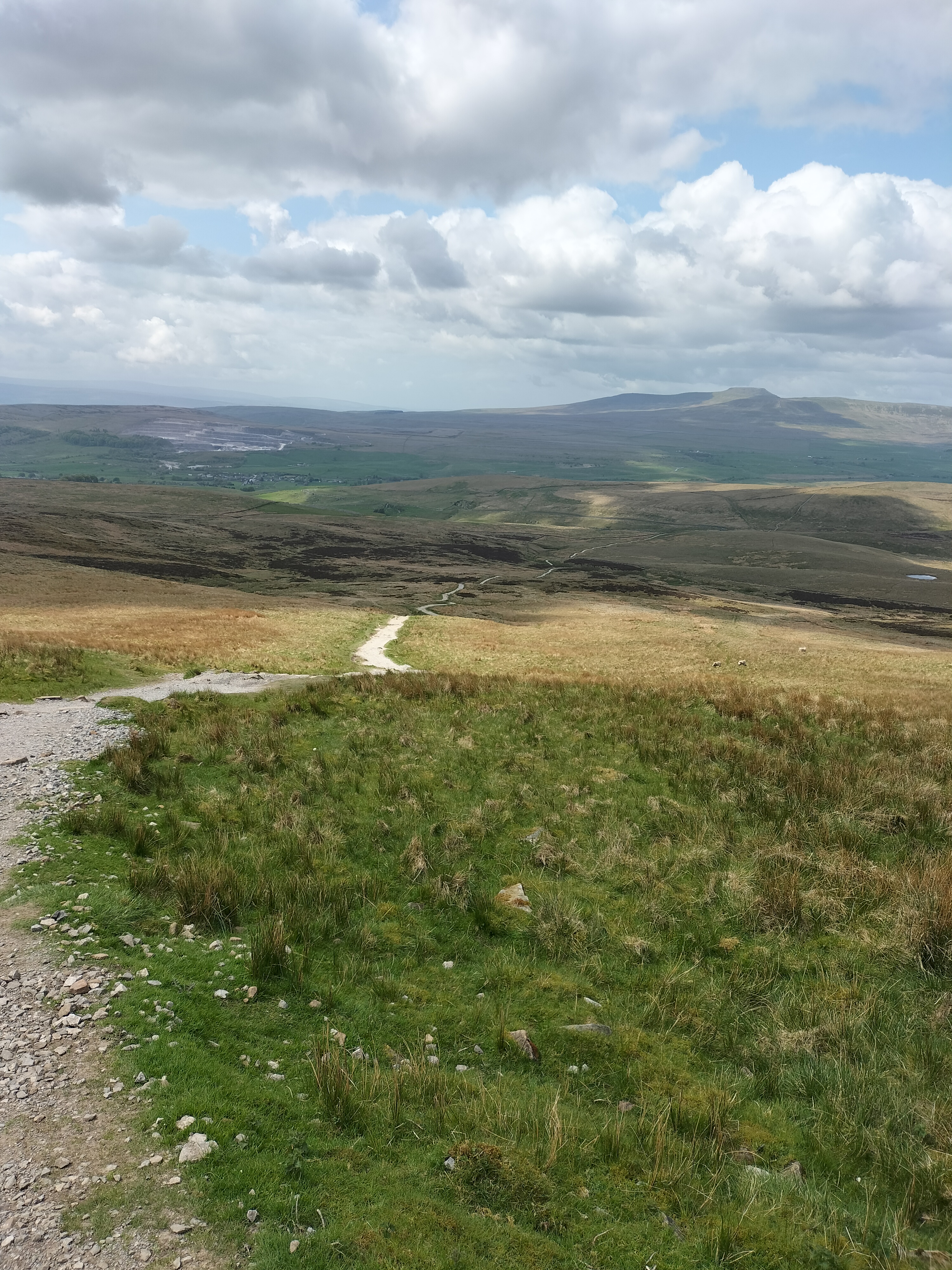
Just before we set off on the downward trail, and with an eye on the clouds bubbling up in the distance, a photograph of the next five miles we needed to go.
And it’s here I will reveal a moment of a basic and elementary photographer’s mistake.
” One last photo before the rain sets in,” he says, scanning the vista. “I didn’t realise it had become so dark so quickly.”
I waited, didn’t say a word while he huffed and puffed, and glared at the sky. For quite a while Then I stated the obvious. ” Your lens cap is still on.”
Good job he has a brilliant sense of humour!!
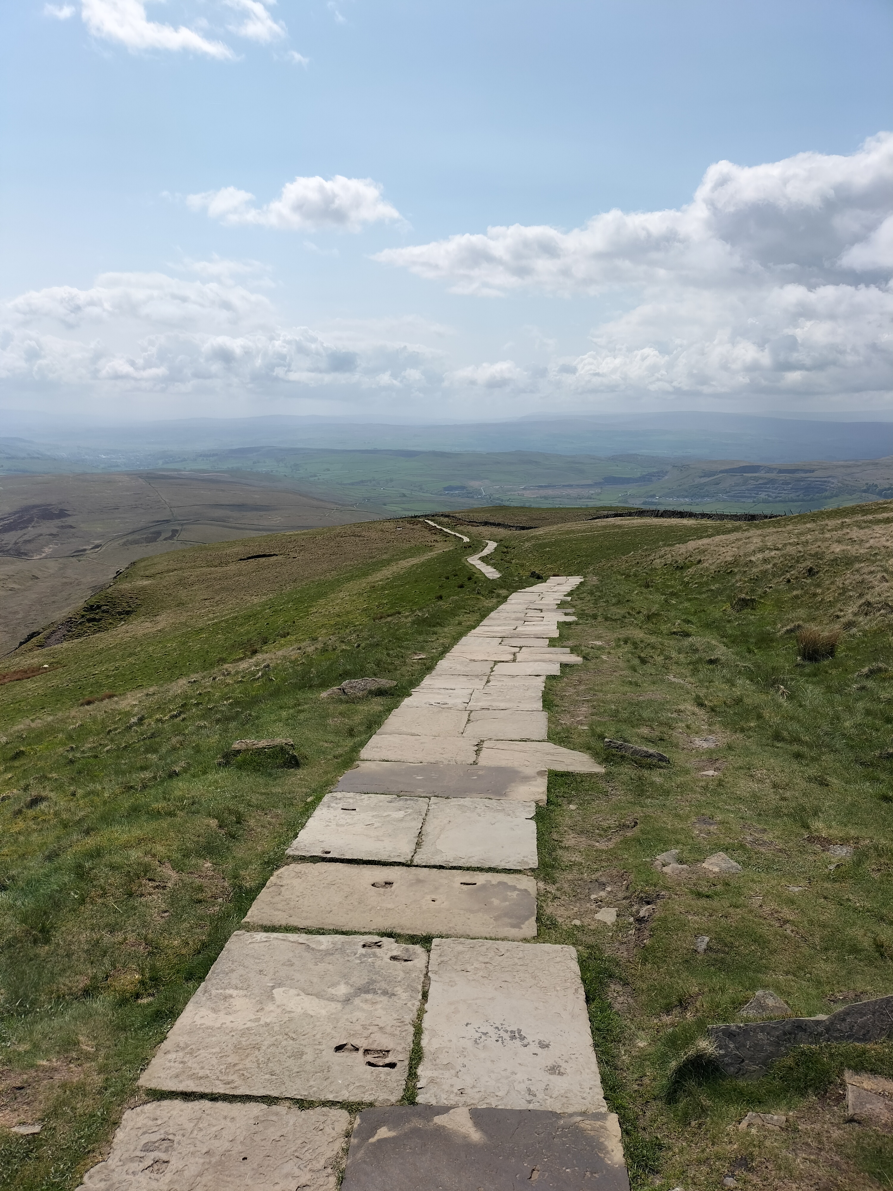
We followed the trail past the rugged terrain of the Warrendale Knotts before descending the hillside on the way back to Settle.
Where we had a well- earned cup of tea and a scone.
This was a walk we did twice when we were in the Yorkshire Dales. The second time we were here was by accident. We got lost – surprise, surprise – and came over a hill to find us again at …
Catrigg Force … a small but impressive waterfall just east of the village of Stainforth. The first time we found it we’d actually planned to call to see it as the first part of a longer walk (more to come on that another time!)
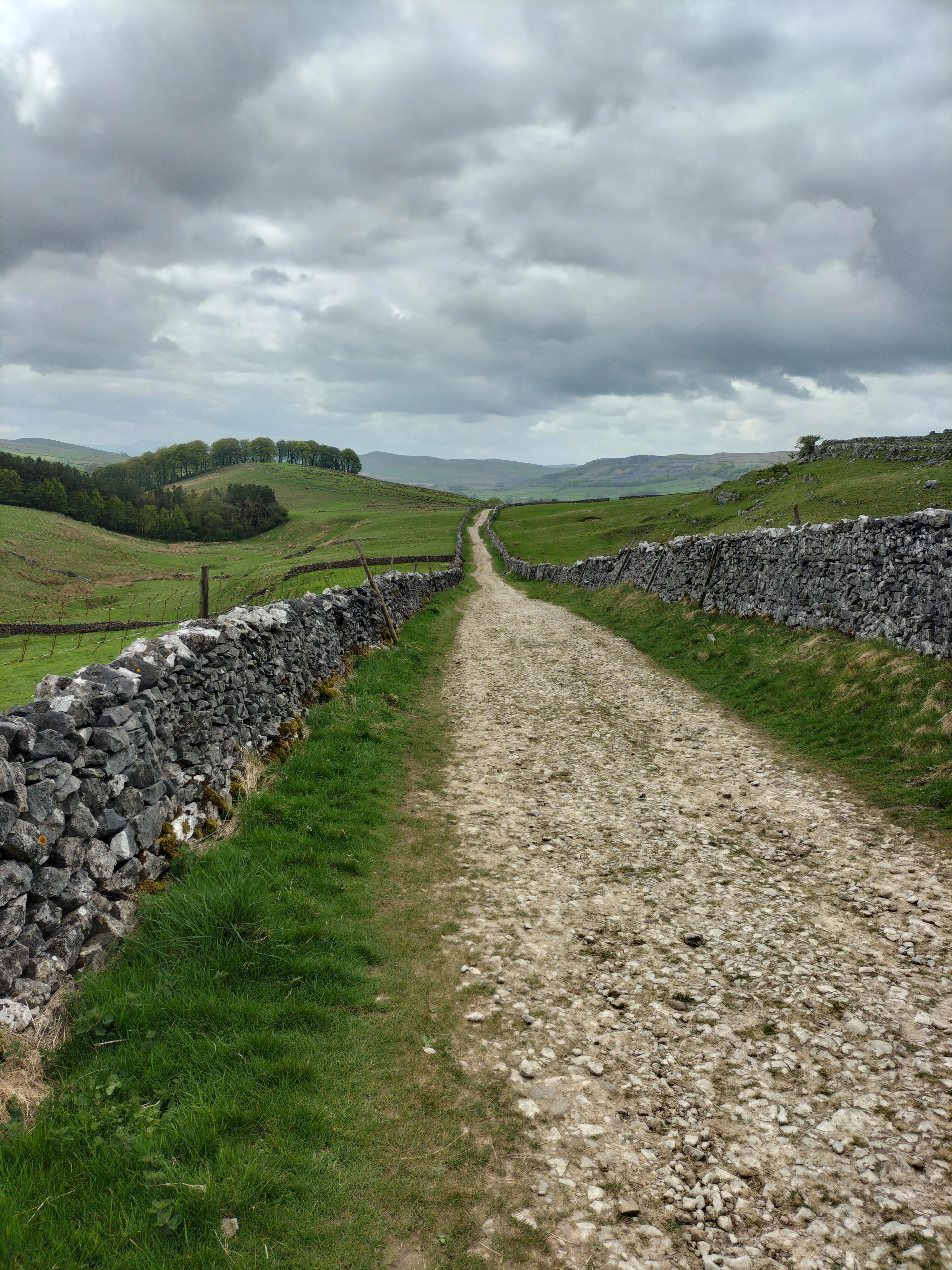
After a snack in the local pub (called the The Craven Heifer in Stainforth – spot a theme in these posts?!!) we headed up a bridleway called Goat Lane. (not sure why it’s called that, we only saw sheep and lambs – definitely no cows… well not at this point anyway!). The track, between parallel stone walls, is a small section of the Pennine Bridleway
We meandered along the upward track for about a mile, past several derelict farm buildings, and stopping to admire the view. In the distance on the moorland, are the Winskill Stones, pedestals of limestone and topped with slate, left behind by ice-age glaciers.Finally we reached the signpost for Catrigg Foss on the left of the track.
No stile this time, a kissing gate, leading to a steep, rocky, narrow, path, down to the stream, Catrigg Beck, which flows from the hills and feeds the waterfall.
The poor quality and lack of any particular viewpoint/perspective in this photograph is because it was taken by me, on my mobile phone, while balancing on the edge of the waterfall and hanging onto a branch of a nearby tree. All without the knowledge of the photographer, who’d wandered off to find the the base of the waterfall.
I followed. Leaving the stream, I made my way down another narrow path alongside a sheer wall of limestone rock and a tree-lined drop to a deep, hidden gully that holds the waterfall and the shallow river, the continuation of Catrigg Beck. There were two separate, quite magical falls, well over six metres in height in the long wooded copse. The sprays of water, a sparkling shower of colours in the sunshine that flickered through the leaves, landed all around us. The only sounds were the waterfalls and the calls of birds. Perfect peace …
Ah well… as I said, this was only the start of a massively, more strenuous, longer walk – a longer walk, planned by the photographer, to take in the landscape from the Victoria Cave in Ribblesdale (discovered by chance in 1837, the year of Queen Victoria’s coronation). This second time we were here was purely by coincidence, and at the end of a quite sedate walk … for us! We ambled through fields, back to where we were staying in a tiny cottage in Langcliffe.
By the way…
Apparently Catrigg Force was a favourite haunt of composer Edward Elgar. He visited the waterfalls and, during his visits to the Yorkshire Dales, was inspired to compose Pomp and Circumstance and the Enigma Variations, his most famous works.
Three fun facts about Elgar – Not only was he a composer, but he was also an amateur chemist. In his spare time, he would tinker with experiments. He was the first composer to fully embrace recording music. And he loved cycling. He had a Royal Sunbeam bicycle that he nicknamed ‘Mr. Phoebus. ‘
Although all three of the books in the Haworth trilogy are based on the same family, they are also stand alone. And yet, to be completely honest, I do need to add this from one of the reviewers…
“This is the part where I’m supposed to tell you that each of these wonderful books can be read alone. But no, don’t do that. In fact, if you haven’t read any of them, you’re luckier than I am, because you can start with the prequel and read in chronological order. I chose to review these books as a set, and I believe that’s how they should be read. Every now and then, I come across books so beautifully written that their characters follow me around, demanding I understand their lives, their mistakes, their loves, and in this case, their families. Taken together, the Howarth Family stories are an achievement worth every one of the five stars I’d give them.“
Changing Patterns – a bargain!
Book Description:
May 1950, Britain is struggling with the hardships of rationing and the aftermath of the Second World War. Peter Schormann, a German ex-prisoner of war, has left his home country to be with Mary Howarth, matron of a small hospital in Wales. The two met when Mary was a nurse at the POW camp hospital. They intend to marry, but the memory of Frank Shuttleworth, an ex-boyfriend of Mary’s, continues to haunt them and there are many obstacles in the way of their happiness, not the least of which is Mary’s troubled family. When tragedy strikes, Mary hopes it will unite her siblings, but it is only when a child disappears that the whole family pulls together to save one of their own from a common enemy.
Excerpt:
16th June 1950
Sometimes Mary couldn’t believe he was there. Sleepless, she would reach out and touch Peter just to reassure herself that after five years apart they were together again. He’d given up a lot to be with her.
‘You are happy?’ He slung his arm around her shoulder and pulled her closer.
The breeze ruffled their hair. The tide was on the turn and Mary watched the waves collide and dissolve. High above, gulls hung motionless their cries lost in the air currents
‘Mm.’ Mary rested against him. The smell of the mown lawn on his skin mingled with the salty tang of spray blown off the sea and the faint smell of pipe tobacco. ‘You?’
‘Of course.’
She turned her head to look at him, brushed a few blades of grass from his cheek. In the four months since he’d found her he’d lost the gaunt pallor, the weariness, and gained a quiet contentment.
‘It is good, the two of us sitting here, alone,’ he said.
‘Tom won’t be long though, he’ll be back from Gwyneth’s soon; he said he was only just digging her vegetable plot over for planting tomorrow.’
‘I do not mean Tom. He is family.’
Mary allowed a beat to pass. ‘I know you didn’t, love. And I know what you really mean. But it’s not our problem. If people don’t like our being together that’s their lookout.’ She kissed him. His mouth was warm.
Smiling she drew back. ‘Tom?’ she murmured, her voice rueful.
They sat peacefully on the doorstep of the cottage, each savouring the other’s closeness.
Gradually the sun disappeared behind the cliffs. The trees became shifting silhouettes and the wind slapped the surface of the sea into rolling metallic arcs and carried the spray towards the cottage. Mary licked her lips, tasted the salt
‘It’s getting chilly.’ She shivered.
Peter stood, reached down and lifted her to her feet, holding her to him. ‘Ich liebe dich, my Mary.’
‘And I love you.’
A few moments passed before she forced herself to stand back and, giving him a quick kiss, take in a long breath. ‘Now,’ she said, ‘I’m late sorting tea out. If you put those things away, I’ll go and give that batter a whisk. I’m making Spam fritters to go with that mash from last night.’
She stood on the top step watching him walk down the gravel path to where he’d left the lawnmower and then glanced towards the cottage next door. Although it was only just dusk the window in Gwyneth Griffith’s parlour suddenly lit up and the oblong pattern spilled across the garden. Tom emerged out of the shadows swinging a spade in his hand and turned onto the lane. Mary waved to him and he waggled the spade in acknowledgement. ‘Tom’s coming now,’ she called out to Peter. ‘I’ll stick the kettle on. He’ll want a brew before he eats.’
The van came from nowhere, a flash of white. Mary saw it veer to the right towards Tom. Hurtling close to the side of the lane it drove along the grass verge, smashing against the overhanging branches of the blackthorn. Caught in the beam of the headlights her brother had no time and nowhere to go. Frozen, Mary watched as he was flung into the air, heard the squeal of the engine and the heavy thud of his body on the bonnet of the van. The spade clattered along the tarmac. Peter threw open the gate and was running before she could move.
‘Tom,’ she heard him yell. Somewhere, someone was screaming. She was screaming.
I was promised an easy walk on one of the days. This is it; the Oxenber and Wharf Wood and Feizor walk from Austwick. It should have taken around two hours… we didn’t allow for the stiles.
We left Austwick by the Pennine Bridleway and walked over the Flascoe footbridge heading up the path towards Oxenber Wood.
We met the obligatory cow – who followed us along her side of the wall in the next field. In fact, by the time we reached the end of this path, there were six of them jostling for a view of us.
And the first of the stiles. This one was stone, sturdy, easy to climb over. We’ve got this sussed, I thought; easy walk, conventional stiles. The photographer couldn’t resist taking in the view of Austwick and the miles of glorious scenery around Ingleborough and Fountains Fell. Then he casually strode halfway over the stile – and was abruptly stopped when his rucksack decided to stay on the other side. We manhandled it over the wall, and carried on, ignoring the snorts from the cows…
And saw this…
Bluebells! Stretching seemingly for miles. And, miles away on the horizon … Pen y Ghent, the destination of one of our … hmm!… shall I say … more strenuous walks in that week: https://tinyurl.com/3e48vc7a
Hundreds of years ago, this area of woodland and pasture was part of the village quarry, and is still rough underfoot with hollows and dips under the grass. We were told it’s a site of special scientific interest and an area of conservation. The trees (as stated on the information board at the beginning of the walk) are mainly Ash, Hazel and Hawthorn.
As we clambered over the limestone rocks to enter the woods, a young man came puffing up behind us. He was a teacher, supposed to be on a day out with a colleague and their class from his school, but had overslept and was now in pursuit. We stopped to let him pass, pretending we didn’t need the break to get our breath back. That hill was steeper than we thought… or looks.
From the loud cheer that rang out a few minutes later, the teacher had obviously found the children.
In the woodland there were areas of slabs of limestone paving with various wild flowers and plants.
Wood Sorrel
Hart’s Tongue Fern.
Dog’s Mercury
There was quite a lot of theDog’s Mercury (as stated on the Information Board) We were told, by a man in the pub where we were having a meal that evening – (we did seem to meet the local naturalist, whichever pub we went in) – that it is a poisonous coloniser of ancient woodland. But, if thoroughly dried, apparently (I’m stressing the “apparently” here), the plant loses its poisonous quality. The juice of the plant is emetic, ophthalmic and purgative, and can be used externally to treat ear and eye problems, warts, and sores.And other ailments!
As a writer I couldn’t help thinking about using this last plant in a story … to kill off a character … maybe?!!
We left the woods, through a wooden gate and onto a path which at first gently rose and then zig-zagged down through a jumble of exposed limestone towards the hamlet of Feizor. Where we stopped at a tea room for a cuppa.
Leaving the tea room we climbed over the first of five high stiles in a stone wall, and along a public footpath through four sloping fields.
You may have noticed that I have no photographs of the fields, nor of the stiles here. We were either too anxiously gazing across the fields, knowing we’d have difficulty both going back to the tea room lane or forwards to continue our walk. This was because of the stiles. There was the stile where the first stone step was three foot high in the wall (“You need to get your leg higher,” I encouraged the photographer), having only been able to reach it myself by taking a running jump at the thing. Then there was the one where the middle stone was broken off revealing only a sharp corner that protruded only enough for the toe of our boots (That one resulted in scraped shins). The two wooden stiles had seesaw wobbles enough to cause seasickness, and the next seemed fine until we found that the space in the wall for us to get through was the width off one boot only. (One narrow ladies’ walking boot – which isn’t mine) Which meant a dare-devil leap forward to the next field was the only way to ‘dismount’!)
At this point I said I was never going over another stile again. Before I saw the next one! We were only glad there was no one nearby who could see us struggling, or worse still, waiting for their turn to climb over any of them.
Finally we triumphed over the last stile (more a small hole in the wall, thankfully), and back onto the tarmac lane… when we realised that, if we’d only walked a few metres further along the lane after leaving the cafe, we would have met the main road that eventually led to the tarmac lane.
And on to the first path …where the cows were waiting for us.
And so into Austwick again.
‘Easier today wasn’t it? Rested now?’ He said later. ‘Try for a longer walk tomorrow?’
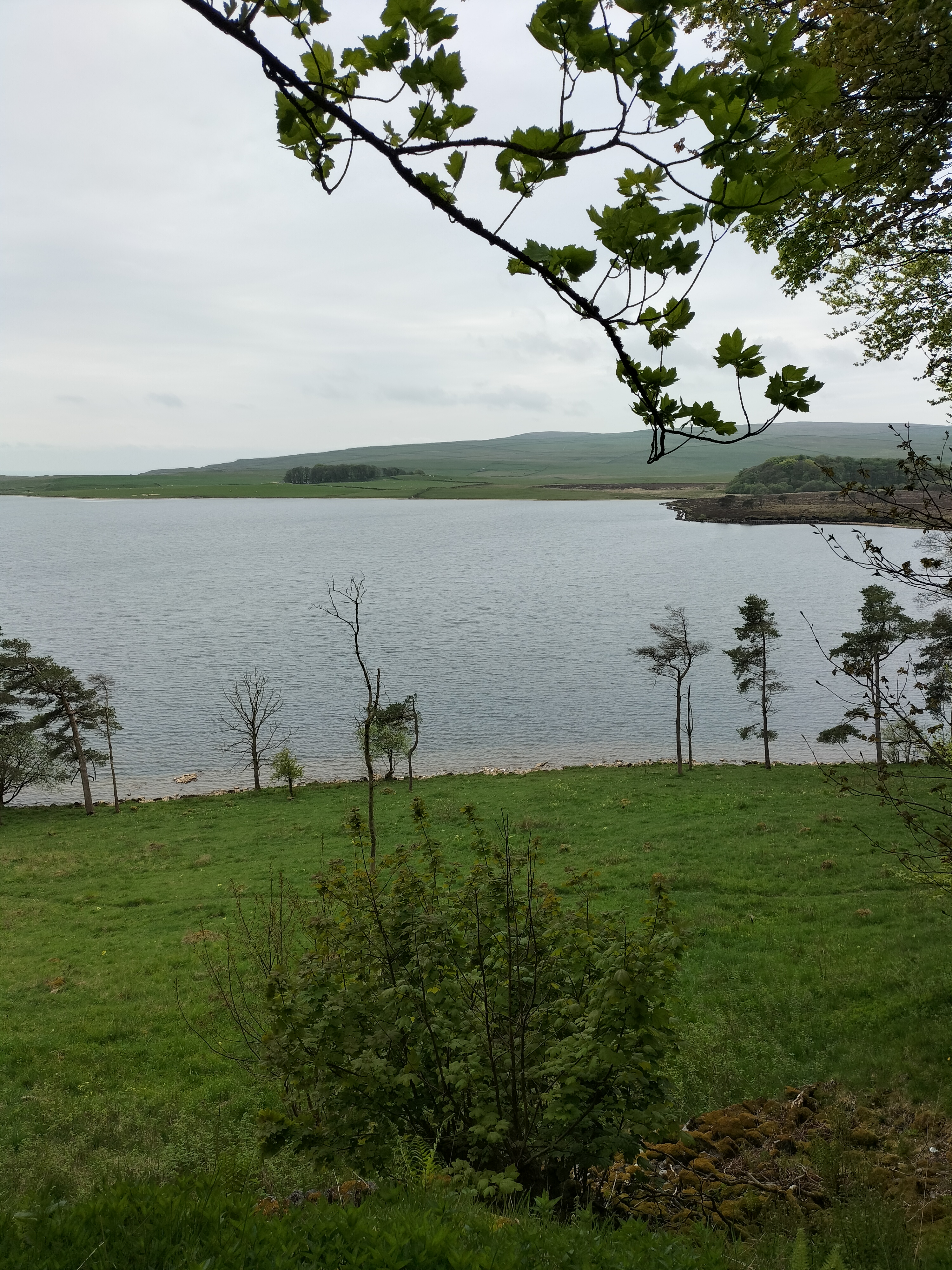
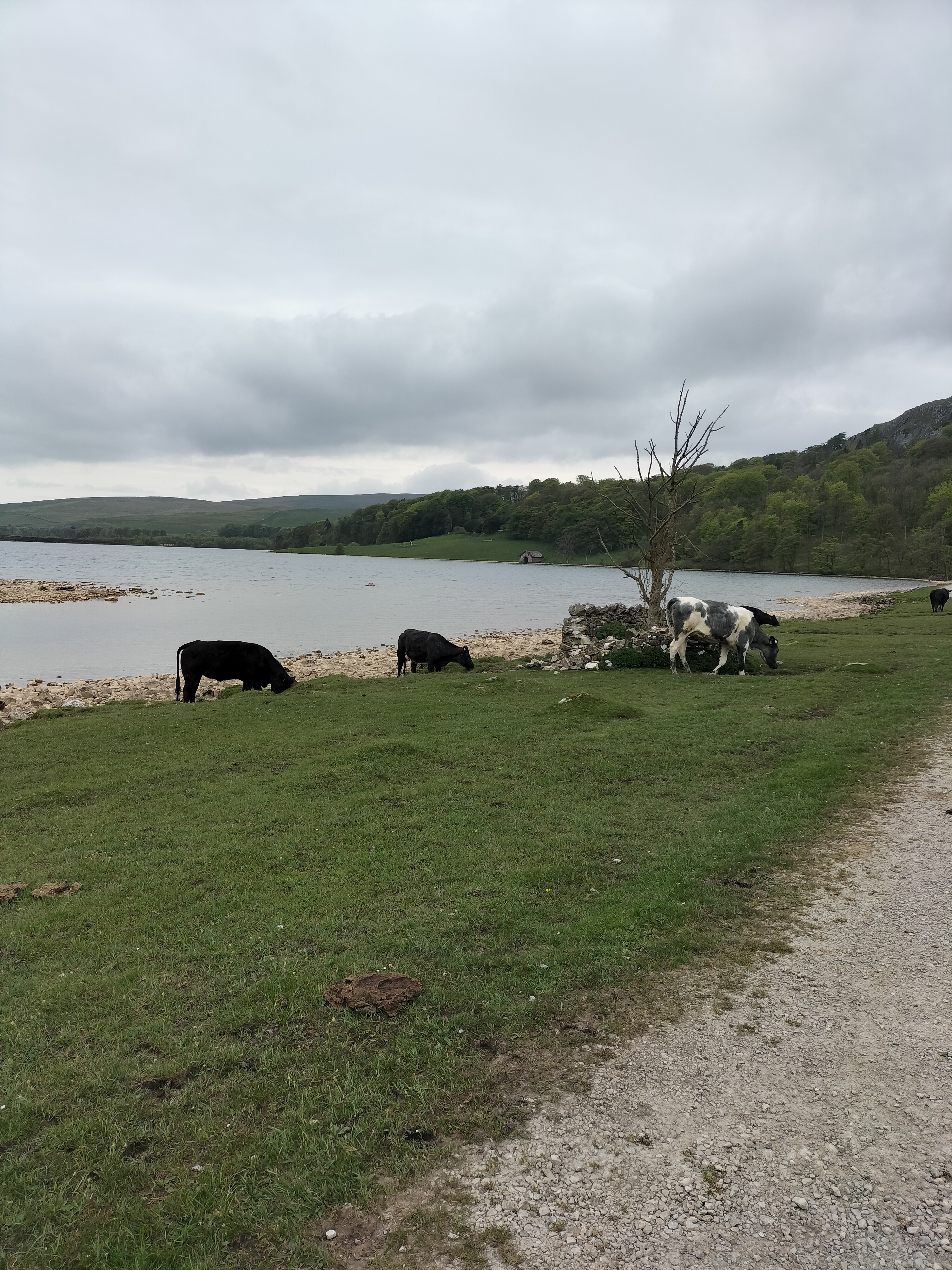
Malham Tarn is a shallow glacial lake three hundred and seventy seven metres above sea level, making it the highest lake in England. Situated above the village of Malham in the Yorkshire Dales National Park, it’s owned by the National Trust. It’s also the source of the River Aire; water flows out of the southern end of the lake and disappears underground to reappear as the River Aire at the foot of Malham Cove about one and a half miles away. Later, we were told by someone local that Malham Tarn is unusual because the water doesn’t sink into the ground. Apparently, during the Ice Age glaciers scraped away the the limestone down to the ancient slate layer underneath, and because slate is impermeable, it doesn’t let the water through. Then, when the glacier melted, the mouth of the Tarn was sealed by banks of clay and gravel.
I studied the map. ‘You said we were having an easy day today.’
‘I told you; eleven miles,’ said the photographer.
‘No, you said a mile.’
It’ s all flat, so it is easy… most of the way.’ And off he strides…
Towards some cows. Who look at us with interest and then decide to follow.
All the way as we walked along the shore of the tarn, through a gate and along a path into the woods.
We passed Tarn House, which was built as a hunting box in the late-18th century, and is now now owned by the National Trust. Used as a Field Studies Centre, there is an Orchid House, which usually has an exhibition area. Seeing the exhibition subject on our day, I passed by.
The house itself must once have been quite grand. It still is impressive, though obviously needs money spending on it.
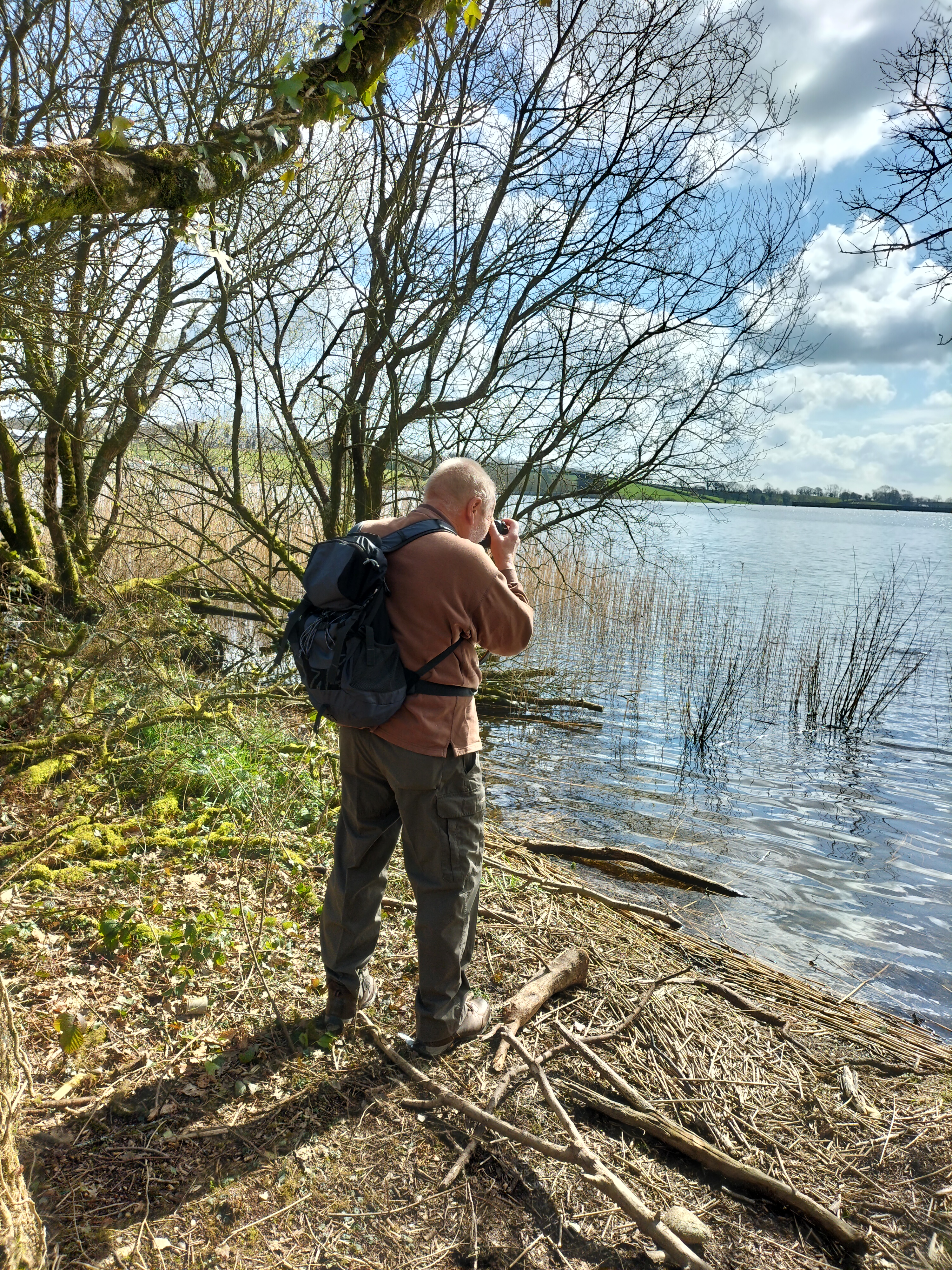
There isn’t a lot of open water in the area, and, in the Stone Age, the lake was inundated with herds of wild animals, and consequently brought hunters from far and wide. Archaeologists have found the remains of their campsites and stone tools along the shoreline.We walked down to the bird hide.
Although we saw Canada geese, a pair of mallard ducks, a greater-spotted woodpecker – and many sparrows, this was the only other wildlife we found…
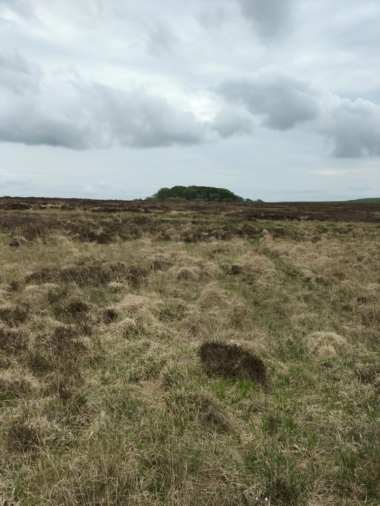
But what was really impressive was the man-made track that leads to the National Nature Reserve. We leisurely followed the boardwalk through the reserve for the next half an hour.
We came out of the reserve onto an unmade track . I expected to turn right to retrace our steps.
‘No left, we’re only halfway around the walk,’ the photographer said. Earlier on I’d seen this in the distance.
Reassured that he’d said the walk was a flat walk, I’d just admired the shape of Great Close Scar.I said nothing. I was saving my breath … and waiting…
An evening stroll to see the vertical face of Malham Cove. It’s magnificent; standing at around seventy-nine metres of sheer rock, the top of the cove is a strange pattern of blocks of limestone. We could hear jackdaws, but knew it was too soon to see the pair of peregrine falcons or house martins that nest during the summer months. We did, however, see two mallard ducks strutting around the nearby stream, who eyed us for a minute or so before realising we had nothing for them, and strutted off.
Only one stile to clamber over … which made such a change (this is a hint of foreshadowing for the next walk… and the perils of a cavalier attitude towards stiles and the advancement of age!)
Formed along the line of the Middle Craven Fault, Malham Cove has been eroded back by the action of water and ice over millions of years. As glaciers moved forward they gauged rocks from the face of the Cove and carried them away. Then, each time the glaciers melted, the torrents of water also eroded the face of the Cove in the form of a massive waterfall.
The water flows underground now, then emerges as a shallow rocky stream.
There was no one else around… we thought … until we heard voices echoing eerily around the amphitheatre. Two men abseiling down the rock face (see them? Tiny figures perilously hanging from ropes?). I’m sure they knew what they were doing.. probably!
‘I’d like to do that,’ said the photographer.
‘No, you wouldn’t,’ I said. (Mind you, I have seen him hanging (also perilously) over the cliffs at home in Pembrokeshire just to get, “that brilliant shot” – so I know he’d be daft enough to have a go)
‘So … what’s tomorrow?’ I asked, as we plodded back over the stile and scrambled up a short rocky path to a field where a herd of cows watched with interest. And then followed us … closely (What is it with us and cows?)
‘I’ve found a good walk where there’s a gorgeous waterfall on the way.’
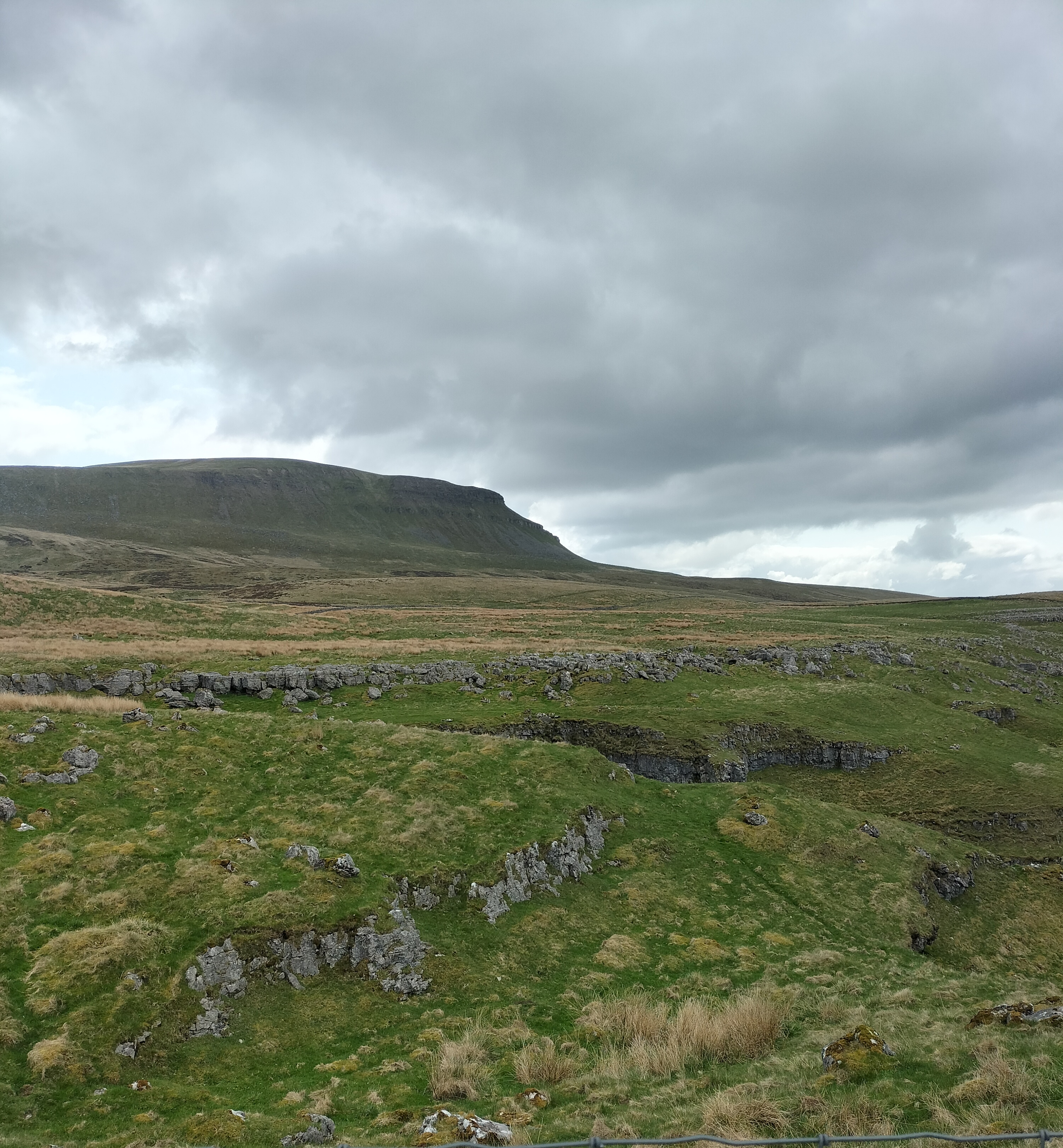
In both the Cumbric language and modern Welsh ‘pen’ means ‘head’, ‘ghent’ is either ‘edge’ or ‘border’. So … Pen-y-ghent or Penyghent … ‘Hill on the Border’
We arrived in Horton-In-Ribblesdale quite early in the day and parked in the village car park. Armed with warm clothes, waterproofs, water and snacks.
I was told Pen-y-ghent is the smallest of the Yorkshire Three Peaks in the Yorkshire Dales, England. Although I’d read that it was an eleven kilometre circular walk I was told by the photographer that we would only be walking around the base of it. The photographer told fibs.He always tells fibs, to ” get the best photographs”. You’d think I’d know this after all these years.
It’s just possible in this photograph to see the track way in the distance. Unfortunately, keeping my head down to make sure I navigated the rocks and ruts in the track, I didn’t notice at the time.
Before we began the ascent we did a detour for about five hundred metres to Hull Pot, a collapsed cavern. I’d read that after rainfall there is an impressive waterfall there, and even, after prolonged rainfall, it turns into a temporary lake. However we arrived after a time of little rain. Still the rock formation of grit stone and sandstone was fascinating.
Pen-y-ghent stands at six hundred and ninety four metres. The higher we went, the colder and windier it became. And the higher we went the steeper some of the sections became, and the more breathless I was. A good excuse to have to take more photographs.
Approaching the summit are a series of man- made steps leading to the summit – all two hundred and ten of them.
Unfortunately we discovered we’d walked up the alternative route, which meant that the scramble up to the top from the other side looked like a sheer drop downwards to me. We decided to retrace our steps. We returned to Horton via an enclosed walled lane called Horton Scar, with aching legs and feet. (The photographer wants me to stress that I’m speaking for myself here).
‘That is the longest, highest walk we’ll be doing this week, isn’t it?’ I asked
The start to our week of walking in the Yorkshire Dales and we began with an easy stroll along the banks of the river Ribble. The name ‘Ribble’ is thought to derive from the Breton word ‘Ribl’ meaning ‘riverbank’. The river begins in the Yorkshire Dales in Ribblesdale, at at a spot called Gavel Gap high on the moor above Newby Head. It’s a famous salmon river and in the Autumn it’s possible to watch salmon leaping up the various waterfalls along its course.
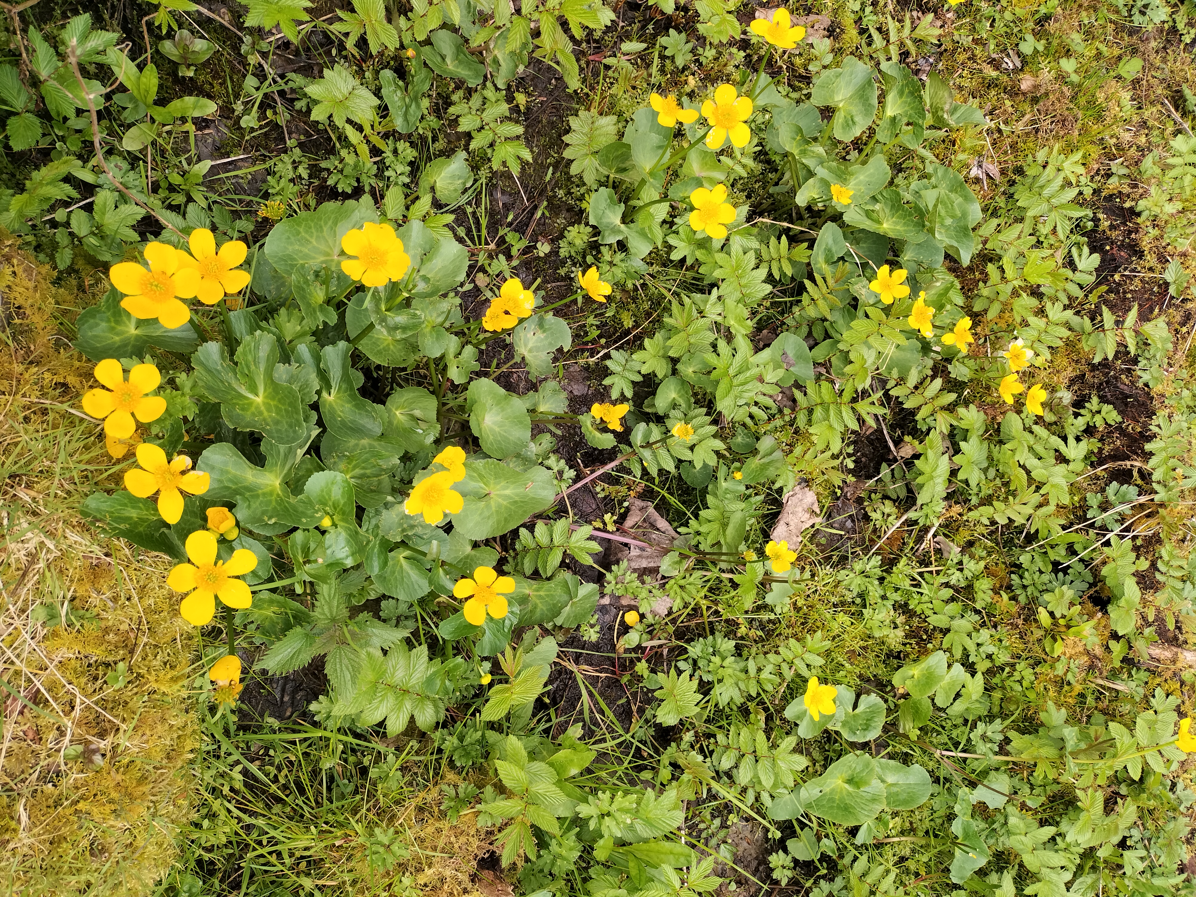
But we’re here in May, and it’s the time of bluebells and wild garlic.
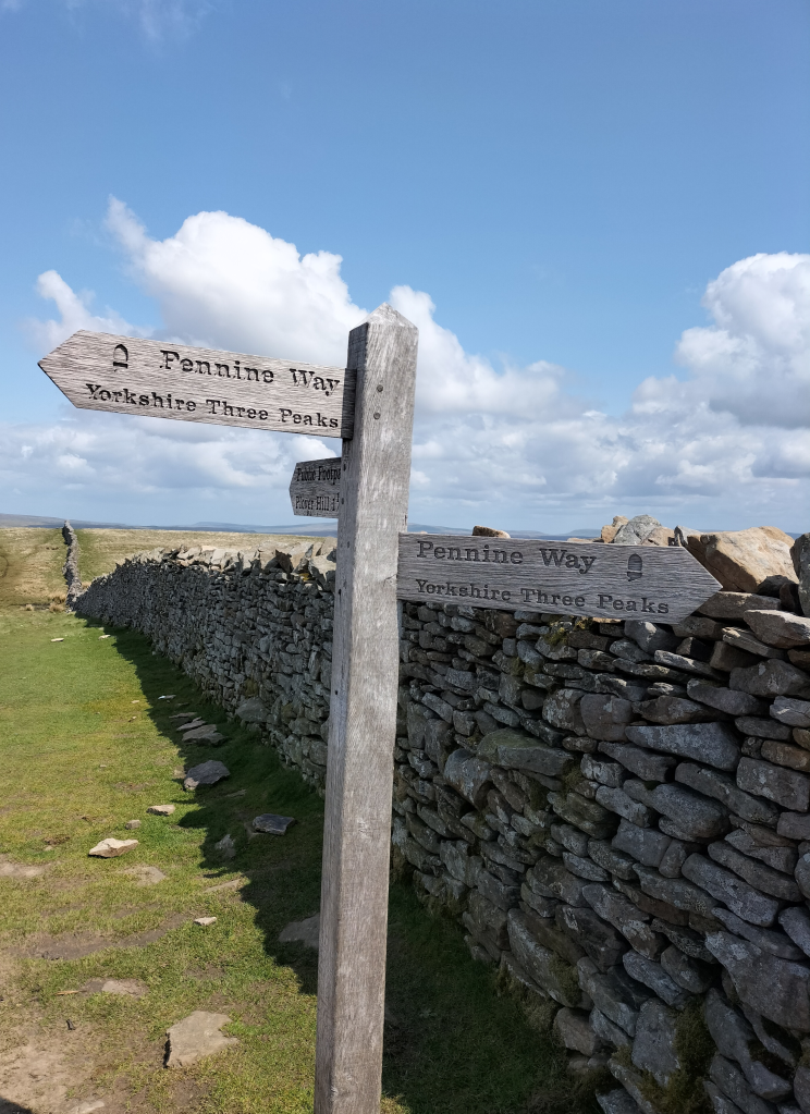
Ribblesdale is the best known walking area in the National Park and features Yorkshire’s famous Three Peaks – Whernside, Ingleborough and Pen-y-Ghent (more about the last on my next post) – offering challenging walks and amazing views. This short walk is the easiest section of the Ribble Way.
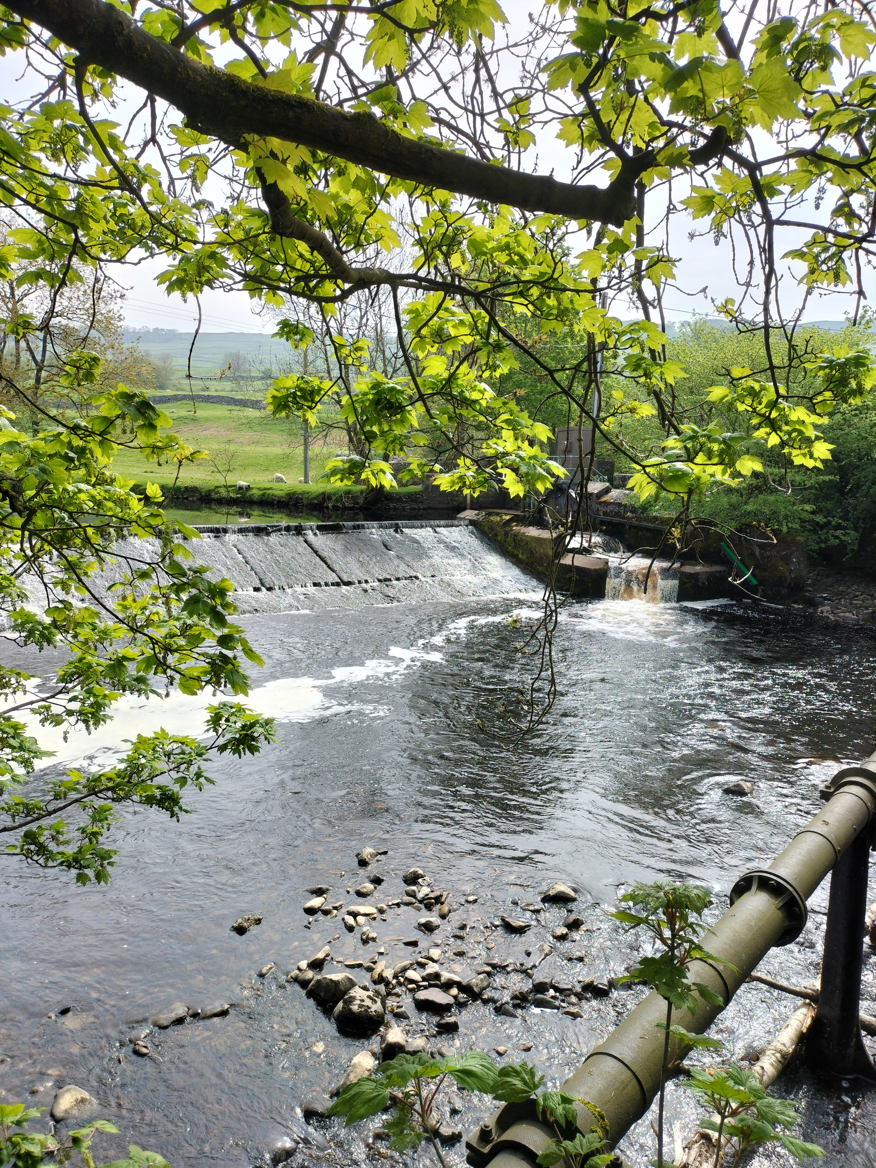
The weir at Longcliffe.
We passed the remains of old cotton and snuff mills, industries long gone now but the houses that were the homes for many of the labourers still stand, strong buildings many built of the local grit stone.
Nearby is the town of Settle where the hydro harnesses the river to create clean, green electricity.
Photograph courtesy of settlehydro.org.uk/
The Hydro is powered by water from the Ribble immediatelyabove the weir, through a sluice gate, down what is called the Archimedes Screw (the turbine) and back into the Ribble just after the base of the weir. Electricity is generated by the falling water rotating the turbine which, in turn, drives a generator. The electricity is fed by a direct line to the old mill building which is now apartments. Any electricity not needed by the apartments is fed into the National Grid.
It was a lovely easy trail, the weather was good, a perfect stroll through the fields and on the Settle bridleway.
And perfect for the photographer to capture two of his favourite subjects… Water and reflections.
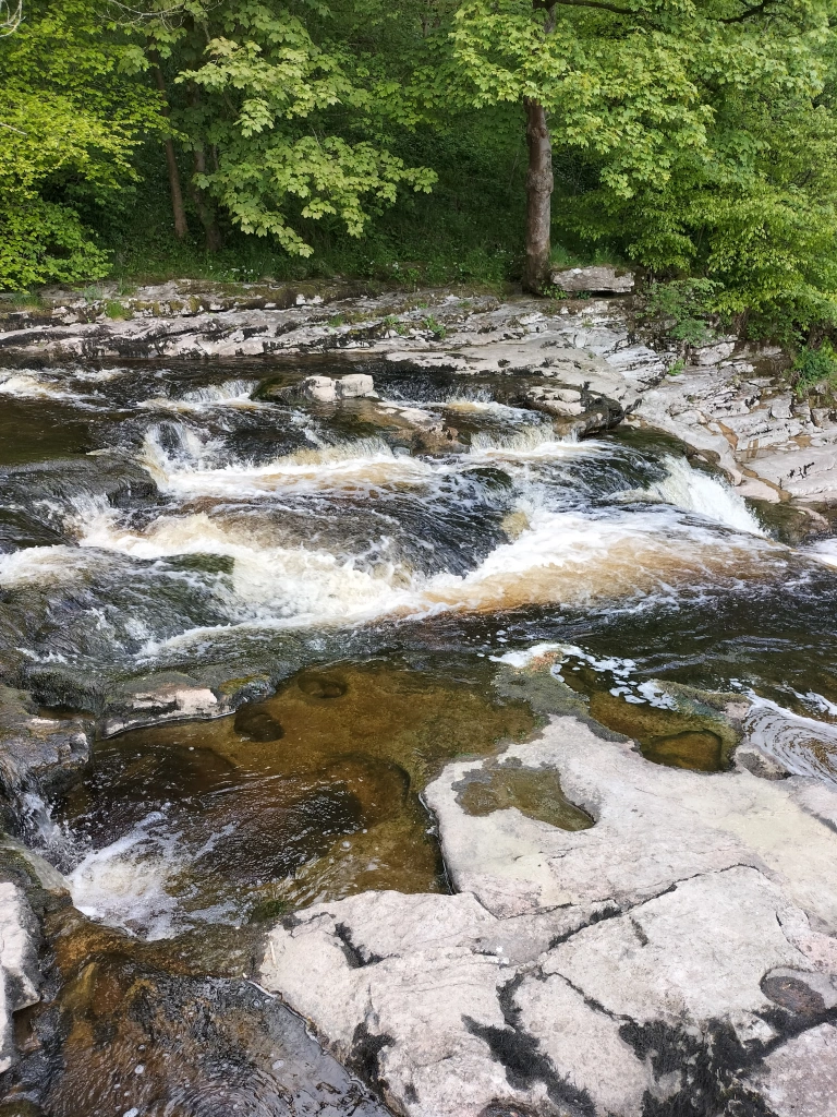
Our main aim for this walk was to see Stainforth Force,the two metre high cascade waterfallwhere the salmon leap in the Autumn.
Llyn y Fan Fach is a glacial lake in the Brecon Beacons situated beneath Picws Du mountain, the second highest peak of the Carmarthen Fans in the Carmarthenshire section of the Black Mountain in the west of the Brecon Beacons. (The name Brecon Beacons has recently reverted to its old Welsh name, Bannau Brycheiniog, which means “the peaks of Brychan’s kingdom”)
For anyone interested Brychan Brycheiniog was a legendary 5th-century king of Brycheiniog (Brecknockshire, alternatively Breconshire in Mid Wales.
Brychan depicted in a window of the church in Brecon, Wales.
There is one thing I want to say before we go any further with this post.
Never believe the stats!
Distance: 9.2 miles (14.8km) circuit (Let’s just say Circuitous! Or, if you’re really wanting to be pedantic – like a dog’s hind leg… or two!) Elevation gain: 720m (Gain is the right word. The exhilaration of getting anywhere near that height makes one feel as if one has reached the top of the world. If you can get enough breath to get that far!) Difficulty:Moderate (if you can call the initial mile of a one in ten ratio upwards on a stony, gravelly track, followed by steeper narrow paths – Moderate.
The Llyn y Fan Fach car park near is reached by a winding single track road (with the added bonus of few signposts in an area that the SAT NAV doesn’t recognise – we went in a complete circle at one point) and is remote with no facilities. At all (Am I selling it to you yet? Hmm? Well… I will… later. Honest.).
All the previous being said, we had a wonderful day’s walk. Hike… I should have said hike, here(Or even … climb!)
Actually, when we arrived there was a group of young people from London who were walking the area as part as their Duke of Edinburgh Award. Very chatty – when they stopped to get their breath – which was as often as us. So I didn’t feel that decrepit!
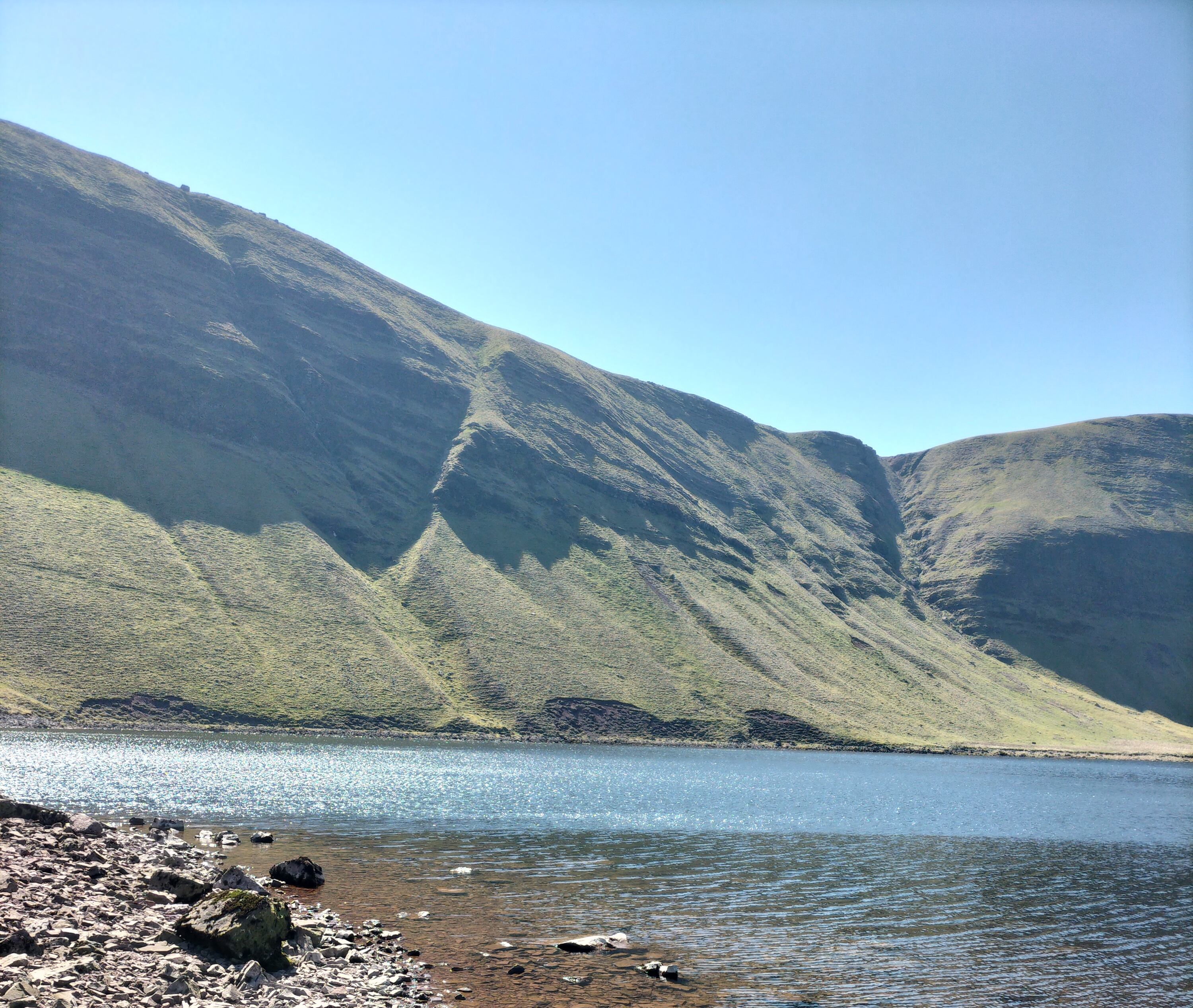
And, of course, we had a picnic sitting by Lyn y Fan Fach, a beautiful lake surrounded by magnificent craggy mountain peaks. Sheltered by a wall, with the sun warm on our backs, we watched the grass swaying under the clear water, the surface a glistening reflection of the sky. The only sounds were the rustling of the wind, the cries of the skylarks, and, in the distance, the faint voices of people walking along the ridges of the Picws Du mountain
Which gave the photographer a chance to peruse the area.
Llyn y Fan Fach is renowned for Welsh Folklore. One folklore legendis the myth of ‘The lady of the lake’. In the folktale, a young farmer of the 13th century spotted the most beautiful girl he’d ever seen emerge from the lake, she was a princess from the kingdom of fairies. He courted the fairy princess by baking her bread and after three attempts he succeeded in winning her hand in marriage on the condition that if he hit her three times she would leave him. He complied easily because she was so beautiful and they were happy for years bringing up a family at his farm near Myddfai, with her magic dowry of farm animals. In time the inevitable happened he hit his wife (reported as apparently playfully!?) and she disappeared back into the lake taking her prized animals with her, leaving the farmer with her sons. The sons once grown became known as the “Physicians of Myddfai” who became physicians to the English royal court..
Further to the east, beneath the peak of Fan Brycheiniog, there is another larger lake called Llyn y Fan Fawr. These lakes and peaks can be visited through a combination of mountain walks. We studied the climb to the right. A very steep climb. And decided to take the easier routeto the left.Easier for some – see below – the photographer in the distance, eager to get more photo opportunities.
It was so clear we could the rise and fall of the land for miles, it was stunning.
The path often disappeared under the mounds of long tough tussock grass and patches of boggy water. Though awe inspiring it felt very isolated: a few people far above us on the ridges of Fan Brycheiniog, a man striding, then sitting down, in the distance, a group of young men studying compasses and maps.We stopped – often – when skylarks rose and fluttered in front of us, desperate to take us away from their nests in the undergrowth. The wind came in strong cold bursts, and after we’d walked another mile, we knew, however disappointing it was, that we should turn back; not try to reach the other lake, Llyn y Fan Fawr, beneath the peak of Fan Brycheiniog, The speed we were going, we would chance being there after dark. Perhaps we shouldn’t have lingered so long at the first lake.Or set out earlier in the day. Or not got lost.
So, after a couple of photo shots, we made our way back across the land and down the track to the car. The Duke of Edinburgh students were still somewhere on the ridge. Knowing how they had dreaded the climb I didn’t envy them. And yet, not having achieved what we set out to do…
Still, a wonderful day in all.
Until the next time we attempt this walk …. or not.
When I was a child my mother took me every Saturday to the small library in our village. I was allowed six books – usually all read by the Wednesday (I was one of those kids who read by torchlight under the bedclothes – and got away with it for years!) I would then wait, not always patiently, until the weekend, when we would go again. I think it was a great relief to both my mother and myself when I was at last allowed to walk to the library by myself.
By the way…In the very olden days libraries were named from the Latin “liber”, meaning “book.” In Greek and the Romance languages, the corresponding term is “bibliotheca”. Or, if you want to go with the medieval version “Calque of Old English bōchord (‘library, collection of books’), equivalent to book + hoard.”
Just thought you might want to know that.
Anyway, when I was a child – libraries were just… libraries. The place one went to to borrow books. For free!!
Image courtesy of Pixabay
Today, libraries are still one of the few free services left. Libraries are used for many different reasons; they contain not only books. magazines, newspapers, manuscripts, but also CDs, DVDs, e-books, audiobooks etc. They connect us to information.And, important in these days, they are also community hubs where authors (if they’re lucky) can go to give talks, hold workshops. It’s where people can connect with other people. They are safe havens.
Reading for pleasure, is one of the most important things one can do, so what we need to make sure of is that future generations have the opportunity to do just that. Books represent the chance for us not only to enjoy the work of so many brilliant writers, but to also to grow, to change, to see life from other points of view. We will only ever see life through our own perspective … unless we read.
In our area, the Pembrokeshire County Council has approved its budget for 2023-24. We will have a Council Tax rise of 7.5%. It would be wonderful if the value of libraries and librarians were understood; if those in authority – those with access to their council budgets – acknowledged this importance for every generation. If enough funding were to ploughed into libraries to preserve them.
Image courtesy of Pixabay
Each month on the Libraries Wales website, they focus on introducing an author based in or writing about Wales. I am thrilled to be the author for April 2023.And I am more than happy, alongside other friends who are also writers, to talk about the value of books and the enjoyment of reading.Just give us the chance!!
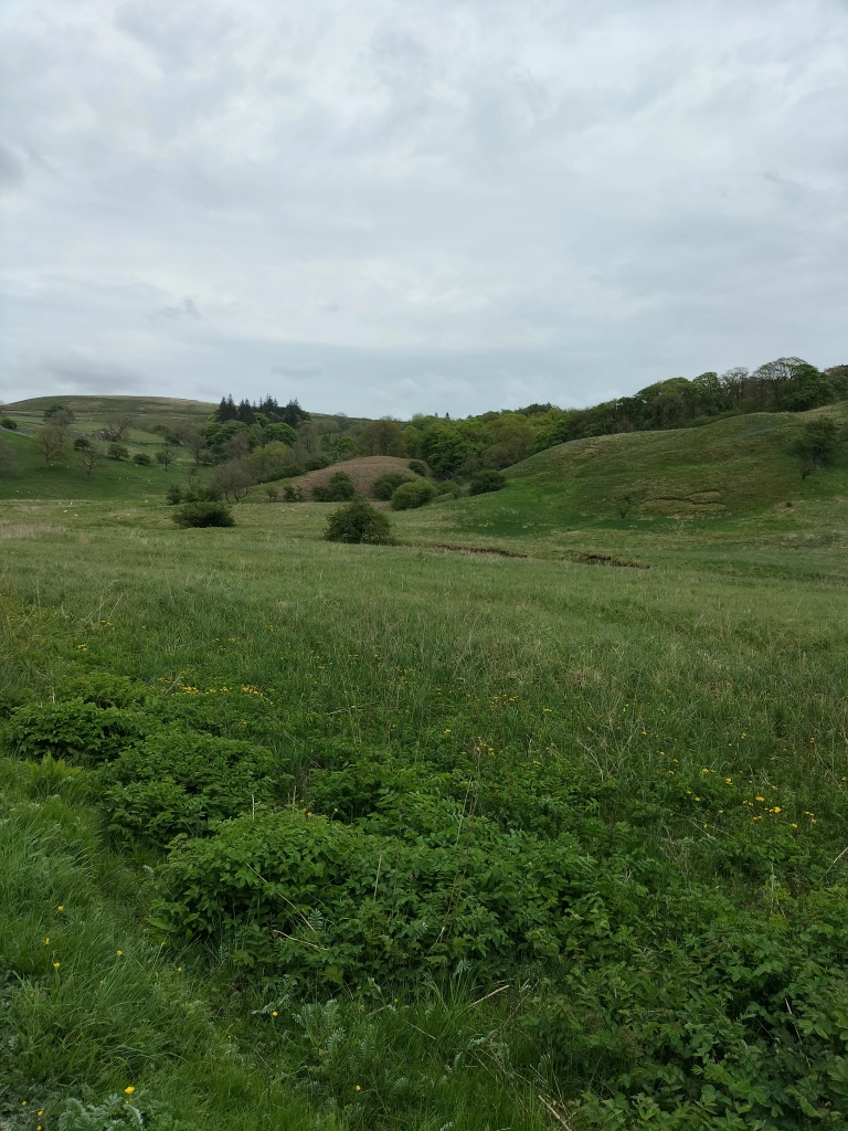
We found Pembrokeshire by lucky accident. With three children under three years of age, we didn’t want to go far on our annual holiday. Wales didn’t seem that far away from Yorkshire, well, not as far as Cornwall… we thought. We found the house we’ve lived in for over forty years by accident. Being auctioned we thought it fun to dream, to put in a bid. We’ll never get it… we thought. We did. With the optimism of youth and dreams of living near the sea we sold our house in Yorkshire. It’ll be an adventure… we thought. And we could always move back if we don’t settle. We’ll give it five years.We didn’t need five years. Although we moved to Pembrokeshire in the depths of November to a house with no electricity, heating, and not nearly enough furniture to fill a large five bedroomed house, we knew we’d done the right thing. Despite all of us muffled in so many layers of clotihng we looked like a set of Michelin Men ( remember those advert?), we were happy – we were bringing up our children in a wonderful place.
Over the years we’ve walked many times around the Llys – y- Fran reservoir, now called the Llys-y-Fran Country Park.
Back in the day (as my grandad used to say), the walk around the reservoir (about seven miles) was more of a hike and a scrabble around rocks, trees, and, sometimes, through streams.There’s still a little negotiating of streams, as I mention later.
But first the technical and public information bits…
Llys-y-Fran Country Park is three hundred and fifty acres in all, which includes the two hundred and twelve acresof the reservoir. In the parish of the village Llys y Fran, the community of New Moat, it’s on the southern slopes of the Preseli Mountains.
Llys-y-Frân dam was constructed between September 1968 and 1972.The final concrete was laid on the nineteenth May 1971, completing a total of over 500,000 tons of the stuff since the project began. By May, the depth of water had risen to forty feet but it was only on the fifth of December 1971, exactly nine months after impounding had started, that the reservoir overflowed for the first time.
The reservoir was officially opened by HRH Princess Margaret, Countess of Snowdon, on Tuesday, the ninth of May, 1972.
The dam is a hundred feet (thirty metres) high and the lake is fed by the River Syfynwy.The water is used by homes and industry in south Pembrokeshireand is managed by Welsh Water. It’s one of eight-one reservoirs in Wales.
The forecast for the day was good, so we donned walking boots and rucksacks and set off. I’m cheating a little here – the photograph below was taken on the last stretch of the homeward-bound section, as we looked back with smugness on how far we’d walked.
Back to the beginning… These days the walk is a wider, if still steep and winding in places, gravelly track around the circuit of the lake, and is interspersed with cycling routes of varying degrees of difficulty. I promise you, (and am most disappointed that I forgot to ask husband to photograph it), there was one route highlighted by a sign of a skull and crossbones… with a note that the route was only for those of the highest skill and fitness … (and, I added to myself, the most crazy!).
“There’s a lot of water to cross, isn’t there?” I remarked, after wobbling on strategically-placed rocks and tree trunks in one particularly wide stream.
“Well, it is a reservoir,” he replied, striding manfully through the water.
“Sarcasm is the lowest form of wit!” Was the only remark I could summon up, as I stopped trying to balance and sloshed after him.
The whole time we walked we met only two cyclists and three couples with dogs. The sun shone (most of the time) and there was just a slight breeze that moved the grasses, the patches of daffodils, the leaves and petals of the primroses, the early gorse. Except for the calls of the Canada Geese and, at one point, the noisy squabble of seagulls, it was peaceful. Through the woodland there were stunning views all along the way.
We stopped for a picnic. I won’t admit we stopped to catch our breath – although we did do a bit of puffing up those steeper parts. I’ll even go as far as to say it stopped me talking … sometimes!Anyway, we were ready for a bite to eat, a coffee, and another photograph opportunity .
The photographer! What isn’t seen here is the robin who followed us around for a least a mile after we’d fed him some crumbs, and is a few inches behind David, patiently waiting for him to move (he had his foot on a crust of bread).
What used to take us two and a half hours to walk this trail, this time took us over three and a half. I claim mitigating circumstances – we stopped often ( very often) for husband to take photos. Oh … and to eat the picnic.
And I refuse to talk about the fact that we both walked like ducks the day after!
N.B. The word llys translates into English as “court” and y frân translates as“[of] the crow“. Just thought you might like to know that.
Interviewing Debby, who is one of the easiest people to talk to, despite her and her father’s fame. She is so open, so honest, so interesting. And it was fascinating to delve into the reasons she wrote her book.
Over the last few years, I have interviewed many authors and writers of various genres. It’s fun, something I enjoy. Pre-pandemic it was in the studios, but since it’s been through zoom which means it’s easier to chat with anyone from all over the world.
The great thing about www.showboat.tv is that, unlike many other online interviews, these chats are edited. So any waffling (usually on my part), any stumbling or stuttering, or, as they say “Up North” any faffing about, is never seen by the audience.
And the other, brilliant part of the whole process, is that it brings the authors and their books, to the attention of readers and viewers all across the world.
What more could a writer ask? My future posts will be about some of the authors I’ve interviewed so far. I’ll be asking them a little more about them selves and how they enjoyed ( or dreaded!) the experience. How it was for them… kind of thing!!
About Debby Campbell
Country music singer and activist for Alzheimer’s, Debby Campbell was born in Albuquerque, New Mexico in 1956 to Diane Kirk and Glen Travis Campbell. She is the eldest of 8 children and the daughter of the most famous “Rhinestone Cowboy” Glen Campbell. Debby loved singing from an early age and spent many summers with her dad on tour, and in the television studios with his Glen Campbell Goodtime Hour television show.
Debby graduated high school in England living with her mom and step-dad Jack, while her step-dad was in the Air Force. Her dad, Glen became a world sensation, and would perform in England and send for Debby so she could spend time with him.
In her early 20’s, Debby married and became a mother of 3, two boys and a girl. She lived in Italy, and the US during this time and currently loves being a grandmother to 6 grandchildren and 1 great-grand child.
In the mid 80’s Debby became a flight attendant and today, remains flying international as well as domestic.
In 1987 Debby became part of her dad’s show on tour as a featured singer, along with her full time job as a flight attendant. She toured and traveled with the Glen Campbell show for 24 years, which included travels to Europe, Australia, New Zealand, Tasmania and Bermuda and so many more. Many of the Glen Campbell fans became loyal fans & friends of Debby’s and she has remained friends with them today.
Her appreciation for Country music landed her with her own show in Branson, Missouri at the Roy Clark Theatre in the early 90’s. She continued her career as a featured singer at the Grand Palace with her dad and then on to her Dad’s Theatre –The Glen Campbell Goodtime Theatre and ending with a residency at the Andy Williams Moon River Theatre.
Debby’s bragging rights include hosting the Jerry Lewis MDA Telethon, performances at the Grand Ole Opry, opened for greats and Grammy Award artist such as Charlie Daniels, Jerry Reed, Eddie Rabbit, Colin Raye, and performing the National Anthem for the National Finals Rodeo in Las Vegas. She is an author of her recently released book titled “Life with My Father Glen Campbell”. She has also been credited with recording duets with her dad on “United We Stand”, “Let It Be Me”, and “Little Green Apples” and on multiple recording of Glen’s “Live with South Dakota Symphony” on CD and DVD. As Glen recorded some of his final music, Debby was instrumental on background vocals.
Debby is active with the Alzheimer’s cause and finds time for her first priority, family and friends. She golfs, enjoys bowling, travel and of course singing.
The Glen Campbellstory is one of exceptional musical talent, a glittering career and a frequently disturbed personal life. In August, 2017, after battling Alzheimer’s disease, his death was announced to the world.
This celebratory Omnibus enhanced edition of Burning Bridges: Life With My Father Glen Campbell includes both an interactive digital timeline of his life, filled with videos and images of live performances and interviews, as well as a Spotify collection of the greatest recordings that Glen Campbell ever made.
As a studio musician Campbell contributed to countless Sixties and Seventies records; as a solo artist he produced the classic hits Galveston, By The Time I Get To Phoenix, Wichita Lineman and Rhinestone Cowboy; he had a successful US TV show, co-starred with John Wayne in the film True Grit, and was lauded for his talents. However, a series of failed marriages saw this shining star fall heavily into serious substance abuse, and the fabric of his life unravelled.
Persistent short-term memory loss resulted from this turbulence and Glen Campbell would have few constants in his life as the years waned on. One of them, however, was the co-author of this book, his daughter Debby. She witnessed his struggles and suffering, both musically and personally, as well as the beginning of his decline into Alzheimer’s disease.
Burning Bridges: Life With My Father Glen Campbell is a loving but unflinching reminiscence of a multi-talented musician, a troubled man and a father. Debby Campbell provides a poignant, eye-witness account of a musical legend like no other.
Actually, two zoom interviews have been uploaded with the incredible Debby Campbell, daughter of the legendary country singer, Glen Campbell. In Booksmart, she talks to Judith Barrow about her book documenting her life of the road with her father, while on Inside Notes, she discusses her latest album plus her new single “Sunflower”.Watch them for a limited time free of charge on the homepage www.showboat.tv
And here Showboat TV tells us how to watch anytime