Pattern of Shadows was my first novel, the sequel, Changing Patterns was published in May 2013. The last of the trilogy, Living in the Shadows was published July 2015. In August 2017, the prequel to the trilogy, A Hundred Tiny Threads,was published. In March 2010, The Memory was published by Honno, a contemporary family saga. I also have an eBook, Silent Trauma, a fiction built on fact novel, published as an eBook. I have an MA in Creative Writing, B.A. (Hons.) in Literature, and a Diploma in Drama and Script Writing. I've had short stories, poems, plays, reviews and articles published throughout the British Isles, notably in several Honno anthologies. I am also a Creative Writing tutor and run workshops on all genres and available for talks and workshops.My blogs are on my website: https://judithbarrowblog.com/ where I review,interview other authors, and generally write about walks & photographs. At the moment I'm running a series of posts called Places in our memories, where writers talk about somewhere that brings back a memory. Always happy to hear from anyone who would like to join in with that. When I'm not writing or teaching creative writing I spend time researching for my writing, painting or walking the Pembrokeshire coastline
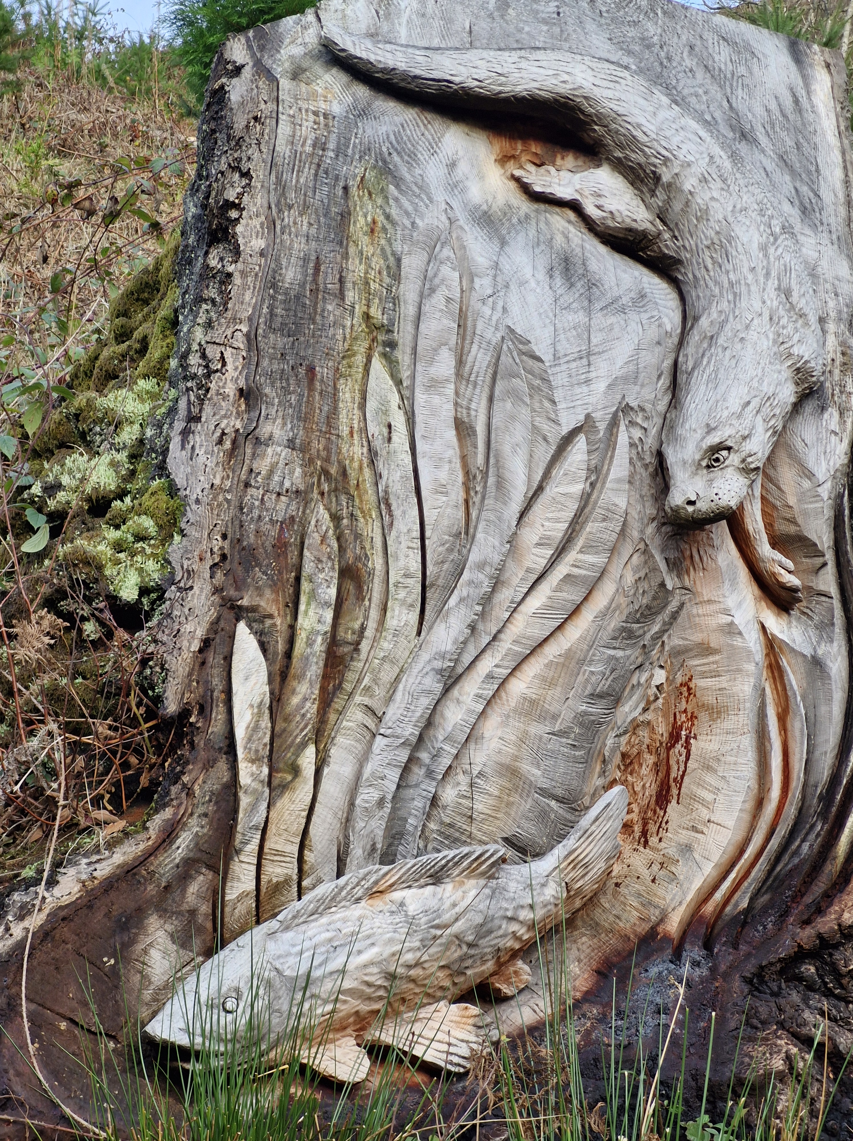
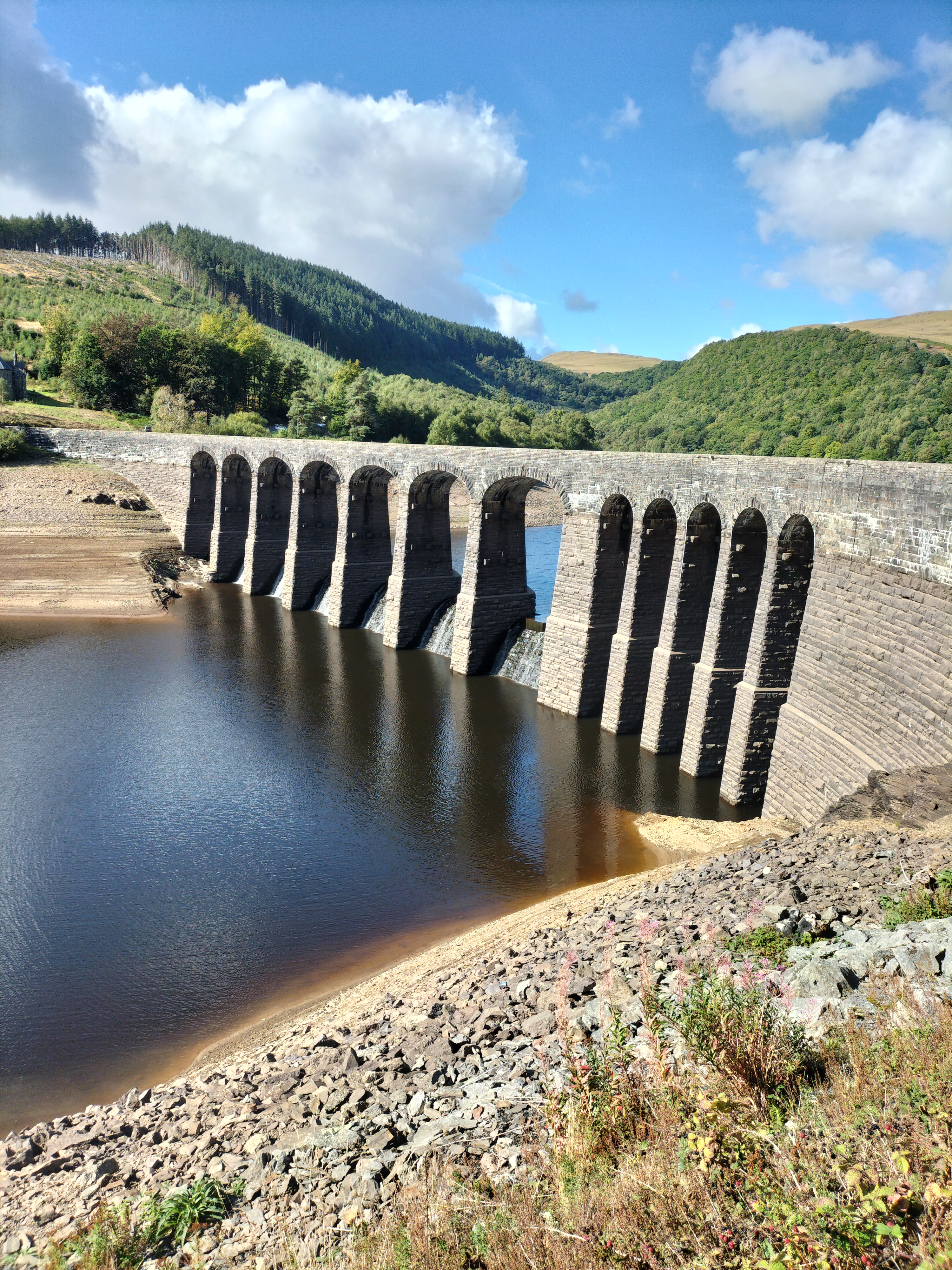
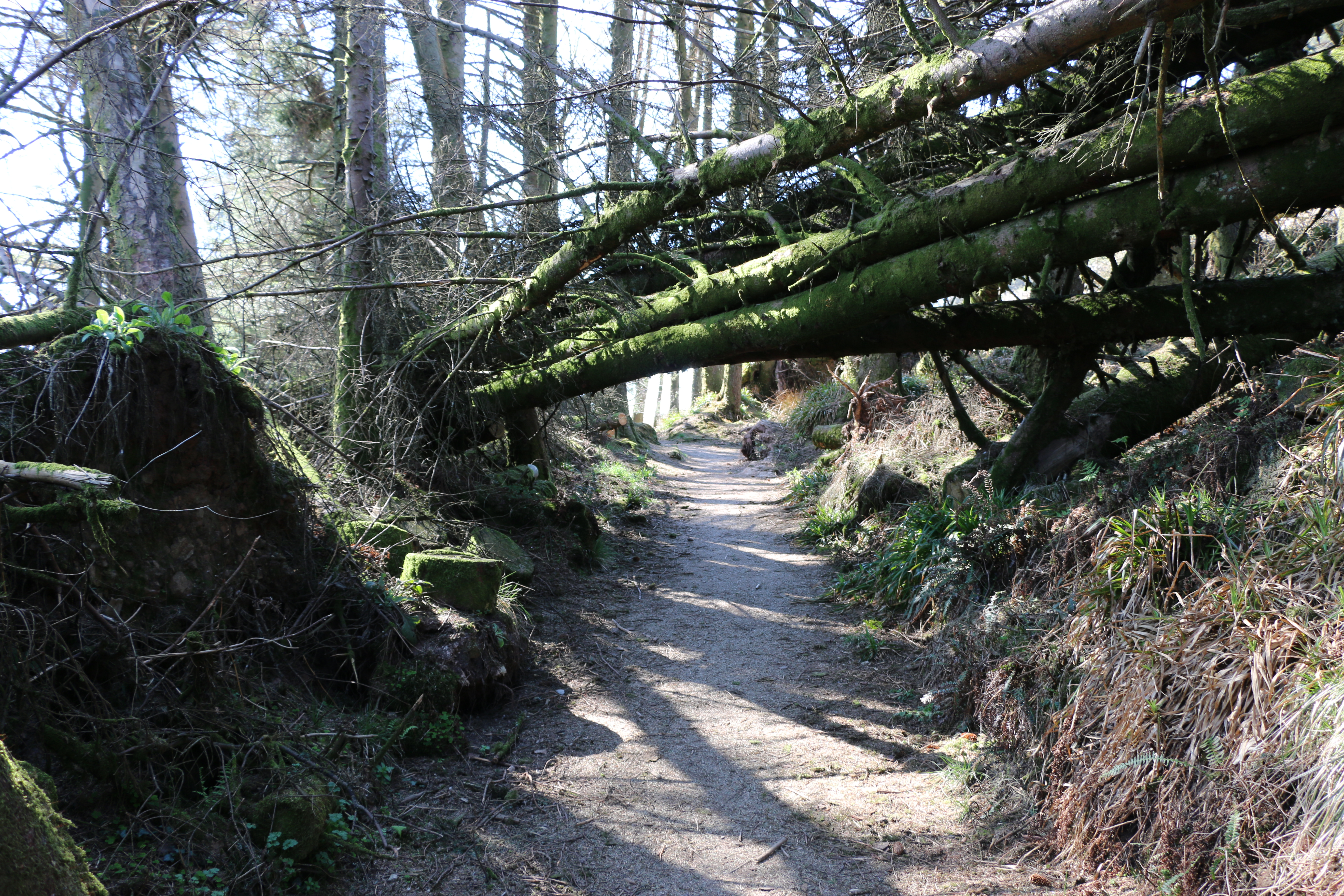
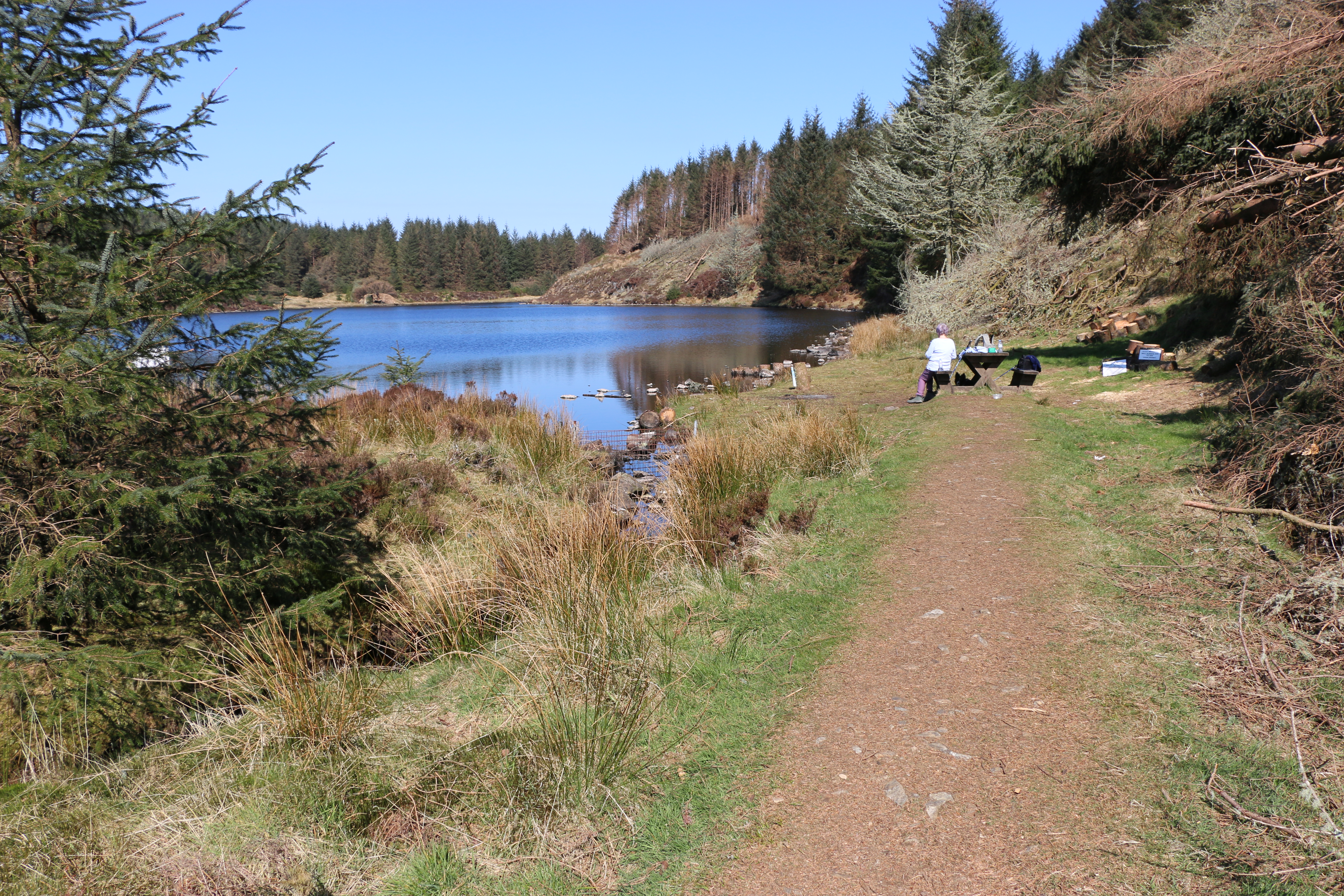
On our recent walk around Garreg Ddu Dam in the lower Elan Valley we noticed that, since we were last here, even more carvings had been created along the trail.
This area of land was originally a Victorian Douglas Fir plantation, clear-felled to reintroduce native species and increase biodiversity. The project to carve the trees lining the road was commissioned Dŵr Cymru Welsh Water and created by chainsaw sculptors Simon O’Rourke, Paul Edwards, and Matthew Crabb, who worked from ideas presented by schoolchildren from the community.
It was getting late in the afternoon, the day had been gloriously sunny and warm, but now dusk was settling in and the gathering clouds in the sky were showing signs of the rain forecast for the following day.
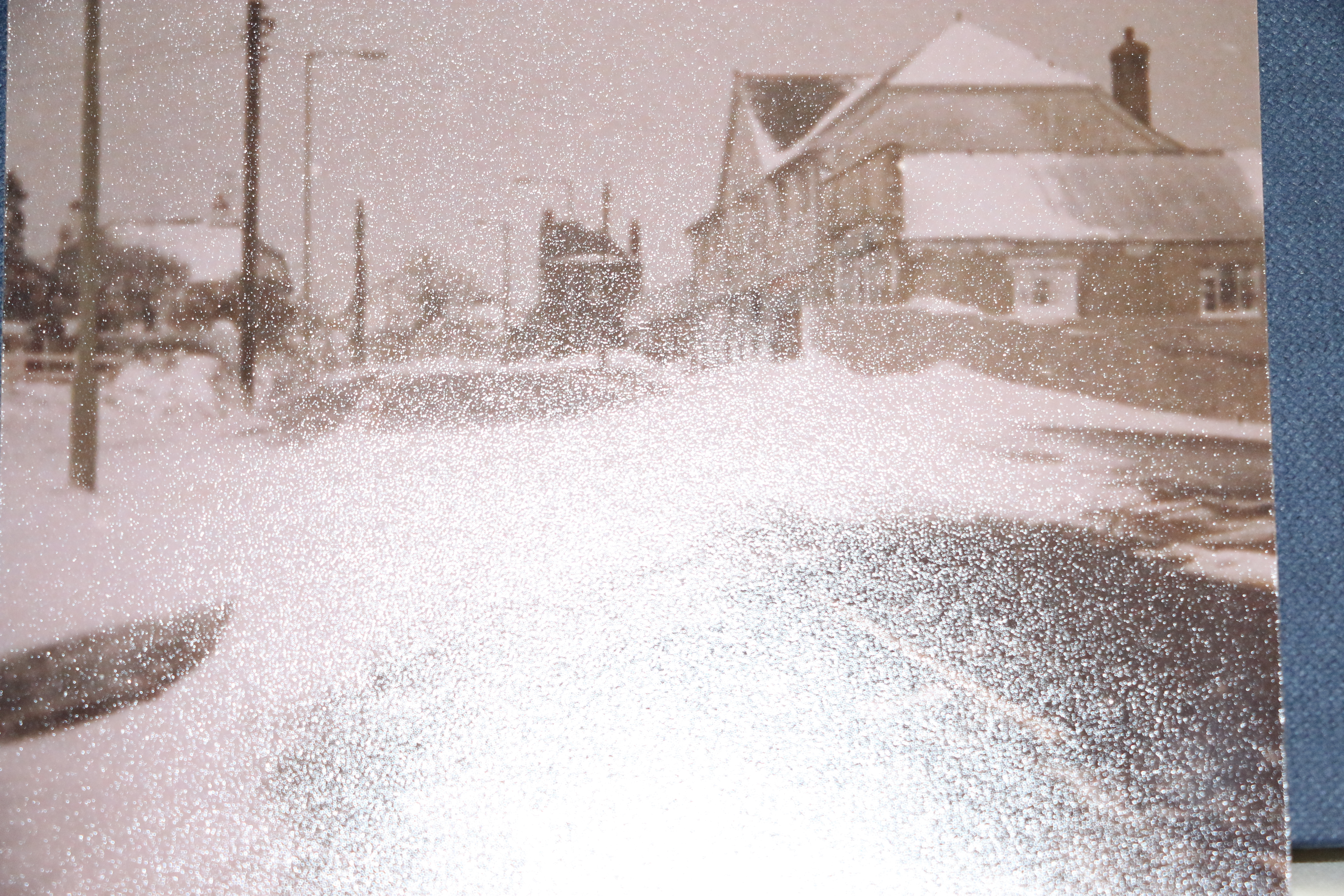
Foel Tower: a point of interest at the start and end of our walk around Garreg-ddu:Just upstream from the submerged dam at Garreg-ddu is the Foel Tower, the starting point for the 70 mile journey of the water supply to Birmingham.
The lower section of Foel Tower has a number of openings inside at different levels where a system of valves and cylinders can be raised and lowered to draw off water from the reservoir at the right depth for the current water level.
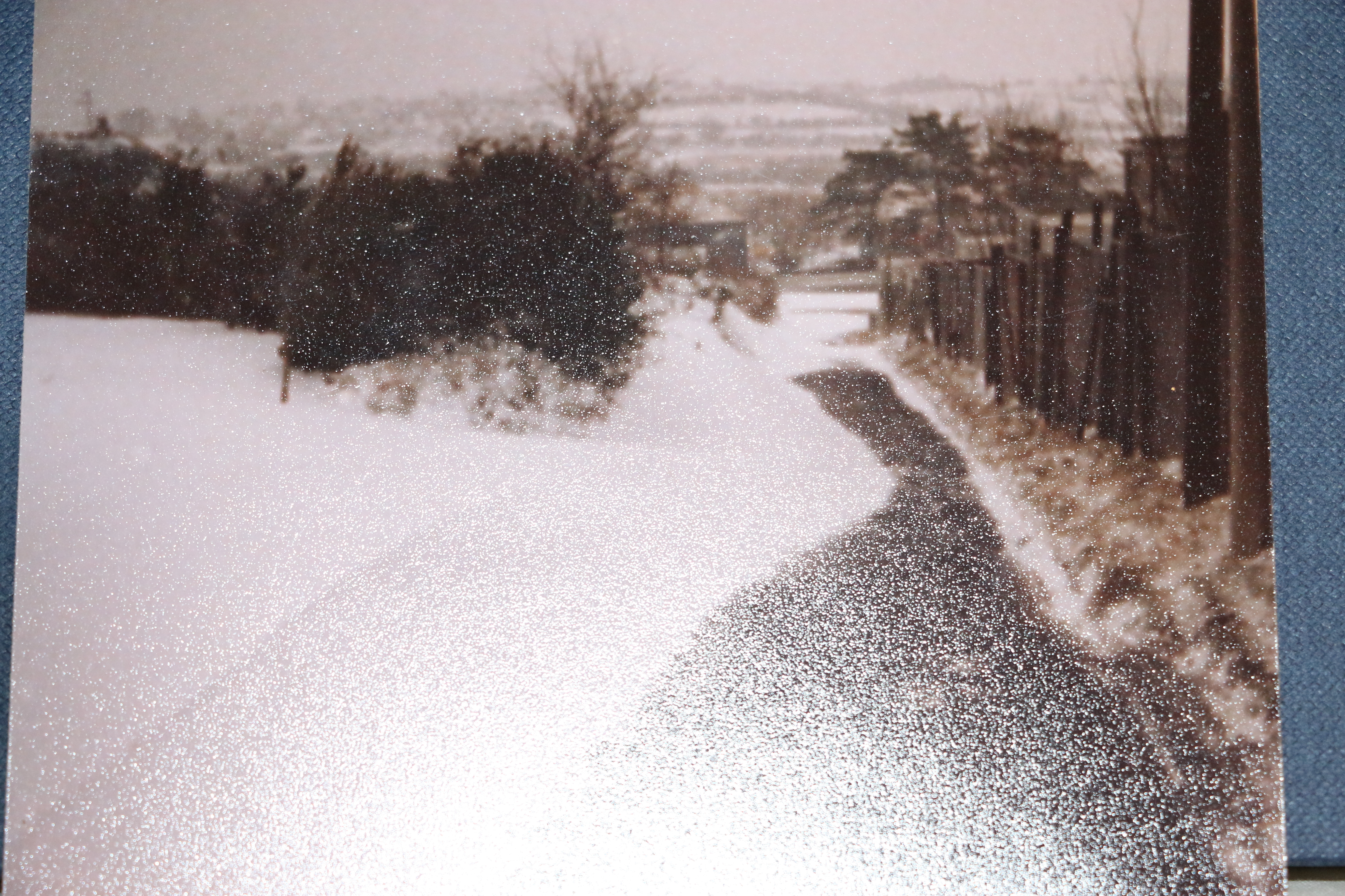
The above photograph was taken in 1947 showing the Foel Tower during very low water levels in the Garreg-ddu. Most of the openings in this image are normally underwater.
Foel Tower takes in water from the Claerwen Valley through a pipeline which takes water underground from the dam system. Water is also collected by Pen-y-garreg and Craig Gochhe, the two dams higher up in the Elan Valley.
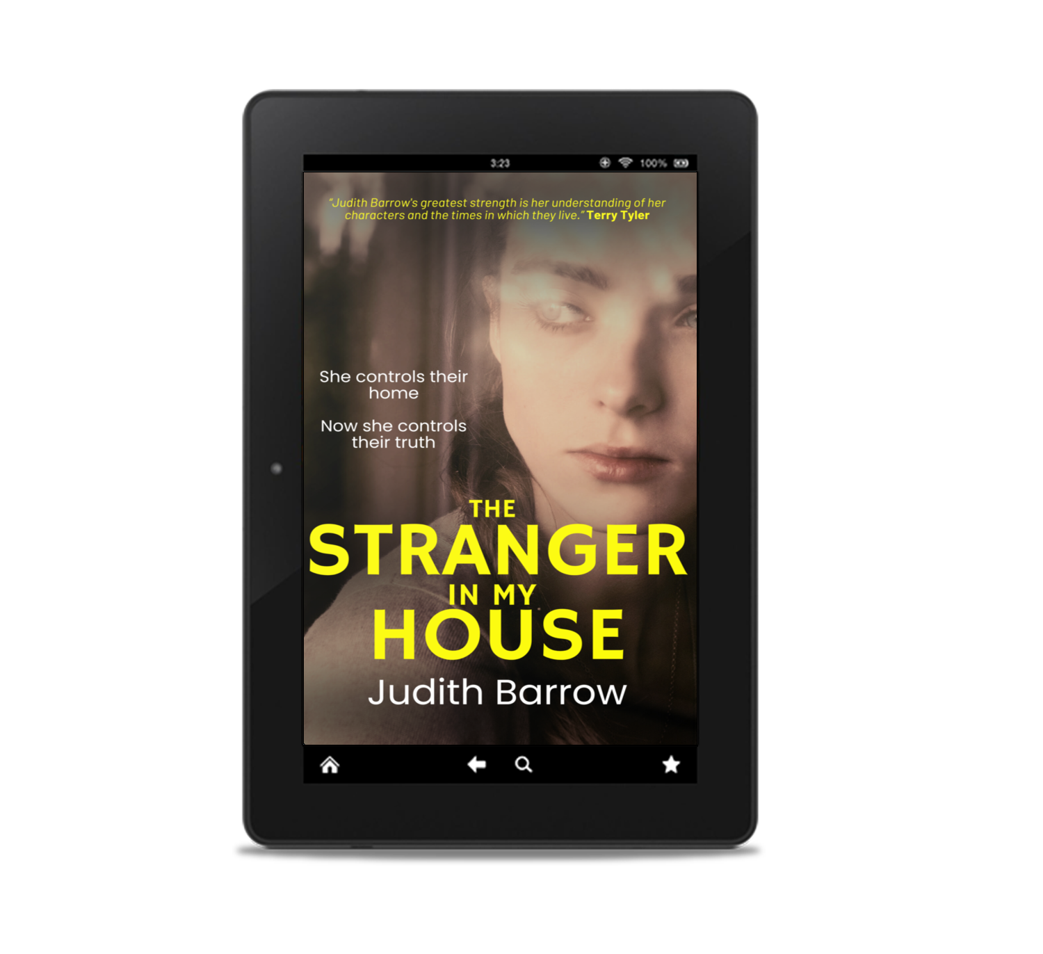
My latest book, published in November 2024 is The Stranger
Review for The Stranger: 5.0 out of 5 stars Storytelling in a class of its own… stunning.
“One of the author’s many strengths is in capturing the clear and authentic voice of a confused child – Mandy’s voice, in The Stranger, still haunts me, torn between her own grief, her sense of right and wrong, and her love for her family. And once more, in her latest book she wonderfully portrays the suffering of eight-year-old twins Chloe and Charlie – already grieving the loss of their mother, their lives torn apart by their father’s marriage to her former nurse, an evil manipulator of the highest order…“
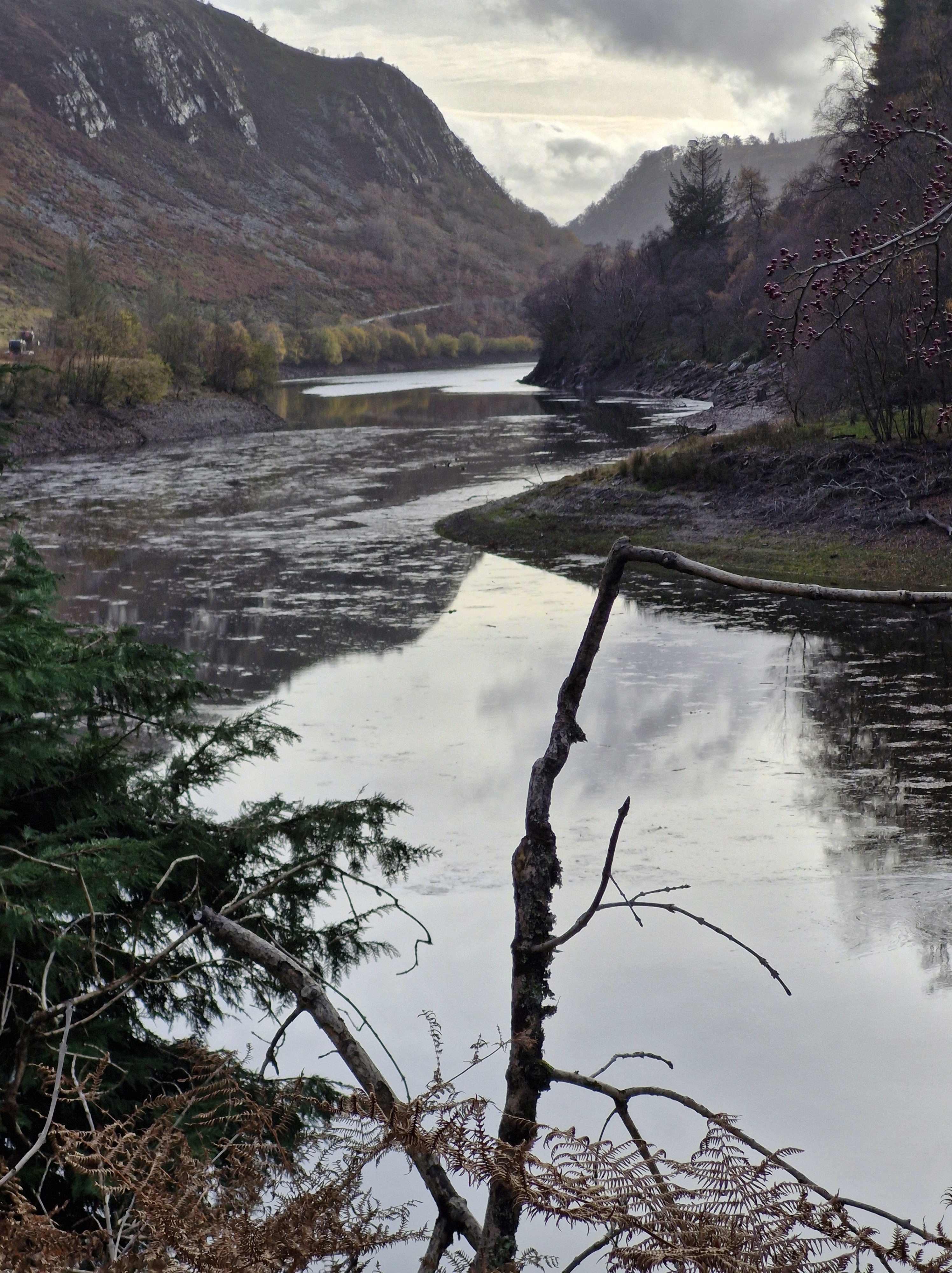
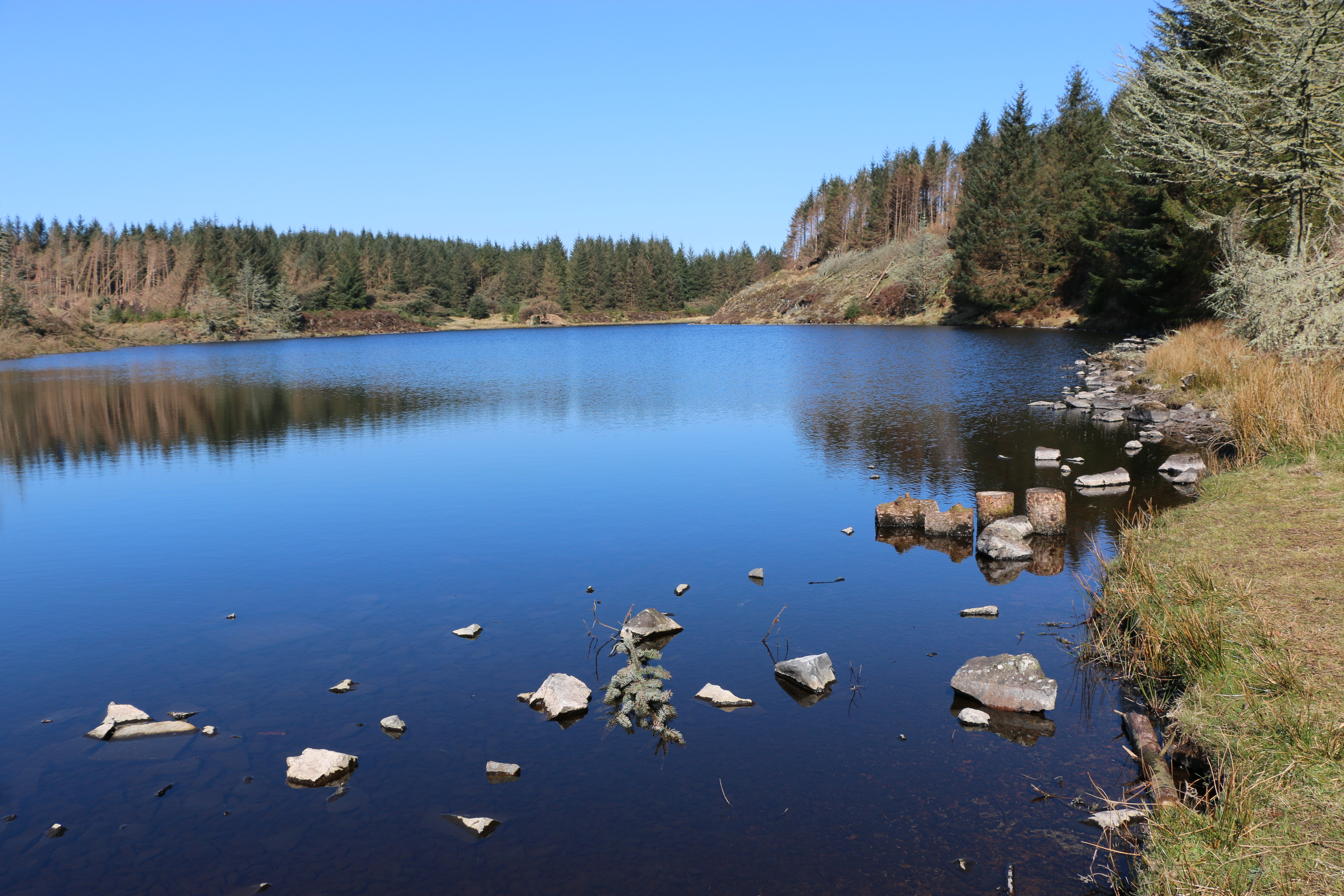
After weeks of what seems to have been constant rain, we embarked on a couple of days away, determined to walk, whatever the weather. We headed for Mid Wales.
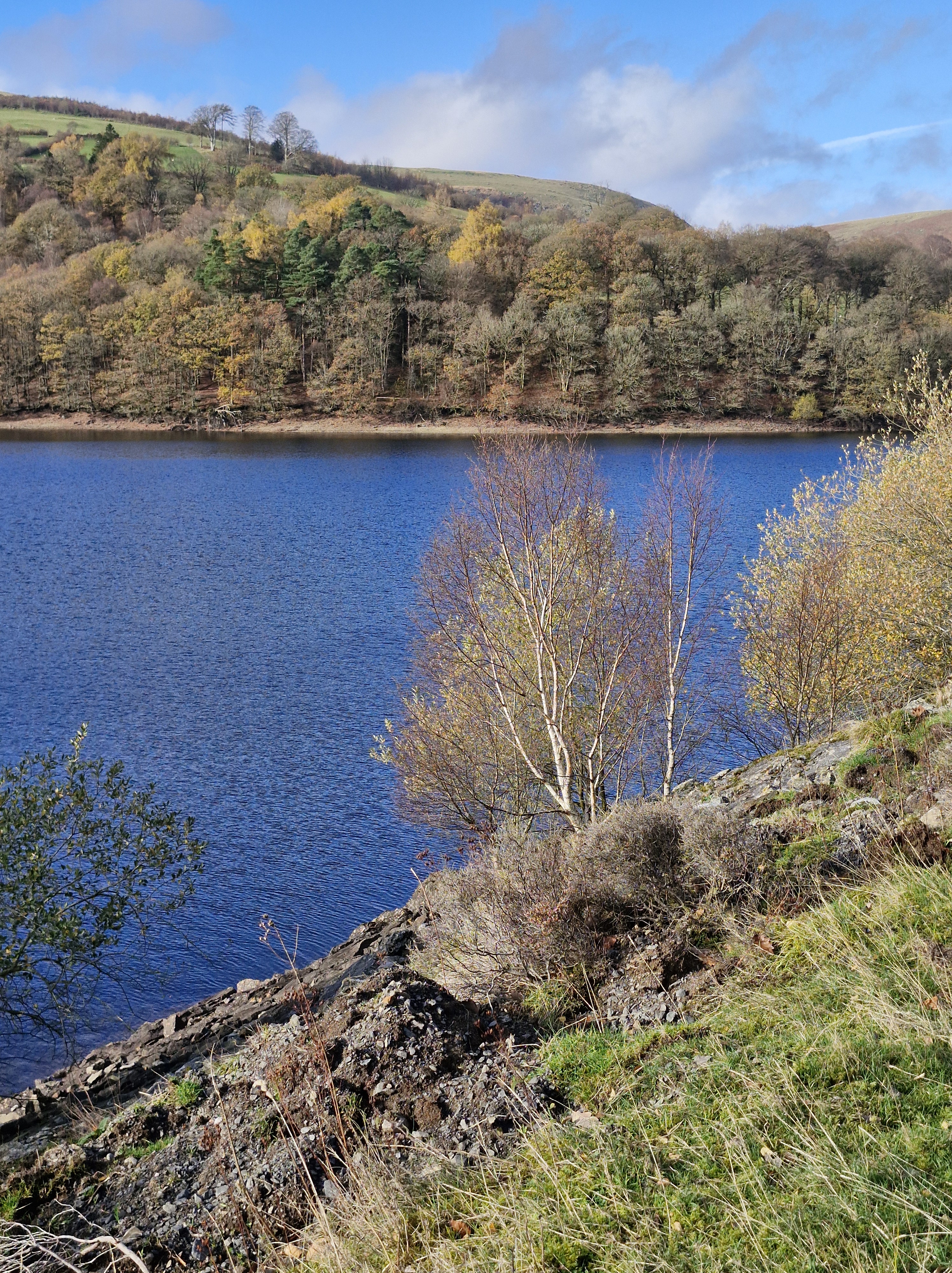
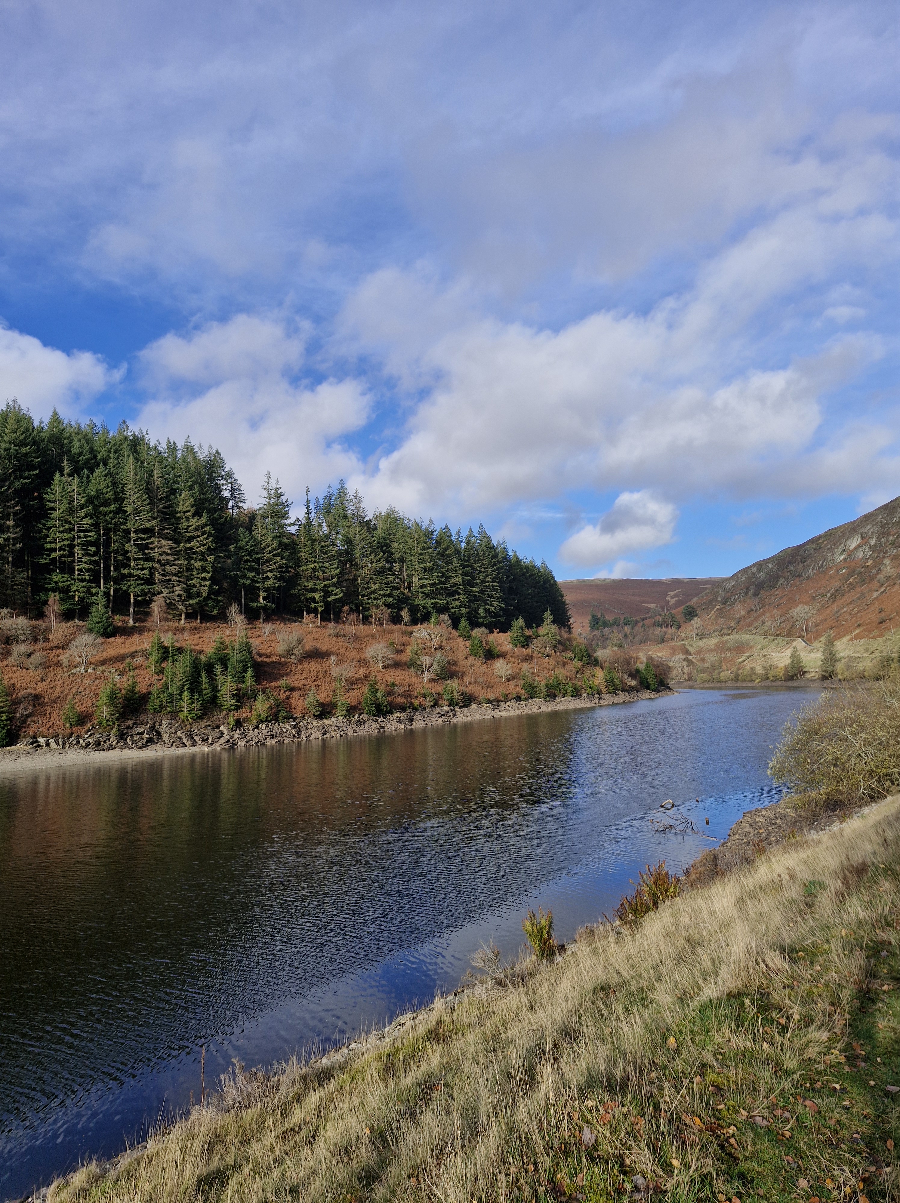
We were lucky: the clouds parted, the rain stopped, the sun came out. We took a trip to Elan Valleyand walked around Garreg Ddu to Pen y Garreg.
We’ve been a few times in the past, the last being in 2023 when there was a drought declared. Below is the road bridge/ wall between Garreg Ddu and Caban Coch. On the left 2023, on the right this time, in November.
Though there were less daylight hours this time to walk we still were able to see some of the differences in the water levels in the reservoirs between our visits in 2023 to this November.
In 2023 the water was so low we could see the outlines of the houses, the roads and the church that were compulsory purchased in 1892 in order to dam the Elan and Claerwen rivers within the Elan Valley and supply water to Birmingham. This was because of the rapid growth of that industrial city, and the numerous outbreaks of disease that prompted Birmingham City Council to petition the British government to pass the Birmingham Corporation Water Act in 1892, allowing the corporation to acquire the land.
Building work began in 1883. There are six impressive dams altogether. Four follow the Elan River – Craig Goch, Pen y Garreg, Garreg Ddu, and Caban Coch and two are on the river Claerwen – the Claerwen dam and the unfinished Dol y Mynach dam.
The History of Elan Valley:
In 1893 one hundred people in Elan Valley had to move to allow the work to begin, but only landowners received compensation payments. Many buildings were demolished: three manor houses, eighteen farms, a school and a church – the latter being replaced by the corporation and renamed Nantgwyllt Church. Over the next three years a railway line was constructed to transport the workers and thousands of tonnes of building material each day.
Thousands of men and their families lived in wooden huts in the the purpose-built Elan Village, where, eventually a library, a public hall, a shop, and a canteen were built. There was also a hospital, used for injuries and as an isolation hospital. There was even street lighting which was powered by hydroelectric generators. New workers were initially expected to spend the first overnight in a lodging house to be deloused and examined for infectious diseases. Only then were they allowed across the river to the village. Single men lived in groups of eight in a terrace house shared with a man and his wife. A guard was employed to check for illegal importation of liquor and unauthorised visitors. There was a bath house which the men could use up to three times a week but the women only once. And the pub was for the men only. A school was provided for those under elevens, after this the children were expected to work.
The dams were built in two phases. The first phase, which cost six million pounds and employed fifty thousand was opened on the twenty-first of July 1904 by King Edward VII and Queen Alexandra. The building of the second phase dams was delayed due to the two World Wars and work only started in 1946. Because of engineering advancements just one large dam was built instead of the three smaller ones originally planned for. This was the Claerwen. This dam was completed in 1952 and opened by Queen Elizabeth II on the twenty-third of October.
One of my greatest pleasures – besides writing – is walking. In fact walking is what I mostly post about on social media; mainly because I realised a long time ago that across many of the socials, it’s writers talking/commenting/sharing with other writers. And it’s my own fault; I have never got around to writing a newsletter to potential readers. Nevertheless I’ve made some lovely friends over the years online as well as in real life.
And, as a creative writing tutor, I’ve also made friends with many people who wanted to learn to write …. something … whether it was a novel, a short story, poetry, travel writing, or writing for children.
Alongside many of the authors I know, I share a fascination of people, and I admit I people watch.Which is probably why all my novels are character led, whatever genre I’m writing in. This no more so than in The Stranger in my House, published on the 14th of November last year (2024). The story has a main theme, coercive control; the ability of one woman to change the lives of a man and also those of his children. And not for the better.
Building characters layer by layer in a story has to have a balance: of their backgrounds, their history, the way they respond to life and to the people around them. Much as in real life. I believe there comes a time when we are all mostly what we have lived, what has happened to us, how we responded, how we were treated, how we treated others. Yes, there is always the argumant of inherited, biological traits, but I do believe that, in later life it’s what our lives have been like. However, I’m always open to that statement being challenged, and I have been involved in many discussions, on many occasions.
In all my stories, as with most writers, my characters take on a personality and life of their own. I found this especially so in The Stranger in my House. So much so that I wondered what happened to Charlie and Chloe, the two protagonists in the story, after the reader closes the book on their lives. At the beginning they are just over six years old. By the end they are adults.
I like to think that Chloe and her husband, Mark, and Charlie and his partner, Simon, become as smitten with being outside, with looking at nature, the change of the seasons, and with walking, as my husband and I are.
And there is nothing better on cold, wet, and windy winter evenings than looking back at photographs of our walks.
So here is another treasured memory:
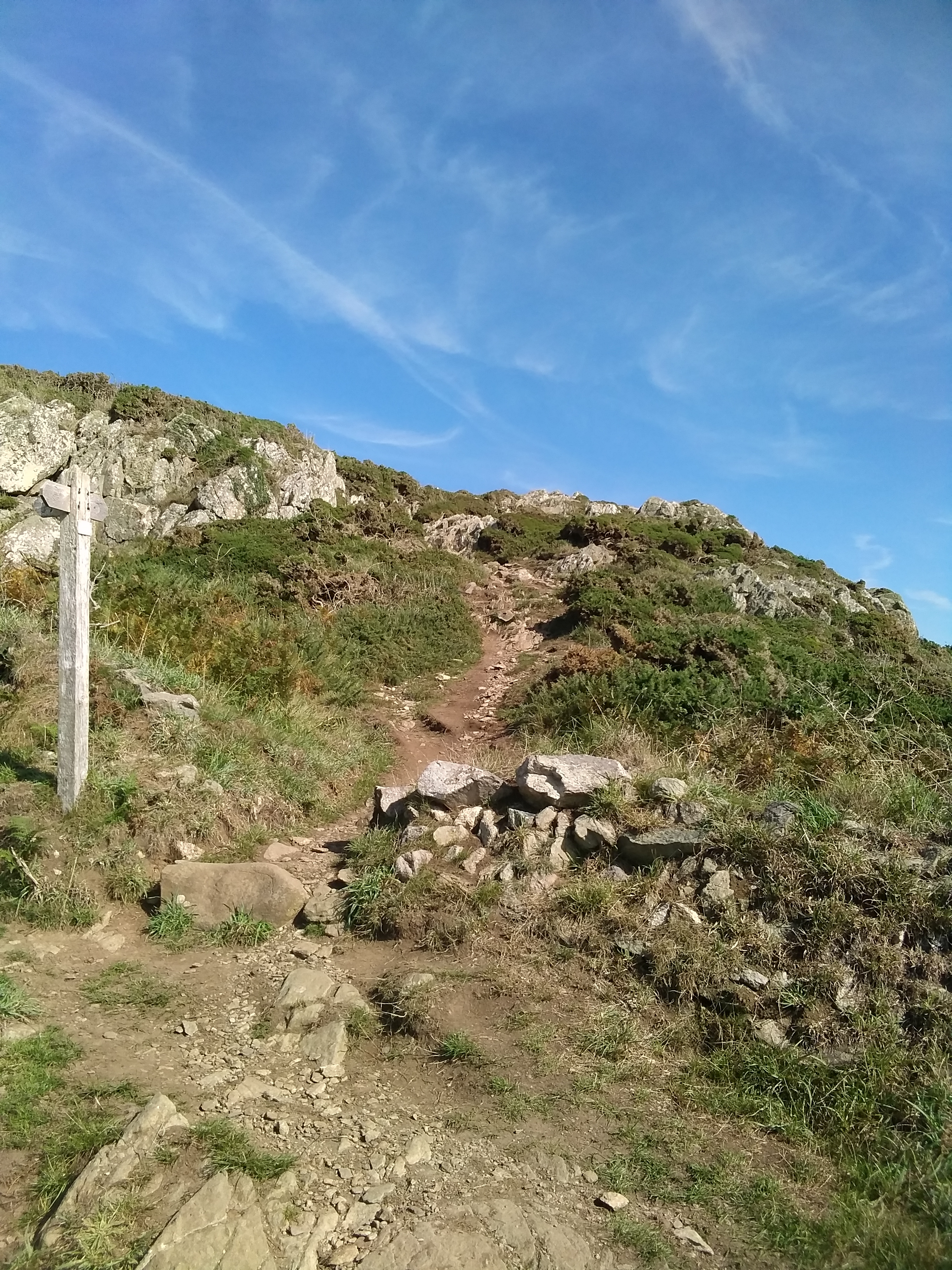
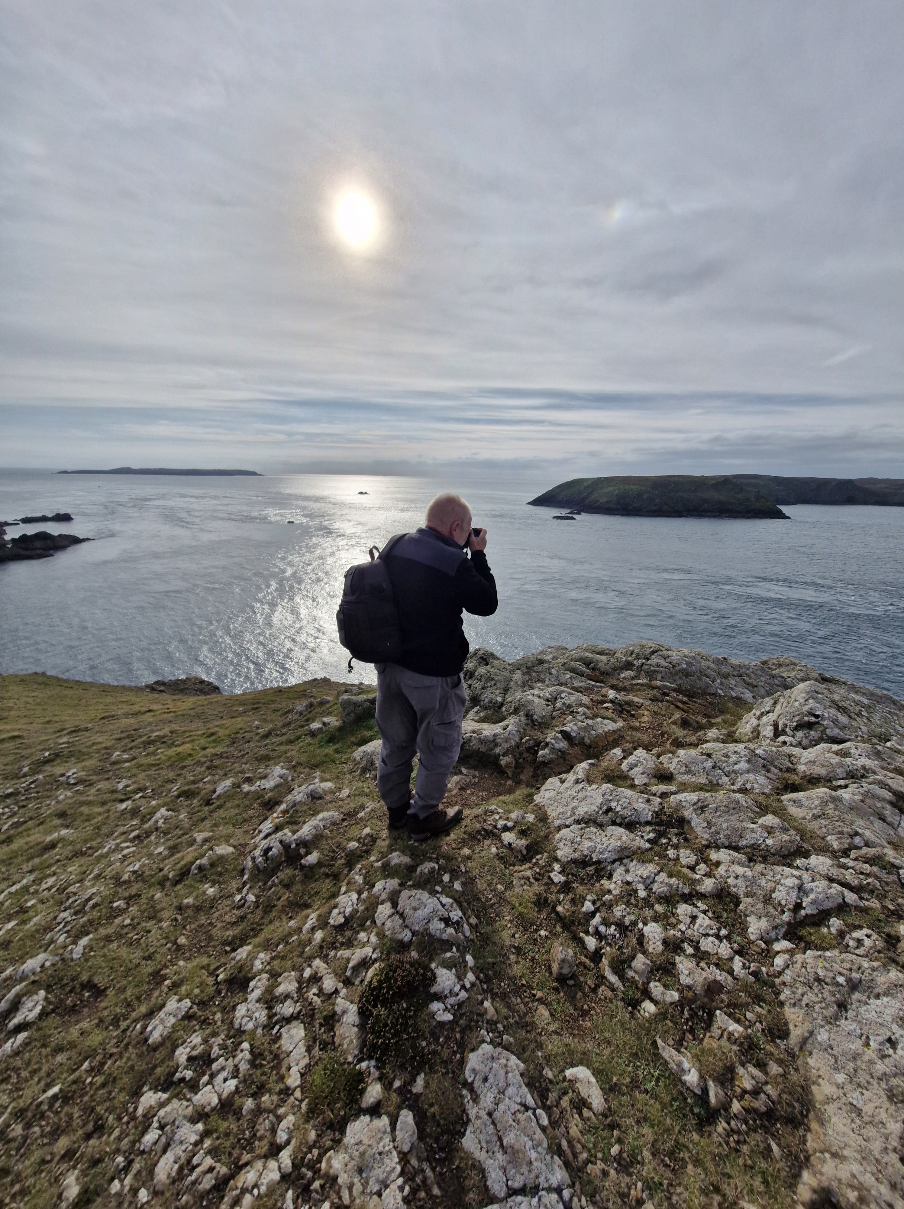
St Justinian’s to Porth Clais:
Walking in the footsteps of St Justinian, or sometimes scrabbling to get to the top of the next path.
Literally on hands and knees. But it was so worth it
Wonderful views overlooking Ramsey Island
Just to prove I was there – I hate having my photo taken, but waa caught unawares by the Photographer.
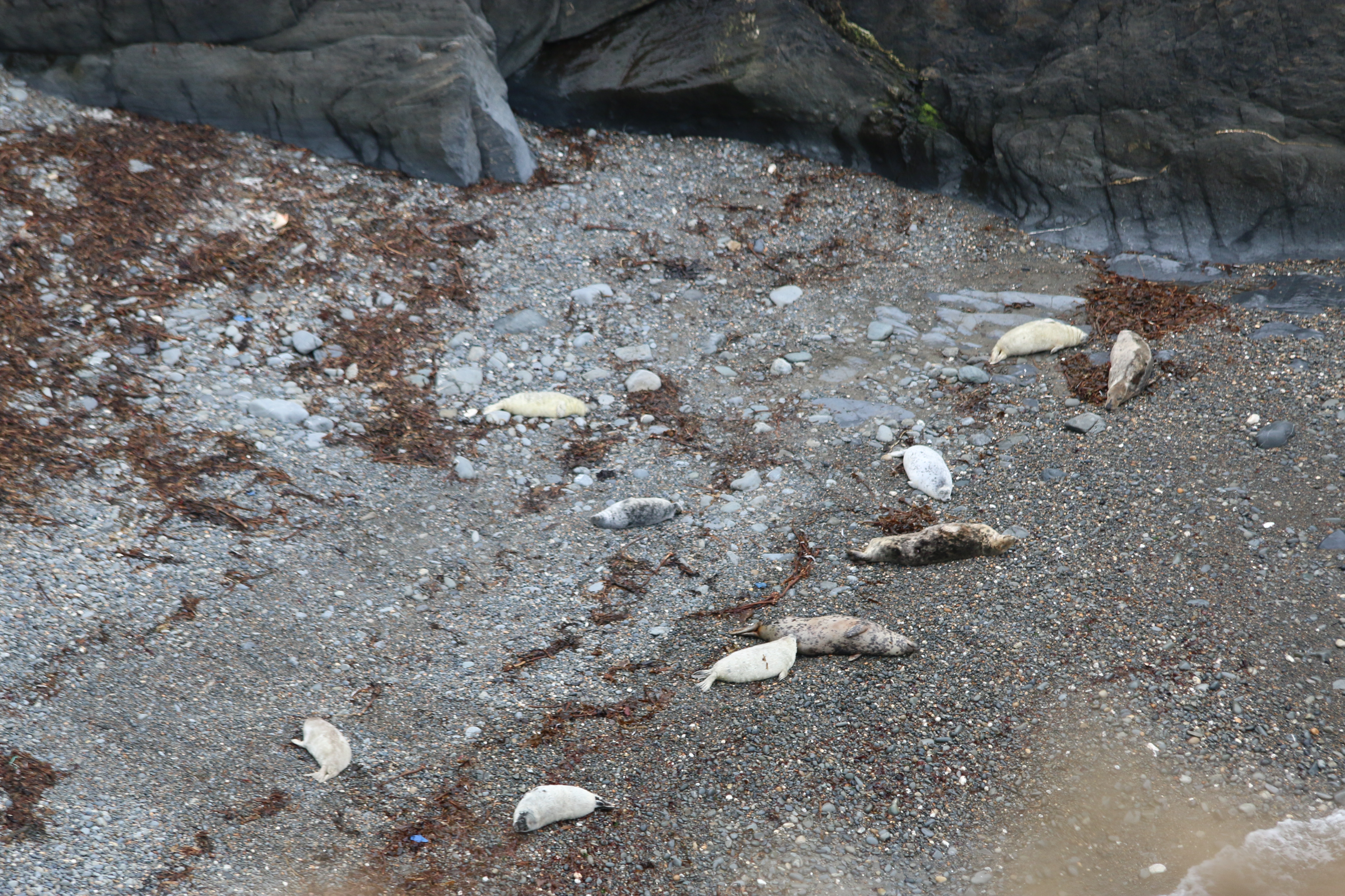
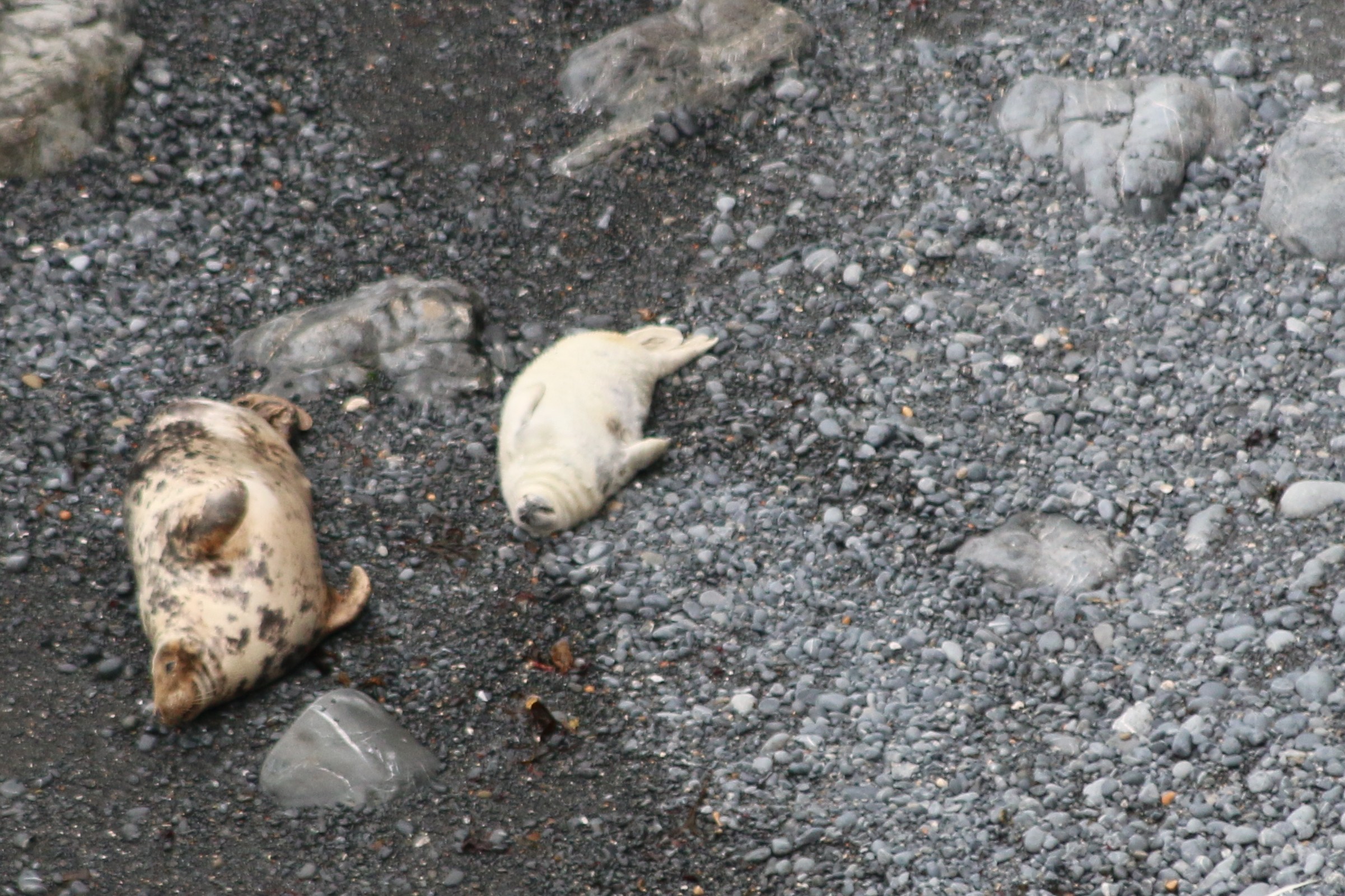
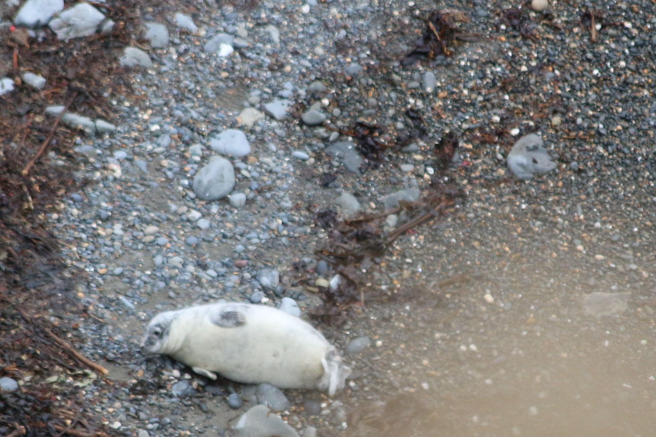
And look who we saw. (from a great distance,of course. As I’ve written in a recent post, we saw the seals and their pups last month, just before the mothers decided their offspring was able to fend for theirselves after only a month or so.
Seal pups and their mums
So… who was St Justinian?
Justinian was born in Brittany in the 6th century. At some point in his life, he made his way to Wales, where he settled on Ramsey Island.
Justinian soon became close friends with St David, the patron saint of Wales, and visited him often in the monastery where the cathedral now stands.
He was less impressed however by the lax behaviour of some of the monks and decided to isolate himself on Ramsey island. According to legend, he took an axe and chopped up the land bridge that linked the island and the mainland. As he worked, the axe became blunter and the lumps of rock remaining became larger and larger. They are still visible today in Ramsey Sound, where the waters foam over them at high tide. Followers joined him on the island but his actions didn’t go down well with everyone though. They soon turned them against him and they beheaded him!
To the astonishment of his killers,he picked up his head and walked across the sea to the mainland, and where he set his head down, another spring of water issued forth.
A spring of water gushed up from the ground where his head first fell and this became the famous healing well known as St. Non’s Well, situated next to the ruins of St. Non’s Chapel.
Justinian was buried where the chapel now stands. Within its walls are some stone footings, which may mark his original gravesite. His body was removed to the cathedral at St Davids, probably at some time before the end of the 15th century.
During the early medieval period, two chapels were built on Ramsey. One was dedicated to St Tyfanog; the other to St Justinian. There is no trace of either building today, though their sites are known.
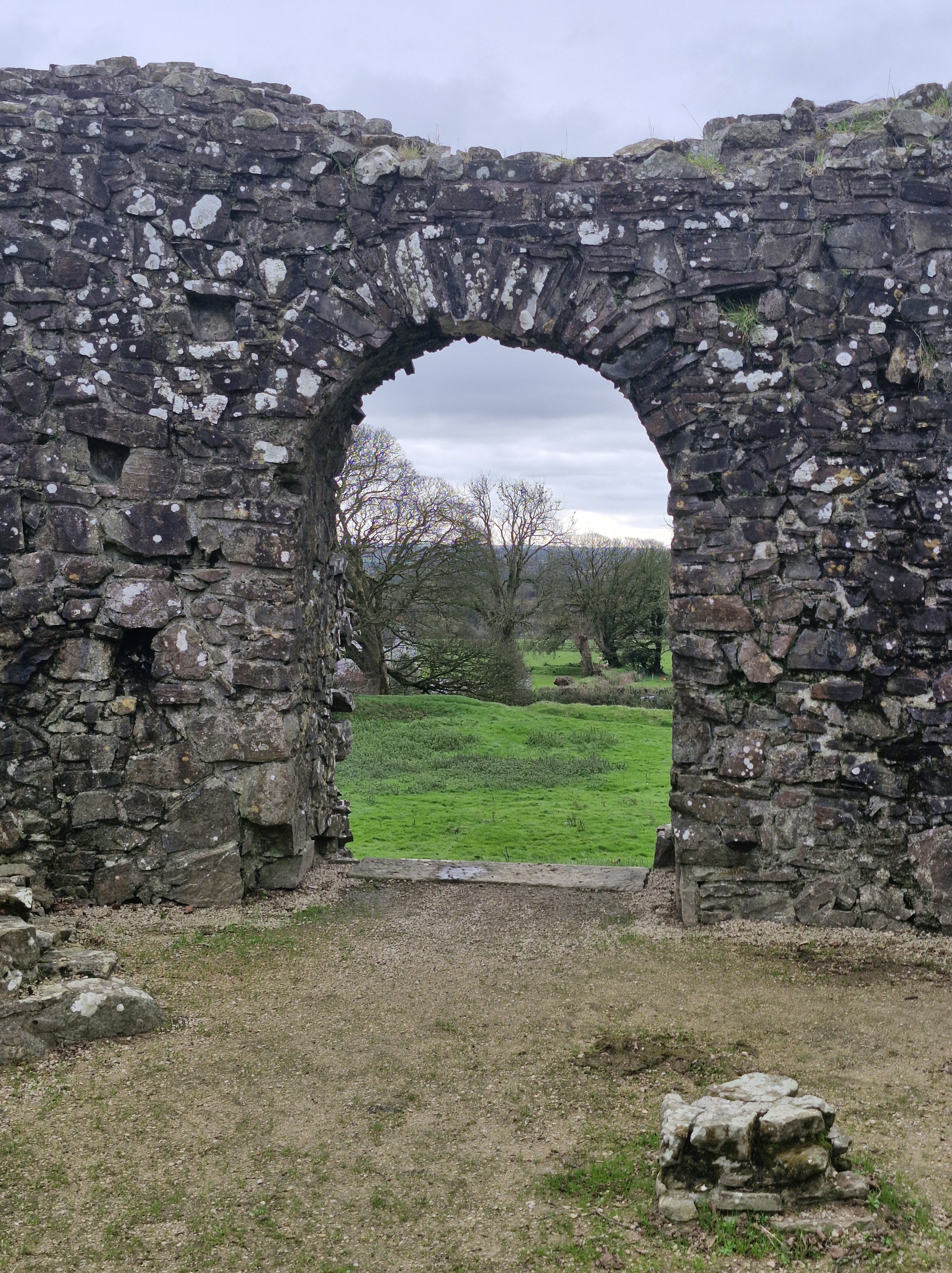
Following a recce for a Narberth U3a future Stroll and Photo at Llys-y- Fran, we took a diversion to Wiston castle. Even though not long enough for a walk, the castle and nearby church are historically interesting.
The castle was builtby an early Flemish settler with the unusual name of Wizo (in Latin) or Gwys (Welsh). Wizo was one of the powerful Norman lords who took control of southern Wales in the decades following the Norman Conquest. The settlement was called Wiston, which was an old Flemish/Saxon word for Wizo’s enclosure. And I am reliably informed, by someone who knows far more about these things than I do, that Wiston is pronounced Wizon,
Wiston is one of the best-preserved motte-and-bailey castles in Wales, (A bailey is an enclosed courtyard within a castle, typically surrounding a central mound (the motte), a small mound or hill which was fortified in the past).
The castle is first mentioned in documents in 1147 when it was attacked by the Welsh, and then again byHywel Sais, who was the son of The Lord Rhys who ruled this area of Wales, in1193. The castle was again attacked and destroyed in 1220 by Llywelyn ap Iorwerth (Llywelyn the Great).There is more information of the history of Wiston castle here:
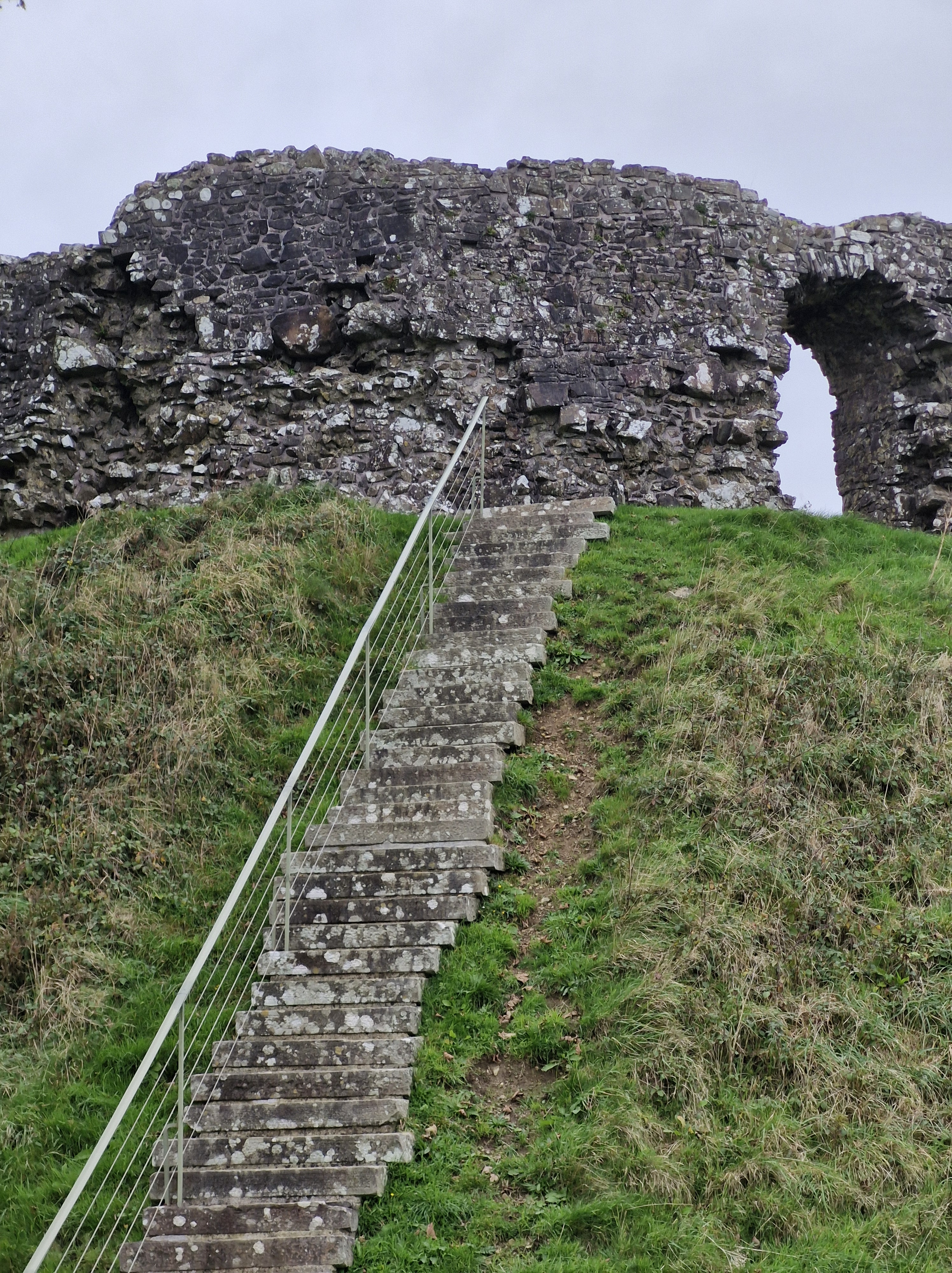
There are forty-nine steps … I counted!
The Keep was a large fortified enclosure. This would originally be an early thirteenth century timber tower within a palisade. The present sixteen-sided stone shell keep was a replacement and would have risen another story with a parapet. The entrance was barred by a stout wooden door and the residential upper floor was reached by stone steps just inside the doorway.
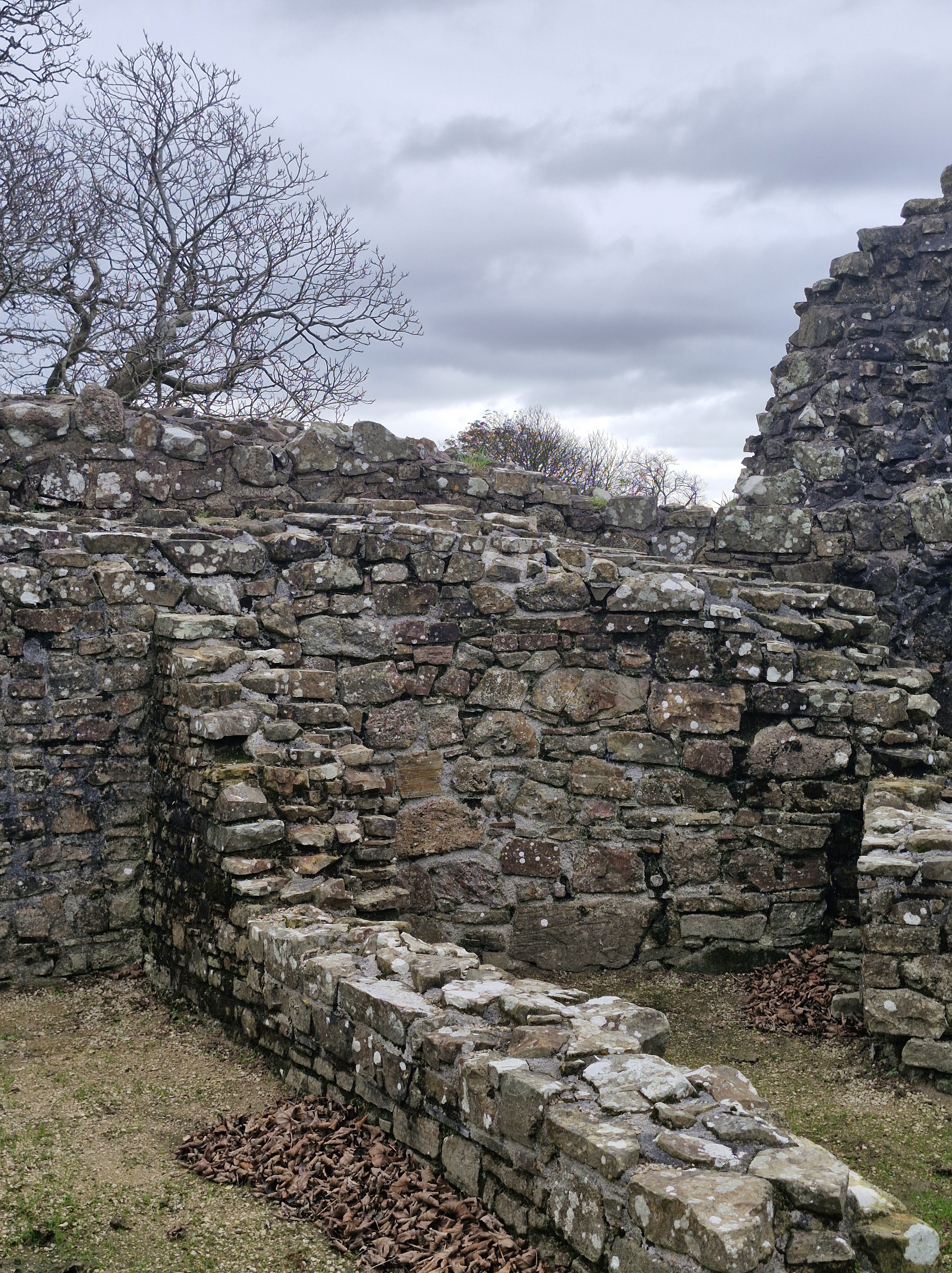
A deep ditch surrounds the base of the mound, separating it from the bailey (the enclosed courtyard within a castle) to the south, and connecting with the moat of the outer bailey on the eastern and western sides. This would have contained essential buildings like stables, barracks, and a chapel – the fortified area where soldiers, servants, and livestock lived and where the day-to-day activities of the castle took place.
Impressive stone walls.Spot the lookout!
And, of course, who goes up … must then go down. Much easier!
The Church of St Mary Magdalene.
Wizo also founded the church nearby at the same time. Though altered by subsequent generations, the church is essentially a Norman building, entered by a very simple doorway made of large slabs of local red sandstone.An interesting church to visit at a later time, I think.
Over the last few weeks we have walked along the Pembrokeshire coast with the Pembrokeshire U3a and the National Trust …
And joined in with a couple of days seal spotting … from the clifftops, so at a distance, of course.
And watching the mothers with their pups was fascinating
Around the coast of West Wales, grey seals can be seen throughout the year. In the summer, around sunset, the seals begin to return to the beach hauling out their daily catch of fish. Mostly, at this time, they bob about in the water, waiting to come ashore to rest. Seals spend a lot of time at sea but come ashore to breed from August until early November, when parents and their pups can be spotted on beaches around Pembrokeshire.
On land they are cumbersome and slow, compared with their agility in the ocean.
Which gave The Photographer plenty of time to get his pictures!
Many thanks Pembrokeshire U3a and the National Trust for two brilliant days .
Fossil records indicate that the ancestors of modern seals first entered the ocean on the west coast, about 28–30 million years ago.
Seals see very well under water—better than they do in bright light above water. Their eyes are adapted with round lenses (like fish) and a large iris that fully opens underwater. On land the iris closes the pupil to a small pin point that lets the seal see clearly through the round lens. A seal’s eye is also adapted for low-light vision with a lining (similar to a cat’s eye) that reflects and amplifies the weak light at depth in the ocean.
A seal’s body stores enough fat in the blubber layer to allow the animal to go for extended periods of time without eating. In addition, most seals are opportunistic feeders and will consume a variety of fish, shellfish, and crustaceans. Seals do not eat on land.
Like all marine mammals, seals get all the water they need from their food. Their bodies are very efficient at removing and recycling water from their food. They avoid drinking sea water; if a seal drinks too much sea water it can become seriously sick. Arctic seals, which spend time on ice, may sometimes eat fresh water ice and snow.
NB: Seals are protected in the UK under various acts, including the Conservation of Seals Act 1970, which prohibits killing, injuring, or taking them except under specific circumstances. Both native species, the grey seal and common seal, are protected, along with any other seal species found in UK waters.
One of our Interesting and Fun Group Walks with the U3a:
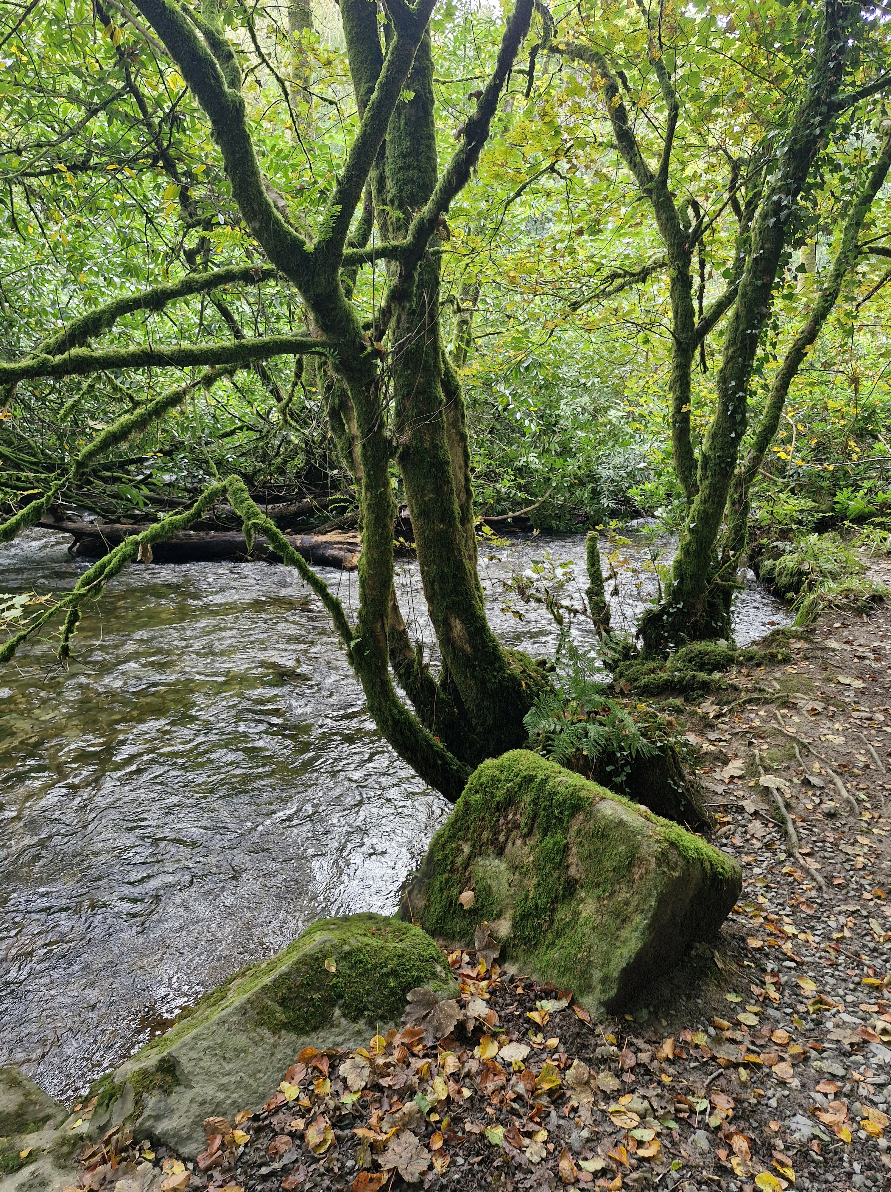
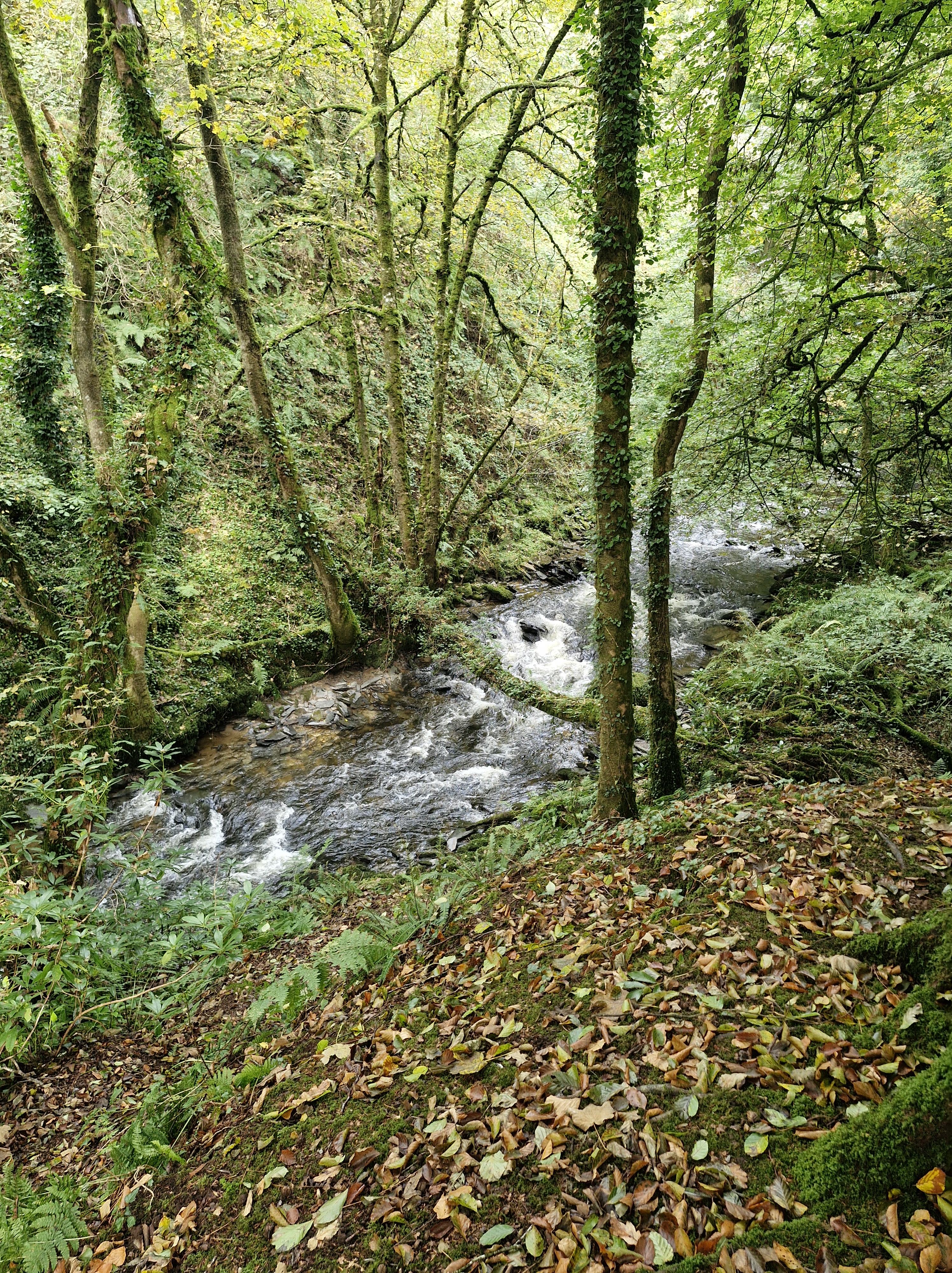
Yesterday we joined with Pembrokeshire U3a on their Monday Walk around the woods and alongside the River Sealy on the Sealyham estate near Wolfscastle.
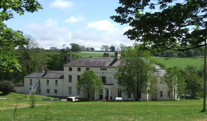
There is a long history of owners of the land dating from the time when King Edward III, in the fourteenth century, granted some land to Thomas Tucker (a captain in the King’s army), who subsequently built a house there.
A house that was later rebuilt in the mid-18th century. Eventually, in 1905, the last of the descendant family members, Catherine Octavia Edwardsn with her husband Victor James Higgon, the last of the Tucker family to live at Sealyham house moved another mansion in Pembrokeshire, Treffgarne Hall.
Around 1910, portions of the land were sold to the Pembrokeshire County Council and, in 1920, Sealyham House and part of the land were sold to the King Edward VII Welsh National Memorial Association and converted into a tuberculosis hospital until 1954. In 1955, it was re-purposed for elderly patients but was permanently closed as a medical facility in 1964. In 1970, the Sealyham house was sold to a Nancy Ellen Perkins. She converted it into an apartment building as rentals. In 1980, it was sold again to an investment firm that used it for an outdoor activities centre. It was resold in 1986 to the Sealtham Activity Centre for young people, as an educational facility,
Sealyham is also well known for the Sealyham Terrier. The Tucker-Edwardes family of the nineteenth century were one of the leading landowners of Pembrokeshire. Breeding dogs was a favourite and expected pastime people of noble families or military background. Captain John Edwardes’ family had the time and the means. Although no records were kept it’s believed that The Welsh Corgi, The Wire Fox Terrier, and the now extinct English White Terrier all played a part in the make up of the Sealyham. After Edwardes’ death in 1891, other breeders began to work with Sealyhams, including a man called Fred Lewis who promoted the breed. But, according to the Kennel Club the Sealyham Terrier is one of the dog breeds of British and Irish origin that are … “considered to be vulnerable due to their declining registration numbers. These breeds are at risk of disappearing from our parks and streets, simply because people don’t know they exist or because they aren’t considered fashionable. in 2024 there are only a hundred dogs of Tucker-Edwardes’ breed, making it an endangered breed.”
It’s eight years this month since the prequel, A Hundred Tiny Threads, to the Haworth Trilogy was published – so a little celebratory post – with an extra personal memory at the end – for one of my oldest books.
It’s 1911 and Winifred Duffy is a determined young woman eager for new experiences, for a life beyond the grocer’s shop counter ruled over by her domineering mother.
The scars of Bill Howarth’s troubled childhood linger. The only light in his life comes from a chance encounter with Winifred, the girl he determines to make his wife.
Meeting her friend Honora’s silver-tongued brother turns Winifred’s heart upside down. But Honora and Conal disappear, after a suffrage rally turns into a riot, and abandoned Winifred has nowhere to turn but home.
The Great War intervenes, sending Bill abroad to be hardened in a furnace of carnage and loss. When he returns his dream is still of Winifred and the life they might have had… Back in Lancashire, worn down by work and the barbed comments of narrow-minded townsfolk, Winifred faces difficult choices in love and life
A couple of reviews:
“When I emerged at the end of this book – during the reading, my immersion was total – it was with a sense of having experienced it all first hand, and of having deeply felt every moment. This was story-telling at its very best… and a book that will long linger in my memory.”
“I loved it… A page-turner that keeps you hooked. The story line has lots of twists and turns and you feel yourself moved on so many different levels. As the book unfolds it gives you moments of tenderness and love, hatred and spite all blended together with conflict, prejudice, guilt, grief and a desperate longing for change. Judith describes the period so well, with some very graphic, cruel and harrowing episodes, enabling you to empathise with each character in turn. I particularly like the fact that the story held together to the last page.”
Three year earlier, on the exact date – the 17th August – the book was published, I’d written the following…
My Grandad
My grandfather died seventy years ago this week. Obviously i never knew him and have only one small black and white photograph of him on my study wall. He’s standing in the backyard of the terraced house they lived in in Oldham. Lancashire. This is a poem I wrote about him a long time ago. My mother said he was gassed in WW1 and never recovered.
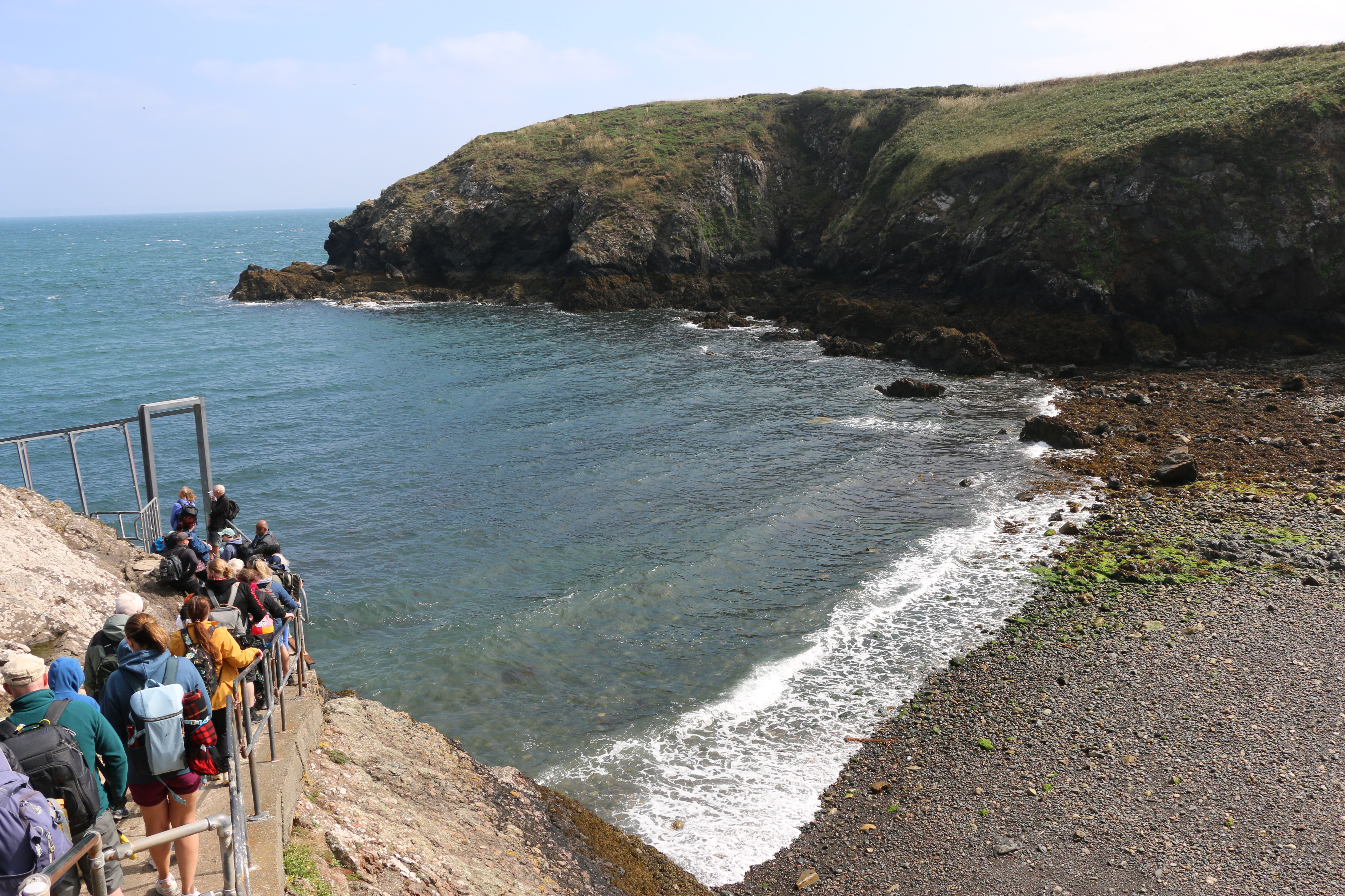
At long last! After living in Pembrokeshire for the last forty-six years and despite walking many miles of the Pembrokeshire coast, and meandrering around a lot of the Welsh countryside discovering wonderful places, lakes, waterfalls … scenary, we hadn’t been on Skomer island. This week we finally managed to go.And it was a glorious day’s adventure.
Together with thethirty other peoplewe had been on the boat with, we climbed the steps and slopes from North Haven beachto the Information and Welcome Point, passing the ruins of one of the lime kilns on the island, now used as a shelter.
Following the short introductory talk by one of the National Trust volunteers on the numerous species of birds on the island, and advice on which paths to take, according to what we were most looking forward to seeing, we set off. Surprisingly it soon seemed that we were on our own as we began our walk of the south section of the island.
During the more prosperous farming days of the nineteenth century lime was important on the island, both as mortar for the buildings and to spread on the land as fertilizer. Limestone and coal would have been imported from the mainland, landed on the beach at North Haven and moved to the kilns to be heated.
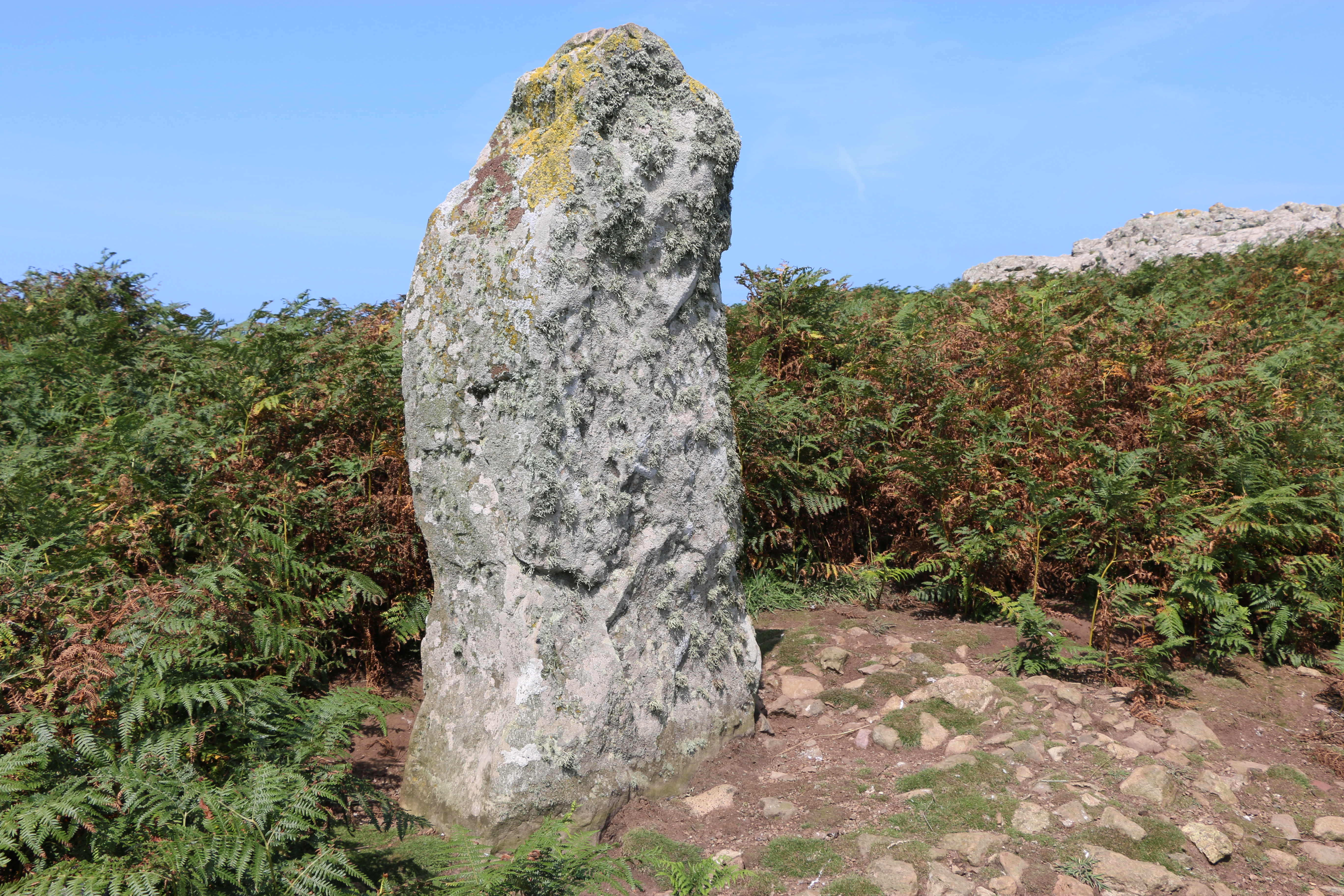
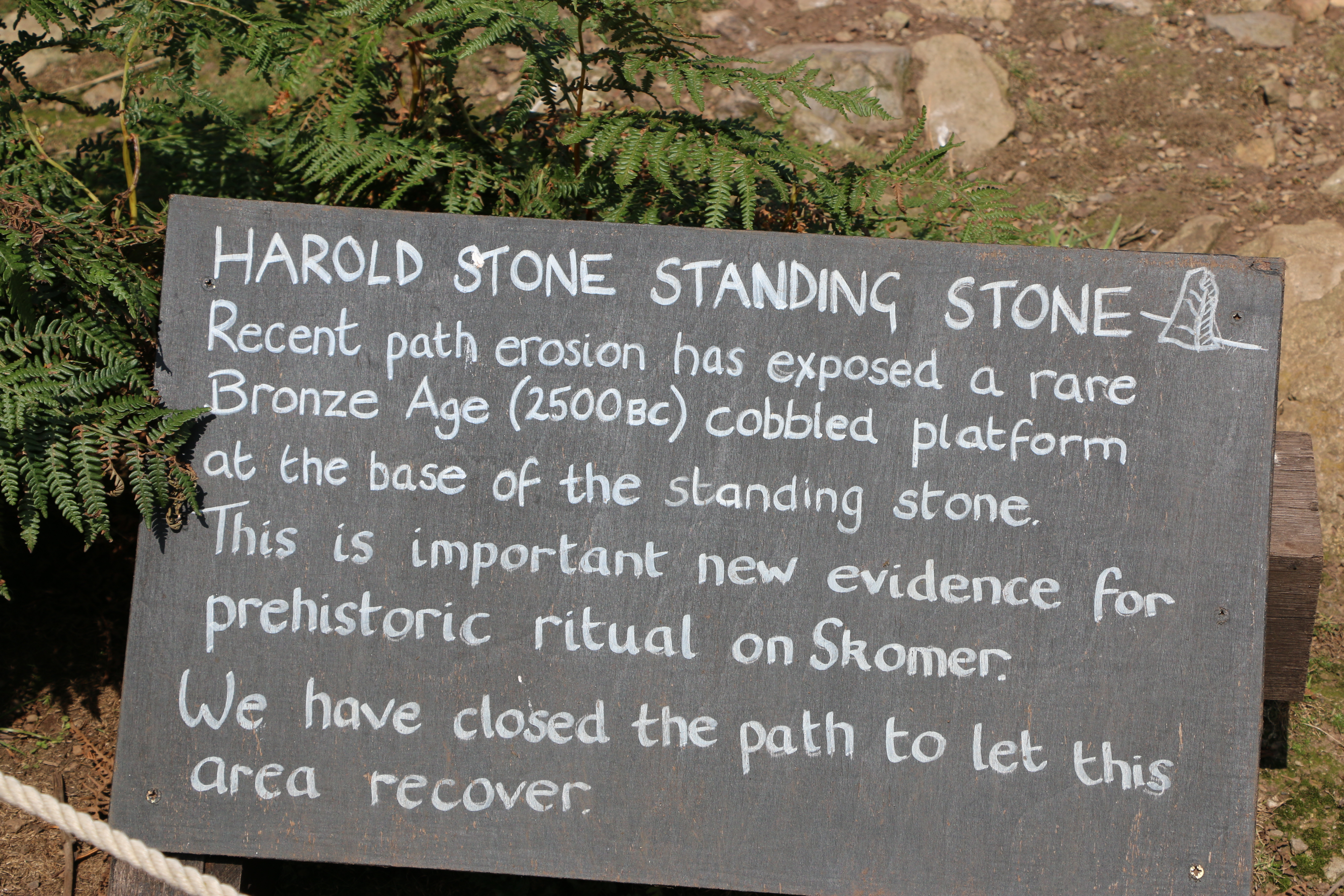
In search of the second of the lime kiln ruins, which is beyond the Harold Stone we took a diversion.
The Harold Stone has no cutting or tool marks, so seems to be mostly unshaped by man, and apparently smoothed by decades of cattle and other animals rubbing against it. As with many standing stones there are various ideas as to its function: the site of an ancient burial ground, a ritual or lookout area of an Iron Age settlement, (there are a number of Iron Age settlements around the Island, each one slightly different),or a marker for boats to approach North Haven.
We were impressed by the care that is taken by the National Trust volunteers in preserving numerous areas of paths and grassland. At one point we saw an outline of a figure, dark against the bright sunshine, carrying an enormous scythe. As she passed us, she laughed and said she felt like the Grim Reaper. Walking on we saw the area she’d cleared and roped off to allow a patch of ground to recover.
We walked on...
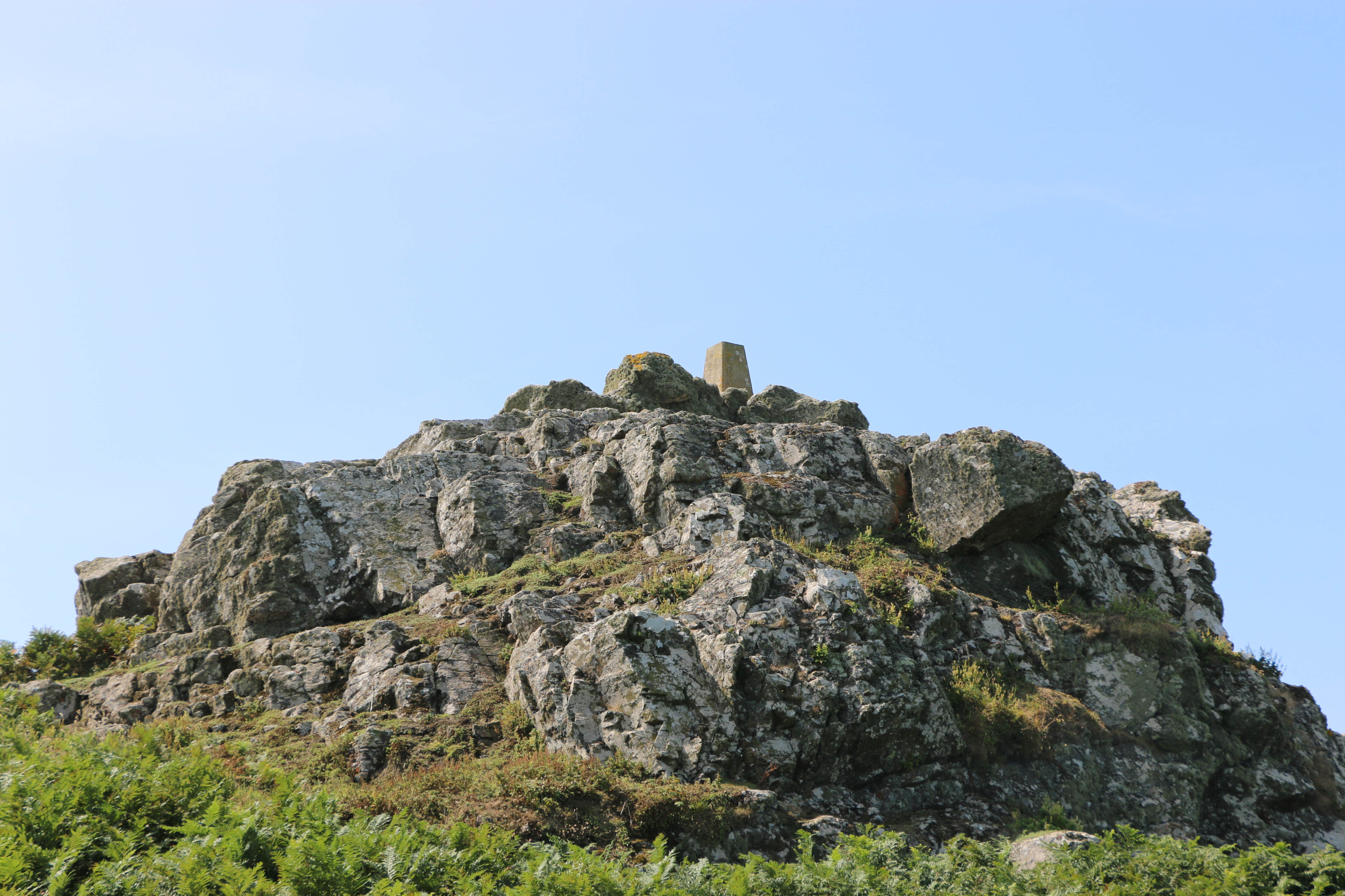
We couldn’t find out what the small ‘monument ‘ is on top of this rock formation.
True to form we didn’t follow our intended circuit and meandered along paths, and retraced our steps in rather a haphazard fashion, (although the Photographer will dispute this and declare our route to be organised according to the circuit he planned). However true his statement was, I must admit we did pass numerous impressive limestone outcrops covered in lichen, and vast expanses of ferns, heather, gorse and wild flowers.
And we did see the majority of Skomer by the end of our time there.
After our short respite at the farmhouse we moved on to Skomer Head. The rocky headland was covered with fading pink Thrift (and evidence of the rabbits). It’s an impressive view from there; we could see Skokholm, which is a sandstone island, and, less clear but still visible, the island of Grassholm. I remembered that. many years ago, we took a trip on the Waverley (the last seagoing paddle steamer) and passed Grassholm. It’s the third largest Gannet colony in the world, and the island is covered in white. I’ll leave that last statement to your imagination!
There are the remains of anIron Age boundary wall running parallel to more modern boundary walls from Skomer Head. The modern one is close to the path and the remaining stones of the prehistoric one on the nearby rock ridge above.
We crossed Wick Stream; a wetland area with small streams that are apparently connected by six dams. We couldn’t see them, though it was interesting to be told by one of the National Trust volunteers that they could be part of the Iron Age walls but they might also be of later origin. Their purpose is not known ,although it’s most likely that they were for water conservation, creating ponds for storage of water and watering stock. The paths along the way were protected by boardwalks, but mostly were rough and rocky on our way to The Wick.
The Wick was formed by geological fault activity and basaltic lava flows. It’s a magnificent cliff face, rocky on one side, steep slopes opposite, and filled with the sound of the breeze and the waves. We saw Fulmars and Great Black-backed Gulls swooping and riding the air currants. It was quite nerve-wracking to peer over the edge from the safety of the ledge that appeared to be especially placed there for that purpose (I could be wrong, but it was what most people were using it for – but as the area was cordoned off to protect the puffins to cross the space to reach their burrows – otherwise the gulls would predate them – the ledge was useful)
The Photographer! Just to prove he took the photos and that it was really hot, sunny weather.
We were running out of time so began to make our way back to North Haven. The path was steep and even more rocky in places but the views were still imposing.
Reluctant though we were to leave Skomer, we arrived back in good time for our departure slot for Dale Princess to take us back to the mainlandwith many photographs and great memories.
A short history of Skomer Island:
Around thirty-seven thousand years ago, Skomer would have been part of the mainland, only being cut off, following rising sea level, by the end of the last Ice Age around twelve thousand years ago
There is evidence of untouched remains of huts, fields and cairns that appear to prove that between five and twelve thousand years ago there was an Iron Age settlement of a small farming community on Skomer. Near the Garland Stone, a pyramidal (shaped like a pyramid), just off the northern tip of the island, there is a short circular detour off the main path across a ridge where a group of nine small cairns have been identified. This is probably a prehistoric cemetery. In North Valley, looking towards North Pond when conditions are suitable the remains of a number of circular Iron Age huts in pairs can be seen. This is the most complete and untouched remains of this period in the whole of Europe.
But then, except for some evidence of Medieval buildings on the island there is no clear record of any habitation until around the thirteenth century.
Farm Complex – I researched for a more detailed history of the farmhousedescribed in Part One, which may be of interest to some:
The farm was lived in by various tenants and owners of the island:
Lord Kensington bought the island in 1897 and used it mainly as part of his sporting estate. A J Neale, a trawler owner from Cardiff, leased the Island in 1905 with the aim of protecting the wildlife, but had to relinquish the lease later and then it was bought by a Mr Sturt, who stayed on the island with his family. His daughter eventually married a local man Reuben Codd. The Codd family farmed the Island until the outbreak of the Second World War in 1939. Afterwards the Island became a Field Study Centre for a year until 1946, run by the West Wales Field Society, and visitors stayed in the house. In 1950 the Codds left the Island. Then, in 1954, the roof of the old farmhouse was severely damaged during a major storm – it was left a ruin. The Skomer Island Heritage Project enabled the old farmhouse was reinstated and took in visitors again. The old barn, once a two-story barn for storage and animals, is now used for visitor and research accommodation.
At long last! After living in Pembrokeshire for the last forty-six years and despite walking many miles of the Pembrokeshire coast, and meandrering around a lot of the Welsh countryside discovering wonderful places, lakes, waterfalls … scenary, we hadn’t been on Skomer island. This week we finally managed to go.And it was a glorious day’s adventure.
Boarding the Dale Princess
Arriving on Skomer …
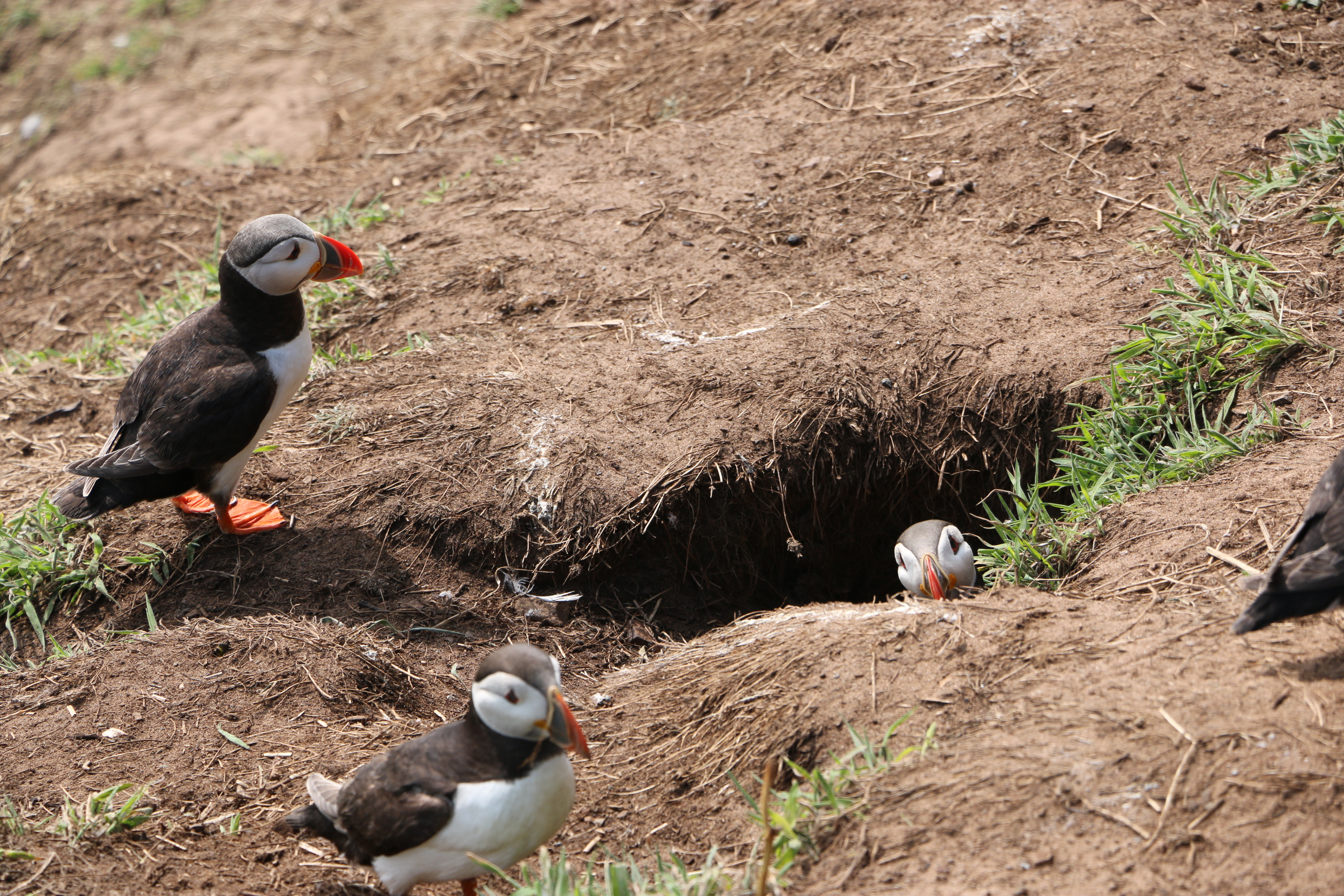
To be greeted by numerous curious puffins who seemed as interested in us as we were in them….
Skomer is internationally important for seabirds and, of course, there are necessary rules to protect the birds so we were told where and how we could walk the paths. One of the National Trust volunteers told us about the numerous species of birds on the island which included the Puffins – now in their last week before they leave the island – we were so lucky to see them.
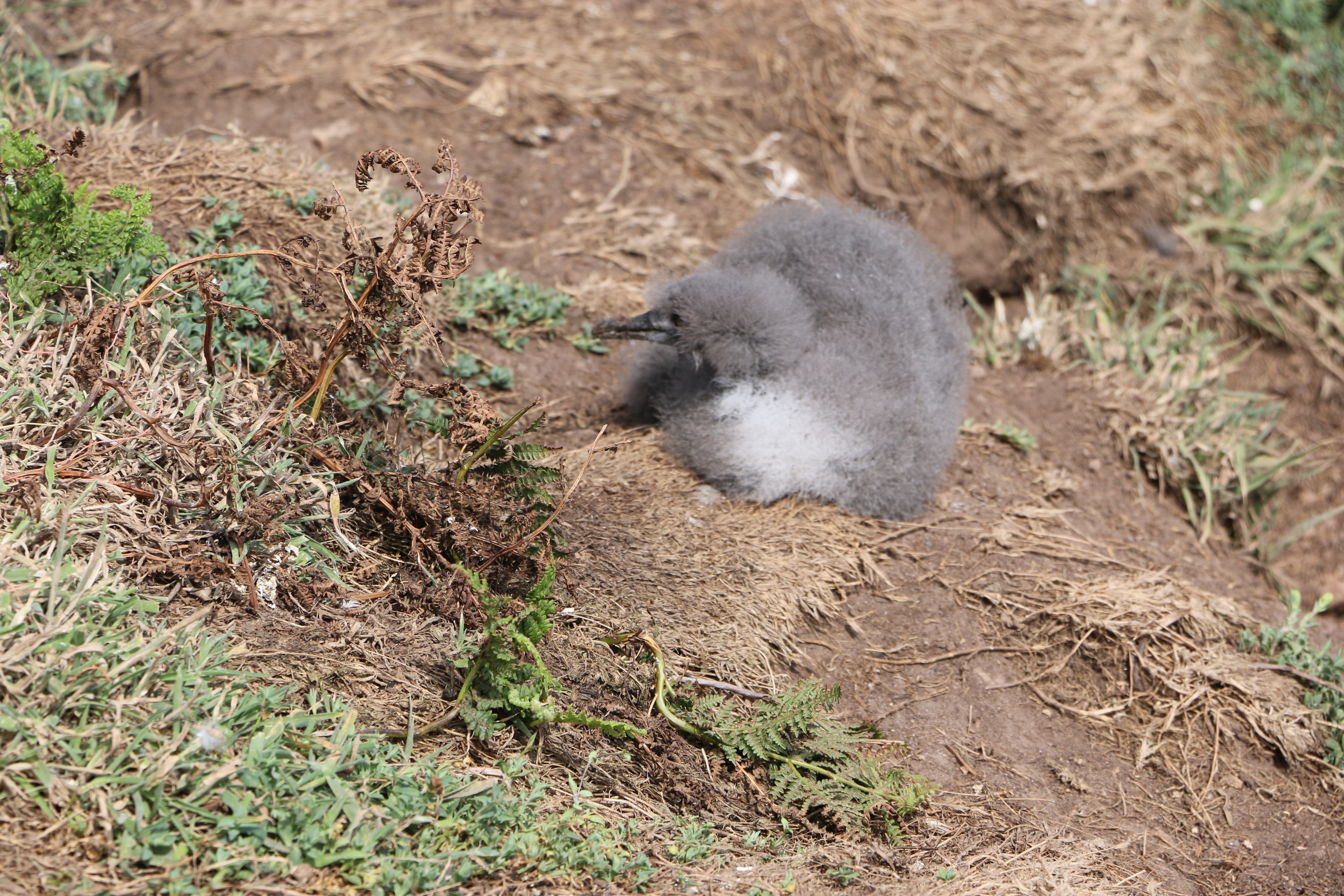
The colony ofManx Shearwaters is the largest colony in the world. Unfortunately we found quite a few remains of these on the narrow paths, apparently caught by the Great Black-backed Gulls. Later in the day we came across a crowd of people watching a Manx Shearwater chick which had wandered out of its ground nest. Seeing the amount of Gulls flying overhead, we hoped it managed to shuffle back to safety.
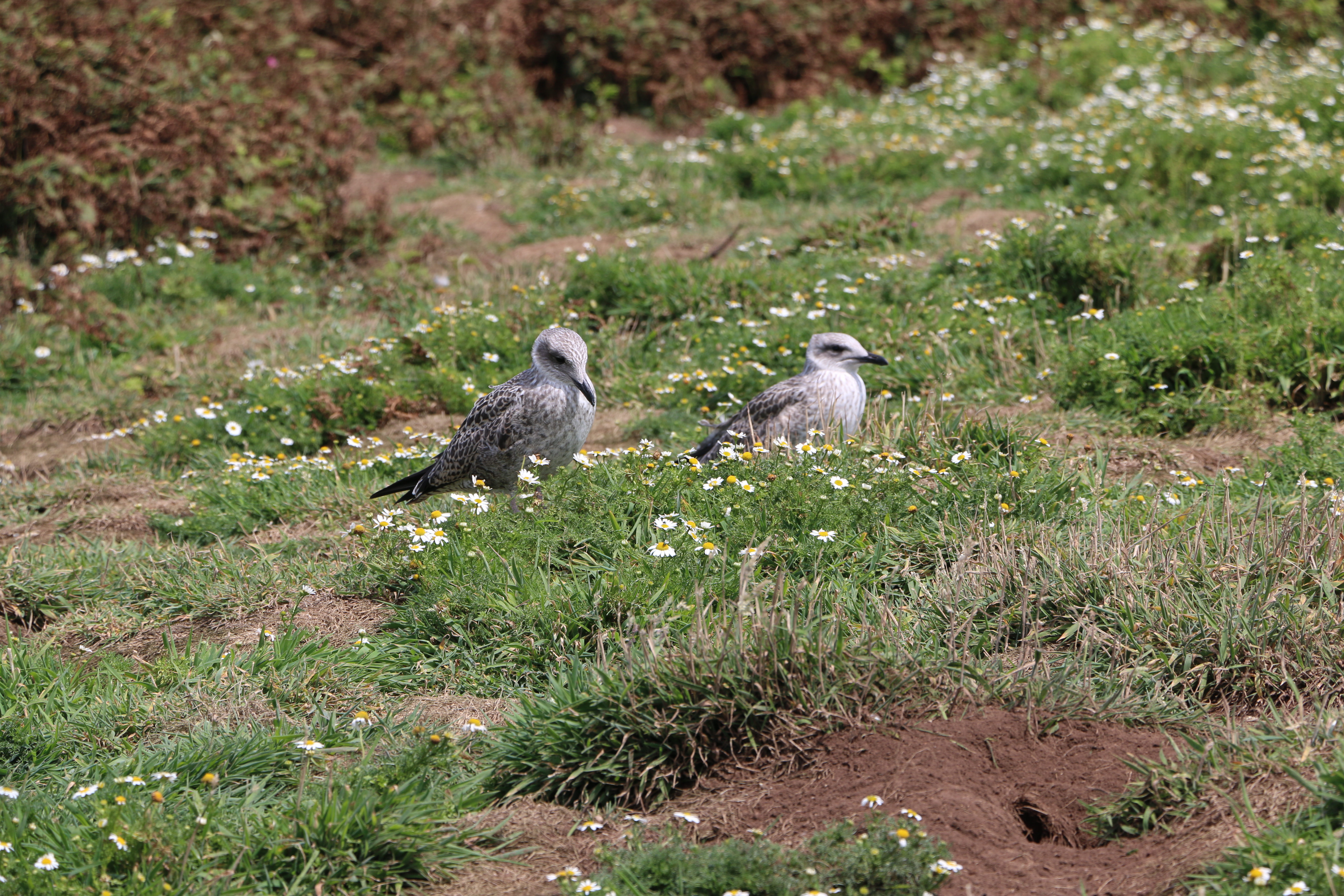
We weren’t lucky enough to see the Storm Petrels that are usually here on the island (they probably were but our binoculars were of slightly less quality than those hired out for five pounds by the National Trust). But we did see Guillemots, Razorbill, Kittiwakes, and so many of the ubiquitous Carrion Crows and Ravens
And at the Bird Hide, we watched Fulmars, Herring, Lesser and Great Black-backed Gulls as well as a pair of Canada Geese around the North Pond. (Well, I think they were Canada Geese, the Photographer said they were … ducks!) Huh!
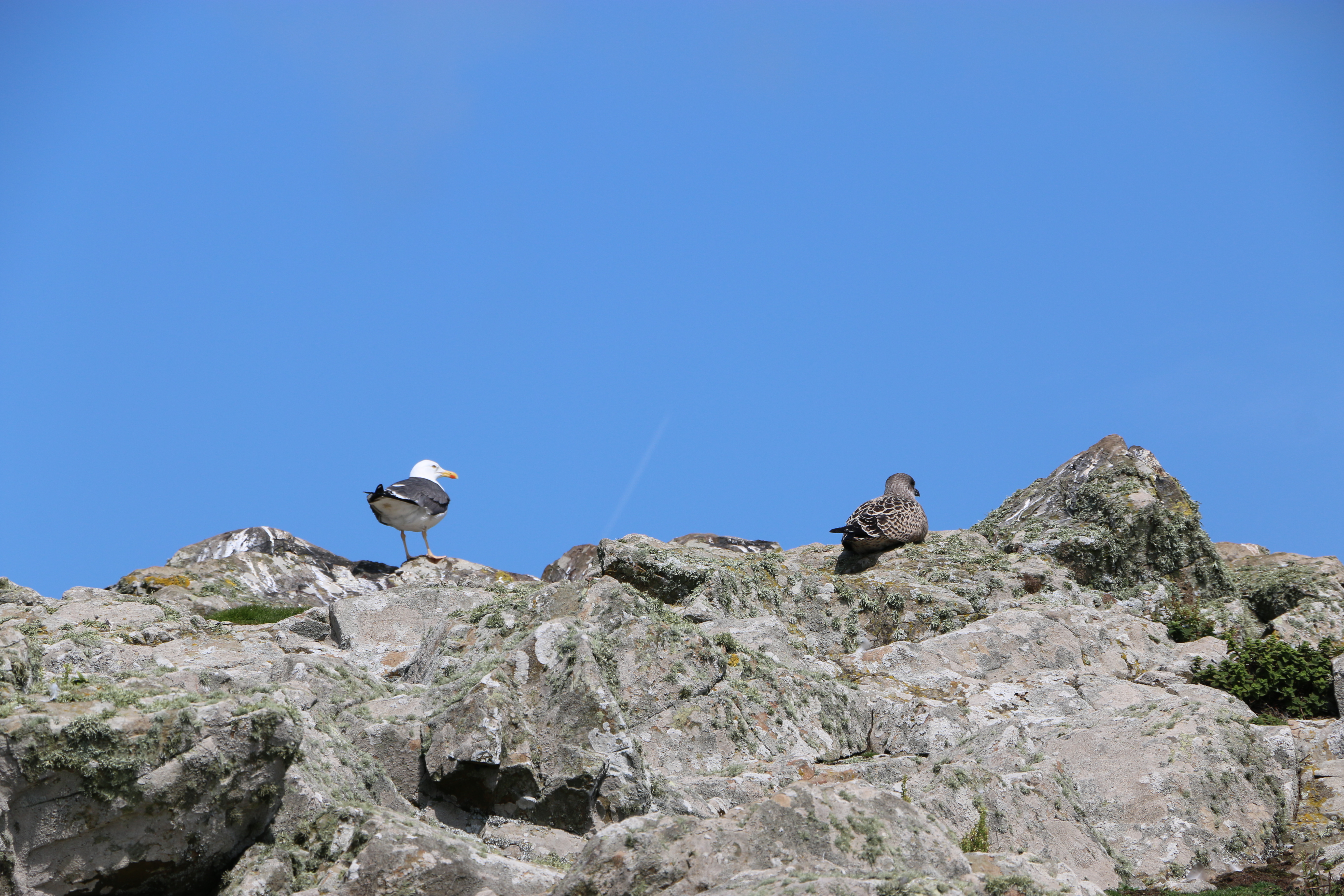
Two watchful Kittiwakes
And, later in the day we were followed by a pair of these little birds – we think they were trying to lure us away from their nest.
We thought they were Stonechats – or Linnets – but maybe someone more knowledgeble will be able to correct us?
Some of the paths are so narrow they were designated one way paths – we were warned not to stand on the grass alongside in case therethere were still Puffin burrows with chicks in them. Others are wider and surrounded by ferns, daisies, wild flowers … a treat to see.
We arrived at the old farmhouse where we stopped for our picnic.
History of the farmhouse:
There are unsubstantiated records of a house built in the centre of the island, thought to be around seventeen hundred on which are the ruins of the old farmhouse, itself dated from about 1840. This was once an impressive and substantial house, built in the traditional Pembrokeshire style with small slates fixed in mortar, protecting the front of the house. Early pictures show a metal veranda running the length of the house, and at the back of the building, an old smoking oven where fish and meats would have been preserved. The slightly thicker soils in this part of the island and access to water in North Valley enabled a range of crops to be grown. There are records of the farm supporting three families at one time with cows and sheep grazing on the land as well as horses to help with the heavy work. Farming was largely abandoned after the outbreak of the First World War and all agriculture on the island finally ended in 1950.
And onwards to today:
In 1959 the Island was bought by the Nature Conservancy (the Government department that became the Countryside Council for Wales) helped by the West Wales Field Society (the charity that became the Wildlife Trust of South and West Wales). It was declared one of the country’s first National Nature Reserves and is now owned by National Trust and managed by the Wildlife Trust of South and West Wales.
In the next part of our visit to Skomer we move on from the farmhouse to the magnificent coastlineand impressive views.
Part Two of The Stranger in my Houseis set against what is now called the Winter of Discontent – A term that comes from Shakespeare’s play Richard III, but it was used in an interview by the then Prime Minister James Callaghan and was taken up by the media. It lasted between November 1978 to February 1979 in the United Kingdom and, following opposition from the Trades Union Congress (TUC), took on the form of widespread strikes by both the private and public sector. Trade unions demandied pay rises greater than the limits Prime Minister, James Callaghan, and his Labour Party government imposed in an effort to control inflation.
It was also the coldest winter in sixteen years. Heavy snowfall and freezing temperatures disrupted transport, businesses, and energy supplies.
In January 1979 (between the 1st and the 14th), some 20,000 railwaymen held four one-day strikes. There were strikes by haulage drivers, petrol tank drivers, and eventually municipal workers – 1,250,000 of them organised a one-day national strike on 22 January 1979.
The most notorious incident was the grave diggers’ strike on Merseyside, which hit the headlines with the press vilifying trade unions for their lack of sympathy with the bereaved, and, it was argued, with the needs of the nation.
But it was a strike by refuse collectors that came to symbolise the complete breakdown of UK public services. Local councils rapidly ran out of storage space as the binmen continued to strike, so rubbish was left in streets and open public spaces instead.
Photograph courtesy of The Guardian
Photo by Evening Standard/Hulton Archive/Getty Images)
A gripping ‘cuckoo in the nest’ domestic thriller
After the death of their mum, twins Chloe and Charlie are shocked when their dad introduces Lynne as their ‘new mummy’. Lynne, a district nurse, is trusted in the community, but the twins can see her kind smile doesn’t meet her eyes. In the months that follow they suffer the torment Lynne brings to their house as she stops at nothing in her need to be in control.
Betrayed, separated and alone, the twins struggle to build new lives as adults, but will they find happiness or repeat past mistakes? Will they discover Lynne’s secret plans for their father? Will they find each other in time?
The Stranger in My House is a gripping ‘cuckoo in the nest’ domestic thriller, exploring how coercive control can tear a family apart. Set in Yorkshire and Cardiff, from the 60s to the winter of discontent, The Stranger in My House dramatises both the cruelty and the love families hide behind closed doors.
“Judith Barrow’s greatest strength is her understanding of her characters and the times in which they live.” Terry Tyler
Grateful for this reader’s review. One of the first for The Stranger in my House, when it was published in November 2024.
Judith Barrow’s done it again! The Stranger in My House is a book that showcases her renowned credentials. The characters are superbly drawn, the tension grows steadily and with each turn of the page your heart is gripped by the dilemmas facing the young protagonists, twins Charlie and Chloe, and their well-intentioned father. As with The Memory (shortlisted for Wales Book of the Year) it’s the way Barrow takes the ordinary and everyday, that we recognise and identify with, and skilfully uses her eye for human behaviour to turn it into something that becomes a nightmare we can readily believe in. The story begins in 1967 and over the following decade the sense of time and place is expertly done without being intrusive. At the core of the tale is coercion and the reader can see how cleverly the others are being manipulated by the woman who undermines them and shatters their family bonds. My dislike for Lynne and her son Saul built with the book’s momentum. There was that fear that they would get away with unimaginable cruelty and malice. To counter that, were those whose innate love and kindness provided a heartwarming buffer. From the start, I was gripped and that grip tightened inexorably. It’s becoming a cliché to say that you couldn’t put a book down – but I couldn’t. I had to know what was going to happen next. It mattered. That is the hallmark of a great author.
You’ll definitely need a constitution for the official book fair bank account and if you’ll be looking for grants, sponsorship etc.
Get started early; you’ll need plenty of planning time. Work out the best time of year for your area by looking around, seeing what else is on at certain times. Is there any event happening on the date you’d like that might help or hinder footfall to your book fair? Is there a festival you could link up with? Or a similar event to yours which would take away your potential public? If the latter, don’t be inflexible, change your date.
Book your venue. You want somewhere that people will pass and enter easily. (Check for disability access and facilities). And check that there is somewhere outside of the building that you can hang a banner advertising the book fair on the day – or, at the least, somewhere that you can stand A boards outside without causing any obstruction
Thorne Moore and I on the morning of our last book fair and hoping this banner will attract enough attention for our last book fair at the. It did – well, alongside the rest of the publicity we’d put out there over the previous few months, it did.
If you intend to ask your authors to give talks, hold creative writing workshops, hold panels on various aspects of writing or genres, or invite publishers to put on an appearance for talks or editor sessions (always a good move and the authors will thank you!), make sure there are enough rooms. Most importantly, make sure the actual room/hall you’ll be holding the book fair in is large enough. You’ll need a fairly spacious area because you’ll be inviting lots of authors to participate… won’t you!?
Also check for the number of tables and chairs the venue has. And make sure you can get your hands on more tables if necessary. You don’t want to have more authors than tables
Find out if the venue has public liability insurance. If not you have two choices, stump up for it yourself (in which case you could be paying out a fortune) or ask the individual authors to take out their own – much the better option and a lot of writers have their own insurance anyway.
Lists, lists and more lists! Try to include as much detail as possible and when things need to be started or completed by. You won’t always hit the targets but you’ll know when they go whizzing by (a bit like that deadline you’ve set for yourself with your WIP). Know which of you is responsible for each task. But don’t forget to ask for or offer help from one another… you are a team working to one goal.
And that’s it! This is what worked for us. And, for anyone brave enough to organise a book fair – good luck.
Oh, and don’t forget – you’re entitled to a little of the publicity for yourself.
Many years ago I was asked by a local online television company, Showboat TV to interview for a programme called BookSmart. In slight trepidation I agreed; I had no experience in interviewing anyone. But as an author and a creative writing tutor they obviously thought I would be able to talk to other writers about their books and the way they wrote.
I remember I had just the first two books of the Haworth trilogy published then …
But ShowBoat TV had faith in me, and it’s been interesting – and fun. I’ve met many people, authors who live in Wales and authors from all over the world. At first it was filmed and shown through the internet; these days, when I interview, we work through Zoom. Which is what I did when interviewing Debbie Campbell last year, and lately Suzi Quatro. Need I say these were the highlights of my volunteering – and Showboat TV are promising more of this ilk for their viewers.
Viewers, whose numbers, may I say, have risen steadily over the years,because the company provides such a variety of programs. Besides BookSmart, there are interviews with musicians and performances of dramas produced by small companies. All accessible from the homepage, which contains all of the seven free series, with one episode following one each day.
But not only does the company cover all this, but they also travel around filming events, and, in the past, they filmed and were sponsors for the September annual book fairs that I helped to organise, initially with friends and fellow authors, Thorne Moore and Alex Martin – then in later years, when Alex moved away, just with Thorne.
It was hard work – and it began in the January of each year.
When embarking on this, the first thing you do is start with the obvious; find someone like-minded to help you with the organising of the whole affair. More importantly, someone who you know well enough to recognise you’ll be able to work together without egos getting in the way. (And, yes, I’m speaking from experience; enough said!) And someone with a sense of humour. Believe me, if you’re determined to hold a book fair, you’ll need one.
So, to the practicalities – but maybe that’s better left for next time…
Glen Rosa is a beautiful glen with Goat Fell mountain in the distance – stunning scenery.
Early morning (apparently the best time to do this walk), and we are already driving through Brodick. We turn into a lane just before the Old Brodick Burial Ground, signposted Cart Track, Glen Rosa’.There are two choices according to the directions; drive the first mile on a lane to where the track begins. or walk it. We debate. If it’s interesting, we’ll walk. We park, walk a little way … it’s just a lane between two hedges … nothing much to see.
The Photographer is keen to photograph the glorious views that the directions promise, so back to the cemetary.
The Brodick Old Cemetery was formerly associated with the Glen Shurig church,, erected in 1839 and demolished about 1931 when the congregation joined the Church of Scotland in Brodick. It looks like an isolated forest clearing and is difficult to acess, but the graveyard has a hundred and twenty-one monumental stones. They are mostly illegible but we do find one dated 1863.
When we arrive where the lane ends and the track begins, just alongside a campsite, we follow the example of others and pull onto the grass verge behind three other cars. We can see the riverbank of Glenrosa Water. We’re keen to get going: out of the car, hoist our rucksacks on our backs, the lead on Dusk.
The view up the glen opens up. We see Cir Mhor in the distance. And beyond it the summit of Cul nan Creagan, Glenshant Hill, and Goat Fell. I see the Photographer’s eyes light up; my heart sinks. ” We’re not going too far are we? It’s quite warm already.” He doesn’t answer – sets off almost at a gallop. Dusk and I follow…
The track is rocky and dusty, but wide, and the surroundings absolutely inspirational.
We arrive at a timber footbridge where the tributary, Garbh Allt, joins the Glenrosa Water and the pathsplits, with the left-hand fork tracing the smaller stream. The Photographer is already on the path at the other side. We see him looking down …
.Dusk and I stop. Two tiny snakes are wriggling around on the path. (For totally personal squeamish reasons I’ve made this photo as small as I can). However tiny they are, we are not going past them. We are going no further…
We wait. The Photographer is fascinated, as are three other walkers. But they don’t have a dog – “I need to stay here to protect Dusk!” I call. Eventually the snakes wriggle away into the grass, and I tentatively pass the spot they’d been cavorting on.
We follow the path alongside the Glenrosa Water. Before long we arrive at the Blue Pool.
A favoured spot for wild swimming, as a wet Dusk demonstrates.
After a stop for a picnic for us and a half of a dog treat for Dusk, we decide to carry on for more photo opportunities. But the path becomes narrower, more overgrown...
Until almost impassable.And after a friendly hiker informs us that it is the start of the breeding seaon for the adders who are coming out of hibernation (I don’t query his knowledge – just the thought decides me) … it’s time to be setting off back to the car … at a gallop.
We could have crossed an old stone bridge to join onto the circular walk, but we’ve been out for quite a few hours and it’s hot, so we retrace our steps and head back to the house.
N.B. Technical note: Goat Fell is labelled as a Corbett mountain. Corbetts are defined as Scottish mountains between 2,500–3,000 feet (762.0–914.4 m) in height with a prominence of at least 500 feet (152.4 m). They are named after John Rooke Corbett, a district valuer from Bristol, who compiled a list of them in the 1920s. He completed the Corbetts in 1939, when he was in his early 60s.
Climbers who climb all of the Corbetts are called Corbetteers, with the first being John Corbett himself. The second completion was by William McKnight Docharty in May 1960. A list of Corbetteers is maintained which as of July 2018 totalled 678.
We parked opposite the Eas Mòr Ecology centre, and crossed the road to pass the Forest at the Falls cafe. “We can call in for a drink and a bite to eat afterwards,” the Photographer says when I look longingly at the table where a couple are enjoying a coffee. The aroma is tempting but Dusk and I follow him up the short, steep path ….
We duck under the trunks of a couple of trees that have fallen across the path. One has a plaque nailed to it – “Bow your heads for you enter sacred and magical lands”. As we were to discover when we finally reached Loch Garbad. Butfirst to the Eas Mór falls.
Today the falls are not as magical as the photographs from the travel website promised when we discovered this walk. It’s a little disappointing but it’s because the weather has been so dry. Only a small slender stream of water runs, mostly obsured by the surrounding shrubs and grasses from where we stand. (hence the above borrowed photograph). It’s certainly not as impressive as the Glenashdale Waterfall from our first walk on Arran, but it does fall over the cliff in a single dramatic drop into a deep dark gorge.
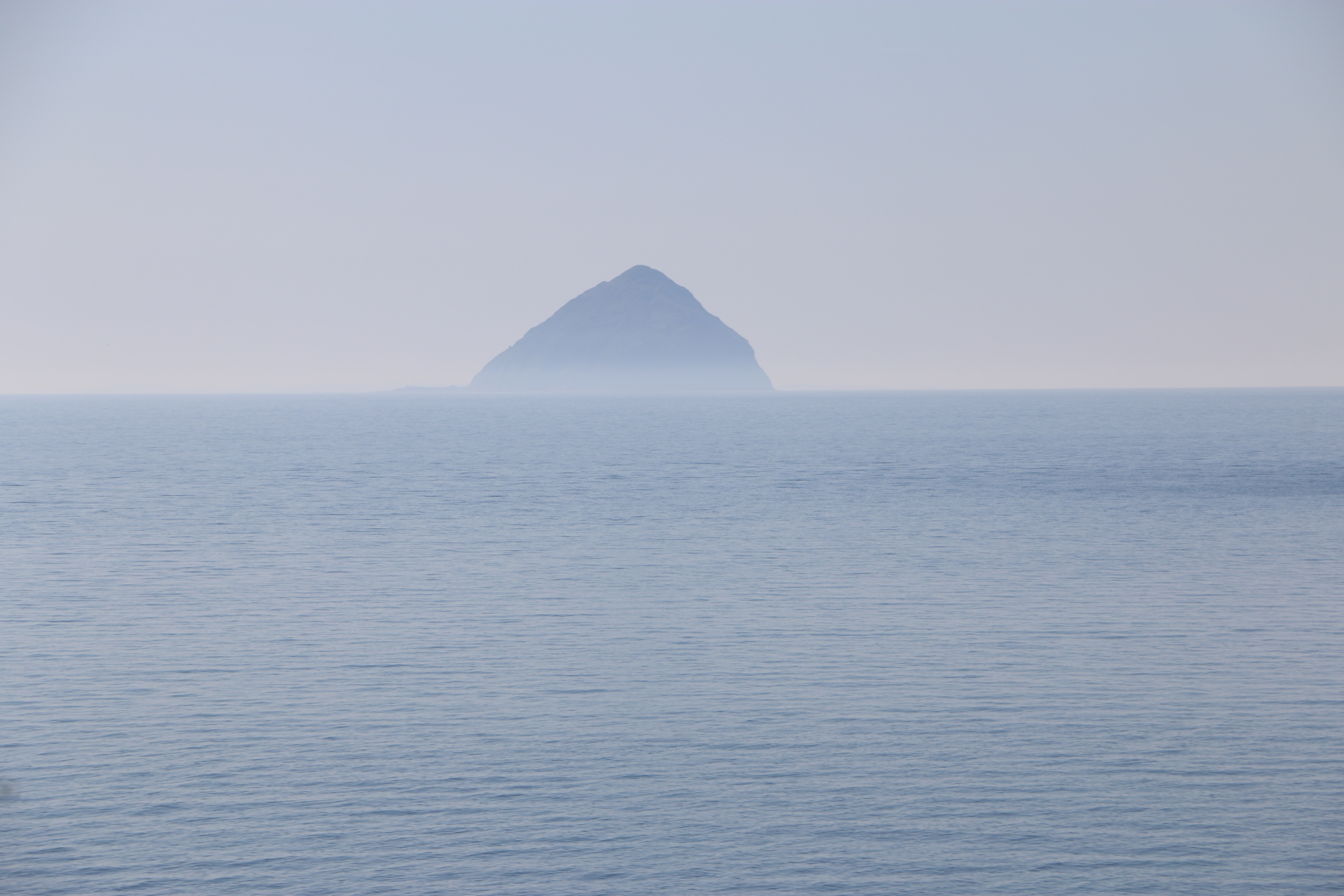
At a stone seat there’s a path junction with a signpost for Loch Garbad. From the description on the map we are following we expected to be walking though woodland but no; all the forest towards the loch has been felled under the Eas Mor project. This is the gradual conversion of the commercial conifer plantations back to semi-natural trees, so many of these have already been planted as saplings. (I’ve included the Facebook link above, because I think it is so impressive what they are doing in so many areas).This is a vast open area of brash (the above ground parts of the tree that hasn’t been removed from the site after felling – the foliage, branches and crown). Not yet as attractive as it will be, but it has opened up a terrific view across to Pladda Island to Ailsa Craig….
We stop for a while to admire and take photographs. Then carry on along the track …
It’s a bit of a slog. We meet only one other couple with a dog. Dusk and it exchange pleasantries, as do we, and then we plod on. (Yes, that is a sly photo of Dusk and me, taken by the Photographer!) The track is rough and narrow in places. I wonder how it must have felt in past times, winding through the overgrown woods, and I appreciate the openness, being able to see that last hill before we get to Loch Garbad.
Not far now.
We’re told to ‘pose’ – As you may be able to see, neither Dusk nor I appreciate this.
We’re both much happier sitting down for a welcome drink of water and taking in the remote beauty of the loch, whilst the Photographer goes off to do his own thing.
An hour later and we’re off again, somehow managing to take a wrong turn and having to retrace our steps to get onto the right path down the hill. Eventually taking the steps past the waterfall again and towards …
The Library in the Woods – which is exactly what it says – housed in a small log cabin it’s a hidden library in beautiful woodland, and filled with books and messages left by visitors over the years. Another project created by Eas Mor Ecology and built in 1998 from trees felled in a storm on Boxing Day.
Time to leave.We take a narrow path downwards through woods and across the bridge over the stream fed by the waterfall. Just in time … to see the cafe closing. “Never mind,” says the Photographer, ” We’ll be back at the house in no time. We can have a coffee there. What’s for tea?”
Winner of ‘Best Short Story Collection’ in the 2014 eFestival of Words, “Nine Lives” comprises nine short dramas in the vein of Terry Tyler’s well-loved novels, some funny, some sad, with her usual unpredictable twists. The first chapter of full-length novel and tale of sibling rivalry, WHAT IT TAKES, is to be found at the end.
The stories:
Angel – The perfect wife of the perfect husband is tempted by the fruit of another. Shut Up And Dance – Paul says he will love Laura whatever size she is. But will he? Mia – The threat of ‘the other woman’… Kiss Your Past Goodbye – Zoe finds out what happened to her first love, who broke her heart. We All Fall Down – Two old friends meet for a drink – just a swift one, of course! Bright Light Fright – A tale of vengeance, a burglary, and a nasty shock. Mama Kin – Emma and Melanie have very different approaches to childcare – oh dear! Don’t Get Mad – Get Even – Kevin and Marcus have been best friends
My Review:
At the moment I’m finding it difficult to concentrate on reading ( well on anything actually). But, having been a fan of Terry Tyler’s writing for a long time I was pleased to come across this collection of short stories. Not a clue why I haven’t found it before!
The one thing (well, not only the one thing – I could expound on this for ages) that I love about this author’s work is her ability to get inside each character’s head, whoever they are, whether a protagonist or the antagonist … or even a minor character. She brings them alive instantly – and draws the reader into the story.
Each of these stories are short, but they pack a punch and made me think. There is always something beyond the words, the characters, the plot. I think it’s life – and the general affliction of humanity; whether it’s pride, or greed, or revenge- or whatever else that lies beneath the facade of what is called ‘real life’.
They may be short, they may be easy reads on the surface – but they dig dip and I loved them.
And the book was the winner of ‘Best Short Story Collection’ in the 2014 Festival of Words, which says everything.